Follow a Simulated Journey of the Destruction of ESA’s Aeolus Mission

The Aeolus spacecraft orbited Earth and used lidar to study the winds in various parts of our atmosphere. It was brought back to Earth in a controlled re-entry on July 28th. Courtesy ESA.
The Aeolus spacecraft used lidar to study the winds in various parts of our atmosphere. It was brought back to Earth in a controlled re-entry on July 28th. Courtesy ESA.

On July 28th, the European Space Agency commanded its long-working Aeolus wind profile mission to re-enter Earth’s atmosphere. It did that and disintegrated into pieces over Antarctica. Of course, satellites do this often. But, Aeolus was different. It maneuvered its way into a safe re-entry profile, a first-of-its kind activity designed to avoid populated regions on Earth.

Continue reading “Follow a Simulated Journey of the Destruction of ESA’s Aeolus Mission”

Tether a Sunshade to an Asteroid to Slow Down Climate Change

Could a solar-sail-like structure (or structures) tethered to an asteroid provide a sunshade for Earth to block sunlight and mitigate climate change? A recent study looks into it. Courtesy NASA.

It probably comes as no surprise to people suffering through drastic weather this year that our planet is heating up. Climate change is the culprit and researchers continue to look for ways to mitigate its effects. A scientist at the University of Hawai’i suggests a novel approach: create a giant solar shade in space to block enough sunlight to counter climate change.

Continue reading “Tether a Sunshade to an Asteroid to Slow Down Climate Change”

Forest Fires in British Columbia are Bad This Year. THIRTY Times Worse Than Average

Heat and drought have fueled an unusually large outbreak of fire in Canada. Credit: NASA

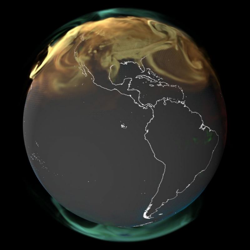
This summer has seen a violent outbreak of forest fires across Canada and North America. According to the Canadian Interagency Forest Fire Center (CIFFC), there were 911 active fires across the country on July 13th, nearly 600 of which were characterized as “out-of-control.” More than half of these active fires are taking place in the provinces of British Columbia, driven by a combination of unusual heat, dry lightning, and drought. The situation is becoming increasingly common thanks to rising global temperatures, diminished rainfall, changing weather patterns, and other related effects of Climate Change.

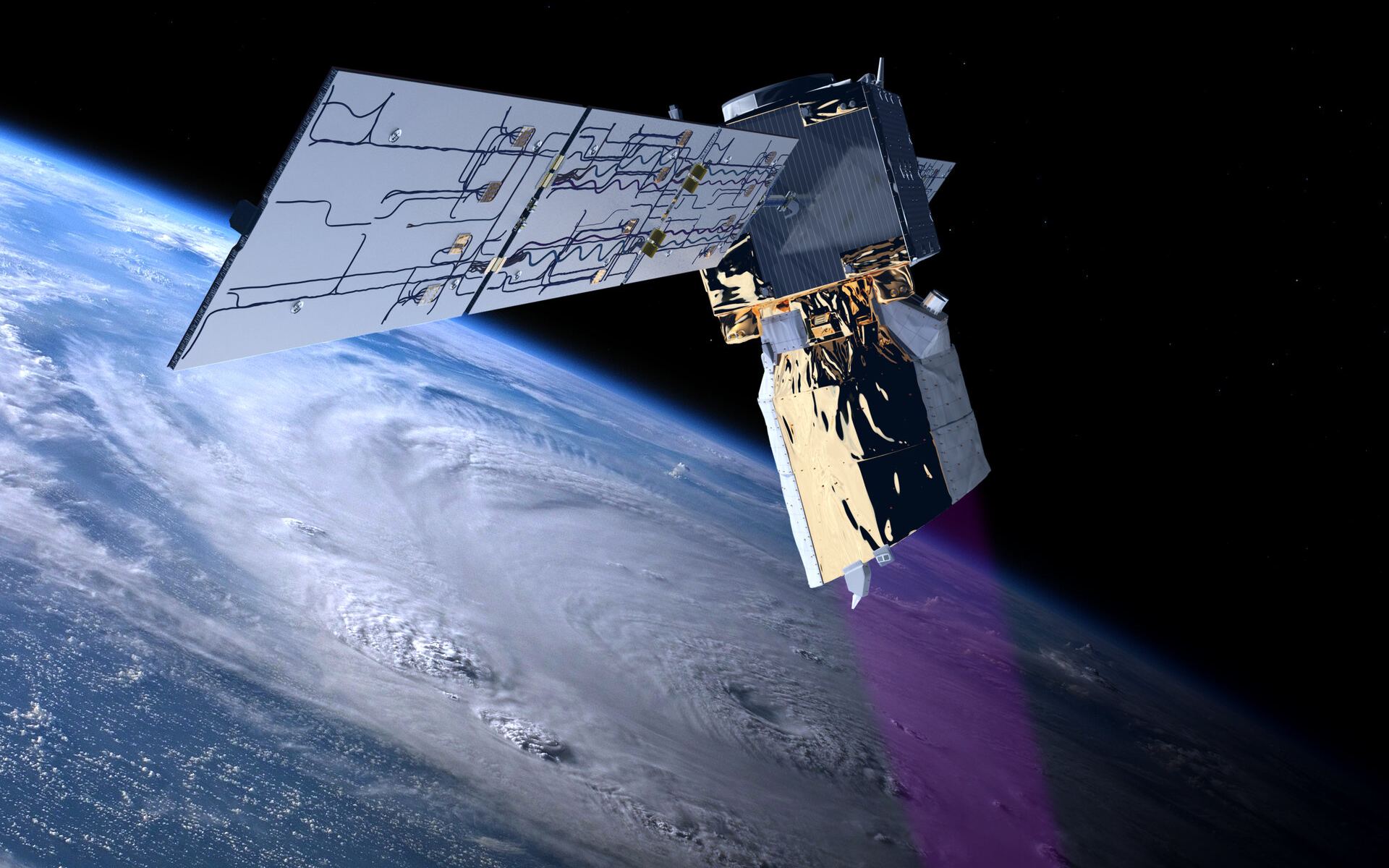
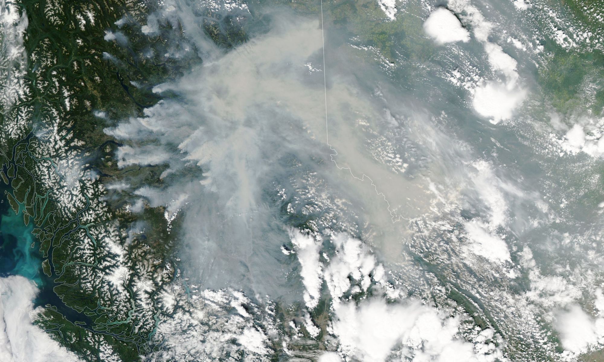
Monitoring forest fires and other meteorological phenomena is an important task for which Earth Observation missions like NASA’s Aqua satellite were created. On July 12th, with six weeks left in the Canadian fire season, Aqua captured images of some of the largest fires over British Columbia using its Moderate Resolution Imaging Spectroradiometer (MODIS) instrument. The image above shows some of the biggest “hot spots” in the province, which produced dense plumes of smoke blowing eastward through the Rocky Mountains and into Alberta and the Northwest Territories.

Continue reading “Forest Fires in British Columbia are Bad This Year. THIRTY Times Worse Than Average”

Mind-Blowing Animation Shows What the World Would Look Like If You Could See Carbon Dioxide Emissions

A map of carbon dioxide in atmosphere from various sources during 2021. CourtesyNASA's Scientific Visualization Studio
A map of carbon dioxide in atmosphere over North America from various sources during 2021. CourtesyNASA's Scientific Visualization Studio

It’s a strange, eerie-looking place. Carbon dioxide gas appears… and disappears in cycles and bursts throughout the year. It’s how our planet would look if we could detect carbon dioxide (CO2) with our eyes. Scientists at NASA’s Global Modeling and Assimilation Office made computer animations of its presence in our atmosphere. Those videos show an almost-alien view of Earth under the influence of this gas.

Continue reading “Mind-Blowing Animation Shows What the World Would Look Like If You Could See Carbon Dioxide Emissions”

Without Ozone, the Earth Might Get a Lot Colder

Clouds trace out the islands of the Caribbean Sea in this photo taken by an astronaut from inside the Cupola on the International Space Station. Credit NASA/NASA Earth Observatory.

The evolution of Earth’s climate contains many components. And new research has shown just how critical the ozone layer is to the surface temperature of the Earth. Without an ozone layer, our planet would be 3.5 Kelvin cooler.

Continue reading “Without Ozone, the Earth Might Get a Lot Colder”

Geoengineering is Shockingly Inexpensive

Geoengineering isn't a quick fix for our climate crisis, and it's also expensive. Image Credit: University of Leeds

Despite decades of warnings and international climate agreements, global carbon emissions are still rising. Carbon emissions seem like an unstoppable juggernaut as energy-hungry humans keep breeding and pursuing more affluent lifestyles. Reducing emissions won’t be enough to confront the climate crisis; we need additional solutions.

Geoengineering, also called climate engineering, could be the solution we seek. But is it financially feasible?

Continue reading “Geoengineering is Shockingly Inexpensive”

Phew, California’s Largest Reservoir is Nearly Full

Shasta Lake, California’s largest reservoir, filled to nearly 100 percent capacity, seen on May 29, 2023 as seen by the Operational Land Imager (OLI) on the Landsat 9 satellite. Credit: US Geological Survey/NASA Earth Observatory/Lauren Dauphin.

California residents will be glad to know their reservoirs are nearly full again after years of drought. New satellite photos show the levels of Shasta Lake, California’s largest reservoir, going from 31% capacity last November to nearly 100% in May 2023. The reservoir was filled with heavy rains and a significant mountain snowpack that melted into the nearby rivers.

This is the highest levels this lake has seen in over four years, following years of persistent and extreme drought in the US southwest. Scientists are working on ways to recharge ground reservoirs with any excess water, to minimize the effect of the next inevitable drought.

Continue reading “Phew, California’s Largest Reservoir is Nearly Full”

European Satellite Measures Exactly How Much Ice Has Been Lost from Glaciers

ESA’s Earth Explorer CryoSat mission is dedicated to precise monitoring of changes in the thickness of marine ice floating in the polar oceans and variations in the thickness of the vast ice sheets that blanket Greenland and Antarctica. Its data are being used to measure ice loss in glaciers. Courtesy ESA/AOES Medialab

As global warming heats up our atmosphere a degree at a time, the world’s glaciers are paying the price. In ten years, they’ve shrunk by a total of 2 percent. To look at it another way, collectively the glaciers have lost 2,720 gigatons of ice thanks to warming air.

Continue reading “European Satellite Measures Exactly How Much Ice Has Been Lost from Glaciers”

Not Snowball Earth, More of a Slushball Earth

DNDXCB View of Earth 650 million years ago during the Marinoan glaciation. the idea of Slushball Earth may change how we view that past ice age. Credit: University of St. Andrews.
Artist's impression of Earth 650 million years ago during the Marinoan glaciation. Credit: University of St. Andrews.

Our planet hasn’t always been the warm, inviting place we know today. At least five times in its history, Earth froze over, locked in the grip of an ice age. Scientists sometimes refer to these periods as “Snowball Earth.” The popular idea is that everything was covered with ice, making life difficult, if not impossible. But, there’s new evidence that during at least one of these icy periods, parts of Earth’s surface could have been more like a giant mushy ball of slush.

Continue reading “Not Snowball Earth, More of a Slushball Earth”

Global Sea Levels Rose by 0.27 cm from 2021 to 2022

An aerial view of the icebergs near Kulusuk Island, off the southeastern coastline of Greenland, a region that is exhibiting an accelerated rate of ice loss. The water runs off into the ocean and is contributing to sea level rise. Credits: NASA Goddard Space Flight Center

It probably comes as no surprise to people living in low-lying coastal regions, but sea waters are rising by large, measurable amounts. That assessment comes from NASA, which has analyzed 30 years of sea-level satellite measurements. The news is not good. Since 1993, the seas rose by a total of 9.1 centimeters. Two years ago, it went up by 0.27 centimeters.

Continue reading “Global Sea Levels Rose by 0.27 cm from 2021 to 2022”