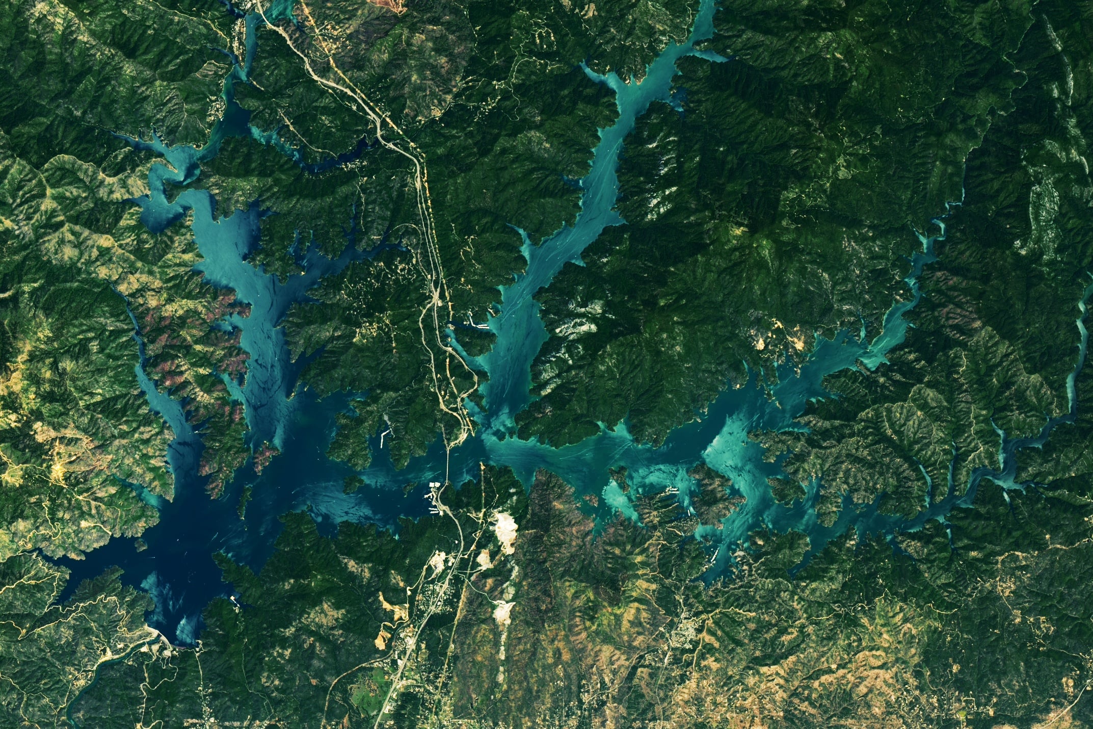
California residents will be glad to know their reservoirs are nearly full again after years of drought. New satellite photos show the levels of Shasta Lake, California's largest reservoir, going from 31% capacity last November to nearly 100% in May 2023. The reservoir was filled with heavy rains and a significant mountain snowpack that melted into the nearby rivers.
This is the highest levels this lake has seen in over four years, following years of persistent and extreme drought in the US southwest. Scientists are working on ways to recharge ground reservoirs with any excess water, to minimize the effect of the next inevitable drought.
Shasta Lake is the eighth largest human-made reservoir in the United States. It has 587 km (365 miles) of mostly mountainous shoreline, with a maximum depth of 157 meters (517 feet.) Lake Mead in Nevada is the largest reservoir in the US.
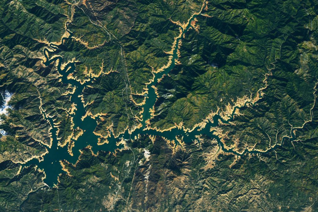
Here's a comparison image of Shasta Lake from just a few months ago, November 18, 2022. The tan "bathtub ring" around the perimeter of the lake shows where water had been in previous years.
By May 29, it was 98% full, according to California Department of Water Resources (DWR), and the brown ring had disappeared.
Shasta Lake was created in 1948 by the Shasta Dam. Planning for the dam started in 1919 and it was built in the years between 1935 to 1945. Its main purpose is for flood control, water storage for agricultural operations, and hydroelectric generation.
Lake Oroville, the state's second-largest reservoir, was also near capacity on May 29, at 97% full.
NASA cautions that full reservoirs do not ensure plentiful water for years into the future. Additionally, the increased water levels currently seen in the reservoirs does not necessarily equate to replenished groundwater stores, which is of great concern to the state of California.
"The past four years are a testament to how drastically reservoirs can change over the course of one or two years," said NASA Earth Observatory’s Lindsey Doermann. "In addition to the many demands for water, lake levels need to be drawn down to create capacity for flood control in wetter seasons. The California DWR is collaborating with other agencies to incorporate better forecasting and observation technologies in order to optimize water releases."
California enacted a law about 10 years ago to try to protect groundwater reserves from overpumping for agricultural needs. The Sustainable Groundwater Management Act requires local groundwater agencies to halt long-term depletion and achieve sustainability, according to an article on Cal Matters, a state news website. But the deadlines are almost 20 years away, and basins are still being stressed. Groundwater may account for two-thirds of agricultural water use during drought years.
"Just one wet year is nowhere near large enough to refill the amount of groundwater storage that we've lost, say, over the last 10 years or more," said Jeanine Jones, a drought manager with the California DWR, in the Cal Matters article.
A recent study using data from NASA’s Gravity Recovery and Climate Experiment (GRACE) and GRACE Follow-On satellite missions found that groundwater depletion in the Central Valley has been accelerating since 2003.
NASA said that officials in California are working to leverage the recent influx of water. While some groundwater recharge happens naturally, resource managers can employ other strategies to send water underground, such as diverting it into canals or ponds and injecting it into the subsurface.