

As the powerful category 4 Hurricane Joaquin was pounding the Bahamas and packing winds of over 130 mph, NASA astronaut Scott Kelly captured a stunning photo of Joaquin on Friday morning, Oct. 2 from his perch aboard the International Space Station (ISS). As of today, Oct. 3. Joaquin has gained strength to 150 mph and is a borderline Cat 5 storm!
Coincidentally, Kelly snapped the photo within hours of the milestone 100th straight successful rocket launch by United Launch Alliance (ULA) on Oct. 2, of the firms Atlas V rocket carrying Mexico’s next generation Morelos-3 communications satellite from Florida to orbit.
Kelly’s spectacular storm photo shows the eye of Hurricane Joaquin over the Caribbean and off the US eastern seaboard with the limb of the Earth and our atmosphere in beautiful detail.
Huge thunderstorms can been off to the north of the immense category 4 storm.
And as of today, Saturday, Oct. 3, Hurricane Joaquin has further strengthened and is now packing maximum sustained winds of 150 MPH or 240 KM/H, according to the latest advisory issued by the National Hurricane Center (NHC) as of 5 p.m. EDT.
Kelly posted the Oct. 2 photo of Joaquin with this caption on his twitter account:
“Early morning shot of Hurricane #Joaquin from @space_station before reaching #Bahamas. Hope all is safe. #YearInSpace.”
Two of the stations solar panels are seen in the photo as well as portions of the US east coast including Florida.
The latest NHC forecast shows Joaquin veering away from the US East Coast. But it’s still creating hurricane force winds and high waves that is threatening Bermuda.
“SEVERE HURRICANE JOAQUIN THREATENING BERMUDA,” said the NHC today.
It is moving northeast at 45 degrees at 17 MPH or 28 KM/H.
Kelly snapped another telling view of Joaquin on Thursday, Oct. 1 showing the Bahamas and Miami in the field of view.
Kelly tweeted; “#HurricaneJoaquin churns over the #Bahamas with #Miami in the field of view from @Space_Station.”

Scott Kelly is a member of the first ever 1 year ISS mission crew comprising Kelly and Russian cosmonaut Mikhail Kornienko.
They arrived at the ISS in March and had just reached the midpoint of their nearly 12 month stay aimed at conducting research to explore the impact of long term stays in space on the human body and aid NASA’s long term plans for a human ‘Journey to Mars’ in the 2030s.
NASA and NOAA satellites are keeping constant watch on the progress of the powerful Hurricane Joaquin, that earlier had the potential to barrel towards tens of millions of US coastal residents.
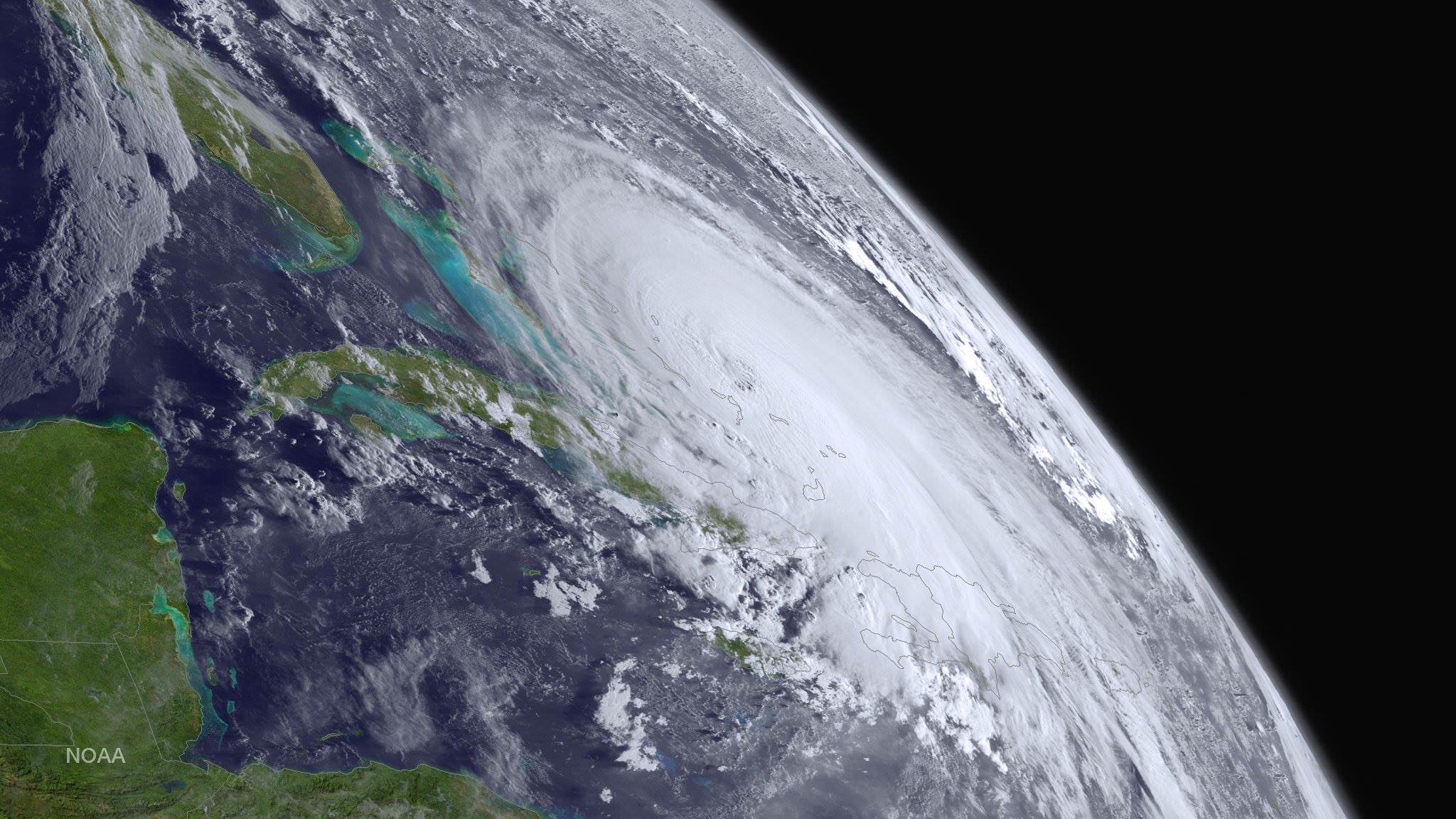
Here’s another stunning view of Hurricane Joaquin taken by the GOES-West satellite on Oct. 1.
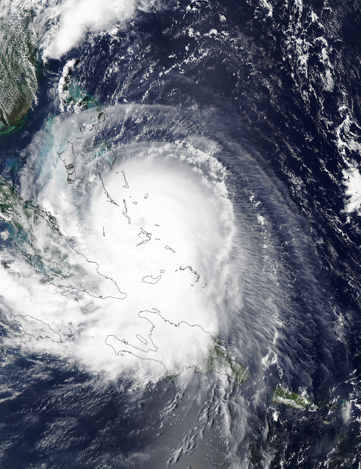
This visible image from NASA’s Aqua satellite shows Hurricane Joaquin over Bahamas on Oct. 1.
Stay tuned here for Ken’s continuing Earth and planetary science and human spaceflight news.
I don’t recognize the lighted coast in the top picture. Could that be Manhattan/Long Island??