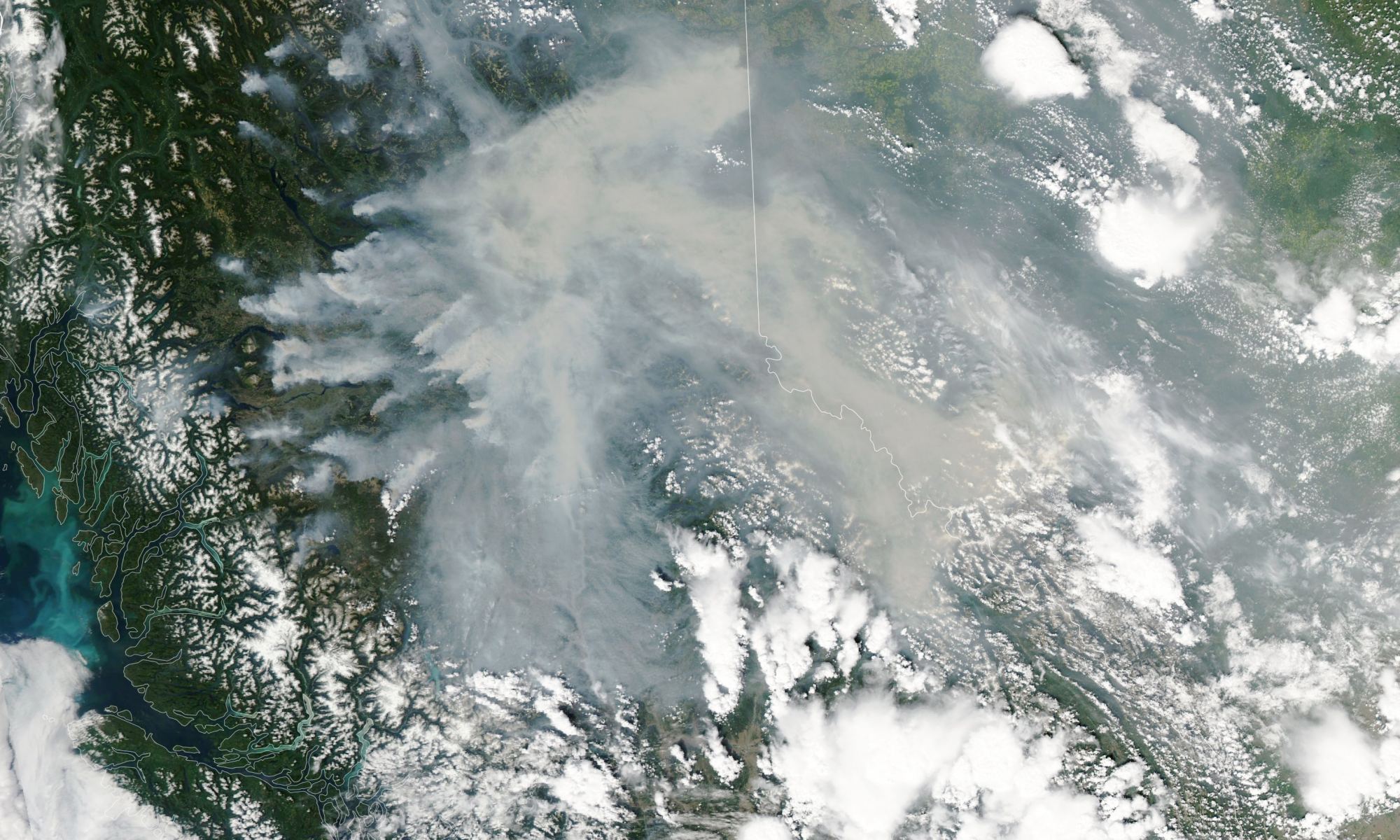
Heat and drought have fueled an unusually large outbreak of fire in Canada. Credit: NASA
This summer has seen a violent outbreak of forest fires across Canada and North America. According to the Canadian Interagency Forest Fire Center (CIFFC), there were 911 active fires across the country on July 13th, nearly 600 of which were characterized as “out-of-control.” More than half of these active fires are taking place in the provinces of British Columbia, driven by a combination of unusual heat, dry lightning, and drought. The situation is becoming increasingly common thanks to rising global temperatures, diminished rainfall, changing weather patterns, and other related effects of Climate Change.
Monitoring forest fires and other meteorological phenomena is an important task for which Earth Observation missions like NASA’s Aqua satellite were created. On July 12th, with six weeks left in the Canadian fire season, Aqua captured images of some of the largest fires over British Columbia using its Moderate Resolution Imaging Spectroradiometer (MODIS) instrument. The image above shows some of the biggest “hot spots” in the province, which produced dense plumes of smoke blowing eastward through the Rocky Mountains and into Alberta and the Northwest Territories.
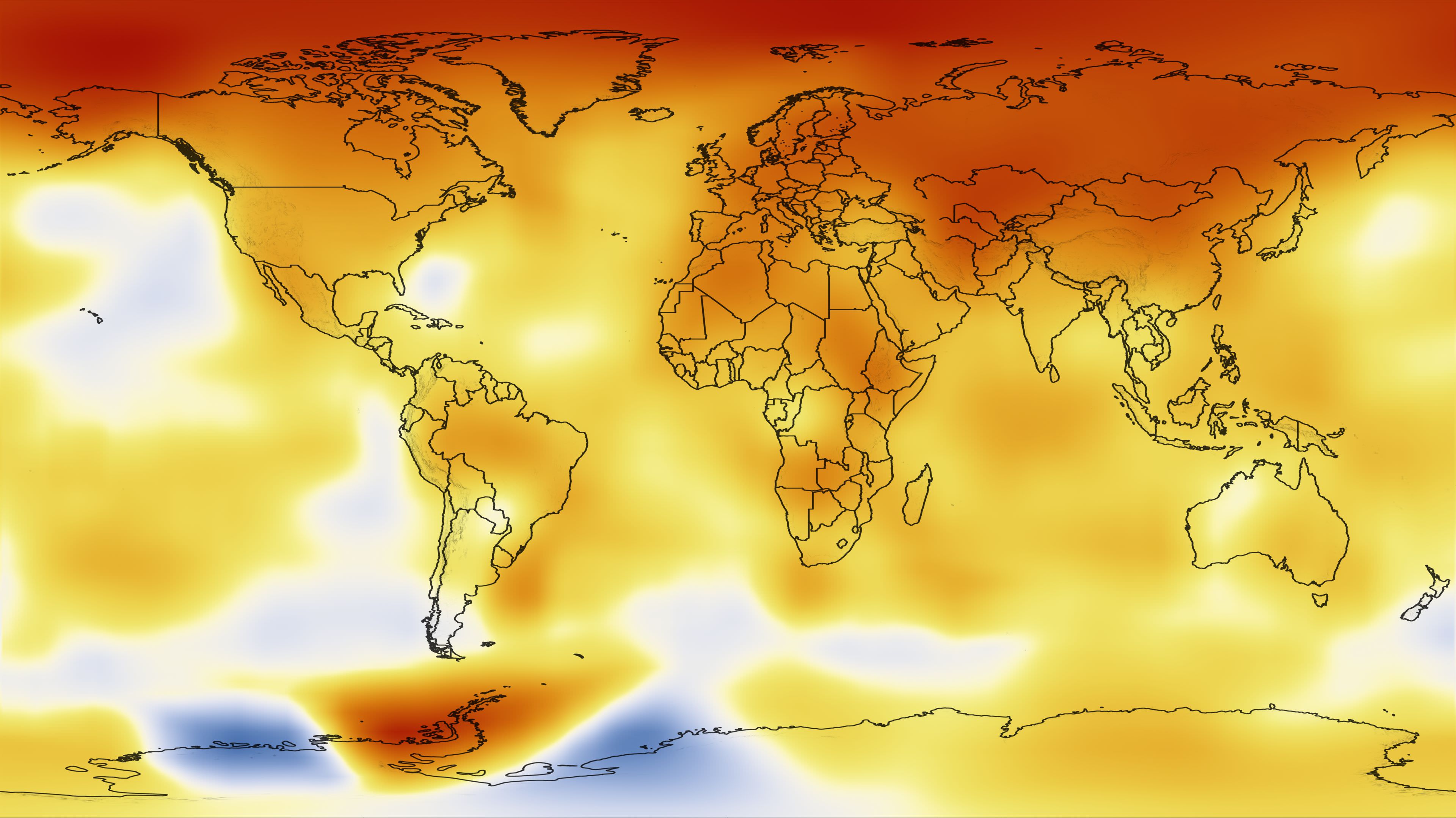
The map shows temperature changes for the last decade—January 2000 to December 2009—relative to the 1951-1980 mean. Credit: NASA
There are a handful of major science institutions around the world that keep track of the Earth’s temperature. They all clearly show that the world’s temperature has risen in the past few decades. One of those institutions is NASA.
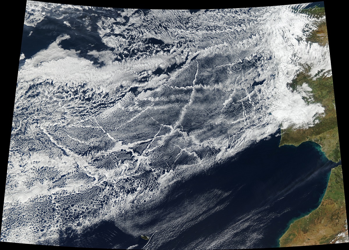
Images acquired of the Aqua satellite of the sea lanes off the coast of Portugal, taken on January 16th, 2018. Credit: NASA/Jeff Schmaltz, LANCE/EOSDIS Rapid Response
Earth, when viewed from space, is a pretty spectacular thing to behold. From orbit, one can see every continent, landmass, and major feature. Weather patterns are also eerily clear from space, with everything from hurricanes to auroras appearing as a single system. On top of that, it is only from orbit that the full extent of human activity can be truly appreciated.
For instance, when one hemisphere of Earth passes from day into night, one can see the patchwork of urban development by picking out the filamentary structure of lights. And as NASA’s Aqua satellite recently demonstrated with a high-resolution image it captured over the Atlantic Ocean, ships criss-crossing the ocean can also create some beautiful patterns.
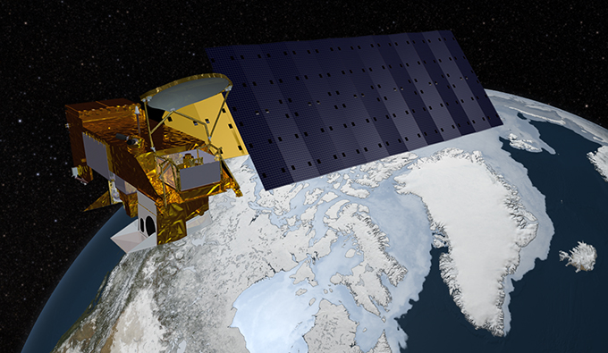
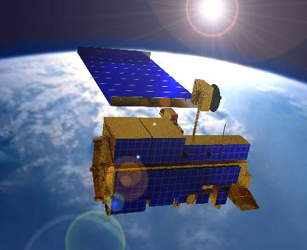
As part of the NASA-centered international Earth Observing System (EOS), the Aqua satellite was launched on May 4th, 2002, to collect information on Earth’s water cycle. Using a suite of six Earth-observing instruments, this satellite has gathered global data on ocean evaporation, water vapor in the atmosphere, clouds, precipitation, soil moisture, sea ice, land ice, and snow cover.
NASA’s Aqua Earth-observing satellite. Credit: NASA
The image was acquired on January 16th, 2018, by the Moderate Resolution Imaging Spectroradiometer (MODIS). Pictured in this image are ships off the coast of Portugal and Spain producing cloud trails known as ship tracks. Some of these tracks stretch for hundreds of kilometers and grow broader with distance – i.e. the narrow ends are the youngest while the broader, wavier ends are older.
These clouds form when water vapor condenses around tiny particles of pollution emitted by the ship’s exhaust. This is due to the fact that some particles generated by ships (like sulfates) are soluble in water and seeds clouds. This also causes light hitting these clouds to scatter in many directions, making them appear brighter and thicker than unpolluted maritime clouds (which are seeded by larger particles like sea salt).
As always, seeing things from space provides an incredible sense of perspective. This is especially helpful when attempting to monitor and model something as complex as Earth’s environment and humanity’s impact on it. And of course, it also allows for some breathtaking photos!
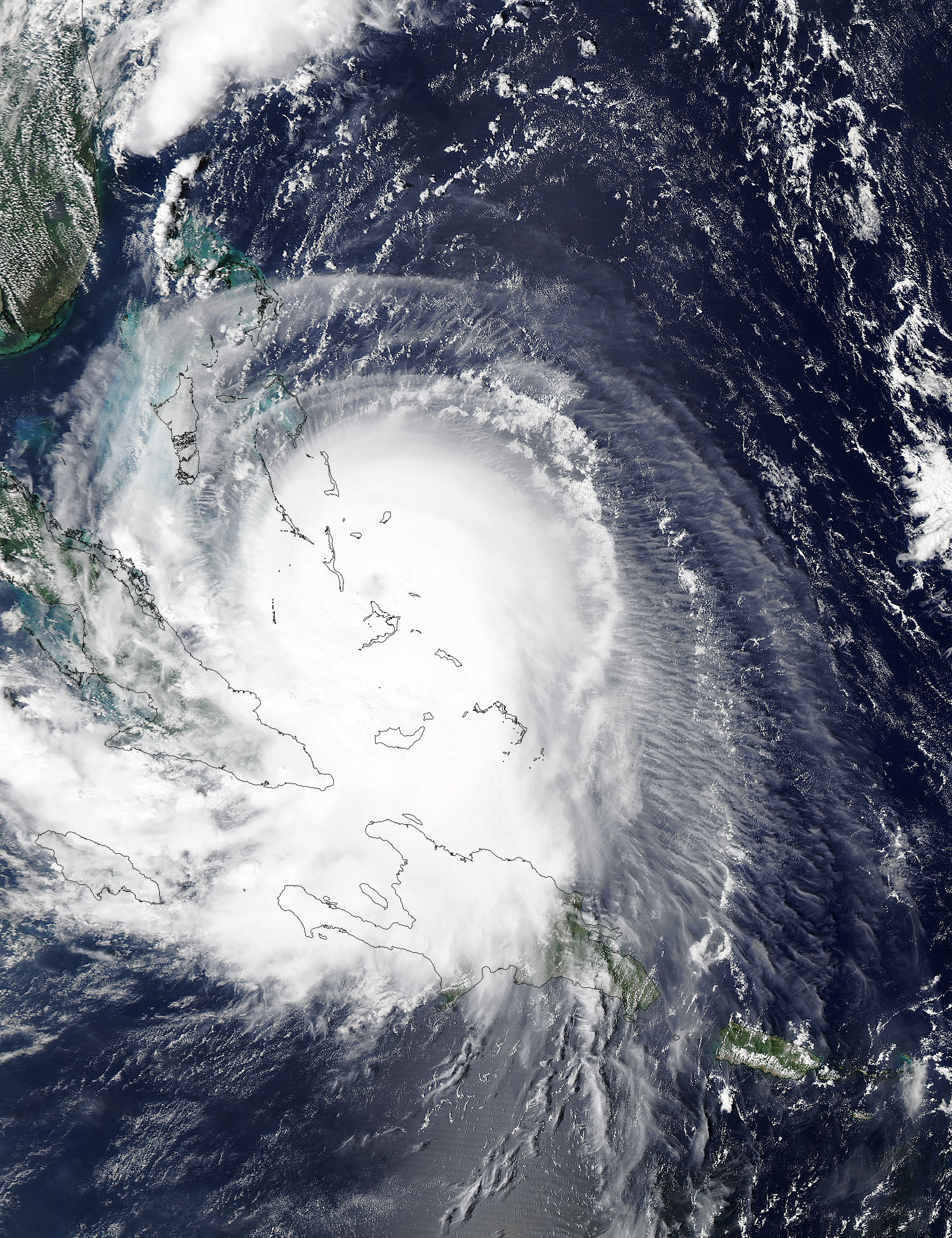
Hurricane Joaquin captured on Oct. 2, 2015 by NASA Astronaut Scott Kelly from the International Space Station. Credit: NASA/Scott Kelly
As the powerful category 4 Hurricane Joaquin was pounding the Bahamas and packing winds of over 130 mph, NASA astronaut Scott Kelly captured a stunning photo of Joaquin on Friday morning, Oct. 2 from his perch aboard the International Space Station (ISS). As of today, Oct. 3. Joaquin has gained strength to 150 mph and is a borderline Cat 5 storm!
Kelly’s spectacular storm photo shows the eye of Hurricane Joaquin over the Caribbean and off the US eastern seaboard with the limb of the Earth and our atmosphere in beautiful detail.
Huge thunderstorms can been off to the north of the immense category 4 storm.
And as of today, Saturday, Oct. 3, Hurricane Joaquin has further strengthened and is now packing maximum sustained winds of 150 MPH or 240 KM/H, according to the latest advisory issued by the National Hurricane Center (NHC) as of 5 p.m. EDT.
Kelly posted the Oct. 2 photo of Joaquin with this caption on his twitter account:
“Early morning shot of Hurricane #Joaquin from @space_station before reaching #Bahamas. Hope all is safe. #YearInSpace.”
Two of the stations solar panels are seen in the photo as well as portions of the US east coast including Florida.
The latest NHC forecast shows Joaquin veering away from the US East Coast. But it’s still creating hurricane force winds and high waves that is threatening Bermuda.
“SEVERE HURRICANE JOAQUIN THREATENING BERMUDA,” said the NHC today.
It is moving northeast at 45 degrees at 17 MPH or 28 KM/H.
Kelly snapped another telling view of Joaquin on Thursday, Oct. 1 showing the Bahamas and Miami in the field of view.
Kelly tweeted; “#HurricaneJoaquin churns over the #Bahamas with #Miami in the field of view from @Space_Station.”
#HurricaneJoaquin churns over the #Bahamas with #Miami in the field of view from @Space_Station #YearInSpace. Credit: NASA/Scott Kelly
Scott Kelly is a member of the first ever 1 year ISS mission crew comprising Kelly and Russian cosmonaut Mikhail Kornienko.
They arrived at the ISS in March and had just reached the midpoint of their nearly 12 month stay aimed at conducting research to explore the impact of long term stays in space on the human body and aid NASA’s long term plans for a human‘Journey to Mars’ in the 2030s.
NASA and NOAA satellites are keeping constant watch on the progress of the powerful Hurricane Joaquin, that earlier had the potential to barrel towards tens of millions of US coastal residents.
Here’s another stunning view of Hurricane Joaquin taken by the GOES-West satellite on Oct. 1.
This stunning image of Hurricane Joaquin is from NOAA’s GOES West satellite on Oct. 1 2015. Many portions of the eastern U.S. are currently experiencing heavy rains and gusty winds associated with a frontal system. Credit: NOAA
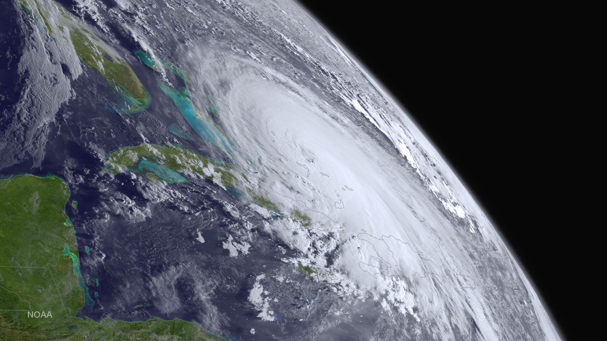
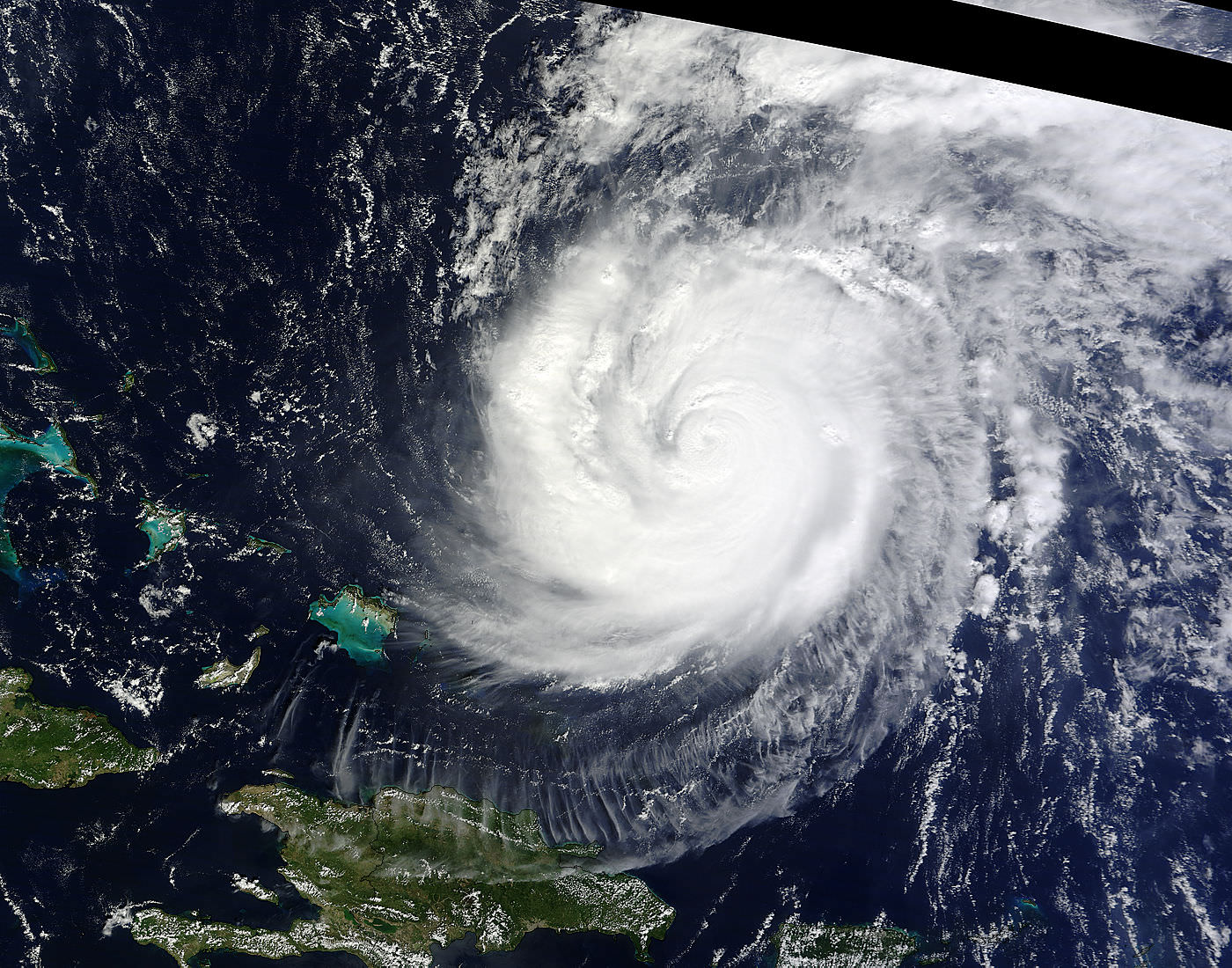
This visible image from NASA’s Aqua satellite shows Hurricane Joaquin over Bahamas on Oct. 1.
NASA’s Aqua satellite captured this visible image of Hurricane Joaquin over Bahamas on Oct. 1 at 17:55 UTC (1:55 p.m. EDT). Credits: NASA Goddard MODIS Rapid Response Team
Stay tuned here for Ken’s continuing Earth and planetary science and human spaceflight news.
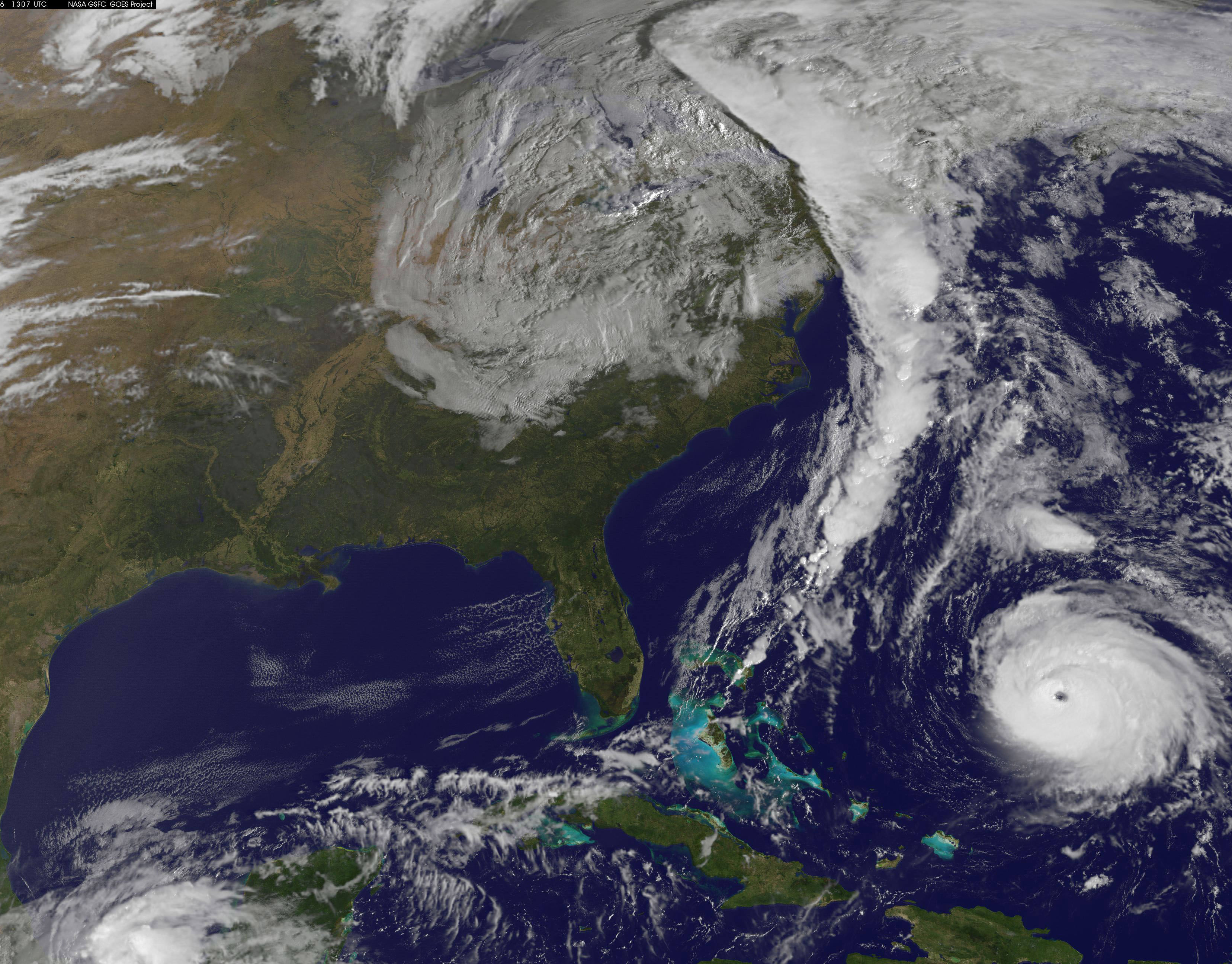
NOAA's GOES-East satellite captured this image of Hurricane Gonzalo off the U.S. East Coast on Oct. 16 at 13:07 UTC (9:07 a.m. EDT). Gonzalo is classified as Category 4 storm. Credit: NASA/NOAA GOES Project
Hurricane Gonzalo, the first major Atlantic Ocean basin hurricane in three years, has strengthened to a dangerous Category 4 storm, threatening Bermuda and forcing a postponement of the upcoming launch of the Orbital Sciences Antares rocket to the space station from the Virginia shore to no earlier than Oct. 27.
A hurricane warning is in effect for the entire island of Bermuda.
NASA and Orbital Sciences had no choice but to delay the Antares blastoff from Oct. 24 to no earlier than Oct. 27 because Bermuda is home to an “essential tracking site” that must be operational to ensure public safety in case of a launch emergency situation.
Antares had been slated for an early evening liftoff with the Cygnus cargo carrier on the Orb-3 mission to the International Space Station (ISS).
NASA and Orbital issued the following statement:
“Due to the impending arrival of Hurricane Gonzalo on the island of Bermuda, where an essential tracking site used to ensure public safety during Antares launches is located, the previously announced “no earlier than” (NET) launch date of October 24 for the Orb-3 CRS mission to the International Space Station for NASA is no longer feasible.”
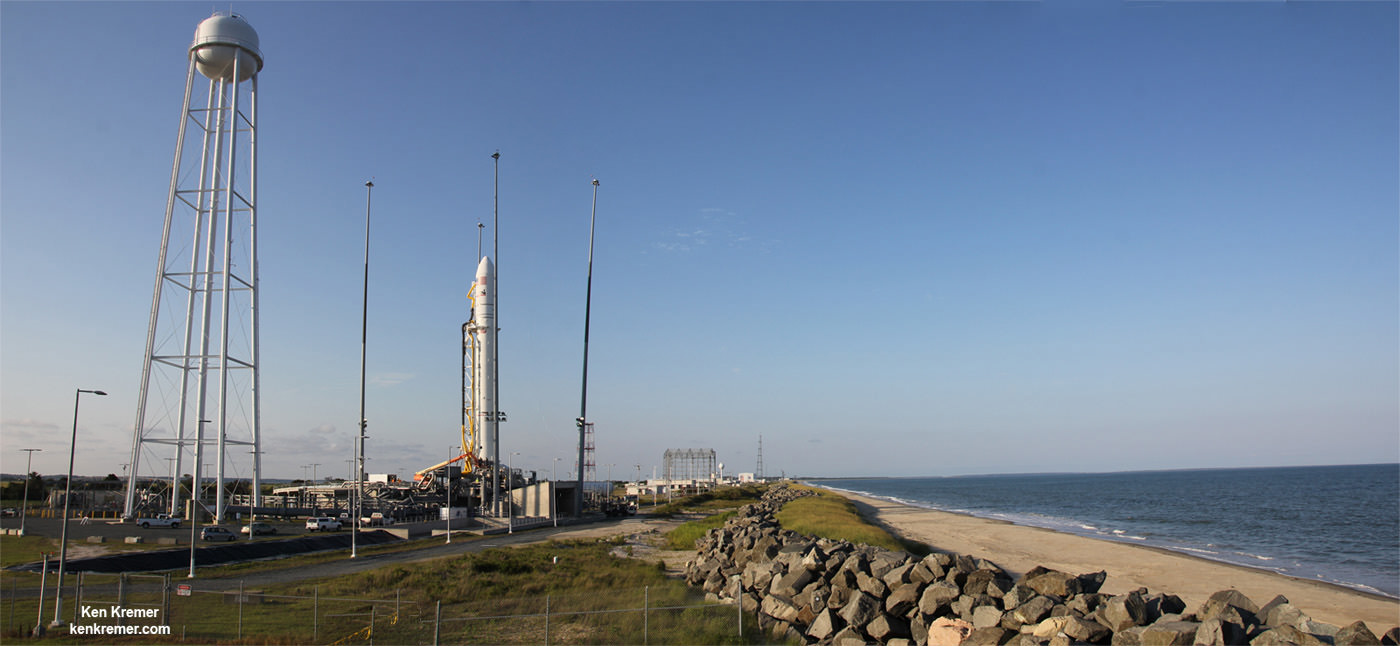
Orbital Sciences Corporation Antares rocket and Cygnus spacecraft prior to blast off on July 13 2014 from Launch Pad 0A at NASA Wallops Flight Facility , VA, on the Orb-2 mission bound for the International Space Station. Credit: Ken Kremer – kenkremer.com
The powerful Gonzalo is currently expected to make a direct hit on Bermuda on Friday afternoon, Oct. 17. It’s packing devastating maximum sustained winds exceeding 145 mph (225 kph).
NASA and NOAA satellites including the Terra, Aqua and GOES-East satellites are providing continuous coverage of Hurricane Gonzalo as it moves toward Bermuda, according to a NASA update today.
The ISS-RapidScat payload tracking ocean winds, that was just attached to the exterior of the ISS, is also designed to help with hurricane monitoring and forecasting.
Tropical storm force winds and 20 to 30 foot wave heights are expected to impact Bermuda throughout Friday and continue through Saturday and into Sunday.
“The National Hurricane Center expects hurricane-force winds, and rainfall totals of 3 to 6 inches in Bermuda. A storm surge with coastal flooding can be expected in Bermuda, with large and destructive waves along the coast. In addition, life-threatening surf and riptide conditions are likely in the Virgin Islands, Puerto Rico, Dominican Republic, Bahamas. Those dangerous conditions are expected along the U.S. East Coast and Bermuda today, Oct. 16,” according to NASA.
On Oct. 15 at 15:30 UTC (11:30 a.m. EDT) NASA’s Terra satellite captured this image of Hurricane Gonzalo in the Atlantic Ocean. Credit: NASA Goddard MODIS Rapid Response Team
After the hurricane passes, a team will be sent to assess the impact of the storm on Bermuda and the tracking station. Further delays are possible if Bermuda’s essential infrastructure systems are damaged, such as power, transportation and communications.
The Antares/Cygnus rocket and cargo ship launch from the Mid-Atlantic Regional Spaceport at NASA’s Wallops Flight Facility along the eastrn shore of Virginia.
Liftoff is currently target for October 27 at 6:44 p.m. (EDT). The rendezvous and berthing of Cygnus with the ISS remains on November 2, with grapple of the spacecraft by the station’s robotic arm at approximately 4:58 a.m. (EST), according to a NASA update.
Stay tuned here for Ken’s continuing Earth and Planetary science and human spaceflight news.
Sensors aboard NASA’s Terra satellite are aiding the search for MH 370. Credit: NASA
NASA has actively joined the hunt for the missing Malaysian Airline flight MH-370 that mysteriously disappeared without a trace more than two weeks ago on March 8, 2014.
Sensors aboard at least two of NASA’s unmanned Earth orbiting global observation satellites as well as others flying on the manned International Space Station (ISS) are looking for signs of the jetliner that could aid the investigators from a multitude of nations and provide some small measure of comfort to the grieving families and loved ones of the passengers aboard.
“Obviously NASA isn’t a lead agency in this effort. But we’re trying to support the search, if possible,” Allard Beutel, NASA Headquarters, Office of Communications director, told Universe Today this evening.
NASA’s airplane search assistance comes in two forms; mining existing space satellite observing data and retargeting space based assets for new data gathering since the incident.
The Malaysian Airline Boeing 777-2H6ER jetliner went missing on March 8 while cruising en route from Kuala Lampur, Malaysia to Beijing, China. See cockpit photo below.
Accurate facts on why MH-370 vanished with 239 passengers aboard have sadly been few and far between.
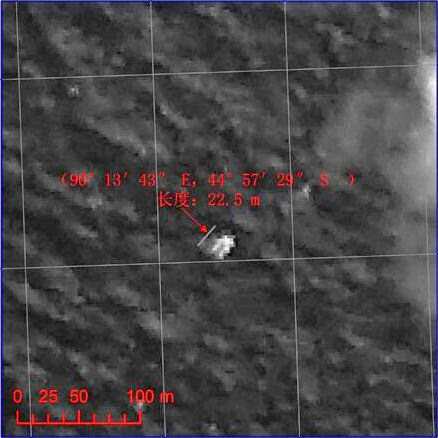
Chinese satellite image of possible debris of MH 370. Credit: China/SASTIND
Last week, the search area shifted to a wide swath in the southern Indian Ocean when potential aircraft debris was spotted in a new series of separate satellite images from Australia and China government officials.
A prior set of official Chinese government satellite images at a different location yielded absolutely nothing.
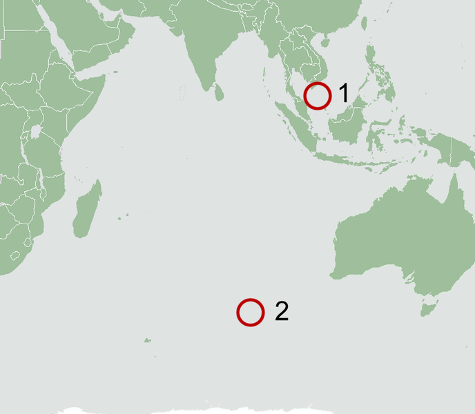
The area is now focused 2,500 km (1,600 mi) south west of Perth, a city on the western coast of Australia.
NASA’s search support was triggered upon activation of the International Charter on Space and Major Disasters.
Available data from NASA’s Terra and Aqua satellites has already been transmitted to the U.S. Geological Survey and new data are now being collected in the search area.
“In response to activation of the International Charter on Space and Major Disasters last week regarding the missing Malaysia Airlines jetliner, NASA sent relevant space-based data to the U.S. Geological Survey’s Earth Resources Observations and Science Hazard Data Distribution System that facilitates the distribution of data for Charter activations,” according to a NASA statement.
And it’s important to note that NASA satellites and space-based cameras are designed for long-term scientific data gathering and Earth observation.
“They’re really not meant to look for a missing aircraft,” Beutel stated.
“The archive of global Earth-observing satellite data is being mined for relevant images. These include broad-area views from the MODIS [instrument] on NASA’s Terra and Aqua satellites,” Beutel informed me.
The next step was to retarget both satellites and another high resolution camera aboard the ISS.
“In addition, two NASA high-resolution assets have been targeted to take images of designated search areas: the Earth Observing-1 satellite and the ISERV camera on the International Space Station,” Beutel explained.
Sensors aboard NASA’s Aqua satellite are aiding the search for MH 370. Credit: NASA
Aqua and Terra were already gathering new observations with the MODIS instrument in the search area off Australia last week. MODIS measures changes in Earth’s cloud cover.
Here are the satellite observation times and capabilities:
• MODIS on the Aqua satellite observed at about 1:30 p.m. local time as it passes overhead from pole-to-pole
• MODIS on the Terra satellite observed at about 10:30 a.m. local time
• The width (field of view) of a MODIS observation is 2,300 kilometers
• One pixel of a MODIS image – the limit of how small a feature it can see – is about 1 kilometer.
A new set of high resolution Earth imaging cameras are being sent to the ISS and are loaded aboard the SpaceX CRS-3 Dragon resupply capsule now slated for blastoff on March 30.
The newly launchedNASA/JAXAGPM precipitation monitoring satellite which will cover this ocean area in the future is still in the midst of science instrument checkout.
The International Space Station (ISS) in low Earth orbit. Credit: NASA
Ships and planes from at least 26 countries have been being dispatched to the new based on the new satellite imagery to search for debris and the black boxes recording all the critical engineering data and cockpit voices of the pilot and copilot and aid investigators as to what happened.
No one knows at this time why the Malaysia Airlines flight mysteriously disappeared.
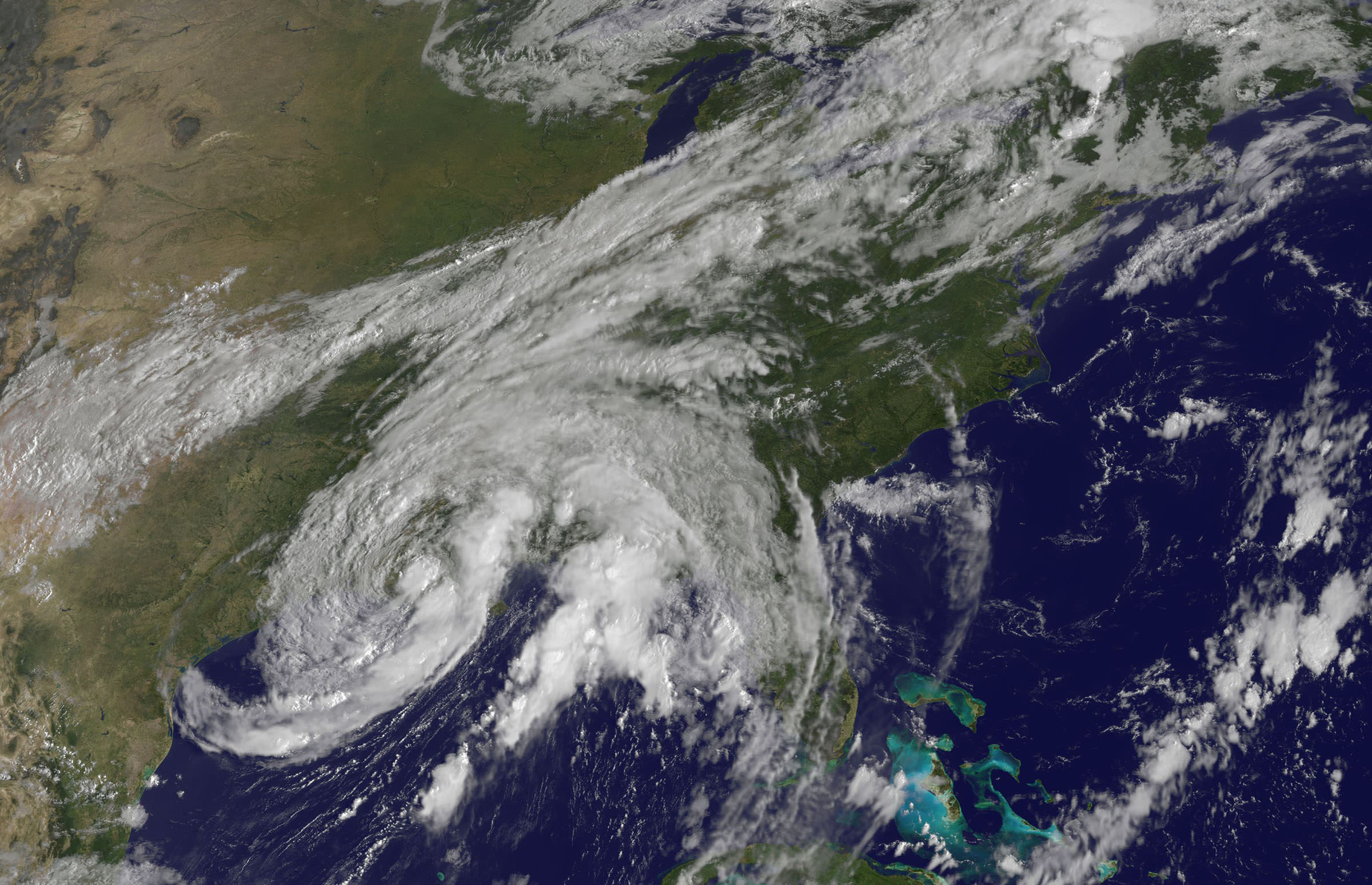
Tropical Storm Lee - Visible image from the GOES-13 satellite on Sunday, Sept. 4 at 9:32 a.m. EDT. It shows the extent of Lee's cloud cover over Louisiana, Mississippi, Alabama and the Florida Panhandle and spread into the Tennessee Valley. The thickest clouds and heaviest rainfall stretch from the northeast to southwest of the center. Credit: NASA/NOAA GOES Project
[/caption]
New imagery from NASA and NOAA satellites taken today (Sept 4) shows the extent of a hurricane season storm currently ravaging the US Gulf Coast and another potentially posing a new threat to US East Coast areas still suffering from the vast destruction caused by Hurricane Irene just days ago. Data from the NASA and NOAA satellites is critical in providing advance warning to government officials and local communities to save human lives and minimize property damage. .
Slow moving Tropical Storm Lee has unleashed strong thunderstorms and heavy rainfall in several Gulf Coast states. Rainfall amounts of up to 7 to 14 inches over the last 48 hours are currently drenching coastal and inland communities – especially in Louisiana, Mississippi and Alabama along a wide swath that extends from Texas to the Florida panhandle.
Isolated pockets of Gulf State areas may see up to 20 inches of rainfall. Severe flooding to homes and roads has occurred in some locations. Winds have diminished from 60 mph on Saturday (Sept. 3) to 45 mph on Sunday.
Imagery and measurements from the Aqua and GOES-13 satellites from NASA and NOAA revealed that TS Lee finally made landfall in Louisiana after two days of drenching rain along the Gulf Coast..
A tropical storm warning is in effect on Sept 4 for New Orleans, Lake Pontchartrain, and Lake Maurepas. Fortunately the rebuilt levees in New Orleans appear to holding in the first serious test since the vast destruction of Hurricane Katrina. Other areas are less lucky.
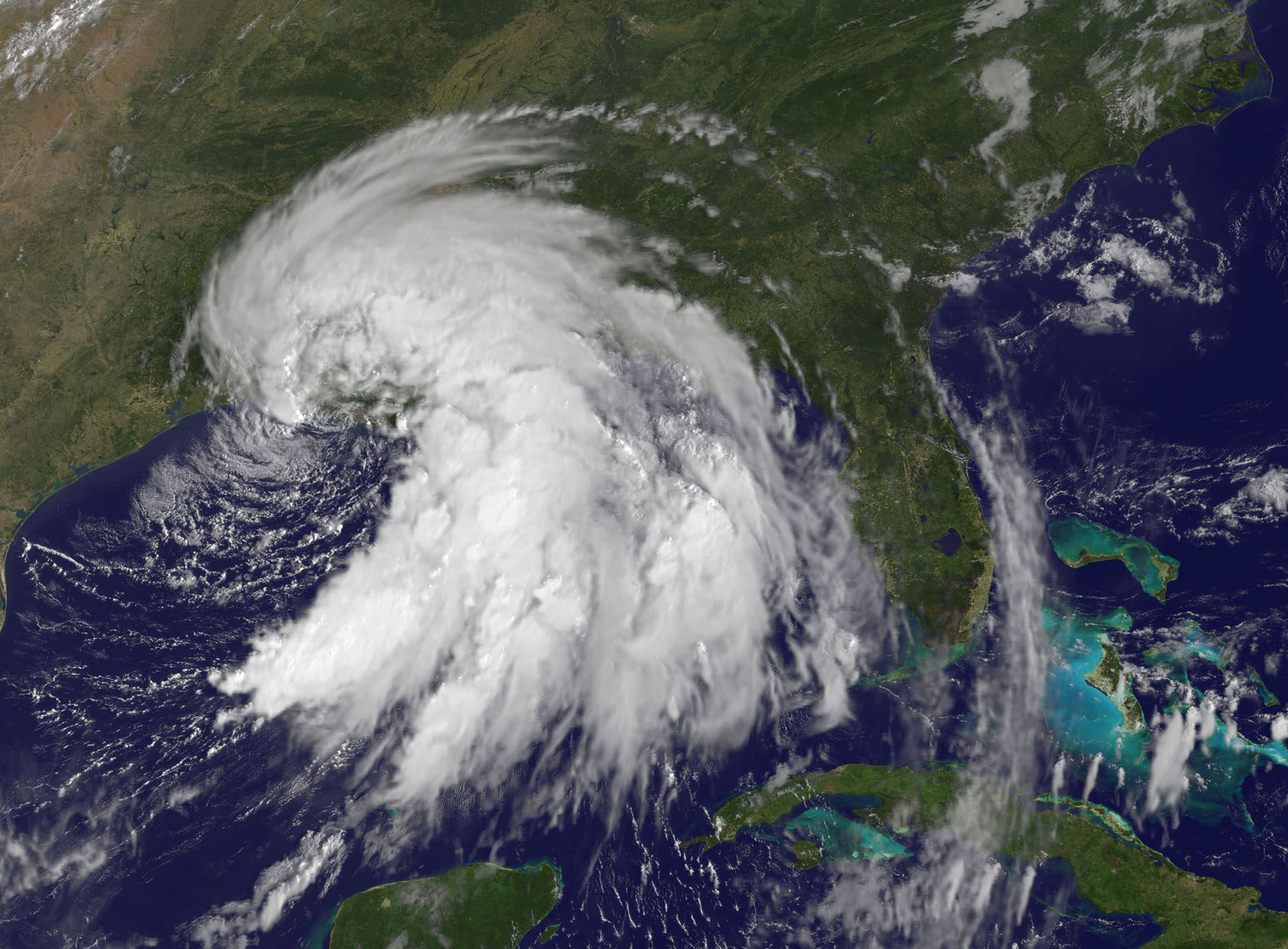
This infrared image of Tropical Storm Lee on Sept. 3 at 3:47 p.m. EDT when the center was still sitting south of the Louisiana coast. The strongest thunderstorms and coldest clouds (purple) stretched from Mobile Bay, south into the Gulf of Mexico and covered about 1/3rd of the Gulf of Mexico. Winds were 55 mph at the time of this image. The image was taken by the AIRS instrument on NASA's Aqua satellite. Credit: NASA JPL, Ed Olsen NASA
Lee’s tropical force winds now extend out 275 miles from the center. A large part of Lee is still over the Gulf of Mexico where the driving wind and rain affected operations on some oil rigs.
Lee has spawned more than a dozen tornadoes in the Gulf Coast states. The storm is spreading more heavy rain and winds on a northeast to east- northeast heading tracking towards Tennessee over the next 24 to 36 hours according to the latest weather forecasts.
Meanwhile Hurricane Katia is packing winds of 110 MPH and is on a path that could cause it to make landfall on the Outer Banks of North Carolina just a week after the state suffered from Hurricane Irene.
This GOES-13 satellite image shows Hurricane Katia (right), Tropical Depression 13 (left) and System 94L (top). Credit: NASA/NOAA GOES Project
Irene caused extensive flooding and devastation on the hundred year scale in several US states still reeling from flooding and destruction. More than 43 deaths have been reported so far, including emergency rescue workers. Initial damage estimates are over $6 Billion.
Thousands of East Coast homes and businesses are still without power as strong after effects from Irene continue to play out.
President Obama toured flood stricken areas of Paterson, New Jersey today (Sept. 4).
According to a statement by Rob Gutro, of NASA’s Goddard Space Flight Center, Greenbelt, Md; Tropical Storm Lee’s winds had dropped from 60 mph exactly 24 hours before to 45 mph at 8 a.m. EDT on Sept. 4.
Lee’s center was over Vermillion Bay, Louisiana near 29.7 North and 92.0 West. It was crawling to the northeast near 3 mph (6 kmh) and expected to continue in that direction today, turning to the east-northeast tonight. Because Lee’s center is over land, he is expected to continue weakening gradually in the next couple of days. Lee’s outer bands still extend far over the Gulf of Mexico, bringing in more moisture and keeping the system going.
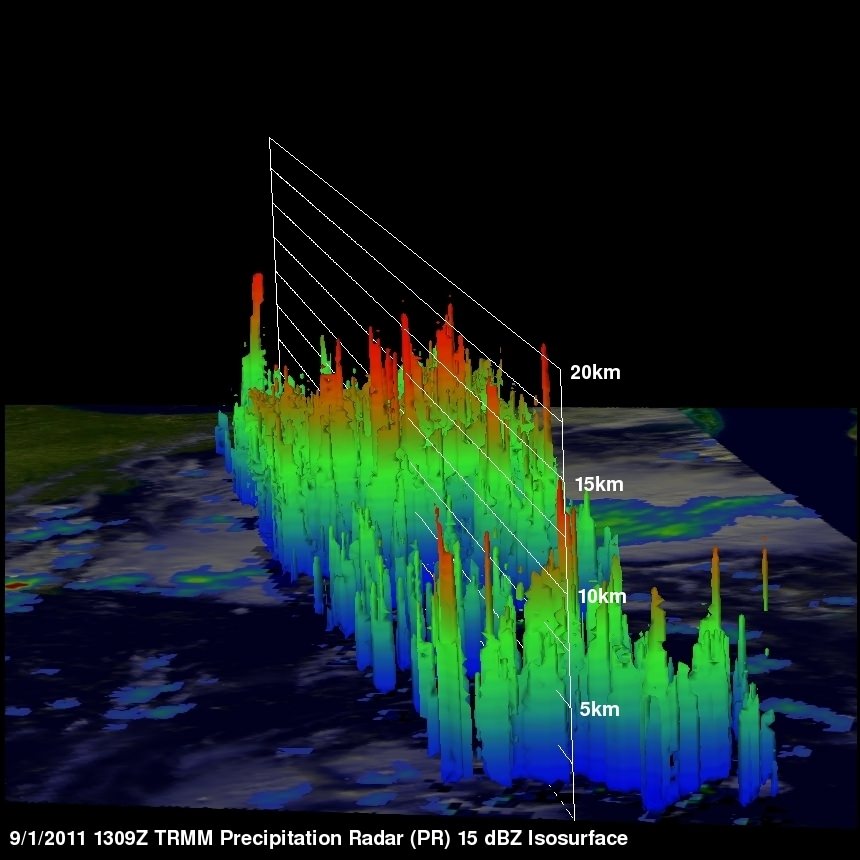
Here's a 3-D look at Tropical Depression 13 from NASA's TRMM Satellite on Sept 1. Some of the highest thunderstorm towers in that area were shown by PR data to reach heights of over 15km (~9.3 miles) and there were areas of heavy rain - which is going to affect the shoreline.. waves of rainfall to move inland. Credit: NASA/Goddard
This visible image of Tropical Storm Lee was taken from the GOES-13 satellite on Saturday, Sept. 3 at 9:32 a.m. EDT. It shows the extent of Lee's cloud cover over Louisiana, Mississippi, Alabama and the Florida Panhandle. The clearing on the southeastern side is a result of drier air moving in and preventing development of thunderstorms. Credit: NASA/NOAA GOES Project