Getting a Handle on How Much Cosmic Dust Hits Earth

A starry sky, with a bright column due to zodiacal light, illuminates the desert landscape around Cerro Paranal, home to ESO's Very Large Telescope (VLT).

[/caption]

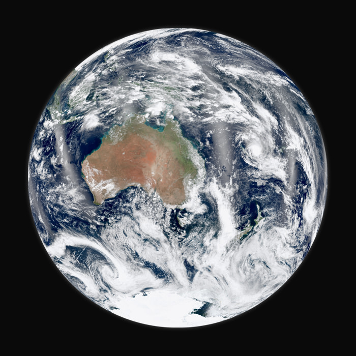
Does Earth have a dust build-up problem?

Estimates vary of how much cosmic dust and meteorites enter Earth’s atmosphere each day, but range anywhere from 5 to 300 metric tons, with estimates made from satellite data and extrapolations of meteorite falls. Thing is, no one really knows for sure and so far there hasn’t been any real coordinated efforts to find out. But a new project proposal called Cosmic Dust in the Terrestrial Atmosphere (CODITA) would provide more accurate estimates of how much material hits Earth, as well as how it might affect the atmosphere.

“We have a conundrum – estimates of how much dust comes in vary by a factor of a hundred,” said John Plane from University of Leeds in the UK. “The aim of CODITA is to resolve this huge discrepancy.”

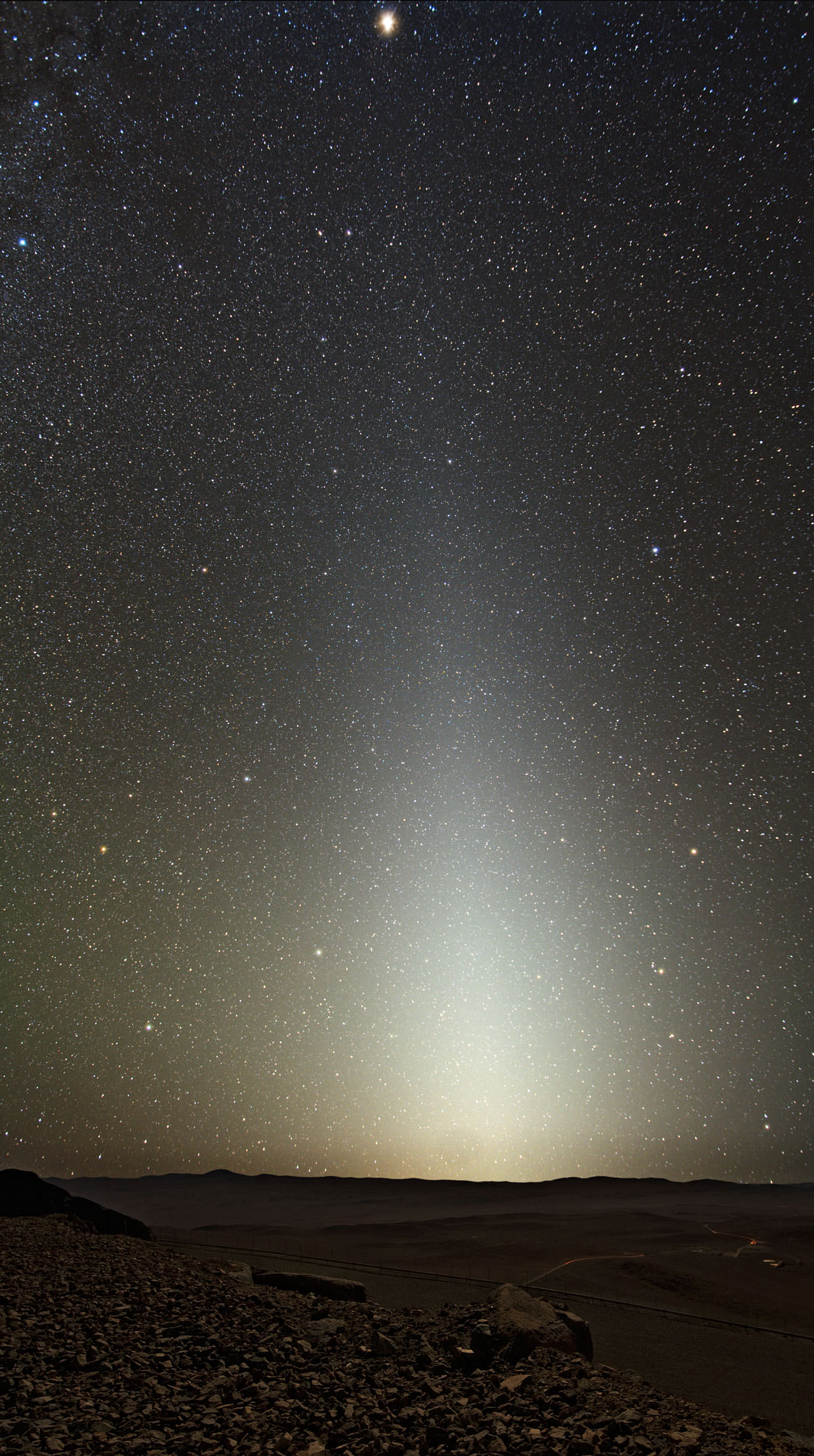
Even though we consider space to be empty, if all the material between the Sun and Jupiter were compressed together it would form a moon 25 km across.

So how much of this stuff – leftovers from the formation of the planets, debris from comets and asteroid collisions, etc. — encounters Earth? Satellite observations suggest that 100-300 metric tons of cosmic dust enter the atmosphere each day. This figure comes from the rate of accumulation in polar ice cores and deep-sea sediments of rare elements linked to cosmic dust, such as iridium and osmium.

But other measurements – which includes meteor radar observations, laser observations and measurements by high altitude aircraft — indicate that the input could be as low as 5 metric ton per day.

Knowing the difference could have a big influence on our understanding of things like climate change and, noctilucent clouds, as well as ozone and ocean chemistry.

“If the dust input is around 200 tons per day, then the particles are being transported down through the middle atmosphere considerably faster than generally believed,” said Plane. “If the 5-tonne figure is correct, we will need to revise substantially our understanding of how dust evolves in the Solar System and is transported from the middle atmosphere to the surface.”

When dust particles approach the Earth they enter the atmosphere at very high speeds, anything from 38,000 to 248,000 km/hour, depending on whether they are orbiting in the same direction or the opposite to the Earth’s motion around the Sun. The particles undergo very rapid heating through collisions with air molecules, reaching temperatures well in excess of 1,600 degrees Celsius. Particles with diameters greater than about 2 millimeters produce visible “shooting stars,” but most of the mass of dust particles entering the atmosphere is estimated to be much smaller than this, so can be detected only using specialized meteor radars.

The metals injected into the atmosphere from evaporating dust particles are involved in a diverse range of phenomena linked to climate change.

“Cosmic dust is associated with the formation of ‘noctilucent’ clouds – the highest clouds in the Earth’s atmosphere. The dust particles provide a surface for the cloud’s ice crystals to form. These clouds develop during summer in the polar regions and they appear to be an indicator of climate change,’ said Plane. “The metals from the dust also affect ozone chemistry in the stratosphere. The amount of dust present will be important for any geo-engineering initiatives to increase sulphate aerosol to offset global warming. Cosmic dust also fertilises the ocean with iron, which has potential climate feedbacks because marine phytoplankton emit climate-related gases.”

The CODITA team will also use laboratory facilities to tackle some of the least well-understood aspects of the problem

“In the lab, we’ll be looking at the nature of cosmic dust evaporation, as well as the formation of meteoric smoke particles, which play a role in ice nucleation and the freezing of polar stratospheric clouds,” said Plane. “The results will be incorporated into a chemistry-climate model of the whole atmosphere. This will make it possible, for the first time, to model the effects of cosmic dust consistently from the outer Solar System to the Earth’s surface.”

CODITA has received a EUR 2.5 million grant from the European Research Council to investigate the dust input over the next 5 years. The international team, led by Plane, is made up of over 20 scientists in the UK, the US and Germany. Plane presented information about the project at the National Astronomy meeting in the UK this week.

Source: Jodrell Bank Centre for Astrophysics

Shaking Up Theories Of Earth’s Formation

Earth may not have formed quite like once thought (Image: NASA/Suomi NPP)

[/caption]

Researchers from The Australian National University are suggesting that Earth didn’t form as previously thought, shaking up some long-standing hypotheses of our planet’s origins right down to the core — literally.

Ian Campbell and Hugh O’Neill, both professors at ANU’s Research School for Earth Sciences, have challenged the concept that Earth formed from the same material as the Sun — and thus has a “chondritic” composition — an idea that has been assumed accurate by planetary scientists for quite some time.


Chondrite meteorites are composed of spherical chondrules, which formed in the solar nebula before the asteroids. (NASA)

Chondrites are meteorites that were formed from the solar nebula that surrounded the Sun over 4.6 billion years ago. They are valuable to scientists because of their direct relationship with the early Solar System and the primordial material they contain.

“For decades it has been assumed that the Earth had the same composition as the Sun, as long the most volatile elements like hydrogen are excluded,” O’Neill said. “This theory is based on the idea that everything in the solar system in general has the same composition. Since the Sun comprises 99 per cent of the solar system, this composition is essentially that of the Sun.”

Instead, they propose that our planet was formed through the collision of larger planet-sized bodies, bodies that had already grown massive enough themselves to develop an outer shell.

This scenario is supported by over 20 years of research by Campbell on columns of hot rock that rise from Earth’s core, called mantle plumes. Campbell discovered no evidence for “hidden reservoirs” of heat-producing elements such as uranium and thorium that had been assumed to exist, had Earth actually formed from chondritic material.

“Mantle plumes simply don’t release enough heat for these reservoirs to exist. As a consequence the Earth simply does not have the same composition as chondrites or the Sun,” Campbell said.

The outer shell of early Earth, containing heat-producing elements obtained from the impacting smaller planets, would have been eroded away by all the collisions.

“This produced an Earth that has fewer heat producing elements than chondritic meteorites, which explains why the Earth doesn’t have the same chemical composition,” O’Neill said.

The team’s paper has been published in the journal Nature. Read the press release from The Australian National University here.

1st Student Selected MoonKAM Pictures Look Inspiringly Home to Earth

Student-run MoonKAM Imager Looks Homeward. This image of the far side of the lunar surface, with Earth in the background, was taken by the MoonKAM system board the Ebb spacecraft as part of the first image set taken from lunar orbit from March 15 – 18, 2012. A little more than half-way up and on the left side of the image is the crater De Forest. Due to its proximity to the southern pole, DeForest receives sunlight at an oblique angle when it is on the illuminated half of the Moon. NASA/Caltech-JPL/MIT/SRS

[/caption]

The first student selected photos of the Moon’s surface snapped by NASA’s new pair of student named Lunar Mapping orbiters – Ebb & Flow – have just been beamed back and show an eerie view looking back to the Home Planet – and all of Humanity – barely rising above the pockmarked terrain of the mysterious far side of our nearest neighbor in space.

Congratulations to Americas’ Youth on an outstanding and inspiring choice !!

The student photo is reminiscent of one of the iconic images of Space Exploration – the first full view of the Earth from the Moon taken by NASA’s Lunar Orbiter 1 back in August 1966 (see below).

The images were taken in the past few days by the MoonKAM camera system aboard NASA’s twin GRAIL spacecraft currently circling overhead in polar lunar orbit, and previously known as GRAIL A and B. The formation-flying probes are soaring over the Moon’s north and south poles.

The nearly identical ships were rechristened as Ebb and Flow after Fourth grade students from the Emily Dickinson Elementary School in Bozeman, Mont., won the honor to rename both spacecraft by submitting the winning entries in a nationwide essay competition sponsored by NASA.

“The Bozeman 4th graders had the opportunity to target the first images soon after our science operations began,” said Maria Zuber, GRAIL principal investigator of the Massachusetts Institute of Technology in Cambridge, Mass., to Universe Today.

“It is impossible to overstate how thrilled and excited we are !”

The initial packet of some 66 student-requested digital images from the Bozeman kids were taken by the Ebb spacecraft from March 15-17 and downlinked to Earth March 20. They sure have lots of exciting classwork ahead analyzing all those lunar features !

“GRAIL’s science mapping phase officially began on March 6 and we are collecting science data,” Zuber stated.

Far Side of Moon Imaged by MoonKAM
This image of the lunar surface was taken by the MoonKAM system onboard NASA’s Ebb spacecraft on March 15, 2012. The 42.3-mile-wide (68-kilometer-wide) crater in the middle of the image (with the smaller crater inside) is Poinsot. Crater Poinsot, named for the French mathematician Louis Poinsot, is located on the northern part of the moon's far side. The target was selected by 4th grade students at Emily Dickinson Elementary School in Montana who had the honor of choosing the first MoonKAM images after winning a nationwide contest. NASA/Caltech-JPL/MIT/SRS

GRAIL’s science goal is to map our Moon’s gravity field to the highest precision ever. This will help deduce the deep interior composition, formation and evolution of the Moon and other rocky bodies such as Earth and also determine the nature of the Moon’s hidden core.

Engaging students and the public in science and space exploration plays a premier role in the GRAIL project. GRAIL is NASA’s first planetary mission to carry instruments – in the form of cameras – fully dedicated to education and public outreach.

Over 2,700 schools in 52 countries have signed up to participate in MoonKAM.

Ebb and Flow - New Names for the GRAIL Twins in Lunar Orbit
4th Grade Students from Bozeman, Montana (inset) won NASA’s contest to rename the GRAIL A and GRAIL B spacecraft and also chose the first lunar targets to be photographed by the onboard MoonKAM camera system. Artist concept of twin GRAIL spacecraft flying in tandem orbits around the Moon to measure its gravity field Credit: NASA/JPL -M ontage: Ken Kremer

5th to 8th grade students can send suggestions for lunar surface targets to the GRAIL MoonKAM Mission Operations Center at UC San Diego, Calif. Students will use the images to study lunar features such as craters, highlands, and maria while also learning about future landing sites.

NASA calls MoonKAM – “The Universe’s First Student-Run Planetary Camera”. MoonKAM means Moon Knowledge Acquired by Middle school students.

The MoonKAM project is managed by Dr Sally Ride, America’s first female astronaut.

“What might seem like just a cool activity for these kids may very well have a profound impact on their futures,” Ride said in a NASA statement. “The students really are excited about MoonKAM, and that translates into an excitement about science and engineering.”

“MoonKAM is based on the premise that if your average picture is worth a thousand words, then a picture from lunar orbit may be worth a classroom full of engineering and science degrees,” says Zuber. “Through MoonKAM, we have an opportunity to reach out to the next generation of scientists and engineers. It is great to see things off to such a positive start.”

MoonKAM image from NASA’s Ebb Lunar Mapping orbiter. This lunar target was selected by the 4th graders at Emily Dickinson Elementary School in Montana who won the contest to rename the GRAIL probes in a nationwide essay contest. NASA/Caltech-JPL/MIT/SRS

Altogether there are eight MoonKAM cameras aboard Ebb and Flow – one 50 mm lens and three 6 mm lenses. Each probe is the size of a washing machine and measures just over 3 feet in diameter and height.

Snapping the first images was delayed a few days by the recent series of powerful solar storms.

“Due to the extraordinary intensity of the storms we took the precaution of turning off the MoonKAMs until the solar flux dissipates a bit,” Zuber told me.

“GRAIL weathered the storm well. The spacecraft and instrument are healthy and we are continuing to collect science data.”

The washing-machine sized probes have been flying in tandem around the Moon since entering lunar orbit in back to back maneuvers over the New Year’s weekend. Engineers spent the past two months navigating the spaceship duo into lower, near-polar and near-circular orbits with an average altitude of 34 miles (55 kilometers) that are optimized for science data collection and simultaneously checking out the spacecraft systems.

Ebb and Flow were launched to the Moon on September 10, 2011 aboard a Delta II rocket from Cape Canaveral, Florida and took a circuitous 3.5 month low energy path to the moon to minimize the overall costs.

The Apollo astronauts reached the Moon in just 3 days. NASA’s next generation Orion space capsule currently under development will send American astronauts back to lunar orbit by 2021 or sooner.

NASA has just granted an extension to the GRAIL mission. Watch for my follow-up report detailing the expanded science goals of GRAIL’s extended lunar journey.

One of the first two remote images of Earth taken from the distance of the Moon on August 23, 1966 by NASA’s Lunar Orbiter 1 spacecraft. Credit: NASA

…….

March 24 (Sat): Free Lecture by Ken Kremer at the New Jersey Astronomical Association, Voorhees State Park, NJ at 830 PM. Topic: Atlantis, the End of Americas Shuttle Program, Orion, SpaceX, CST-100, Moon and the Future of NASA Human & Robotic Spaceflight

Orion Crew Capsule Targeted for 2014 Leap to High Orbit

The Orion Exploration Flight Test-1 (EFT-1) is scheduled to launch the first unmanned Orion crew cabin into a high altitude Earth orbit in 2014 atop a Delta 4 Heavy rocket from Cape Canaveral, Florida. Artist’s concept. Credit: NASA

[/caption]

NASA is on course to make the highest leap in human spaceflight in nearly 4 decades when an unmanned Orion crew capsule blasts off from Cape Canaveral, Fla., on a high stakes, high altitude test flight in early 2014.

A new narrated animation (see below) released by NASA depicts the planned 2014 launch of the Orion spacecraft on the Exploration Flight Test-1 (EFT-1) mission to the highest altitude orbit reached by a spaceship intended for humans since the Apollo Moon landing Era.

Orion is NASA’s next generation human rated spacecraft and designed for missions to again take humans to destinations beyond low Earth orbit- to the Moon, Mars, Asteroids and Beyond to deep space.


Orion Video Caption – Orion: Exploration Flight Test-1 Animation (with narration by Jay Estes). This animation depicts the proposed test flight of the Orion spacecraft in 2014. Narration by Jay Estes, Deputy for flight test integration in the Orion program.

Lockheed Martin Space Systems is making steady progress constructing the Orion crew cabin that will launch atop a Delta 4 Heavy booster rocket on a two orbit test flight to an altitude of more than 3,600 miles and test the majority of Orion’s vital vehicle systems.

The capsule will then separate from the upper stage, re-enter Earth’s atmosphere at a speed exceeding 20,000 MPH, deploy a trio of huge parachutes and splashdown in the Pacific Ocean off the west coast of California.

Lockheed Martin is responsible for conducting the critical EFT-1 flight under contract to NASA.

Orion will reach an altitude 15 times higher than the International Space Station (ISS) circling in low orbit some 250 miles above Earth and provide highly valuable in-flight engineering data that will be crucial for continued development of the spaceship.

Orion Exploration Flight Test One Overview. Credit: NASA

“This flight test is a challenge. It will be difficult. We have a lot of confidence in our design, but we are certain that we will find out things we do not know,” said NASA’s Orion Program Manager Mark Geyer.

“Having the opportunity to do that early in our development is invaluable, because it will allow us to make adjustments now and address them much more efficiently than if we find changes are needed later. Our measure of success for this test will be in how we apply all of those lessons as we move forward.”

Lockheed Martin is nearing completion of the initial assembly of the Orion EFT-1 capsule at NASA’s historic Michoud Assembly Facility (MAF) in New Orleans, which for three decades built all of the huge External Fuel Tanks for the NASA’s Space Shuttle program.

In May, the Orion will be shipped to the Kennedy Space Center in Florida for final assembly and eventual integration atop the Delta 4 Heavy rocket booster and launch from Space Launch Complex 37 at nearby Cape Canaveral. The Delta 4 is built by United Launch Alliance.

The first integrated launch of an uncrewed Orion is scheduled for 2017 on the first flight of NASA’s new heavy lift rocket, the SLS or Space Launch System that will replace the now retired Space Shuttle orbiters

Continued progress on Orion, the SLS and all other NASA programs – manned and unmanned – is fully dependent on the funding level of NASA’s budget which has been significantly slashed by political leaders of both parties in Washington, DC in recent years.

…….

March 24 (Sat): Free Lecture by Ken Kremer at the New Jersey Astronomical Association, Voorhees State Park, NJ at 830 PM. Topic: Atlantis, the End of Americas Shuttle Program, Orion, SpaceX, CST-100 and the Future of NASA Human & Robotic Spaceflight

Fears of Tornado Catastrophes Due to Global Warming Unfounded

Tornadoes in the Midwest US, March 2, 2012 Tornadoes swept the Midwest US on March 2, 2012. In this image, clouds are rendered using thermal infrared (heat) and visible imagery from the Geostationary Operational Environmental Satellite-East (GOES-East). Background land information is from the Moderate Resolution Imaging Spectroradiometer (MODIS). Image credit: NOAA-NASA GOES Project/NASA Earth Observatory.

[/caption]

The 2012 tornado season got off to a rousing start. Between February 28th and March 3rd, two deadly storm systems developed in the southern United States. The storms spawned numerous tornadoes that together killed at least 52 people. This kind of extreme tornado activity, so early in the year, has fueled fears that global warming will increase the severity and duration of the tornado season. But, scientific studies show that this is not necessarily to be expected.

Early tornadoes are not unheard of. For example, on February 29 in 1952, two tornadoes caused severe damage in the south-eastern US. But this year, the number of early tornadoes has been much higher. The National Oceanic and Atmospheric Administration reported that in January of 2012, the tornado total was 95, much higher than the 1991–2010 average of 35. And the five-day total for February 28 to March 3 could rank as the highest ever since record-keeping began in 1950, according to meteorologist Dr. Jeff Masters, co-founder of the Weather Underground. With such a record-breaking start, it is not surprising people worry that a more severe 2012 storm season is ahead, and that global warming is to blame.

Tornadoes form when warm and moist air from the Gulf of Mexico meets with very cold and dry air above, which was brought south from the arctic. The collision of these air masses, which have different densities, as well as speeds and directions of motion, forces them to want to switch places very rapidly. This creates updrafts of warm and wet air, which produce thunderstorms. And, as the updrafts climb through the atmosphere, they encounter fast- moving jet stream winds, which change speed and direction with altitude. These changes give the updraft a strong twisting motion that spawns tornadoes.

The severity of tornadoes is rated on the Fujita Scale, which examines how much damage is left after a tornado has passed: F0-F1 tornadoes produce minor damage and so are considered weak, F2-F3 tornadoes produce significant damage and are considered strong, and F4-F5 tornadoes produce severe damage and are considered violent. The problem with this ranking is that it is related to a human-based assessment of damage; you need something (buildings, vegetation, etc.) to be destroyed and someone to see the damage. So, a severe tornado that occurs somewhere where there is nothing to be destroyed would be classed as weak, and one that occurs where there is no-one to see the damage wouldn’t even be counted.

National Oceanic and Atmospheric Administration's VORTEX-99 team observed several tornadoes on May 3, 1999, in central Oklahoma. The tube-like funnel is attached at the top to a rotating cloud base and surrounded by a translucent dust cloud near the ground. Image credit: NOAA.

Still, tornado awareness and volunteer reporting programs, along with good record-keeping, have significantly improved our understanding of tornadoes and their frequency. Surprisingly, the Storm Prediction Center’s tornado database, which goes back to 1950, does not show an increasing trend in recent tornadoes. This finding is confirmed by Dr. Stanley Changnon from the University of Illinois at Urbana-Champaign, whose study of insurance industry records was published last year. Dr. Changnon’s work shows that tornado catastrophes and their losses peaked in the years between 1966 and 1973, but have shown no upward trend since that time. In fact, the number of the most damaging storms, those rated as F2 to F5 has actually decreased over the past 5 decades. So, it does not appear that global warming is increasing the number of tornadoes that occur.

This is actually not as surprising as it seems. While a local increase in temperature and humidity, whether caused by global warming or not, would be expected to create more thunderstorms, it is not clear that these thunderstorms would spawn tornadoes. The reason is that global warming does not increase temperatures the same everywhere. Warming at the poles is expected to exceed warming at more southern latitudes. This means that cold polar air will be much less colder than before and warm Gulf of Mexico air will only be slightly warmer. When these two air masses meet above the southern US, the temperature difference between them will not be so great and their drive to swap places will be much less intense. The result will be a significantly slower moving updraft of warm air that is not expected to produce as many extreme thunderstorms or spawn as many tornadoes.

So, global warming is not expected to increase the total frequency of tornado activity. However, warming global temperatures will mean an earlier spring and the potential for earlier tornadoes. In fact, the early tornado numbers we’ve seen so far this year may be a sign of a global warming-induced shift in the tornado season, according to Dr. Masters. If this is the case, the tornado season may start earlier, but it will also end earlier. As meteorologist Harold Brooks from the National Severe Storms Laboratory in Norman, Oklahoma, points out, this record start to the 2012 tornado season does not necessarily mean the rest of the season will be severe.

Sources:
Recap of deadly U.S. tornado outbreak February 28-March 3, 2012, M. Daniel, EarthSky Mar 5, 2012.
NASA Earth Observatory, March 5, 2012.
Temporal distribution of weather catastrophes in the USA, S.A. Changnon, Climatic Change 106 (2), 129-140, 2011, doi: 10.1007/s10584-010-9927-1.
Does Global Warming Influence Tornado Activity? Diffenbaugh et al., EOS 89 (53), 553-554, 2008.

Mexican Lake Bears Witness To Ancient Impact

Lake Cuitzeo in central Mexico. (Via Julio Marquez, Wikipedia Commons)

[/caption]

Exotic sediments found beneath the floor of Lake Cuitzeo in central Mexico support theories of a major cosmic impact event 12,900 years ago, report a 16-member international research team. The impact may have caused widespread environmental changes and contributed to the extinctions of many large animal species.

Images of single and twinned nanodiamonds show the atomic lattice framework of the nanodiamonds. Each dot represents a single atom. (Source: UCSB release.)

The team found a 13,000-year-old  layer of sediment that contains materials associated with impact events, such as soot, impact spherules and atomic-scale structures known as nanodiamonds. The nanodiamonds found at Lake Cuitzeo are of a variety known as lonsdaleite, even harder than “regular” diamond and only found naturally as the result of impact events.

The thin layer of sediment below Cuitzeo corresponds to layers of similar age found throughout North America, Greenland and Western Europe.

It’s thought that a large several-hundred-meter-wide asteroid or comet entered Earth’s atmosphere at a shallow angle 12,900 years ago, melting rocks, burning biomass and, in general, causing widespread chaos and destruction. This hypothesized event would have occurred just before a period of unusually cold climate known as the Younger Dryas.

The Younger Dryas has been associated with the extinction of large North American animals such as mammoths, saber-tooth cats and dire wolves.

“The timing of the impact event coincided with the most extraordinary biotic and environmental changes over Mexico and Central America during the last approximately 20,000 years, as recorded by others in several regional lake deposits,” said James Kennett, professor of earth science at UC Santa Barbara and member of the research team. “These changes were large, abrupt, and unprecedented, and had been recorded and identified by earlier investigators as a ‘time of crisis.’ ”

The exotic materials found in the sediment beneath Cuitzeo could not have been created by any volcanic, terrestrial or man-made process. “These materials form only through cosmic impact,” Kennett said.

The only other widespread sedimentary layer ever found to contain such an abundance of nanodiamonds and soot is found at the K-T boundary, 65 million years ago. This, of course, corresponds to the impact event that led to the extinction of the dinosaurs.

The researchers’ findings appeared March 5 in the Proceedings of the National Academy of Sciences. Read the news release from UC Santa Barbara here.

Is There Life on Earth?

An Earthshine-lit moon sets over ESO's Paranal Observatory in Chile.

[/caption]

It may seem like a silly question — of course there’s life on Earth — but what if we didn’t know that? What if we were looking at Earth from another vantage point, from another planet in another star system, perhaps? Would we be able to discern then if Earth were in fact teeming with life? All we’d have to go on would be the tiniest bit of light reflected off Earth, nearly lost in the intense glare of the Sun.

Researchers have found that the secret is knowing what kind of light to look for. And they discovered this with a little help from the Moon.

How Earthshine works. (ESO/L. Calçada)

By using Earthshine — sunlight light reflected off Earth onto the Moon — astronomers with the European Southern Observatory have been able to discern variations that correlate with identifying factors of our planet as being a happy home for life.

In observations made with ESO’s Very Large Telescope (VLT), the presence of oceans, clouds, atmospheric gases and even plants could be detected in the reflected Earthshine.

The breakthrough method was the use of spectropolarimetry, which measures polarized light reflected from Earth. Like polarized sunglasses are able to filter out reflected glare to allow you to see clearer, spectropolarimetry can focus on light reflected off a planet, allowing scientists to more clearly identify important biological signatures.

“The light from a distant exoplanet is overwhelmed by the glare of the host star, so it’s very difficult to analyze — a bit like trying to study a grain of dust beside a powerful light bulb,” said Stefano Bagnulo of the Armagh Observatory, Northern Ireland, and co-author of the study. “But the light reflected by a planet is polarized, while the light from the host star is not. So polarimetric techniques help us to pick out the faint reflected light of an exoplanet from the dazzling starlight.”

Since we have fairly reliable proof that life does in fact exist on Earth, this provides astronomers with a process and a benchmark for locating evidence of life on other distant worlds — life as we know it, anyway.

Read more on the ESO website here.

Main image credit: ESO/B. Tafreshi/TWAN (twanight.org). This research was presented in a paper, “Biosignatures as revealed by spectropolarimetry of Earthshine”, by M. Sterzik et al. to appear in the journal Nature on 1st March 2012. The team is composed of Michael F. Sterzik (ESO, Chile), Stefano Bagnulo (Armagh Observatory, Northern Ireland, UK) and Enric Palle (Instituto de Astrofisica de Canarias, Tenerife, Spain).

The Best ISS Video Ever? You Decide.


Is this the best video footage ever of photos taken from the International Space Station? ISS astronaut and Expedition 29 commander Mike Fossum seems to think so.

If anyone would know what a good ISS video is, he would! So watch, and decide for yourself.

Video uploaded by YouTube user bitmeizer. Made from sequences of still photographs taken by Expedition 29 crew members, the time-lapse videos have been digitally smoothed out and a soundtrack added, along with some transition effects.

Original video segments courtesy of the Image Science & Analysis Laboratory, NASA Johnson Space Center. See more at the Gateway to Astronaut Photography of Earth.

Antarctica Gives NASA Satellite The Ol’ Frazil Dazzle

Tendrils of ice particles, called frazil, extend out into Antarctica's Mackenzie Bay. (NASA/EO-1 - ALI)

[/caption]

Ghostly green tendrils drift out into Mackenzie Bay off the coast of eastern Antarctica in this image, acquired by NASA’s Earth-Observing (EO-1) satellite on Feb. 12, 2012.

The tendrils are made of fine particles of ice called frazil, the result of upwelling cold water from deep beneath the Amery ice shelf.

Sea water flowing in currents under the Amery ice shelf gets cooled to temperatures below freezing, the result of greater water pressures existing at depth. As some of the water rises and flows along the underside of the shelf toward the open ocean, it gradually encounters less pressure since the ice thickness decreases the further away from shore it extends.

When the supercold water approaches the surface where pressure is lowest, it instantly freezes, forming needle-like ice particles called frazil.

Only 3 -4 millimeters wide, the frazil crystals can still be concentrated enough to be visible from orbit as it drifts into the bay, flowing around icebergs as it is carried along by wind and currents. (The largest iceberg in the image is a little over 4 km/2.5 miles long.)

Eventually the warmer surface water that surrounds the southern continent melts the frazil, and the tendrils fade away.

Scheduled to fly for a year and only designed to last a year and a half, EO-1 celebrated its eleventh anniversary on November 21, 2011. During its time in orbit the satellite has accomplished far more than anyone dreamed, and its Earth-observing mission continues on. Read more on the EO-1 site here.