On Monday, April 8th, people across North America witnessed a rare celestial event known as a total solar eclipse. This phenomenon occurs when the Moon passes between the Sun and Earth and blocks the face of the Sun for a short period. The eclipse plunged the sky into darkness for people living in the Canadian Maritimes, the American Eastern Seaboard, parts of the Midwest, and northern Mexico. Fortunately for all, geostationary satellites orbiting Earth captured images of the Moon's shadow as it moved across North America.
One such satellite was the Geostationary Operational Environmental Satellite-16 (GOES-16), part of the Earth observation network jointly run by NASA and the National Oceanic and Atmospheric Administration (NOAA). The GOES-16 (GOES-East) satellite is the first of the series, regularly monitoring space weather and providing continuous imagery and atmospheric measurements of Earth's western hemisphere. From its orbit at a distance of 36,000 km (~22,370 mi) from Earth, GOES-16 captured the passage of the eclipse across North America from approximately 10:00 A.M. to 05:00 P.M. EST (07:00 A.M. to 02:00 P.M. PST).
Solar eclipses take several forms, which include what many residents in North America witnessed yesterday (i.e., the Moon completely blocking the face of the Sun). There's also an annual eclipse, which happens when the Moon passes between the Sun and Earth when it is at or near its farthest point from Earth. As a result, the face of the Sun is not completely obscured and is visible as a bright ring in the sky. There's also a partial eclipse, which happens when the Sun, Moon, and Earth are not perfectly lined up, making the Sun appear crescent-shaped.
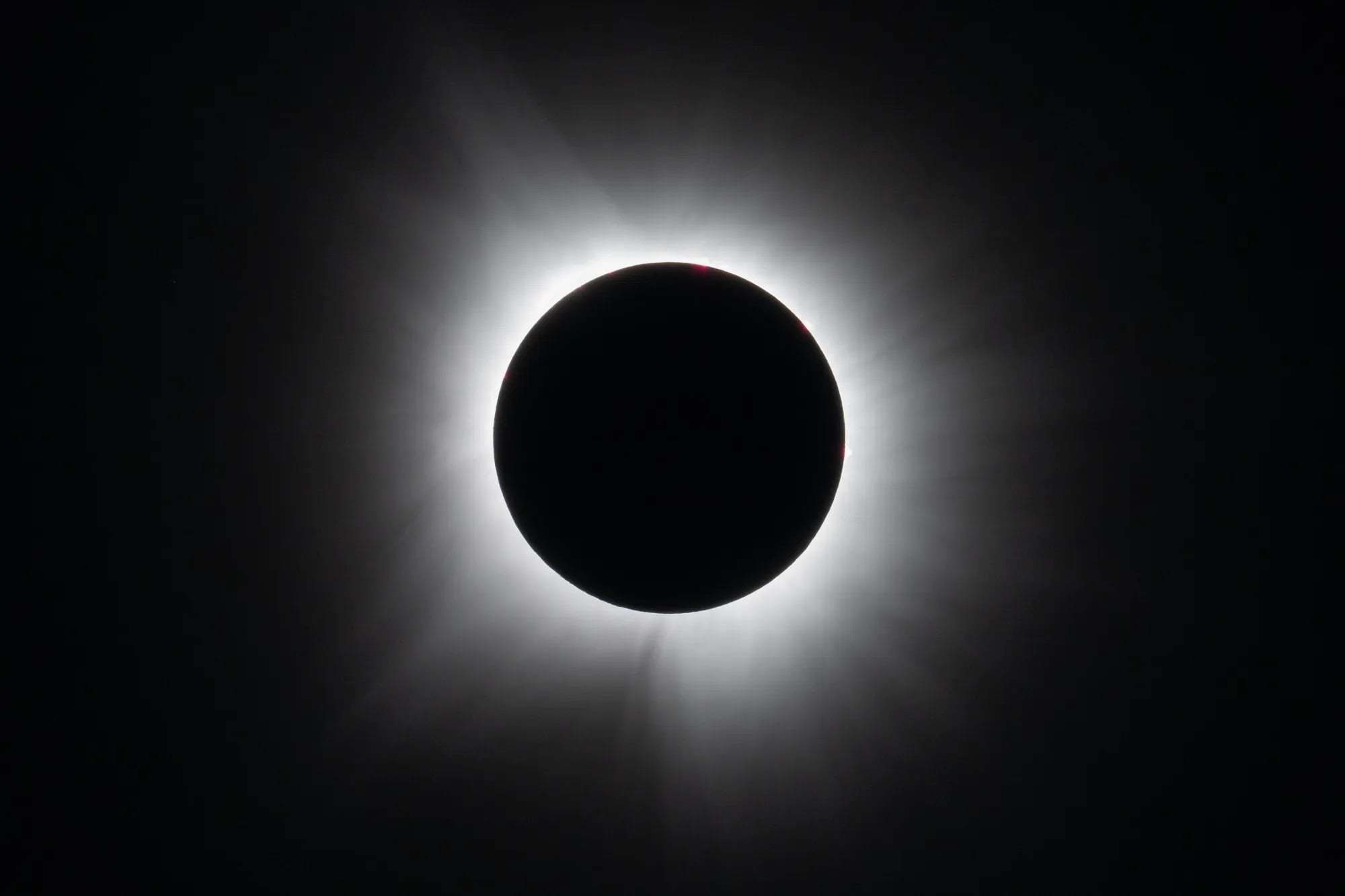
There's also what is known as a hybrid solar eclipse, which can appear to shift between annular and total (due to Earth's curvature) as the Moon's shadow moves across the globe. A total eclipse, however, is the rarest of these events, where people located directly in the center of the Moon's shadow will see only the Sun's outer atmosphere (the corona). The next total eclipse is not expected to occur until August 12th, 2026, and will be visible to residents in Greenland, Iceland, Spain, Russia, and a small area of Portugal. For people in Europe, Africa, and North America, the same eclipse will appear as a partial one.
The passage of the Moon's shadow across Earth's surface is known as the "path of totality." As the images show, this path spanned across the North American continent from Mexico to the eastern tip of Canada. Aside from GEOS-16, images were also taken by the European Space Agency's (ESA) Copernicus Sentinel-3 mission using its Sea and Land Surface Temperature Radiometer (SLSTR). This satellite monitors Earth's oceans, land, glaciers, and atmosphere to monitor and improve our understanding of global weather dynamics.
In addition to providing a rare glimpse at what a total eclipse looks like from space, the combined images are also an effective tool for researching how an eclipse influences Earth's weather. As the Moon obscures light and heat from the Sun, air temperatures drop in the path of totality and can cause cloud formations to evolve in different ways. Data from GOES-16, Sentinel-3, and other Earth Observation satellites is now being used to explore these effects.
*Further Reading: ESA*
