Here's the Total Solar Eclipse, Seen From Space

Credit: NASA/Keegan Barber

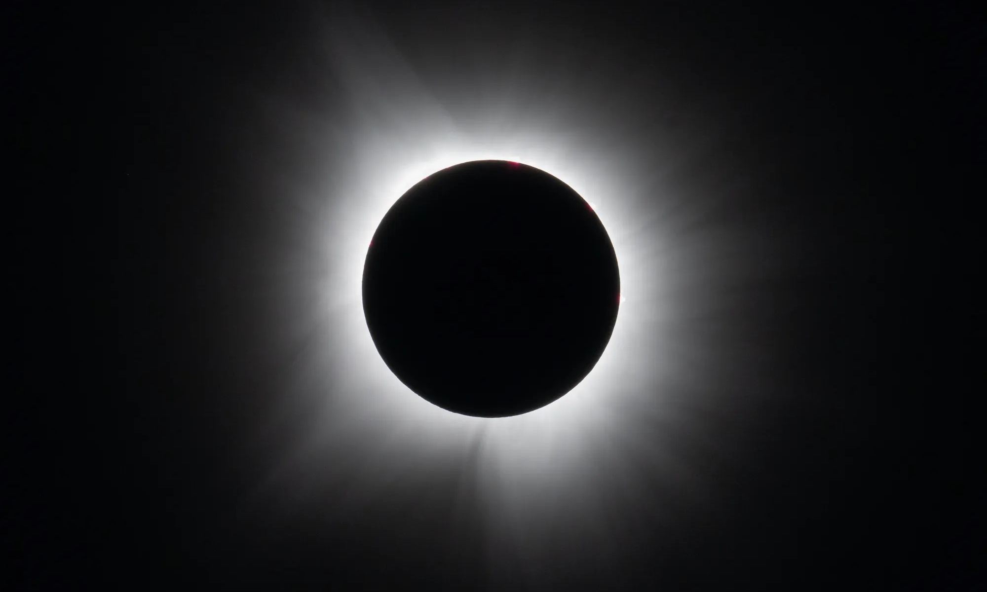
On Monday, April 8th, people across North America witnessed a rare celestial event known as a total solar eclipse. This phenomenon occurs when the Moon passes between the Sun and Earth and blocks the face of the Sun for a short period. The eclipse plunged the sky into darkness for people living in the Canadian Maritimes, the American Eastern Seaboard, parts of the Midwest, and northern Mexico. Fortunately for all, geostationary satellites orbiting Earth captured images of the Moon’s shadow as it moved across North America.

Continue reading “Here's the Total Solar Eclipse, Seen From Space”

After Stalling Out for 40 Years, the Largest Iceberg in the World is on the Move

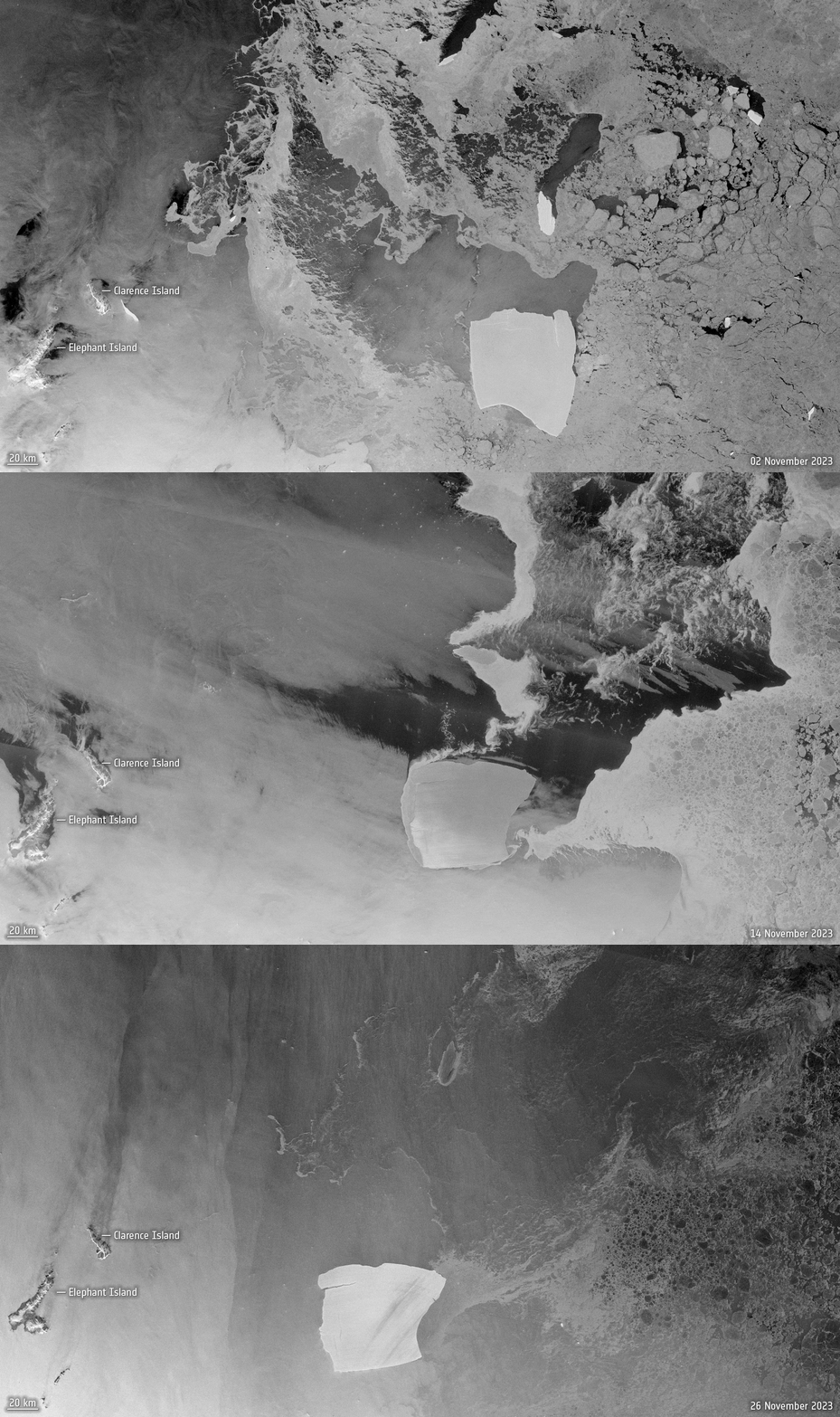
An animation from Copernicus Sentinel-1 images shows iceberg A23a’s movements from 2 November 2023, 14 November 2023 and 26 November 2023. Credit: ESA.

In 1986, a gigantic iceberg separated from the Fichner-Ronne ice shelf in West Antarctica. It was so big that it became grounded, stuck to the seafloor, and remained in position for 40 years. Finally, it has now been pushed off the seafloor and has begun drifting in the Weddell Sea to a region in the South Atlantic called Iceberg Alley. Designated A23a, this monster berg measures 4000 sq km (1,500 square miles) and is about 400 meters (1,300 feet) thick – the world’s largest.

Continue reading “After Stalling Out for 40 Years, the Largest Iceberg in the World is on the Move”

Because of Extreme Drought, Lake Powell is Barely a Lake Anymore

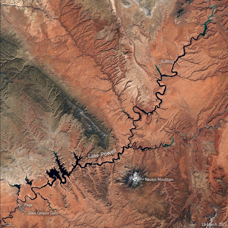
This Copernicus Sentinel-2 image allows us a wider view of Lake Powell and its dwindling water levels amidst the climate crisis. Contains modified Copernicus Sentinel data (2022), processed by ESA.

The two largest reservoirs in the United States are now at their lowest levels since they were first created. After several decades of drought – with the past two years classified as intense drought in the US Southwest — both Lake Powell and Lake Mead are shrinking. Recent satellite images show just how dramatic the changes have been, due to the ongoing the climate crisis..

Continue reading “Because of Extreme Drought, Lake Powell is Barely a Lake Anymore”

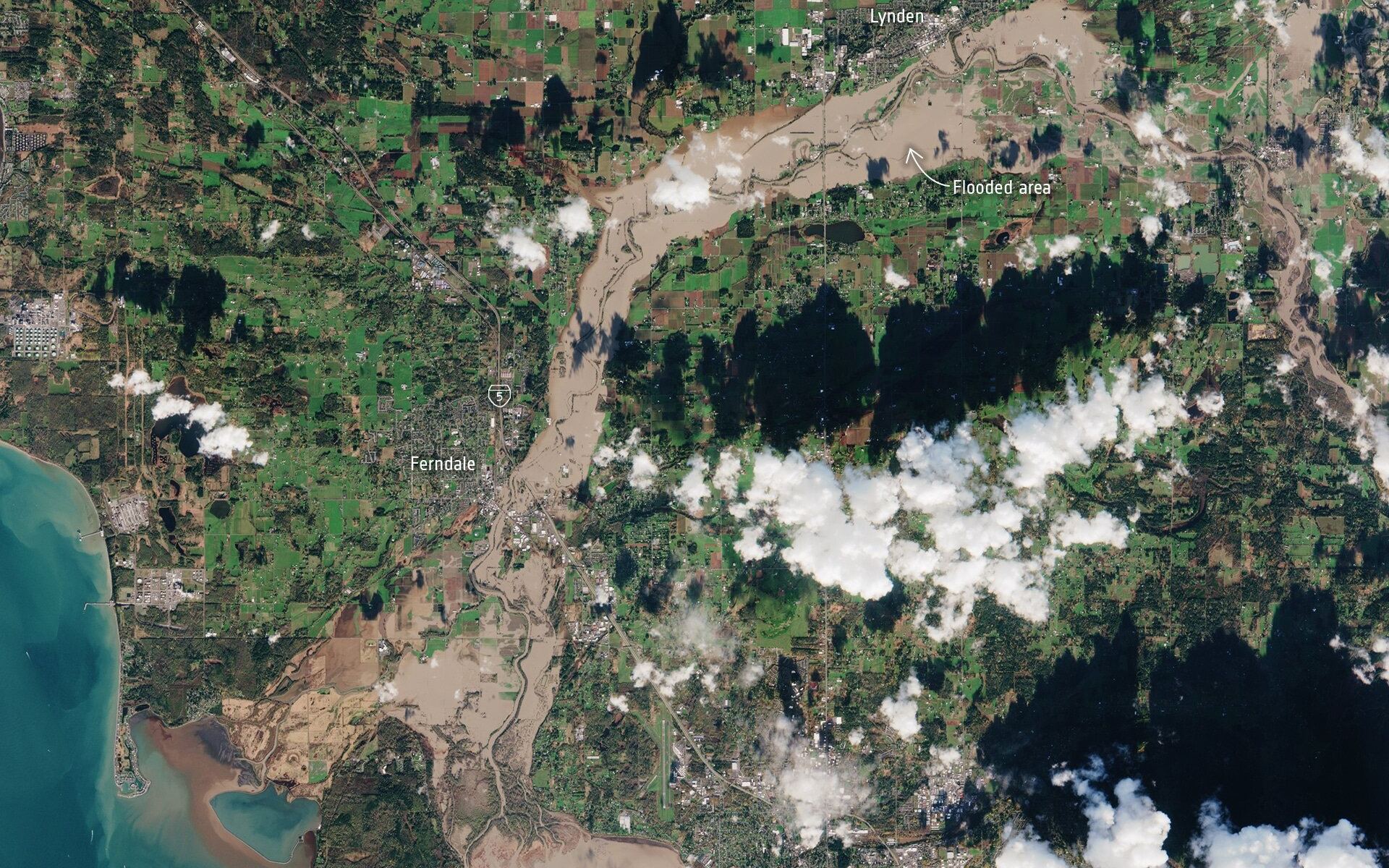
The Severe Pacific Northwest Flooding Seen From Space

The State of Washington and the Province of BC are in a state of emergency following days of severe wind, rain, and flooding. The situation began when an “atmospheric river” (a plume of moisture) extended over the Pacific Northwest, triggering severe rainfall that caused already-rising rivers to overflow. This led to blocked roads, mudslides, fallen bridges, and thousands of animals drowning in farmland areas.

This extensive damage was photographed from space by Earth observation satellites, one of which was the European Space Agency’s (ESA) Copernicus Sentinel mission and the International Space Station (ISS). These images captured the extent of the floods in the Nooksack and Fraser River valleys this week, which both spilled over their banks this week, leading to washed-out roads and forcing the evacuation of thousands of people.

Continue reading “The Severe Pacific Northwest Flooding Seen From Space”

Another Big Iceberg Just Broke off from Antarctica

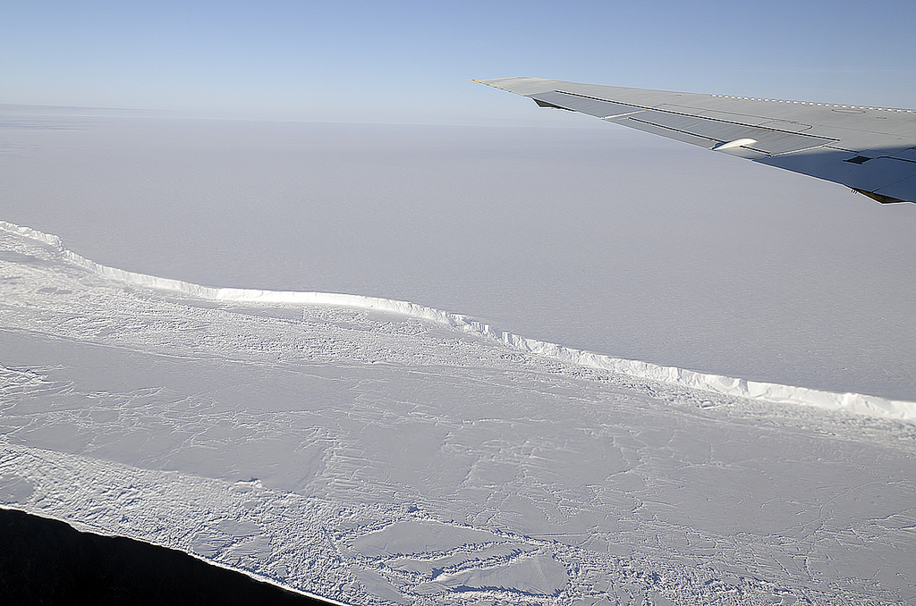
The wing of NASA's DC-8 cuts across the frozen expanse of the Brunt Ice Shelf, with its 100-foot-high cliff face. Credit: Michael Studinger/NASA.

Glaciologists have been closely monitoring ice shelves in Antarctica for signs of cracks and chasms that indicate breakups. The loss of ice around the Earth’s polar regions is one of many consequences of climate change, which is leading to rising ocean levels and various feedback mechanisms. Recently, the ESA’s Copernicus Sentinel-1 satellite witnessed a giant iceberg breaking off from Antarctica’s Brunt Ice Shelf on February 26th.

The Copernicus Sentinel mission consists of two polar-orbiting satellites that rely on C-band synthetic aperture radar imaging to conduct Earth observations in all weather conditions. In recent years, it has been monitoring the Brunt Ice Shelf for signs of cracks and chasms. According to the images it recently captured, an iceberg larger than New York City broke free and began floating out to sea.

Continue reading “Another Big Iceberg Just Broke off from Antarctica”

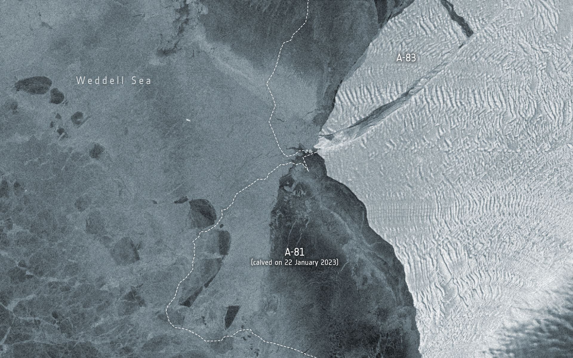
It Looks Like Iceberg A-68A is Coming Apart

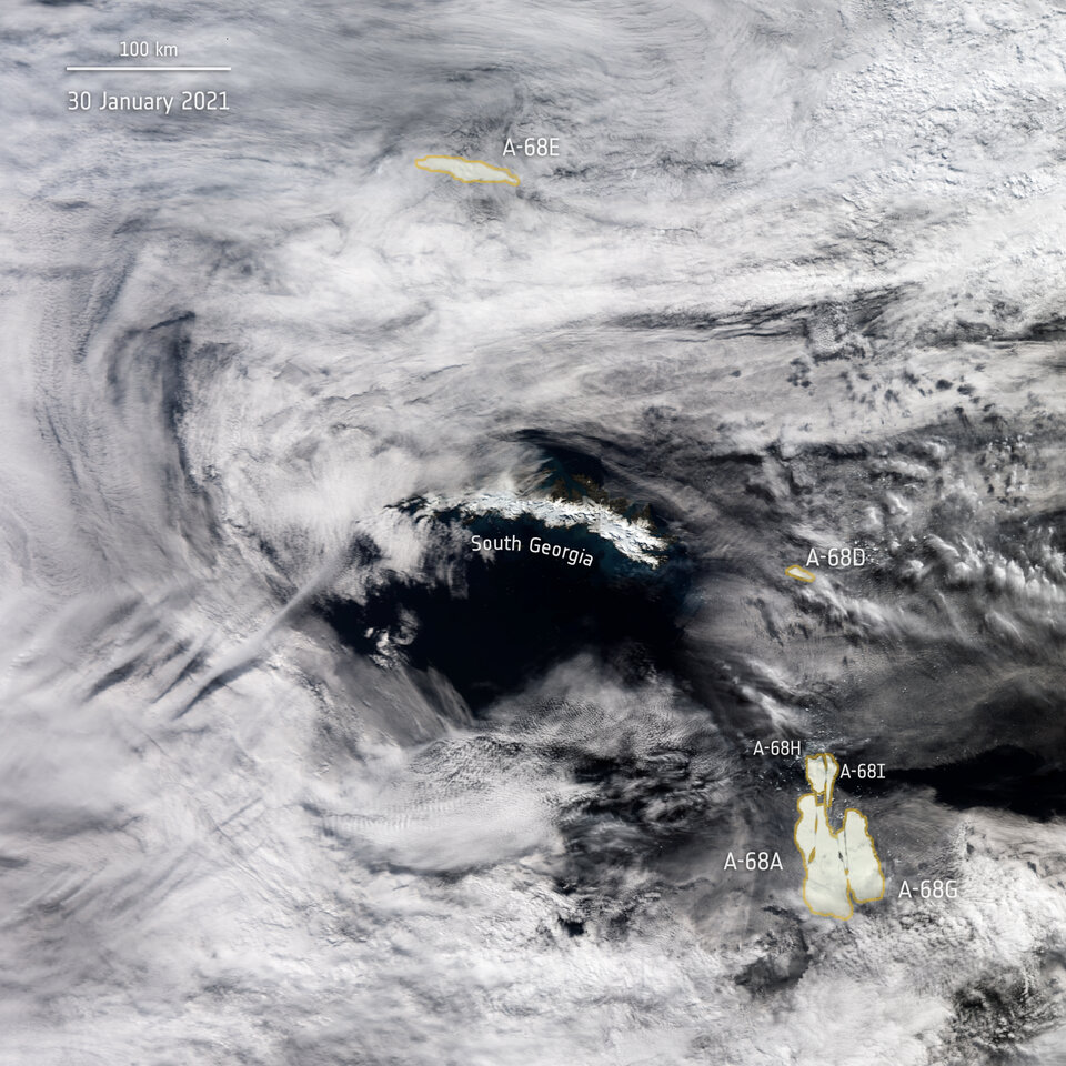
A-68 iceberg positions as seen by Copernicus Sentinel-3 mission on January 30 2021. Image Credit: ESA

Iceberg A-68A, the massive frigid behemoth posing a threat to South Georgia Island, might be breaking into pieces. Satellite images from the European Space Agency showed large cracks forming in the iceberg.

Now it appears to breaking apart.

Continue reading “It Looks Like Iceberg A-68A is Coming Apart”

Watch the Incredible Plume of Dust from Africa Cross the Entire Atlantic Ocean

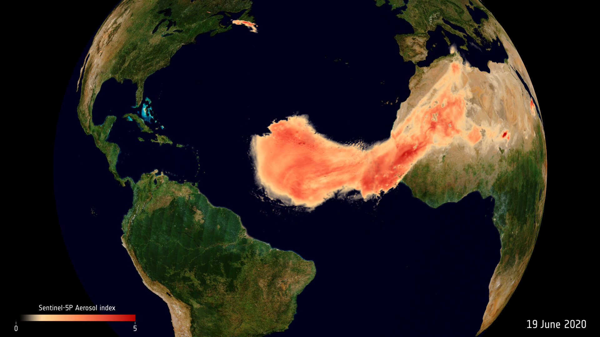
The Saharan dust plume over the Atlantic Ocean. Image Credit: contains modified Copernicus Sentinel data (2020), processed by ESA, CC BY-SA 3.0 IGO

Dust plumes are a natural phenomena, part of Earth’s nutrient cycle. They occur when high-velocity winds pick up tiny dry particles from the Earth’s surface and carry them long distances. Every summer, dust plumes from Africa’s Sahara desert travel across the Atlantic Ocean.

They’re usually not this big, and they often sink into the ocean. But this one’s coming right to America.

Continue reading “Watch the Incredible Plume of Dust from Africa Cross the Entire Atlantic Ocean”