How Long Will Our Spacecraft Survive?

How Long Will Our Spacecraft Survive?

There are many hazards out there, eager to disrupt and dismantle the mighty machines we send out into space. How long can they survive to perform their important missions?

Every few months, an eager new spacecraft arrives on the launch pad, ready for its date with destiny. If we don’t blow it all to bits with a launch vehicle failure, it’ll be gently placed into orbit with surgical precision. Then it’ll carry out a noble mission of exploring the Solar System, analyzing the Earth, or ensuring we have an infinite number of radio stations in our cars, allowing us to never be satisfied with any of them.

Space is hostile. Not just to fragile hu-mans, but also to our anthropomorphized Number Five is alive robotic spacecraft which we uncaringly send to do our bidding. There are many hazards out there, eager to disrupt and dismantle our stalwart electronic companions. Oblivion feeds voraciously on our ever trusting space scouts and their tiny delicate robotic hearts, so many well before their time.

How long have they got? How long will our spacecraft survive as we cast them on their suicide missions to “go look at stuff on behalf of the mighty human empire”? When spacecraft are hurled into the void, all mission planners know they’re living on borrowed time.

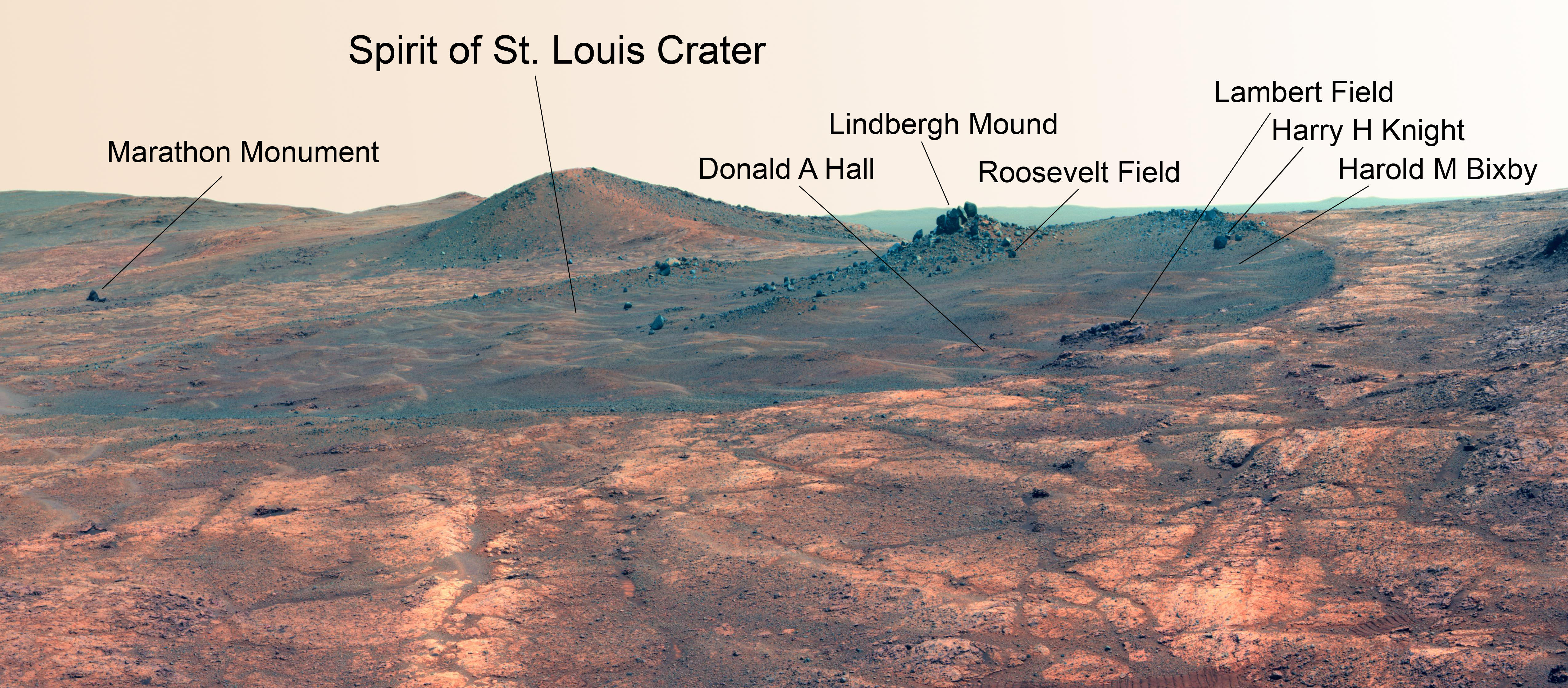
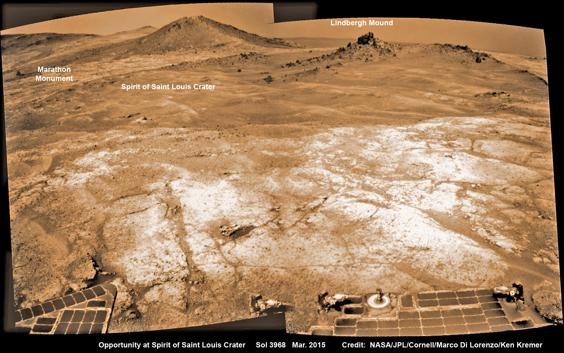
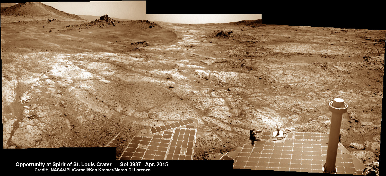
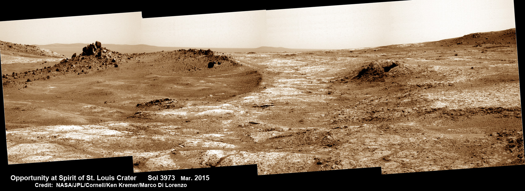
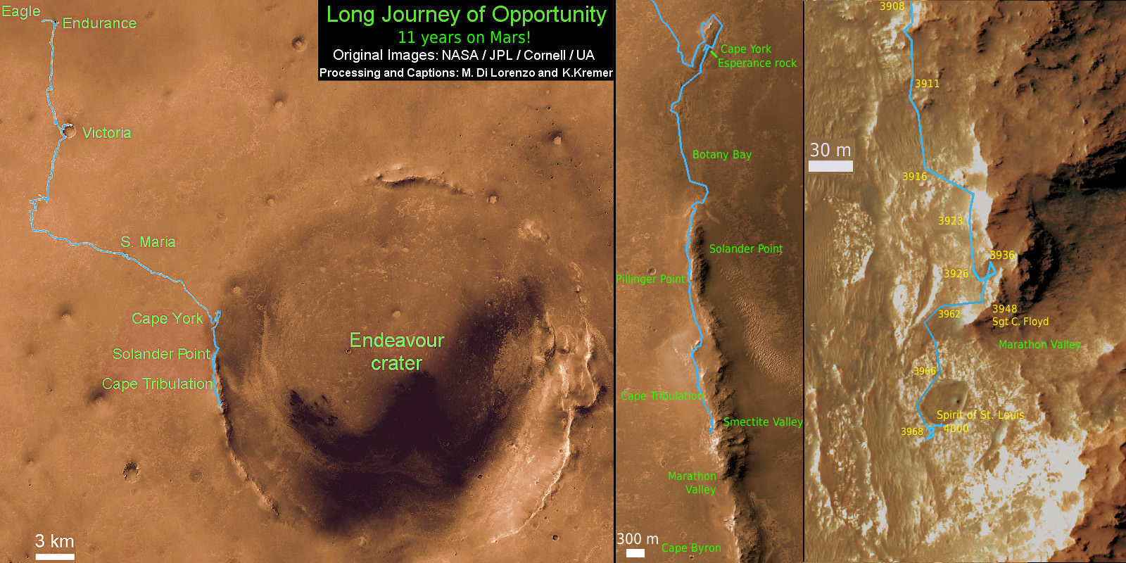
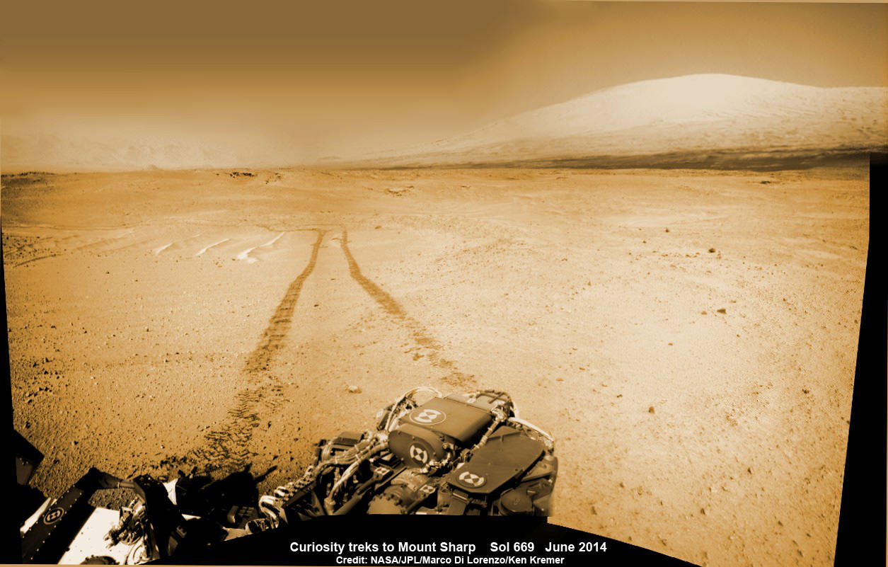
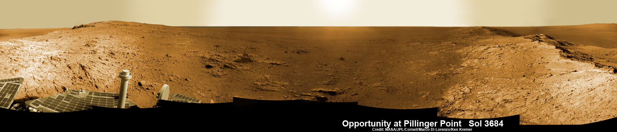
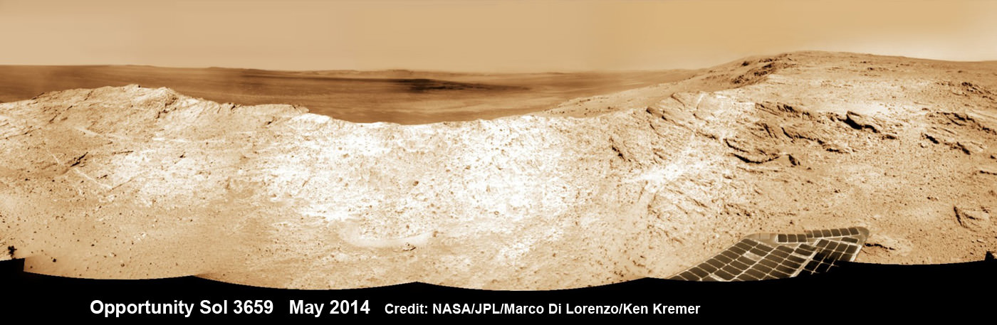
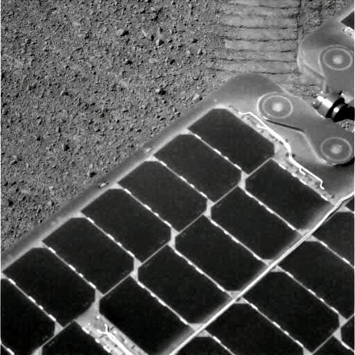
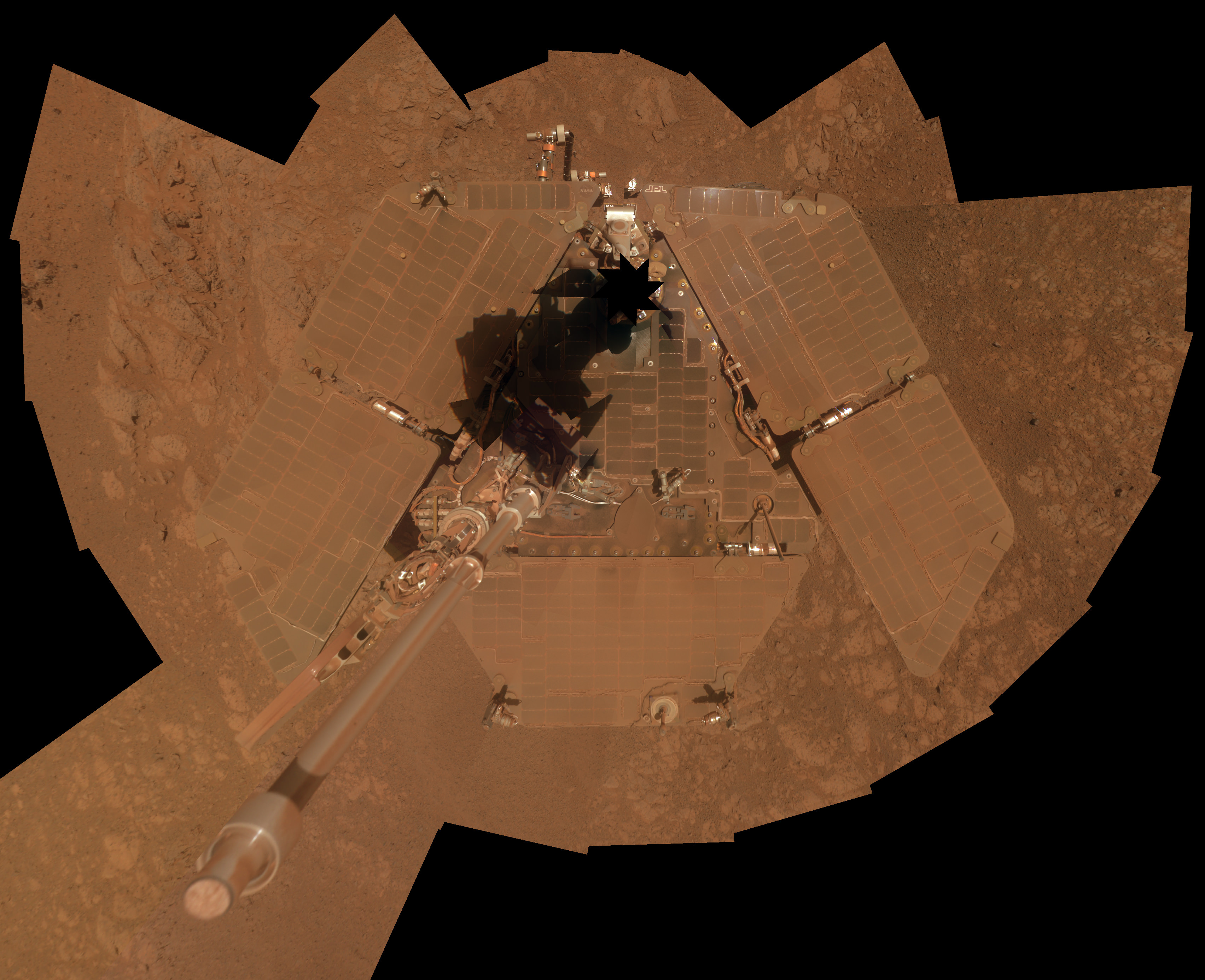
The intrepid Mars Exploration Rovers, Spirit and Opportunity, were only expected to operate for 3 months. NASA’s Spitzer Space Telescope carried a tank of expendable helium coolant to let it see the dimmest objects in the infrared spectrum.

Sometimes the spacecraft wear down for unexpected reasons, like electronic glitches, or parts wearing out. Hubble was equipped with rotating gyroscopes that eventually wore out over time, making it more difficult to steer at its targets, and only an intervention by rescue and repair allowed the mission to keep going.

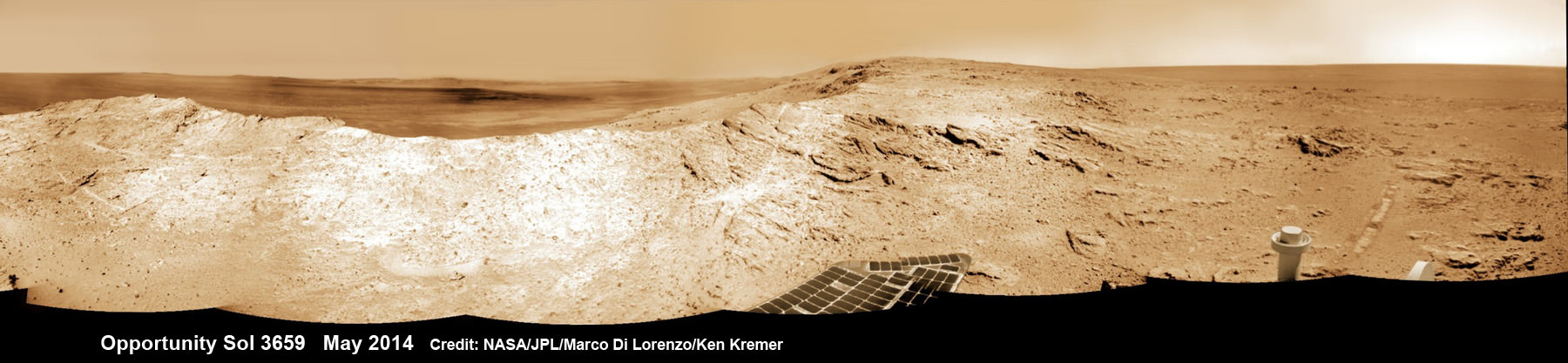
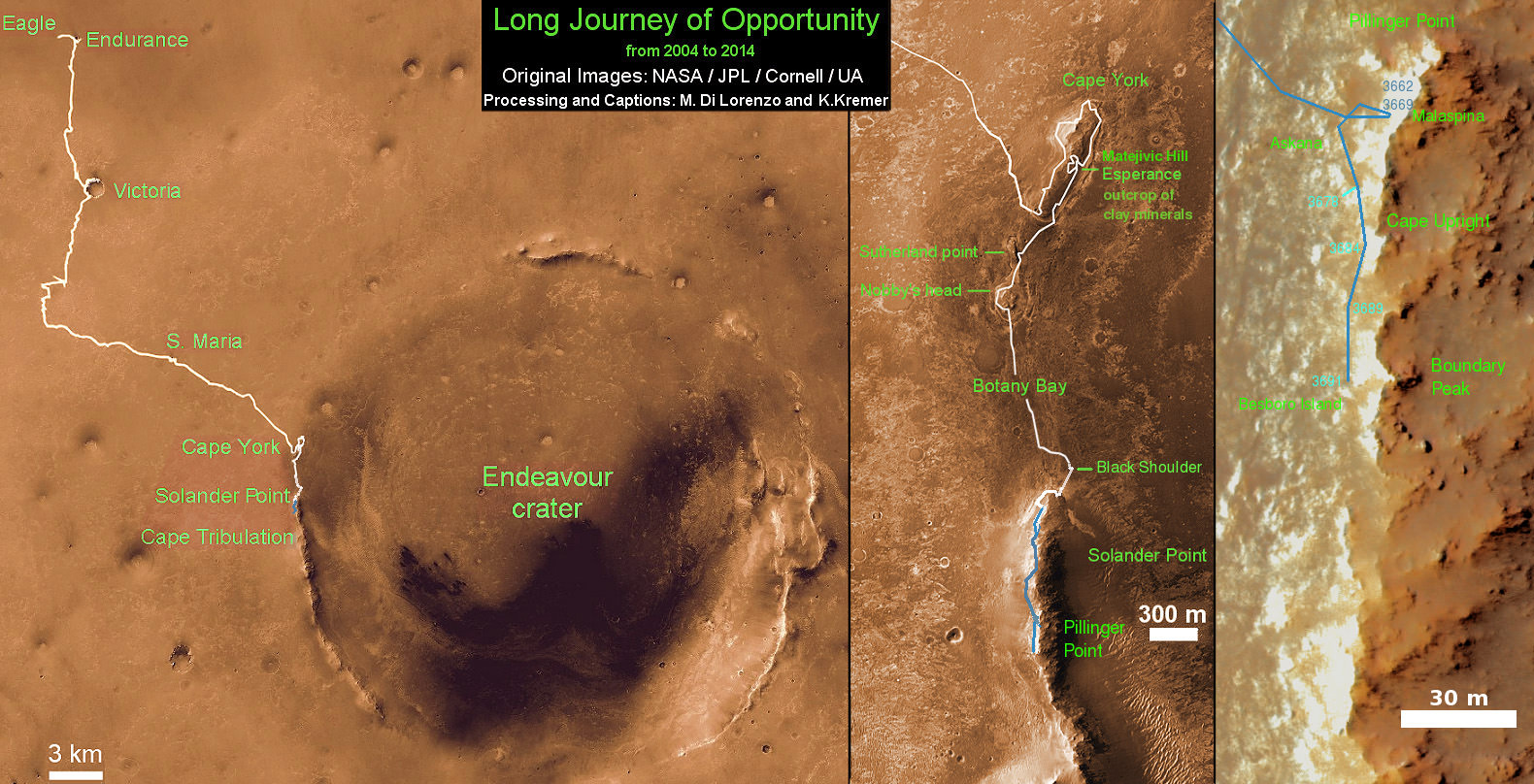
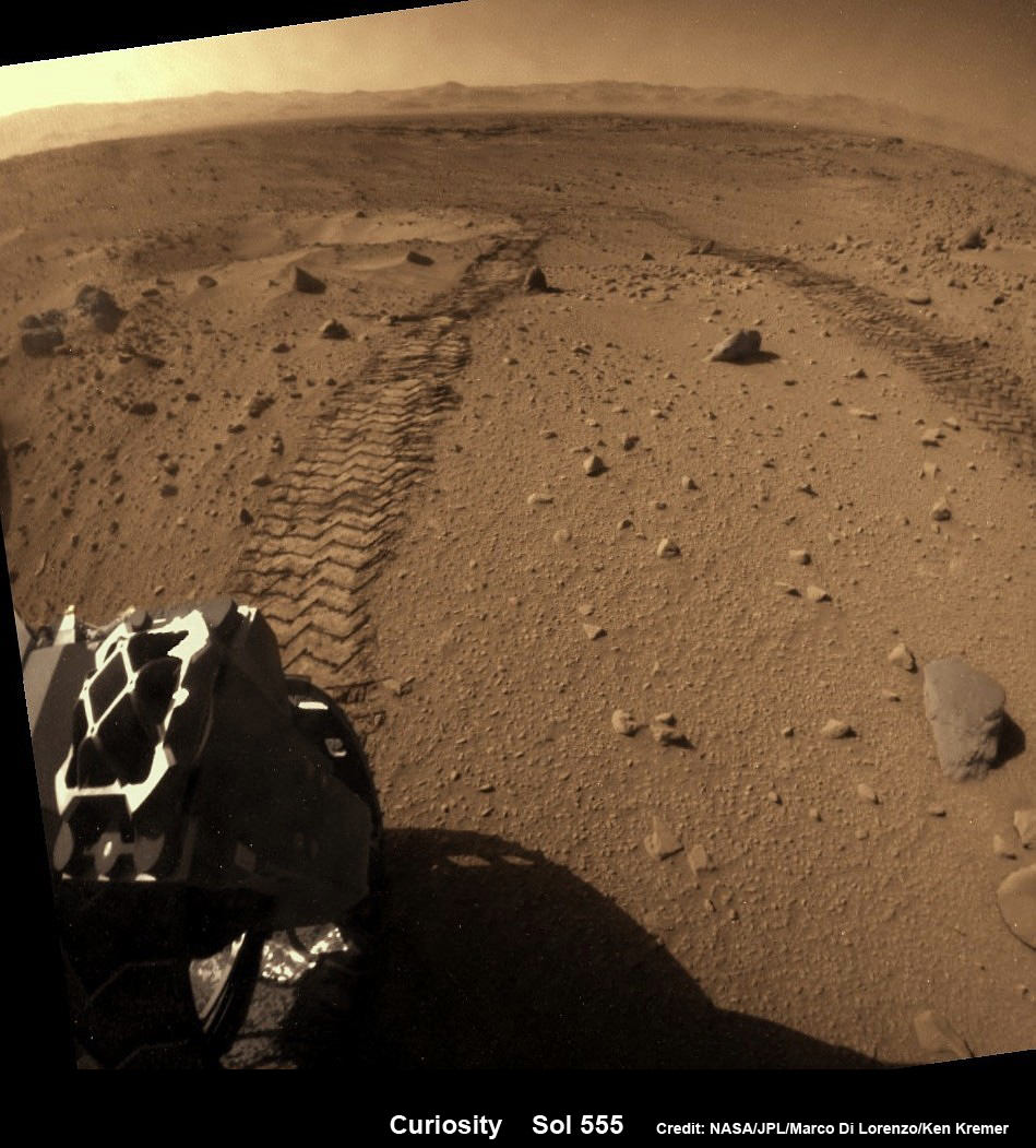
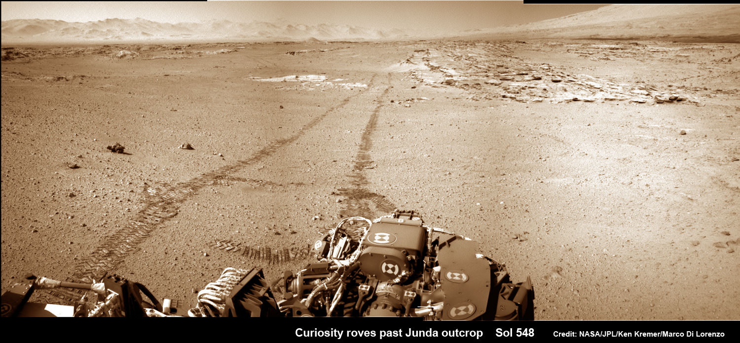
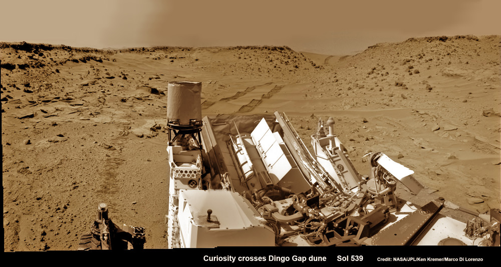
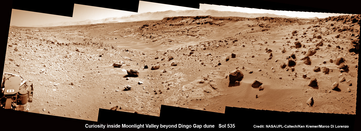
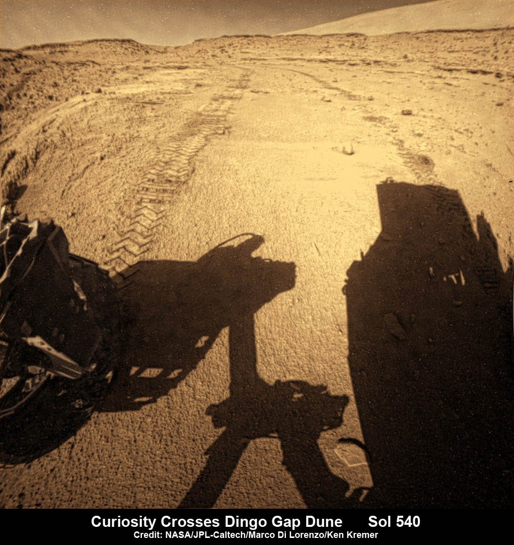
In general, a spacecraft is expected to last a few months to a few years. Spirit and Opportunity only had a planned mission of 3 months. It took Spirit more than 6 dauntless years to finally succumb to the hostile Martian environment. Opportunity is still kicking more than a decade later, thanks to some very careful driving and gusts of Martian wind clearing off its solar panels which didn’t surprise anybody.

Artist impression of Rosetta and Asteroid 2867 Steins. Credit:  ESA
Artist impression of Rosetta and Asteroid 2867 Steins. Credit: ESA

ESA’s Rosetta spacecraft needed to survive for 10 years in a dormant state before its encounter with Comet 67/P. It’s expected to last until the end of 2015. Then its orbit will carry it too far from the Sun to operate its solar panels, then it’ll go to sleep one last time.

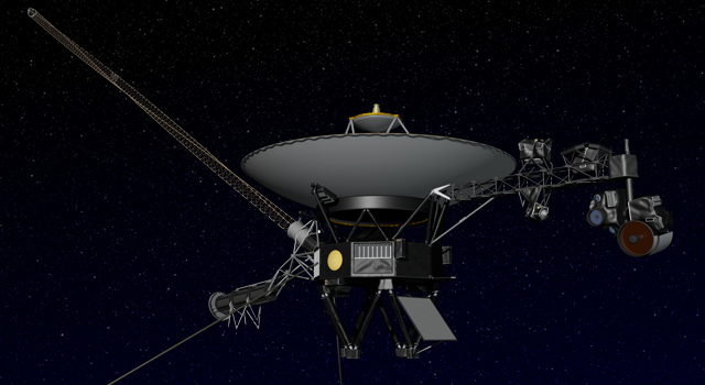
As a testament to luck and remarkable feats of engineering, some survive much longer than anyone ever expected. NASA’s Voyager Spacecraft, launched in 1977, are still going and communicating with Earth. It’s believed they’ll survive until 2025, when their radioisotope thermoelectric generators stop producing power.

At which point they’ll return to the Earth at the heart of a massive alien spacecraft and scare the bejeebus out of us.

… And I know what you’re thinking. Once our spacecraft stop functioning, they’ll still exist. Perhaps getting close enough to another source of solar energy to start transmitting again.

So, how long will our spacecraft hold together in something roughly robot-probe shaped? Any spacecraft orbiting a planet or Moon won’t last long geologically before they’re given a rocky kiss of death with help from a big group hug from gravity.

This might take a decade, a hundred years or a million. Eventually, that spacecraft is racing towards a well distributed grave on its new home.

Solar Dynamics Observatory. Credit: NASA

A spacecraft that’s orbiting the Sun should last much longer. However, a gravitational threesome with a planet or large asteroid could drag it into a solar death spiral or hurl it into a planet. There are asteroids whipping around from the formation of the Solar System, and they haven’t crashed into anything… yet.

A lucky spacecraft might last hundreds of millions, or even billions of years. Our little robot friends that leave the gravitational pull of the Solar System have a chance of making it for the long haul.

Once they’re out in interstellar space, there will be very few micrometeorites to punch little holes in them. Unless they happen to run into another star – and that’s very unlikely – they’ll travel through space until they’re worn away over billions of years, and who knows what that means for future alien archaeology students. The golden records on the Voyager spacecraft were designed to still be playable for a billion years in space.

Artist's concept of NASA's Voyager spacecraft. Image credit: NASA/JPL-Caltech
Artist’s concept of NASA’s Voyager spacecraft. Image credit: NASA/JPL-Caltech

It’s tough to keep a spacecraft operating in space. It’s a really hostile place, ready to fry their little silicon brains, scuttle them with a micrometeorite, or just erode them away over an incomprehensible length of time.

Are horrible space agency fiends tossing our trusting big eyed robot pals to their doom on one-way missions into the abyss? Don’t worry viewers, I have it on good authority this is what the robots want.

Beloved astronaut Chris Hadfield said if Voyager had stayed at home where it’s safe, it would’ve been sad forever, because it never would have discovered things. I think he’s right, Voyager is as happy as it could be exploring the parts of our Universe the rest of us aren’t able to go and see for ourselves.

What’s your favorite spacecraft survivor story? Tell us in the comments below.

Opportunity Rover Team Honors Pioneering Lindbergh Flight at Mars Mountaintop Crater

Martian Reminder of a Pioneering Flight. Names related to the first solo nonstop flight across the Atlantic have been informally assigned to a crater NASA's Opportunity Mars rover is studying. This false-color view of the "Spirit of St. Louis Crater" and the "Lindbergh Mound" inside it comes from Opportunity's panoramic camera. Image Credit: NASA/JPL-Caltech/Cornell Univ./Arizona State Univ.

Martian Reminder of a Pioneering Flight. Names related to the first solo nonstop flight across the Atlantic have been informally assigned to a crater NASA’s Opportunity Mars rover is studying. This false-color view of the “Spirit of St. Louis Crater” and the “Lindbergh Mound” inside it comes from Opportunity’s panoramic camera. Image Credit: NASA/JPL-Caltech/Cornell Univ./Arizona State Univ.
See additional Opportunity photo mosaics below [/caption]

The science team leading NASA’s long-lived Opportunity rover mission is honoring the pioneering solo nonstop trans-Atlantic flight of aviator Charles Lindbergh by assigning key features of the Mars mountain top crater area the rover is now exploring with names related to the historic flight.

Opportunity is now studying an elongated crater called “Spirit of St. Louis” and an unparalleled rock spire within the crater called “Lindbergh Mound” which are named in honor of Lindbergh himself and his plane – the Spirit of Saint Louis.

“Spirit of Saint Louis” crater is quite special in many ways related not just to history but also to science and exploration – that very reasons behind Lindbergh’s flight and Opportunity’s astounding mission to the Red Planet.

The team is ecstatic that the 11 year old rover Opportunity has reached “Spirit of St. Louis Crater” because its serves as the gateway to the alien terrain of “Marathon Valley” holding caches of water altered minerals that formed under environmental conditions conducive to support Martian microbial life forms, if they ever existed.

The crater, rock spire and several features in and near it are shown in several recent panoramic mosaics, above and below, created by the rover team and separately by the image processing team of Ken Kremer and Marco Di Lorenzo.

Opportunity’s view (annotated) on the day the NASA rover exceeded the distance of a marathon on the surface of Mars on March 24, 2015, Sol 3968 with features named in honor of Charles Lindbergh’s historic solo flight across the Atlantic Ocean in 1927. Rover stands at Spirit of Saint Louis Crater near mountaintop at Marathon Valley overlook and Martian cliffs at Endeavour crater holding deposits of water altered clay minerals.  This navcam camera photo mosaic was assembled from images taken on Sol 3968 (March 24, 2015) and colorized.  Credit: NASA/JPL/Cornell/Marco Di Lorenzo/Ken Kremer/kenkremer.com
Opportunity’s view (annotated) on the day the NASA rover exceeded the distance of a marathon on the surface of Mars on March 24, 2015, Sol 3968 with features named in honor of Charles Lindbergh’s historic solo flight across the Atlantic Ocean in 1927. Rover stands at Spirit of Saint Louis Crater near mountaintop at Marathon Valley overlook and Martian cliffs at Endeavour crater holding deposits of water altered clay minerals. This navcam camera photo mosaic was assembled from images taken on Sol 3968 (March 24, 2015) and colorized. Credit: NASA/JPL/Cornell/Marco Di Lorenzo/Ken Kremer/kenkremer.com

Marathon Valley and Spirit of St. Louis Crater are located just a few hundred meters south of a Mars mountain summit at a majestic spot called Cape Tribulation. It lies along a marvelous ridgeline along the western rim of Endeavour crater, which spans some 22 kilometers (14 miles) in diameter.

“What’s the connection between St. Louis and the Spirit of St. Louis? Lindbergh flew from New York to Paris, but he named his aircraft for the St. Louis citizens who purchased it for him,” says Prof. Ray Arvidson, the rover Deputy Principal Investigator of Washington University in St. Louis.

The raw images for the mosaics were taken in March and April 2015 using the robots mast mounted pancam and navcam cameras. The mosaics are shown in false color and colorized versions, annotated and unannotated.

Charles Lindbergh embarked in May 1927 on his history making flight from New York to Paris in the airplane he named Spirit of St. Louis, the first solo nonstop flight across the Atlantic.

Opportunity at Spirit of Saint Louis crater scanning into Marathon Valley and Endeavour crater from current location on Mars in April 2015 in this photo mosaic.  The crater, featuring an odd mound of rocks now named Lingbergh Mound, is the gateway to Marathon Valley and exposures of water altered clay minerals.  This navcam camera photo mosaic was assembled from images taken on Sol 3987 (April 12, 2015) and colorized.  Credit: NASA/JPL/Cornell/ Ken Kremer/kenkremer.com/Marco Di Lorenzo
Opportunity at Spirit of Saint Louis crater scanning into Marathon Valley and Endeavour crater from current location on Mars in April 2015 in this photo mosaic. The crater, featuring an odd mound of rocks now named Lingbergh Mound, is the gateway to Marathon Valley and exposures of water altered clay minerals. This navcam camera photo mosaic was assembled from images taken on Sol 3987 (April 12, 2015) and colorized. Credit: NASA/JPL/Cornell/ Ken Kremer/kenkremer.com/Marco Di Lorenzo

The shallow Spirit of St. Louis Crater is about 110 feet (34 meters) long and about 80 feet (24 meters) wide, with a floor slightly darker than surrounding terrain, says NASA.

Lindbergh Mound dominates the crater measuring about 7 to 10 feet (2 to 3 meters) tall, rising higher than the crater’s rim.

The annotations also include features named to recognize the financial backing for the flight from St. Louis residents including Harold M. Bixby and Harry M. Knight. The plane’s designer was Donald A. Hall.

Opportunity arrives at Spirit of Saint Louis crater and peers into Marathon Valley and Endeavour crater from current location on Mars as of April 3, 2015 in this photo mosaic.  The crater, featuring an odd mound of rocks now named Lingbergh Mound,  is the gateway to Marathon Valley and exposures of water altered clay minerals.  This pancam camera photo mosaic was assembled from images taken on Sol 3973 (March 29, 2015) and colorized.  Credit: NASA/JPL/Cornell/ Ken Kremer/kenkremer.com/Marco Di Lorenzo
Opportunity arrives at Spirit of Saint Louis crater and peers into Marathon Valley and Endeavour crater from current location on Mars as of April 3, 2015 in this photo mosaic. The crater, featuring an odd mound of rocks now named Lingbergh Mound, is the gateway to Marathon Valley and exposures of water altered clay minerals. This pancam camera photo mosaic was assembled from images taken on Sol 3973 (March 29, 2015) and colorized. Credit: NASA/JPL/Cornell/ Ken Kremer/kenkremer.com/Marco Di Lorenzo

Among other features named are Roosevelt Field, the spot on New York’s Long Island from which Lindbergh took off, and Marathon Monument, where the rover completed a her first marathon distance runners drive on Mars. The team picked a distinctive outcrop, Marathon Monument, to mark the finish line, said NASA officials.

“The science team for the rover picks crater names from a list of “vessels of exploration,” including ships of sail and spacecraft as well as aircraft. As long as the rover remains in the crater, names for interesting features will drawn from a list of names related to this famous flight,” according to a NASA statement.

Stay tuned here for Ken’s continuing Earth and planetary science and human spaceflight news.

Ken Kremer

11 Year Traverse Map for NASA’s Opportunity rover from 2004 to 2015. This map shows the entire path the rover has driven during 11 years and three months and a marathon runners distance on Mars for over 4000 Sols, or Martian days, since landing inside Eagle Crater on Jan 24, 2004 -to current location just past the Cape Tribulation summit at the western rim of Endeavour Crater at Marathon Valley. Rover surpassed Marathon distance on Sol 3968 and marked 11th Martian anniversary on Sol 3911. Opportunity discovered clay minerals at Esperance – indicative of a habitable zone - and is searching for more on the road ahead at Marathon Valley.  Credit: NASA/JPL/Cornell/ASU/Marco Di Lorenzo/Ken Kremer – kenkremer.com
11 Year Traverse Map for NASA’s Opportunity rover from 2004 to 2015. This map shows the entire path the rover has driven during 11 years and three months and a marathon runners distance on Mars for over 4000 Sols, or Martian days, since landing inside Eagle Crater on Jan 24, 2004 -to current location just past the Cape Tribulation summit at the western rim of Endeavour Crater at Marathon Valley. Rover surpassed Marathon distance on Sol 3968 and marked 11th Martian anniversary on Sol 3911. Opportunity discovered clay minerals at Esperance – indicative of a habitable zone – and is searching for more on the road ahead at Marathon Valley. Credit: NASA/JPL/Cornell/ASU/Marco Di Lorenzo/Ken Kremer – kenkremer.com

Helicopter Drones on Mars

Mars helicopter drone
A small drone helicopter currently being developed by engineers at NASA's Jet Propulsion Laboratory could serve as a reconnaissance scout for future Mars rovers, greatly enhancing their effectiveness. Credit NASA JPL

NASA’s Jet Propulsion Laboratory recently announced that it is developing a small drone helicopter to scout the way for future Mars rovers. Why would Mars rovers need such a robotic guide? The answer is that driving on Mars is really hard.

Here on Earth, robots exploring volcanic rims, or assisting rescuers, can be driven by remote control, with a joystick. This is because radio signals reach the robot from its control center almost instantly. Driving on the moon isn’t much harder. Radio signals traveling at the speed of light take about two and half seconds to make the round trip to the moon and back. This delay isn’t long enough to seriously interfere with remote control driving. In the 1970’s Soviet controllers drove the Lunokhod moon rovers this way, successfully exploring more than 40 km of lunar terrain.

Driving on Mars is much harder, because it is so much further away. Depending on its position with respect to Earth, signals can take between 8 and 42 minutes for the round trip. Pre-programmed instructions must be sent to the rover, which it then executes on its own. Each Martian drive takes hours of careful planning. Stereo images taken by the rover’s navigation cameras are carefully scrutinized by engineers. Images from spacecraft orbiting Mars sometimes provide additional information.

A rover can be programmed either to simply execute a list of driving commands sent from Earth, or it can use images taken by its navigation cameras and processed by its on-board computers to measure speed and detect obstacles or hazards by itself. It can even plot its own safe path to a specified goal. Drives based on instructions from the ground are the fastest.

The Mars Exploration Rovers Spirit and Opportunity could drive up to 124 meters in an hour this way. This corresponds to about the length of an American football field. But this mode was also the least safe.

When the rover actively guides itself with its cameras, progress is safer, but much slower because of all the image processing needed. It may progress by as little as 10 meters an hour, which is about the distance from the goal line to the 10 yard line on an American football field. This method must be used whenever the rover doesn’t have a clear view of the route ahead, which is often the case due to rough and hilly terrain.

As of early 2015, the farthest Curiosity has driven in a single day is 144 meters. Opportunity’s longest daily drive was 224 meters, a distance the length of two American football fields.

If ground controllers could get a better view of the path ahead, they could devise instructions allowing a future rover to safely drive much further in a day.

That’s where the idea of a drone helicopter comes in. The helicopter could fly out ahead of the rover every day. Images made from its aerial vantage point would be invaluable to ground controllers for identifying points of scientific interest, and planning driving routes to get there.

Flying a helicopter on Mars poses special challenges. One advantage is that Martian gravity is only 38% as strong as that of Earth, so that the helicopter wouldn’t need to generate as much lift as one of the same mass on Earth. A helicopter’s propeller blades generate lift by pushing air downward. This is harder to do on Mars than on Earth, because the Martian atmosphere is on hundred times thinner. To displace enough air, the propeller blades would need to spin very quickly, or to be very large.

The copter must be capable of flying on its own, using prior instructions, maintaining stable flight along a pre-specified route. It must land and take off repeatedly in rocky Martian terrain. Finally it must be capable of surviving the harsh conditions of Mars, where the temperature plummets to 100 degrees Fahrenheit or lower every night.

The JPL engineers designed a copter with a mass of 1 kilogram; a tiny fraction of the 900 kg mass of the Curiosity rover. Its propeller blades span 1.1 meters from blade tip to blade tip, and are capable of spinning at 3400 rotations per minute. The body is about the size of a tissue box.

The copter is solar powered, with a disk of solar cells gathering enough power every day to power a flight of two to three minutes and to heat the vehicle at night. It can fly about half a kilometer in that time, gathering images for transmission to ground control as it goes. Engineers expect that the reconnaissance that the drone copter gathers will be invaluable in planning a rover’s drives, tripling the distance that can be traveled in a day.

References and further reading:
Thanks to Mark Maimone of NASA Jet Propulsion Laboratory for information about the daily driving distances of Curiosity and Opportunity.

J.J. Biesiadecki, P. C. Leger, and M.W. Maimone (2007), ‘tradeoffs between directed and autonomous driving on the Mars exploration rovers’, The International Journal of Robotics Research, 26(1), 91-104

E. Howell, Opportunity Mars rover treks past 41 kilometers towards ‘Marathon Valley’, Universe Today, Dec. 2014.

T. Reyes, An incredible journey, Mars Curiosity rover reaches base of Mount Sharp. Universe Today, Sept. 2014.

Helicopter could be ‘scout’ for Mars rovers. NASA Jet Propulsion Laboratory Press release. January 22, 2015.

Crazy Engineering: The Mars helicopter. NASA Jet Propulsion Laboratory video.

Curiosity- Mars Science Laboratory, NASA.

Mars- Future rover plans. NASA

Curiosity Skips Drilling, Resumes Mount Sharp Trek after Pounding Slippery Rock at Martian Valley of Slippery Sands

NASA’s Curiosity rover hammers into ‘Bonanza King’ rock outcrop evaluating potential as 4th drill site for sampling at ‘Hidden Valley’ in this photo mosaic view captured on Aug. 20, 2014, Sol 724. Inset MAHLI camera image at right shows resulting rock indentation that caused it to budge and be unsafe for further drilling. Note the background of treacherous sand dune ripples and deep wheel tracks inside Hidden Valley that forced quick exit to alternate route forward. Navcam camera raw images stitched and colorized. Credit: NASA/JPL-Caltech/MSSS/Ken Kremer-kenkremer.com/Marco Di Lorenzo

NASA’s Curiosity rover will skip drilling into a possible 4th rock target and instead resume the trek to Mount Sharp after finding it was unfortunately a slippery rock at the edge of a Martian valley of slippery sands and was therefore too risky to proceed with deep drilling and interior sampling for chemical analysis.

After pounding into the “Bonanza King” rock outcrop on Wednesday, Aug. 20, to evaluate its potential as Curiosity’s 4th drill target on Mars and seeing that it moved on impact, the team decided it was not even safe enough to continue with the preliminary ‘mini-drill’ operation that day.

So they cancelled the entire drill campaign at “Bonanza King” and decided to set the rover loose to drive onwards to her mountain climbing destination.

This image from the front Hazcam on NASA's Curiosity Mars rover shows the rover's drill in place during a test of whether the rock beneath it, "Bonanza King," would be an acceptable target for drilling to collect a sample. Subsequent analysis showed the rock budged during the Aug. 19, 2014, test. Credit: NASA/JPL-Caltech
This image from the front Hazcam on NASA’s Curiosity Mars rover shows the rover’s drill in place during a test of whether the rock beneath it, “Bonanza King,” would be an acceptable target for drilling to collect a sample. Subsequent analysis showed the rock budged during the Aug. 19, 2014, test. Credit: NASA/JPL-Caltech

“We have decided that the rocks under consideration for drilling, based on the tests we did, are not good candidates for drilling,” said Curiosity Project Manager Jim Erickson of NASA’s Jet Propulsion Laboratory, Pasadena, California, in a statement.

“Instead of drilling here, we will resume driving toward Mount Sharp.”

Bonanza King was an enticing target because the outcrop possessed thin, white, cross-cutting mineral veins which could indicate that liquid water flowed here in the distant past. Water is a prerequisite for life as we know it.

Loose, unstable rocks pose a prospective hazard to the 1 ton robots hardware and health if they become dislodged during impact by the percussive drill located at the end of the robotic arm.

It’s worth recalling that whirling rocks during the nailbiting Red Planet touchdown two years ago on Aug. 6, 2012, inside Gale Crater are suspected to have slightly damaged Curiosity’s REMS meteorological instrument station.

Each drill target must pass a series of tests. And the prior three at more extensive outcrops all met those criteria. By comparison, imagery showed Bonanza King was clearly part of a much smaller outcrop. See our Bonanza King photo mosaics herein.

NASA’s Curiosity rover looks back to ramp with potential 4th drill site target at ‘Bonanza King’ rock outcrop in ‘Hidden Valley’ in this photo mosaic view captured on Aug. 6, 2014, Sol 711.  Inset shows results of brushing on Aug. 17, Sol 722, that revealed gray patch beneath red dust.  Note the rover’s partial selfie, valley walls, deep wheel tracks in the sand dunes and distant rim of Gale crater beyond the ramp. Navcam camera raw images stitched and colorized.  Credit: NASA/JPL-Caltech/Ken Kremer-kenkremer.com/Marco Di Lorenzo
NASA’s Curiosity rover looks back to ramp with potential 4th drill site target at ‘Bonanza King’ rock outcrop in ‘Hidden Valley’ in this photo mosaic view captured on Aug. 6, 2014, Sol 711. Inset shows results of brushing on Aug. 17, Sol 722, that revealed gray patch beneath red dust. Note the rover’s partial selfie, valley walls, deep wheel tracks in the sand dunes and distant rim of Gale crater beyond the ramp. Navcam camera raw images stitched and colorized. Credit: NASA/JPL-Caltech/Ken Kremer-kenkremer.com/Marco Di Lorenzo

“One step in the procedure, called “start hole,” uses the hammering action of the percussive drill to create a small indentation in the rock. During this part of the test, the rock moved slightly, the rover sensed that instability in the target, and protective software properly halted the procedure,” according to a NASA statement.

This pale, flat Martian rock thus failed to pass the team’s safety criteria for drilling when it budged.

Bonanza King sits in an bright outcrop on the low ramp at the northeastern end of a spot leading in and out of an area called “Hidden Valley” which lies between Curiosity’s August 2012 landing site in Gale Crater and her ultimate destinations on Mount Sharp which dominates the center of the crater.

Just days ago, the rover team commanded a quick exit from “Hidden Valley” to backtrack out of the dune filled valley because of fears the six wheeled robot could get stuck in slippery sands extending the length of a football field.

“Hidden Valley” looked like it could turn into “Death Valley.”

As Curiosity tested the outcrop, the rover team was simultaneously searching for an alternate safe path forward to the sedimentary layers of Mount Sharp because she arrived at Hidden Valley after recently driving over a field of sharp edged rocks in the “Zabriskie Plateau” that caused further rips and tears in the already damaged 20 inch diameter aluminum wheels.

It will take a route skirting the north side of the sandy-floored valley taking care to steer away from the pointiest rocks.

Curiosity rover looks back to the rocky plains of the Zabriskie plateau from sandy ramp into ‘Hidden Valley’ with 4th drill site target at ‘Bonanza King’ rock outcrop as shown in this photo mosaic view captured on Aug. 14, 2014, Sol 719.  Sharp edged rocks at Zabriskie tore new holes into rover wheels.   Navcam camera raw images stitched and colorized.  Credit: NASA/JPL-Caltech/Marco Di Lorenzo/Ken Kremer-kenkremer.com
Curiosity rover looks back to the rocky plains of the Zabriskie plateau from sandy ramp into ‘Hidden Valley’ with 4th drill site target at ‘Bonanza King’ rock outcrop as shown in this photo mosaic view captured on Aug. 14, 2014, Sol 719. Sharp edged rocks at Zabriskie tore new holes into rover wheels. Navcam camera raw images stitched and colorized. Credit: NASA/JPL-Caltech/Marco Di Lorenzo/Ken Kremer-kenkremer.com

“After further analysis of the sand, Hidden Valley does not appear to be navigable with the desired degree of confidence,” Erickson said. “We will use a route avoiding the worst of the sharp rocks as we drive slightly to the north of Hidden Valley.”

To date, Curiosity’s odometer totals over 5.5 miles (9.0 kilometers) since landing inside Gale Crater on Mars in August 2012. She has taken over 179,000 images.

Curiosity still has about another 2 miles (3 kilometers) to go to reach the entry way at a gap in the treacherous sand dunes at the foothills of Mount Sharp sometime later this year.

Hidden Valley gives a foretaste of the rippely slippery sand dune challenges lurking ahead!

Mount Sharp is a layered mountain that dominates most of Gale Crater and towers 3.4 miles (5.5 kilometers) into the Martian sky and is taller than Mount Rainier.

“Getting to Mount Sharp is the next big step for Curiosity and we expect that in the Fall of this year,” Dr. Jim Green, NASA’s Director of Planetary Sciences at NASA Headquarters, Washington, DC, told me in an interview marking the 2nd anniversary since touchdown on Aug. 6.

“Drilling on the crater floor will provide needed geologic context before Curiosity climbs the mountain.”

The team may go back to its original plan to drill at the potential science destination known as “Pahrump Hills” which was changed due to the route change forced by the slippery sands in Hidden Valley.

The main map here shows the assortment of landforms near the location of NASA's Curiosity Mars rover as the rover's second anniversary of landing on Mars nears. The gold traverse line entering from upper right ends at Curiosity's position as of Sol 705 on Mars (July 31, 2014). The inset map shows the mission's entire traverse from the landing on Aug. 5, 2012, PDT (Aug. 6, EDT) to Sol 705, and the remaining distance to long-term science destinations near Murray Buttes, at the base of Mount Sharp. The label "Aug. 5, 2013" indicates where Curiosity was one year after landing.    Credit: NASA/JPL-Caltech/Univ. of Arizona
The main map here shows the assortment of landforms near the location of NASA’s Curiosity Mars rover as the rover’s second anniversary of landing on Mars nears. The gold traverse line entering from upper right ends at Curiosity’s position as of Sol 705 on Mars (July 31, 2014). The inset map shows the mission’s entire traverse from the landing on Aug. 5, 2012, PDT (Aug. 6, EDT) to Sol 705, and the remaining distance to long-term science destinations near Murray Buttes, at the base of Mount Sharp. The label “Aug. 5, 2013” indicates where Curiosity was one year after landing. Credit: NASA/JPL-Caltech/Univ. of Arizona

Read an Italian language version of this story by my imaging partner Marco Di Lorenzo – here

Stay tuned here for Ken’s continuing Rosetta, Curiosity, Opportunity, Orion, SpaceX, Boeing, Orbital Sciences, Dream Chaser, commercial space, MAVEN, MOM, Mars and more planetary and human spaceflight news.

Ken Kremer

Curiosity rover panorama of Mount Sharp captured on June 6, 2014 (Sol 651) during traverse inside Gale Crater.  Note rover wheel tracks at left.  She will eventually ascend the mountain at the ‘Murray Buttes’ at right later this year. Assembled from Mastcam color camera raw images and stitched by Marco Di Lorenzo and Ken Kremer.   Credit:   NASA/JPL/MSSS/Marco Di Lorenzo/Ken Kremer-kenkremer.com
Curiosity rover panorama of Mount Sharp captured on June 6, 2014 (Sol 651) during traverse inside Gale Crater. Note rover wheel tracks at left. She will eventually ascend the mountain at the ‘Murray Buttes’ at right later this year. Assembled from Mastcam color camera raw images and stitched by Marco Di Lorenzo and Ken Kremer. Credit: NASA/JPL/MSSS/Marco Di Lorenzo/Ken Kremer-kenkremer.com
Up close view of hole in one of rover Curiosity’s six wheels caused by recent driving over rough Martian rocks. Mosaic assembled from Mastcam raw images taken on Dec. 22, 2013 (Sol 490).  Credit: NASA/JPL/MSSS/Ken Kremer - kenkremer.com/Marco Di Lorenzo
Up close view of hole in one of rover Curiosity’s six wheels caused by recent driving over rough Martian rocks. Mosaic assembled from Mastcam raw images taken on Dec. 22, 2013 (Sol 490). Credit: NASA/JPL/MSSS/Ken Kremer – kenkremer.com/Marco Di Lorenzo

Curiosity Reverses Back from Martian Valley of Slippery Sand and Finds Fourth Rock Drilling Candidate at ‘Bonanza King’

NASA’s Curiosity rover looks back to ramp with 4th drill site target at ‘Bonanza King’ rock outcrop in ‘Hidden Valley’ at site marking her 2nd anniversary on Mars, as shown in this photo mosaic view captured on Aug. 6, 2014, Sol 711. Note the rover’s partial selfie, valley walls, deep wheel tracks in the sand dunes and distant rim of Gale crater beyond the ramp. Navcam camera raw images stitched and colorized. Credit: NASA/JPL-Caltech/Ken Kremer-kenkremer.com/Marco Di Lorenzo

NASA’s Curiosity rover looks back to ramp with 4th drill site target at ‘Bonanza King’ rock outcrop in ‘Hidden Valley’ at site marking her 2nd anniversary on Mars, as shown in this photo mosaic view captured on Aug. 6, 2014, Sol 711. Note the rover’s partial selfie, valley walls, deep wheel tracks in the sand dunes and distant rim of Gale crater beyond the ramp. Navcam camera raw images stitched and colorized.
Credit: NASA/JPL-Caltech/Ken Kremer-kenkremer.com/Marco Di Lorenzo[/caption]

Not wanting to get stuck in a rut, Curiosity’s handlers have commanded NASA’s SUV-sized rover to reverse course and drive out of a potentially hazardous Martian valley of slippery sand with poor wheel traction and instead backtrack towards an enticing nearby spot that the team feels could be the fourth candidate for rock drilling – and thereby widen the scope of the story of habitable environments on the Red Planet.

The new drilling target under up close evaluation right now is named ‘Bonanza King’ – shown in our photo mosaic above.

Bonanza King was chosen after the six wheeled rover unexpectedly experienced significant wheel slippage in the past week while driving over an extended dune field of sandy ripples that basically stopped forward movement inside the Martian valley.

The team was thus in a quandary over whether to push forward on a route through the loose sands of “Hidden Valley” and possibly risk getting mired in a hidden sand trap or drive backwards over a field of sharp rocks on the “Zabriskie plateau” and beyond that are certain to tear further holes in the wheels.

Drilling Candidate Site 'Bonanza King' on Mars.    This image from the Mast Camera (Mastcam) on NASA's Curiosity Mars rover shows a portion of the pale rock outcrop that includes the "Bonanza King" target chosen for evaluation as the mission's fourth rock-drilling site. Raised ridges on the flat rocks -- possible mineral veins -- are visible at upper and middle right. Tread marks from one of Curiosity's wheels are visible in the lower half of the image from Sol 707, Aug. 12, 2014.  Credit: NASA/JPL-Caltech/MSSS
Drilling Candidate Site ‘Bonanza King’ on Mars. This image from the Mast Camera (Mastcam) on NASA’s Curiosity Mars rover shows a portion of the pale rock outcrop that includes the “Bonanza King” target chosen for evaluation as the mission’s fourth rock-drilling site. Raised ridges on the flat rocks — possible mineral veins — are visible at upper and middle right. Tread marks from one of Curiosity’s wheels are visible in the lower half of the image from Sol 707, Aug. 12, 2014. Credit: NASA/JPL-Caltech/MSSS

As reported here last week on the occasion of her 2nd anniversary on Mars since the dramatic touchdown inside Gale Crater on Aug. 6, 2012, Curiosity had been driving merrily through the supposed safe valley of sandy ripples of “Hidden Valley.” She was approaching a bedrock unit named “Pahrump Hills” that for the first time is actually part of the humongous mountain named Mount Sharp she will soon scale and which is the primary science destination of the mission.

But rather soon after driving over a low hump from Zabriskie plateau (see our mosaic below) into Hidden Valley, the robot experienced wheel slippage in the ripples of sand filling the crater floor which was much higher than anticipated. And even worse than comparable test drives in a practice sand lot at JPL.

Curiosity rover looks back to the rocky plains of the Zabriskie plateau from sandy ramp into ‘Hidden Valley’ with 4th drill site target at ‘Bonanza King’ rock outcrop as shown in this photo mosaic view captured on Aug. 14, 2014, Sol 719.  Sharp edged rocks at Zabriskie tore new holes into rover wheels.   Navcam camera raw images stitched and colorized.  Credit: NASA/JPL-Caltech/Marco Di Lorenzo/Ken Kremer-kenkremer.com/
Curiosity rover looks back to the rocky plains of the Zabriskie plateau from sandy ramp into ‘Hidden Valley’ with 4th drill site target at ‘Bonanza King’ rock outcrop as shown in this photo mosaic view captured on Aug. 14, 2014, Sol 719. Sharp edged rocks at Zabriskie tore new holes into rover wheels. Navcam camera raw images stitched and colorized.
Credit: NASA/JPL-Caltech/Marco Di Lorenzo/Ken Kremer-kenkremer.com

The sandy ripples extend out to the sloping valley walls with no end in sight.

“We need to gain a better understanding of the interaction between the wheels and Martian sand ripples, and Hidden Valley is not a good location for experimenting,” said Curiosity Project Manager Jim Erickson of NASA’s Jet Propulsion Laboratory in Pasadena, California, in a statement.

And since Hidden Valley is as long as a football field and has only two navigable exits at the northeastern and southwestern ends (see map below), the team was forced to drive back to the entrance way at the northern end to consider an alternative route forward to the base of Mount Sharp.

In the meantime while they evaluate the way forward, the team decided that Bonanza King offers similar science to what scientists anticipate at the outcrops at “Pahrump Hills”- a preview of a geological unit that is part of the base of Mount Sharp for the first time since landing rather than still belonging to the floor of Gale Crater.

“Geologically speaking, we can tie the Bonanza King rocks to those at Pahrump Hills. Studying them here will give us a head start in understanding how they fit into the bigger picture of Gale Crater and Mount Sharp,” said Curiosity Deputy Project Scientist Ashwin Vasavada of JPL, in a statement.

Bonanza King sits in an bright outcrop on the low ramp leading in and out of Hidden Valley.

Curiosity rover up close view of ‘Bonanza King’ rock outcrop and 4th drill target looking down from ramp and back into ‘Hidden Valley’ and hazardous dune field of sandy ripples on Aug. 14, 2014, Sol 719.  Wheel tracks show where Curiosity drove into the valley, and back out again, earlier in August 2014. The largest of the individual flat rocks in the foreground are a few inches (several centimeters) across. Hazcam camera raw image flattened and colorized.  Credit: NASA/JPL-Caltech/Marco Di Lorenzo/Ken Kremer - kenkremer.com
Curiosity rover up close view of ‘Bonanza King’ rock outcrop and 4th drill target looking down from ramp and back into ‘Hidden Valley’ and hazardous dune field of sandy ripples on Aug. 14, 2014, Sol 719. Wheel tracks show where Curiosity drove into the valley, and back out again, earlier in August 2014. The largest of the individual flat rocks in the foreground are a few inches (several centimeters) across. Hazcam camera raw image flattened and colorized. Credit: NASA/JPL-Caltech/Marco Di Lorenzo/Ken Kremer – kenkremer.com

It looks like a pale paving stone. Since its location within the geological layers visible on the ramp is similar to what was expected at the Pahrump Hills outcrop, it’s very appealing to the science team.

Furthermore when one of the rovers wheel’s drove over the outcrop, it cracked open one of the rocks and exposed bright interior material, possibly from mineral veins – which is super exciting from a science perspective as a potential marker for flowing liquid water.

Right now the team is collecting spectral data with the science instruments to assess its science utility and is planning a super fast drilling campaign, far shorter than the prior three.

The plan would be to core a sample from the interior of the dinner plate sized rock slab for delivery to Curiosity’s pair of the onboard chemistry labs, SAM and CheMin to analyze for the chemical ingredients to support miartin microbes, if they ever existed.

“This outcrop on the ramp is too appealing to pass up,” Vasavada said.

The main map here shows the assortment of landforms near the location of NASA's Curiosity Mars rover as the rover's second anniversary of landing on Mars nears. The gold traverse line entering from upper right ends at Curiosity's position as of Sol 705 on Mars (July 31, 2014). The inset map shows the mission's entire traverse from the landing on Aug. 5, 2012, PDT (Aug. 6, EDT) to Sol 705, and the remaining distance to long-term science destinations near Murray Buttes, at the base of Mount Sharp. The label "Aug. 5, 2013" indicates where Curiosity was one year after landing.    Credit: NASA/JPL-Caltech/Univ. of Arizona
The main map here shows the assortment of landforms near the location of NASA’s Curiosity Mars rover as the rover’s second anniversary of landing on Mars nears. The gold traverse line entering from upper right ends at Curiosity’s position as of Sol 705 on Mars (July 31, 2014). The inset map shows the mission’s entire traverse from the landing on Aug. 5, 2012, PDT (Aug. 6, EDT) to Sol 705, and the remaining distance to long-term science destinations near Murray Buttes, at the base of Mount Sharp. The label “Aug. 5, 2013” indicates where Curiosity was one year after landing. Credit: NASA/JPL-Caltech/Univ. of Arizona

To date, Curiosity’s odometer totals over 5.5 miles (9.0 kilometers) since landing inside Gale Crater on Mars in August 2012. She has taken over 178,000 images.

Curiosity still has about another 2 miles (3 kilometers) to go to reach the entry way at a gap in the treacherous sand dunes at the foothills of Mount Sharp sometime later this year.

Mount Sharp is a layered mountain that dominates most of Gale Crater and towers 3.4 miles (5.5 kilometers) into the Martian sky and is taller than Mount Rainier.

“Getting to Mount Sharp is the next big step for Curiosity and we expect that in the Fall of this year,” Dr. Jim Green, NASA’s Director of Planetary Sciences at NASA Headquarters, Washington, DC, told me in an interview making the 2nd anniversary on Aug. 6.

Up close view of hole in one of rover Curiosity’s six wheels caused by recent driving over rough Martian rocks. Mosaic assembled from Mastcam raw images taken on Dec. 22, 2013 (Sol 490).  Credit: NASA/JPL/MSSS/Ken Kremer - kenkremer.com/Marco Di Lorenzo
Up close view of hole in one of rover Curiosity’s six wheels caused by driving over rough Martian rocks. Mosaic assembled from Mastcam raw images taken on Dec. 22, 2013 (Sol 490). Credit: NASA/JPL/MSSS/Ken Kremer – kenkremer.com/Marco Di Lorenzo

Stay tuned here for Ken’s continuing Rosetta, Curiosity, Opportunity, Orion, SpaceX, Boeing, Orbital Sciences, Dream Chaser, commercial space, MAVEN, MOM, Mars and more planetary and human spaceflight news.

Ken Kremer

1 Martian Year on Mars!  Curiosity treks to Mount Sharp in this photo mosaic view captured on Sol 669, June 24, 2014.    Navcam camera raw images stitched and colorized.   Credit: NASA/JPL-Caltech/Marco Di Lorenzo/Ken Kremer – kenkremer.com
1 Martian Year on Mars!
Curiosity treks to Mount Sharp in this photo mosaic view captured on Sol 669, June 24, 2014. Navcam camera raw images stitched and colorized. Credit: NASA/JPL-Caltech/Marco Di Lorenzo/Ken Kremer – kenkremer.com
2 Earth Years on Mars!  NASA’s Curiosity rover celebrated the 2nd anniversary on Mars at ‘Hidden Valley’ as shown in this photo mosaic view captured on Aug. 6, 2014, Sol 711.   Note the valley walls, rover tracks and distant crater rim.  Navcam camera raw images stitched and colorized.  Credit: NASA/JPL-Caltech/Ken Kremer-kenkremer.com/Marco Di Lorenzo
2 Earth Years on Mars! NASA’s Curiosity rover celebrated the 2nd anniversary on Mars at ‘Hidden Valley’ as shown in this photo mosaic view captured on Aug. 6, 2014, Sol 711. Note the valley walls, rover tracks and distant crater rim. Navcam camera raw images stitched and colorized. Credit: NASA/JPL-Caltech/Ken Kremer-kenkremer.com/Marco Di Lorenzo

Opportunity Peers Out from ‘Pillinger Point’ – Honoring British Beagle 2 Mars Scientist Where Ancient Water Flowed

Opportunity Mars rover peers into vast Endeavour Crater from Pillinger Point mountain ridge named in honor of Colin Pillinger, the Principal Investigator for the British Beagle 2 lander built to search for life on Mars. Pillinger passed away from a brain hemorrhage on May 7, 2014. This navcam camera photo mosaic was assembled from images taken on June 5, 2014 (Sol 3684) and colorized. Credit: NASA/JPL/Cornell/Marco Di Lorenzo/Ken Kremer-kenkremer.com

NASA’s decade old Opportunity rover has reached a long sought after region of aluminum-rich clay mineral outcrops at a new Endeavour crater ridge now “named ‘Pillinger Point’ after Colin Pillinger the Principal Investigator for the [British] Beagle 2 Mars lander”, Prof. Ray Arvidson, Deputy Principal Investigator for the rover, told Universe Today exclusively. See above the spectacular panoramic view from ‘Pillinger Point’ – where ancient water once flowed billions of year ago.

The Beagle 2 lander was built to search for signs of life on Mars.

The Mars Exploration Rover (MER) team named the noteworthy ridge in honor of Prof. Colin Pillinger – a British planetary scientist at the Open University in Milton Keynes, who passed away at the age of 70 on May 7, 2014.

‘Pillinger Point’ is a scientifically bountiful place possessing both clay mineral outcrops and mineral veins where “waters came up through the cracks”, Arvidson explained to me.

Since water is a prerequisite for life as we know it, this is a truly fitting tribute to name Opportunity’s current exploration site ‘Pillinger Point’ after Prof. Pillinger.

See our new photo mosaic above captured by Opportunity peering out from ‘Pillinger Point’ ridge on June 5, 2014 (Sol 3684) and showing a panoramic view around the eroded mountain ridge and into vast Endeavour crater.

The gigantic crater spans 14 miles (22 kilometers) in diameter.

See below our Opportunity 10 Year traverse map showing the location of Pillinger Point along the segmented rim of Endeavour crater.

British planetary scientist Colin Pillinger with the Beagle 2 lander.

Pillinger Point is situated south of Solander Point and Murray Ridge along the western rim of Endeavour in a region with caches of clay minerals indicative of an ancient Martian habitable zone.

For the past several months, the six wheeled robot has been trekking southwards from Solander towards the exposures of aluminum-rich clays – now named Pillinger Point- detected from orbit by the CRISM spectrometer aboard NASA’s powerful Martian ‘Spysat’ – the Mars Reconnaissance Orbiter (MRO) – while gathering context data at rock outcrops along the winding way.

“We are about 3/5 of the way along the outcrops that show an Al-OH [aluminum-hydroxl] montmorillonite [clay mineral] signature at 2.2 micrometers from CRISM along track oversampled data,” Arvidson told me.

“We have another ~160 meters to go before reaching a break in the outcrops and a broad valley.”

The rover mission scientists ultimate goal is travel even further south to ‘Cape Tribulation’ which holds a motherlode of the ‘phyllosilicate’ clay minerals based on extensive CRISM measurements accomplished earlier at Arvidson’s direction.

“The idea is to characterize the outcrops as we go and then once we reach the valley travel quickly to Cape Tribulation and the smectite valley, which is still ~2 km to the south of the present rover location,” Arvidson explained.

Mars Express and Beagle 2 were launched in 2003, the same year as NASA’s twin rovers Spirit and Opportunity, on their interplanetary voyages to help unlock the mysteries of Mars potential for supporting microbial life forms.

Pillinger was the driving force behind the British built Beagle 2 lander which flew to the Red Planet piggybacked on ESA’s Mars Express orbiter. Unfortunately Beagle 2 vanished without a trace after being deployed from the orbiter on Dec. 19, 2003 with an expected air bag assisted landing on Christmas Day, Dec. 25, 2003.

In an obituary by the BBC, Dr David Parker, the chief executive of the UK Space Agency, said that Prof. Pillinger had played a critical role in raising the profile of the British space programme and had inspired “young people to dream big dreams”.

NASA’s Opportunity Mars rover captures sweeping panoramic vista near the ridgeline of 22 km (14 mi) wide Endeavour Crater’s western rim. The center is southeastward and also clearly shows the distant rim. See the complete panorama below. This navcam panorama was stitched from images taken on May 10, 2014 (Sol 3659) and colorized. Credit: NASA/JPL/Cornell/Marco Di Lorenzo/Ken Kremer-kenkremer.com

During his distinguished career Pillinger also analyzed lunar rock samples from NASA’s Apollo moon landing missions and worked on ESA’s Rosetta mission.

“It’s important to note that Colin’s contribution to planetary science goes back to working on Moon samples from Apollo, as well as his work on meteorites,” Dr Parker told the BBC.

Today, June 16, marks Opportunity’s 3696th Sol or Martian Day roving Mars – compared to a warranty of just 90 Sols.

So far she has snapped over 193,400 amazing images on the first overland expedition across the Red Planet.

Her total odometry stands at over 24.51 miles (39.44 kilometers) since touchdown on Jan. 24, 2004 at Meridiani Planum.

NASA’s Opportunity Mars rover captures sweeping panoramic vista near the ridgeline of 22 km (14 mi) wide Endeavour Crater's western rim. The center is southeastward and the distant rim is visible in the center. An outcrop area targeted for the rover to study is at right of ridge.  This navcam panorama was stitched from images taken on May 10, 2014 (Sol 3659) and colorized.  Credit: NASA/JPL/Cornell/Marco Di Lorenzo/Ken Kremer-kenkremer.com
NASA’s Opportunity Mars rover captures sweeping panoramic vista near the ridgeline of 22 km (14 mi) wide Endeavour Crater’s western rim. The center is southeastward and the distant rim is visible in the center. An outcrop area targeted for the rover to study is at right of ridge. This navcam panorama was stitched from images taken on May 10, 2014 (Sol 3659) and colorized. Credit: NASA/JPL/Cornell/Marco Di Lorenzo/Ken Kremer-kenkremer.com

Meanwhile on the opposite side of Mars, Opportunity’s younger sister rover Curiosity is trekking towards gigantic Mount Sharp after drilling into her 3rd Red Planet rock at Kimberley.

Stay tuned here for Ken’s continuing Curiosity, Opportunity, Orion, SpaceX, Boeing, Orbital Sciences, MAVEN, MOM, Mars and more planetary and human spaceflight news.

Ken Kremer

Traverse Map for NASA’s Opportunity rover from 2004 to 2014 - A Decade on Mars. This map shows the entire path the rover has driven during a decade on Mars and over 3692 Sols, or Martian days, since landing inside Eagle Crater on Jan 24, 2004 to current location along Pillinger Point ridge south of Solander Point summit at the western rim of Endeavour Crater and heading to clay minerals at Cape Tribulation.  Opportunity discovered clay minerals at Esperance - indicative of a habitable zone.  Credit: NASA/JPL/Cornell/ASU/Marco Di Lorenzo/Ken Kremer
Traverse Map for NASA’s Opportunity rover from 2004 to 2014 – A Decade on Mars
This map shows the entire path the rover has driven during a decade on Mars and over 3692 Sols, or Martian days, since landing inside Eagle Crater on Jan 24, 2004 to current location along Pillinger Point ridge south of Solander Point summit at the western rim of Endeavour Crater and heading to clay minerals at Cape Tribulation. Opportunity discovered clay minerals at Esperance – indicative of a habitable zone. Credit: NASA/JPL/Cornell/ASU/Marco Di Lorenzo/Ken Kremer

Curiosity says ‘Goodbye Kimberley’ after Parting Laser Blasts and Seeking New Adventures Ahead

The Mars Hand Lens Imager on NASA's Curiosity Mars rover provided this nighttime view of a hole produced by the rover's drill and, inside the hole, a line of scars produced by the rover's rock-zapping laser. The hole is 0.63 inch (1.6 centimeters) in diameter. The camera used its own white-light LEDs to illuminate the scene on May 13, 2014. Credit: NASA/JPL-Caltech/MSSS

NASA’s rover Curiosity said ‘Goodbye Kimberley’ having fulfilled her objectives of drilling into a cold red sandstone slab, sampling the tantalizing grey colored interior and pelting the fresh bore hole with a pinpoint series of parting laser blasts before seeking new adventures on the road ahead towards the inviting slopes of Mount Sharp, her ultimate destination.

Curiosity successfully drilled her 3rd hole deep into the ‘Windjama’ rock target at the base of Mount Remarkable and within the science waypoint at a region called “The Kimberley” on May 5, Sol 621.

Since then, the 1 ton robot carefully scrutinized the resulting 2.6 inches (6.5 centimeters) deep bore hole and the mound of dark grey colored drill tailings piled around for an up close examination of the texture and composition with the MAHLI camera and spectrometers at the end of her 7-foot-long (2 meters) arm to glean every last drop of science before moving on.

Curiosity’s panoramic view departing Mount Remarkable and ‘The Kimberley Waypoint’ where rover conducted 3rd drilling campaign inside Gale Crater on Mars. The navcam raw images were taken on Sol 630, May 15, 2014, stitched and colorized. Credit: NASA/JPL-Caltech/Ken Kremer – kenkremer.com/Marco Di Lorenzo

Multiple scars clearly visible inside the drill hole and on the Martian surface resulting from the million watt laser firings of the Mast mounted Chemistry and Camera (ChemCam) instrument left no doubt of Curiosity’s capabilities or intentions.

Furthermore she successfully delivered pulverized and sieved samples to the pair of onboard miniaturized chemistry labs; the Chemistry and Mineralogy instrument (CheMin) and the Sample Analysis at Mars instrument (SAM) – for chemical and compositional analysis.

Curiosity completed an “intensive investigation of ‘The Kimberley’, having successfully drilled, acquired and dropped samples into CheMin and SAM,” wrote science team member Ken Herkenhoff in an update.

“MAHLI has taken lots of excellent images of the drill hole, including some during the night with LEDs on, nicely showing the ChemCam LIBS spots.”

“The initial analysis of this new sample by Chemin is ongoing, requiring repeated overnight integration to build up high-quality data,” says Herkenhoff.

The rover’s earth bound handlers also decided that one drill campaign into Kimberley was enough.

So the rover will not be drilling into any other rock targets here.

Composite photo mosaic shows deployment of NASA Curiosity rovers robotic arm and two holes after drilling into ‘Windjana’ sandstone rock on May 5, 2014, Sol 621, at Mount Remarkable as missions third drill target for sample analysis by rover’s chemistry labs.  The navcam raw images were stitched together from several Martian days up to Sol 621, May 5, 2014 and colorized.   Credit: NASA/JPL-Caltech/Ken Kremer - kenkremer.com/Marco Di Lorenzo
Composite photo mosaic shows deployment of NASA Curiosity rovers robotic arm and two holes after drilling into ‘Windjana’ sandstone rock on May 5, 2014, Sol 621, at Mount Remarkable as missions third drill target for sample analysis by rover’s chemistry labs. The navcam raw images were stitched together from several Martian days up to Sol 621, May 5, 2014 and colorized. Credit: NASA/JPL-Caltech/Ken Kremer – kenkremer.com/Marco Di Lorenzo

And it may be a very long time before the next drilling since the guiding team of scientists and engineers wants desperately to get on and arrive at the foothills of Mount Sharp as soon as possible.

But the robot will undoubtedly be busy with further analysis of the ‘Windjana’ sample along the way, since there’s plenty of leftover sample material stored in the CHIMRA sample processing mechanism to allow future delivery of samples when the rover periodically pauses during driving.

This May 12, 2014, view from the Mars Hand Lens Imager (MAHLI) in NASA's Curiosity Mars Rover shows the rock target "Windjana" and its immediate surroundings after inspection of the site by the rover by drilling and other activities.  Credit:   NASA/JPL-Caltech/MSSS
This May 12, 2014, view from the Mars Hand Lens Imager (MAHLI) in NASA’s Curiosity Mars Rover shows the rock target “Windjana” and its immediate surroundings after inspection of the site by the rover by drilling and other activities. Credit: NASA/JPL-Caltech/MSSS

“Windjana” is named after a gorge in Western Australia.

It’s been a full year since the first two drill campaigns were conducted during 2013 at the ‘John Klein’ and ‘Cumberland’ outcrop targets inside Yellowknife Bay. They were both mudstone rock outcrops and the interiors were markedly different in color.

“The drill tailings from this rock are darker-toned and less red than we saw at the two previous drill sites,” said Jim Bell of Arizona State University, Tempe, deputy principal investigator for Curiosity’s Mast Camera (Mastcam).

“This suggests that the detailed chemical and mineral analysis that will be coming from Curiosity’s other instruments could reveal different materials than we’ve seen before. We can’t wait to find out!”

The science team chose Windjana for drilling “to analyze the cementing material that holds together sand-size grains in this sandstone,” says NASA.

Curiosity’s Panoramic view of Mount Remarkable at ‘The Kimberley Waypoint’ where rover conducted 3rd drilling campaign inside Gale Crater on Mars. The navcam raw images were taken on Sol 603, April 17, 2014, stitched and colorized. Credit: NASA/JPL-Caltech/Ken Kremer – kenkremer.com/Marco Di Lorenzo.  Featured on APOD - Astronomy Picture of the Day on May 7, 2014
Curiosity’s Panoramic view of Mount Remarkable at ‘The Kimberley Waypoint’ where rover conducted 3rd drilling campaign inside Gale Crater on Mars. The navcam raw images were taken on Sol 603, April 17, 2014, stitched and colorized. Credit: NASA/JPL-Caltech/Ken Kremer – kenkremer.com/Marco Di Lorenzo
Featured on APOD – Astronomy Picture of the Day on May 7, 2014

“The Kimberley Waypoint was selected because it has interesting, complex stratigraphy,” Curiosity Principal Investigator John Grotzinger, of the California Institute of Technology, Pasadena, told me.

Curiosity departed the ancient lakebed at the Yellowknife Bay region in July 2013 where she discovered a habitable zone with the key chemical elements and a chemical energy source that could have supported microbial life billions of years ago – and thereby accomplished the primary goal of the mission.

Windjama lies some 2.5 miles (4 kilometers) southwest of Yellowknife Bay.

Curiosity still has about another 4 kilometers to go to reach the foothills of Mount Sharp sometime later this year.

The sedimentary layers of Mount Sharp, which reaches 3.4 miles (5.5 km) into the Martian sky, is the six wheeled robots ultimate destination inside Gale Crater because it holds caches of water altered minerals. Such minerals could possibly indicate locations that sustained potential Martian life forms, past or present, if they ever existed.

Stay tuned here for Ken’s continuing Curiosity, Opportunity, Orion, SpaceX, Boeing, Orbital Sciences, LADEE, MAVEN, MOM, Mars and more planetary and human spaceflight news.

Ken Kremer

Opportunity Rover Gets Power Boost from Wind Events on Mars

A nearly dust-free solar panel for the Opportunity rover following a dust cleaning wind event sometime during the last week of March 2014 (on Earth). Credit: NASA/JPL-Caltech/Cornell Univ./Arizona State University.

The Opportunity rover on Mars has gotten a 70% boost in power over the past few weeks. A good portion of that comes from the fact that its springtime in Mars’ southern hemisphere where Oppy now sits along the western rim of Endeavour Crater and so the Sun is now shining longer and higher in the sky. But also, several recent gusts of wind – or perhaps small dust devils – have cleaned much of the dust off the rover’s solar panels.

The rover team reported that between Sols 3605 and 3606 (March 15 and March 16, 2014), there was a dust cleaning event that resulted in about a 10% improvement in power production to 574 watt-hours, and then another cleaning event this week has put the power output to 615 watt-hours.

See a self-portrait that Opportunity took of its solar panels back in January to compare with the image above of how much cleaner the solar panels are now.

To celebrate 10 years of the Opportunity rover on Mars, the rover team used the panoramic camera (Pancam) to take images of the rover itself during the interval Jan. 3, 2014, to Jan. 6, 2014. Credit: NASA/JPL-Caltech/Cornell Univ./Arizona State Univ.

Of course, this is not the first time a wind cleaning event has dusted off the solar panels — in fact it has happened several times (see here, here, and here) which is one of the reasons for the longevity of the solar-powered rovers.

I love these self-images the rovers can take, and below is a great recent image the rover took of its own shadow, in the late-afternoon Sun. The image was taken by the rover’s rear hazard avoidance camera.

Late afternoon lighting produced a dramatic shadow of NASA's Mars Exploration Rover Opportunity photographed by the rover's rear hazard-avoidance camera on March 20, 2014. Credit: NASA/JPL-Caltech/Cornell Univ./Arizona State Univ.
Late afternoon lighting produced a dramatic shadow of NASA’s Mars Exploration Rover Opportunity photographed by the rover’s rear hazard-avoidance camera on March 20, 2014. Credit: NASA/JPL-Caltech/Cornell Univ./Arizona State Univ.

The image was taken looking eastward shortly before sunset on Sol 3,609 (March 20, 2014). The rover’s shadow falls across a slope called the McClure-Beverlin Escarpment on the western rim of Endeavour Crater, where Opportunity is investigating rock layers for evidence about ancient environments. The scene includes a glimpse into the distance across the 14-mile-wide (22-kilometer-wide) crater.

Source: JPL

Curiosity Rover pauses mid-drive and captures Spectacular Martian Mountain Snapshot

Mars rock rows and Mount Sharp. Martian landscape scene with rows of striated rocks in the foreground and Mount Sharp on the horizon. NASA's Curiosity Mars rover paused mid drive at the Junda outcrop to snap the component images for this navcam camera photomosaic on Sol 548 (Feb. 19, 2014) and then continued traveling southwards towards mountain base. UHF Antenna at right. Credit: NASA/JPL-Caltech/Marco Di Lorenzo/Ken Kremer-kenkremer.com

Mars rock rows and Spectacular Mount Sharp
Martian landscape scene with rows of striated rocks in the foreground and spectacular Mount Sharp on the horizon. NASA’s Curiosity Mars rover paused mid drive at the Junda outcrop to snap the component images for this colorized navcam camera photomosaic on Sol 548 (Feb. 19, 2014) and then continued traveling southwards towards mountain base. UHF Antenna at right.
Credit: NASA/JPL-Caltech/Marco Di Lorenzo/Ken Kremer-kenkremer.com
See stereo 3-D and look back views below[/caption]

Like any good tourist, NASA’s rover Curiosity apparently couldn’t resist the photobug urge from a gorgeous Martian mountain scene she happened by recently and decided to pull over and enjoy the view.

So she stopped the dune buggy mid-drive on the sandy road to her daily destination one Sol last week on Feb. 19, powered up the camera suite and excitedly snapped a spectacular landscape view of a striated rock field dramatically back dropped by towering Mount Sharp on the horizon.

See our Mars rocks and Mount Sharp photomosaic above and a 3-D stereoscopic view from NASA below.

The sedimentary foothills of Mount Sharp, which reaches 3.4 miles (5.5 km) into the Martian sky, is the 1 ton robots ultimate destination inside Gale Crater because it holds caches of water altered minerals.

Martian Landscape With Rock Rows and Mount Sharp (Stereo)  This stereo landscape scene from NASA's Curiosity Mars rover on Feb. 19, 2014 shows rows of rocks in the foreground and Mount Sharp on the horizon. It appears three dimensional when viewed through red-blue glasses with the red lens on the left. Credit: NASA/JPL-Caltech
Martian Landscape With Rock Rows and Mount Sharp (Stereo) This stereo landscape scene from NASA’s Curiosity Mars rover on Feb. 19, 2014 shows rows of rocks in the foreground and Mount Sharp on the horizon. It appears three dimensional when viewed through red-blue glasses with the red lens on the left. Credit: NASA/JPL-Caltech

And just for good measure, Curiosity also snapped a series of breathtaking look back photos showing her tracks in the dune filled terrain from whence she came since straddling through the Dingo Gap gateway. See our mosaics below.

The panoramic mountain view taken on Sol 548 shows rows of striated rocks all oriented in a similar direction in the foreground with Mount Sharp in the background.

Curiosity looks back across dune field to  her wheel tracks and a small crater she just missed. Flattened rear hazcam image, colorized from Sol 555 (Feb 27, 2014).    Credit: NASA/JPL-Caltech/Marco Di Lorenzo/Ken Kremer-kenkremer.com
Curiosity looks back across dune field to her wheel tracks and a small crater she just missed. Flattened rear hazcam image, colorized from Sol 555 (Feb 27, 2014). Credit: NASA/JPL-Caltech/Marco Di Lorenzo/Ken Kremer-kenkremer.com

Scientists directed Curiosity to drive by the rock rows nicknamed “Junda” after their interest was piqued by orbital images taken by the powerful telescopic camera on NASA’s Mars Reconnaissance Orbiter (MRO) circling overhead.

The six wheeled rover paused during the planned Feb. 19 drive of 328 feet (100 meters) to capture the imagery.

She then pushed forward to finish the day’s drive and snapped another fabulous look back view – see our mosaic below.

And the next day on Feb. 20 (Sol 549), she also completed her second 100 meter drive in reverse.

Her handlers are occasionally commanding Curiosity to drive backwards in a newly tested bid to minimize serious damage to the six 20 inch diameter wheels in the form of rips and tears caused by rough edged Red Planet rocks – see our wheel mosaic below.

Curiosity looks back at Martian sand dunes and rover tracks after passing by Junda outcrop (right) on Sol 548 (Feb. 19, 2014) with Gale Crater rim and Mount Sharp on the distant horizon. Navcam colorized photomosaic. Credit: NASA/JPL-Caltech/Ken Kremer- kenkremer.com/Marco Di Lorenzo

Curiosity is well on the way to her next near term goal, which is a science waypoint, named Kimberly (formerly called KMS-9), which lies about half a mile ahead.

Kimberly is of interest to the science team because it sits at an the intersection of different rock layers and also features ground with striations like those at “Junda”.

Curiosity looks back eastward to ‘Dingo Gap’ sand dune inside Gale Crater. After crossing over the 3 foot (1 meter) tall dune on Sol 539, Feb. 9, 2014  the rover drove westward into the ‘Moonlight Valley’.  The parallel rover wheel tracks are 9 feet (2.7 meters) apart.  Assembled from Sol 539 colorized navcam raw images.  Credit: NASA/JPL/ Ken Kremer- kenkremer.com/Marco Di Lorenzo
Curiosity looks back eastward to ‘Dingo Gap’ sand dune inside Gale Crater. After crossing over the 3 foot (1 meter) tall dune on Sol 539, Feb. 9, 2014 the rover drove westward into the ‘Moonlight Valley’. The parallel rover wheel tracks are 9 feet (2.7 meters) apart. Assembled from Sol 539 colorized navcam raw images. Credit: NASA/JPL/ Ken Kremer- kenkremer.com/Marco Di Lorenzo

So, after the rover reaches Kimberly, researchers plan to temporarily halt driving for awhile to investigate the location and direct the robot to drill into another rock to collect samples for analysis by the two state- of-the -art chemistry labs.

If drilling is warranted, Kimberly would be the site of Curiosity’s first drilling operation since the Cumberland outcrop target was bored into during the spring of 2013 at Yellowknife Bay.

Curiosity departed the Yellowknife Bay region in July 2013 where she discovered a habitable zone and thereby accomplished the primary goal of the mission.

To date Curiosity’s odometer stands at 5.3 kilometers and she has taken over 125,000 images.

The robot has somewhat less than another 5 km to go to reach the base of Mount Sharp.

She perhaps may arrive sometime in mid 2014.

Arrival time at Mount Sharp depends on driving speed and whether the upcoming terrain is smoother or strewn with sharp edged rocks that have hindered progress due to accumulating wear and tear on the aluminum wheels.

Up close photomosaic view shows lengthy tear in rover Curiosity’s left front wheel caused by recent driving over sharp edged Martian rocks on the months long trek to Mount Sharp. Raw images taken by the MAHLI camera on Curiosity’s arm on Jan. 31, 2014 (Sol 529) were assembled to show some recent damage to several of its six wheels   Credit: NASA / JPL / MSSS / Marco Di Lorenzo / Ken Kremer- kenkremer.com  See below complete 6 wheel mosaic and further wheel mosaics for comparison
Up close photomosaic view shows lengthy tear in rover Curiosity’s left front wheel caused by recent driving over sharp edged Martian rocks on the months long trek to Mount Sharp. Raw images taken by the MAHLI camera on Curiosity’s arm on Jan. 31, 2014 (Sol 529) were assembled to show some recent damage to several of its six wheels Credit: NASA / JPL / MSSS / Marco Di Lorenzo / Ken Kremer- kenkremer.com See below complete 6 wheel mosaic and further wheel mosaics for comparison

Meanwhile, NASA’s sister Opportunity rover is exploring clay mineral outcrops by the summit of Solander Point on the opposite side of Mars at the start of her 2nd Decade investigating the Red Planet’s mysteries.

A pair of new orbiters are streaking to the Red Planet to fortify Earth’s invasion fleet- NASA’s MAVEN and India’s MOM.

Stay tuned here for Ken’s continuing Curiosity, Opportunity, Chang’e-3, GPM, SpaceX, Orbital Sciences, LADEE, MAVEN, MOM, Mars and more planetary and human spaceflight news. Learn more at Ken’s upcoming presentations at the NEAF convention on April 12/13.

Ken Kremer

Curiosity’s View Past Tall Dune at edge of ‘Dingo Gap’  This photomosaic from Curiosity’s Navigation Camera (Navcam) taken at the edge of the entrance to the Dingo Gap shows a 3 foot (1 meter) tall dune and valley terrain beyond to the west, all dramatically back dropped by eroded rim of Gale Crater. View from the rover’s current position on Sol 528 (Jan. 30, 2014). The rover team may decide soon whether Curiosity will bridge the dune gap as a smoother path to next science destination. Credit: NASA/JPL-Caltech/Marco Di Lorenzo/Ken Kremer- kenkremer.com
Curiosity’s View Past Tall Dune at edge of ‘Dingo Gap’
This photomosaic from Curiosity’s Navigation Camera (Navcam) taken at the edge of the entrance to the Dingo Gap shows a 3 foot (1 meter) tall dune and valley terrain beyond to the west, all dramatically back dropped by eroded rim of Gale Crater. View from the rover’s current position on Sol 528 (Jan. 30, 2014). The rover team may decide soon whether Curiosity will bridge the dune gap as a smoother path to next science destination. Credit: NASA/JPL-Caltech/Marco Di Lorenzo/Ken Kremer- kenkremer.com

Martian Dune Buggy Curiosity Adopts New Driving Mode to Save Wheels from Rough Rocks

Curiosity looks back eastward to ‘Dingo Gap’ sand dune inside Gale Crater. After crossing over the 3 foot (1 meter) tall dune on Sol 539, Feb. 9, 2014 the rover drove westward into the ‘Moonlight Valley’. The parallel rover wheel tracks are 9 feet (2.7 meters) apart. Assembled from Sol 539 colorized navcam raw images. Credit: NASA/JPL/ Ken Kremer- kenkremer.com/Marco Di Lorenzo

Curiosity looks back eastward to ‘Dingo Gap’ sand dune inside Gale Crater
After crossing over the 3 foot (1 meter) tall dune on Sol 539, Feb. 9, 2014 the rover drove westward into the ‘Moonlight Valley’. The parallel rover wheel tracks are 9 feet (2.7 meters) apart. Assembled from Sol 539 colorized navcam raw images. Credit: NASA/JPL/ Ken Kremer- kenkremer.com/Marco Di Lorenzo
See Dune and Wheel mosaics below – Story updated [/caption]

The team directing the epic trek of NASA’s Curiosity rover across the floor of Gale Crater has adopted new driving strategies and a new way forward in response to the unexpected wheel damage caused by driving over fields of rough edged Red Planet rocks in recent months.

This week, engineers directed dune buggy Curiosity to drive backwards for a lengthy distance over the Martian surface for the first time since landing.

The SUV sized vehicle apparently passed the reverse driving feasibility test with flying colors and is now well on the way to the exciting journey ahead aiming for the sedimentary layers at the base of towering Mount Sharp – the primary mission destination – which reaches 3.4 miles (5.5 km) into the Martian sky and possesses water altered minerals.

“We wanted to have backwards driving in our validated toolkit because there will be parts of our route that will be more challenging,” said Curiosity Project Manager Jim Erickson of NASA’s Jet Propulsion Laboratory, Pasadena, Calif, in a statement.

On Tuesday, Feb. 18, Curiosity not only drove in reverse, but the 329 feet (100.3 meters) distance covered marked her farthest one-day advance in over three months.

And she is also now roving over the much sought after smoother Martian terrain, as hoped, when the team decided to alter the traverse route based on high resolution imaging observations collected by the telescopic camera on NASA’s Mars Reconnaissance Orbiter (MRO) circling overhead.

The goal is to minimize wear and tear on the 20 inch diameter wheels.

This map shows the route driven and route planned for NASA's Curiosity Mars rover from before reaching "Dingo Gap" -- in upper right -- to the mission's next science waypoint, "Kimberley" (formerly referred to as "KMS-9") -- in lower left.   Credit: NASA/JPL-Caltech/Univ. of Arizona
This map shows the route driven and route planned for NASA’s Curiosity Mars rover from before reaching “Dingo Gap” — in upper right — to the mission’s next science waypoint, “Kimberley” (formerly referred to as “KMS-9”) — in lower left. Credit: NASA/JPL-Caltech/Univ. of Arizona

Engineers were forced to devise new driving techniques and consider a new route forward after the aluminum wheels accumulated significant punctures and rips during the past few months of driving over fields strewn with sharp edged Martian rocks.

“We have changed our focus to look at the big picture for getting to the slopes of Mount Sharp, assessing different potential routes and different entry points to the destination area,” Erickson said.

“No route will be perfect; we need to figure out the best of the imperfect ones.”

But to reach the smooth terrain and the science rich targets located on the pathway ahead, the six wheeled rover first had to pass through a gateway known as the ‘Dingo Gap’ sand dune.

Curiosity’s View Past Tall Dune at edge of ‘Dingo Gap’  This photomosaic from Curiosity’s Navigation Camera (Navcam) taken at the edge of the entrance to the Dingo Gap shows a 3 foot (1 meter) tall dune and valley terrain beyond to the west, all dramatically back dropped by eroded rim of Gale Crater. View from the rover’s current position on Sol 528 (Jan. 30, 2014). The rover team may decide soon whether Curiosity will bridge the dune gap as a smoother path to next science destination. Credit: NASA/JPL-Caltech/Marco Di Lorenzo/Ken Kremer- kenkremer.com
Curiosity’s View Past Tall Dune at edge of ‘Dingo Gap’
This photomosaic from Curiosity’s Navigation Camera (Navcam) taken at the edge of the entrance to the Dingo Gap shows a 3 foot (1 meter) tall dune and valley terrain beyond to the west, all dramatically back dropped by eroded rim of Gale Crater. View from the rover’s current position on Sol 528 (Jan. 30, 2014). The rover team may decide soon whether Curiosity will bridge the dune gap as a smoother path to next science destination. Credit: NASA/JPL-Caltech/Marco Di Lorenzo/Ken Kremer- kenkremer.com

“Moonlight Valley” is the name of the breathtaking new locale beyond Dingo, Curiosity Principal Investigator John Grotzinger, of Caltech, told Universe Today.

Curiosity crossed through the 3 foot (1 meter) tall Dingo Gap sand dune with ease on Feb. 9 and roved on to targets in the “Moonlight Valley” and the region beyond.

“Moonlight Valley has got lots of veins cutting through it,” Grotzinger told me.

“We’re seeing recessive bedrock.”

Curiosity scans Moonlight Valley beyond Dingo Gap Dune. Curiosity’s view to “Moonlight Valley” beyond after crossing over ‘Dingo Gap’ sand dune. This photomosaic was taken after Curiosity drove over the 1 meter tall Dingo Gap sand dune and shows dramatic scenery in the valley beyond, back dropped by eroded rim of Gale Crater. Assembled from navigation camera (navcam) raw images from Sol 535 (Feb. 6, 2104) Credit: NASA/JPL-Caltech/Ken Kremer- kenkremer.com/Marco Di Lorenzo

Since passing through the Dingo Gap gateway, Curiosity has traveled another 937 feet (285.5 meters) for a total mission odometry of 3.24 miles (5.21 kilometers) since the nail biting landing on Aug. 6, 2012.

“After we got over the dune, we began driving in terrain that looks like what we expected based on the orbital data. There are fewer sharp rocks, many of them are loose, and in most places there’s a little bit of sand cushioning the vehicle,” Erickson said.

Curiosity looks back to ‘Dingo Gap’ sand dune after crossing over, backdropped by Mount Sharp on Sol 540, Feb. 12, 2014.  Rear hazcam fisheye image linearized and colorized.  Credit: NASA/JPL/Marco Di Lorenzo/Ken Kremer- kenkremer.com
Curiosity looks back to ‘Dingo Gap’ sand dune after crossing over, backdropped by Mount Sharp on Sol 540, Feb. 12, 2014. Rear hazcam fisheye image linearized and colorized. Credit: NASA/JPL/Marco Di Lorenzo/Ken Kremer- kenkremer.com

Curiosity’s near term goal is to reach her next science waypoint, named Kimberly (formerly called KMS-9) which lies about two-thirds of a mile (about 1.1 kilometers) ahead.

Kimberly is of interest to the science team because it sits at an the intersection of different rock layers.

The 1 ton robot may be directed to drill into another rock at Kimberly.

If approved, Kimberly would be her first since drilling operation since boring into Cumberland rock target last spring and since departing the Yellowknife Bay region in July 2013 where she discovered a habitable zone.

Curiosity looks back to ‘Dingo Gap’ sand dune after crossing over, backdropped by Mount Sharp on Sol 535, Feb. 5, 2014.  Hazcam fisheye image linearized and colorized.  Credit: NASA/JPL/Marco Di Lorenzo/Ken Kremer- kenkremer.
Curiosity looks back to ‘Dingo Gap’ sand dune after crossing over, backdropped by Mount Sharp on Sol 535, Feb. 5, 2014. Hazcam fisheye image linearized and colorized. Credit: NASA/JPL/Marco Di Lorenzo/Ken Kremer- kenkremer

To date Curiosity’s odometer stands at 5.2 kilometers and she has taken over 118,000 images. The robot has about another 5 km to go to reach the foothills of Mount Sharp.

Meanwhile, NASA’s sister Opportunity rover was just imaged from orbit by MRO while exploring clay mineral outcrops by the summit of Solander Point on the opposite side of Mars at the start of her 2nd Decade investigating the Red Planet’s mysteries.

And a pair of new orbiters are streaking to the Red Planet to fortify Earth’s invasion fleet- NASA’s MAVEN and India’s MOM.

Stay tuned here for Ken’s continuing Curiosity, Opportunity, Chang’e-3, SpaceX, Orbital Sciences, LADEE, MAVEN, MOM, Mars and more planetary and human spaceflight news.

Ken Kremer

Up close photomosaic view shows lengthy tear in rover Curiosity’s left front wheel caused by recent driving over sharp edged Martian rocks on the months long trek to Mount Sharp. Raw images taken by the MAHLI camera on Curiosity’s arm on Jan. 31, 2014 (Sol 529) were assembled to show some recent damage to several of its six wheels   Credit: NASA / JPL / MSSS / Marco Di Lorenzo / Ken Kremer- kenkremer.com  See below complete 6 wheel mosaic and further wheel mosaics for comparison
Up close photomosaic view shows lengthy tear in rover Curiosity’s left front wheel caused by recent driving over sharp edged Martian rocks on the months long trek to Mount Sharp. Raw images taken by the MAHLI camera on Curiosity’s arm on Jan. 31, 2014 (Sol 529) were assembled to show some recent damage to several of its six wheels Credit: NASA / JPL / MSSS / Marco Di Lorenzo / Ken Kremer- kenkremer.com