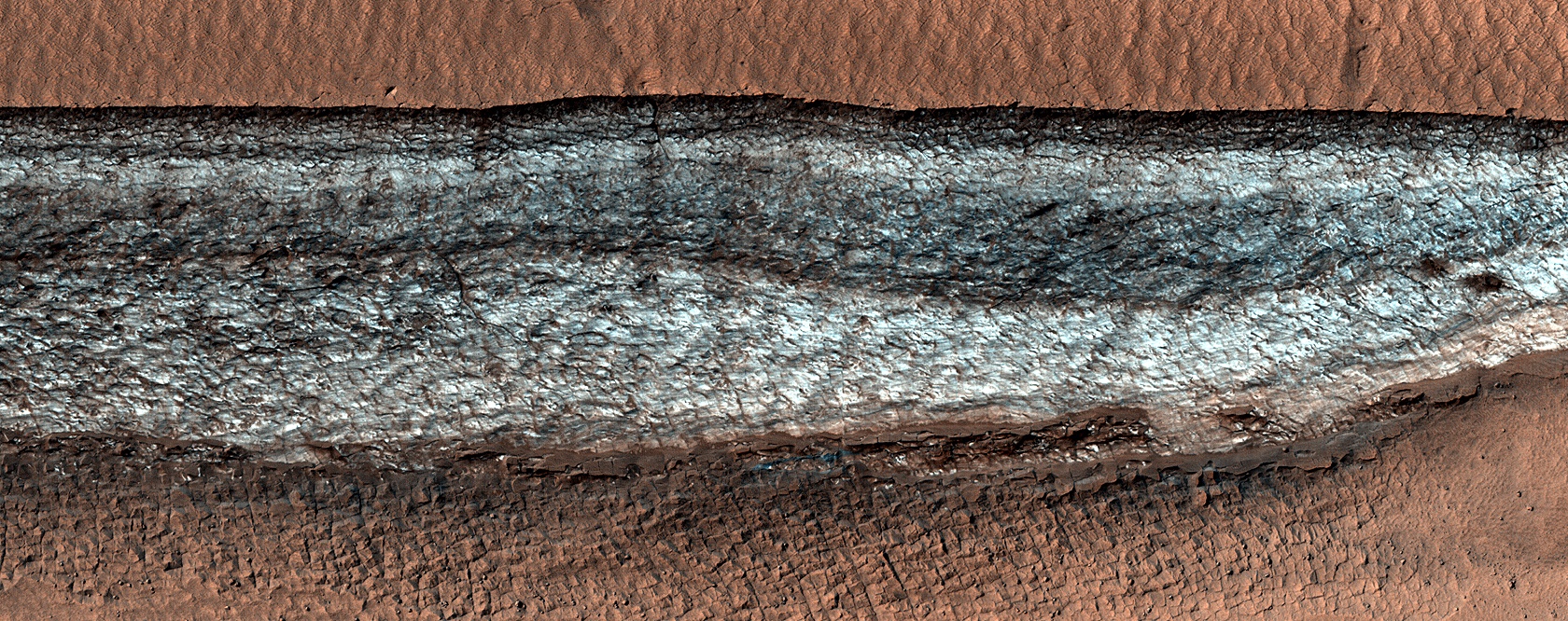
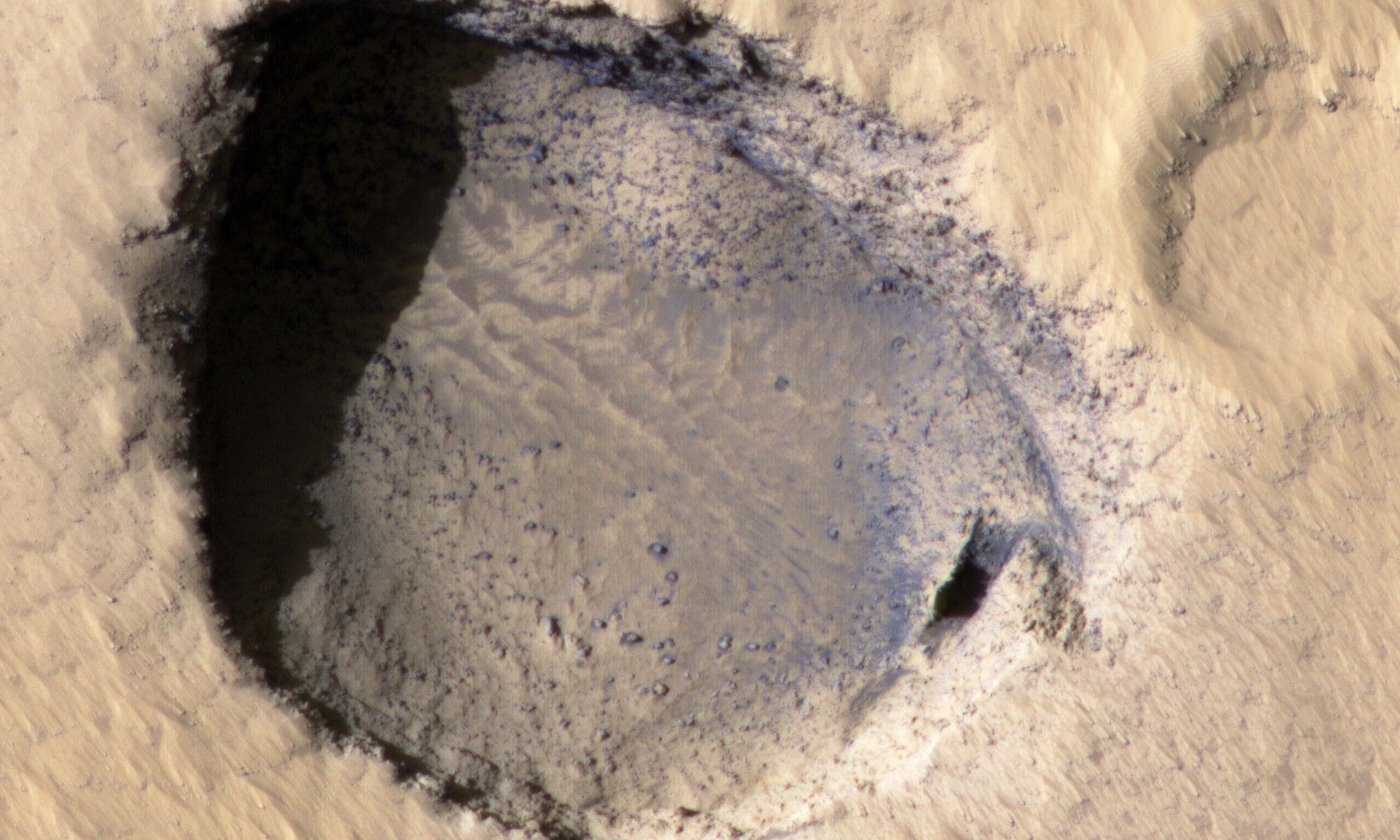
A New Map Shows Where Mars is Hiding all its Ice

The blue areas on this map of Mars are regions where NASA missions have detected subsurface water ice (from the equator to 60 degrees north latitude). Scientists can use the map – part of the Subsurface Water Ice Mapping project – to decide where the ... Credit: NASA/JPL-Caltech/Planetary Science Institute.

Water will be one of the most important resources for human explorers on Mars. They’ll need it for drinking, propellant, breathing, and more. It makes sense to land near a spot where there’s water ice close to the surface.

NASA has released a new map of Mars’s northern hemisphere showing all the places where subsurface water ice has been detected, some of which are surprisingly close to the equator, as well as surprisingly close to the surface. This map could decide the first human landing site.

Continue reading “A New Map Shows Where Mars is Hiding all its Ice”

Navigate a Global Image of Mars (If Your Computer Can Handle It)

The Global CTX Mosaic of Mars allows scientists and the public to explore the planet like never before. It includes different layers of data that can be turned on or off, like these labels for named geographic features on the planet. Credits: NASA/JPL-Caltech/MSSS,

Using data from the Mars Reconnaissance Orbiter (MRO), planetary scientists have created one of the most unique and detailed maps of Mars ever. But fair warning, the biggest version of this is a could overload your computer.  

Global CTX Mosaic of Mars is the highest-resolution global image of the Red Planet ever created and it even allows you see Mars in 3D.

Continue reading “Navigate a Global Image of Mars (If Your Computer Can Handle It)”

Fly Around Jezero Crater on Mars in This New Video

Image of the region around Jezero Crater. Credit: NASA/JPL.

There’s a reason Jezero Crater was chosen as the landing site for the Perseverance Rover: it is considered one of the likeliest places to find any evidence if Mars was ever habitable for long periods of time. In this great new flyby video from ESA, you can get a birds-eye look at Perseverance’s home.

Created from data ESA’s Mars Express and NASA’s Mars Reconnaissance Orbiter, the video takes you on an aerial tour of the crater. From this perspective, you can see the water features in this ancient impact crater and understand why this was considered one of the best places to explore Mars.

Continue reading “Fly Around Jezero Crater on Mars in This New Video”

There's a Crater on Mars That Looks Like a Bear

A bear on Mars? Credit: NASA/JPL-Caltech/UArizona.

Facial pareidolia is the human tendency or illusion of seeing facial structures in an everyday objects – such as seeing the “man in the Moon,” or the face of Jesus on a piece of toast. But here’s a newly found crater on Mars that might be a case of ‘bear-adoilia.’

Continue reading “There's a Crater on Mars That Looks Like a Bear”

Many Clouds on Mars are Driven by Dust, not Water

One of the benefits of having a cluster of satellites orbiting another planet is that scientists can then analyze that planet’s weather. Sometimes in that process, they find patterns that are strikingly similar to those found on our home planet. That was the case recently when a group of scientists from ESA used data from Mars Express to analyze cloud formation on Mars. To no one’s surprise, dust seemed to be at the core of that formation. But the resultant clouds looked very much like those found here on Earth – in the tropics. 

Continue reading “Many Clouds on Mars are Driven by Dust, not Water”

This Ice Cliff is One of the Few Places With Exposed Water ice in the Mid-Latitudes on Mars. It’s Probably Tens of Millions of Years old

An icy cliff face on Mars. Credit: NASA/JPL-Caltech/UArizona.

Because of the orbiters and landers that have studied Mars over the years, scientists have learned that water ice is very likely locked away just under the surface throughout the planet’s mid-latitudes. These regions – especially in the northern hemisphere — are mostly covered with smooth material and scientists suspect ice is just underneath.

But sometimes, images like this give one from the HiRISE (High Resolution Imaging Science Experiment) camera on the Mars Reconnaissance Orbiter, provides a glimpse of the ice that might be buried below the surface. This image shows a cliff jutting out of the normally smooth terrain, and the cliff is covered with bright ice.

Continue reading “This Ice Cliff is One of the Few Places With Exposed Water ice in the Mid-Latitudes on Mars. It’s Probably Tens of Millions of Years old”

The Tharsis Region of Mars is Peppered With These Strange Pit Craters. Now They’ve Been Found Elsewhere

An Atypical Pit Crater in ancient terrain near Elysium Mons, as seen by the Mars Reconnaissance Orbiter. Credit: NASA/JPL-Caltech/UArizona.

Pit craters are found on solid bodies throughout our Solar System, including Earth, Venus, the Moon, and Mars. These craters – which are not formed by impacts — can be indications of underground lava tubes, which are created when the top of a stream of molten rock solidifies and the lava inside drains away, leaving a hollow tube of rock. If a portion of the roof of the tube is unsupported, parts of it may fall in, making a hole or a pit along the lava tube’s path.

Continue reading “The Tharsis Region of Mars is Peppered With These Strange Pit Craters. Now They’ve Been Found Elsewhere”

A New Map of Mars, Made From 51,000 Orbital Images

Seen are six views of the Nili Fossae region of Mars captured by the Compact Reconnaissance Imaging Spectrometer for Mars, or CRISM, one of the instruments aboard NASA’s Mars Reconnaissance Orbiter. The varying colors represent minerals on the Martian surface seen in different wavelengths of light. Credits: NASA/JPL-Caltech/JHU-APL

When NASA sent the Mars Reconnaissance Orbiter (MRO) to the red planet in 2006, the spacecraft took an instrument with it called CRISM—Compact Reconnaissance Imaging Spectrometer for Mars. CRISM’s job is to produce maps of Mars’ surface mineralogy. It’s been an enormous success, but unfortunately, the loss of its last cryocooler in 2017 means the spectrometer can only undertake limited observations.

But CRISM is going out with a bang, creating one final image of the surface of Mars that NASA will release in batches over the next six months.

Continue reading “A New Map of Mars, Made From 51,000 Orbital Images”

This Bizarre Terrain on Mars is Caused by Water Ice and Carbon Dioxide

Spring fans and polygons on Mars, as seen by the HiRISE camera on the Mars Reconnaissance Orbiter. Credit: NASA/JPL-Caltech/UArizona.

From orbit, this landscape on Mars looks like a lacy honeycomb or a spider web. But the unusual polygon-shaped features aren’t created by Martian bees or spiders; they are actually formed from a ongoing process of seasonal change from created from water ice and carbon dioxide.

Continue reading “This Bizarre Terrain on Mars is Caused by Water Ice and Carbon Dioxide”