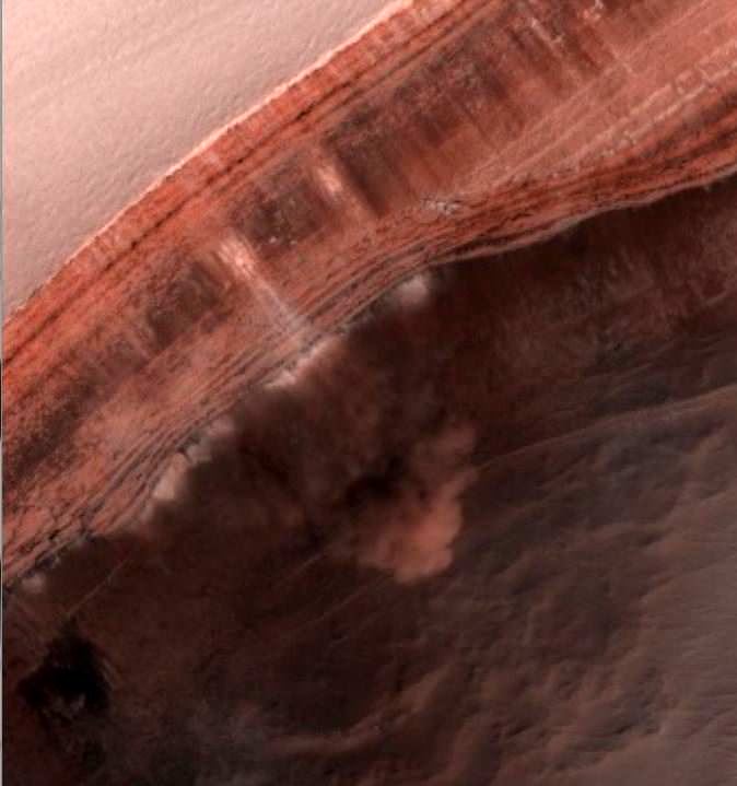
Because of the orbiters and landers that have studied Mars over the years, scientists have learned that water ice is very likely locked away just under the surface throughout the planet's mid-latitudes. These regions – especially in the northern hemisphere -- are mostly covered with smooth material and scientists suspect ice is just underneath.
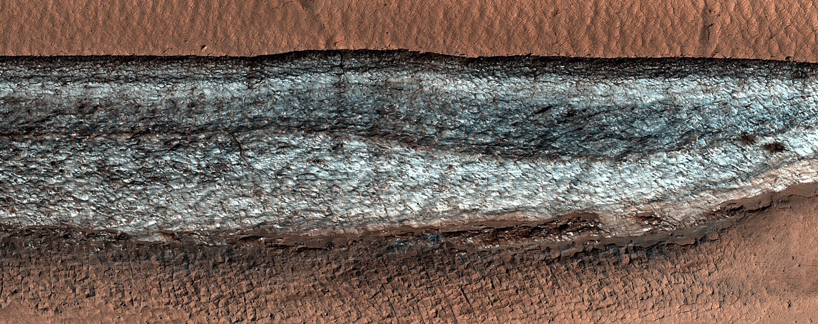
But sometimes, images like this give one from the HiRISE (High Resolution Imaging Science Experiment) camera on the Mars Reconnaissance Orbiter, provides a glimpse of the ice that might be buried below the surface. This image shows a cliff jutting out of the normally smooth terrain, and the cliff is covered with bright ice.
"The bright material on the cliff face is icy and is preserved only because the cliff points away from the equator, so it is shaded most of the time," wrote HiRISE team member Shane Byrne. "Faint bands on the cliff might indicate layers in the ice that record different climate conditions. We do not know how much time this ice took to accumulate here, but studies elsewhere on Mars indicate that material like this is sometimes at least tens of millions of years old."
Byrne said the cliff in this image is one example out of a few dozen that are known. However, if sunlight hits these icy cliffs, and if the cliff is steep enough, sometimes an avalanche can take place as the ice sublimates away. HiRISE has previously taken several images of avalanches as they are taking place!
Back in 2019, scientists used data from MRO and the Mars Odyssey mission to create a map of water ice in the Martian mid-latitudes where they believe the ice could be as little as an inch (2.5 centimeters) below the surface.
"You wouldn't need a backhoe to dig up this ice. You could use a shovel," said the lead author of the study, Sylvain Piqueux of NASA's Jet Propulsion Laboratory. "We're continuing to collect data on buried ice on Mars, zeroing in on the best places for astronauts to land."
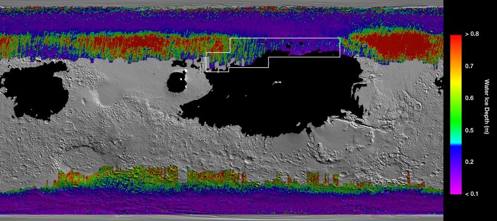
The water ice just below the surface would provide easily accessible in-situ resources for future explorers on Mars. While there are several enticing places they could land, a large portion of a region called Arcadia Planitia is the most tempting target in the northern hemisphere. The map above shows lots of blue and purple in this region, representing water ice less than one foot (30 centimeters) below the surface; warm colors are over two feet (60 centimeters) deep.
Landing humans on Mars is likely a decade or two away, but in the meantime, MRO and HiRISE will keep circling the planet, on the lookout for landing sites that might include water ice nearby.
Check out all the stunning imagery of Mars on the HiRISE camera website.