NOAA/NASA/USAF Deep Space Climate Observatory (DSCOVR) Launching Feb. 8 to Monitor Solar Winds

DSCOVR mission logo. Credit: NOAA/NASA/U.S. Air Force

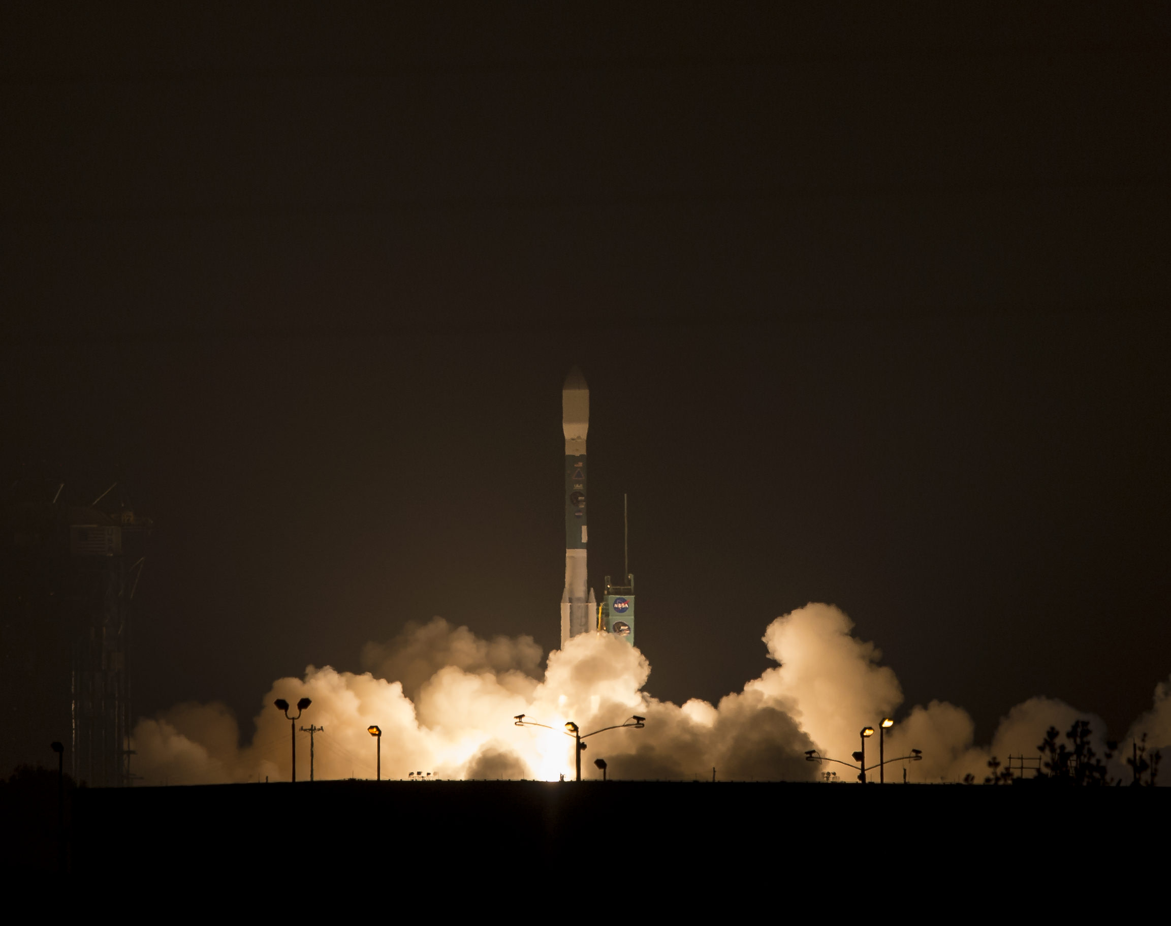
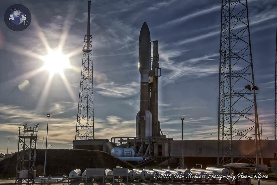
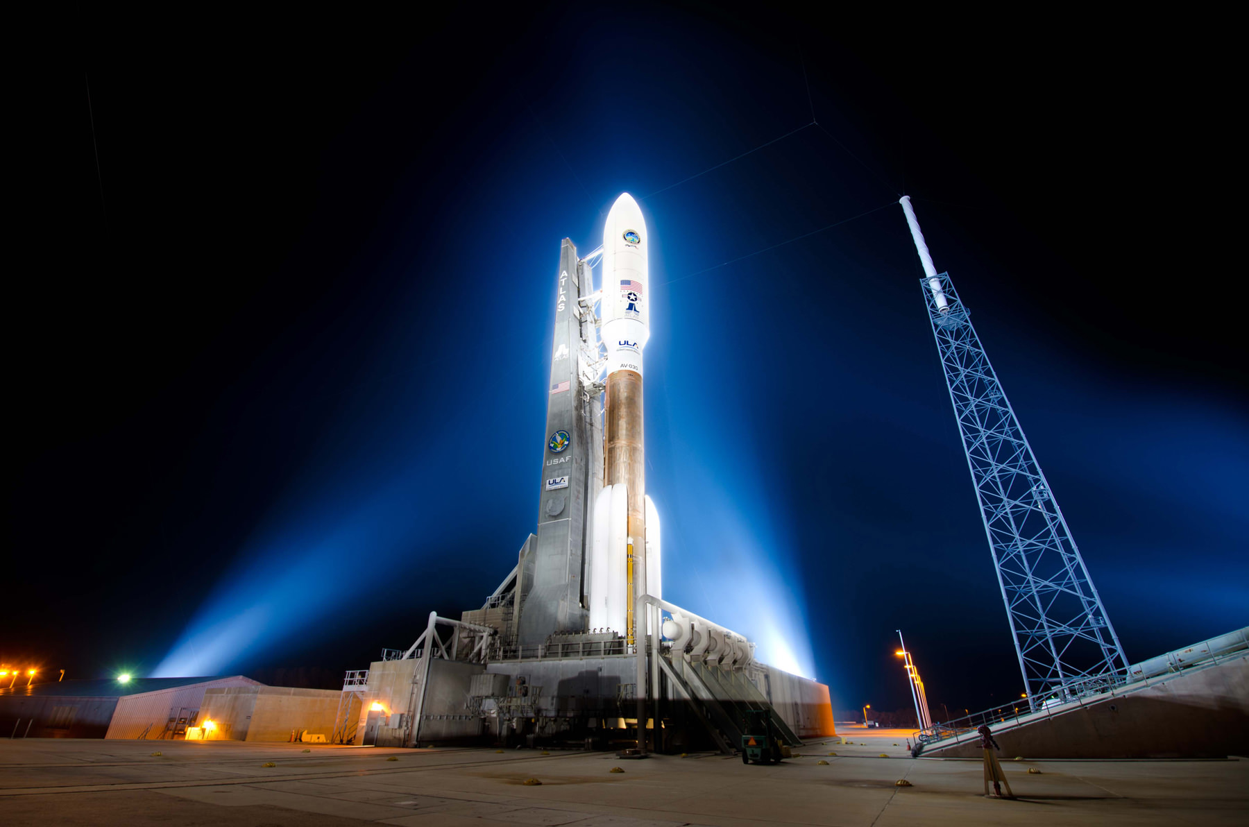
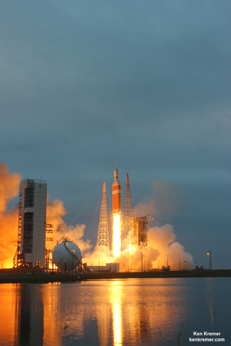
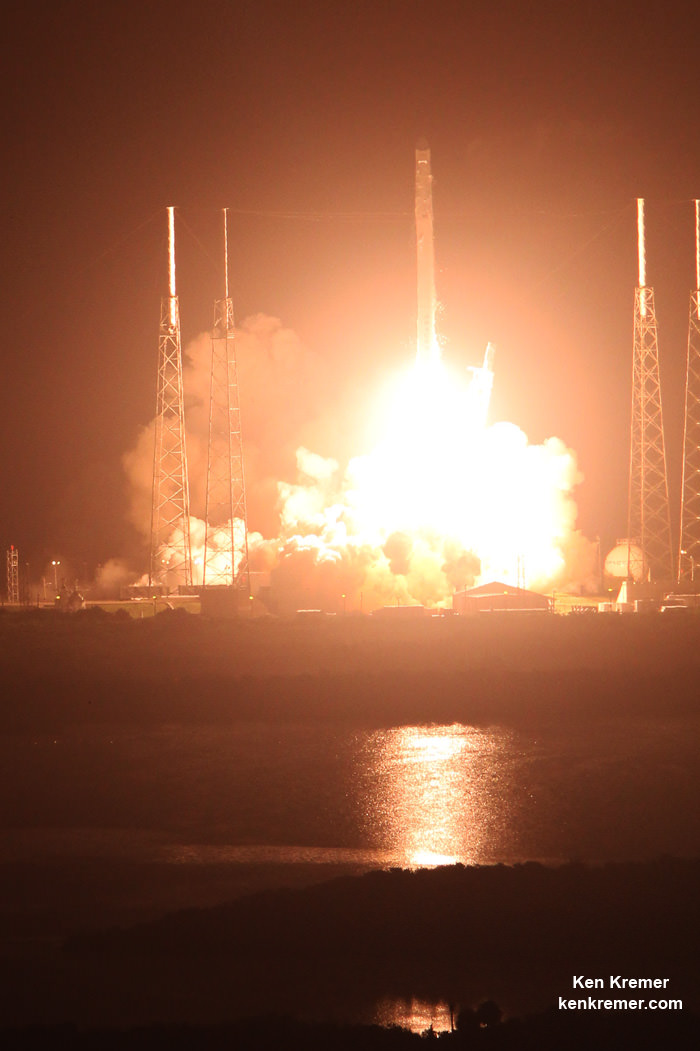
The long awaited Deep Space Climate Observatory, or DSCOVR science satellite is slated to blast off atop a SpaceX Falcon 9 on Sunday, Feb. 8, from Cape Canaveral, Florida on a mission to monitor the solar wind and aid very important forecasts of space weather at Earth.

DSCOVR is a joint mission between NOAA, NASA, and the U.S Air Force (USAF) that will be managed by NOAA. The satellite and science instruments are provided by NASA and NOAA.

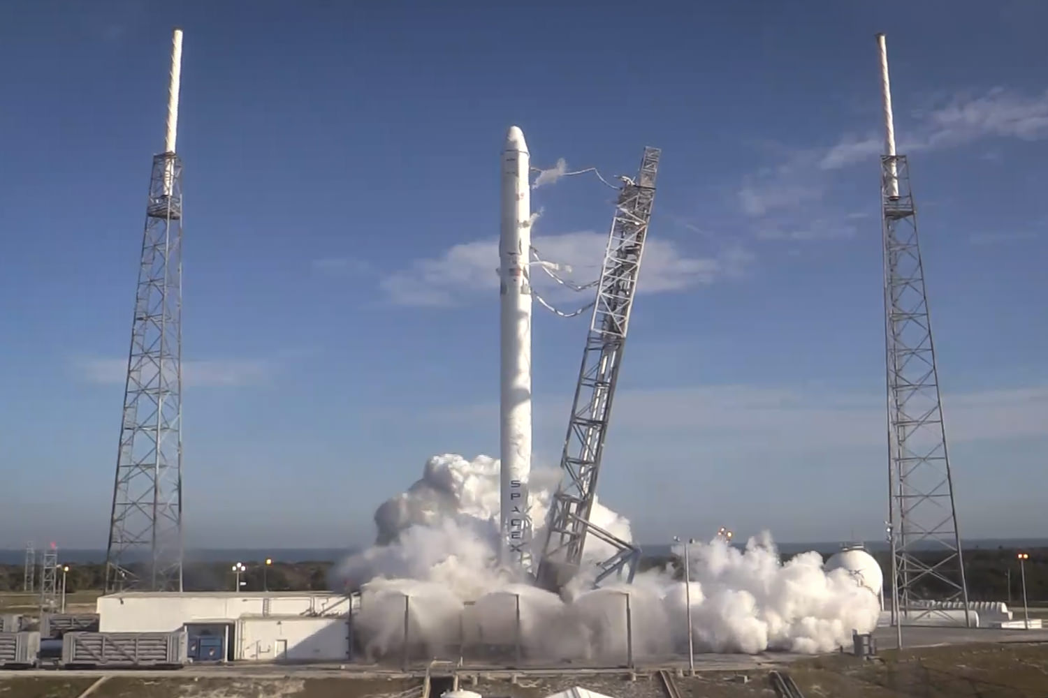
Update Feb 8: Hold, Hold, Hold !!! 6:10 PM 2/8/15 Terminal Count aborted at T Minus 2 min 26 sec due to a tracking issue. NO launch of Falcon 9 today. rocket being safed now. next launch opportunity is Monday. Still TBD.

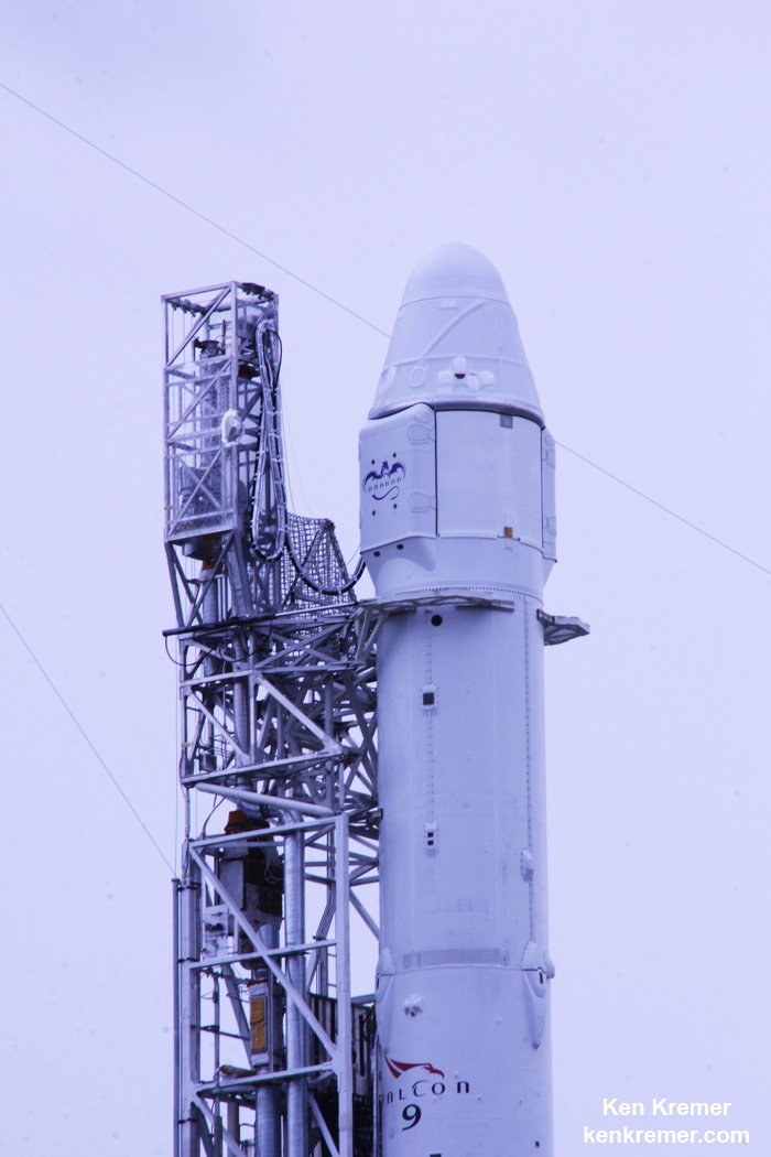
The rocket is provided by the USAF. SpaceX will try to recover the first stage via a guided descent to a floating barge in the Atlantic Ocean.

The weather outlook is currently very promising with a greater than 90 percent chance of favorable weather at launch time shortly after sunset on Sunday which could make for a spectacular viewing opportunity for spectators surrounding the Florida Space coast.

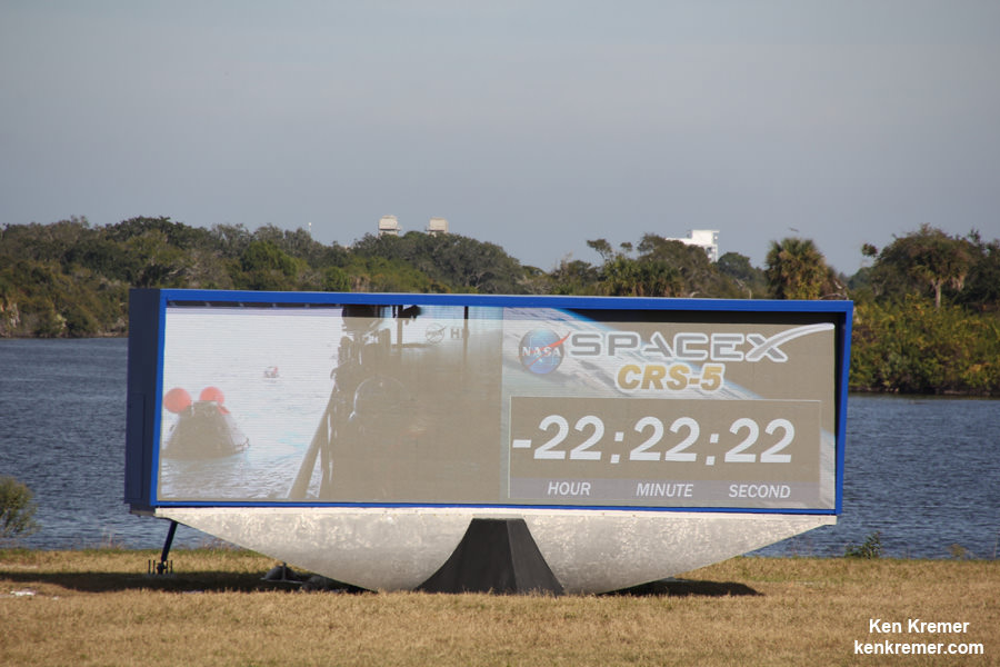
Liftoff atop the SpaceX Falcon 9 rocket is targeted for at 6:10:12 p.m. EST on Feb. 8, from Cape Canaveral Air Force Station Space Launch Complex 40.

There is an instantaneous launch window, meaning that any launch delay due to weather, technical or other factors will force a scrub to Monday.

The launch will be broadcast live on NASA TV: http://www.nasa.gov/nasatv

NASA’s DSCOVR launch blog coverage of countdown and liftoff will begin at 3:30 p.m. Sunday.

NOAA/NASA Deep Space Climate Observatory (DSCOVR) undergoes processing in NASA Goddard Space Flight Center clean room. Solar wind instruments at right. DSCOVER will launch in February 2015 atop SpaceX Falcon 9 rocket.  Credit: Ken Kremer/kenkremer.com/AmericaSpace
NOAA/NASA Deep Space Climate Observatory (DSCOVR) undergoes processing in NASA Goddard Space Flight Center clean room. Solar wind instruments at right. DSCOVER will launch in February 2015 atop SpaceX Falcon 9 rocket. Credit: Ken Kremer/kenkremer.com/AmericaSpace

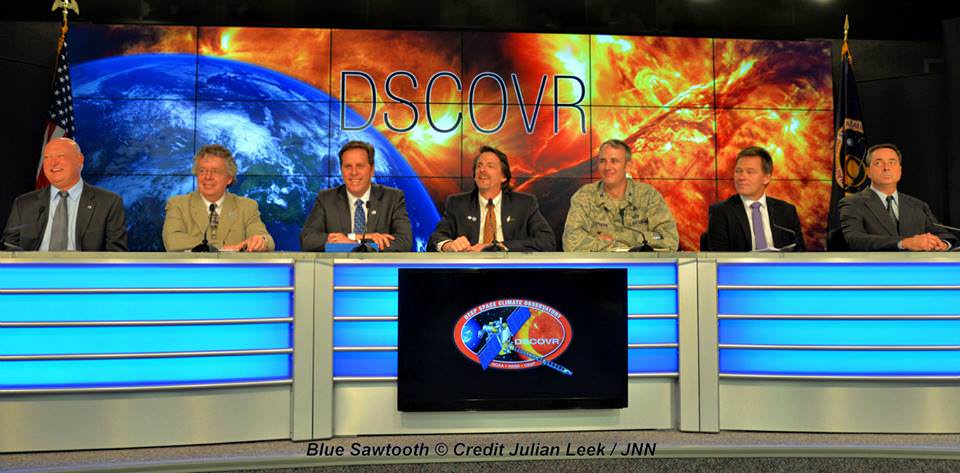
“DSCOVR is NOAA’s first operational space weather mission to deep space,” said Stephen Volz, assistant administrator of the NOAA Satellite and Information Service in Silver Spring, Maryland, at the pre-launch briefing today (Feb. 7) at the Kennedy Space Center in Florida.

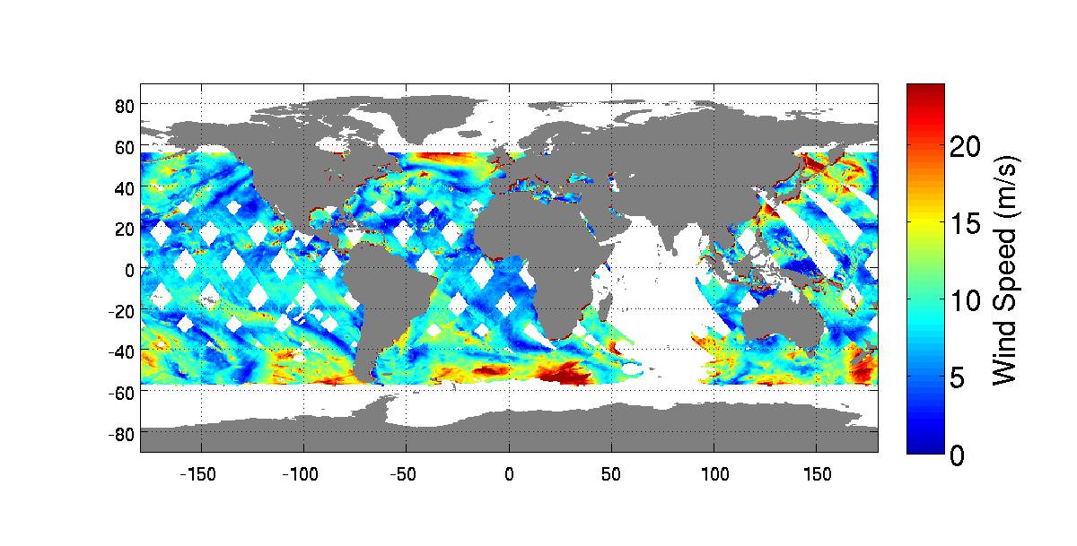
The mission of DSCOVR is vital because its solar wind observations are crucial to maintaining accurate space weather forecasts to protect US infrastructure from disruption by approaching solar storms.

“DSCOVR will maintain the nation’s solar wind observations, which are critical to the accuracy and lead time of NOAA’s space weather alerts, forecasts, and warnings,” according to a NASA description.

“Space weather events like geomagnetic storms caused by changes in solar wind can affect public infrastructure systems, including power grids, telecommunications systems, and aircraft avionics.”

DSCOVR will replace NASA’s aging Advanced Composition Explorer (ACE) satellite which is nearly 20 years old and far beyond its original design lifetime.

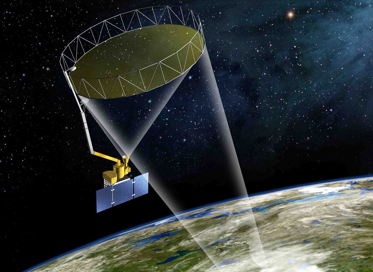
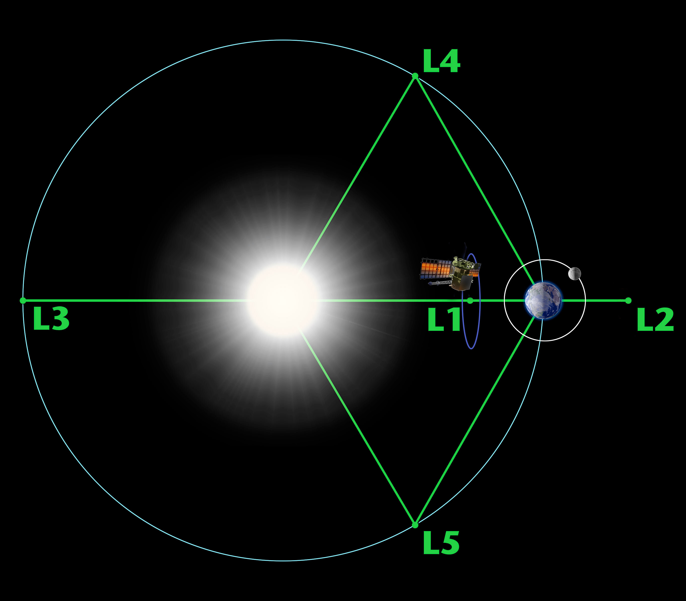
The couch sized probe is being targeted to the L1 Lagrange Point, a neutral gravity point that lies on the direct line between Earth and the sun located 1.5 million kilometers (932,000 miles) sunward from Earth. At L1 the gravity between the sun and Earth is perfectly balanced and the satellite will orbit about that spot just like a planet.

L1 is a perfect place for the science because it lies outside Earth’s magnetic environment. The probe will measure the constant stream of solar wind particles from the sun as they pass by.

Diagram of the five Lagrange points associated with the sun-Earth system, showing DSCOVR orbiting the L-1 point. Image is not to scale.  Credit:  NASA/WMAP Science Team
Diagram of the five Lagrange points associated with the sun-Earth system, showing DSCOVR orbiting the L-1 point. Image is not to scale. Credit: NASA/WMAP Science Team

This will enable forecasters to give a 15 to 60 minute warning of approaching geomagnetic storms that could damage valuable infrastructure.

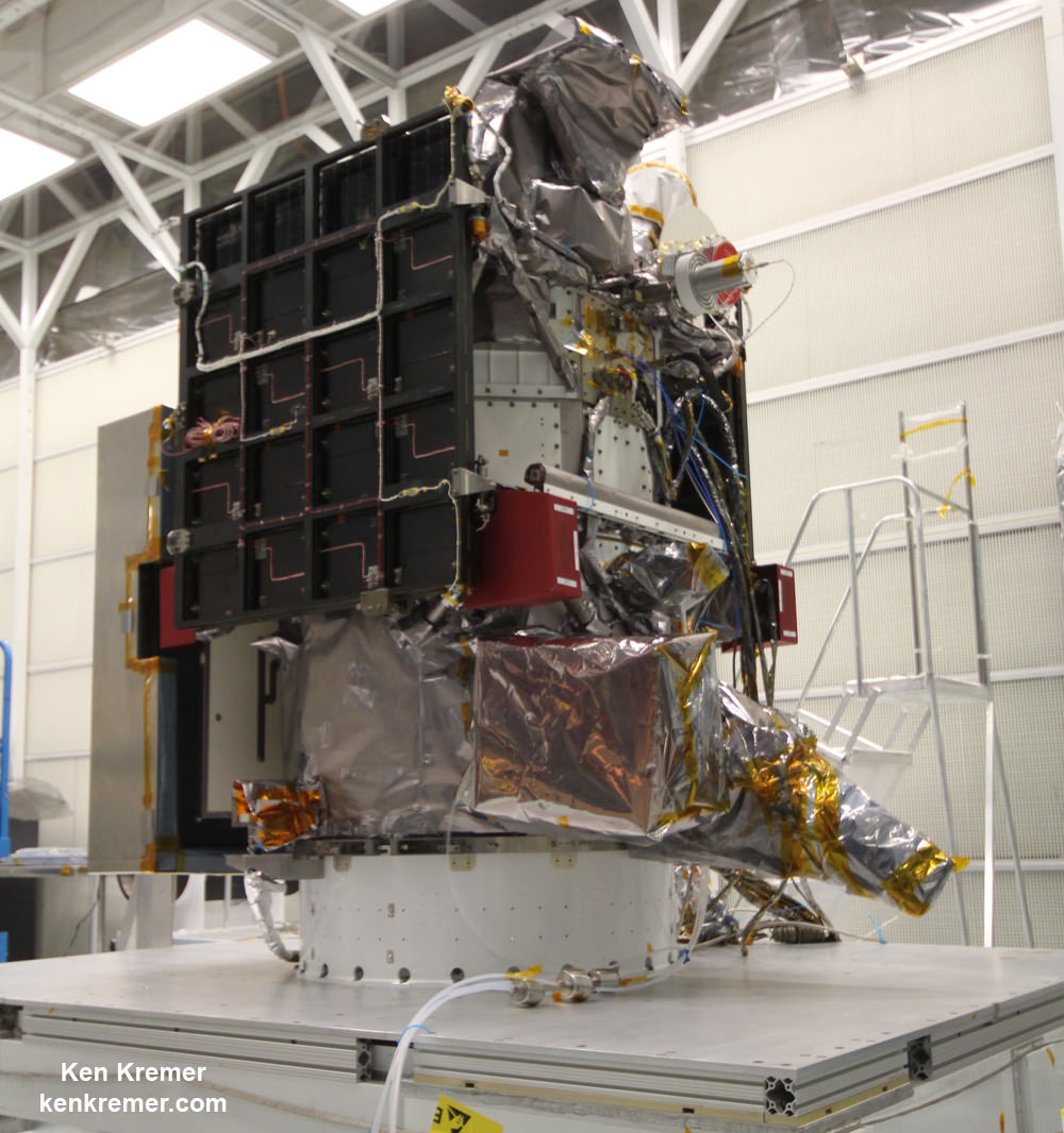
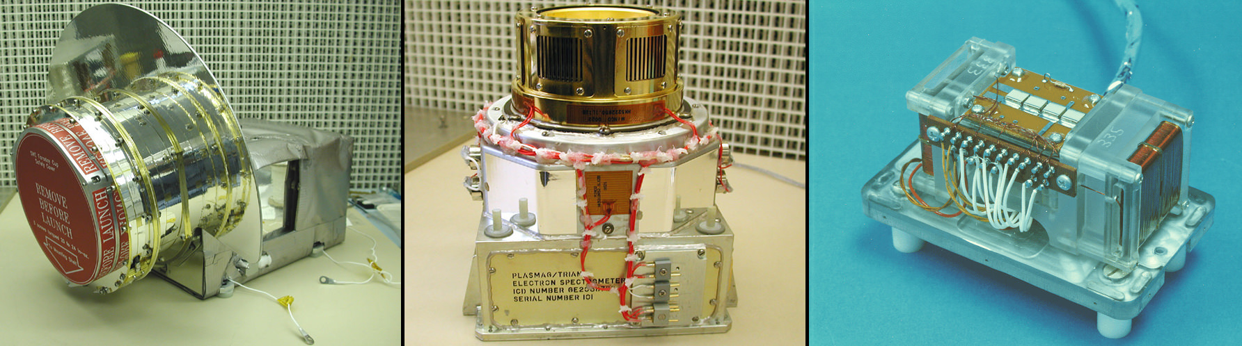
DSCOVR is equipped with a suite of four continuously operating solar science and Earth science instruments from NASA and NOAA.

It will make simultaneous scientific observations of the solar wind and the entire sunlit side of Earth.

Three instruments will help measure the solar wind on the DSCOVR mission: (shown from left to right), the Faraday cup to monitor the speed and direction of positively-charged solar wind particles, the electron spectrometer to monitor electrons, and a magnetometer to measure magnetic fields.  Credit: NASA/DSCOVR
Three instruments will help measure the solar wind on the DSCOVR mission: (shown from left to right), the Faraday cup to monitor the speed and direction of positively-charged solar wind particles, the electron spectrometer to monitor electrons, and a magnetometer to measure magnetic fields. Credit: NASA/DSCOVR

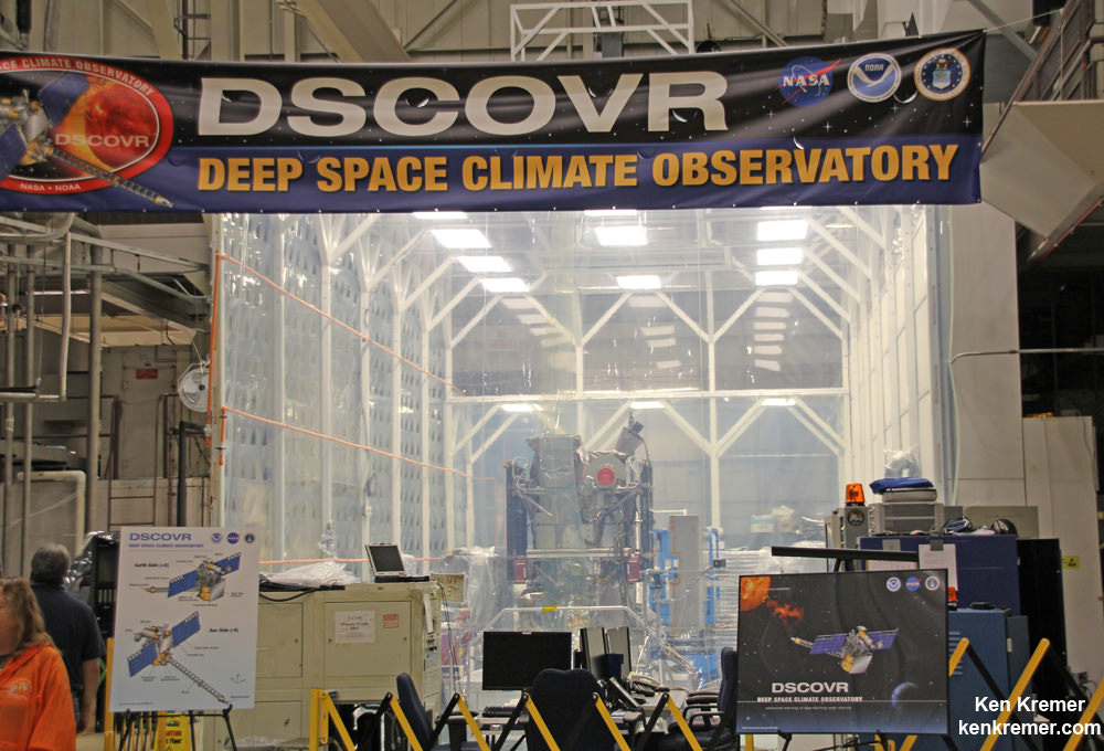
The 750-kilogram DSCOVR probe measures 54 inches by 72 inches.

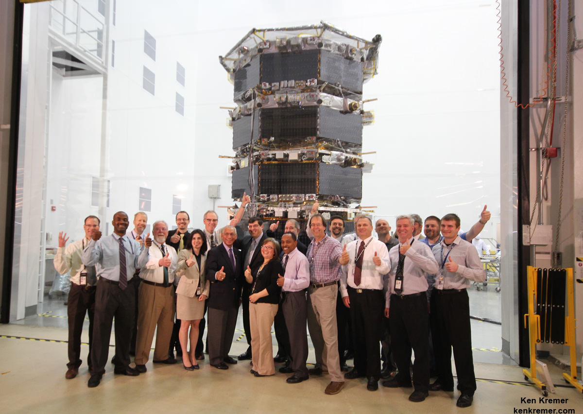
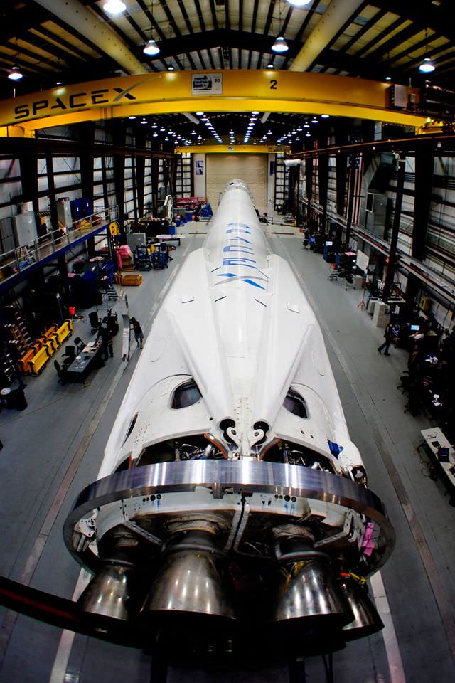
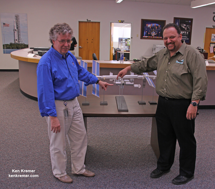
I saw the DSCOVR spacecraft up close at NASA Goddard Space Flight Center in Maryland last fall during processing in the clean room.

NOAA/NASA/USAF Deep Space Climate Observatory (DSCOVR) undergoes processing in NASA Goddard Space Flight Center clean room.  Probe will launch in February atop SpaceX Falcon 9 rocket.  Credit: Ken Kremer - kenkremer.com
NOAA/NASA/USAF Deep Space Climate Observatory (DSCOVR) undergoes processing in NASA Goddard Space Flight Center clean room. Probe will launch in February atop SpaceX Falcon 9 rocket. Credit: Ken Kremer – kenkremer.com

A secondary objective of the rocket launch for SpaceX is to conduct their second attempt to recover the Falcon 9 first stage booster on an ocean going barge. Read my articles about the first attempt in January 2015, starting here.

It was originally named ‘Triana’ (aka Goresat) and was conceived by then US Vice President Al Gore as a low cost satellite to take near continuous views of the Earth’s entire globe to feed to the internet as a means of motivating students to study math and science. It was eventually built as a much more capable Earth science satellite as well as to conduct the space weather observations.

But Triana was shelved for purely partisan political reasons and the satellite was placed into storage and the science was lost until now.

Stay tuned here for Ken’s continuing Earth and planetary science and human spaceflight news.

Ken Kremer

The team is ready for the launch of NASA's DSCOVR spacecraft aboard a SpaceX Falcon 9 rocket. L/R Mike Curie KSC NASA News Chief, Stephen Volz, assistant administrator NOAA, Tom Berger, director of NOAA Space Weather Prediction Center Boulder Colorado,Steven Clark, NASA Joint Agency Satellite Division, Col. D. Jason Cothern, Space Demonstration Division chief at Kirkland AFB NM. Hans Koenigsmann, VP of mission assurance at SpaceX in Hawthorne, California, Mike McAlaneen, launch weather officer 45th Space wing Cape Canaveral Air Force Station, Florida.  Credit: Julian Leek
The team is ready for the launch of NASA’s DSCOVR spacecraft aboard a SpaceX Falcon 9 rocket. L/R Mike Curie KSC NASA News Chief, Stephen Volz, assistant administrator NOAA, Tom Berger, director of NOAA Space Weather Prediction Center Boulder Colorado,Steven Clark, NASA Joint Agency Satellite Division, Col. D. Jason Cothern, Space Demonstration Division chief at Kirkland AFB NM. Hans Koenigsmann, VP of mission assurance at SpaceX in Hawthorne, California, Mike McAlaneen, launch weather officer 45th Space wing Cape Canaveral Air Force Station, Florida. Credit: Julian Leek

NASA Launches Revolutionary Earth Science Satellite Measuring Soil Moisture Cycle

NASA's Soil Moisture Active Passive (SMAP) observatory, on a United Launch Alliance Delta II rocket, is seen after the mobile service tower was rolled back Friday, Jan. 30 at Space Launch Complex 2, Vandenberg Air Force Base, Calif. Image Credit: NASA/Bill Ingalls

NASA’s Soil Moisture Active Passive (SMAP) observatory, on a United Launch Alliance Delta II rocket, is seen after the mobile service tower was rolled back Friday, Jan. 30 at Space Launch Complex 2, Vandenberg Air Force Base, Calif.
Image Credit: NASA/Bill Ingalls
Story updated[/caption]

At dawn this morning (Jan. 31) NASA launched an advanced Earth science satellite aimed at making measurements of our planet’s surface soil moisture and freeze/thaw states from space that will revolutionize our understanding of the water, energy, and carbon cycles driving all life on Earth, aid weather forecasting and improve climate change models.

NASA’s new Soil Moisture Active Passive (SMAP) observatory thundered off the pad at 6:22 a.m. PST (9:22 a.m. EST) Saturday atop a two stage United Launch Alliance Delta II rocket from Space Launch Complex 2 on Vandenberg Air Force Base, California.

The $916 million satellite successfully separated from the rocket’s second stage some 57 minutes after the flawless liftoff and was injected into an initial 411- by 425-mile (661- by 685-kilometer) orbit. The spacecraft then deployed its solar arrays and telemetry indicated it was in excellent health.

“We’re in contact with SMAP and everything looks good right now,” NASA Launch Manager Tim Dunn said.

“Deployment of the solar arrays is underway. We just couldn’t be happier.”

SMAP separated from the second stage while pointed toward the sun as seen in the video below from a rocket mounted camera:

Video Caption: A camera on the second stage of the Delta II rocket captured this footage as the SMAP spacecraft pushed itself away from the rocket to complete the delivery of the Earth-observing spacecraft to its proper orbit following Jan. 31, 2015 liftoff. Credit: NASA TV/ULA

SMAP is NASA’s 1st Earth observing satellite designed to make high resolution global observations of Earth’s vital surface soil moisture content and freeze/thaw cycle just below your feet. It will aid global forecasting and have broad applications for science and society.

SMAP’s combined radar and radiometer instruments will peer into the top 2 inches (5 centimeters) of soil, through clouds and moderate vegetation cover, day and night, to produce the highest-resolution, most accurate soil moisture maps ever obtained from space, says NASA.

The blastoff of SMAP successfully concluded NASA’s ambitious plans to launch a record breaking total of five Earth science satellites in less than a year’s time.

“The launch of SMAP completes an ambitious 11-month period for NASA that has seen the launch of five new Earth-observing space missions to help us better understand our changing planet,” said NASA Administrator Charles Bolden.

“Scientists and policymakers will use SMAP data to track water movement around our planet and make more informed decisions in critical areas like agriculture and water resources.”

Artist's rendering of the Soil Moisture Active Passive satellite. The width of the region scanned on Earth’s surface during each orbit is about 620 miles (1,000 kilometers).  Image credit: NASA/JPL-Caltech
Artist’s rendering of the Soil Moisture Active Passive satellite. The width of the region scanned on Earth’s surface during each orbit is about 620 miles (1,000 kilometers). Image credit: NASA/JPL-Caltech

SMAP is projected to last for at least a three year primary mission.

The prior NASA Earth science instrument launched was the Cloud Aerosol Transport System (CATS) payload hauled to space by the SpaceX CRS-4 Dragon on Jan. 10, 2015 and recently installed on the exterior of the ISS. Read my CATS installation story – here.

The three earlier NASA Earth science missions launched over the past year included ISS-RapidScat in September 2014, the Global Precipitation Measurement (GPM) Core Observatory, a joint mission with the Japan Aerospace Exploration Agency, in February 2014, and the Orbiting Carbon Observatory-2 (OCO-2) carbon observatory in July 2014.

“Congratulations to the NASA Launch Services Program team, JPL and all of our mission partners on today’s successful launch of the SMAP satellite,” said Jim Sponnick, ULA vice president, Atlas and Delta Programs.

“It is our honor to launch this important Earth science mission to help scientists observe and predict natural hazards, and improve our understanding of Earth’s water, energy and carbon cycles.”

SMAP will provide high-resolution, space-based measurements of soil moisture and its state — frozen or thawed — a new capability that will allow scientists to better predict natural hazards of extreme weather, climate change, floods and droughts, and help reduce uncertainties in our understanding of Earth’s water, energy and carbon cycles, according to a NASA description.

The mission will map the entire globe every two to three days for at least three years and provide the most accurate and highest-resolution maps of soil moisture ever obtained. The spacecraft’s final circular polar orbit will be 426 miles (685 kilometers), at an inclination of 98.1 degrees. The spacecraft will orbit Earth once every 98.5 minutes and repeat the same ground track every eight days.

“All subsystems are being powered on and checked out as planned,” Kent Kellogg, the SMAP project manager, during a post-launch press conference.

“Communications, guidance and control, computers and power are all operating nominally.”

The observatory is in excellent health. Its instruments will be turned on in 11 days.

Today’s blastoff of SMAP marks ULA’s second successful launch this month as well as the second of 13 planned for 2015. ULA’s first launch of 2015 was MUOS-3 from Cape Canaveral on Jan. 20.

ULA’s next launch involves NASA’s Magnetospheric Multiscale Mission (MMS) to study Earth’s magnetic reconnection. It is scheduled for launch on an Atlas V 421 booster on March 12 from Cape Canaveral. See my up close visit with MMS and NASA Administrator Charles Bolden at NASA Goddard Space Flight Center detailed in my story – here.

Stay tuned here for Ken’s continuing Earth and planetary science and human spaceflight news.

Ken Kremer

NASA and NOAA Satellites Image Crippling Blizzard of 2015 Pounding New England

NASA-NOAA Suomi NPP satellite captures blizzard near peak intensity as it moves over New York and Boston regions at 1:45 am EST, Jan. 27, 2015. This view is a combination of the day-night band and high resolution infrared imagery from Suomi NPP showing the historic blizzard near peak intensity as it moves over the New York through Boston Metropolitan areas at 06:45Z (1:45 a.m. EST) on January 27, 2015. Credit: NOAA/NASA

NEW JERSEY – Record breaking snow from the ‘Blizzard of 2015’ hit vast regions of the US Northeast today, Jan. 27, 2015, stretching from Long Island to New England.

NASA and NOAA Earth orbiting satellites are keeping track of the storm affecting millions of residents.

This afternoon the agencies provided a new set of night-time and daytime views of the Blizzard of 2015 taken by the Suomi NPP and the GOES-East satellites.

The crippling blizzard is causing misery, extensive destruction to homes and businesses in localized areas, power outages, traffic accidents, breaks in some sea walls and deaths.

The satellite image above shows a combination of the day-night band and high resolution infrared imagery from the NASA-NOAA’s Suomi NPP satellite.

It was taken as the historic blizzard neared peak intensity as it moved over the New York area and through the Boston Metropolitan areas at 06:45Z (1:45 a.m. EST) on January 27, 2015.

The high cloud tops from the most intense parts of the storm blurred the regions normally bright nighttime lights in the satellite image.

Although the snow totals were about half the over two feet forecast for the New York Metropolitan region, many areas to the north and east were inundated with very heavy to historic snow fall totals, as bad or worse than the forecasters predicted.

Over two feet of snow fell on areas of New York’s Long Island and stretching north to vast regions of Connecticut, Massachusetts, New Hampshire and into Maine.

Near hurricane force waves are crashing into some coastal towns along the Massachusetts shoreline. Wind gusts as high as 78 mph have been recorded.

“Highest snowfall report has been Auburn, MA with 32.5 inches! Wind gust reports as high as 78 mph in Nantucket, MA,” according to a tweet this evening from the National Weather Service (NWS).

Worchester, Mass had a record breaking 31 inches of snow. And it’s still falling this evening in the 2nd largest city in New England.

A flood emergency is in effect in Marshfield, Mass., where an 80 foot section of the seawall was smashed by crashing waves and is destroying homes as shown on NBC Nightly News.

Blinding snow is raging in Portland, Maine this evening according on a live NBC News report.

On January 27, 2015 at 17:35 UTC (12:35 p.m. EST) NOAA's Geostationary Operational Environmental or GOES- East satellite captured an image of the nor'easter over New England. Credit: NASA/NOAA GOES Project
On January 27, 2015 at 17:35 UTC (12:35 p.m. EST) NOAA’s Geostationary Operational Environmental or GOES- East satellite captured an image of the nor’easter over New England. Credit: NASA/NOAA GOES Project

“At 10 a.m. EST, the National Weather Service noted “the powerful nor’easter that brought moderate to heavy snowfall and blizzard conditions to the Northeast on Monday will continue to affect the region on Tuesday, with heavy snow and blizzard conditions expected from eastern Long Island to Maine as the system slowly moves to the northeast. Snow and strong winds will being tapering off from south to north Tuesday night into Wednesday morning,” wrote NASA’s Rob Gutro of NASA’s Goddard Space Flight Center in an update.

“Later on January 27, 2015 at 17:35 UTC (12:35 p.m. EST) NOAA’s Geostationary Operational Environmental or GOES-East satellite captured an image of the nor’easter over New England. The image was created by the NASA/NOAA GOES Project and showed the clouds associated with the nor’easter blanketing New England. An occluded front extended north and eastward out of the low pressure area’s center out into the Atlantic Ocean.”

The latest NOAA forecast as of 4 PM, Jan. 27 states:

HIGH WINDS AND HEAVY SNOW WILL BEGIN TO GRADUALLY TAPER OFF FROM SOUTH TO NORTH TONIGHT…BUT WILL LAST INTO EARLY WEDNESDAY MORNING ACROSS PORTIONS OF MAINE. HEAVY SNOWFALL WILL COMBINE WITH SUSTAINED WINDS OF 30 TO 40 MPH…AND GUSTS IN EXCESS OF 50 MPH…TO CREATE LIFE-THREATENING WHITEOUT OR BLIZZARD CONDITIONS. THESE WINDS MAY LEAD TO DOWNED TREES AND POWER LINES RESULTING IN POWER OUTAGES. TRAVEL WILL BE IMPOSSIBLE AND LIFE-THREATENING IN MANY AREAS. ALONG THE IMMEDIATE COASTLINE…WIND GUSTS TO NEAR 65 MPH WILL BE POSSIBLE. COASTAL FLOODING AND SEVERE BEACH EROSION WILL ALSO BE A POSSIBILITY…AND VULNERABLE ROADS AND STRUCTURES MAY BE FLOODED OR DAMAGED.

Stay tuned here for Ken’s continuing Earth and planetary science and human spaceflight news.

Reporting from snowy New Jersey.

Ken Kremer

Busy Year of 13 Launches by ULA in 2015 Begins with Blastoffs for the Navy and NASA

MUOS-3 communications satellite for the US Navy awaits launch atop an Atlas V rocket at pad 41 at Cape Canaveral Air Force Station, FL on Jan. 20, 2015. Credit: John Studwell/AmericaSpace

A busy year of 13 space launches by rocket provider United Launch Alliance (ULA) in 2015 begins with a pair of blastoffs for the US Navy and NASA tonight and next week, emanating from both the US East and West Coasts.

The hefty manifest of 13 liftoffs in 2015 comes hot on the heels of ULA’s banner year in 2014 whereby they completed every one of the firm’s 14 planned launches in 2014 with a 100% success rate.

“What ULA has accomplished in 2014, in support of our customers’ missions, is nothing short of remarkable,” said ULA CEO Tory Bruno.

“When you think about every detail – all of the science, all of the planning, all of the resources – that goes into a single launch, it is hard to believe that we successfully did it at a rate of about once a month, sometimes twice.”

ULA’s stable of launchers includes the Delta II, Delta IV and the Atlas V. They are in direct competition with the Falcon 9 rocket from SpaceX founded by billionaire Elon Musk.

And ULA’s 2015 launch calendar begins tonight with a milestone launch for the US Navy that also marks the 200th launch overall of the venerable Atlas-Centaur rocket that has a renowned history dating back some 52 years to 1962 with multiple variations.

And tonight’s blastoff of the Multi-User Objective System (MUOS-3) satellite for the US Navy involves using the most powerful variant of the rocket, known as the Atlas V 551.

Liftoff of MUOS-3 is set for 7:43 p.m. EDT from Space Launch Complex-41 at Cape Canaveral Air Force Station in Florida. The launch window extends for 44 minutes and the weather outlook is very favorable. It will be carried live on a ULA webcast.

MUOS-3 Navy communications satellite and Atlas V rocket at pad 41 at Cape Canaveral Air Force Station, FL for launch on Jan. 20, 2015. Credit: ULA

The second ULA launch of 2015 comes just over 1 week later on January 29, lofting NASA’s SMAP Earth observation satellite on a Delta II rocket from Vandenberg Air Force Base in California.

MUOS is a next-generation narrowband tactical satellite communications system designed to significantly improve ground communications for U.S. forces on the move, according to ULA.

This is the third satellite in the MUOS series and will provide military users 10 times more communications capability over existing systems, including simultaneous voice, video and data, leveraging 3G mobile communications technology.

ULA’s second launch in 2015 thunders aloft from the US West Coast with NASA’s Soil Moisture Active Passive mission (SMAP). It is the first US Earth-observing satellite designed to collect global observations of surface soil moisture.

SMAP will blastoff from Space Launch Complex 2 at Vandenberg AFB at 9:20 a.m. EST (6:20 a.m. PST) on ULA’s Delta II rocket.

NASA's Soil Moisture Active Passive mission (SMAP) will lift off from Space Launch Complex 2 at Vandenberg Air Force Base in California at 9:20 a.m. EST (6:20 a.m. PST) on a United Launch Alliance Delta II rocket.   Credit:  NASA
NASA’s Soil Moisture Active Passive mission (SMAP) will lift off from Space Launch Complex 2 at Vandenberg Air Force Base in California at 9:20 a.m. EST (6:20 a.m. PST) on a United Launch Alliance Delta II rocket. Credit: NASA

“It goes without saying: ULA had a banner year,” Bruno said. “As we look ahead to 2015, we could not be more honored to continue supporting our nation in one of the most technologically complex, critical American needs: affordable, reliable access to space.”

ULA began operations in December 2006 with the merger of the expendable launch vehicle operations of Boeing and Lockheed Martin.

ULA’s Delta IV Heavy is currently the world’s most powerful rocket and flawlessly launched NASA’s Orion capsule on Dec. 5, 2014 on its highly successful uncrewed maiden test flight on the EFT-1 mission.

Overall, the 14-mission launch manifest in 2014 included 9 national security space missions, 3 space exploration missions, including NASA’s Orion EFT-1 and 2 commercial missions.

NASA’s first Orion spacecraft blasts off at 7:05 a.m. atop United Launch Alliance Delta 4 Heavy Booster at Space Launch Complex 37 (SLC-37) at Cape Canaveral Air Force Station in Florida on Dec. 5, 2014.   Launch pad remote camera view.   Credit: Ken Kremer - kenkremer.com
NASA’s first Orion spacecraft blasts off at 7:05 a.m. atop United Launch Alliance Delta 4 Heavy Booster at Space Launch Complex 37 (SLC-37) at Cape Canaveral Air Force Station in Florida on Dec. 5, 2014. Launch pad remote camera view. Credit: Ken Kremer – kenkremer.com

Beyond MUOS-3 and SMAP, the launch manifest on tap for 2015 also includes additional NASA science satellites, an ISS commercial cargo resupply mission as well as more GPS satellites for military and civilian uses and top secret national security launches using the Delta II, Delta IV and the Atlas V boosters.

NASA’s Magnetospheric Multiscale Mission (MMS) to study Earth’s magnetic reconnection is scheduled for launch on an Atlas V 421 booster on March 12 from Cape Canaveral. See my up close visit with MMS and NASA Administrator Charles Bolden at NASA Goddard Space Flight Center detailed in my story – here.

NASA Administrator Charles Bolden poses with the agency’s Magnetospheric Multiscale (MMS) spacecraft, mission personnel, Goddard Center Director Chris Scolese and NASA Associate Administrator John Grunsfeld, during visit to the cleanroom at NASA's Goddard Space Flight Center in Greenbelt, Md., on May 12, 2014.  Credit: Ken Kremer- kenkremer.com
NASA Administrator Charles Bolden poses with the agency’s Magnetospheric Multiscale (MMS) spacecraft, mission personnel, Goddard Center Director Chris Scolese and NASA Associate Administrator John Grunsfeld, during visit to the cleanroom at NASA’s Goddard Space Flight Center in Greenbelt, Md., on May 12, 2014. Credit: Ken Kremer- kenkremer.com

In March, June and September the GPS 2F-9, 2F-10 and 2F-11 navigation satellites will launch on Delta IV and Atlas V rockets from Cape Canaveral.

Two top secret NRO satellites are set to launch on a Delta IV and Atlas in April and August from Vandenberg.

An Air Force Orbital Test Vehicle (OTV) space plane may launch as soon as May atop an Atlas V from Cape Canaveral.

The MUOS-4 liftoff is set for August on another Atlas from the Cape.

The Morelos 3 communications satellite for the Mexican Ministry of Communications and Transportation is due to launch in October from the Cape.

In November, the Atlas V will be pressed into service for the first time to launch the Orbital Sciences Cygnus Orb-4 cargo vehicle to the International Space Station (ISS) as a replacement rocket for the Orbital Sciences Antares rocket which is grounded following its catastrophic Oct. 28 explosion on the Orb-3 mission from NASA Wallops.

This Cygnus launched atop Antares on Jan. 9 and docked on Jan. 12   Cygnus pressurized cargo module – side view – during exclusive visit by  Ken Kremer/Universe Today to observe prelaunch processing by Orbital Sciences at NASA Wallops, VA. ISS astronauts will open this hatch to unload 2780 pounds of cargo.  Docking mechanism hooks and latches to ISS at left. Credit: Ken Kremer – kenkremer.com
This Cygnus launched atop Antares on Jan. 9, 2014. The next Cygnus Orb-4 will launch for the first time atop an Atlas V in Nov. 2015. Cygnus pressurized cargo module – side view – during exclusive visit by Ken Kremer/Universe Today to observe prelaunch processing by Orbital Sciences at NASA Wallops, VA. ISS astronauts will open this hatch to unload 2780 pounds of cargo. Docking mechanism hooks and latches to ISS at left. Credit: Ken Kremer – kenkremer.com

The Orb-4 launch also marks ULA’s first launch to the ISS. It may be followed by another Cygnus launch atop an Atlas V in 2016 as Orbital works to bring the Antares back into service.

Antares doomed descent to incendiary destruction after first stage propulsion system of Orbital Sciences’ rocket exploded moments after blastoff from NASA’s Wallops Flight Facility, VA, on Oct. 28, 2014. Credit: Ken Kremer – kenkremer.com

In another major milestone down the road, the Atlas V is being man rated since it was chosen to launch the Boeing CST-100 space taxi which NASA selected as one of two new commercial crew vehicles to launch US astronauts to the ISS as soon as 2017.

Stay tuned here for Ken’s continuing Earth and planetary science and human spaceflight news.

Ken Kremer

SpaceX and NASA On Track For Spectacular Predawn Jan. 6 Launch of Critical Cargo Mission to ISS

A SpaceX Falcon 9 rocket and Dragon cargo ship are set to liftoff on a resupply mission to the International Space Station (ISS) from launch pad 40 at Cape Canaveral, Florida on Jan. 6, 2015. File photo. Credit: Ken Kremer – kenkremer.com

SpaceX is on track to rollout their Falcon 9 rocket carrying the Dragon cargo freighter this evening, Monday, Jan, 5, 2015 to launch pad 40 on a mission bound for the International Space Station (ISS) to deliver critical supplies.

The Dragon CRS-5 mission is slated to blast off at 6:20 a.m. EST, Tuesday, Jan. 6, 2015, atop the SpaceX Falcon 9 rocket from Space Launch Complex 40 at Cape Canaveral Air Force Station in Florida.

The predawn launch should put on a spectacular sky show for spectators along the Florida space coast.

There is only an instantaneous launch window available, meaning that the blastoff must proceed at that exact instant. Any delays due to technical issues or weather would force a scrub until at least Friday, Jan. 9.

SpaceX Falcon 9 ready for rollout to launch pad for Dragon CRS-5 mission.  Credit: SpaceX
SpaceX Falcon 9 ready for rollout to launch pad for Dragon CRS-5 mission. Credit: SpaceX

The launch has already been postponed several times, most recently from Dec. 19, 2014 when a static fire test of the first stage engines on Dec. 17 shut down prematurely.

A second static fire test of the SpaceX Falcon 9 successfully went the full duration of approximately 3 seconds and cleared the path for a liftoff attempt after the Christmas holidays.

The delay allowed the teams to recoup and recover and enjoy the festive holiday season.

“It was a good decision to postpone the launch until after the holidays,” said Hans Koenigsmann, VP of Mission Assurance, SpaceX, at a media briefing today at the Kennedy Space Center (KSC).

Following the catastrophic failure of the Orbital Sciences Antares rocket and Cygnus cargo freighter on Oct. 28 from NASA’s Wallops Flight Facility in Virginia, officials have been prudently cautious to ensure that all measures were carefully rechecked to maximize the possibilities of a launch success.

SpaceX Falcon 9 rocket completes successful static fire test on Dec. 19 ahead od planned CRS-5 mission for NASA in early January 2015. Credit:  SpaceX
SpaceX Falcon 9 rocket completes successful static fire test on Dec. 19 ahead od planned CRS-5 mission for NASA in early January 2015. Credit: SpaceX

CRS-5 marks the company’s fifth resupply mission to the ISS under a $1.6 Billion contract with NASA to deliver 20,000 kg (44,000 pounds) of cargo to the station during a dozen Dragon cargo spacecraft flights through 2016 under NASA’s Commercial Resupply Services (CRS) contract

The weather odds have improved to 70% GO from 60% GO reported Major Perry Sweat, 45th Weather Squadron rep, USAF, at the briefing today at the Kennedy Space Center.

A frontal boundary has settled in over Central Florida. This front and its associated cloudiness will be very slow to move south of the Space Coast. With the clouds only slowly eroding overhead, the primary weather concern remains thick clouds, according to Sweat.

The unmanned cargo freighter is loaded with more than 5108 pounds (2317 kg) of scientific experiments, technology demonstrations, crew supplies, spare parts, food, water, clothing and assorted research gear for the space station.

The Dragon research experiments will support over 256 science and research investigations for the six person space station crews on Expeditions 42 and 43.

Among the payloads is the Cloud-Aerosol Transport System (CATS), a remote-sensing laser instrument to measure clouds and the location and distribution of pollution, dust, smoke, and other particulates and aerosols in the atmosphere.

Commander Barry “Butch” Wilmore on the International Space Station shared this beautiful image of #sunrise earlier today, 1/3/15.  Credit: NASA/Barry ‘Butch’ Wilmore
Commander Barry “Butch” Wilmore on the International Space Station shared this beautiful image of #sunrise earlier today, 1/3/15. Credit: NASA/Barry ‘Butch’ Wilmore

Assuming all goes well, Dragon will rendezvous at the ISS on Thursday, Jan. 8, for grappling and berthing by the ISS astronauts maneuvering the 57 foot-long (17 meter-long) Canadian built robotic arm.

The SpaceX CRS-5 launch is the first cargo launch to the ISS since the doomed Orbital Sciences Antares/Cygnus launch ended in catastrophe on Oct. 28.

With Antares launches on indefinite hold, the US supply train to the ISS is now wholly dependent on SpaceX.

Orbital Sciences has now contracted United Launch Alliance
(ULA) to launch the firms Cygnus cargo freighter to the ISS by late 2015 on an Atlas V rocket.

A secondary objective of SpaceX is to attempt to recover the Falcon 9 first stage on an off shore barge.

NASA Television live launch coverage begins at 5 a.m. EST on Jan. 6.

 SpaceX Falcon 9 rocket is set to soar to ISS after completing  successful static fire test on Dec. 19 ahead of planned CRS-5 mission for NASA in early January 2015. Credit: Ken Kremer – kenkremer.com
SpaceX Falcon 9 rocket is set to soar to ISS after completing successful static fire test on Dec. 19 ahead of replanned CRS-5 mission for NASA launching on Jan. 6, 2015. Credit: Ken Kremer – kenkremer.com

Stay tuned here for Ken’s continuing Earth and planetary science and human spaceflight news.

Ken Kremer

New countdown clock at NASA’s Kennedy Space Center displays SpaceX Falcon 9 CRS-5 mission and recent Orion ocean recovery at the Press Site viewing area on Dec. 18, 2014.  Credit: Ken Kremer – kenkremer.com
New countdown clock at NASA’s Kennedy Space Center displays SpaceX Falcon 9 CRS-5 mission and recent Orion ocean recovery at the Press Site viewing area on Dec. 18, 2014. Credit: Ken Kremer – kenkremer.com

Compromises Lead to Climate Change Deal

Secretary-General Addresses Lima Climate Action High-level Meeting. Credit: UN Photo/Mark Garten

Earlier this month, delegates from the various states that make up the UN met in Lima, Peru, to agree on a framework for the Climate Change Conference that is scheduled to take place in Paris next year. For over two weeks, representatives debated and discussed the issue, which at times became hotly contested and divisive.

In the end, a compromise was reached between rich and developing nations, which found themselves on opposite sides for much of the proceedings.

And while few member states walked away feeling they had received all they wanted, many expressed that the meeting was an important step on the road to the 2015 Climate Change Conference. It is hoped that this conference will, after 20 years of negotiations, create the first binding and universal agreement on climate change.

The 2015 Paris Conference will be the 21st session of the Conference of the Parties who signed the 1992 United Nations Framework Convention on Climate Change (UNFCCC) and the 11th session of the Meeting of the Parties who drafted the 1997 Kyoto Protocol.

The objective of the conference is to achieve a legally binding and universal agreement on Climate Change specifically aimed at curbing greenhouse gas emissions to limit global temperature increases to an average of 2 degrees Celsius above pre-industrial levels.

This map represents global temperature anomalies averaged from 2008 through 2012. Credit: NASA Goddard Institute for Space Studies/NASA Goddard's Scientific Visualization Studio.
This map represents global temperature anomalies averaged from 2008 through 2012. Credit: NASA Goddard Institute for Space Studies/NASA Goddard’s Scientific Visualization Studio.

This temperature increase is being driven by increased carbon emissions that have been building steadily since the late 18th century and rapidly in the 20th. According to NASA, CO² concentrations have not exceeded 300 ppm in the upper atmosphere for over 400,000 years, which accounts for the whole of human history.

However, in May of last year, the National Oceanic and Atmospheric Administration (NOAA) announced that these concentrations had reached 400 ppm, based on ongoing observations from the Mauna Loa Observatory in Hawaii.

Meanwhile, research conducted by the U.S. Global Change Research Program indicates that by the year 2100, carbon dioxide emissions could either level off at about 550 ppm or rise to as high as 800. This could mean the difference between a temperature increase of 2.5 °C, which is sustainable, and an increase of 4.5 °C (4.5 – 8 °F), which would make life untenable for many regions of the planet.

Hence the importance of reaching, for the first time in over 20 years of UN negotiations, a binding and universal agreement on the climate that will involve all the nations of the world. And with the conclusion of the Lima Conference, the delegates have what they believe will be a sufficient framework for achieving that next year.

While many environmental groups see the framework as an ineffectual compromise, it was hailed by members of the EU as a step towards the long-awaited global climate deal that began in 1992.

“The decisions adopted in Lima pave the way for the adoption of a universal and meaningful agreement in 2015,” said UN Secretary-General Ban Ki-moon in a statement issued at the conclusion of the two-week meeting. In addition, Peru’s environment minister – Manuel Pulgar-Vidal, who chaired the summit – was quoted by the BBC as saying: “As a text it’s not perfect, but it includes the positions of the parties.”

Al Gore and UNEP Executive Director Achim Steiner at the China Pavilion. Credit: UNEP
Al Gore and UNEP Executive Director Achim Steiner at the China Pavilion at the Lima Conference. Credit: UNEP

Amongst the criticisms leveled by environmental groups is the fact that many important decisions were postponed, and that the draft agreement contained watered-down language.

For instance, on national pledges, it says that countries “may” include quantifiable information showing how they intend to meet their emissions targets, rather than “shall”. By making this optional, environmentalists believe that signatories will be entering into an agreement that is not binding and therefore has no teeth.

However, on the plus side, the agreement kept the 194 members together and on track for next year. Concerns over responsibilities between developed and developing nations were alleviated by changing the language in the agreement, stating that countries have “common but differentiated responsibilities”.

Other meaningful agreements were reached as well, which included boosted commitments to a Green Climate Fund (GCF), financial aid for “vulnerable nations”, new targets to be set for carbon emission reductions, a new process of Multilateral Assessment to achieve new levels of transparency for carbon-cutting initiatives, and new calls to raise awareness by putting climate change into school curricula.

In addition, the Lima Conference also led to the creation of The 1 Gigaton Coalition, a UN-coordinated group dedicated to promoting renewable energy. As stated by the UNEP, this group was created “to boost efforts to save billions of dollars and billions of tonnes of CO² emissions each year by measuring and reporting reductions of greenhouse gas emissions resulting from projects and programs that promote renewable energy and energy efficiency in developing countries.”

A massive, over 7-metre-high balloon, representing one tonne of carbon dioxide (CO2). Credit: UN Photo/Mark Garten

Coordinated by the United Nations Environment Programme (UNEP) with the support of the Government of Norway, they will be responsible for measuring CO² reductions through the application of renewable energy projects. The coalition was formed in light of the fact that while many nations have such initiatives in place, they are not measuring or reporting the drop in greenhouse gases that result.

They believe that, if accurately measured, these drops in emissions would equal 1 Gigaton by the year 2020. This would not only be beneficial to the environment, but would result in a reduced financial burden for governments all across the world.

As UNEP Executive Director Achim Steiner stated in a press release: “Our global economy could be $18 trillion better off by 2035 if we adopted energy efficiency as a first choice, while various estimates put the potential from energy efficient improvements anywhere between 2.5 and 6.8 gigatons of carbon per year by 2030.”

Ultimately, the 1 Gigaton Coalition hopes to provide the information that demonstrates unequivocally that energy efficiency and renewables are helping to close the gap between current emissions levels and what they will need to come down to if we hope to meet a temperature increase of just 2 °C. This, as already stated, could mean the difference between life and death for many people, and ultimately for the environment as a whole.

The location of UNFCCC talks are rotated by regions throughout United Nations countries. The 2015 conference will be held at Le Bourget from 30 November to 11 December 2015.

Further Reading: UN, UNEP, UNFCCC

Global Warming Watch: How Carbon Dioxide Bleeds Across The Earth

High concentrations of carbon dioxide (in red) tend to congregate in the northern hemisphere during colder months, when plants can't absorb as much from the atmosphere. This picture is based on a NASA Goddard computer model from ground-based observations and depicts concentrations on March 30, 2006. Credit: NASA's Goddard Space Flight Center/B. Putman/YouTube (screenshot)

Red alert — the amount of carbon dioxide in the atmosphere is increasing year-by-year due to human activity. It’s leading to a warming Earth, but just how quickly — and how badly it will change the environment around us — is hard to say.

NASA released a new video showing how carbon dioxide — a product mainly of fossil fuels — shifts during a typical year. Billed as the most accurate model to date, the emissions shown in 2006 (tracked by ground-based sources) show how wind currents across the globe spread the gas across the globe. The red you see up there indicates high concentrations. The full video is below the jump.

In spring and summer, plants absorb carbon dioxide and the amount in the atmosphere above that hemisphere decreases. In fall and winter, carbon dioxide is not absorbed as well since the plants are dead or dormant. Also seen in the video is carbon monoxide that spreads out from forest fires, particularly in the southern hemisphere.

“Despite carbon dioxide’s significance, much remains unknown about the pathways it takes from emission source to the atmosphere or carbon reservoirs such as oceans and forests,” NASA stated.

“Combined with satellite observations such as those from NASA’s recently launched OCO-2 [Orbiting Carbon Observatory-2], computer models will help scientists better understand the processes that drive carbon dioxide concentrations.”

The model is called GEOS-5 and was made by scientists at the NASA Goddard Space Flight Center’s global modeling and assimilation office.

Source: NASA

NASA’s RapidScat Ocean Wind Watcher Starts Earth Science Operations at Space Station

ISS-RapidScat data on a North Atlantic extratropical cyclone, as seen by the National Centers for Environmental Prediction Advanced Weather Interactive Processing System used by weather forecasters at the National Oceanic and Atmospheric Administration's Ocean Prediction Center. Image Credit: NASA/JPL-Caltech/NOAA

Barely two months after being launched to the International Space Station (ISS), NASA’s first science payload aimed at conducting Earth science from the station’s exterior has started its ocean wind monitoring operations two months ahead of schedule.

Data from the ISS Rapid Scatterometer, or ISS-RapidScat, payload is now available to the world’s weather and marine forecasting agencies following the successful completion of check out and calibration activities by the mission team.

Indeed it was already producing high quality, usable data following its power-on and activation at the station in late September and has monitored recent tropical cyclones in the Atlantic and Pacific Oceans prior to the end of the current hurricane season.

RapidScat is designed to monitor ocean winds for climate research, weather predictions, and hurricane monitoring for a minimum mission duration of two years.

“RapidScat is a short mission by NASA standards,” said RapidScat Project Scientist Ernesto Rodriguez of JPL.

“Its data will be ready to help support U.S. weather forecasting needs during the tail end of the 2014 hurricane season. The dissemination of these data to the international operational weather and marine forecasting communities ensures that RapidScat’s benefits will be felt throughout the world.”

ISS-RapidScat instrument, shown in this artist's rendering, was launched to the International Space Station aboard the SpaceX CRS-4 mission on Sept. 21, 2014 and attached at ESA’s Columbus module.  It will measure ocean surface wind speed and direction and help improve weather forecasts, including hurricane monitoring. Credit: NASA/JPL-Caltech/Johnson Space Center.
ISS-RapidScat instrument, shown in this artist’s rendering, was launched to the International Space Station aboard the SpaceX CRS-4 mission on Sept. 21, 2014, and attached at ESA’s Columbus module. It will measure ocean surface wind speed and direction and help improve weather forecasts, including hurricane monitoring. Credit: NASA/JPL-Caltech/Johnson Space Center.

The 1280 pound (580kilogram) experimental instrument was developed by NASA’s Jet Propulsion Laboratory. It’s a cost-effective replacement to NASA’s former QuikScat satellite.

The $26 million remote sensing instrument uses radar pulses reflected from the ocean’s surface at different angles to calculate the speed and direction of winds over the ocean for the improvement of weather and marine forecasting and hurricane monitoring.

The RapidScat, payload was hauled up to the station as part of the science cargo launched aboard the commercial SpaceX Dragon CRS-4 cargo resupply mission that thundered to space on the company’s Falcon 9 rocket from Space Launch Complex-40 at Cape Canaveral Air Force Station in Florida on Sept. 21.

ISS-RapidScat is NASA’s first research payload aimed at conducting near global Earth science from the station’s exterior and will be augmented with others in coming years.

ISS-RapidScat viewed the winds within post-tropical cyclone Nuri as it moved parallel to Japan on Nov. 6, 2014 05:30 UTC. Image Credit: NASA/JPL-Caltech
ISS-RapidScat viewed the winds within post-tropical cyclone Nuri as it moved parallel to Japan on Nov. 6, 2014, 05:30 UTC. Image Credit: NASA/JPL-Caltech

It was robotically assembled and attached to the exterior of the station’s Columbus module using the station’s robotic arm and DEXTRE manipulator over a two day period on Sept 29 and 30.

Ground controllers at Johnson Space Center intricately maneuvered DEXTRE to pluck RapidScat and its nadir adapter from the unpressurized trunk section of the Dragon cargo ship and attached it to a vacant external mounting platform on the Columbus module holding mechanical and electrical connections.

The nadir adapter orients the instrument to point its antennae at Earth.

The couch sized instrument and adapter together measure about 49 x 46 x 83 inches (124 x 117 x 211 centimeters).

“The initial quality of the RapidScat wind data and the timely availability of products so soon after launch are remarkable,” said Paul Chang, ocean vector winds science team lead at NOAA’s National Environmental Satellite, Data and Information Service (NESDIS)/Center for Satellite Applications and Research (STAR), Silver Spring, Maryland.

“NOAA is looking forward to using RapidScat data to help support marine wind and wave forecasting and warning, and to exploring the unique sampling of the ocean wind fields provided by the space station’s orbit.”

A SpaceX Falcon 9 rocket carrying a Dragon cargo capsule packed with science experiments and station supplies blasts off from Space Launch Complex 40 at Cape Canaveral Air Force Station, Florida, at 1:52 a.m. EDT on Sept. 21, 2014 bound for the ISS.  Credit: Ken Kremer/kenkremer.com
A SpaceX Falcon 9 rocket carrying a Dragon cargo capsule packed with science experiments and station supplies blasts off from Space Launch Complex 40 at Cape Canaveral Air Force Station, Florida, at 1:52 a.m. EDT on Sept. 21, 2014, bound for the ISS. Credit: Ken Kremer/kenkremer.com

This has been a banner year for NASA’s Earth science missions. At least five missions will be launched to space within a 12 month period, the most new Earth-observing mission launches in one year in more than a decade.

ISS-RapidScat is the third of five NASA Earth science missions scheduled to launch over a year.

NASA has already launched the of the Global Precipitation Measurement (GPM) Core Observatory, a joint mission with the Japan Aerospace Exploration Agency, in February and the Orbiting Carbon Observatory-2 (OCO-2) carbon observatory in July 2014.

Stay tuned here for Ken’s continuing Earth and Planetary science and human spaceflight news.

Ken Kremer

Cat 4 Hurricane Gonzalo Threatens Bermuda and Delays Antares Launch to Space Station

NOAA's GOES-East satellite captured this image of Hurricane Gonzalo off the U.S. East Coast on Oct. 16 at 13:07 UTC (9:07 a.m. EDT). Gonzalo is classified as Category 4 storm. Credit: NASA/NOAA GOES Project

Hurricane Gonzalo, the first major Atlantic Ocean basin hurricane in three years, has strengthened to a dangerous Category 4 storm, threatening Bermuda and forcing a postponement of the upcoming launch of the Orbital Sciences Antares rocket to the space station from the Virginia shore to no earlier than Oct. 27.

A hurricane warning is in effect for the entire island of Bermuda.

NASA and Orbital Sciences had no choice but to delay the Antares blastoff from Oct. 24 to no earlier than Oct. 27 because Bermuda is home to an “essential tracking site” that must be operational to ensure public safety in case of a launch emergency situation.

Antares had been slated for an early evening liftoff with the Cygnus cargo carrier on the Orb-3 mission to the International Space Station (ISS).

NASA and Orbital issued the following statement:

“Due to the impending arrival of Hurricane Gonzalo on the island of Bermuda, where an essential tracking site used to ensure public safety during Antares launches is located, the previously announced “no earlier than” (NET) launch date of October 24 for the Orb-3 CRS mission to the International Space Station for NASA is no longer feasible.”

Orbital Sciences Corporation Antares rocket and Cygnus spacecraft prior to blast off on July 13  2014 from Launch Pad 0A at NASA Wallops Flight Facility , VA, on the Orb-2 mission bound for the International Space Station.  Credit: Ken Kremer - kenkremer.com
Orbital Sciences Corporation Antares rocket and Cygnus spacecraft prior to blast off on July 13 2014 from Launch Pad 0A at NASA Wallops Flight Facility , VA, on the Orb-2 mission bound for the International Space Station. Credit: Ken Kremer – kenkremer.com

The powerful Gonzalo is currently expected to make a direct hit on Bermuda on Friday afternoon, Oct. 17. It’s packing devastating maximum sustained winds exceeding 145 mph (225 kph).

NASA and NOAA satellites including the Terra, Aqua and GOES-East satellites are providing continuous coverage of Hurricane Gonzalo as it moves toward Bermuda, according to a NASA update today.

The ISS-RapidScat payload tracking ocean winds, that was just attached to the exterior of the ISS, is also designed to help with hurricane monitoring and forecasting.

Tropical storm force winds and 20 to 30 foot wave heights are expected to impact Bermuda throughout Friday and continue through Saturday and into Sunday.

“The National Hurricane Center expects hurricane-force winds, and rainfall totals of 3 to 6 inches in Bermuda. A storm surge with coastal flooding can be expected in Bermuda, with large and destructive waves along the coast. In addition, life-threatening surf and riptide conditions are likely in the Virgin Islands, Puerto Rico, Dominican Republic, Bahamas. Those dangerous conditions are expected along the U.S. East Coast and Bermuda today, Oct. 16,” according to NASA.

On Oct. 15 at 15:30 UTC (11:30 a.m. EDT) NASA's Terra satellite captured this image of Hurricane Gonzalo in the Atlantic Ocean. Credit: NASA Goddard MODIS Rapid Response Team
On Oct. 15 at 15:30 UTC (11:30 a.m. EDT) NASA’s Terra satellite captured this image of Hurricane Gonzalo in the Atlantic Ocean. Credit: NASA Goddard MODIS Rapid Response Team

After the hurricane passes, a team will be sent to assess the impact of the storm on Bermuda and the tracking station. Further delays are possible if Bermuda’s essential infrastructure systems are damaged, such as power, transportation and communications.

The Antares/Cygnus rocket and cargo ship launch from the Mid-Atlantic Regional Spaceport at NASA’s Wallops Flight Facility along the eastrn shore of Virginia.

Liftoff is currently target for October 27 at 6:44 p.m. (EDT). The rendezvous and berthing of Cygnus with the ISS remains on November 2, with grapple of the spacecraft by the station’s robotic arm at approximately 4:58 a.m. (EST), according to a NASA update.

Stay tuned here for Ken’s continuing Earth and Planetary science and human spaceflight news.

Ken Kremer

NASA Inaugurates New Space Station Era as Earth Science Observation Platform with RapidScat Instrument

ISS-RapidScat instrument, shown in this artist's rendering, was launched to the International Space Station aboard the SpaceX CRS-4 mission on Sept. 21, 2014 and attached at ESA’s Columbus module. It will measure ocean surface wind speed and direction and help improve weather forecasts, including hurricane monitoring. Credit: NASA/JPL-Caltech/Johnson Space Center.

NASA inaugurated a new era of research for the International Space Station (ISS) as an Earth observation platform following the successful installation and activation of the ISS-RapidScat science instrument on the outposts exterior at Europe’s Columbus module.

The ISS Rapid Scatterometer, or ISS-RapidScat, is NASA’s first research payload aimed at conducting near global Earth science from the station’s exterior and will be augmented with others in coming years.

RapidScat is designed to monitor ocean winds for climate research, weather predictions, and hurricane monitoring.

The 1280 pound (580 kilogram) experimental instrument is already collecting its first science data following its recent power-on and activation at the station.

“Its antenna began spinning and it started transmitting and receiving its first winds data on Oct.1,” according to a NASA statement.

The first image from RapidScat was released by NASA on Oct. 6, shown below, and depicts preliminary measurements of global ocean near-surface wind speeds and directions.

Launched Sept. 21, 2014, to the International Space Station, NASA's newest Earth-observing mission, the International Space Station-RapidScat scatterometer to measure global ocean near-surface wind speeds and directions, has returned its first preliminary images.  Credit: NASA-JPL/Caltech
Launched Sept. 21, 2014, to the International Space Station, NASA’s newest Earth-observing mission, the International Space Station-RapidScat scatterometer to measure global ocean near-surface wind speeds and directions, has returned its first preliminary images. Credit: NASA-JPL/Caltech

The $26 million remote sensing instrument uses radar pulses to observe the speed and direction of winds over the ocean for the improvement of weather forecasting.

“Most satellite missions require weeks or even months to produce data of the quality that we seem to be getting from the first few days of RapidScat,” said RapidScat Project Scientist Ernesto Rodriguez of NASA’s Jet Propulsion Laboratory, Pasadena, California, which built and manages the mission.

“We have been very lucky that within the first days of operations we have already been able to observe a developing tropical cyclone.

“The quality of these data reflect the level of testing and preparation that the team has put in prior to launch,” Rodriguez said in a NASA statement. “It also reflects the quality of the spare QuikScat hardware from which RapidScat was partially assembled.”

RapidScat, payload was hauled up to the station as part of the science cargo launched aboard the commercial SpaceX Dragon CRS-4 cargo resupply mission that thundered to space on the company’s Falcon 9 rocket from Space Launch Complex-40 at Cape Canaveral Air Force Station in Florida on Sept. 21.

Dragon was successfully berthed at the Earth-facing port on the station’s Harmony module on Sept 23, as detailed here.

It was robotically assembled and attached to the exterior of the station’s Columbus module using the station’s robotic arm and DEXTRE manipulator over a two day period on Sept 29 and 30.

Ground controllers at Johnson Space Center intricately maneuvered DEXTRE to pluck RapidScat and its nadir adapter from the unpressurized trunk section of the Dragon cargo ship and attached it to a vacant external mounting platform on the Columbus module holding mechanical and electrical connections.

Fascinating: #Canadarm & Dextre installed the #RapidScat Experiment on Columbus! @ISS_Research @NASAJPL @csa_asc. Credit: ESA/NASA/Alexander Gerst

The nadir adapter orients the instrument to point at Earth.

The couch sized instrument and adapter together measure about 49 x 46 x 83 inches (124 x 117 x 211 centimeters).

Engineers are in the midst of a two week check out process that is proceeding normally so far. Another two weeks of calibration work will follow.

Thereafter RapidScat will begin a mission expected to last at least two years, said Steve Volz, associate director for flight programs in the Earth Science Division, NASA Headquarters, Washington, at a prelaunch media briefing at the Kennedy Space Center.

RapidScat is the forerunner of at least five more Earth science observing instruments that will be added to the station by the end of the decade, Volz explained.

The second Earth science instrument, dubbed CATS, could be added by year’s end.

The Cloud-Aerosol Transport System (CATS) is a laser instrument that will measure clouds and the location and distribution of pollution, dust, smoke, and other particulates in the atmosphere.

CATS is slated to launch on the next SpaceX resupply mission, CRS-5, currently targeted to launch from Cape Canaveral, FL, on Dec. 9.

A SpaceX Falcon 9 rocket carrying a Dragon cargo capsule packed with science experiments and station supplies blasts off from Space Launch Complex 40 at Cape Canaveral Air Force Station, Florida, at 1:52 a.m. EDT on Sept. 21, 2014 bound for the ISS.  Credit: Ken Kremer/kenkremer.com
A SpaceX Falcon 9 rocket carrying a Dragon cargo capsule packed with science experiments and station supplies blasts off from Space Launch Complex 40 at Cape Canaveral Air Force Station, Florida, at 1:52 a.m. EDT on Sept. 21, 2014, bound for the ISS. Credit: Ken Kremer/kenkremer.com

This has been a banner year for NASA’s Earth science missions. At least five missions will be launched to space within a 12 month period, the most new Earth-observing mission launches in one year in more than a decade.

ISS-RapidScat is the third of five NASA Earth science missions scheduled to launch over a year.

NASA has already launched the Global Precipitation Measurement (GPM) Core Observatory, a joint mission with the Japan Aerospace Exploration Agency in February, and the Orbiting Carbon Observatory-2 (OCO-2) carbon observatory in July 2014.

NASA managers show installed location of ISS-RapidScat instrument on the Columbus module on an ISS scale model at the Kennedy Space Center press site during launch period for the SpaceX CRS-4 Dragon cargo mission.  Posing are Steve Volz, associate director for flight programs in the Earth Science Division, NASA Headquarters, Washington and Howard Eisen, RapidScat Project Manager.  Credit: Ken Kremer - kenkremer.com
NASA managers show installed location of ISS-RapidScat instrument on the ESA Columbus module on an ISS scale model at the Kennedy Space Center press site during launch period for the SpaceX CRS-4 Dragon cargo mission. Posing are Steve Volz, associate director for flight programs in the Earth Science Division, NASA Headquarters, Washington, and Howard Eisen, RapidScat Project Manager. Credit: Ken Kremer – kenkremer.com

Stay tuned here for Ken’s continuing Earth and Planetary science and human spaceflight news.

Ken Kremer

…………….

Learn more about Commercial Space Taxis, Orion and NASA Human and Robotic Spaceflight at Ken’s upcoming presentations:

Oct 14: “What’s the Future of America’s Human Spaceflight Program with Orion and Commercial Astronaut Taxis” & “Antares/Cygnus ISS Rocket Launches from Virginia”; Princeton University, Amateur Astronomers Assoc of Princeton (AAAP), Princeton, NJ, 7:30 PM

Oct 23/24: “Antares/Cygnus ISS Rocket Launch from Virginia”; Rodeway Inn, Chincoteague, VA