MAVEN Arrives at Mars! Parks Safely in Orbit

The control room at Lockheed Martin shortly before MAVEN successfully entered Mars orbit tonight September 21, 2014. Credit: NASA-TV

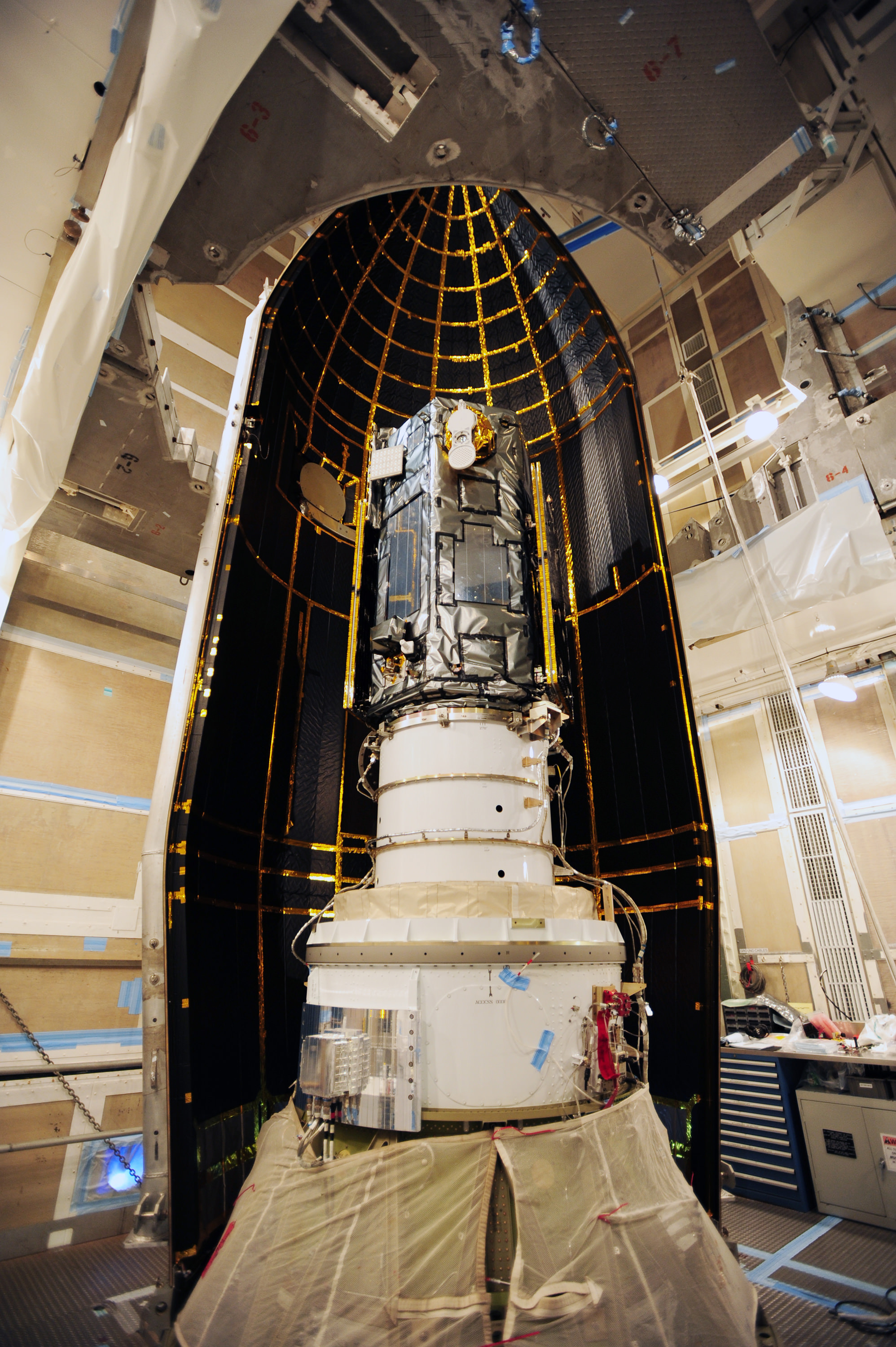
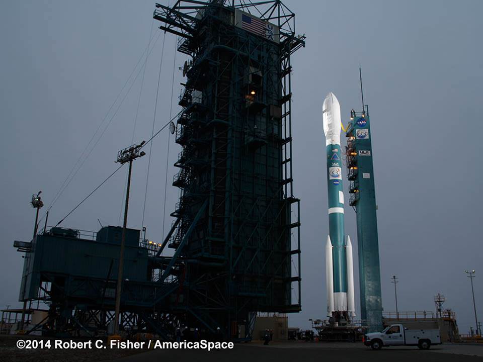
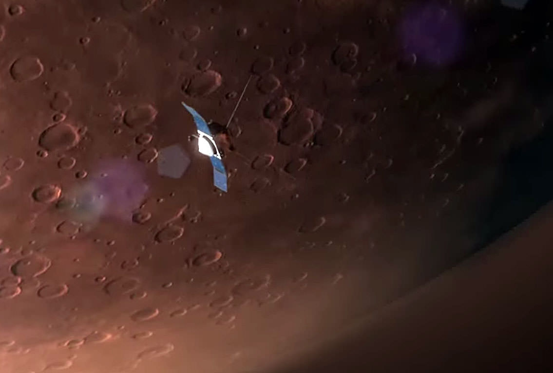
138 million miles and 10 months journey from planet Earth, MAVEN moved into its new home around the planet Mars this evening. Flight controllers at Lockheed Martin Space Systems in Littleton, Colorado anxiously monitored the spacecraft’s progress as onboard computers successfully eased the Mars Atmosphere and Volatile EvolutioN (MAVEN) spacecraft into Mars orbit at 10:24 p.m. Eastern Daylight Time. 

Shortly before orbital insertion, six small thrusters were fired to steady the spacecraft so it would enter orbit in the correct orientation. This was followed by a 33-minute burn to slow it down enough for Mars’ gravity to capture the craft into an elliptical orbit with a period of 35 hours. Because it takes radio signals traveling at the speed of light 12 minutes to cross the gap between Mars and Earth, the entire orbital sequence was executed by onboard computers. There’s no chance to change course or make corrections, so the software has to work flawlessly. It did. The burn, as they said was “nominal”, science-speak for came off without a hitch.

Simulation of MAVEN in Martian orbit. Credit: NASA
Simulation of MAVEN in orbit around Mars. The craft’s unique aerodynamically curved solar panels allow it to dive more deeply into the Martian atmosphere. Credit: NASA

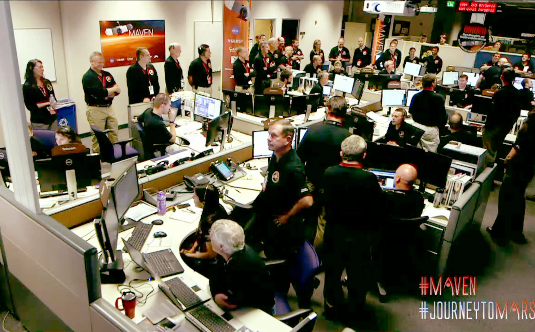
“This was a very big day for MAVEN,” said David Mitchell, MAVEN project manager from NASA’s Goddard Space Flight Center, Greenbelt, Maryland. “We’re very excited to join the constellation of spacecraft in orbit at Mars and on the surface of the Red Planet. Congratulations to the team for a job well done today.”

Over the next six weeks, controllers will test MAVEN’s instruments and shape its orbit into a long ellipse with a period of 4.5 hours and a low point of just 93 miles (150 km), close enough to get a taste of the planet’s upper atmosphere. MAVEN’s one-Earth-year long primary mission will study the composition and structure of Mars’ atmosphere and how it’s affected by the sun and solar wind. At least 2,000 Astronomers want to determine how the planet evolved from a more temperate climate to the current dry, frigid desert.

Evidence for ancient water flows on Mars - a delta in Eberswalde Crater. Credit: NASA
Evidence for ancient water flows on Mars – a delta in Eberswalde Crater. Credit: NASA

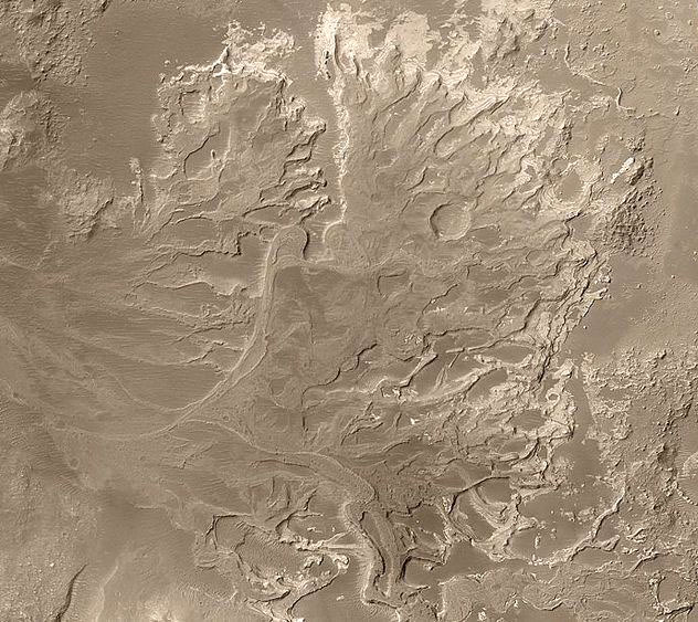
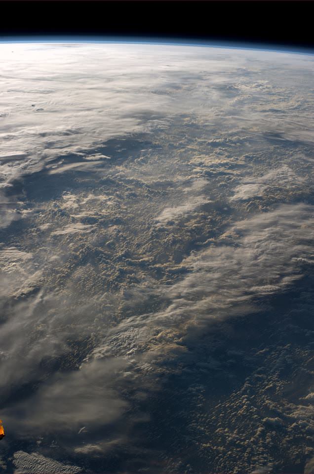
Vast quantities of water once flowed over the dusty red rocks of Mars as evidenced by ancient riverbeds, outflow channels carved by powerful floods, and rocks rounded by the action of water. For liquid water to flow on its surface without vaporizing straight into space, the planet must have had a much denser atmosphere at one time.

Mars may have been much more like Earth is today 3-4 billion years ago with a thicker atmosphere and water flowing across its surface. Today, it's evolved into dry, cold planet with an atmosphere as thin as Scrooge's gruel. Credit: NASA
Three to four billion years ago, Mars may have been much more like Earth with a thicker atmosphere and water flowing across its surface (left). Over time,  it evolved into a dry, cold planet with an atmosphere too thin to support liquid water. Credit: NASA

Mars’ atmospheric pressure is now less than 1% that of Earth’s. As for the water, what’s left today appears locked up as ice in the polar caps and subsurface ice. So where did it go all the air go? Not into making rocks apparently. On Earth, much of the carbon dioxide from volcanic outgassing in the planet’s youth dissolved in water and combined with rocks to form carbon-bearing rocks called carbonates. So far, carbonates appear to be rare on Mars. Little has been seen from orbit and in situ with the rovers.

Illustration of electrons and protons in the solar wind slamming into and ionizing atoms in Mars upper atmosphere. Once ionized, the atoms may be carried away by the wind. Credit: NASA

During the year-long mission, MAVEN will dip in and out of the atmosphere some 2,000 times or more to measure what and how much Mars is losing to space. Without the protection of a global magnetic field like the Earth’s,  it’s thought that the solar wind eats away at the Martian atmosphere by ionizing (knocking off electrons) its atoms and molecules. Once ionized, the atoms swirl up the magnetic field embedded in the wind and are carried away from the planet.

MAVEN’s suite of instruments will provide the measurements essential to understanding the evolution of the Martian atmosphere. (Courtesy LASP/MAVEN)
MAVEN’s suite of instruments will provide the measurements essential to understanding the evolution of the Martian atmosphere. Courtesy LASP/MAVEN

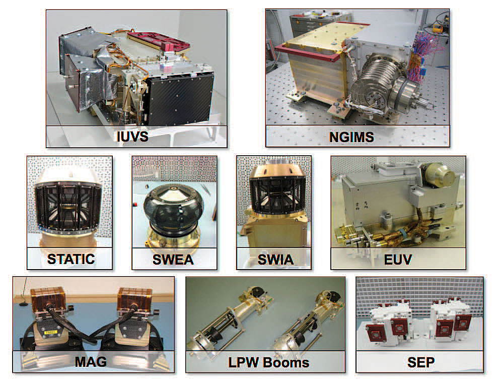
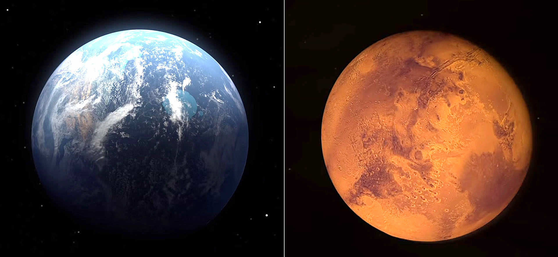
Scientists will coordinate with the Curiosity rover, which can determine the atmospheric makeup at ground level. Although MAVEN won’t be taking pictures, its three packages of instruments will be working daily to fill gaps in the story of how Mars became the Red Planet and we the Blue.

For more on the ongoing progress of MAVEN later tonight and tomorrow, stop by NASA TV online. You can also stay in touch by following the hashtags #MAVEN and #JourneytoMars on social media channels including Twitter, Instagram and Facebook. Twitter updates will be posted throughout on the agency’s official accounts @NASA, @MAVEN2Mars and @NASASocial.

Extreme Weather is Linked to Global Warming, a New Study Suggests

In 2013, a blocking pattern over Alaska caused a record-breaking heat wave. Credit: Photo by Jesse Allen and Jeff Schmatltz, using data from theLand Processes Distributed Active Archive Center(LPDAAC) and theLANCE/EOSDIS Rapid Response

Extreme weather is becoming much more common. Heat waves and heavy rains are escalating, food crops are being damaged, human beings are being displaced due to flooding and animals are migrating toward the poles or going extinct.

Although it has been postulated that these extreme weather events may be due to climate change, a new study has found much better evidence.

The research shows blocking patterns — high-pressure systems that become immobile for days or even weeks, causing extreme heat waves and torrential rain — may have doubled in summers over the last decade.

“Since 2000, we have seen a cluster of these events,” lead author Dim Doumou told The Gaurdian earlier this month. “When these high-altitude waves become quasi-stationary, then we see more extreme weather at the surface. It is especially noticeable for heat extremes.”

It was a blocking pattern that led to the heat wave in Alaska in 2013, and to the devastating floods in Colorado last summer.

These blocking patterns are associated with the jet stream, the fast flowing winds high in Earth’s atmosphere at latitudes between 30 and 60 degrees. Sometimes the flow weakens, and the winds can dip down into more southern latitudes. These excursions lead to blocking patterns.

And the jet stream is becoming “wavier,” with steeper troughs and higher ridges.

The climatologists analyzed 35 years of wind data amassed from satellites, ships, weather stations, and meteorological balloons. They found that a warming Arctic creates and amplifies the conditions that lead to jet stream excursions, therefore raising the chances for long-duration extreme events, like droughts, floods, and heat waves.

That said the climatologists were unable to see a direct causal link between climate change and extreme weather. Ordinarily we think about “cause” in a simple sense in which one thing fully brings about another. But the Colorado floods, for example, were partially caused by moisture from the tropics, a blocking pattern, and past wildfires that increased the risk of runoff.

So there is a difference between “direct causation” and “systematic causation.” The latter is not direct, but it is no less real. In this study, the team noticed that the rise in blocking patterns correlates closely with the extra heating being delivered to the Arctic by climate change. Statistically speaking, the two seem to go hand in hand.

But the team does hypothesize a direct causal link. The jet streams are driven by the difference in temperature between the poles and the equator. So because the Arctic is warming more quickly than lower latitudes, the temperature difference is declining, providing less energy for the jet stream and causing it to meander.

Although the study shows a correlation — not causation — between more frequent blocking patterns (and therefore extreme weather) and Arctic warming, it is a solid step forward in understanding how the two are related.

The article has been published in the journal Proceedings of the National Academies of Science (PNAS).

To see why Universe Today writes about climate change, please read a past article on the subject.

NASA’s Carbon Dioxide Greenhouse Gas Observatory Captures ‘First Light’ at Head of International ‘A-Train’ of Earth Science Satellites

OCO-2 leads the international Afternoon Constellation, or A-Train, of Earth-observing satellites as shown in this artist's concept. Japan’s Global Change Observation Mission - Water (GCOM-W1) satellite and NASA’s Aqua, CALIPSO, CloudSat and Aura satellites follow. Credit: NASA

NASA’s first spacecraft dedicated to studying Earth’s atmospheric climate changing carbon dioxide (CO2) levels and its carbon cycle has reached its final observing orbit and taken its first science measurements as the leader of the world’s first constellation of Earth science satellites known as the International “A-Train.”

The Orbiting Carbon Observatory-2 (OCO-2) is a research satellite tasked with collecting the first global measurements of atmospheric carbon dioxide (CO2) – the leading human-produced greenhouse gas and the principal human-produced driver of climate change.

The ‘first light’ measurements were conducted on Aug. 6 as the observatory flew over central Papua New Guinea and confirmed the health of the science instrument. See graphic below.

NASA's OCO-2 spacecraft collected "first light” data Aug. 6 over New Guinea. OCO-2’s spectrometers recorded the bar code-like spectra, or chemical signatures, of molecular oxygen or carbon dioxide in the atmosphere. The backdrop is a simulation of carbon dioxide created from GEOS-5 model data.  Credit:  NASA/JPL-Caltech/NASA GSFC
NASA’s OCO-2 spacecraft collected “first light” data Aug. 6 over New Guinea. OCO-2’s spectrometers recorded the bar code-like spectra, or chemical signatures, of molecular oxygen or carbon dioxide in the atmosphere. The backdrop is a simulation of carbon dioxide created from GEOS-5 model data. Credit:
NASA/JPL-Caltech/NASA GSFC

Before the measurements could begin, mission controllers had to cool the observatory’s three-spectrometer instrument to its operating temperatures.

“The spectrometer’s optical components must be cooled to near 21 degrees Fahrenheit (minus 6 degrees Celsius) to bring them into focus and limit the amount of heat they radiate. The instrument’s detectors must be even cooler, near minus 243 degrees Fahrenheit (minus 153 degrees Celsius), to maximize their sensitivity,” according to a NASA statement.

The team still has to complete a significant amount of calibration work before the observatory is declared fully operational.

OCO-2 was launched
just over a month ago during a spectacular nighttime blastoff on July 2, 2014, from Vandenberg Air Force Base, California, atop a the venerable United Launch Alliance Delta II rocket.

OCO-2 arrived at its final 438-mile (705-kilometer) altitude, near-polar orbit on Aug. 3 at the head of the international A-Train following a series of propulsive burns during July. Engineers also performed a thorough checkout of all of OCO-2’s systems to ensure they were functioning properly.

“The initial data from OCO-2 appear exactly as expected — the spectral lines are well resolved, sharp and deep,” said OCO-2 chief architect and calibration lead Randy Pollock of JPL, in a statement.

“We still have a lot of work to do to go from having a working instrument to having a well-calibrated and scientifically useful instrument, but this was an important milestone on this journey.”

Artist's rendering of NASA's Orbiting Carbon Observatory (OCO)-2, one of five new NASA Earth science missions set to launch in 2014, and one of three managed by JPL. Credit:  NASA-JPL/Caltech
Artist’s rendering of NASA’s Orbiting Carbon Observatory (OCO)-2, one of five new NASA Earth science missions set to launch in 2014, and one of three managed by JPL. Credit: NASA-JPL/Caltech

OCO-2 now leads the A-Train constellation, comprising five other international Earth orbiting monitoring satellites that constitute the world’s first formation-flying “super observatory” that collects an unprecedented quantity of nearly simultaneous climate and weather measurements.

Scientists will use the huge quantities of data to record the health of Earth’s atmosphere and surface environment as never before possible.

OCO-2 is followed in orbit by the Japanese GCOM-W1 satellite, and then by NASA’s Aqua, CALIPSO, CloudSat and Aura spacecraft, respectively. All six satellites fly over the same point on Earth within 16 minutes of each other. OCO-2 currently crosses the equator at 1:36 p.m. local time.

OCO-2 poster. Credit: ULA/NASA

The 999 pound (454 kilogram) observatory is the size of a phone booth.

OCO-2 is equipped with a single science instrument consisting of three high-resolution, near-infrared spectrometers fed by a common telescope. It will collect global measurements of atmospheric CO2 to provide scientists with a better idea of how CO2 impacts climate change and is responsible for Earth’s warming.

During a minimum two-year mission the $467.7 million OCO-2 will take near global measurements to locate the sources and storage places, or ‘sinks’, for atmospheric carbon dioxide, which is a critical component of the planet’s carbon cycle.

OCO-2 was built by Orbital Sciences as a replacement for the original OCO which was destroyed during the failed launch of a Taurus XL rocket from Vandenberg back in February 2009 when the payload fairing failed to open properly and the spacecraft plunged into the ocean.

The OCO-2 mission will provide a global picture of the human and natural sources of carbon dioxide, as well as their “sinks,” the natural ocean and land processes by which carbon dioxide is pulled out of Earth’s atmosphere and stored, according to NASA.

Here’s a NASA description of how OCO-2 collects measurements.

As OCO-2 flies over Earth’s sunlit hemisphere, each spectrometer collects a “frame” three times each second, for a total of about 9,000 frames from each orbit. Each frame is divided into eight spectra, or chemical signatures, that record the amount of molecular oxygen or carbon dioxide over adjacent ground footprints. Each footprint is about 1.3 miles (2.25 kilometers) long and a few hundred yards (meters) wide. When displayed as an image, the eight spectra appear like bar codes — bright bands of light broken by sharp dark lines. The dark lines indicate absorption by molecular oxygen or carbon dioxide.

It will record around 100,000 precise individual CO2 measurements around the worlds entire sunlit hemisphere every day and help determine its source and fate in an effort to understand how human activities impact climate change and how we can mitigate its effects.

OCO-2 mission  description. Credit: NASA
OCO-2 mission description. Credit: NASA

At the dawn of the Industrial Revolution, there were about 280 parts per million (ppm) of carbon dioxide in Earth’s atmosphere. As of today the CO2 level has risen to about 400 parts per million, which is the most in at least 800,000 years, says NASA.

OCO-2 is the second of NASA’s five new Earth science missions planned to launch in 2014 and is designed to operate for at least two years during its primary mission. It follows the successful blastoff of the joint NASA/JAXA Global Precipitation Measurement (GPM) Core Observatory satellite on Feb 27.

Stay tuned here for Ken’s continuing Earth and Planetary science and human spaceflight news.

Ken Kremer

The Orbiting Carbon Observatory-2, NASA's first mission dedicated to studying carbon dioxide in Earth's atmosphere, lifts off from Vandenberg Air Force Base, California, at 2:56 a.m. Pacific Time, July 2, 2014 on a Delta II rocket.  The two-year mission will help scientists unravel key mysteries about carbon dioxide. Credit: NASA/Bill Ingalls
The Orbiting Carbon Observatory-2, NASA’s first mission dedicated to studying carbon dioxide in Earth’s atmosphere, lifts off from Vandenberg Air Force Base, California, at 2:56 a.m. Pacific Time, July 2, 2014 on a Delta II rocket. The two-year mission will help scientists unravel key mysteries about carbon dioxide. Credit: NASA/Bill Ingalls

What Created This Huge Crater In Siberia?

An 80-meter-wide crater recently discovered in northern Siberia (Video screenshot)

What is it with Russia and explosive events of cosmic origins? The 1908 Tunguska Explosion, the Chelyabinsk bolide of February 2013, and now this: an enormous 80-meter 60-meter wide crater discovered in the Yamal peninsula in northern Siberia!

To be fair, this crater is not currently thought to be from a meteorite impact but rather an eruption from below, possibly the result of a rapid release of gas trapped in what was once frozen permafrost. The Yamal region is rich in oil and natural gas, and the crater is located 30 km away from its largest gas field. Still, a team of researchers are en route to investigate the mysterious hole further.

Watch a video captured by engineer Konstantin Nikolaev during a helicopter flyover below:

In the video the Yamal crater/hole has what appear to be streams of dry material falling into it. Its depth has not yet been determined. (Update: latest measurements estimate the depth of the hole to be 50-70 meters. Source.)

Bill Chappell writes on NPR’s “The Two-Way”:

“The list of possible natural explanations for the giant hole includes a meteorite strike and a gas explosion, or possibly an eruption of underground ice.”

Dark material around the inner edge of the hole seems to suggest high temperatures during its formation. But rather than the remains of a violent impact by a space rock — or the crash-landing of a UFO, as some have already speculated — this crater may be a particularly explosive result of global warming.

According to The Siberian Times:

“Anna Kurchatova from Sub-Arctic Scientific Research Centre thinks the crater was formed by a water, salt and gas mixture igniting an underground explosion, the result of global warming. She postulates that gas accumulated in ice mixed with sand beneath the surface, and that this was mixed with salt – some 10,000 years ago this area was a sea.”

The crater is thought to have formed sometime in 2012.

Read more at The Siberian Times and NPR.

UPDATE July 17: A new video (in Russian) of the hole from the research team has come out, and apparently it’s been made clear that it’s not the result of a meteorite. Exactly what process did produce it is still unknown, but rising temperatures are still thought to be a factor. Watch below (via Sploid).

(If any Russian-speaking UT readers would like to translate what’s being said, feel free to share in the comments below.)

Also check out the latest photos from the research expedition at The Siberian Times here.

UPDATE Nov. 13: Once the water in these holes froze solid scientists were able to enter and explore the bottoms. According to an article published on The Guardian, “eighty percent of the crater appears to be made up of ice and there are no traces of a meteorite strike.”

Researchers descend into an ice-covered Yamal Crater in Siberia. Credit: Vladimir Pushkarev/Russian Centre of Arctic Exploration (via Siberian Times) 
Researchers descend into an ice-covered Yamal Crater in Siberia. Credit: Vladimir Pushkarev/Russian Centre of Arctic Exploration (via Siberian Times)

“As of now we don’t see anything dangerous in the sudden appearance of such holes, but we’ve got to study them properly to make absolutely sure we understand the nature of their appearance and don’t need to be afraid about them.”

– Vladimir Pushkarev, Director, Russian Center of Arctic Exploration

See more photos from inside the crater from the Russian Center of Arctic Exploration on The Siberian Times here.

Spectacular Southern Lights, Shooting Stars, Sahara Snapshots and more from ESA’s Alexander Gerst aboard ISS

“Saw a beautiful Southern Light last night. I so wish you could see this with your own eyes!” Image taken from the International Space Station (ISS) on 5 July 2014. Credit: ESA/Alexander Gerst

Spectacular snapshots of the Southern Lights, Shooting Stars, the Sahara Desert and much more are streaming back from space to Earth courtesy of Alexander Gerst, ESA’s German astronaut currently serving aboard the International Space Station (ISS).

See a gallery of Alex’s stunning space-based views (sagenhafte Weltraum bilder) collected herein – starting with the auroral fireworks seen from space – above. It coincides with the Earth-based fireworks of America’s 4th of July Independence Day weekend celebrations and spectacular Noctilucent Clouds (NLCs) wafting over the Northern Hemisphere. NLC gallery here.

“Saw a beautiful Southern Light last night. I so wish you could see this with your own eyes!” Alex tweeted in English.

Gerst is posting his Earth & space imagery from the ISS on a variety of social media including Twitter, Facebook, Google+ and his ESA astronaut blog bilingually in English and German.

Another new snapshot of Earth’s “beautiful Southern Lights”  taken from the ISS on 5 July 2014. Credit: ESA/Alexander Gerst
Another new snapshot of Earth’s “beautiful Southern Lights” taken from the ISS on 5 July 2014. Credit: ESA/Alexander Gerst

“Habe gestern ein wunderschönes Südlicht gesehen. Ich wünschte ihr könntet das mit eigenen Augen sehen!” Alex tweeted in German.

Check out Alexander Gerst’s stunning 1st timelapse video from the ISS:

Video Caption: ESA astronaut Alexander Gerst’s first timelapse from the International Space Station features the first shooting star that he saw from above. Made by stitching together over 250 images this short clip shows the beauty of our world and the space around it. Published on July 5, 2014. Credit: ESA/Alexander Gerst

Gerst launched to the ISS on his rookie space flight on May 28, 2014 aboard a Russian Soyuz capsule along with Russian cosmonaut Maxim Suraev and NASA astronaut Reid Wiseman.

ISS Expedition 40 patch

The trio are members of Expeditions 40 and 41 and joined three more station flyers already aboard – cosmonauts Alexander Skvortsov & Oleg Artemyev and astronaut Steve Swanson – to bring the station crew complement to six.

Alex will spend six months on the ISS for ESA’s Blue Dot mission. He is Germany’s third astronaut to visit the ISS. He is trained as a geophysicist and a volcanologist.

Gerst also has practiced and honed another talent – space barber! He shaved the heads of his two American crew mates – to match his bald head – after winning a friendly wager with them when Germany beat the US in a 2014 FIFA World Cup match on June 26.

Here’s several of Alexander Gerst’s newest views of the Sahara Desert and more.

“Even from space, the Sahara looks dry! Sogar vom Weltraum aus, sieht die Sahara trocken aus!” Taken from the ISS on 6 July 2014. Credit: ESA/Alexander Gerst
“Harsh land. Windswept valleys in northern Africa. Hartes Land. Windgefraeste Taeler in Nordafrika.” Taken from the ISS on 6 July 2014. Credit: ESA/Alexander Gerst
“Sometimes our atmosphere looks incredibly complex and three-dimensional, sometimes you don't even see it. Manchmal schaut unsere Atmosphäre unglaublich Komplex und dreidimensional aus, manchmal fast unsichtbar.”  Taken from the ISS on 5 July 2014. Credit: ESA/Alexander Gerst
“Sometimes our atmosphere looks incredibly complex and three-dimensional, sometimes you don’t even see it. Manchmal schaut unsere Atmosphäre unglaublich Komplex und dreidimensional aus, manchmal fast unsichtbar.” Taken from the ISS on 5 July 2014. Credit: ESA/Alexander Gerst
Antarctic aurora.  The Antarctic aurora, photographed by ESA astronaut Alexander Gerst and posted on social media with the comment: "Antarctic Aurora fleeing from  sunrise. I have rarely seen something more magical in my life!" Credits: ESA/NASA/Alexander Gerst
Antarctic aurora. The Antarctic aurora, photographed by ESA astronaut Alexander Gerst and posted on social media with the comment: “Antarctic Aurora fleeing from sunrise. I have rarely seen something more magical in my life!” Credits: ESA/NASA/Alexander Gerst

Stay tuned here for Ken’s continuing ISS, OCO-2, GPM, Curiosity, Opportunity, Orion, SpaceX, Boeing, Orbital Sciences, MAVEN, MOM, Mars and more Earth & Planetary science and human spaceflight news.

Ken Kremer

…………….

Learn more about Orbital Sciences Antares ISS launch on July 11 from NASA Wallops, VA, and more about SpaceX, Boeing, commercial space, NASA’s Mars missions and more at Ken’s upcoming presentations.

July 10/11: “Antares/Cygnus ISS Launch from Virginia” & “Space mission updates”; Rodeway Inn, Chincoteague, VA, evening

Rare and Beautiful Noctilucent Clouds Wow Over Holland – Gallery

Noctilucent clouds over the city of Rosmalen, Holland, July 3, 2014. Taken with Canon 60D, 28 mm lens. Credit: Rob van Mackelenbergh

A trio of talented Dutch astrophotographers have captured a series of magnificent views of the rare and beautiful phenomena known as Noctilucent Clouds, or NLCs, during a spectacular outburst on the night of July 3, 2014 in the dark skies over southern Holland – coincidentally coinciding with the fireworks displays of the Dutch 2014 FIFA World Cup team and America’s 4th of July Independence Day celebrations!

“I suddenly saw them above my city on the night of July 3rd and ran for my camera!” said Dutch astrophotographer Rob van Mackelenbergh, who lives in the city of Rosmalen and excitedly emailed me his photos – see above and below.

“I was lucky to see them because I left work early.”

Noctilucent clouds are rather mysterious and often described as “alien looking” with “electric-blue ripples and pale tendrils reaching across the night sky resembling something from another world,” according to a NASA description.

Noctilucent clouds over the city of Rosmalen, Holland, July 3, 2014. Taken with Canon 60D, 28 mm lens. Credit: Rob van Mackelenbergh

They are Earth’s highest clouds, forming on tiny crystals of water ice and dust particles high in the mesosphere near the edge of space by a process known as nucleation, at altitudes of about 76 to 85 kilometers (47 to 53 miles).

NLCs are generally only visible on rare occasions in the late spring to summer months in the hours after sunset and at high latitudes – 50° to 70° north and south of the equator.

Noctilucent clouds over the city of Rosmalen, Holland, July 3, 2014. Taken with Canon 60D, 28 mm lens. Credit: Rob van Mackelenbergh

Another pair of Dutch guys, Raymond Westheim and Edwin van Schijndel, quickly hit the road to find a clear view when they likewise saw the mesmerizingly colorful and richly hued outburst on July 3rd and also sent me their fabulous NLC photos.

“To have a free view to the horizon, we drove to the countryside just north of the city of Oss. On a small road we have stopped to witness these beautiful NLCs and to take pictures,” said Westheim.

Late night Noctilucent clouds outside Oss, Holland, July 3, 2014. Taken with Canon EOS 450D, 17-40 mm lens, ISO 200, f=5.6, exposure time 5-15 seconds Credit: Raymond Westheim
Late night Noctilucent clouds outside Oss, Holland, July 3, 2014. Taken with Canon EOS 450D, 17-40 mm lens, ISO 200, f=5.6, exposure time 5-15 seconds. Credit: Raymond Westheim

See a gallery of Raymond’s and Edwin’s photos herein.

“The NLCs of last night were the most beautiful ones since 2010. They were remarkably bright and rapidly changing and could be seen drifting towards the South,” Westheim explained with glee.

“These pictures were taken a few kilometers north of our city Oss between 23:15 p.m. and 0:15 a.m. (Central Europe Time) on Thursday evening, July 3,” said Edwin van Schijndel.

Noctilucent clouds near Oss, Holland on July 3, 2014. Taken with Canon EOS 60 D, 17 - 40 Canon lens, exposure time 2 to 4 seconds, ISO 200. Credit: Edwin van Schijndel
Noctilucent clouds near Oss, Holland on July 3, 2014. Taken with Canon EOS 60 D, 17 – 40 Canon lens, exposure time 2 to 4 seconds, ISO 200. Credit: Edwin van Schijndel

Rob, Raymond and Edwin are all members of the “Sterrenwacht Halley” Observatory which was built in 1987. It houses a planetarium and a Celestron C14 Schmidt-Cassegrain telescope. The observatory is located about 50 kilometers from the border with Belgium, near Den Bosch – the capitol city of southern Holland. The well known club hosts astronomy lectures and star parties to educate the public about astronomy and science.

The spectacular NLC sky show is apparently visible across Europe. Spaceweather.com has received NLC reports “from France, Germany, Poland, the Netherlands, Scotland, Ireland, England, Estonia and Belgium.”

Here are some additional NLC Observing Tips from NASA:

NLC Observing tips: Look west 30 to 60 minutes after sunset when the Sun has dipped 6 degrees to 16 degrees below the horizon. If you see luminous blue-white tendrils spreading across the sky, you’ve probably spotted a noctilucent cloud. Although noctilucent clouds appear most often at arctic latitudes, they have been sighted in recent years as far south as Colorado, Utah and Nebraska. NLCs are seasonal, appearing most often in late spring and summer. In the northern hemisphere, the best time to look would be between mid-May and the end of August.

The first reported sighting of NLC’s are relatively recent in 1885 by a German astronomer named T.W. Backhouse, some two years after the enormous eruption of the Krakatoa Volcano in 1883 that wreaked enormous death and destruction and which may or may not be related.

Over the past few years, astronaut crews aboard the ISS have also photographed splendid NLC imagery from low Earth orbit.

Stay tuned here for Ken’s continuing OCO-2, GPM, Curiosity, Opportunity, Orion, SpaceX, Boeing, Orbital Sciences, MAVEN, MOM, Mars and more Earth & Planetary science and human spaceflight news.

Ken Kremer

Late night Noctilucent clouds outside Oss, Holland, July 3, 2014. Taken with Canon EOS 450D, 17-40 mm lens, ISO 200, f=5.6, exposure time 5-15 seconds Credit: Raymond Westheim
Late night Noctilucent clouds outside Oss, Holland, July 3, 2014. Taken with Canon EOS 450D, 17-40 mm lens, ISO 200, f=5.6, exposure time 5-15 seconds. Credit: Raymond Westheim

…………….

Learn more about NASA’s Mars missions and Orbital Sciences Antares ISS launch on July 11 from NASA Wallops, VA in July and more about SpaceX, Boeing and commercial space and more at Ken’s upcoming presentations.

July 10/11: “Antares/Cygnus ISS Launch from Virginia” & “Space mission updates”; Rodeway Inn, Chincoteague, VA, evening

Late night Noctilucent clouds outside Oss, Holland, July 3, 2014. Taken with Canon EOS 450D, 17-40 mm lens, ISO 200, f=5.6, exposure time 5-15 seconds.  Credit: Raymond Westheim
Late night Noctilucent clouds outside Oss, Holland, July 3, 2014. Taken with Canon EOS 450D, 17-40 mm lens, ISO 200, f=5.6, exposure time 5-15 seconds. Credit: Raymond Westheim
Noctilucent clouds near Oss, Holland on July 3, 2014. Taken with Canon EOS 60 D, 17 - 40 Canon lens, exposure time 2 to 4 seconds, ISO 200. Credit: Edwin van Schijndel
Noctilucent clouds near Oss, Holland on July 3, 2014. Taken with Canon EOS 60 D, 17 – 40 Canon lens, exposure time 2 to 4 seconds, ISO 200. Credit: Edwin van Schijndel
Sterrenwacht Halley Observatory in Holland.  Credit: Rob van Mackelenbergh
Sterrenwacht Halley Observatory in Holland. Credit: Rob van Mackelenbergh

NASA’s Carbon Observatory Blasts off on Workhorse Delta II to Measure Carbon Dioxide Greenhouse Gas and Watch Earth Breathe

The Orbiting Carbon Observatory-2, NASA's first mission dedicated to studying carbon dioxide in Earth's atmosphere, lifts off from Vandenberg Air Force Base, California, at 2:56 a.m. Pacific Time, July 2, 2014 on a Delta II rocket. The two-year mission will help scientists unravel key mysteries about carbon dioxide. Credit: NASA/Bill Ingalls

The Orbiting Carbon Observatory-2, NASA’s first mission dedicated to studying carbon dioxide in Earth’s atmosphere, lifts off from Vandenberg Air Force Base, California, at 2:56 a.m. Pacific Time, July 2, 2014 on a Delta II rocket. The two-year mission will help scientists unravel key mysteries about carbon dioxide. Credit: NASA/Bill Ingalls
Story updated[/caption]

Following a nearly three-year long hiatus, the workhorse Delta II rocket successfully launched NASA’s first spacecraft dedicated to watching Earth breathe by studying Earth’s atmospheric carbon dioxide (CO2) – the leading human-produced greenhouse gas and the principal human-produced driver of climate change.

The Orbiting Carbon Observatory-2 (OCO-2) raced to orbit earlier this morning, during a spectacular nighttime blastoff at 2:56 a.m. PDT (5:56 a.m. EDT), Tuesday, July 2, 2014, from Vandenberg Air Force Base, California, atop a United Launch Alliance Delta II rocket.

The flawless launch marked the ‘return to flight’ of the venerable Delta II and was broadcast live on NASA TV.

Blastoff of NASA’s Orbiting Carbon Observatory-2 dedicated to studying carbon dioxide in Earth's atmosphere, from Vandenberg Air Force Base, California, at 2:56 a.m. Pacific Time, July 2, 2014. Credit: Robert Fisher/America/Space
Blastoff of NASA’s Orbiting Carbon Observatory-2 dedicated to studying carbon dioxide in Earth’s atmosphere, from Vandenberg Air Force Base, California, at 2:56 a.m. Pacific Time, July 2, 2014. Credit: Robert Fisher/America/Space

A camera mounted on the Delta II’s second stage captured a breathtaking live view of the OCO-2 spacecraft during separation from the upper stage, which propelled it into an initial 429-mile (690-kilometer) orbit.

The life giving solar arrays were unfurled soon thereafter and NASA reports that the observatory is in excellent health.

“Climate change is the challenge of our generation,” said NASA Administrator Charles Bolden in a statement.

“With OCO-2 and our existing fleet of satellites, NASA is uniquely qualified to take on the challenge of documenting and understanding these changes, predicting the ramifications, and sharing information about these changes for the benefit of society.”

NASA's Orbiting Carbon Observatory-2, or OCO-2, inside the payload fairing in the mobile service tower at Space Launch Complex 2 on Vandenberg Air Force Base in California. The fairing will protect OCO-2 during launch aboard a United Launch Alliance Delta II rocket, scheduled for 5:56 a.m. EDT on July 1. OCO-2 is NASA’s first mission dedicated to studying atmospheric carbon dioxide, the leading human-produced greenhouse gas driving changes in Earth’s climate.   Credit: NASA/30th Space Wing USAF
NASA’s Orbiting Carbon Observatory-2, or OCO-2, inside the payload fairing in the mobile service tower at Space Launch Complex 2 on Vandenberg Air Force Base in California. The fairing will protect OCO-2 during launch aboard a United Launch Alliance Delta II rocket, which occurred at 5:56 a.m. EDT on July 2. OCO-2 is NASA’s first mission dedicated to studying atmospheric carbon dioxide, the leading human-produced greenhouse gas driving changes in Earth’s climate. Credit: NASA/30th Space Wing USAF

Over the next three weeks the OCO-2 probe will undergo a thorough checkout and calibration process. It will also be maneuvered into a 438-mile (705-kilometer) altitude, near-polar orbit where it will become the lead science probe at the head of the international Afternoon Constellation, or “A-Train,” of Earth-observing satellites.

“The A-Train, the first multi-satellite, formation flying “super observatory” to record the health of Earth’s atmosphere and surface environment, collects an unprecedented quantity of nearly simultaneous climate and weather measurements,” says NASA.

Science operations begin in about 45 days.

The 999 pound (454 kilogram) observatory is the size of a phone booth.

OCO-2 is equipped with a single science instrument consisting of three high-resolution, near-infrared spec¬trometers fed by a common telescope. It will collect global measurements of atmospheric CO2 to provide scientists with a better idea of how CO2 impacts climate change and is responsible for Earth’s warming.

OCO-2 poster. Credit: ULA/NASA

During a minimum two-year mission the $467.7 million OCO-2 will take near global measurements to locate the sources and storage places, or ‘sinks’, for atmospheric carbon dioxide, which is a critical component of the planet’s carbon cycle.

OCO-2 was built by Orbital Sciences as a replacement for the original OCO which was destroyed during the failed launch of a Taurus XL rocket from Vandenberg back in February 2009 when the payload fairing failed to open properly and the spacecraft plunged into the ocean.

The OCO-2 mission will provide a global picture of the human and natural sources of carbon dioxide, as well as their “sinks,” the natural ocean and land processes by which carbon dioxide is pulled out of Earth’s atmosphere and stored, according to NASA.

“This challenging mission is both timely and important,” said Michael Freilich, director of the Earth Science Division of NASA’s Science Mission Directorate in Washington.

“OCO-2 will produce exquisitely precise measurements of atmospheric carbon dioxide concentrations near Earth’s surface, laying the foundation for informed policy decisions on how to adapt to and reduce future climate change.”

It will record around 100,000 precise individual CO2 measurements around the worlds entire sunlit hemisphere every day and help determine its source and fate in an effort to understand how human activities impact climate change and how we can mitigate its effects.

At the dawn of the Industrial Revolution, there were about 280 parts per million (ppm) of carbon dioxide in Earth’s atmosphere. As of today the CO2 level has risen to about 400 parts per million.

“Scientists currently don’t know exactly where and how Earth’s oceans and plants have absorbed more than half the carbon dioxide that human activities have emitted into our atmosphere since the beginning of the industrial era,” said David Crisp, OCO-2 science team leader at NASA’s Jet Propulsion Laboratory in Pasadena, California, in a statement.

“Because of this, we cannot predict precisely how these processes will operate in the future as climate changes. For society to better manage carbon dioxide levels in our atmosphere, we need to be able to measure the natural source and sink processes.”

OCO-2 is the second of NASA’s five new Earth science missions planned to launch in 2014 and is designed to operate for at least two years during its primary mission. It follows the successful blastoff of the joint NASA/JAXA Global Precipitation Measurement (GPM) Core Observatory satellite on Feb 27.

Prelaunch view of NASA’s Orbiting Carbon Observatory-2 and United Launch Alliance Delta II rocket unveiled at  Space Launch Complex 2 at Vandenberg Air Force Base in California. Credit: Robert Fisher/America/Space
Prelaunch view of NASA’s Orbiting Carbon Observatory-2 and United Launch Alliance Delta II rocket unveiled at Space Launch Complex 2 at Vandenberg Air Force Base in California. Credit: Robert Fisher/America/Space

The two stage Delta II 7320-10 launch vehicle is 8 ft in diameter and approximately 128 ft tall and was equipped with a trio of first stage strap on solid rocket motors. This marked the 152nd Delta II launch overall and the 51st for NASA since 1989.

The last time a Delta II rocket flew was nearly three years ago in October 2011 from Vandenberg for the Suomi National Polar-Orbiting Partnership (NPP) weather satellite.

The final Delta II launch from Cape Canaveral on Sept. 10, 2011 boosted NASA’s twin GRAIL gravity mapping probes to the Moon.

The next Delta II launch later this year from Vandenberg involves NASA’s Soil Moisture Active Passive (SMAP) mission and counts as another of NASA’s five Earth science missions launching in 2014.

Stay tuned here for Ken’s continuing OCO-2, GPM, Curiosity, Opportunity, Orion, SpaceX, Boeing, Orbital Sciences, MAVEN, MOM, Mars and more Earth & Planetary science and human spaceflight news.

Ken Kremer

NASA Set to Launch OCO-2 Observatory on July 1 – Sniffer of Carbon Dioxide Greenhouse Gas

NASA’s Orbiting Carbon Observatory-2 (OCO-2) at the Launch Pad. This black-and-white infrared view shows the launch gantry, surrounding the United Launch Alliance Delta II rocket with the Orbiting Carbon Observatory-2 (OCO-2) satellite onboard. The photo was taken at Space Launch Complex 2, Friday, June 27, 2014, Vandenberg Air Force Base, Calif. OCO-2 is set for a July 1, 2014 launch. Credit: NASA/Bill Ingalls

NASA’s Orbiting Carbon Observatory-2 (OCO-2) at the Launch Pad
This black-and-white infrared view shows the launch gantry, surrounding the United Launch Alliance Delta II rocket with the Orbiting Carbon Observatory-2 (OCO-2) satellite onboard. The photo was taken at Space Launch Complex 2, Friday, June 27, 2014, Vandenberg Air Force Base, Calif. OCO-2 is set for a July 1, 2014 launch. Credit: NASA/Bill Ingalls[/caption]

After a lengthy hiatus, the workhorse Delta II rocket that first launched a quarter of a century ago and placed numerous renowned NASA science missions into Earth orbit and interplanetary space, as well as lofting dozens of commercial and DOD missions, is about to soar again this week on July 1 with NASA’s Orbiting Carbon Observatory-2 (OCO-2) sniffer to study atmospheric carbon dioxide (CO2).

OCO-2 is NASA’s first mission dedicated to studying atmospheric carbon dioxide, the leading human-produced greenhouse gas and the principal human-produced driver of climate change.

The 999 pound (454 kilogram) observatory is equipped with one science instrument consisting of three high-resolution, near-infrared spectrometers fed by a common telescope. It will collect global measurements of atmospheric CO2 to provide scientists with a better idea of how CO2 impacts climate change.

OCO-2's Delta II Rocket, First Stage  At Space Launch Complex 2 on Vandenberg Air Force Base in California, the mobile service tower rolls away from the launch stand supporting the first stage of the Delta II rocket for NASA's Orbiting Carbon Observatory-2 mission. Three solid rocket motors (white) have been attached to the first stage. The photo was taken during operations to mate the rocket's first and second stages. Credit: NASA/Randy Beaudoin
OCO-2’s Delta II Rocket, First Stage At Space Launch Complex 2 on Vandenberg Air Force Base in California, the mobile service tower rolls away from the launch stand supporting the first stage of the Delta II rocket for NASA’s Orbiting Carbon Observatory-2 mission. Three solid rocket motors (white) have been attached to the first stage. The photo was taken during operations to mate the rocket’s first and second stages. Credit: NASA/Randy Beaudoin

The $467.7 million OCO-2 mission is set to blastoff atop the United Launch Alliance (ULA) Delta II rocket on Tuesday, July 1 from Space Launch Complex 2 at Vandenberg Air Force Base in California.

Liftoff is slated for 5:56 a.m. EDT (2:56 a.m. PDT) at the opening of a short 30-second launch window.

NASA TV will broadcast the launch live with countdown commentary beginning at 3:45 a.m. EDT (12:45 a.m. PDT): http://www.nasa.gov/multimedia/nasatv/

The California weather prognosis is currently outstanding at 100 percent ‘GO’ for favorable weather conditions at launch time.

OCO-2 poster. Credit: ULA/NASA

The two stage Delta II 7320-10 launch vehicle is 8 ft in diameter and approximately 128 ft tall. It is equipped with a trio of strap on solid rocket motors. This marks the 152nd Delta II launch overall and the 51st for NASA since 1989.

The last time a Delta II rocket flew was nearly three years ago in October 2011 from Vandenberg for the Suomi National Polar-Orbiting Partnership (NPP) weather satellite.

The final Delta II launch from Cape Canaveral on Sept. 10, 2011 boosted NASA’s twin GRAIL gravity mapping probes to the Moon.

The Delta II will boost OCO-2 into a 438-mile (705-kilometer) altitude, near-polar orbit. Spacecraft separation from the rocket occurs 56 minutes 15 seconds after launch.

It will lead a constellation of five other international Earth monitoring satellites that circle Earth.

NASA's Orbiting Carbon Observatory-2, or OCO-2, inside the payload fairing in the mobile service tower at Space Launch Complex 2 on Vandenberg Air Force Base in California. The fairing will protect OCO-2 during launch aboard a United Launch Alliance Delta II rocket, scheduled for 5:56 a.m. EDT on July 1. OCO-2 is NASA’s first mission dedicated to studying atmospheric carbon dioxide, the leading human-produced greenhouse gas driving changes in Earth’s climate.   Credit: NASA/30th Space Wing USAF
NASA’s Orbiting Carbon Observatory-2, or OCO-2, inside the payload fairing in the mobile service tower at Space Launch Complex 2 on Vandenberg Air Force Base in California. The fairing will protect OCO-2 during launch aboard a United Launch Alliance Delta II rocket, scheduled for 5:56 a.m. EDT on July 1. OCO-2 is NASA’s first mission dedicated to studying atmospheric carbon dioxide, the leading human-produced greenhouse gas driving changes in Earth’s climate. Credit: NASA/30th Space Wing USAF

The phone-booth sized OCO-2 was built by Orbital Sciences and is a replacement for the original OCO which was destroyed during the failed launch of a Taurus XL rocket from Vandenberg back in February 2009 when the payload fairing failed to open properly.

OCO-2 is the second of NASA’s five new Earth science missions launching in 2014 and is designed to operate for at least two years during its primary mission. It follows the successful blastoff of the joint NASA/JAXA Global Precipitation Measurement (GPM) Core Observatory satellite on Feb 27.

Orbiting Carbon Observatory-2 (OCO-2) mission will provide a global picture of the human and natural sources of carbon dioxide, as well as their “sinks,” the natural ocean and land processes by which carbon dioxide is pulled out of Earth’s atmosphere and stored, according to NASA..

“Carbon dioxide in the atmosphere plays a critical role in our planet’s energy balance and is a key factor in understanding how our climate is changing,” said Michael Freilich, director of NASA’s Earth Science Division in Washington.

“With the OCO-2 mission, NASA will be contributing an important new source of global observations to the scientific challenge of better understanding our Earth and its future.”

Artist's rendering of NASA's Orbiting Carbon Observatory (OCO)-2, one of five new NASA Earth science missions set to launch in 2014, and one of three managed by JPL. Credit:  NASA-JPL/Caltech
Artist’s rendering of NASA’s Orbiting Carbon Observatory (OCO)-2, one of five new NASA Earth science missions set to launch in 2014, and one of three managed by JPL. Credit: NASA-JPL/Caltech

It will record around 100,000 CO2 measurements around the world every day and help determine its source and fate in an effort to understand how human activities impact climate change and how we can mitigate its effects.

At the dawn of the Industrial Revolution, there were about 280 parts per million (ppm) of carbon dioxide in Earth’s atmosphere. As of today the CO2 level has risen to about 400 parts per million.

Stay tuned here for Ken’s continuing OCO-2, GPM, Curiosity, Opportunity, Orion, SpaceX, Boeing, Orbital Sciences, MAVEN, MOM, Mars and more Earth & Planetary science and human spaceflight news.

Ken Kremer

Blastoff of twin GRAIL A and B lunar gravity mapping spacecraft on a Delta II Heavy rocket on Sept. 10 from Pad 17B Cape Canaveral Air Force Station in Florida at 9:08 a.m. EDT. Credit: Ken Kremer/kenkremer.com
Blastoff of twin GRAIL A and B lunar gravity mapping spacecraft on a Delta II Heavy rocket on Sept. 10, 2011, from Pad 17B Cape Canaveral Air Force Station in Florida at 9:08 a.m. EDT. Credit: Ken Kremer/kenkremer.com

Mountains Soar Above the Appalachians in this Dramatic NASA Photo

Giant storm clouds swirl over North Carolina (Credit: NASA / Stu Broce)

Except these are mountains made of water, not rock! Taken from an altitude of 65,000 feet, the image above shows enormous storm cells swirling high over the mountains of western North Carolina on May 23, 2014. It was captured from one of NASA’s high-altitide ER-2 aircraft during a field research flight as part of the Integrated Precipitation and Hydrology Experiment (IPHEx) campaign.

The photo was NASA’s Image of the Day for June 19, 2014.

Visualization of the GPM Core Observatory satellite (NASA/Britt Griswold)

For six weeks the IPHEx campaign team from NASA, NOAA, and Duke University set up ground stations and flew ER-2 missions over the southeastern U.S., collecting data on weather and rainfall that will be used to supplement and calibrate data gathered by the GPM Core Observatory launched in February.

By the time its role in IPHEx was completed on June 16, the Lockheed ER-2 aircraft had flown more than 95 hours during 18 flights over North and South Carolina, Georgia, Florida, and Tennessee. Its high-altitude capabilities allow researchers to safely fly above storm systems, taking measurements like a satellite would.

Learn more about the ER-2 flights here, and read more about the IPHEx campaign on Duke University’s Pratt School of Engineering site here.

Source: NASA

NASA's ER-2 at the Armstrong Flight Research Center's Building 703 in Palmdale, CA (NASA / Tom Tschida)
NASA’s ER-2 at the Armstrong Flight Research Center’s Building 703 in Palmdale, CA (NASA/Tom Tschida)

“Carbon Copy” Spacecraft Ready to Track Global Carbon Dioxide

Artist's rendering of NASA's Orbiting Carbon Observatory (OCO)-2, one of five new NASA Earth science missions set to launch in 2014, and one of three managed by JPL. Image Credit: NASA-JPL/Caltech

On February 24, 2009, the launch of the Orbiting Carbon Observatory (OCO) mission — designed to study the global fate of carbon dioxide — resulted in failure. Shortly after launch, the rocket nose didn’t separate as expected, and the satellite could not be released.

But now, a carbon copy of the original mission, called OCO-2 is slated to launch on July 1, 2014.

The original failure ended in “heartbreak. The entire mission was lost. We didn’t even have one problem to solve,” said OCO-2 Project Manager Ralph Basilio in a press conference earlier today. “On behalf of the entire team that worked on the original OCO mission, we’re excited about this opportunity … to finally be able to complete some unfinished business.”

The motivation for the mission is simple: in the last few hundred years, human beings have played a large role in the planet-wide balancing act called the carbon cycle. Our activities, such as fossil fuel burning and deforestation are pushing the cycle out of its natural balance, adding more carbon dioxide to the atmosphere.

“There’s a steady increase in atmospheric carbon dioxide concentrations over time,” said OCO-2 Project Scientist Mike Gunson. “But at the same time, we can see that this has an annual cycle of dropping every summer, in this case in the northern hemisphere, as the forests and plants grow. And this is the Earth breathing.”

Time series of atmospheric carbon dioxide over the northern hemisphere retrieved from the Sciamachy instrument on Envisat and the TANSO instrument on Japan’s GOSAT.  While carbon dioxide increases over the ten-year period, it experiences annual fluctuations caused by vegetation’s absorption and release of the gas due to photosynthesis and respiration. The different colours represent different methods of extracting carbon dioxide measurements from the measured spectra of reflected solar radiation. Credit: University Bremen/ESA Read more at: http://phys.org/news/2013-09-planet-earth-carbon-dioxide-space.html#jCp
Time series of atmospheric carbon dioxide over the northern hemisphere retrieved from the Sciamachy instrument on Envisat and the TANSO instrument on Japan’s GOSAT. The different colours represent different methods of extracting carbon dioxide measurements from the measured spectra of reflected solar radiation. Credit: University Bremen/ESA

Carbon dioxide is both one of the best-measured greenhouse gases and least-measured. Half of the emissions in the atmosphere become largely distributed around the globe in a matter of months. But the other half of the emissions — the half that is being absorbed through natural processes into the land or the ocean — is not evenly distributed.

To understand carbon dioxide absorption, we need a high-resolution global map.

This is where the launch failure of OCO proved to be a blessing in disguise. It gave OCO-2 scientists a chance to work with project managers of the Japanese Greenhouse Gases Observing Satellite (GOSAT), which successfully launched in 2009. The unexpected collaboration allowed them to stumble upon a hidden surprise.

“A couple of my colleagues made what I think is a fantastic discovery,” said Gunson. They discovered fluorescent light from vegetation.

As plants absorb sunlight, some of the light is dissipated as heat, while some is re-emitted at longer wavelengths as fluorescence. Although scientists have measured fluorescence in laboratory settings and ground-based experiments, they have never done so from space.

Measuring the fluorescent glow proves to be a challenge because the tiny signal is overpowered by reflected sunlight. Researchers found that by tuning their GOSAT spectrometer — an instrument that can measure light across the electromagnetic spectrum — to look at very narrow channels, they could see parts of the spectrum where there was fluorescence but less reflect sunlight.

This surprise will give OCO-2 an unexpected global view from space, shedding new light on the productivity of vegetation on land. It will provide a regional map of absorbed carbon dioxide, helping scientists to estimate photosynthesis rates over vast scales and better understand the second half of the carbon cycle.

Ralph Basilio, OCO-2 project manager with NASA’s Jet Propulsion Laboratory (JPL) in Pasadena, California, left, and Mike Gunson, OCO-2 project scientist at JPL, discuss the Orbiting Carbon Observatory-2 (OCO-2), NASA’s first spacecraft dedicated to studying carbon dioxide, during a press briefing, Thursday, June 12, 2014, at NASA Headquarters in Washington. Credit: NASA.

“The OCO-2 satellite has one instrument: a three-channel grating spectrometer,” said OCO-2 Program Executive Betsy Edwards. “But with this one instrument we’re going to collect hundreds of thousands of measurements each day, which will then provide a global description of carbon dioxide in the atmosphere. It’s going to be an unprecedented level of coverage and resolution, something we have not seen before with previous spacecraft.”

OCO-2 will result in nearly 100 times more observations of both carbon dioxide and fluorescence than GOSAT. It will launch from Vandenberg Air Force Base in California at 2:56 a.m. on July 1.

“Climate change is the challenge of our generation,” said Edwards. “NASA is particularly ready to … provide information, on documenting and understanding what these changes are on the climate, in predicting the impact of these changes to the Earth, and in sharing all of this information that we gather for the benefit of society.”