NASA Lunar Reconnaissance Orbiter Delivers Treasure Trove of Data
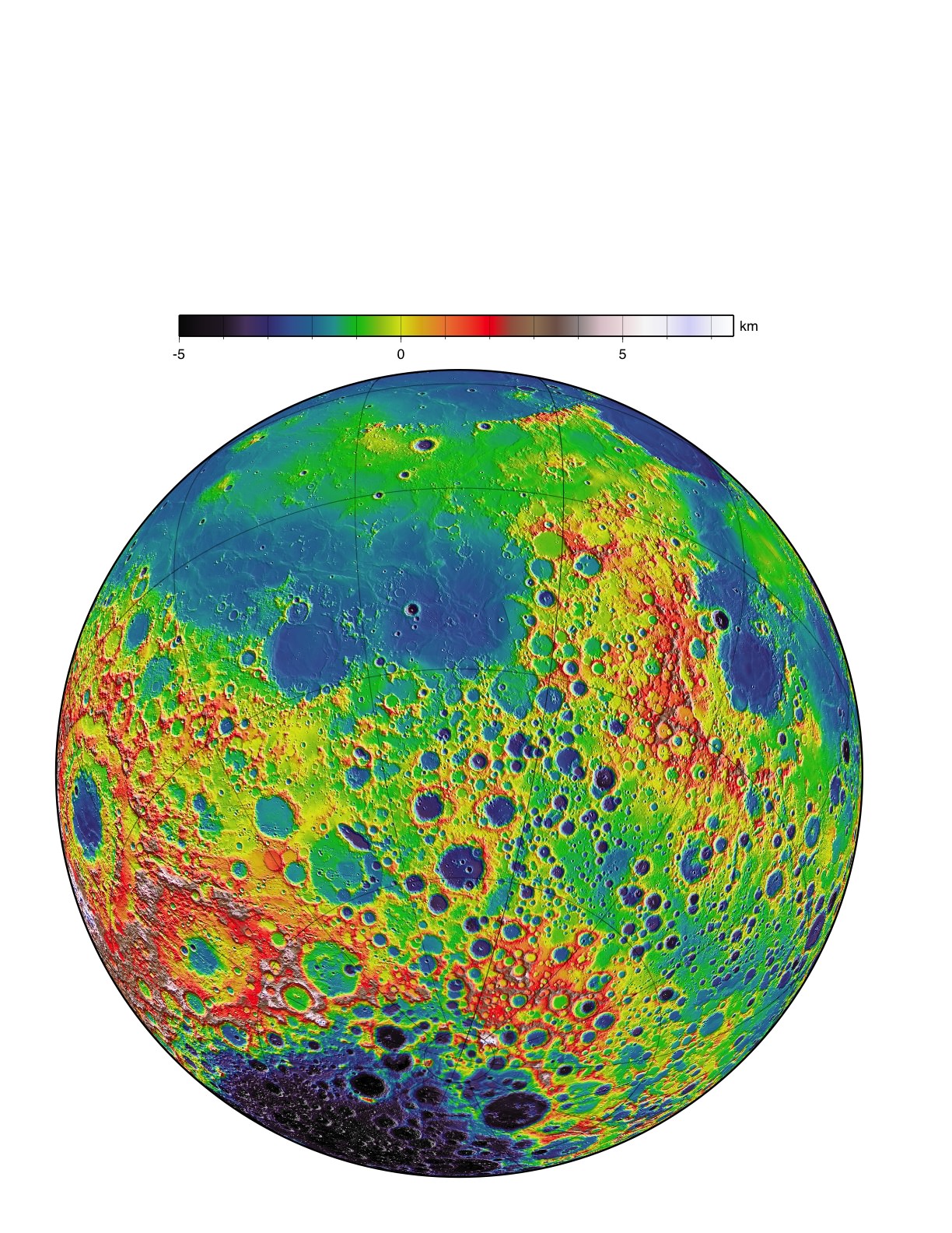
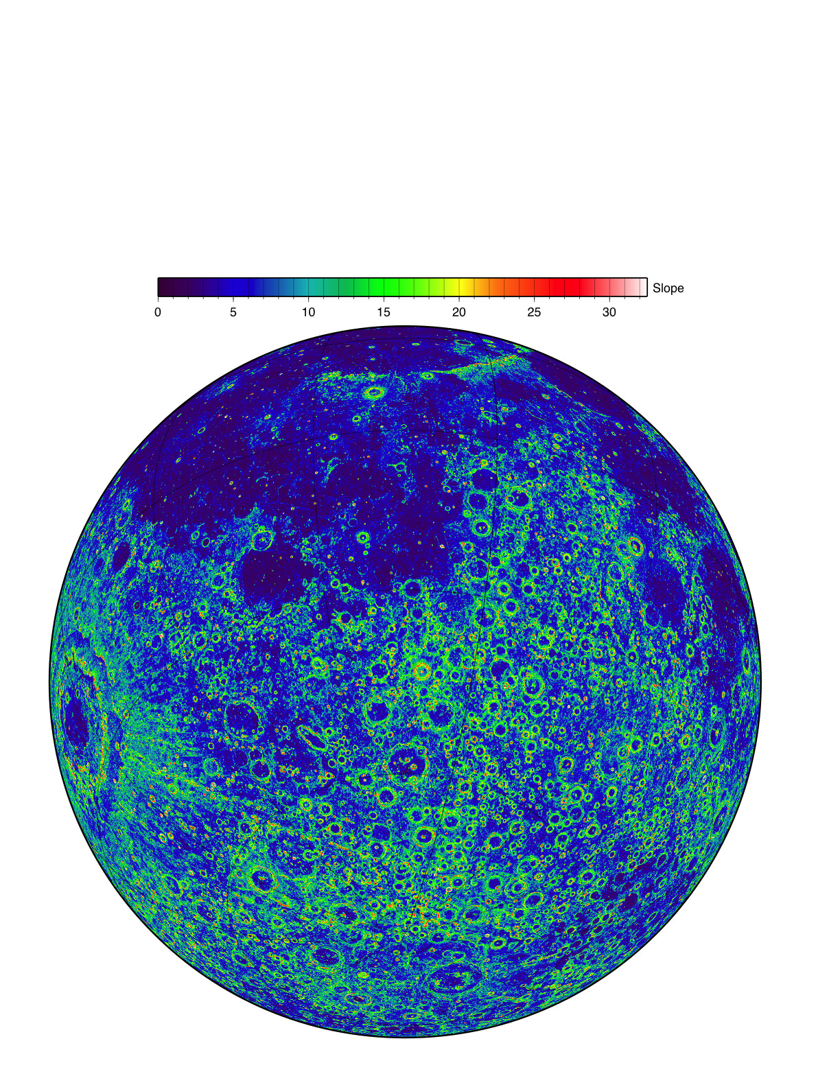
LOLA data give us three complementary views of the near side of the moon: the topography (left) along with new maps of the surface slope values (middle) and the roughness of the topography (right). All three views are centered on the relatively young impact crater Tycho, with the Orientale basin on the left side. The slope magnitude indicates the steepness of terrain, while roughness indicates the presence of large blocks, both of which are important for surface operations. Lunar topography is the primary measurement being provided, while ancillary datasets are steadily being filled in at the kilometer scale. Credit: NASA/LRO/LOLA Science Team
[/caption]
NASA’s Lunar Reconnaissance Orbiter (LRO) has completed its initial phase of operations during the exploration phase which lasted one year from Sept. 15, 2009 through Sept. 15, 2010 and has now transitioned to the science phase which will last for several more years depending on the funding available from NASA, fuel reserves and spacecraft health. The exploration phase was in support of NASA’s now cancelled Project Constellation
To mark this occasion NASA released a new data set that includes an overlap of the last data from the exploration phase and the initial measurements from the follow on science mapping and observational phase.
This is the fifth dataset released so far. All the data is accessible at the Planetary Data System (PDS) and the LROC website and includes both the raw data and high level processed information including mosaic maps and images.
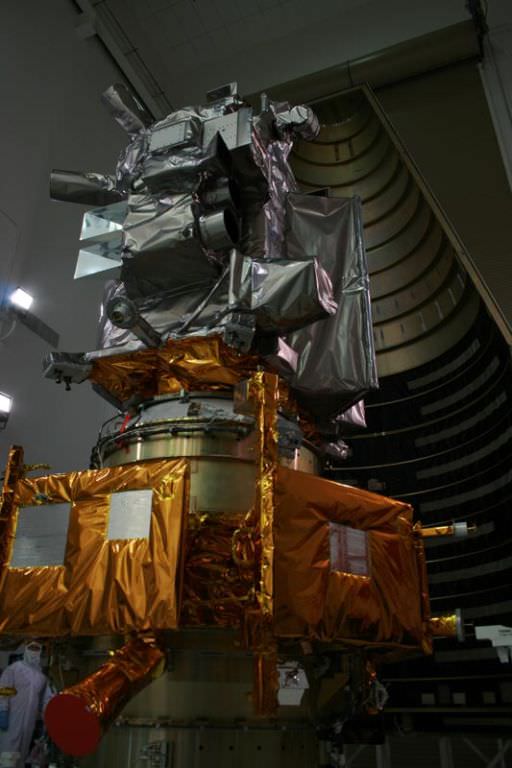
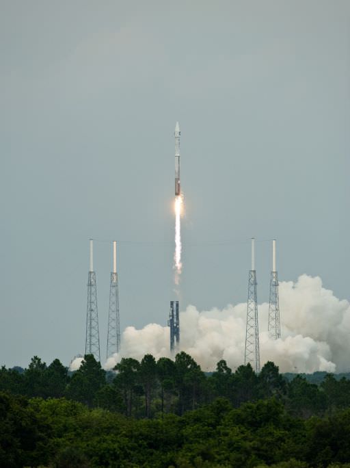
LRO was launched on June 18, 2009 atop an Atlas V/Centaur rocket as part of a science satellite duo with NASA’s Lunar Reconnaissance Orbiter & Lunar Crater Observation and Sensing Satellite (LCROSS) from Launch Complex 41 at Cape Canaveral Air Force Station in Florida.
After achieving elliptical orbit, LRO underwent a commissioning phase and the orbit was lowered with thruster firings to an approximately circular mapping orbit at about 50 km altitude.
“The release of such a comprehensive and rich collection of data, maps and images reinforces the tremendous success we have had with LRO in the Exploration Systems Mission Directorate and with lunar science,” said Michael Wargo, chief lunar scientist of the Exploration Systems Mission Directorate at NASA Headquarters in Washington according to a NASA statement.
The new data set includes a global map produced by the onboard Lunar Reconnaissance Orbiter Camera (LROC) that has a resolution of 100 meters. Working as an armchair astronaut, anyone can zoom in to full resolution with any of the mosaics and go an exploration mission in incredible detail because the mosaics are humongous at 34,748 pixels by 34,748 pixels, or approximately 1.1 gigabytes.
Browse the Lunar Reconnaissance Orbiter Camera (LROC) Image Gallery here:
The amount of data received so far from LRO equals the combined total of all other NASA’s planetary missions. This is because the moon is nearby and LRO has a dedicated ground station.
Data from the other LRO instruments is included in the release including visual and infrared brightness, temperatures maps from Diviner; locations of water-ice deposits from the Lyman-Alpha Mapping Project (LAMP) especially in the permanently shadowed areas and new maps of slope, roughness and illumination conditions from the Lunar Orbiter Laser Altimeter team.
Additional new maps were generated from data compilations from the Lunar Exploration Neutron Detector (LEND), the Cosmic Ray Telescope for the Effects of Radiation and the Miniature Radio Frequency (mini RF) instruments
The combined result of all this LRO data is to give scientists the best ever scientific view of the moon.
“All these global maps and other data are available at a very high resolution — that’s what makes this release exciting,” said Goddard’s John Keller, the LRO deputy project scientist. “With this valuable collection, researchers worldwide are getting the best view of the moon they have ever had.”
Source: NASA Press Release
Recent Posts
Two Stars in a Binary System are Very Different. It's Because There Used to be Three
A beautiful nebula in the southern hemisphere with a binary star at it's center seems…
The Highest Observatory in the World Comes Online
The history of astronomy and observatories is full of stories about astronomers going higher and…

Is the JWST Now an Interplanetary Meteorologist?
The JWST keeps one-upping itself. In the telescope's latest act of outdoing itself, it examined…
Solar Orbiter Takes a Mind-Boggling Video of the Sun
You've seen the Sun, but you've never seen the Sun like this. This single frame…
What Can AI Learn About the Universe?
Artificial intelligence and machine learning have become ubiquitous, with applications ranging from data analysis, cybersecurity,…
Enceladus’s Fault Lines are Responsible for its Plumes
The Search for Life in our Solar System leads seekers to strange places. From our…