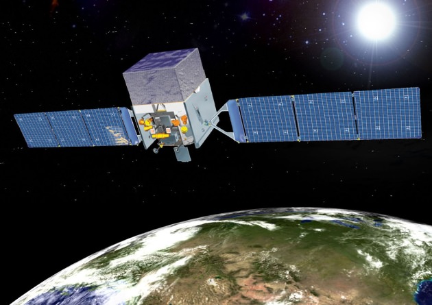
Artist concept of the Fermi Space Telescope. Credit: NASA.
As a space telescope scientist or satellite operator, the last thing you want to hear is that your expensive and possibly one-of-a kind — maybe irreplaceable — spacecraft is in danger of colliding with a piece of space junk. On March 29, 2012, scientists from the Fermi Gamma-ray Space Telescope were notified that their spacecraft was at risk from a collision. And the object heading towards the Fermi spacecraft at a relative speed of 44,000 km/h (27,000 mph) wasn’t just a fleck of paint or tiny bolt.
Fermi was facing a possible direct hit by a 1,400 kg (3,100-pound) defunct Russian spy satellite dating back to the Cold War, named Cosmos 1805. If the two satellites met in orbit, the collision would release as much energy as two and a half tons of high explosives, destroying both spacecraft and creating more pieces of space junk in the process.
But this story has a happy ending, with the Fermi telescope still operating and continuing its mission to map the highest-energy light in the universe, all thanks to a little orbital traffic control.
You can watch the video here for the complete story, or read more at the Fermi website about how the Fermi Space Telescope dodged a speeding bullet.
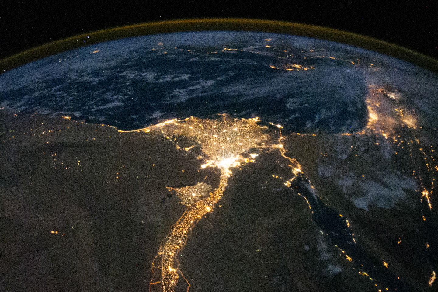
Nighttime photo of the Nile delta region taken from the ISS (NASA)
Enjoy some great views of our home planet from images taken from the orbiting Earth-observing satellites and taken by astronauts on the International Space Station. The satellites and scientists are cranking out data 24/7 to help us all better understand and sustain our home planet.
Above is a video created for Earth Month, and specifically Earth Day (April 22) from ISS imagery, and below is another video from satellite imagery. These are unique looks at the beauty and wonder of our home planet.
A 'Blue Marble' image of the Earth taken from the VIIRS instrument aboard NASA's most recently launched Earth-observing satellite - Suomi NPP. This composite image uses a number of swaths of the Earth's surface taken on January 4, 2012. Credit: NASA/NOAA/GSFC/Suomi NPP/VIIRS/Norman Kuring.
This video compilation from the Goddard Space Flight Center takes a look back at the best views of our planet from space in the last year, including true color satellite images, Earth science data visualizations, time lapses from the International Space Station, and computer models.
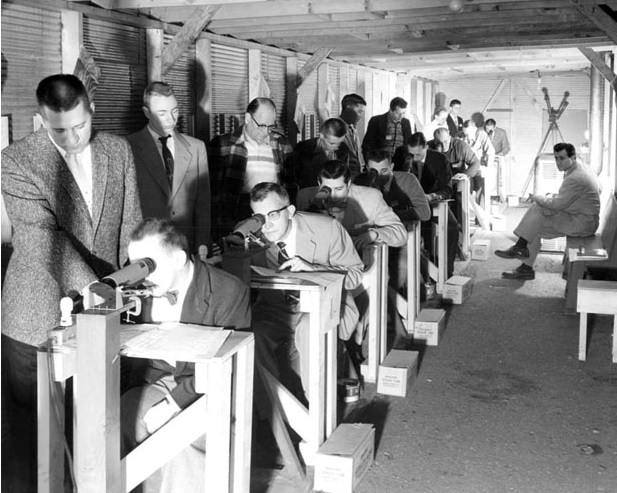
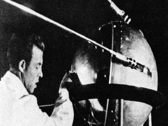
An Operation Moonwatch team in action based out of Terre Haute, Indiana. (Courtesy of Keep Watching the Skies! Author Patrick McCray, used with Permission).
Amateur astronomers have done more than just watch the skies, they’ve been a national security asset. In the mid-1950’s, it was realized that the reality of the Space Age was at best only a decade away. Sub-orbital German V-2 rockets captured by the Soviets and the United States were reaching higher and higher altitudes, and it was only a matter of time before orbital velocity would be achieved.
Keep in mind, this was the age of backyard bomb shelters, “duck and cover” drills, and civil preparedness as Cold War fever reached a heightened pitch. Ground Observer Corps encouraged and trained citizen groups how to spot and report enemy bombers approaching the U.S coast in preparation for a nuclear confrontation. And remember, there was no reason to think that this build up wouldn’t extend to the militarization of space. It was in this era that Operation Moonwatch was born.
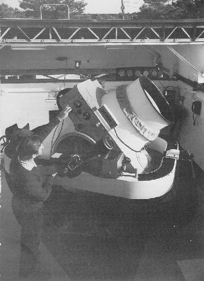
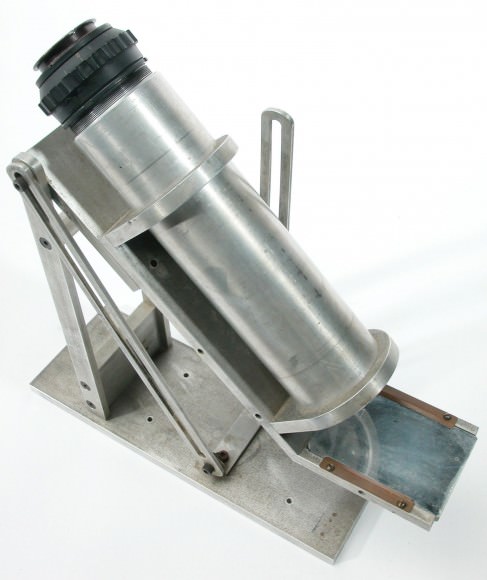
Conceived by Harvard astronomer Fred Whipple, Operation Moonwatch was the “Galaxy Zoo” of its day. The idea was simple; teams of observers around the world would track, time and record satellite passes over their location and feed this data back to the computation center at Cambridge, Massachusetts (telephone, Western Union or ham radio were the methods of the day) This data would give engineers information as to where to point their enormous Baker-Nunn cameras. These instruments were wide-field Schmidt cameras that could cover large swaths of the sky. They were to be positioned at 12 locations worldwide to keep tabs on satellites in low Earth orbit (LEO).
A Baker-Nunn satellite tracking camera ready for action. (Credit: NASA).
To be sure, there were obstacles to overcome. The Baker-Nunn cameras were well behind schedule, and the entire system was struggling to come online by mid-1958 in time for the International Geophysical Year (IGY). School and community groups had to be organized, trained, and equipped. Knowing precise location in the pre-GPS era had to be addressed. Many purchased optical kits available from Radio Shack, while many teams built their own. Then there was the dilemma of what a satellite would actually look like to an observer on the ground. Could a trained spotter even see it? Civil Air Patrol groups experimented with various trial substitutions, such as following aircraft, flocks of birds and bats at dusk and even tracking pebbles tossed into the sky!
Operation Moonwatch was also to play a part of the 1958 International Geophysical Year. Many doubted to effectiveness of amateur groups, but public interest ran high. Then on October 4th 1957, the world was caught off guard as Sputnik 1 lifted off from the Baikonur Cosmodrome.
The world was stunned that the Soviets had beaten the West into space. The National Advisory Committee for Aeronautics (later to become NASA in 1958) had yet to achieve a successful orbital launch, and the United States Naval Research Laboratory was still floundering to get the Vanguard program off the pad. The launch of Sputnik found a scant few Moonwatch teams at the ready to catch its first dusk passes over the United States. Keep in mind, the Sputnik satellite was too small and faint to see with the naked eye. What most casual observers in the general public saw (remember the opening scenes in the movie October Sky?) was actually the rocket booster that put Sputnik into space.
Moonwatch teams would “look up by looking down” using a bench mounted telescope that looked at a reflective plate aimed skyward. With observers arranged in a row aimed at a picket line, they would call out when the target satellite crossed the local meridian. This would in turn be documented by an onsite recorder for transmission.
With Sputnik, the Operation Moonwatch volunteers found themselves thrust into the spotlight. Newspapers & radio shows clamored to interview volunteers, as the public suddenly became obsessed with space. Moonwatchers followed and documented to launch of the dog Laika aboard Sputnik 2 on November 3rd, 1957, and when the U.S. finally launched its first satellite Explorer I on February 1st 1958 Operation Moonwatch tracked it. Magazines such as National Geographic and Boys Life ran articles on the project and told teams how they could participate. When Sputnik 4 reentered over the U.S. on September 1962, it was data from Operation Moonwatch observers that proved vital in its recovery.
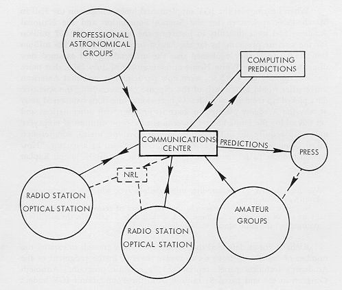
How Operation Moonwatch fit into the hierarchy. Note how amateur groups were associated with this press. (Credit: NASA archives, The Role of the NAS & TPESP).
Moonwatch was disbanded in 1975, but many volunteers continued tracking satellites and sharing data on their own. I always think that it’s fascinating that three very early satellites from the early days of Operation Moonwatch are still in orbit and can been seen with a good pair of binoculars and a little patience , Vanguards 1, 2 & 3. It could be argued that Operation Moonwatch provided a civilian means to monitor the goings on of governments in low Earth orbit and may have contributed to the Outer Space Treaty outlawing the use of nuclear weapons in space. Another fortunate occurrence of the era was the establishment of a civilian space agency in the U.S., argued for successfully by Dr. James Van Allen. How different would the course of history have been if the U.S. space program had become a “fourth branch” of the military?
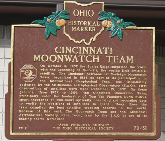
Cincinnati plaque commemorating Operation Moonwatch. (Brian Van Flandern Public Domain image).
Today, modern satellite trackers still follow, image and share information on satellites worldwide. This effort transcends borders; when hazardous payloads such as Russia’s failed Mars mission Phobos-Grunt reentered in early 2012 satellite trackers documented its final passage, and efforts are still underway to keep tabs on the USAF’s X-37 spy satellite. One can also see a stark contrast between the efforts to enlist civilian effort during the Cold War and the modern Global War on Terrorism. Interest in science was at an all-time high in the 1950’s, as it was realized the West might be lagging behind in science education. In a post-9/11 era, there almost seems to be a movement to isolate participation. Many model rocketry groups are under increased restriction, and even amateur astronomers may see essential tools such as green laser pointers restricted for use.
Image of Space Shuttle Discovery on STS-119 captured from the ground… note the NASA “Blue Meatball” logo on the wing! (Credit: Ralf Vandebergh, used with permission).
But the good news is, anyone can still track a satellite from the comfort of their own backyard all in the spirit of Operation Moonwatch. DARPA announced a project last year which may resurrect a program similar to Operation Moonwatch. Named SpaceView, this program seeks to augment the U.S. Air Force’s Space Surveillance Network. Keep an eye on the sky, and remember a dedicated few amateur observers that played a crucial role in modern history as you watch satellites drift silently by in the twilight skies.
For more on the fscinating hostory of Operation Moonwatch, read Patrick McCray’s Keep Watching the Skies!
According to Analytical Graphics, Inc. (AGI), the Center for Space Standards and Innovation (CSSI) has determined that on January 22, 2013 debris from the Chinese FENGYUN 1C collided with Russia’s BLITS satellite. The FENGYUAN 1C is the satellite that was destroyed by China on January 11, 2007 in a test of an anti-satellite missile. The collision changed the orbit of the Russian satellite, along with its spin velocity and attitude. The animation above is from AGI and it depicts the event. Continue reading “Chinese Space Debris Collides with Russian Satellite”
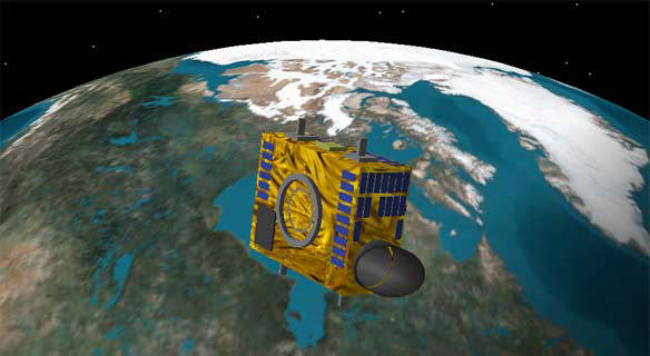
The Canadian asteroid-hunting NEOSSAT is among the fleet of satellites launched on Feb. 25, 2013.Credit: Canadian Space Agency
A Polar Satellite Launch Vehicle (PSLV) successfully launched from India today, sending seven different international satellites into orbit. Launch was at 7:31 a.m. EST (12:31 UTC) and on board were three Canadian-built spacecraft including a small asteroid-hunting satellite (weighing in at just 74 kg) called NEOSSat, other small satellites from the UK, Austria and Denmark and an India-France joint effort called SARAL, an Earth observation satellite, the primary payload for the launch.
Reports indicate all seven satellites were placed in their proper orbits and after their initial check-outs will being their missions.
NEOSSat (Near-Earth Object Surveillance Satellite)will track large asteroids that may come close to Earth and also track space debris in orbit. The suitcase-sized NEOSSat will orbit approximately 800 kilometers above the Earth, searching for objects that are difficult to spot using ground-based telescopes. Because of its location, NEOSSat will not be limited by the day-night cycle and will operate continuously.
“NEOSSat will discover many asteroids much faster than can be done from the ground alone,” said Alan Hildebrand of the University of Calgary. “Its most exciting result, however, will probably be discovering new targets for exploration by both manned and unmanned space missions.”
SARAL will be monitoring climate on Earth; CanX-3 BRITE (BRIght Target Explorer) is billed as the smallest astronomical telescope looking for faint objects; Sapphire is a military satellite that will keep track of objects orbiting between 3,800 and 25,000 miles (6,000 and 40,000 kilometers) from Earth; TUGSat-1 BRITE from Austria will monitor changes in brightness in stars; AAUSat 3 from Denmark will moniter ship traffic on Earth’s oceans, and STRaND-1 is a nanosatellite carrying a smartphone, has unique “screaming in space” experiment.
The Canadian asteroid-hunting NEOSSAT is among the fleet of satellites launched on Feb. 25, 2013.Credit: Canadian Space Agency
Early next week, an Indian rocket will launch into space carrying seven satellites on board. Among them will be a small but mighty asteroid-hunting telescope called NEOSSat. Built by the Canadian Space Agency, it will mainly focus on the Atira class of asteroids, which are made up of space rocks within Earth’s orbit, to figure out their size and distribution. The suitcase-sized NEOSSat will orbit approximately 800 kilometers above Earth, searching for near-Earth asteroids that are difficult to spot using ground-based telescopes.
Here’s a full rundown of what’s soaring to space on Monday (Feb. 25), if all goes to plan. Check out the launch from India at this link; it’s supposed to go into space around 7:25 a.m. Eastern (12:25 p.m. UTC).
– NEOSSat (Canada). Short for Near-Earth Object Surveillance Satellite, the satellite is actually split into two different missions. For half the time, it will be keeping a sharp eye out for asteroids that may swing by Earth at some point. The telescope will spend its other science mission watching satellites and space debris in orbit, to better track their movements.
“NEOSSat will discover many asteroids much faster than can be done from the ground alone,” said Alan Hildebrand of the University of Calgary. “Its most exciting result, however, will probably be discovering new targets for exploration by both manned and unmanned space missions.”
– SARAL (India/France). This is by far the largest satellite of the fleet; the rest of the mini sats listed below are hitching a ride to share launch costs. The satellite is supposed to take altimeter measurements of water and ice to watch the movement of waves and to add more data into climate change databases, among other objectives.
– CanX-3BRITE (Canada). The BRIght Target Explorer is billed as the smallest astronomical telescope, at just 8 inches (20 centimeters) across. Unlike bigger observatories that focus on very faint objects, BRITE will — as the name suggests — watch over brighter stars that we commonly use on Earth to connect the dots in constellations. Oddly enough, despite their prominence in our sky, these brighter stars are poorly studied, astronomers said.
– Sapphire (Canada). A military mission, this satellite will keep track of objects orbiting between 3,800 and 25,000 miles (6,000 and 40,000 kilometers) from Earth. The Canadians will share this information with their close military ally, the Americans.
– TUGSat-1 BRITE (Austria). This will be the first Austrian satellite. Like CanX-3, it will investigate bright stars by watching the changes in brightness using a technique called photometry (measuring visible light.) The satellite is equipped with a high-resolution CCD imager to take pictures.
– AAUSat 3 (Denmark). This satellite will test the capabilities of automatic identification of ships (AIS) technology, following the beacons that ships are required to send out with information about their cargo and destination. Most of the testing will focus on the water around Greenland.
– STRaND-1 (United Kingdom). This satellite is literally a screamer, as it will be broadcasting the sound of human screams into space to see if anyone nearby can hear them. (This is to test the oft-repeated phrase that in space, nobody can hear you scream.) Besides monitoring shrieks, the satellite makers will be testing how well the satellite is controlled by a smartphone. The acronym is short for Surrey Training, Research and Nanosatellite Demonstrator.
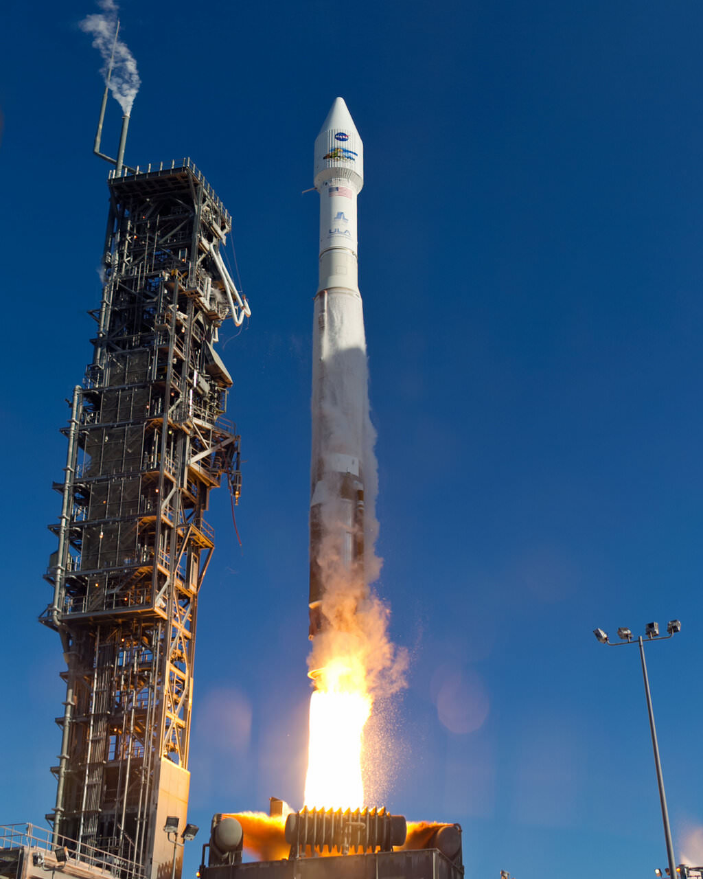
An Atlas-V rocket with the Landsat Data Continuity Mission (LDCM) spacecraft onboard is seen as it launches on Monday, Feb. 11, 2013 at Vandenberg Air Force Base, California. Credit: NASA
NASA launched a successor to the long-time Landsat satellite Earth-observing program today, sending the Landsat Data Continuity Mission satellite to orbit via an Atlas V rocket from Vandenberg Air Force Base at 1:02 EST (10:02 PST, 18:02 UTC). The new LDCM carries two new instruments, the Operational Land Imager and the Thermal Infrared Sensor, which will collect data that are compatible with data from previous Landsat mission, 5 and 7, and improve upon it with advanced instrument designs that are more sensitive to changes to the land surface, NASA said. This is the eighth Landsat satellite, and after extensive on-orbit testing and certified for its mission, it will be renamed Landsat 8.
See the launch video, below:
LDCM will continue the Landsat program’s 40-year data record of monitoring Earth from space, making critical observations to help with energy and water management, forest monitoring, human and environmental health, urban planning, disaster recovery and agriculture.
The new satellite is about the size of a large SUV, weighing 2,780 kg (6,133-pounds). The two instruments will monitor Earth’s surface in visible and multiple infrared wavelengths, resolving large-scale surface features and collecting some 400 images per day. The satellite is equipped with a 3.14-terabyte solid-state recorder to store data between downlink sessions.
“This will be the best Landsat satellite launched to date,” said Jim Irons, LDCM project scientist at Goddard Spaceflight Center, “the best Landsat satellite ever in terms of the quality and quantity of the data collected by the LDCM sensors.”
The United Launch Alliance (ULA) Atlas-V rocket with the Landsat Data Continuity Mission (LDCM) spacecraft onboard is seen as it launches on Monday, Feb. 11, 2013 at Vandenberg Air Force Base, California. Credit: NASA
Irons said the Landsat program is a critical and extremely valuable national asset.
“Since the launch of Landsat 1, we have seen — and we have caused — dramatic changes to the global land surface that continue today at rates unprecedented in human history,” he said. “These changes are due to an increasing population, advancing technologies and climate change. LDCM will extend and improve upon the Landsat record of landscape change. The resulting observations and information will be critical to managing increasing demands on land resources and preparing for inevitable changes to the global land surface.”
Recently, Landsat 5 successfully set the new Guinness World Records title for ‘Longest-operating Earth observation satellite.’ It was launched on March 1, 1984, and outlived its three-year design life. It delivered high-quality, global data of Earth’s land surface for 28 years and 10 months, completing over 150,000 orbits and sending back more than 2.5 million images of Earth’s surface. On Dec. 21, 2012 the USGS announced Landsat 5 would be decommissioned in the coming months after the failure of a redundant gyroscope. The satellite carries three gyroscopes for attitude control and needs two to maintain control.
The Landsat Program is managed by the U.S. Geological Survey (USGS).
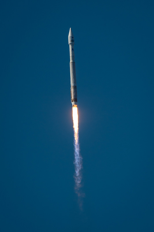
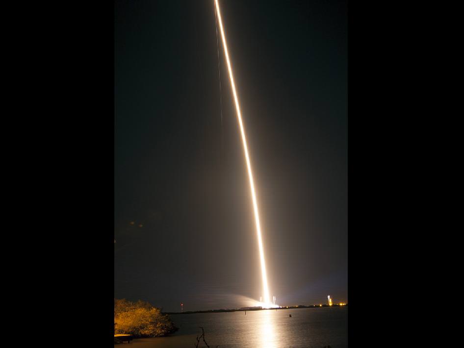
A United Launch Alliance Atlas V 401 rocket streaks away from Space Launch Complex 41 into the night sky over Cape Canaveral Air Force Station in Florida, carrying NASA's Tracking and Data Relay Satellite-K, TDRS-K, to orbit. Credit: NASA/Glenn Benson
NASA’s Tracking and Data Relay Satellite System will get an upgrade as the first of a new generation of communications satellites was launched to orbit on Wednesday, January 30 at 8:48 p.m. EST from Cape Canaveral. See the launch video and more images of the launch, below.
The TDRS system provides a critical communications link to Earth for the International Space Station, the Hubble Space Telescope and many satellites.
“TDRS-K bolsters our network of satellites that provides essential communications to support space exploration,” said Badri Younes, deputy associate administrator for Space Communications and Navigation at NASA. “It will improve the overall health and longevity of our system.”
The TDRS system provides tracking, telemetry, command and high-bandwidth data return services for numerous science and human exploration missions orbiting Earth. These include the International Space Station and NASA’s Hubble Space Telescope.
“With this launch, NASA has begun the replenishment of our aging space network,” said Jeffrey Gramling, TDRS project manager. “This addition to our current fleet of seven will provide even greater capabilities to a network that has become key to enabling many of NASA’s scientific discoveries.”
TDRS-K was launched on a United Launch Alliance Atlas V rocket from Space Launch Complex-41. After a three-month test phase, NASA will accept the spacecraft for additional evaluation before putting the satellite into service.
The TDRS-K spacecraft includes several modifications from older satellites in the TDRS system, including redesigned telecommunications payload electronics and a high-performance solar panel designed for more spacecraft power to meet growing S-band requirements. Another significant design change, the return to ground-based processing of data, will allow the system to service more customers with evolving communication requirements.
The next TDRS spacecraft, TDRS-L, is scheduled for launch in 2014. TDRS-M’s manufacturing process will be completed in 2015.
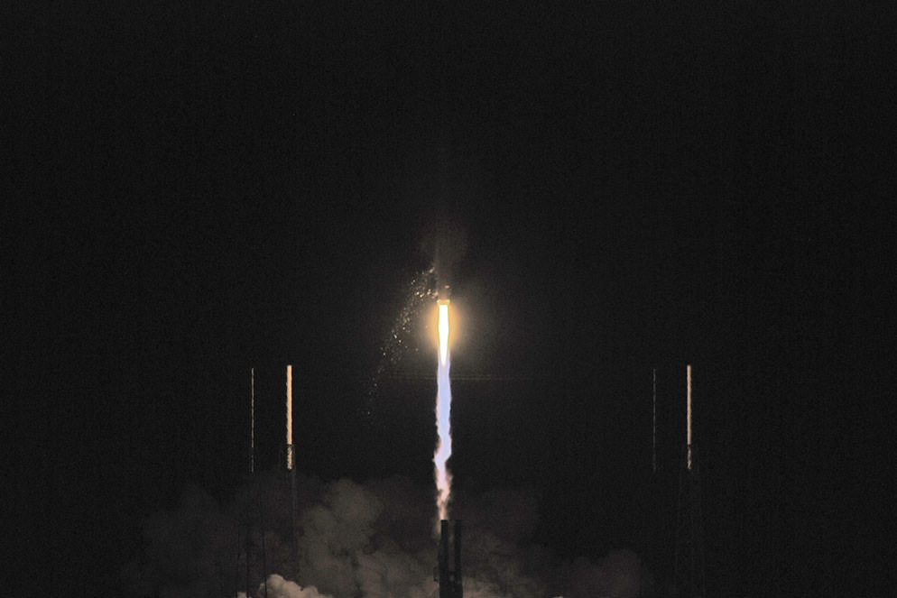
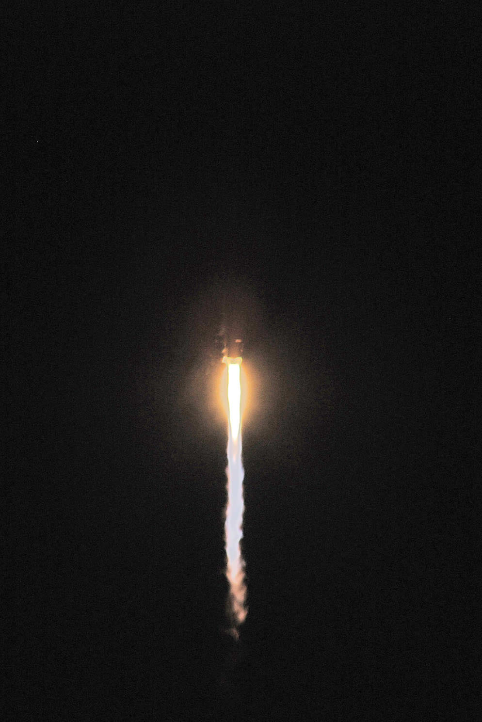
The Atlas rocket clears the utility tower. Credit: John O'Connor/nasatech. Tower Clear! The vehicle begins to gain speed as she burns off fuel. Credit: John O'Connor/nasatech.The TDRS-K launch at the beginning of the roll program. Credit: John O'Connor/nasatech.
See more images and details of the launch at the nasatech website.
This image of Asia and Australia at night is a composite assembled from data acquired by the Suomi NPP satellite in April and October 2012. Credit: NASA, NOAA, and the Department of Defense.
Two months of night-time imagery gathered by the Suomi NPP satellite have resulted in a stunning new look at Earth at night, appropriately nicknamed the Black Marble.
The nighttime views were made possible by the new satellite’s “day-night band” of the Visible Infrared Imaging Radiometer Suite. VIIRS detects light in a range of wavelengths from green to near-infrared and uses filtering techniques to observe dim signals such as city lights, gas flares, auroras, wildfires, and reflected moonlight. In this case, auroras, fires, and other stray light have been removed to emphasize the city lights.
“This is not your father’s low light sensor!” said Steve Miller, senior research scientist and deputy director of the Cooperative Institute for Research in the Atmosphere (CIRA), Colorado State University, speaking at the American Geophysical Union conference this week.
See more views and a video presentation of the VIIRS data below:
The new satellite is providing a much higher resolution across a greater band of light than previous night-light gathering satellites.
Originally developed for meteorologists to be able to look at nighttime clouds, the VIIRS data is providing a wide variety of information. “We are getting as much mileage from these data sets as we can,” said Chris Elvidge, who leads the Earth Observation Group at NOAA’s National Geophysical Data Center.
Elvidge and Miller said the data is being used to model population distribution, fossil fuel and CO2 emissions, and other information that can be gleaned from nighttime lights such finding power outages, determining astronomical viewing conditions, providing site selection for astronomical observatories, and looking at impacts of artificial lights on humans and animals.
The difference between electrical lights and fires, and night glow and auroras can even be determined by VIIRS.
North and South America at night is a composite assembled from data acquired by the Suomi NPP satellite in April and October 2012. Credit: NASA, NOAA, and the Department of Defense.
Europe, Africa, and the Middle East at night is a composite assembled from data acquired by the Suomi NPP satellite in April and October 2012. Credit: NASA, NOAA, and the Department of Defense.
Named for satellite meteorology pioneer Verner Suomi, NPP flies over any given point on Earth’s surface twice each day at roughly 1:30 a.m. and p.m. The polar-orbiting satellite flies 824 kilometers (512 miles) above the surface, sending its data once per orbit to a ground station in Svalbard, Norway, and continuously to local direct broadcast users distributed around the world,
.