Getting to the Core of Earth’s Falling Snow

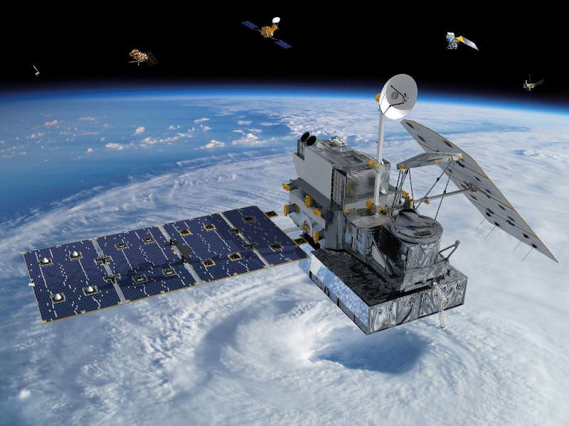
Visualization of the GPM Core Observatory and Partner Satellites. Credit: NASA

[/caption]

An international plan is unfolding that will launch satellites into orbit to study global snowfall precipitation with unprecedented detail. With the upcoming Global Precipitation Measurement (GPM) satellites, for the first time we will know when, where and how much snow falls on Earth, allowing greater understanding of energy cycles and how best to predict extreme weather.

Snow is more than just a pretty winter decoration… it’s also a very important contributor to fresh water supply in many regions around the world, especially those areas that rely on spring runoff from mountains.

The snowmelt from the Sierra Nevadas, for example, accounts for a third of the water supply for California.

But changing climate and recent drought conditions have affected how much snow the mountains receive in winter… and thus how much water is released in the spring. Unfortunately, as of now there’s no reliable way to comprehensively detect and measure falling snow from space… whether in the Sierras or the Andes or the Alps.
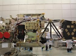
Engineers are building and testing the GPM Core Observatory at Goddard Space Flight Center. (NASA/GSFC)

The GPM Core satellite, slated to launch in 2014, will change that.

“The GPM Core, with its ability to detect falling snows, it’s one of the very first times that we’ve put sensors in space to specifically look at falling snow,” said GPM Deputy Project Scientist Gail Skofronick-Jackson in an online video. “We’re at that edge where rain was fifty years ago. We’re still figuring out how to measure snow.”

And why is snow such a difficult subject to study?

“Rain tends to be spherical like drops,” says Skofronick-Jackson. “But if you’ve ever been out in a snowfall and you’ve looked at your shirt, you see the snow comes in all different forms.”

Once GPM scientists calculate all the various types of snowflake shapes, the satellite will be able to detect them from orbit.

“The GPM Core, with its additional frequencies and information on the sensors, is going to be able to provide us for the first time a lot more information about falling snow than we’ve ever done before.”

Knowing where and how much snow and rain falls globally is vital to understanding how weather and climate impact both our environment and Earth’s energy cycles, including effects on agriculture, fresh water availability, and responses to natural disasters.

Snowfall is a missing part of the puzzle, and GPM will fill those pieces in.

Find out more about the GPM program at pmm.nasa.gov/GPM.

GPM Core is currently being assembled at NASA’s Goddard Space Flight Center and scheduled to launch in 2014 on a Japanese H-IIA rocket.  Initiated by NASA and the Japanese Aerospace Exploration Agency (JAXA), GPM consists of a consortium of international agencies, including the Centre National d’Études Spatiales (CNES), the Indian Space Research Organization (ISRO), the National Oceanic and Atmospheric Administration (NOAA), the European Organization for the Exploitation of Meteorological Satellites (EUMETSAT), and others. 

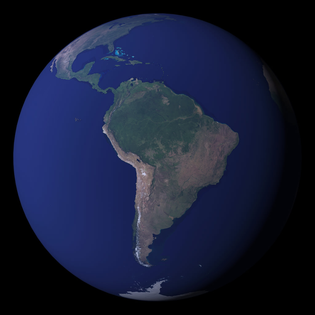
NASA’s Blue Marble…Side B.

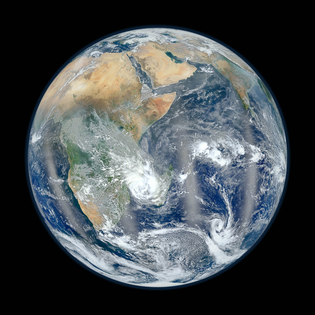
Earth's eastern hemisphere made from Suomi NPP satellite images. (NASA/NOAA)

[/caption]

In response to last week’s incredibly popular “Blue Marble” image, NASA and NOAA have released a companion version, this one showing part of our planet’s eastern hemisphere.

The image is a composite, made from six separate high-resolution scans taken on January 23 by NASA’s recently-renamed Suomi NPP satellite.

From the description on NASA Goddard Space Flight Center’s Flickr page:

Compiled by NASA Goddard scientist Norman Kuring, this image has the perspective of a viewer looking down from 7,918 miles (about 12,742 kilometers) above the Earth’s surface from a viewpoint of 10 degrees South by 45 degrees East. The four vertical lines of ‘haze’ visible in this image shows the reflection of sunlight off the ocean, or ‘glint,’ that VIIRS captured as it orbited the globe. Suomi NPP is the result of a partnership between NASA, NOAA and the Department of Defense.

Last week’s “Blue Marble” image is now one of the most-viewed images of all time on Flickr, receiving nearly 3.2 million views!

See the previously released image here.

NASA launched the National Polar-orbiting Operational Environmental Satellite System Preparatory Project (or NPP) on October 28, 2011 from Vandenberg Air Force Base. On Jan. 24, NPP was renamed Suomi National Polar-orbiting Partnership, or Suomi NPP, in honor of the late Verner E. Suomi. It’s the first satellite designed to collect data to improve short-term weather forecasts and increase understanding of long-term climate change.

Image credit: NASA/NOAA

Added: check out a “zoomified” version of this image on John Williams’ StarryCritters site.


ROSAT – Fiery Debris To Rain From The Sky

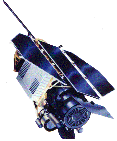
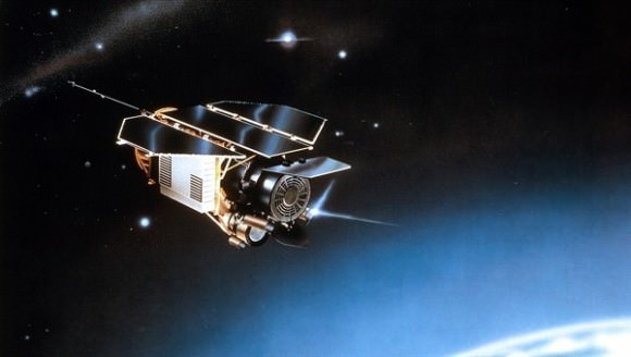
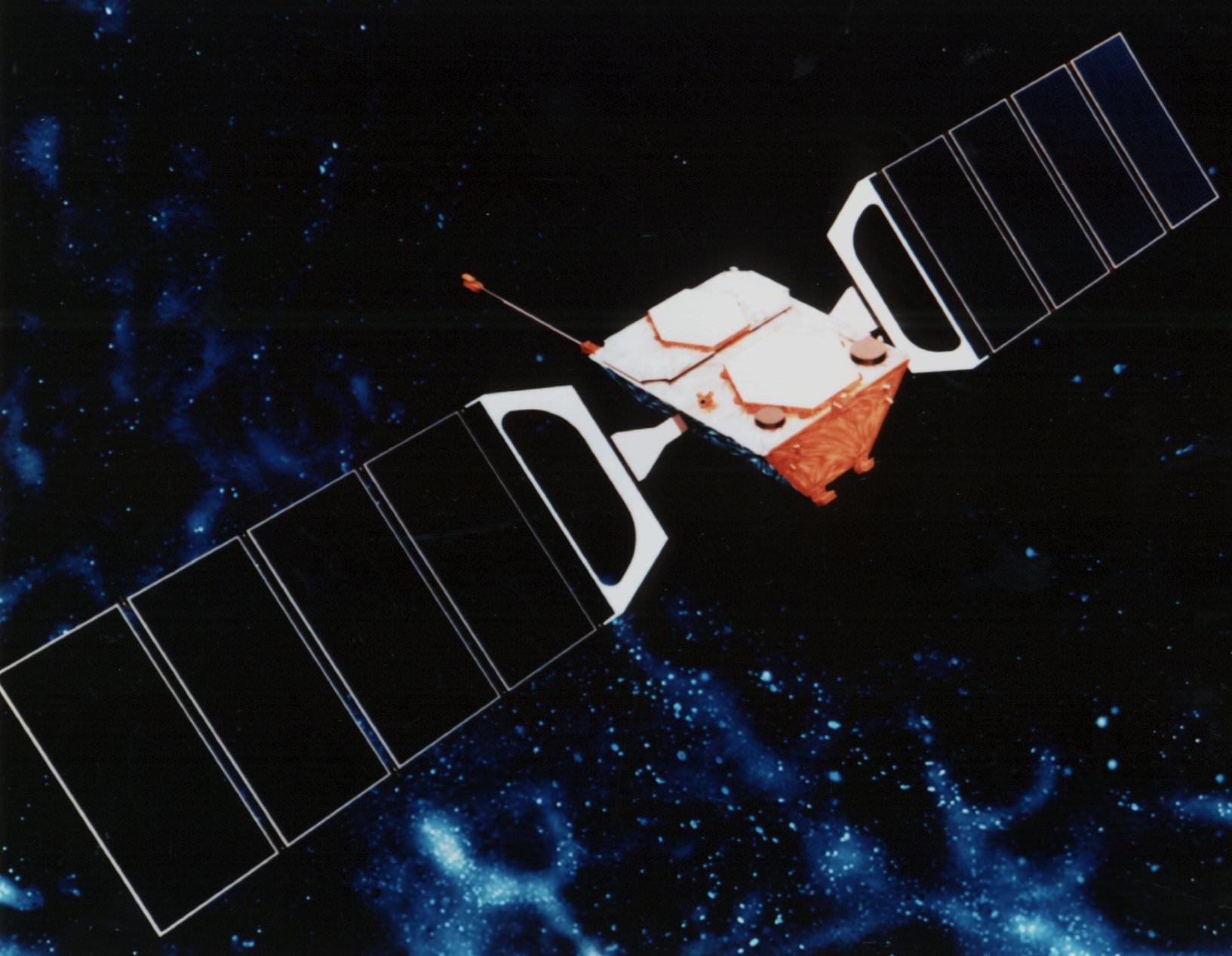
ROSAT Credit: NASA

[/caption]

The recent re-entry of the UARS satellite was not the end of falling satellite debris, as the German ROSAT X-ray observatory satellite will soon crash back to Earth.

Last month NASA’s large UARS satellite re-entered the atmosphere and burned up over the Pacific Ocean, with about 500 kg of debris falling into the water. But the smaller Roentgen Satellite or ROSAT will have approximately 30 pieces equaling 1.5 tons that will resist burn up and make it to the surface.

The largest piece of the satellite expected to reach the surface is the heat-resistant, 32 inch, 400 kg mirror.

Compared to UARS, there is an increased chance of someone being hit by a piece of the falling debris. The odds have been estimated as a 1 in 2,000; UARS was 1 in 3,200.

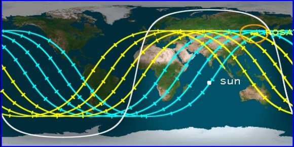
As with UARS, it is unknown where ROSAT will burn up and where its remaining parts will impact the surface, however the satellite is expected to re-enter between the 21st and 24th of October. The Center for Orbital and Re-Entry Debris studies predicts October 23, 2011 a 06:40 UTC ± 30 hours.

For up to date predictions check the Centre for Orbital and Re-Entry Debris Studies.

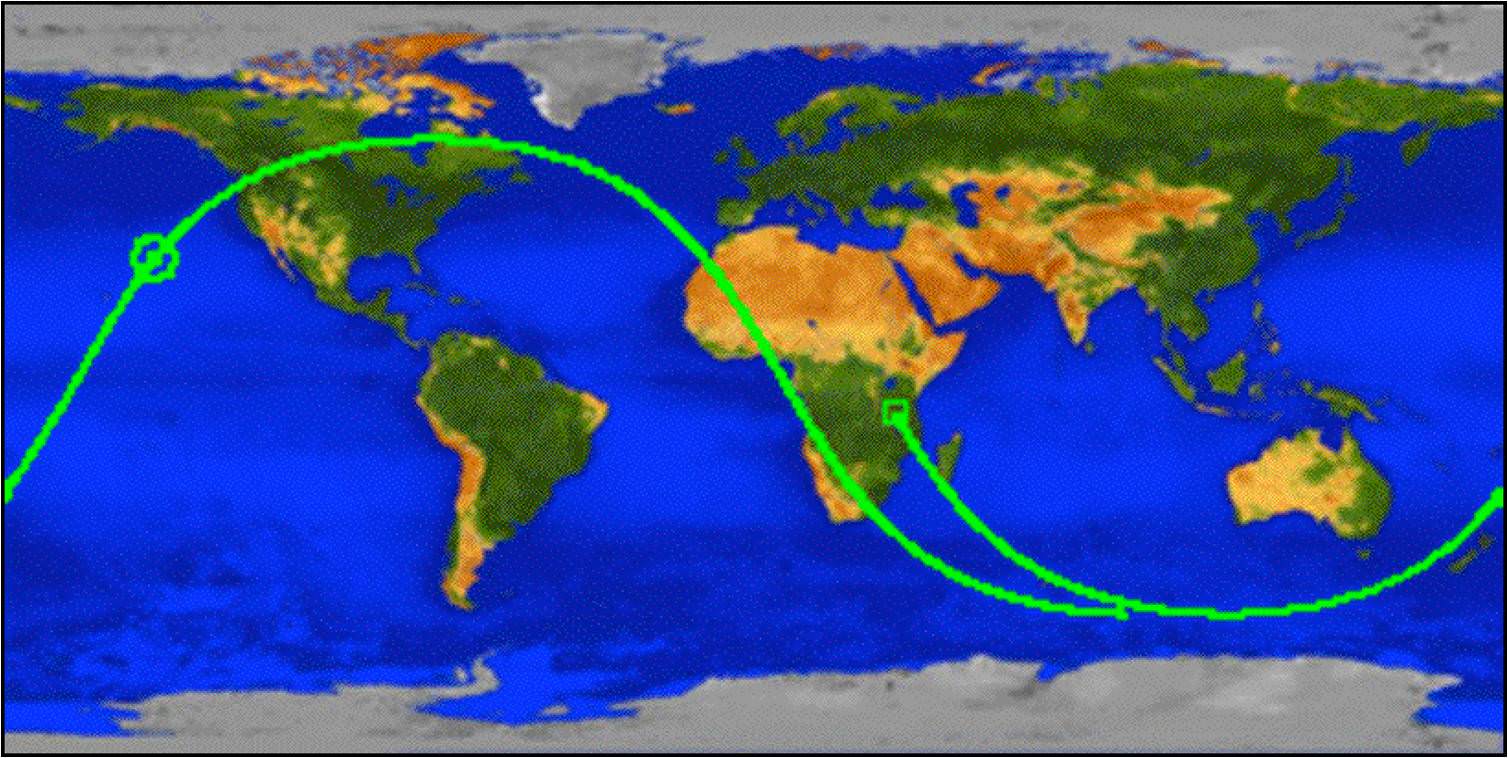
Prediction Ground Track Credit: Center for Orbital and Reentry Debris Studies

Until then, you can keep an eye out for the small satellite as it is a naked eye object. It’s nowhere near as bright as the ISS, but it is visible. Check Heavens Above or Spaceweather for predictions of when it will pass over your location.

The 2.4 ton Roentgen Satellite (ROSAT) was launched by NASA in 1990 as a joint venture between Germany, Britain and the USA.

The satellite was designed to catalogue X-ray sources in deep space and mapped around 110,000 stars and supernovae. It also discovered that some comets emit X-rays. It was permanently damaged in 1998, and its mission was officially ended in February of 1999.

ROSAT will soon meet its fiery end; will you see it pass over before then?

Keep an eye out for that falling mirror.

Credit: NASA

UARS: When and Where Did It Go Down?

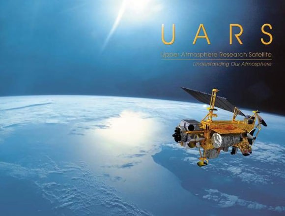
Credit: NASA

[/caption]
After a night of changing predictions and hopes of many to see a fireball in the sky, the UARS (Upper Atmosphere Research Satellite) finally met it’s fiery demise.

The decommissioned, 6.5 ton satellite is believed to have re-entered the Earths atmosphere over the Pacific Ocean, and in it’s death throes the massive satellite broke up, and the surviving debris likely landed in the ocean, off of the West coast of North America.

In regard to the exact re-entry point and position of the debris field, Nicholas Johnson, chief orbital debris scientist at NASA’s Johnson Space Center, said “We don’t know where the debris field might be… We may never know.”

The US Department of Defense’s Joint Space Operations Center at Vandenberg Air Force Base in California and the U.S. Strategic Command radar tracking assessed that the satellite reentered the atmosphere sometime between 0323 and 0509 GMT on September 24, 2011 (the Strategic Command predicted it would re-enter at 04:16 GMT). During this period, the satellite was heading across the Pacific Ocean on a southwest-to-northeast trajectory approaching Canada’s west coast. The mid-point of that groundtrack and a possible reentry location is 31 N latitude and 219 E longitude (green circle marker on the above map).

“If the re-entry point was at the time of 04:16 GMT, then all that debris wound up in the Pacific Ocean,” Johnson said during a media briefing on Saturday. “If the re-entry point occurred earlier than that, practically the entire pass before 04:16 was over water. So the only way debris could have probably reached land would be if the re-entry occurred after 04:16.”

NASA says there are no reports of damage or injury caused by the surviving components that made it to the surface, and there are so far no credible visual reports of anyone seeing the UARS satellite burning up.

The Earth-observing satellite was in orbit for 20 years and 10 days.

Credit: NASA

How Satellites Work

GPS Satellite
According to a new proposal, GPS satellites may be the key to finding dark matter. Credit: NASA

[/caption]
In 1957, the Soviet Union launched the world’s first satellite, known as Sputnik. This changed the course of world history and led the United States, their chief rival in the Space Race, to mount a massive effort of its own to put manned craft in orbit and land a man on the moon. Since then, the presence of satellites in our atmosphere has become commonplace, which has muted the sense of awe and wonder involved. However, for many, especially students studying in engineering and aerospace programs, the question of How Satellites Work is still one of vital importance.

Satellite perform a wide array of functions. Some are observational, such as the Hubble Space Telescope – providing scientists with images of distant stars, nebulas, galaxies, and other deep space phenomena. Others are dedicated to scientific research, particularly the behavior of organisms in low-gravity environments. Then there are communications satellites which relay telecommunications signals back and forth across the globe. GPS satellites offer navigational aid and tracking aides to people looking to transport goods or navigate their way across land and oceans. And military satellites are used to observe and monitor enemy installations and formations on the ground while also helping the airforce and navy guide their ordinance to enemy targets.

Satellites are deployed by attaching them to rockets which then ferry them into orbit around the planet. Once deployed, they are typically powered by rechargeable batteries which are recharged through solar panels. Other satellites have internal fuel cells that convert chemical energy to electrical energy, while a few rely on nuclear power. Small thrusters provide attitude, altitude, and propulsion control to modify and stabilize the satellite’s position in space.

When it comes to classifying the orbit of a satellite, scientists use a varying list to describe the particular nature of their orbits. For example, Centric classifications refer to the object which the satellite orbits (i.e. planet Earth, the Moon, etc). Altitude classifications determine how far the satellite is from Earth, whether it is in low, medium or high orbit. Inclination refers to whether the satellite is in orbit around the equatorial plane, the polar regions, or the polar-sun orbit that passes the equator at the same local time on every pass so as to stay in the light. Eccentricity classifications describe whether the orbit is circular or elliptical, while Synchronous classifications describe whether or not the satellite’s rotation matches the rotational period of the object (i.e. a standard day).

Depending on the nature of their purpose, satellites also carry a wide range of components inside their housing. This can include radio equipment, storage containers, camera equipment, and even weaponry. In addition, satellites typically have an on-board computer to send and receive information from their controllers on the ground, as well as compute their positions and calculate course corrections.

We have written many articles about satellites for Universe Today. Here’s an article about the satellites in space, and here’s an article about exploring satellites with Google Earth.

If you’d like more info on satellites, check out these articles:
National Geographics article about Orbital Objects
Satellites and Space Weather

We’ve also recorded an episode of Astronomy Cast about the space shuttle. Listen here, Episode 127: The US Space Shuttle.

Sources:
http://en.wikipedia.org/wiki/Satellite
http://en.wikipedia.org/wiki/List_of_orbits
http://www.gma.org/surfing/sats.html
http://science.howstuffworks.com/satellite5.htm
http://www.howstuffworks.com/satellite.htm

Artificial Satellites

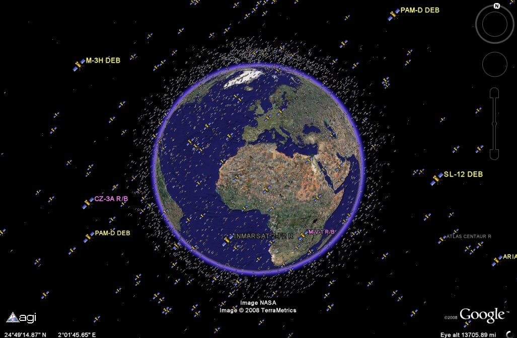
It's getting crowded out there: active and inactive satellites are tracked (Google/Analytical Graphics)

[/caption]
Artificial satellites are human-built objects orbiting the Earth and other planets in the Solar System. This is different from the natural satellites, or moons, that orbit planets, dwarf planets and even asteroids. Artificial satellites are used to study the Earth, other planets, to help us communicate, and even to observe the distant Universe. Satellites can even have people in them, like the International Space Station and the Space Shuttle.

The first artificial satellite was the Soviet Sputnik 1 mission, launched in 1957. Since then, dozens of countries have launched satellites, with more than 3,000 currently operating spacecraft going around the Earth. There are estimated to be more than 8,000 pieces of space junk; dead satellites or pieces of debris going around the Earth as well.

Satellites are launched into different orbits depending on their mission. One of the most common ones is geosynchronous orbit. This is where a satellite takes 24 hours to orbit the Earth; the same amount of time it takes the Earth to rotate once on its axis. This keeps the satellite in the same spot over the Earth, allowing for communications and television broadcasts.

Another orbit is low-Earth orbit, where a satellite might only be a few hundred kilometers above the planet. This puts the satellite outside the Earth’s atmosphere, but still close enough that it can image the planet’s surface from space or facilitate communications. This is the altitude that the space shuttle flies at, as well as the Hubble Space Telescope.

Artificial satellites can have a range of missions, including scientific research, weather observation, military support, navigation, Earth imaging, and communications. Some satellites fulfill a single purpose, while others are designed to perform several functions at the same time. Equipment on a satellite is hardened to survive in the radiation and vacuum of space.

Satellites are built by various aerospace companies, like Boeing or Lockheed, and then delivered to a launch facility, such as Cape Canaveral. Launch facilities are located as close as possible to the Earth’s equator, to give an extra velocity kick into space. This allows rockets to use less fuel or launch heavier payloads.

The altitude of a satellite’s orbit defines how long it will stay in orbit. Low orbiting satellites are mostly above the Earth’s atmosphere, but they’re still buffeted by the atmosphere and their orbit eventually decays and they crash back into the atmosphere. Other satellites orbiting in high orbits will likely be there for millions of years.

We’ve written many articles about artificial satellites for Universe Today. Here’s an article about geosynchronous orbit, and here’s an article about orbital speed.

You can get more information about satellites from NASA. Here’s a cool realtime satellite tracking system, and here’s Hubblesite.

We’ve also recorded several episodes of Astronomy Cast about satellites. Here’s a good one, Episode 82: Space Junk.

Source: NASA

Satellite Finder

Globalstar satellite

[/caption]
There are some amazing resources on the Internet that will let you track and find satellites in the sky. Did you know that the International Space Station is the brightest manmade object in the sky? It’s easy to see if you know when and were to look. So, this article should give you some good satellite finder resources, so you can track down and bag sightings of satellites.

The first place to start is NASA’s tracking page for the International Space Station, space shuttle and Hubble Space Telescope. This tells you where the spacecraft currently are, and also give you a way to find out when the spacecraft are going to be flying over your part of the world. They have a quick list of common locations, but you can also enter your latitude and longitude, and the system will give you some sighting opportunities.

Next, check out the Real Time Satellite Tracking page. This shows you the current position of thousands of satellites, and lets you see what’s overhead right now. You can set up satellite finders to watch the position of certain satellites. It’s an amazing resource.

Another great tool is Heaven’s Above. It lets you put in your local address, and then get predictions for satellites that will be overhead in the next few days. You can see the current position of the International Space Station, and much more.

If you have an iPhone, here’s a cool app that lets you find out the current location of the International Space Station and the space shuttle (if it’s in orbit right now).

If you have a satellite dish, and you need a satellite finder to maximize the strength of the signal, here’s a link to a Satellite finding kit from Amazon.com. It lets you finely tune the direction of your satellite dish to get the best signal from the satellite.

We have written many articles about satellites for Universe Today. Here’s an article about how you can watch satellites gather data in real time, and here’s a service that lets you launch your own satellite for only $8000.

We have done many episodes of Astronomy Cast about satellites. Listen to Episode 84: Getting Around the Solar System.

Satellite Map of the World

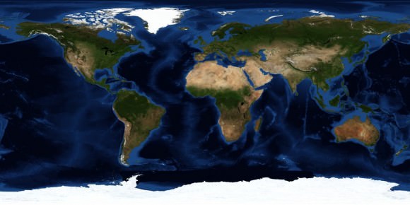
World satellite map. Image credit: NASA

There’s no better way to appreciate the planet you live on than to have a great big picture of it on your wall. Here are some ways you can get your hands on a satellite map of the world.

If you’ve got a nice printer and you’d like to save yourself some money, why not download a satellite map of the world for free from NASA. You can get free satellite images from the NASA Earth Observatory.

[/caption]

Each month NASA releases a new composite satellite image of the entire planet. This lets you track changes from month to month. You can view the full images on this page.

NASA satellite map of the Earth

You can also get a free satellite map of the world captured at night. This photo shows whole planet Earth, but now you’re seeing it at night. The bright spots are cities and populated areas. It’s easy to see the differences between 1st world countries and more developing nations.

Earth lights at night.

If you want to just buy a poster that you can put on your wall, you can find a bunch of satellite world maps from Amazon.com. Here’s a link to buy the Earth at night poster. And here’s an image of the whole Earth by day.

After Loss of Lunar Orbiter, India Looks to Mars Mission

India Moon Mission
Artist concept of Chandrayaan-1 orbiting the moon. Credit: ISRO

[/caption]
After giving up on re-establishing contact with the Chandrayaan-1 lunar orbiter, Indian Space Research Organization (ISRO) Chairman G. Madhavan Nair announced the space agency hopes to launch its first mission to Mars sometime between 2013 and 2015. Nair said the termination of Chandrayaan-1, although sad, is not a setback and India will move ahead with its plans for the Chandrayaan-2 mission to land an unmanned rover on the moon’s surface to prospect for chemicals, and in four to six years launch a robotic mission to Mars.


“We have given a call for proposal to different scientific communities,” Nair told reporters. “Depending on the type of experiments they propose, we will be able to plan the mission. The mission is at conceptual stage and will be taken up after Chandrayaan-2.”

On the decision to quickly pull the plug on Chandrayaan-1, Nair said, “There was no possibility of retrieving it. (But) it was a great success. We could collect a large volume of data, including more than 70,000 images of the moon. In that sense, 95 percent of the objective was completed.”

Contact with Chandrayaan-1 may have been lost because its antenna rotated out of direct contact with Earth, ISRO officials said. Earlier this year, the spacecraft lost both its primary and back-up star sensors, which use the positions of stars to orient the spacecraft.

The loss of Chandrayaan-1 comes less than a week after the spacecraft’s orbit was adjusted to team up with NASA’s Lunar Reconnaissance Orbiter for a Bi-static radar experiment. During the maneuver, Chandrayaan-1 fired its radar beam into Erlanger Crater on the moon’s north pole. Both spacecraft listened for echoes that might indicate the presence of water ice – a precious resource for future lunar explorers. The results of that experiment have not yet been released.

Chandrayaan-1 craft was designed to orbit the moon for two years, but lasted 315 days. It will take about 1,000 days until it crashes to the lunar surface and is being tracked by the U.S. and Russia, ISRO said.

The Chandrayaan I had 11 payloads, including a terrain-mapping camera designed to create a three-dimensional atlas of the moon. It is also carrying mapping instruments for the European Space Agency, radiation-measuring equipment for the Bulgarian Academy of Sciences and two devices for NASA, including the radar instrument to assess mineral composition and look for ice deposits. India launched its first rocket in 1963 and first satellite in 1975. The country’s satellite program is one of the largest communication systems in the world.

Sources: New Scientist, Xinhuanet