These Streaks on Mars Could be Flowing Sand, not Water

These dark, narrow, 100 meter-long streaks called recurring slope lineae flowing downhill on Mars are inferred to have been formed by contemporary flowing water. However, a new study by planetary scientists indicates that these may actually be the result of dry flows. Credits: NASA/JPL/University of Arizona

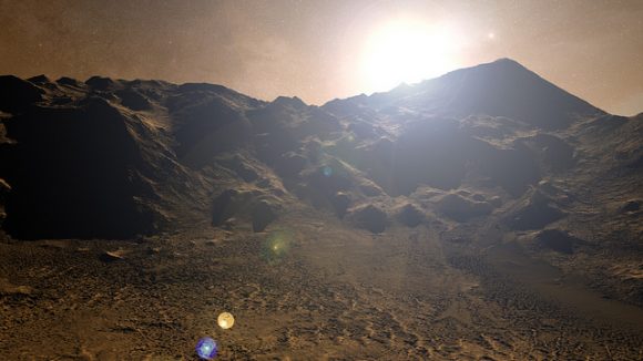
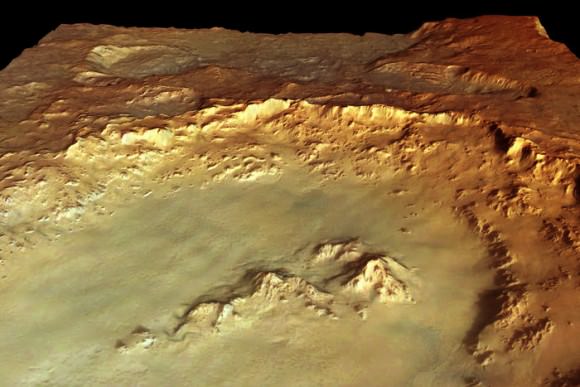
When robotic missions first began to land on the surface of Mars in the 1970s, they revealed a harsh, cold and desiccated landscape. This effectively put an end generations of speculation about “Martian canals” and the possibility of life on Mars. But as our efforts to explore the Red Planet have continued, scientists have found ample evidence that the planet once had flowing water on its surface.

In addition, scientists have been encouraged by the appearance of Recurring Slope Lineae (RSL), which were believed to be signs of seasonal water flows. Unfortunately, a new study by researchers from the U.S. Geological Survey indicates that these features may be the result of dry, granular flows. These findings are another indication that the environment could be too dry for microorganisms to survive.

The study, titled “Granular Flows at Recurring Slope Lineae on Mars Indicate a Limited Role for Liquid Water“, recently appeared in the scientific journal Nature Geoscience. Led by Dr. Colin Dundas, of the US Geological Survey’s Astrogeology Science Center, the team also included members from the Lunar and Planetary Laboratory (LPL) at the University of Arizona and Durham University.

This inner slope of a Martian crater has several of the seasonal dark streaks called “recurrent slope lineae,” or RSL, which were caputred by the HiRISE camera on NASA’s Mars Reconnaissance Orbiter. Credits: NASA/JPL-Caltech/UA/USGS

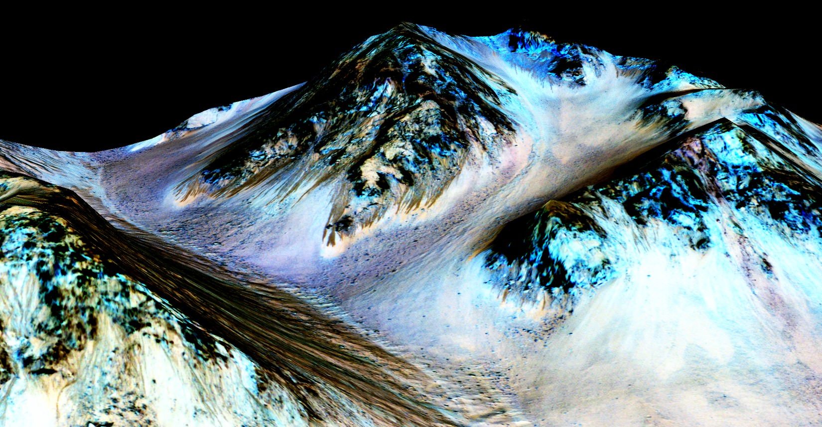
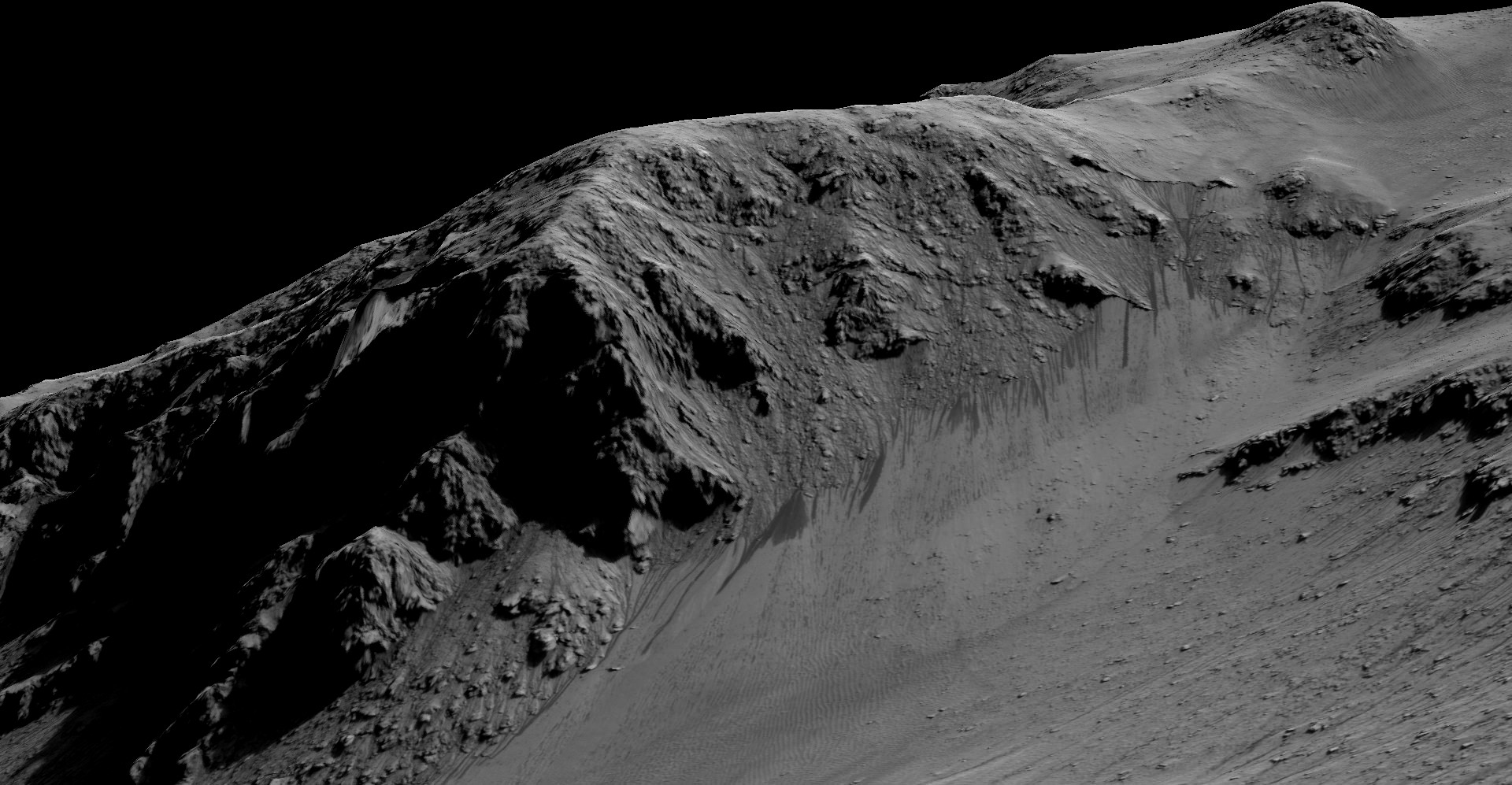
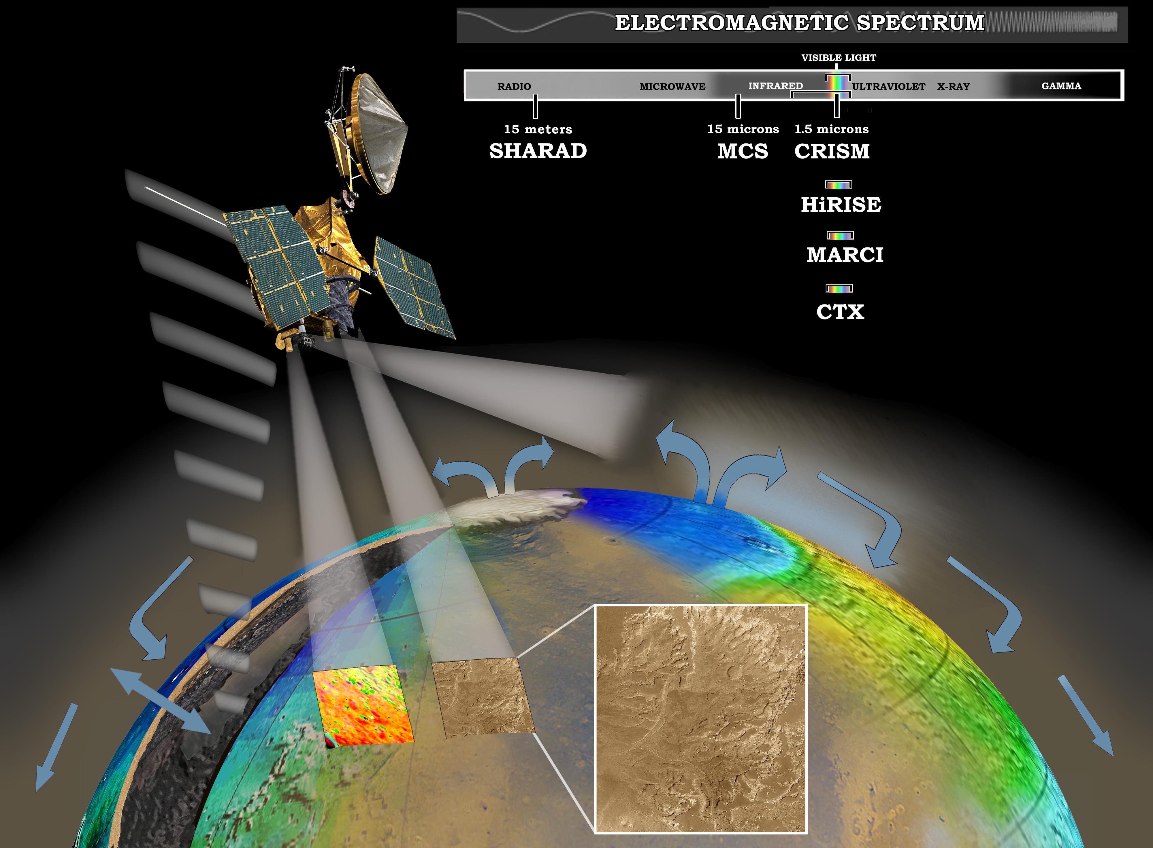
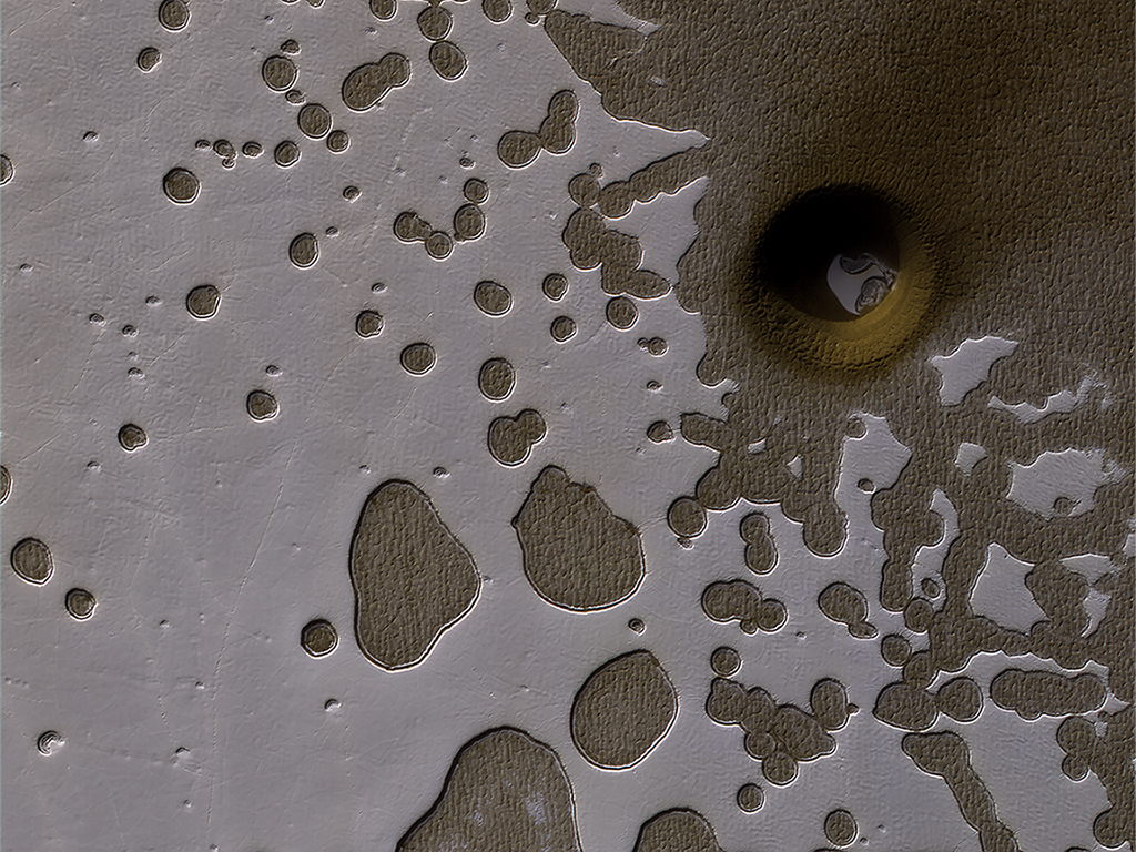
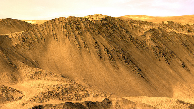
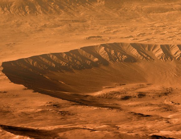
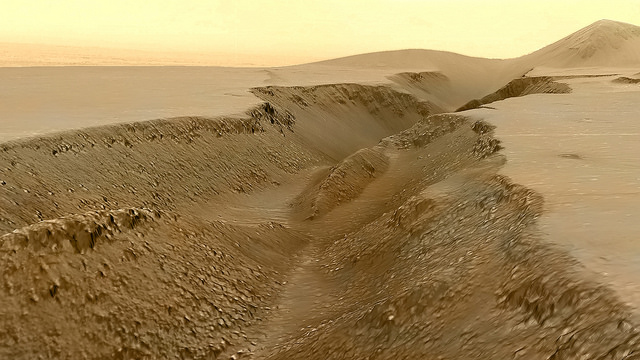
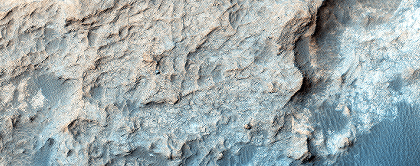
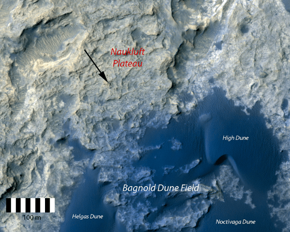
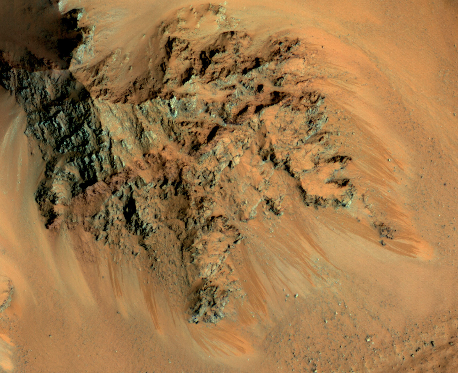
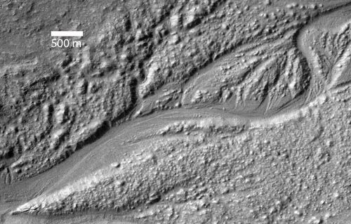
For the sake of their study, the team consulted data from the High Resolution Image Science Experiment (HiRISE) camera aboard the NASA Mars Reconnaissance Orbiter (MRO). This same instrument was responsible for the 2011 discovery of RSL, which were found in the middle latitudes of Mars’ southern hemisphere. These features were also observed to appear on Martian slopes during late spring through summer and then fade away in winter.

The seasonal nature of these flows was seen as a strong indication that they were the result of flowing salt-water, which was indicated by the detection of hydrated salt at the sites. However, after re-examining the HiRISE data, Dundas and his team concluded that RSLs only occur on slopes that are steep enough for dry grains to descend – in much the same way that they would on the faces of active dunes.

As Dundas explained in a recent NASA press release:

“We’ve thought of RSL as possible liquid water flows, but the slopes are more like what we expect for dry sand. This new understanding of RSL supports other evidence that shows that Mars today is very dry.”

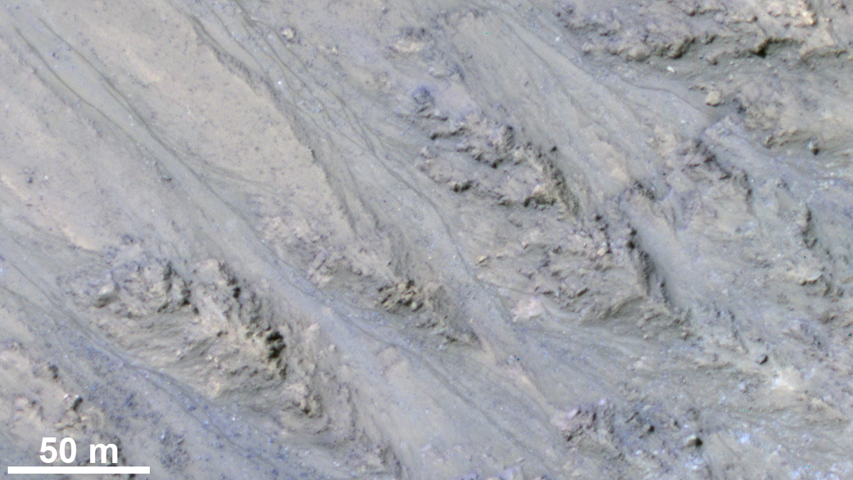
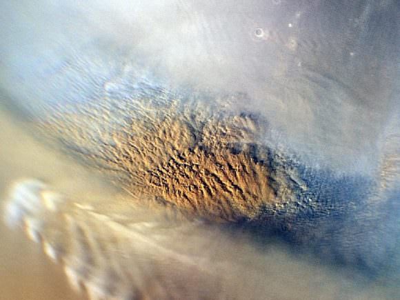
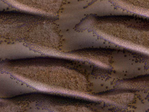
Using pairs of images from HiRISE, Dundas and his colleagues constructed a series of 3-D models of slope steepness. These models incorporated 151 RSL features identified by the MRO at 10 different sites. In almost all cases, they found that the RSL were restricted to slopes that were steeper than 27° and each flow ended on a slope that matched the patterns seen in slumping dry sand dunes on Mars and Earth.

Dark, narrow streaks flowing downhill on Mars at sites like the Horowitz Crater are inferred to be due to seasonal flows of water. Credit: NASA/JPL-Caltech/Univ. of Arizona

Basically, sand flows end where a steep angle gives way to a less-steep “angle of repose”, whereas liquid water flows are known to extend along less steep slopes. As Alfred McEwen, HiRISE’s Principal Investigator at the University of Arizona and a co-author of the study, indicated, “The RSL don’t flow onto shallower slopes, and the lengths of these are so closely correlated with the dynamic angle of repose, it can’t be a coincidence.”

These observations is something of a letdown, since the presence of liquid water in Mars’ equatorial region was seen as a possible indication of microbial life. However, compared to seasonal brine flows, the present of granular flows is a far better fit with what is known of Mars’ modern environment. Given that Mars’ atmosphere is very thin and cold, it was difficult to ascertain how liquid water could survive on its surface.

Nevertheless, these latest findings do not resolve all of the mystery surrounding RSLs. For example, there remains the question of how exactly these numerous flows begin and gradually grow, not to mention their seasonal appearance and the way they rapidly fade when inactive. On top of that, there is the matter of hydrated salts, which have been confirmed to contain traces of water.

To this, the authors of the study offer some possible explanations. For example, they indicate that salts can become hydrated by pulling water vapor from the atmosphere, which might explain why patches along the slopes experience changes in color. They also suggest that seasonal changes in hydration might result in some trigger mechanism for RSL grainflows, where water is absorbed and release, causing the slope to collapse.

NASA’s Mars Reconnaissance Orbiter investigating Martian water cycle. Credit: NASA/JPL/Corby Waste

If atmospheric water vapor is a trigger, then it raises another important question – i.e. why do RSLs appear on some slopes and not others? As Alfred McEwen – HiRISE’s Principal Investigator and a co-author on the study – explained, this could indicate that RSLs on Mars and the mechanisms behind their formation may not be entirely similar to what we see here on Earth.

“RSL probably form by some mechanism that is unique to the environment of Mars,” he said, “so they represent an opportunity to learn about how Mars behaves, which is important for future surface exploration.” Rich Zurek, the MRO Project Scientist of NASA’s Jet Propulsion Laboratory, agrees. As he explained,

“Full understanding of RSL is likely to depend upon on-site investigation of these features. While the new report suggests that RSL are not wet enough to favor microbial life, it is likely that on-site investigation of these sites will still require special procedures to guard against introducing microbes from Earth, at least until they are definitively characterized. In particular, a full explanation of how these enigmatic features darken and fade still eludes us. Remote sensing at different times of day could provide important clues.”

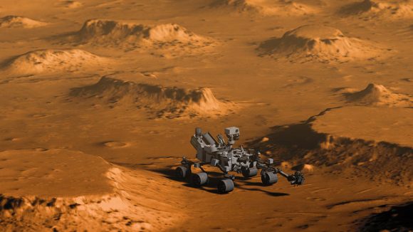
In the coming years, NASA plans to carry out the exploration of several sites on the Martian surface using the Mars 2020 rover, which includes a planned sample-return mission. These samples, after being collected and stored by the rover, are expected to be retrieved by a crewed mission mounted sometime in the 2030s, and then returned to Earth for analysis.

The days when we are finally able to study the Mars’ modern environment up close are fast approaching, and is expected to reveal some pretty Earth-shattering things!

Further Reading: NASA

What Made this Mysterious Pit on Mars? Impact Crater or Natural Collapse?

The HiRISE camera on NASA's Mars Reconnaissance Orbiter captured this unusual crater or pit on the surface of Mars. Frozen carbon dioxide gives the region its unique "Swiss cheese" like appearance. Image:NASA/JPL/University of Arizona
The HiRISE camera on NASA’s Mars Reconnaissance Orbiter captured this unusual crater or pit on the surface of Mars. Frozen carbon dioxide gives the region its unique “Swiss cheese” like appearance. Image:NASA/JPL/University of Arizona

During late summer in the Southern hemisphere on Mars, the angle of the sunlight as it strikes the surface brings out some subtle details on the planet’s surface.

In this image, the HiRISE camera on board NASA’s Mars Reconnaissance Orbiter (MRO) captured an area of frozen carbon dioxide on the surface. Some of the carbon dioxide ice has melted, giving it a swiss-cheese appearance. But there is also an unusual hole or crater on the right side of the image, with some of the carbon dioxide ice clearly visible in the bottom of the pit.

NASA scientists are uncertain what exactly caused the unusual pit. It could be an impact crater, or it could be a collapsed pit caused by melting or sublimation of sub-surface carbon dioxide ice.

MRO has been in orbit around Mars for over 10 years, and has completed over 50,000 orbits. The MRO has two cameras. The CTX camera is lower resolution, and has imaged over 99% of the Martian surface. HiRISE is the high-resolution camera that is used to closely examine areas and objects of interest, like the unusual surface pit in this image.

More Reading:

Get Away From It All with these Amazing DTM Views of Mars

The rim of Tooting Crater on Mars, rendered from HiRISE data using Autodesk Maya and Adobe Photoshop. Credit: NASA/JPL/University of Arizona/USGS/image editing by Kevin Gill.

By day, Kevin Gill is a software engineer at the Jet Propulsion Laboratory. But on nights and weekends he takes data from spacecraft and turns them into scenes that can transport you directly to the surface of Mars.

Gill is one of many so-called “amateur” image editing enthusiasts that take real, high-resolution data from spacecraft and create views that can make you feel like you are standing on the surface of Mars, or out flying around the Solar System.

Gasa Crater on Mars. Rendered using Autodesk Maya and Adobe Photoshop. HiRISE data processed using HiView and gdal. Credit: NASA/JPL/University of Arizona/USGS/image editing by Kevin Gill.

Some of the best data around for these purposes come from the HiRISE camera on board the Mars Reconnaissance Orbiter. Data known as Digital Terrain Model (DTM) files, the HiRISE DTMs are made from two or more images of the same area of a region on Mars, taken from different angles. This data isn’t just for making stunning images or amazing movies. For scientists, DTMs are very powerful research tools, used to take measurements such a elevation information and model geological processes.

So, just how do you go from this DTM image from HiRISE:

DTM image of the Central Peak of Elorza Crater on Mars. Credit: NASA/JPL/University of Arizona/USGS

To this amazing image?

Martian sunrise over the Central Peak of Elorza Crater. Rendered using Autodesk Maya and Adobe Photoshop. HiRISE data processed using HiView and gdal. Credit: NASA/JPL/University of Arizona/USGS/image editing by Kevin Gill

I’m going to let Kevin explain it:

To prep the data, I use Photoshop (to convert the JP2 file to a TIFF), and then standard GIS tools like gdal (Geospatial Data Abstraction Library) to create textures for 3D modeling. Using Autodesk Maya, I input those into a material as a color texture (orthoimagery) or displacement map (the DTM data).

I connect that material to a NURBS plane (sort of like a polygon mesh) that is scaled similarly to the physical properties of the data. I set up a camera at a nice angle (it takes a number of low-resolution test renders to get an angle I like) and let it render.

Then I just pull that render into Photoshop where I have a series of monochromatic color tints which gives the image it’s Martian feel. For the sky, I use either a sky from a MSL MastCam image or one that I took outside with my cell phone. If I’m using a sky I took with my cell phone, I’ll adjust the colors to make it look more like it would on Mars. If the colors in the image are still boring at this point, I may run a HDR adjustment on it in Photoshop.

Fissure in the Cerberus region. This false color view of a volcanic fissure in the Cerberus region of Mars was created using a digital terrain model (DTM) from the High Resolution Imaging Science Experiment (HiRISE) camera aboard NASA’s Mars Reconnaissance Orbiter. The horizon was taken from Curiosity Mastcam imagery. Credit: NASA/JPL-Caltech/University of Arizona/ image editing by Kevin Gill.

What all this means is that you can create all these amazing view, plus incredible flyover videos, like this one Kevin put together of Endeavour Crater:

Or you can have some fun and visualize where the Curiosity rover is sitting:

Doin’ Science with Curiosity. Created using HiRIST DTM and Ortho data and NASA model of Curiosity. Rendered using Autodesk Maya and Adobe Photoshop. Curiosity Model: Brian Kumanchik, NASA/JPL-Caltech. Image editing by Kevin Gill.

We’ve written about this type of image editing previously, with the work of the people at UnmannedSpaceflight.com and others. Of course, the image editing software keeps improving, along with all the techniques.

Kevin also wanted to point out the work of other image editing enthusiast, Sean Doran.

“Sean’s work is resulting in views similar to mine,” Kevin said via email. “I know he’s using a process very different from mine, but we are thinking along the same lines in what we want out of the end product. His are quite impressive.”

For example, here is a flyover video of the Opportunity rover sitting along the rim of Endeavour Crater:

You can see more of Sean’s work on his Flickr page

And you can see all of Kevin’s Mars DTM images at his Flick page here. Kevin also recently wrote up a great explanation of his image editing for The Planetary Society, which you can read here.

Thanks to Kevin Gill for sharing his images and expertise!

HiRISE Captures Curiosity on the Naukluft Plateau

MSL Curiosity on the Naukluft Plateau on the Martian surface. This image was captured by HiRise on the Mars Reconnaissance Orbiter. Image: NASA/JPL/University of Arizona

Viewing orbital images of the rovers as they go about their business on the surface of Mars is pretty cool. Besides being of great interest to anyone keen on space in general, they have scientific value as well. New images from the High Resolution Imaging Science Equipment (HiRise) camera aboard the Mars Reconnaissance Orbiter (MRO) help scientists in a number of ways.

Recent images from HiRise show the Mars Science Laboratory (MSL) Curiosity on a feature called the Naukluft Plateau. The Plateau is named after a mountain range in Namibia, and is the site of Curiosity’s 10th and 11th drill targets.

Orbital imagery of the rovers is used to track the activity of sand dunes in the areas the rovers are working in. In this case, the dune field is called the Bagnold Dunes. HiRise imagery allows a detailed look at how dunes change over time, and how any tracks left by the rover are filled in with sand over time. Knowledge of this type of activity is a piece of the puzzle in understanding the Martian surface.

Curiosity on the Naukluft Plateau as captured by HiRise. Image: NASA/JPL/University of Arizona

But the ability to take such detailed images of the Martian surface has other benefits, as well. Especially as we get nearer to a human presence on Mars.

Orbital imaging is turning exploration on its ear. Throughout human history, exploration required explorers travelling by land and sea to reconnoiter an area, and to draw maps and charts later. We literally had no idea what was around the corner, over the mountain, or across the sea until someone went there. There was no way to choose a location for a settlement until we had walked the ground.

From the serious (SpaceX, NASA) to the fanciful (MarsOne), a human mission to Mars, and an eventual established presence on Mars, is a coming fact. The how and the where are all connected in this venture, and orbital images will be a huge part of choosing where.

Tracking the changes in dunes over time will help inform the choice for human landing sites on Mars. The types and density of sand particles may be determined by monitoring rover tracks as they fill with sand. This may be invaluable information when it comes to designing the types of facilities used on Mars. Critical infrastructure in the form of greenhouses or solar arrays will need to be placed very carefully.

Sci-Fi writers have exaggerated the strength of sand storms on Mars to great effect, but they are real. We know from orbital monitoring, and from rovers, that Martian sandstorms can be very powerful phenomena. Of course, a 100 km/h wind on Earth is much more dangerous than on Mars because of the density of the atmosphere. Martian air is 1% the density of Earth’s, so on Mars the 100 km/h wind wouldn’t do much.

But it can pick up dust, and that dust can foul important equipment. With all this in mind, we can see how these orbital images give us an important understanding of how sand behaves on Mars.

This Martian sandstorm was captured by the MRO's Mars Color Imager instrument. Scientists were monitoring such storms prior to Curiosity's arrival on Mars. Image: NASA/JPL-Caltech/MSSS
This Martian sandstorm was captured by the MRO’s Mars Color Imager instrument. Scientists were monitoring such storms prior to Curiosity’s arrival on Mars. Image: NASA/JPL-Caltech/MSSS

There’s an unpredictability factor to all this too. We can’t always know in advance how important or valuable orbital imagery will be in the future. That’s part of doing science.

But back to the cool factor.

For the rest of us, who aren’t scientists, it’s just plain cool to be able to watch the rovers from above.

And, look at all the Martian eye candy!

These sand dunes in the southern hemisphere of Mars are just starting their seasonal defrost of carbon dioxide. Image: NASA/JPL/University of Arizona

‘The Martian’ is a Cinematic Triumph – Follow Mark Watney’s Trail across the Real Mars in Photos and Flyover Video

Scene from ‘The Martian’ starring Matt Damon as NASA astronaut Mark Watney contemplating magnificent panoramic vista while stranded alone on Mars. Credits: 20th Century Fox

Scene from ‘The Martian’ starring Matt Damon as NASA astronaut Mark Watney contemplating magnificent panoramic vista while stranded alone on Mars.
Credits: 20th Century Fox
See real Martian maps and flyover video from DLR and NSA below
Story/imagery updated[/caption]

Go now and experience Hollywood’s blockbuster new space epic ‘The Martian’ helmed by world renowned director Ridley Scott and starring Matt Damon as the protagonist, NASA astronaut Mark Watney. And you can follow Watney’s dramatic fictional path across the Red Planet in newly released real photos and a flyover video of the region, from DLR and NASA, as it looks today.

‘The Martian’ is a mesmerizingly enjoyable cinematic triumph for everyone that’s all about science, space exploration and one man’s struggle to survive while left totally isolated on the Red Planet in the face of seemingly insurmountable odds – relying on his wits alone to endure “on a planet where nothing grows” while hoping somehow for a rescue by NASA four years in the future.

The movie combines compelling and plausible storytelling with outstanding special effects that’s clearly delighting huge audiences worldwide with a positive and uplifting view of what could be achieved in the future – if only we really put our minds to it!

Based on the bestselling book by Andy Weir, ‘The Martian’ movie from 20th Century Fox tells the spellbinding story of how NASA astronaut Mark Watney is accidentally stranded on the surface of Mars during the future Ares 3 manned expedition in 2035, after a sudden and unexpectedly fierce dust storm forces the rest of the six person crew – commanded by Jessica Chastain as Commander Lewis – to quickly evacuate after they believe he is dead.

Real topographic map of the area of Mars covered in ‘The Martian.’ Follow the path of Mark Watney’s fictional endeavors from the Ares 3 landing site at Acidalia Planitia to NASA’s real Mars Pathfinder lander at the mouths of Ares Vallis and Tiu Valles and back, and finally to the Ares 4 landing site at  Schiaparelli Crater.  Credit: DLR/ESA
Real topographic map of the area of Mars covered in ‘The Martian.’ Follow the path of Mark Watney’s fictional endeavors from the Ares 3 landing site at Acidalia Planitia to NASA’s real Mars Pathfinder lander at the mouths of Ares Vallis and Tiu Valles and back, and finally to the Ares 4 landing site at Schiaparelli Crater. Credit: DLR/ESA/NASA

Now you can follow the fictional exploits of Mark Watney’s stunningly beautiful trail across the real Mars through a set of newly released maps, imagery and a 3D video created by the DLR, the German Aerospace Agency, and NASA – and based on photos taken by the European Space Agency’s Mars Express orbiter and NASA’s Mars Reconnaissance Orbiter (MRO).

DLR’s stunning 3D overflight video sequence was created from a dataset of 7300 stereo images covering roughly two-and-a-half million square kilometres of precisely mapped Martian landscape captured over the past 12 years by Mars Express High Resolution Stereo Camera (HRSC). The electric score is by Stephan Elgner.

Video Caption: Following the path of The Martian – video generated using images acquired by the Mars Express orbiter. Scientists from German Aerospace Center, DLR– who specialise in producing highly accurate topographical maps of Mars – reconstructed Watney’s route using stereo image data acquired by the High Resolution Stereo Camera on board European Space Agency’s #MarsExpress spacecraft. They then compiled this data into a video that shows the spectacular landscape that the protagonist would see ‘in the future’ on his trek from Ares 3 at Acidalia Planitia/Chryse Planitia to Ares 4 at Schiaparelli Crater. Credit: DLR/ESA

Ridley Scotts ‘The Martian’ takes place mostly on the surface of the Red Planet and is chock full of breathtakingly beautiful panoramic vistas. In the book you can only imagine Mars. In the movie Scott’s talents shine as he immerses you in all the action on the alien world of Mars from the opening scene.

Starting with the landing site for Watney’s Ares 3 mission crew at Acidalia Planitia, the book and movie follows his triumphs and tribulations, failures and successes as he logically solves one challenging problem after another – only to face increasingly daunting and unexpected hurdles as time goes by and supplies run low.

The DLR route map shows a real topographic view of Watney’s initial journey back and forth from the fictional Ares 3 landing site to the actual landing site of NASA’s 1997 Mars Pathfinder lander and Sojourner rover mission at the mouth of Ares Vallis.

People and technology from NASA's Jet Propulsion Laboratory aid fictional astronaut Mark Watney during his epic survival story in "The Martian."  Credits: 20th Century Fox
Mark Watney arrives at the NASA’s 1997 Pathfinder lander to gather communications gear in a scene from “The Martian.” People and technology from NASA’s Jet Propulsion Laboratory aid fictional astronaut Mark Watney during his epic survival story in “The Martian.” Credits: 20th Century Fox

The map continues with Watney’s months-long epic trek to the fictional landing site of Ares 4 Mars Ascent Vehicle (MAV) spacecraft at Schiaparelli Crater, by way of Marth Valles and other Martian landmarks, craters and valleys.

At the request of Andy Weir, the HiRISE camera on NASA’s MRO orbiter took photos of the Martian plain at the Ares 3 landing site in Acidalia Planitia, which is within driving distance from the Pathfinder lander and Sojourner rover in the book and movie.

This May 2015 image from the HiRISE camera on NASA's Mars Reconnaissance Orbiter shows a location on Mars associated with the best-selling novel and Hollywood movie, "The Martian." It is in a region called Acidalia Planitia, at the landing site for the science-fiction tale's Ares 3 mission.  For the story's central character, Acidalia Planitia is within driving distance from where NASA's Mars Pathfinder, with its Sojourner rover, landed in 1997. Credits: NASA/JPL-Caltech/Univ. of Arizona
This May 2015 image from the HiRISE camera on NASA’s Mars Reconnaissance Orbiter shows a location on Mars associated with the best-selling novel and Hollywood movie, “The Martian.” It is in a region called Acidalia Planitia, at the landing site for the science-fiction tale’s Ares 3 mission. For the story’s central character, Acidalia Planitia is within driving distance from where NASA’s Mars Pathfinder, with its Sojourner rover, landed in 1997. Credits: NASA/JPL-Caltech/Univ. of Arizona

The Martian is all about how Watney uses his botany, chemistry and engineering skills to “Science the sh** out of it” to grow food and survive until the hoped for NASA rescue.

Learning how to live off the land will be a key hurdle towards enabling NASA’s real strategy for long term space voyages on a ‘Journey to Mars’ and back.

‘The Martian’ is a must see movie that broadly appeals to space enthusiasts and general audiences alike who can easily identify with Watney’s ingenuity and will to live.

Since its worldwide premiere on Oct. 2, ‘The Martian’ has skyrocketed to the top of the US box office for the second weekend in a row, hauling in some $37.3 million. The total domestic box office receipts now top $108 million and rockets to over $228 million worldwide in the first 10 days alone.

I absolutely loved ‘The Martian’ when I first saw the movie on opening weekend. And enjoyed it even more the second time, when I could pick up a few details I missed the first time around.

Matt Damon stars as NASA astronaut Mark Watney in ‘The Martian.' Credit: 20th Century Fox
Matt Damon stars as NASA astronaut Mark Watney in ‘The Martian.’ Credit: 20th Century Fox

The movie begins as the crew evacuates after they believe Watney was killed by the dust storm. Watney actually survived the storm but lost contact with NASA. The film recounts his ingenious years long struggle to survive, figure out how to tell NASA he is alive and send a rescue crew before he starves to death on a planet where nothing grows. Watney’s predicament is a survival lesson to all including NASA.

‘The Martian’ was written by Andy Weir in 2010 and the film could well break the October movie box office record currently held by ‘Gravity.’

The movie closely follows the book, which I highly recommend you read at some point.

By necessity, the 2 hour 20 minute movie cannot capture every event in the book. So there is an abbreviated sense of Watney’s detailed science to survive and lengthy overland trips.

All the heroics and difficulties in traveling to Pathfinder and back and getting communications started, as well as the final month’s long journey to Schiaparelli crater are significantly condensed, but captured in spirit.

The Martian is brilliant and intelligent and rivals Stanley Kubrik’s space epic ‘2001: A Space Odyssey’ as one of the top movies about humanities space exploration quest.

The one big science inaccuracy takes place right at the start with the violent Martian dust storm.

On Mars the atmosphere is so thin that the winds would not be anywhere near as powerful or destructive as portrayed. This is acknowledged by Weir and done for dramatic license. We can look past that since the remainder of the tale portrays a rather realistic architectural path to Mars and vision of how scientists and engineers think. Plus the dust storms can in fact kick up tremendous amounts of particles that significantly block sunlight from impinging on solar energy generating panels.

Personally I can’t wait for the ‘Directors Cut’ with an added 30 to 60 minutes of scenes that were clearly filmed – but not included in the original theatrical release.

THE MARTIAN features a star studded cast that includes Matt Damon, Jessica Chastain, Kristen Wiig, Kate Mara, Michael Pena, Jeff Daniels, Chiwetel Ejiofor, and Donald Glover.

“NASA has endorsed “The Martian’” Jim Green, NASA’s Director of Planetary Sciences, told Universe Today. Green served as technical consultant on the film.

At NASA’s Kennedy Space Center in Florida agency scientists, astronauts actors from the 20th Century Fox Entertainment film "The Martian" met the media. Participants included, from the left, Center Director Bob Cabana, NASA's Planetary Science Division Director Jim Green, Ph.D., actress Mackenzie Davis, who portrays Mindy Park in the movie, retired NASA astronaut Nicole Stott and actor Chiwetel Ejiofor, who portrays Vincent Kapoor in "The Martian." Credit: Julian Leek
At NASA’s Kennedy Space Center in Florida agency scientists, astronauts actors from the 20th Century Fox Entertainment film “The Martian” met the media. Participants included, from the left, Center Director Bob Cabana, NASA’s Planetary Science Division Director Jim Green, Ph.D., actress Mackenzie Davis, who portrays Mindy Park in the movie, retired NASA astronaut Nicole Stott and actor Chiwetel Ejiofor, who portrays Vincent Kapoor in “The Martian.” Credit: Julian Leek

The DLR film was created by a team led by Ralf Jaumann from the DLR Institute of Planetary Research, Principal Investigator for HRSC. He believes that producing the overflight video was not just a gimmick for a science fiction film:

“Mars generates immense fascination, and our curiosity continues to grow! Many people are interested in our research, and young people in particular want to know what it is really like up there, and how realistic the idea that one day people will leave their footprints on the surface of Mars truly is. The data acquired by HRSC shows Mars with a clarity and detail unmatched by any other experiment. Only images acquired directly on the surface, for instance by rovers like Curiosity, are even closer to reality, but they can only show a small part of the planet. Thanks to this animation, we have even noticed a few new details that we had not seen in a larger spatial context. That is why we made the film – it helps everyone see what it would be like for Watney to travel through these areas… the clouds were the only creative touches we added, because, fortunately, they do not appear in the HRSC data,” according to a DLR statement.

Here’s the second official trailer for The Martian:

As a scientist and just plain Earthling, my most fervent hope is that ‘The Martian’ will inspire our young people to get interested in all fields of science, math and engineering and get motivated to become the next generation of explorers – here on Earth and beyond to the High Frontier to benefit all Mankind.

Stay tuned here for Ken’s continuing Earth and planetary science and human spaceflight news.

Ken Kremer

Movie poster for The Martian
The Martian. Image credit: 20th Century Fox

Route map in original German (Deutsch):

21962932715_702f79a908_o

This Mountain on Mars Is Leaking

Seasonal flows spotted by HiRISE on northwestern slopes in Hale Crater. (NASA/JPL/University of Arizona)

As the midsummer Sun beats down on the southern mountains of Mars, bringing daytime temperatures soaring up to a balmy 25ºC (77ºF), some of their slopes become darkened with long, rusty stains that may be the result of water seeping out from just below the surface.

The image above, captured by the HiRISE camera aboard NASA’s Mars Reconnaissance Orbiter on Feb. 20, shows mountain peaks within the 150-km (93-mile) -wide Hale Crater. Made from data acquired in visible and near infrared wavelengths the long stains are very evident, running down steep slopes below the rocky cliffs.

These dark lines, called recurring slope lineae (RSL) by planetary scientists, are some of the best visual evidence we have of liquid water existing on Mars today – although if RSL are the result of water it’s nothing you’d want to fill your astro-canteen with; based on the first appearances of these features in early Martian spring any water responsible for them would have to be extremely high in salt content.

According to HiRISE Principal Investigator Alfred McEwen “[t]he RSL in Hale have an unusually “reddish” color compared to most RSL, perhaps due to oxidized iron compounds, like rust.”

See a full image scan of the region here, and watch an animation of RSL evolution (in another location) over the course of a Martian season here.

Perspective view of Hale crater made from data acquired by ESA's Mars Express. Credit: ESA/DLR/FU Berlin (G. Neukum)
Perspective view of Hale crater made from data acquired by ESA’s Mars Express. Credit: ESA/DLR/FU Berlin (G. Neukum)
Channels in the southeastern ejecta of Hale crater. Credit: NASA/JPL-Caltech/Arizona State University. (Source.)
THEMIS image of channels in the southeastern ejecta of Hale crater. Credit: NASA/JPL-Caltech/Arizona State University. (Source.)

Hale Crater itself is likely no stranger to liquid water. Its geology strongly suggests the presence of water at the time of its formation at least 3.5 billion years ago in the form of subsurface ice (with more potentially supplied by its cosmic progenitor) that was melted en masse at the time of impact. Today carved channels and gullies branch within and around the Hale region, evidence of enormous amounts of water that must have flowed from the site after the crater was created. (Source.)

The crater is named after George Ellery Hale, an astronomer from Chicago who determined in 1908 that sunspots are the result of magnetic activity.

Read more on the University of Arizona’s HiRISE site here.

Sources: NASA, HiRISE and Alfred McEwen

UPDATE April 13: Conditions for subsurface salt water (i.e., brine) have also been found to exist in Gale Crater based on data acquired by the Curiosity rover. Gale was not thought to be in a location conducive to brine formation, but if it is then it would further strengthen the case for such salt water deposits in places where RSL have been observed. Read more here.

No, a Dinosaur Skull Hasn’t Been Found on Mars: Why We See Familiar Looking Objects on the Red Planet

The dinosaur on Mars, the Face in Cydonia, the rat, the human skull, the Smiley face, the prehistoric vertebrae and the conglomerate rock. Something is amiss in this montage and shouldn't be included. (Photo Credits: NASA/JPL)

What is up with the fossils on Mars? Found – a dinosaur skull on Mars? Discovered – a rat, squirrel or gerbil on Mars? In background of images from Curiosity, vertebrae from some extinct Martian species? And the human skull, half buried in photos from Opportunity Rover. All the images are made of stone from the ancient past and this is also what is called Pareidolia. They are figments of our imaginations, and driven by our interest to be there – on Mars – and to know that we are not alone. Altogether, they make a multitude of web pages and threads across the internet.

Is she or isn’t she, a face on the red planet Mars? Discovered in the thousands of photos transmitted to Earth by the Viking orbiter in the 1970s, the arrival of Mars Global Surveyor included Mars Orbiter Camera (MOC) which revealed details that put to rest the face of Cydonia. Actually, it is alive and well for many. (Photo Credits: NASA/JPL- Viking/MGS, GIF – Judy Schmidt)

Rock-hounds and Martian paleontologists, if only amateur or retired, have found a bounty of fascinating rocks nestled among the rocks on Mars. There are impressive web sites dedicated to each’s eureka moment, dissemination among enthusiasts and presentation for discussion.

At left, MSL's Curiosity landed not far from a sight hard to leave - Yellow Knife including sight "John Klein". Inset: this authors speculative thought - mud chips? At right, is Mars enthusiasts' Bone on Mars. (Photo Credits: NASA/JPL, Wikimedia)
At left, MSL’s Curiosity landed not far from a sight hard to leave – Yellow Knife including sight “John Klein”. Inset: this authors speculative thought – mud chips? At right, is Mars enthusiasts’ Bone on Mars. (Photo Credits: NASA/JPL, Wikimedia)

NASA scientists have sent the most advanced robotic vehicles to the surface of Mars, to the most fascinating and diverse areas that are presently reachable with our technology and landing skills. The results have been astounding scientifially but also in terms of mysteries and fascination with the strange, alien formations. Some clearly not unlike our own and others that must be fossil remnants from a bygone era – so it seems.

Be sure to explore, through the hyperlinks, many NASA, NASA affiliates’ and third party websites – embedded throughout this article. Also, links to specific websites are listed at the end of the article.

The Dinosaur skull on Mars is actually dated from Martian Sol 297 (June 7, 2013). The imager used to return this and an historic array of landscapes, close-ups and selfies is the Mars Hand Lens Imager (MAHLI). MSL Curiosity includes the NAVCAM, cameras for navigation, HAZCAM, MASTCAM,and MARDI cameras. Together, the array of images is historic and overwhelming raising more questions than answers including speculative and imaginative "discoveries." (Photo Credit: NASA/JPL)
The Dinosaur skull on Mars is actually dated from Martian Sol 297 (June 7, 2013). The imager used to return this was the MASTCAM and an historic array of landscapes, close-ups and selfies has been produced by the Mars Hand Lens Imager (MAHLI). Other MSL Curiosity cameras are the NAVCAM, cameras for navigation, HAZCAM and MARDI camera. The array of images is historic and overwhelming raising more questions than answers including speculative and imaginative “discoveries.” (Photo Credit: NASA/JPL)

The centerpiece of recent interest is the dinosaur skull protruding from the Martian regolith, teeth still embedded, sparkling efferdent white. There are no sockets for these teeth. Dinosaur dentures gave this senior citizen a few extra good years. The jaw line of the skull has no joint or connection point with the skull. So our minds make up the deficits, fill in the blanks and we agree with others and convince ourselves that this is a fossilized skull. Who knows how this animal could have evolved differently.

But evolve it did – within our minds. Referencing online dictionaries [ref], “Pareidolia is the imagined perception of a pattern (or meaning) where it does not actually exist, as in considering the moon to have human features.” I must admit that I do not seek out these “discoveries” on Mars but I enjoy looking at them and there are many scientists at JPL that have the same bent. Mars never fails to deliver and caters to everyone, but when skulls and fossils are seen, it is actually us catering to the everyday images and wishes we hold in our minds.

No one is left out of the imagery returned from the array of NASA's Martian assets in orbit.  Mars exhibits an incredible display of wind swept sand dunes (center photo). (Photo Credits: NASA, Paramount Pictures)
No one is left out of the imagery returned from the array of NASA’s Martian assets in orbit. Mars exhibits an incredible display of wind swept sand dunes (center photo). (Photo Credits: NASA, Paramount Pictures)

The “Rat on Mars” (main figure, top center) is actually quite anatomically complete and hunkered down, having taken its final gasps of air, eons ago, as some cataclysmic event tore the final vestiges of Earth-like atmosphere off the surface. It died where it once roamed and foraged for … nuts and berries? Surprisingly, no nuts have been found. Blueberries – yes – they are plentiful on Mars and could have been an excellent nutritional source for rats; high in iron and possibly like their Earthly counterpart, high in anti-oxidants.

The Blueberries of Mars are actually concretions of iron rich minerals from water - ground or standing pools - created over thousands of years during periodic epochs of wet climates on Mars. (Photo Credits: NASA/JPL/Cornell)
The Blueberries of Mars are actually concretions of iron rich minerals from water – ground or standing pools – created over thousands of years during periodic epochs of wet climates on Mars. (Photo Credits: NASA/JPL/Cornell)

The blueberries were popularized by Dr. Steve Squyres, the project scientist of the Mars Exploration Rover (MER) mission. Discovered in Eagle crater and across Meridiani Planum, “Blueberries” are spherules of concretions of iron rich minerals from water. It is a prime chapter in the follow-the-water story of Mars. And not far from the definition of Pareidolia, Eagle Crater refers to the incredible set of landing bounces that sent “Oppy” inside its capsule, surrounded by airbags on a hole-in-one landing into that little crater.

When the global dust storm cleared, Mariner 9's fist landfall was the tip of Olympus Mons, 90,000 feet above its base. Two decades later, Mars Global Surveyors laser altimeter data was used to computer generate this image. At left are sand dunes near the north pole were photographed in 2008 by the Mars Reconnaissance Orbiter Camera (MROC). The sand dunes challenge scientists' understanding of Mars' geology and meterology while fueling speculation that such features are plants or trees on Mars. (Photo Credit: NASA/JPL)
When the global dust storm cleared, Mariner 9’s first landfall was the tip of Olympus Mons, 90,000 feet above its base. Two decades later, Mars Global Surveyors laser altimeter data was used to computer generate this image(NASA Solar System Exploration page). At left are sand dunes near the north pole photographed in 2008 (APOD) by the Mars Reconnaissance Orbiter HiRISE camera. The sand dunes challenge scientists’ understanding of Mars’ geology and meterology while fueling speculation that such features are plants or trees on Mars. (Photo Credit: NASA/JPL)

Next, is the face of Mars of the Cydonia region (Images of Cydonia, Mars, NSSDC). As seen in the morphed images, above, the lower resolution Viking orbiter images presented Mars-o-philes clear evidence of a lost civilization. Then, Washington handed NASA several years of scant funding for planetary science, and not until Mars Global Surveyor, was the Face of Cydonia photographed again. The Mars Orbiter Camera from the University of Arizona delivered high resolution images that dismissed the notion of a mountain-sized carving. Nonetheless, this region of Mars is truly fascinating geologically and does not disappoint those in search of past civilizations.

At left, drawings by Italian astronomer Giovanni Schiaparelli coinciding with Mars' close opposition with Earth in 1877. At right, the drawings of Percival Lowell who built the fine observatory in Flagstaff to support his interest in Mars and the search for a ninth planet. H.G. Wells published his book "War of the Worlds" in 1897. (Image Credits: Wikipedia)
At left, drawings by Italian astronomer Giovanni Schiaparelli coinciding with Mars’ close opposition with Earth in 1877. At right, the drawings of Percival Lowell who built the fine observatory in Flagstaff to support his interest in Mars and the search for a ninth planet. H.G. Wells published his book “War of the Worlds” in 1897. (Image Credits: Wikipedia)

And long before the face on Mars in Cydonia, there were the canals of Mars. Spotted by the Mars observer Schiaparelli, the astronomer described them as “channels” in his native language of Italian. The translation of the word turned to “Canals” in English which led the World to imagine that an advanced civilization existed on Mars. Imagine if you can for a moment, this world without Internet or TV or radio and even seldom a newspaper to read. When news arrived, people took it verbatim. Canals, civilizations – imagine how imaginations could run with this and all that actually came from it. It turns out that the canals or channels of Mars as seen with the naked eye were optical illusions and a form of Pareidolia.

So, as our imagery from Mars continues to return in ever greater detail and depth, scenes of pareidolia will fall to reason and we are left with understanding. It might seem sterile and clinical but its not. We can continue to enjoy these fascinating rocks – dinosaurs, rats, skulls, human figures – just as we enjoy a good episode of Saturday Night Live. And neither the science or the pareidolia should rob us of our ability to see the shear beauty of Mars, the fourth rock from the Sun.

Having supported Mars Phoenix software development includin the final reviews of the EDL command sequence, I was keen to watch images arrive from the lander. The image was on a office wall entertaining the appearance of a not-so-tasty junk food item on Mars. (Photo Credit: NASA/JPL/Univ. Arizona, Illustration - T.Reyes)
Having supported Mars Phoenix software development including the final reviews of the EDL command sequence, I was keen to watch images arrive from the lander. The image was on an office wall entertaining the appearance of a not-so-tasty junk food item on Mars. (Photo Credit: NASA/JPL/Univ. Arizona, Illustration – T.Reyes)

In the article’s main image, what should not be included is the conglomerate rock on Mars. NASA/JPL scientists and geologists quickly recognized this as another remnant of Martian hydrologics – the flow of water and specifically, the bottom of a stream bed (NASA Rover Finds Old Streambed on Martian Surface). Truly a remarkable discovery and so similar to conglomerate rocks on Earth.

Favorite Images From Mars Rover Curiosity, NASA/JPL

The BeautifulMars Project: Making Mars Speak Human, University of Arizona

MRO HiRISE, High Resolution Imaging Science Experiment, University of Arizona

Nine Planets, Mars, general information and links to many other sites

Mars Phoenix Lander, University of Arizona web site

Mind-Blowing Beauty of Mars’ Dunes: HiRISE Photo, Discovery Channel

Two Sources of Mars Anomaly Imagery and Discussion: One, Two

Nobody Knows What These Mysterious Plumes are on Mars

In the Journal Nature, astronomers deliver an exhaustive study of limited albeit high quality ground-based observations of Mars and come up short. A Martian mystery remains. What caused the extremely high-altitude plumes on Mars? (Credit: Nature, Sánchez-Lavega, A. et al. Feb 16, 2015, Figures 1a, 2)

In March 2012, amateur astronomers began observing unusual clouds or plumes along the western limb of the red planet Mars. The plumes, in the southern hemisphere rose to over 200 kilometers altitude persisting for several days and then reappeared weeks later.

So a group of astronomers from Spain, the Netherlands, France, UK and USA have now reported their analysis of the phenomena. Their conclusions are inconclusive but they present two possible explanations.

Was dust lofted to extreme altitudes or ice crystals transported into space.? Hubble images show cloud formations (left) and the effects of a global dust storm on Mars (Credit: NASA/Hubbble)

Mars and mystery are synonymous. Among Martian mysteries, this one has persisted for three years. Our own planet, much more dynamic than Mars, continues to raise new questions and mysteries but Mars is a frozen desert. Frozen in time are features unchanged for billions of years.

An animated sequence of images taken by Wayne Jaeschke on March 20, 2012 showing the mystery plume over the western limb of the red planet (upper right). South is up in the photo. (Credit: W. Jaeschke)

In March 2012, the news of the observations caught the attention of Universe Today contributing writer Bob King. Reported on his March 22nd 2012 AstroBob blog page, the plumes or clouds were clear to see. The amateur observer, Wayne Jaeschke used his 14 inch telescope to capture still images which he stitched together into an animation to show the dynamics of the phenomena.

ModernDay_Astrophotographer2Now on February 16 of this year, a team of researchers led by Agustín Sánchez-Lavega of the University of the Basque Country in Bilbao, Spain, published their analysis in the journal Nature of the numerous observations, presenting two possible explanations. Their work is entitled: “An Extremely high-altitude plume seen at Mars morning terminator.”

Map from the Mars Global Surveyor of the current magnetic fields on Mars. Credit: NASA/JPL

The phenomena occurred over the Terra Cimmeria region centered at 45 degree south latitude. This area includes the tiger stripe array of magnetic fields emanating from concentrations of ferrous (iron) ore deposits on Mars; discovered by the Mars Global Surveyor magnetometer during low altitude aerobraking maneuvers at the beginning of the mission in 1998. Auroral events have been observed over this area from the interaction of the Martian magnetic field with streams of energetic particles streaming from the Sun. Sánchez-Lavega states that if these plumes are auroras, they would have to be over 1000 times brighter than those observed over the Earth.

Auroras photographed from The International Space Station. The distinct Manicouagan impact crater is seen in northern Canada. Terrestial aurora exist at altitudes of 100 km (60 miles) (Credit: NASA)

The researchers also state that another problem with this scenario is the altitude. Auroras over Mars in this region have been observed up to 130 km, only half the height of the features. In the Earth’s field, aurora are confined to ionospheric altitudes – 100 km (60 miles). The Martian atmosphere at 200 km is exceedingly tenuous and the production of persistent and very bright aurora at such an altitude seems highly improbable.

The duration of the plumes – March 12th to 23rd, eleven days (after which observations of the area ended) and April 6th to 16th – is also a problem for this explanation. Auroral arcs on Earth are capable of persisting for hours. The Earth’s magnetic field functions like a capacitor storing charged particles from the Sun and some of these particles are discharged and produced the auroral oval and arcs. Over Mars, there is no equivalent capacitive storage of particles. Auroras over Mars are “WYSIWYG” – what you see is what you get – directly from the Sun. Concentrated solar high energy streams persisting for this long are unheard of.

The second explanation assessed by the astronomers is dust or ice crystals lofted to this high altitude. Again the altitude is the big issue. Martian dust storms will routinely lift dust to 60 km, still only one-third the height of the plumes. Martian dust devils will lift particles to 20 km. However, it is this second explanation involving ice crystals – Carbon Dioxide and Water – that the researchers give the most credence. In either instance, the particles must be concentrated and their reflectivity must account for the total brightness of the plumes. Ice crystals would be more easily transported to these heights, and also would be most highly reflective.

The paper also considered the shape of the plumes. The remarkable quality of modern amateur astrophotography cannot be overemphasized. Also the duration of the plumes was considered. By local noon and thereafter they were not observed. Again, the capabilities tendered by ground-based observations were unique and could not be duplicated by the present set of instruments orbiting Mars.

A Martian dust devil roughly 12 miles (20 kilometers) high was captured on Amazonis Planitia region of Mars, March 14, 2012 by the HiRISE camera on NASA's Mars Reconnaissance Orbiter. The plume is little more than three-quarters of a football field wide (70 yards, or 70 meters). (Image credit: NASA/JPL-Caltech/UA)
A Martian dust devil roughly 12 miles (20 kilometers) high was captured on Amazonis Planitia region of Mars, March 14, 2012 by the HiRISE camera on NASA’s Mars Reconnaissance Orbiter. The plume is little more than three-quarters of a football field wide (70 yards, or 70 meters). (Image credit: NASA/JPL-Caltech/UA)

Still too many questions remain and the researchers state that “both explanations defy our present understanding of the Mars’ upper atmosphere.” By March 20th and 21st, the researchers summarized that at least 18 amateur astronomers observed the plume using from 20 to 40 cm telescopes (8 to 16 inch diameter) at wavelengths from blue to red. At Mars, the Mars Color Imager on MRO (MARCI) could not detect the event due to the 2 hour periodic scans that are compiled to make global images.

Of the many ground observations, the researchers utilized two sets from the venerable astrophotographers Don Parker and Daiman Peach. While observations and measurements were limited, the researchers analysis was exhaustive and included modeling assuming CO2, Water and dust particles. The researchers did find a Hubble observation from 1997 that compared favorably with the 2012 events and likewise modeled that event for comparison. However, Hubble results provided a single observation and the height estimate could not be narrowly constrained.

Explanation of these events in 2012 are left open-ended by the research paper. Additional observations are clearly necessary. With increased interest from amateurs and continued quality improvements plus the addition of the Maven spacecraft suite of instruments plus India’s Mars Orbiter mission, observations will eventually be gained and a Martian mystery solved to make way for yet another.

References:

An Extremely High-Altitude Plume seen at Mars’ Morning Terminator, Journal Nature, February 16, 2015

Amateur astronomer photographs curious cloud on Mars, AstroBob, March 22, 2012

Do You See a Mountain or a Crater in This Picture?

A 'new' fresh 1-km wide crater on Mars, captured by the HiRISE camera on the Mar Reconnaissance Orbiter. Or does it look like a mountain to you? Credit: NASA/JPL/University of Arizona.

Yesterday, we posted an image taken by the HiRISE camera on the Mars Reconnaissance Orbiter (MRO) of an unusual crater formed by a triple-asteroid. We noticed some comments on the article and on social media of people who said, “hey, that looks like a mountain, not a crater!”

Thanks to our brains, this is a common illusion! Depending on the angle of the Sun when the picture was taken, images of craters taken from overhead (i.e. from orbit) may appear to be a mountain. Here on Earth, we’re used to seeing sunlight coming from overhead, and our brain interprets what we see with the assumption that the sunlight *must* always come from above. Satellite photos of terrain, however usually only show shadows when the light source is nearly horizontal with the surface.

There’s an easy fix for this illusion: flip the image over so it appears the sunlight is coming from above. We’ve done that for you, below:

The same 1-km fresh crater on Mars, but with the image upside down. Credit: NASA/JPL/University of Arizona.

Dr. Richard Barrans from Newman University in Kansas explains this crater/mountain illusion:

When a crater is illuminated from above, the shadow inside the crater is near the top and the bright part is near the bottom. A mountain shows exactly the opposite lighting pattern: bright at the top and shadowed at the bottom. This is because the part of the crater or mountain that is most perpendicular to the incoming light reflects it the best. Anyway, your brain interprets pictures under the assumption that the light is from the top of the scene. So if a picture shows an object that is bright at the top and dark at the bottom, it interprets it as a mound lit from above, not as a crater lit from below.

We do know that any photo of anything that is concave or convex will flip in its appearance if the photo is turned upside down. Take a look at any of these crater images from HiRISE, and you’ll likely be deceived on most of them! (remember, they are ALL craters!)

And here’s the image from yesterday:

A triple crater in Elysium Planitia on Mars. Credit: NASA/JPL/University of Arizona.

You can now amaze your friends. You’re welcome.

Amazing Impact Crater Where a Triple Asteroid Smashed into Mars

A triple crater in Elysium Planitia on Mars. Credit: NASA/JPL/University of Arizona.

At first glance, you many not guess that this feature on Mars is an impact crater. The reason it looks so unusual is that it likely is a triple impact crater, formed when three asteroids struck all at once in the Elysium Planitia region.

Why do planetary scientists think the three craters did not form independently at different times?

“The ejecta blanket appears to be uniform around the triple-crater showing no signs of burial or overlapping ejecta from overprinting craters,” write scientists Eric Pilles, Livio Tornabene, Ryan Hopkins, and Kayle Hansen on the HiRISE website. “The crater rims are significantly stunted where the craters overlap.”

This oblong-shaped crater could have been created from a triple asteroid, or it could have been a binary asteroid, and one broke apart, creating the three overlapping craters. The team says the two larger craters must have been produced by asteroids of approximately the same size, probably on the order of a few hundred meters across.

“The northern crater might have been created by a smaller asteroid, which was orbiting the larger binary pair, or when one of the binary asteroids broke up upon entering the atmosphere,” the team explained. “The shape of the triple-crater is oblong, suggesting an oblique impact; therefore, another alternative would be that the asteroid split upon impact and ricocheted across the surface, creating additional craters.”

Studying craters on Mars — and there are lots of them, thanks to Mars’ sparse atmosphere — can help estimate the ages of different terrains, as well as revealing materials such as ice or minerals that get exposed from the impact.

HiRISE is the amazing camera on board the Mars Reconnaissance Orbiter.