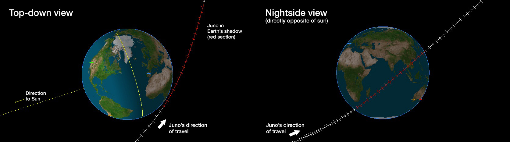
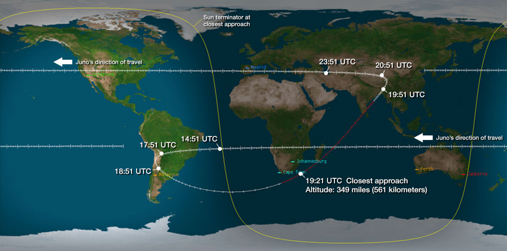
Trajectory Map of Juno’s Earth Flyby on Oct. 9, 2013
The Earth gravity assist is required to accelerate Juno’s arrival at Jupiter on July 4, 2016 and will capture an unprecedented movie of the Earth/Moon system. Credit: NASA/JPL
Details on how to watch via Slooh – see below [/caption]
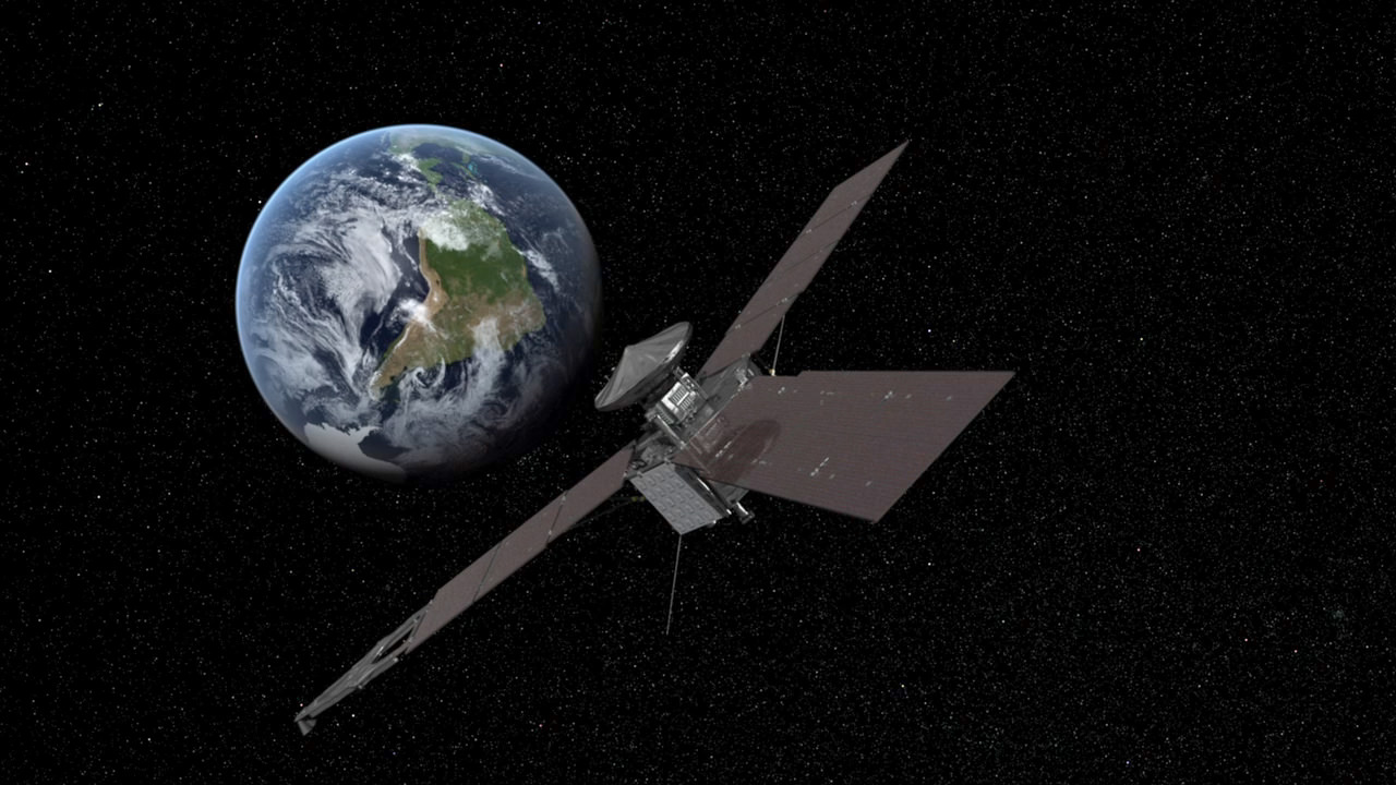
NASA’s solar powered Jupiter-bound Juno orbiter is careening towards Earth for an absolutely critical gravity assisted fly by speed boost while capturing an unprecedented movie view of the Earth/Moon system – on its ultimate quest to unveiling Jupiter’s genesis!
“Juno will flyby Earth on October 9 to get a gravity boost and increase its speed in orbit around the Sun so that it can reach Jupiter on July 4, 2016,” Juno chief scientist Dr. Scott Bolton told Universe Today in an exclusive new Juno mission update – as the clock is ticking to zero hour. “The closest approach is over South Africa.”
All this ‘high frontier’ action comes amidst the utterly chaotic US government partial shutdown, that threatened the launch of the MAVEN Mars orbiter, has halted activity on many other NASA projects and stopped public announcements of the safe arrival of NASA’s LADEE lunar orbiter on Oct. 6, Juno’s flyby and virtually everything else related to NASA!
Bolton confirmed that the shutdown fortunately hasn’t altered or killed Juno’s flyby objectives. And ops teams at prime contractor Lockheed Martin have rehearsed and all set.
And some more good news is that Slooh will track the Juno Earth Flyby “LIVE” – for those hoping to follow along. Complete details below!
“The shutdown hasn’t affected our operations or plans, Bolton told me. Bolton is Juno’s principal investigator from the Southwest Research Institute (SwRI), San Antonio, Texas.
“Juno is 100% healthy.”
“But NASA is unable to participate in our public affairs and press activities,” Bolton elaborated.
97% of NASA’s employees are furloughed – including public affairs – due to the legal requirements of the shutdown!
A full up science investigation of our Home Planet by Juno is planned, that will also serve as a key test of the spacecraft and its bevy of state of the art instruments.
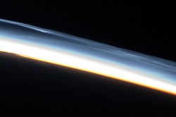
“During the earth flyby we have most of our instruments on and will obtain a unique movie of the Earth Moon system on our approach.
“We will also calibrate instuments and measure earth’s magnetosphere, obtain closeup images of the Earth and the Moon in UV [ultraviolet] and IR [infrared],” Bolton explained to Universe Today.
The flyby will accelerate the spacecraft’s velocity by 16,330 mph.
Where is the best view of Juno’s flyby, I asked?
“The closest approach is over South Africa and is about 500 kilometers [350 miles],” Bolton replied.
The time of closest approach is 3:21 p.m. EDT (12:21 PDT / 19:21 UTC) on Oct. 9, 2013
Watch this mission produced video about Juno and the Earth flyby:
Video caption: On Oct. 9, 2013, NASA’s Jupiter-bound Juno spacecraft is making a quick pass to get a gravity boost from the mother planet. Dr. Scott Bolton of Southwest Research Institute® is the Juno mission principal investigator, leading an international science team seeking to answer some fundamental questions about the gas giant and, in turn, about the processes that led to formation of our solar system.
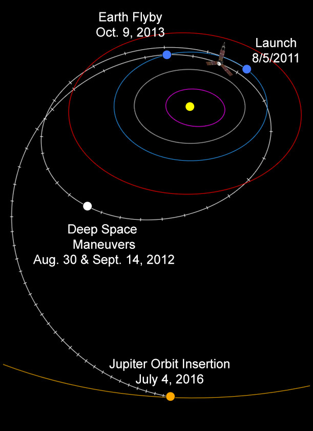
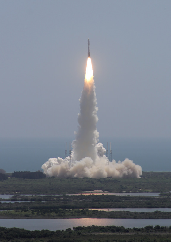
NASA’s Juno spacecraft blasted off atop an Atlas V rocket two years ago from Cape Canaveral Air Force Station, FL, on Aug. 5, 2011 to begin a 2.8 billion kilometer science trek to discover the genesis of Jupiter hidden deep inside the planet’s interior.
Juno is on a 5 year and 1.7 Billion mile (2.8 Billion km) trek to the largest planet in our solar system. When it arrives at Jupiter on July 4, 2016, Juno will become the first polar orbiting spacecraft at the gas giant.
During a one year science mission – entailing 33 orbits lasting 11 days each – the probe will plunge to within about 3000 miles of the turbulent cloud tops and collect unprecedented new data that will unveil the hidden inner secrets of Jupiter’s genesis and evolution.
The goal is to find out more about the planets origins, interior structure and atmosphere, observe the aurora, map the intense magnetic field and investigate the existence of a solid planetary core
Why does Juno need a speed boost from Earth?
“A direct mission to Jupiter would have required about 50 percent more fuel than we loaded,” said Tim Gasparrini, Juno program manager for Lockheed Martin Space Systems, in a statement.
“Had we not chosen to do the flyby, the mission would have required a bigger launch vehicle, a larger spacecraft and would have been more expensive.”
Viewers near Cape Town, South Africa will have the best opportunity to view the spacecraft traveling across the sky.
Juno itself will most likely not be visible to the unaided eye, but binoculars or a small telescope with a wide field should provide an opportunity to view, according to a Slooh statement.
Slooh will track Juno live on October 9th, 2013.
Check here for international starting times: http://goo.gl/7ducFs – and for the Slooh broadcast hosted by Paul Cox.
Viewers can view the event live on Slooh.com using their computer or mobile device, or by downloading the free Slooh iPad app in the iTunes store. Questions can be asked during the broadcast via Twitter by using the hashtag #nasajuno -says Slooh.
Amidst the government shutdown, Juno prime contractor Lockheed Martin is working diligently to ensure the mission success.
Because there are NO 2nd chances!
“The team is 100 percent focused on executing the Earth flyby successfully,” said Gasparrini.
“We’ve spent a lot of time looking at possible off-nominal conditions. In the presence of a fault, the spacecraft will stay healthy and will perform as planned.”
Stay tuned here for continuing Juno, LADEE, MAVEN and more up-to-date NASA news.
And be sure to check back here for my post-flyby update.
What’s not at all clear is whether Juno will detect any signs of ‘intelligent life’ in Washington D.C.!
…………….
Learn more about Juno, LADEE, MAVEN, Curiosity, Mars rovers, Cygnus, Antares, SpaceX, Orion, the Gov’t shutdown and more at Ken’s upcoming presentations
Oct 8: “NASA’s Historic LADEE Lunar & Antares/Cygnus ISS Rocket Launches from Virginia”& “Curiosity, MAVEN, Juno and Orion updates”; Princeton University, Amateur Astronomers Assoc of Princeton (AAAP), Princeton, NJ, 8 PM