
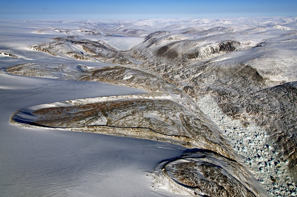
Enjoy this tour of the Arctic and Greenland, courtesy of the pilots of IceBridge, a six-year NASA mission to survey the ice at both of Earth’s poles. These views come from NASA’s P-3B aircraft, and the video is a selection of some of the best footage from the forward and nadir cameras mounted to the aircraft taken during IceBridge’s spring deployment over Greenland and the Arctic Ocean.
This airborne mission is collecting radar, laser altimetry, and other data on the changing ice sheets, glaciers, and sea ice of the Arctic and Antarctic. It is the largest airborne survey of Earth’s polar ice ever flown, and it will provide an unprecedented three-dimensional view of Arctic and Antarctic ice sheets, ice shelves and sea ice. These flights will provide a yearly, multi-instrument look at the behavior of the rapidly changing features of the Greenland and Antarctic ice.
Data collected during IceBridge will help scientists bridge the gap in polar observations between NASA’s Ice, Cloud and Land Elevation Satellite (ICESat) — in orbit since 2003 — and ICESat-2, planned for late 2015. ICESat stopped collecting science data in 2009, making IceBridge critical for ensuring a continuous series of observations.
Find out more about the mission and see more images and videos at the Operation IceBridge website.
Nice way to start a Tuesday morning.
ditto!
Awesome
Proud to be an American taxpayer.
I’ve enjoyed some fantastic flights over Greenland, but at 36,000 feet. This imagery, from much lower, is a delight.
I’ll never understand why people would choose an aisle seat! Looking down on the planet, even from commercial aircraft, I feel like a greek god. It’s constantly compelling, from crop irrigation circles, to Slick Rock in Utah, to the Alps, strange military formations in the desert, the Mississippi, Great Lakes, and more. Other planes, cloud formations, thunderstorms all provide steady entertainment. Beets the crap outta the onboard TV schlock. I’ve even been treated to the Aurora Borealis a few times. If I book a flight from California to Europe, you’d better believe I want a North facing window seat for the nighttime arctic fly-by!
Now, I try to run a GPS or smartphone near the window, and if I spot something curious on the ground, I use Google Earth later on to see what it was. Just last month, I spotted some crop irrigation circles, but the farmer had written the word “OBEY” in massive green letters next to the circle. Got a picture of it, but never found it on Google Earth. I suppose, being plant, it was ephemeral…but what was the farmer’s message?
I hate packing, jet lag, ground transfers, and airports, but I sure do love the flight!