Hakuto-R Spacecraft Just Captured its Own Stunning Version of ‘Earthrise’

The Hakuto-r lunar lander took this 'Earthrise"-like image from its current location in lunar orbit. Credit: ispace.

The Hakuto-R lunar lander, currently in orbit around the Moon, just captured a beautiful “Earthrise”-like image, and one with an interesting side note. The Mission 1 lander, from the Tokyo-based commercial company ispace, took the image during the time of the April 20 solar eclipse, where totality was visible in Australia; and so the photo includes a perfect view of the shadow of the Moon passing above the Land Down Under.

The spacecraft was approximately 100 km (60 miles) above the lunar surface when it took the photo.

Continue reading “Hakuto-R Spacecraft Just Captured its Own Stunning Version of ‘Earthrise’”

NASA’s Aqua Satellite Watches Ships Crossing the Atlantic Ocean

Images acquired of the Aqua satellite of the sea lanes off the coast of Portugal, taken on January 16th, 2018. Credit: NASA/Jeff Schmaltz, LANCE/EOSDIS Rapid Response

Earth, when viewed from space, is a pretty spectacular thing to behold. From orbit, one can see every continent, landmass, and major feature. Weather patterns are also eerily clear from space, with everything from hurricanes to auroras appearing as a single system. On top of that, it is only from orbit that the full extent of human activity can be truly appreciated.

For instance, when one hemisphere of Earth passes from day into night, one can see the patchwork of urban development by picking out the filamentary structure of lights. And as NASA’s Aqua satellite recently demonstrated with a high-resolution image it captured over the Atlantic Ocean, ships criss-crossing the ocean can also create some beautiful patterns.

As part of the NASA-centered international Earth Observing System (EOS), the Aqua satellite was launched on May 4th, 2002, to collect information on Earth’s water cycle. Using a suite of six Earth-observing instruments, this satellite has gathered global data on ocean evaporation, water vapor in the atmosphere, clouds, precipitation, soil moisture, sea ice, land ice, and snow cover.

NASA’s Aqua Earth-observing satellite. Credit: NASA

The image was acquired on January 16th, 2018, by the Moderate Resolution Imaging Spectroradiometer (MODIS). Pictured in this image are ships off the coast of Portugal and Spain producing cloud trails known as ship tracks. Some of these tracks stretch for hundreds of kilometers and grow broader with distance – i.e. the narrow ends are the youngest while the broader, wavier ends are older.

These clouds form when water vapor condenses around tiny particles of pollution emitted by the ship’s exhaust. This is due to the fact that some particles generated by ships (like sulfates) are soluble in water and seeds clouds. This also causes light hitting these clouds to scatter in many directions, making them appear brighter and thicker than unpolluted maritime clouds (which are seeded by larger particles like sea salt).

As always, seeing things from space provides an incredible sense of perspective. This is especially helpful when attempting to monitor and model something as complex as Earth’s environment and humanity’s impact on it. And of course, it also allows for some breathtaking photos!

Further Reading: NASA

You Can’t See the Great Wall of China From Space, But You Can See Their Giant Solar Farm

A view from Earth orbit of the Longyangxia Dam Solar Park in China. Credit: NASA/Landsat 8.

While the Great Wall of China is not readily visible from space (we debunked that popular myth here) there are several other human-built structures that actually can be seen from space. And that list is growing, thanks to the large solar farms being built around the world.

The solar farm with the current distinction of being the largest in the world — as of February 2017 – is the Longyangxia Dam Solar Park in China. These new images from NASA’s Landsat 8 satellite show the farm’s blue solar panels prominently standing out on the brown landscape of the western province of Qinghai, China. Reportedly, the solar farm covers 27 square kilometers (10.42 square miles), and consists of nearly 4 million solar panels.

You can see in the image below from 2013 that the farm has been growing over the years. The project has cost the amount of 6 billion yuan ($889.5 million).

The orbital view from April 16, 2013
of the Longyangxia Dam Solar Park in China. Credit: NASA/Landsat 8.

China wants to shed its title of the biggest polluter in the world and is now investing in clean, renewable energy. It has a goal of producing 110 GW of solar power and 210 GW of wind power by the year 2020. That sounds like a lot, but in a country of 1.4 billion people that relies heavily on coal, it amounts to less than 1 percent of the country’s more than 1,500 gigawatts of total power generation capacity, says Inside Climate News.

According to NASA, China is now the world’s largest producer of solar power, however Germany, Japan, and the United States produce more solar power per person.

China has another solar farm in the works that will have a capacity of 2,000 MW when it is finished.

Here’s another wider-angle view from Landsat 8 of the Longyangxia Dam and lake near the solar farm.

The Longyangxia Dam Solar Park as seen from orbit on January 5, 2017. Credit: NASA/Landsat 8.

Source: Landsat

Gorgeous Views of Earth from Space Ring in New Year 2016 From the Space Station and Beyond

Earth from GOES East

Happy New Year 2016 from the International Space Station (ISS) and Beyond!

Behold Earth ! Courtesy of our Human and Robotic emissaries to the High Frontier we can ring in the New Year by reveling in gorgeous new views of our beautiful Home Planet taken from the space station and beyond. Continue reading “Gorgeous Views of Earth from Space Ring in New Year 2016 From the Space Station and Beyond”

This is Our Planet From a Million Miles Away

Earth imaged on July 6, 2015 by NOAA's DSCOVR satellite from L1. Credit: NOAA/NASA/GSFC

This picture of our home planet truly is EPIC – literally! The full-globe image was acquired with NASA’s Earth Polychromatic Imaging Camera (aka EPIC; see what they did there) on board NOAA’s DSCOVR spacecraft, positioned nearly a million miles (1.5 million km) away at L1.

L1 is one of five Lagrange points that exist in space where the gravitational pull between Earth and the Sun are sort of canceled out, allowing spacecraft to be “parked” there. (Learn more about Lagrange points here.) Launched aboard a SpaceX Falcon 9 on Feb. 11, 2015, the Deep Space Climate Observatory (DSCOVR) arrived at L1 on June 8 and, after a series of instrument checks, captured the image of Earth’s western hemisphere above on July 6.

The EPIC instrument has the capability to capture images in ten narrowband channels from infrared to ultraviolet; the true-color picture above was made from images acquired in red, green, and blue visible-light wavelengths.

More than just a pretty picture of our blue marble, this image will be used by the EPIC team to help calibrate the instrument to remove some of the blue atmospheric haze from subsequent images. Once the camera is fully set to begin operations daily images of our planet will be made available on a dedicated web site starting in September.

DSCOVR's location at L1 (NOAA/NASA)
DSCOVR’s location at L1 (NOAA/NASA)

Designed to provide early warnings of potentially-disruptive geomagnetic storms resulting from solar outbursts, DSCOVR also carries Earth-observing instruments that will monitor ozone and aerosols in the atmosphere and measure the amount of energy received, reflected, and emitted by Earth – the planet’s “energy budget.

But also, from its permanent location a million miles away, DSCOVR will be able to get some truly beautiful – er, EPIC – images of our world.

DSCOVR is a joint mission between NOAA, NASA, and the U.S. Air Force. Learn more about DSCOVR here.

Source: NASA

UPDATE: President Obama liked this image so much, he decided to Tweet about it with a message of planetary conservation!

The POTUS' Tweet about the DSCOVR image on July 20, 2015.
The POTUS’ Tweet about the DSCOVR image on July 20, 2015.

UPDATE 7/29/15: Here’s another view from DSCOVR on July 6, showing Europe, Africa, and the Middle East:

DSCOVR image of Earth from July 6, 2015. (NASA/NOAA)

Exquisite Views of Earth’s Cities Featured in First Ultra HD Videos from Space Station

The UrtheCast Corp. Iris camera aboard the International Space Station taking ultra HD video of Earth. Credit: NASA/UrtheCast

A trio of Earth’s cities come to life like never before with today’s (June 17) publication of the first ever full-color, ultra High Definition full color videos captured by a new commercial camera installed aboard the International Space Station (ISS) that was developed and built by the Canadian-based company UrtheCast Corp.

See Boston, Barcelona and London up close and alive like you’ve never seen them before in the exquisite HD Vimeo videos featured above and below. Indeed the high def videos are “unparalled” says Urthecast.

“These are the the world’s first, full-color HD videos of Earth, filmed from the International Space Station (ISS),” said Urthecast. They have roughly one-meter resolution.

Be sure to click to enlarge the videos to get the full majesty of these cities from space.

Amazingly, you can even watch cars drive along freeways and shipping containers zipping along waterways in the video shot by Iris, UrtheCast’s Ultra HD video camera bolted to the exterior of the massive outpost that’s orbiting Earth at an altitude of some 250 miles (400 kilometers).

“Today, we are continuing our advancement towards democratizing the Earth Observation industry, making timely Earth video and imagery from space accessible to everyone,” explained Scott Larson, UrtheCast Co-founder and Chief Executive Officer, in a statement.

In the lead video of the city of Boston, United States, above you get a glimpse of “fabled Fenway Park in HD” from the Iris camera aboard the ISS.
“Fenway, the oldest ball park in Major League Baseball and the home of the Boston Red Sox, sits aside the Charles River and the beautiful Emerald Necklace — a linear string of parks and rivers,” notes the Urthecast description.

UrtheCast’s goal is to provide “Ultra HD video and still imagery of Earth that will allow for monitoring of the environment, humanitarian relief, social events, agricultural land, etc,” says the company on its website.

The three videos from the Iris full color HD camera cover areas in each of the three cities ranging up to 1.19 x 0.67 miles (1.92 x 1.08 kms) “that is, as of yet, unparalleled.”

Here’s the full color HD video of London, United Kingdom:

Video caption: London, United Kingdom. Like peering out over the Thames River from your airplane window — see a Tube train depart, the London Eye spin, and cars circle Charing Cross. Captured from the International Space Station at roughly one-meter resolution, UrtheCast’s ‘First Light’ video suite features downtown London, England, showcasing the nucleus of one of Europe‘s most populous cities. Credit: UrtheCast

“With the ultimate goal of connecting the planet and highlighting what unites us all, we’re revealing a perspective of Earth from space that was previously reserved for a small few. By opening up our API to the web development community, we’re providing collaboration tools that will help people monitor, protect, and benefit our world and will lead to the democratization of Earth Observation imagery,” noted Larsen.

Here’s the full color HD video of Barcelona, Spain:

Barcelona, Spain. Colourful shipping containers zip around the Port of Barcelona in this ‘First Light’ UrtheCast video, captured at roughly one-meter resolution from the International Space Station. To the left of the frame, high atop Montjuïc hill, lies the site of the 1992 Olympics, settled against the shore of the Balearic Sea. Credit: UrtheCast

UrtheCast says it expects Iris to achieve Initial Operation Capability (IOC) status sometime this summer. Their medium-resolution, Theia, achieved IOC status in 2014 “and is actively filling orders for imagery and data.”

Both cameras were flown to the ISS on Russian spacecraft and installed on the exterior of the Russian segment by Russian cosmonauts.

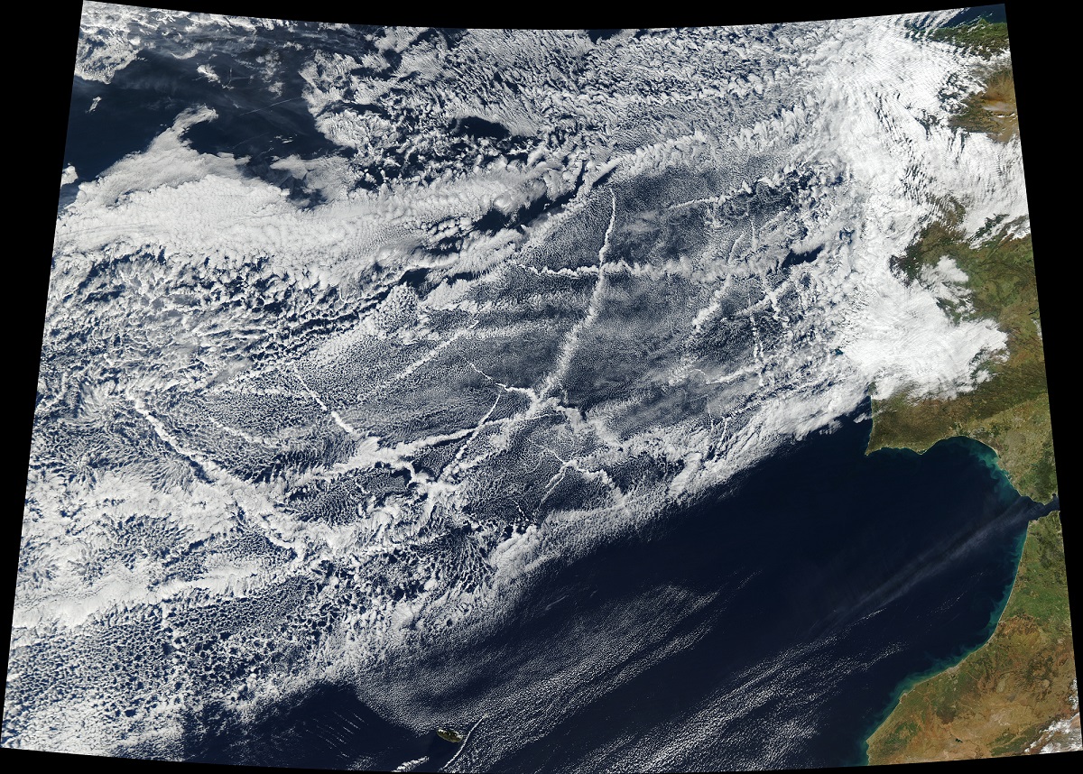
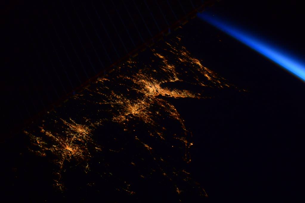
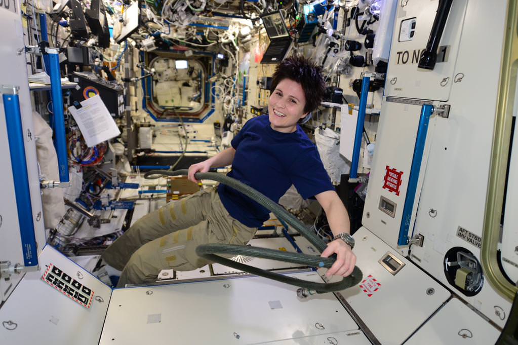
Meanwhile, the human crews aboard the ISS continue to capture breathtaking imagery with hand held cameras.

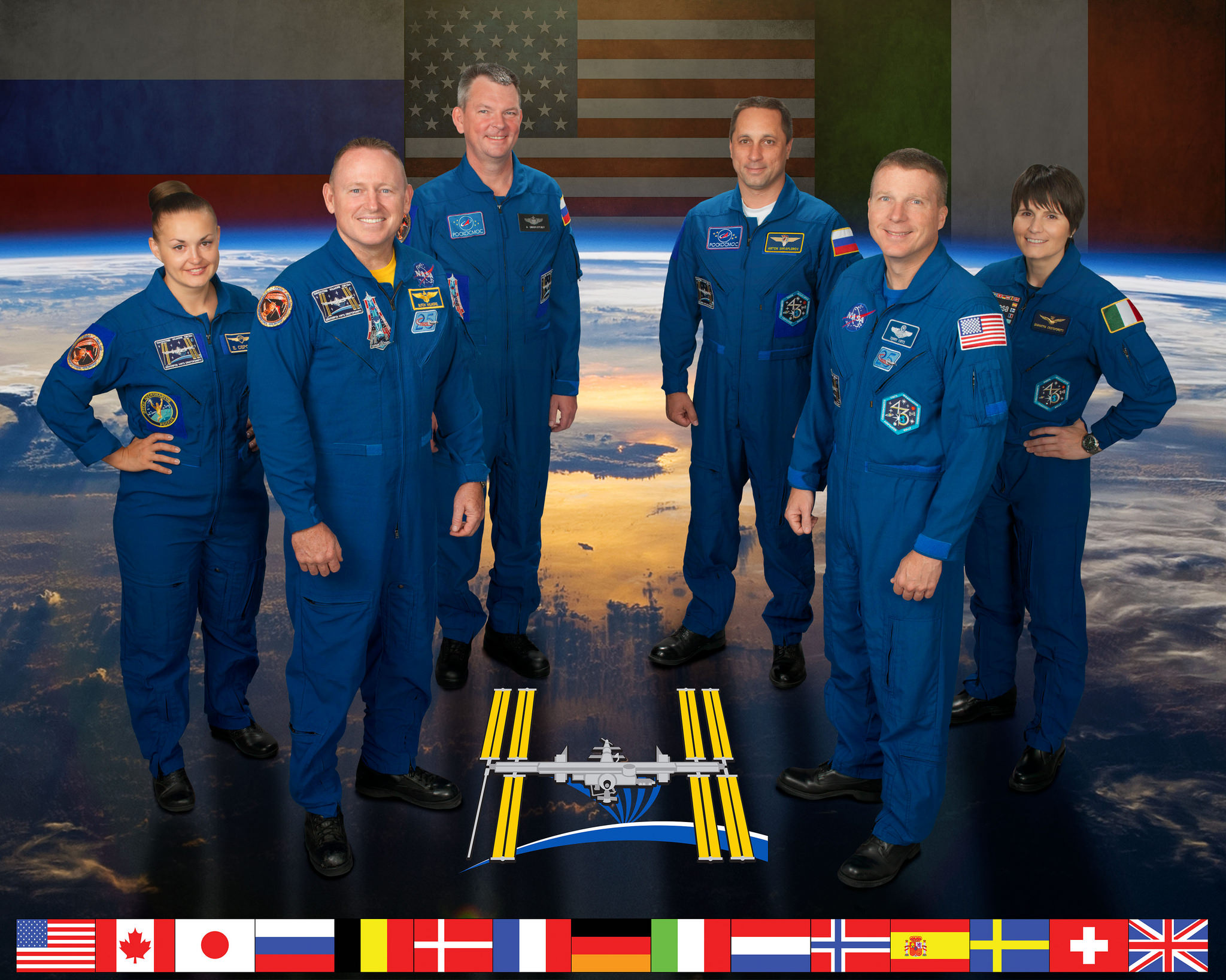
So be sure to check out my popular story about the dazzling image of the Great Pyramids from the space station taken by NASA astronaut Terry Virts – the commander of Expedition 43. Virts just returned home from the station last week, as detailed in my story here.

Stay tuned here for Ken’s continuing Earth and planetary science and human spaceflight news.

Ken Kremer

Gorgeous Sunrises, Auroras, Landscapes, and More from Space Station Crew

Almost disappearing behind the solar panels before sunrise: the US East coast from DC to Boston. #HelloEarth. Credit: NASA/ESA/Samantha Cristoforetti

The Expedition 42 crew aboard the International Space Station (ISS) continues to delight us with stunning views of ‘Our Beautiful Earth from Space.’

Here’s a collection of a few of the newest sunrises, auroras, landscapes, nightlights, and more snapshots from the multinational crew of six astronauts and cosmonauts living and working aboard the ISS orbiting some 250 miles (400 kilometers) overhead.

And don’t forget that at sunset tonight (Feb. 8), a SpaceX Falcon 9 rocket is due to blastoff at 6:10 p.m., EST, if all goes well carrying the DSCOVR space weather satellite about a million miles (1.5 million kilometers) away to the L1 Lagrange point.

The Falcon 9 will blastoff from Cape Canaveral, Florida, pictured below:

From Key West to the Gulf of Mexico and #Atlanta, a very nice, clear, half moonlit night.  Credit: NASA/Terry Virts.   KSC and Cape Canaveral launch pads along Florida east coast at right.
From Key West to the Gulf of Mexico and #Atlanta, a very nice, clear, half moonlit night. Credit: NASA/Terry Virts.
KSC and Cape Canaveral launch pads along Florida east coast at right.

Tens of millions of you are included in the lead sunrise photo of the U.S. East Coast – taken by ESA astronaut Samantha Cristoforetti perched aboard the orbiting lab complex.

And here’s a “speechless sunrise” taken today by NASA astronaut Terry Virts. We agree!

#speechless from this #sunrise.   Credit: NASA/Terry Virts
#speechless from this #sunrise. Credit: NASA/Terry Virts

Always happy to see this lovely sight that has become familiar in #Patagonia.  Credit: NASA/ESA/Samantha Cristoforetti
Always happy to see this lovely sight that has become familiar in #Patagonia. Credit: NASA/ESA/Samantha Cristoforetti

This, on the contrary, I've seen only once: the Strait of Magellan and la Tierra del Fuego free of clouds!  Credit: NASA/ESA/Samantha Cristoforetti
This, on the contrary, I’ve seen only once: the Strait of Magellan and la Tierra del Fuego free of clouds! Credit: NASA/ESA/Samantha Cristoforetti

#Moscow shining like a bright star under the aurora.    Credit: NASA/Terry Virts
#Moscow shining like a bright star under the aurora. Credit: NASA/Terry Virts

#aurora over Anchorage and Fairbanks #Alaska.   Credit: NASA/Terry Virts
#aurora over Anchorage and Fairbanks #Alaska. Credit: NASA/Terry Virts

The current six person crew includes astronauts and cosmonauts from three nations; America, Russia and Italy including four men and two women serving aboard the massive orbiting lab complex.

They comprise Expedition 42 Commander Barry “Butch” Wilmore and Terry Virts from NASA, Samantha Cristoforetti from the European Space Agency (ESA) and cosmonauts Aleksandr Samokutyayev, Yelena Serova, and Anton Shkaplerov from Russia.

Brazilian clouds showing off their #majesty.  Credit: NASA/Terry Virts
Brazilian clouds showing off their #majesty. Credit: NASA/Terry Virts

L+72/73: Logbook. Wow, this has been a busy week! But we can still catch up a little bit...  ESA astronaut Samantha Cristoforetti
L+72/73: Logbook. Wow, this has been a busy week! But we can still catch up a little bit… ESA astronaut Samantha Cristoforetti

L+72/73: Logbook. Wow, this has been a busy week! But we can still catch up a little bit… ESA astronaut Samantha Cristoforetti
….https://plus.google.com/app/basic/stream/z12iczzoqovhfdo2z23odnbwmz3cir0ox04?cbp=1hmsp4t51xmr3&sview=27&cid=5&soc-app=115&soc-platform=1&spath=%2Fapp%2Fbasic%2F%2BSamanthaCristoforetti%2Fposts …

Soyuz- everyone’s ride to space and back!

#soyuz #earth #beauty.  Credit: NASA/Terry Virts
#soyuz #earth #beauty. Credit: NASA/Terry Virts

Stay tuned here for Ken’s continuing Earth and planetary science and human spaceflight news.

Ken Kremer

'I wish I could bring all of you up to see this!'  Credit: NASA/Terry Virts
‘I wish I could bring all of you up to see this!’ Credit: NASA/Terry Virts

ISS Expedition 42. Credit: NASA/ESA/Roscosmos

This Is the Very First Photo of Earth From Space

The first photo of Earth from space was taken on Oct. 24, 1947 (Credit: White Sands Missile Range/Applied Physics Laboratory)

These days we see photos of our planet taken from space literally every day. Astronauts living aboard the International Space Station, weather and Earth-observing satellites in various orbits, even distant spacecraft exploring other planets in our Solar System… all have captured images of Earth from both near and far. But there was a time not that long ago when there were no pictures of Earth from space, when a view of our planet against the blackness of the cosmos was limited to the imagination of dreamers and artists and there was nothing but the Moon orbiting our world.

On this day in 1946, before Apollo, before Mercury, even before Sputnik, that was no longer the case.

The image above shows the first photo captured of Earth from space, taken by a camera mounted to a V-2 rocket that was launched from the U.S. Army’s White Sands Missile Range in New Mexico. Taken to the United States by the dozen from Germany after the end of World War II, the V-2 (for “Vergeltungswaffe 2”) missiles were used by the Army to improve on their own rocket designs and also by scientists who were permitted to fill their payloads with experiments.

On October 24, 1946, a V-2 was launched from the Missile Range while a mounted 35mm movie camera captured images every 1.5 seconds. It reached an altitude of 65 miles before crashing back to Earth and, while the camera was destroyed on impact, the film cassette survived. The grainy photo seen above was on that roll, one of our first views of Earth from above the atmosphere.

(Okay, technically there’s still atmosphere above 65 miles — even the ISS orbiting at 260-plus statute miles has to give itself a boost to compensate for drag now and again — but the official aeronautical delineation of “space” begins at about 62 miles, or 100 km: the Kármán Line. V-2 #13 passed that mark in 1946 by 3 miles.)

In the following years more V-2 rockets would be launched, some reaching heights of 100 miles, giving us many more detailed views of our planet as it looks from space and prompting Clyde Holliday, the APL engineer who developed the mounted film cameras, to envision that “the entire land area of the globe might be mapped in this way.”

Assembled panorama of V-2 images taken from an altitude of 60 miles in 1948 (JHUAPL/US Navy)

Now, 68 years later, seeing pictures of Earth from space are a much more common, if no less amazing, occurrence. But it all started with that one launch of a missile designed for war but repurposed for science.

Read more here in an article for Smithsonian’s Air & Space by Tony Reichhardt, and watch a contemporary news reel below about the 1946 V-2 launch:

Source: Air & Space

A Hybrid Solar Eclipse Seen From Earth… and Space

The Elektro-L satellite's view of how the Nov. 3, 2013 solar eclipse effected Earth. Blackness from the eclipse covers Africa. Credit: Elektro-L/Vitaliy EgorovVitaliy Egorov.

The final eclipse for 2013 was a grand event, witnessed across the Atlantic and the heart of Africa this past Sunday. Like so many other photographers along the North American east coast, we were at the ready to greet the partially eclipsed Sun at dawn. And as the shadow of the Moon touched down, teams on land, air and sea were ready to meet with the fleeting umbra as it raced eastward towards sunset over the Horn of Africa region.

But a fleet of spacecraft were also on hand to witness the rare spectacle as well. Turned earthward and sunward, these spacecraft documented not only the passage of the Moon’s shadow over the Earth, but recorded multiple partial solar eclipses from orbit as well.

The first view comes from the Roscosmos Electro-L satellite based in a geostationary orbit over the Indian Ocean:

Electro-L had captured such a view before, during the annular eclipse over Australia earlier this year in May. Roscosmos increased the frame capture rate of Electro-L to twice its usual speed for the sequence. As you watch the Earth pass from a waning gibbous to crescent phase, you can just see the umbra, or central shadow of the Moon, slide into view and come into contact with the sunset terminator over eastern Africa. You can also see the cloud cover that marks the dust storms that plagued eclipse-chasers based around the Lake Turkana region in Kenya.

One of the first public pictures of the umbra of the Moon as seen from space was taken from the Mir space station during a total solar eclipse in 1999. To our knowledge, such a feat has yet to be duplicated aboard the International Space Station. The phase angle of the ISS’s orbit during the eclipse was nearly perpendicular to the Sun-Moon-Earth syzygy, and unfavorable for this particular eclipse.

Thanks to the Russian journalist Vitaliy Egorov for bringing the Electro-L eclipse sequence to the attention of Universe Today!

Next up is a sequence of images from NASA’s Aqua satellite:

Sunday's eclipse and the Moon's umbra as seen from the Aqua satellite. (Credit: NASA/GSFC/Jeff Schmaltz/MODIS Land Rapid Response Team).
Sunday’s eclipse and the Moon’s umbra off of the west coast of Africa as seen from the Aqua satellite. (Credit: NASA/GSFC/Jeff Schmaltz/MODIS Land Rapid Response Team).

Launched in 2002, Aqua is part of the “A-train” (as in “Afternoon”) constellation of Earth-observing satellites. Perched in a low-Earth Sun-synchronous orbit, Aqua caught sight of the umbra of the Moon at around 14:45 UT on Sunday, November 3rd as it raced to make first landfall over the nation of Gabon and awaiting eclipse chasers.

Some Sun observing spacecraft caught sight of the eclipse as well. The European Space Agency’s Proba-2 nabbed three partial solar eclipses from its vantage point in low Earth orbit:

PROBA-2 used its SWAP imager to grab the sequences. Orbiting the Earth once every 99 minutes or 14.5 time a day, these “orbital eclipses” are quick, lasting about 10 minutes each in duration.

Finally, EUMETSAT’s MeteoSat-10 meteorological satellite based in a geostationary orbit over Africa captured an outstanding sequence, showing nearly the entire trek of the umbra across the entire path of the eclipse:

The sequence runs from 7:30 to 18:30 UT on November 3rd. Note how the video shows the shadow fade in and sharpen as the eclipse touches down off of the US East Coast and intensifies from an annular to total along the first 15 seconds of its track, only to speed up and flatten towards sunset over Africa. And all in six seconds!

And back here on Earth, we couldn’t resist stitching together the bounty from our own minor eclipse expedition for a stop-motion view of the partially eclipsed Sun rising over the Vehicle Assembly Building at the Kennedy Space Center in Florida:

We’d like to also mention a photo that isn’t a “solar eclipse seen from space…” Y’know the one, which shows the Earth, the Moon’s shadow, and a totally-eclipsed Sun, against a star dappled Milky Way. We won’t dignify it with a link. This has already been debunked by Bad Astronomer himself Phil Plait, but the bogus pic now seems to make its rounds across ye’ ole Web now during every eclipse. Seriously? Do we all crave “link juice” that bad? There are lots of real awesome eclipse photos out there, from Earth & beyond! Please, do your part to tell that well meaning friend/coworker/relative/stranger on Twitter that this “ultimate eclipse photo…” isn’t.

How rare are hybrid solar eclipses? Well, the next solar eclipse that is both annular and total along its track occurs over southeast Asia on April 20th, 2023. It’s interesting to note that this past weekend’s eclipse may have been the first sunrise solar eclipse over the VAB since it was built in 1966. Eclipses in the same 18 years and 11 days- long saros cycle repeat, but move about 120 degrees westward. Thus, follow an eclipse cycle through a “triple saros”— known as an “Exeligmos,” an ultimate scrabble word if you can land it on a triple word score! —and an eclipse’s geometry will roughly line back up over a 54 year 33 day long span. Saros 143 produced a an eclipse crossing a similar path on October 2nd, 1959 (before the VAB was built!) and will repeat its Atlantic sunrise performance on December 6th, 2067! Let’s see, by then I’ll be…

Could Cassini See You On “The Day The Earth Smiled?”

The face of Earth aimed toward Cassini during imaging on July 19, 2013

So along with the rest of the world, you smiled. You waved. You went outside on July 19, wherever you were, and looked upwards and out into the solar system knowing that our robotic representative Cassini would be capturing a few pixels’ worth of photons bouncing off our planet when they eventually reached Saturn, 900 million miles away. But did Cassini actually capture any photons coming from where you were? The image above will tell you.

Assembled by the Planetary Habitability Laboratory at the University of Puerto Rico at Arecibo (where the enormous 305-meter radio telescope is located) this image shows what side of Earth was facing Cassini when its “pale blue dot” images were obtained, at approximately 22:47 UTC (Cassini time.)

Didn’t make it into Cassini’s photo? That’s ok… maybe MESSENGER had already caught you earlier that very same day:

The view of Earth seen by MESSENGER from Mercury on July 19, 2013

Before Cassini took its images — several hours before, in fact — the MESSENGER spacecraft was holding some photo shoots of its own from 61 million miles in the other direction!

The image above shows the side of Earth that was facing Mercury on the morning of July 19, 2013, when MESSENGER was acquiring images in our direction during a hunt for any possible satellites of the innermost planet.

Earth was as bright (-4.8 magnitude) as the maximum brightness of Venus at the moment the image was taken from Mercury.

Of course, in both series of images specific details of our planet can’t be made out — Earth was barely more than a pixel in size (regardless of any bloom caused by apparent brightness.) Clouds, countries, continents, oceans… the entire population of our world, reduced to a single point of light — a “mote of dust suspended in a sunbeam.”

For both portrayals, high-resolution black and white images from the GOES East and Meteosat meteorological satellites were combined with color information from NASA Visible Earth to generate true-color images of our planet as it would have looked to each respective imaging spacecraft… if they had the impossibly-precise optics to resolve Earth from such distances, of course.

But it’s ok that they don’t… we can still use our imaginations.

Read more here on the PHL’s news release.

Earth from the geostationary weather satellite GOES East on July 19, 2013 at 5 PM EST. This is approximately the view that Cassini would have had of Earth during imaging.

Image credits: PHL @ UPR Arecibo, NASA/Johns Hopkins University Applied Physics Laboratory/Carnegie Institution of Washington, NERC Satellite Station, Dundee University, Scotland. Thanks to Prof. Abel Méndez (PHL/UCR) for the heads-up on these.