
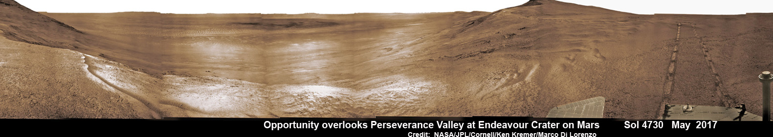
From the precipice of “Perseverance Valley” NASA’s teenaged Red Planet robot Opportunity has begun the historic first ever descent of an ancient Martian gully – that’s simultaneously visually and scientifically “tantalizing” – on an expedition to discern ‘How was it carved?’; by water or other means, Jim Green, NASA’s Planetary Sciences Chief tells Universe Today.
Since water is an indispensable ingredient for life as we know it, the ‘opportunity’ for Opportunity to study a “possibly water-cut” gully on Mars for the first time since they were discovered over four decades ago by NASA orbiters offers a potential scientific bonanza.
“Gullies on Mars have always been of intense interest since first observed by our orbiters,” Jim Green, NASA’s Planetary Sciences Chief explained to Universe Today.
“How were they carved? muses Green. “Water is a natural explanation but this is another planet. Now we have a chance to find out for real!”
Their origin and nature has been intensely debated by researchers for decades. But until now the ability to gather real ‘ground truth’ science by robotic or human explorers has remained elusive.
“This will be the first time we will acquire ground truth on a gully system that just might be formed by fluvial processes,” Ray Arvidson, Opportunity Deputy Principal Investigator of Washington University in St. Louis, told Universe Today.
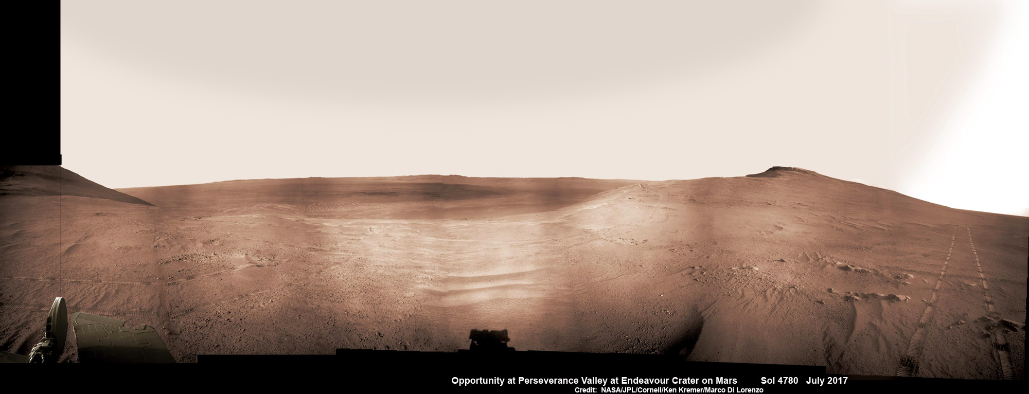
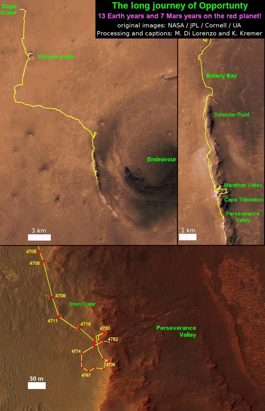
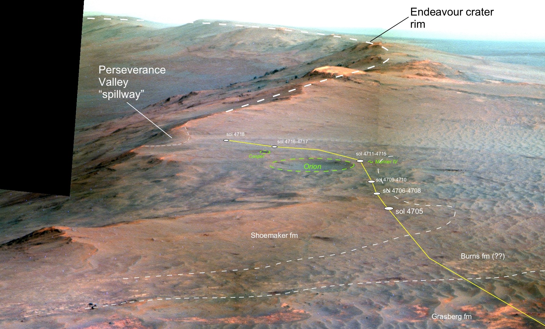
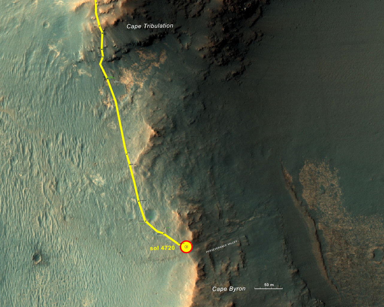
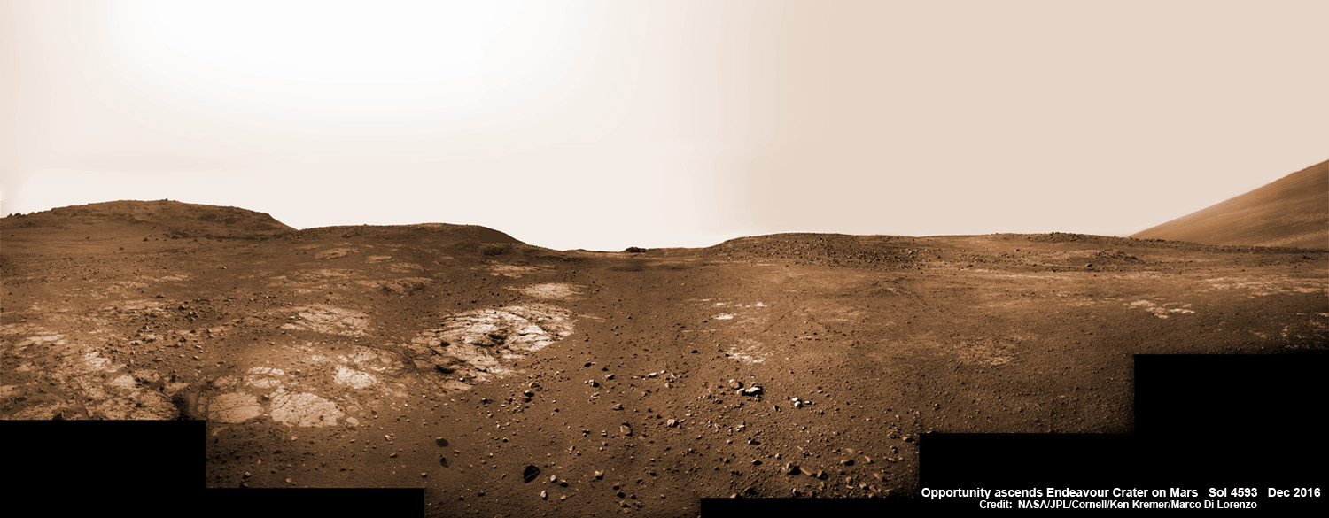
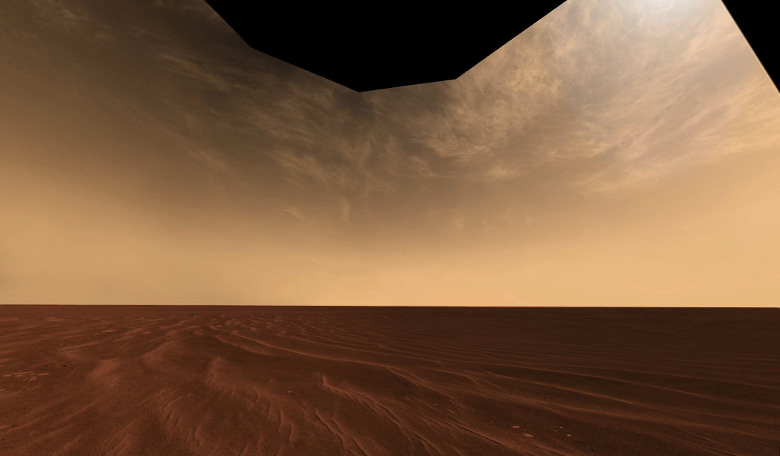
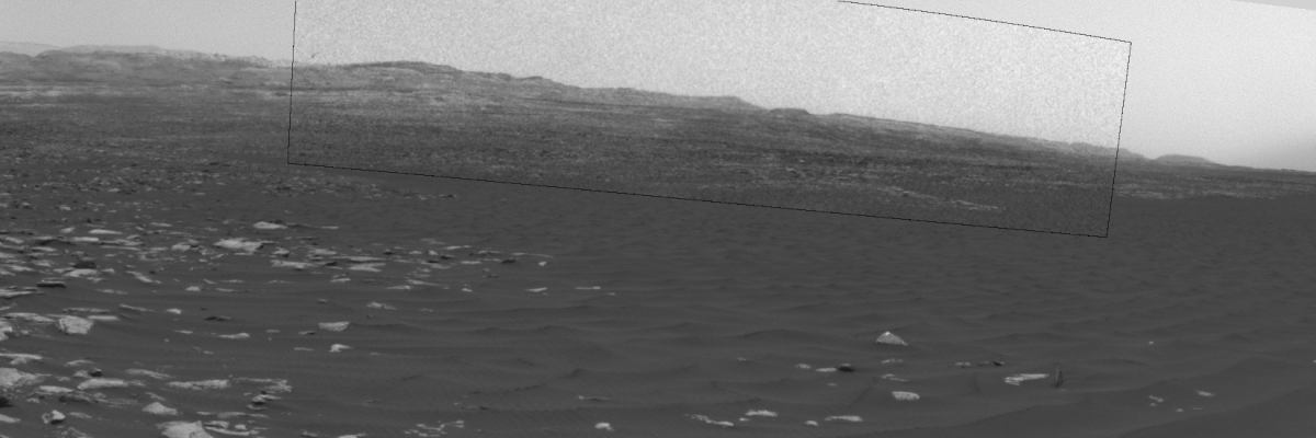
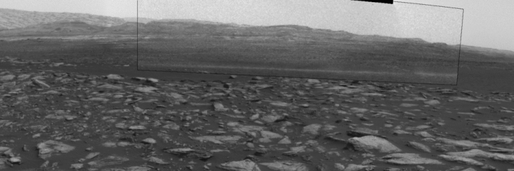
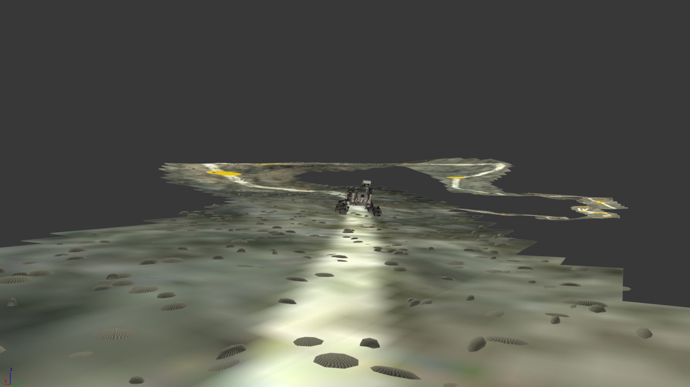
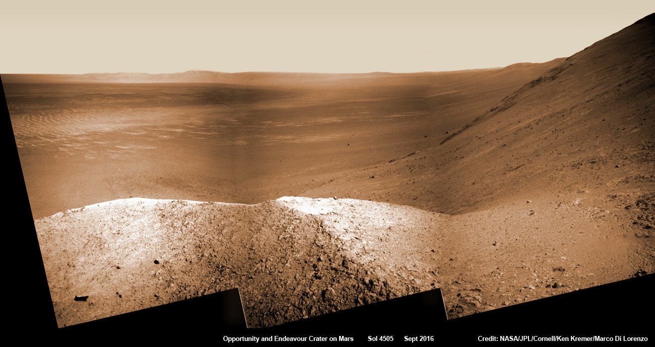
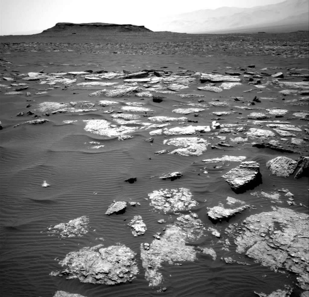
“Perseverance Valley” is located along the eroded western rim of gigantic Endeavour crater – as illustrated by our exclusive photo mosaics herein created by the imaging team of Ken Kremer and Marco Di Lorenzo.
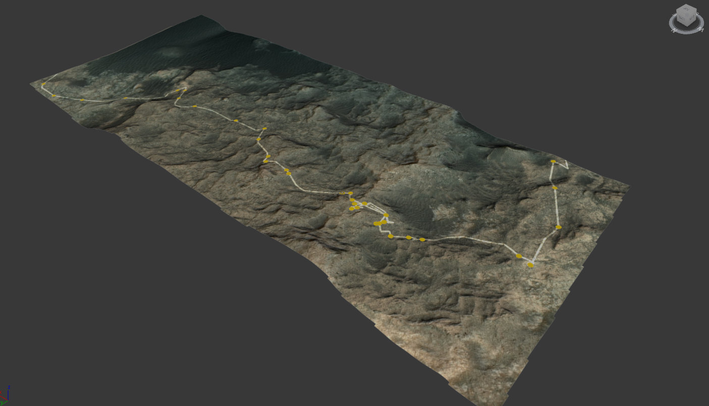
After arriving at the upper entryway to “Perseverance Valley” the six wheeled rover drove back and forth to gather high resolution imagery of the inner slope for engineers to create a 3D elevation map and plot a safe driving path down – as illustrated in our lead mosaic showing the valley and extensive wheel tracks at left, center and right.
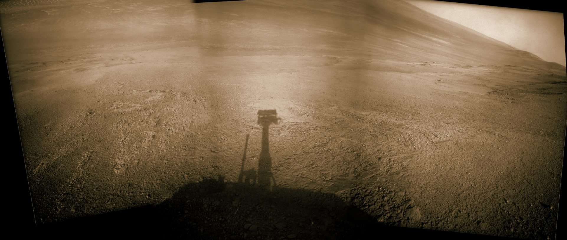
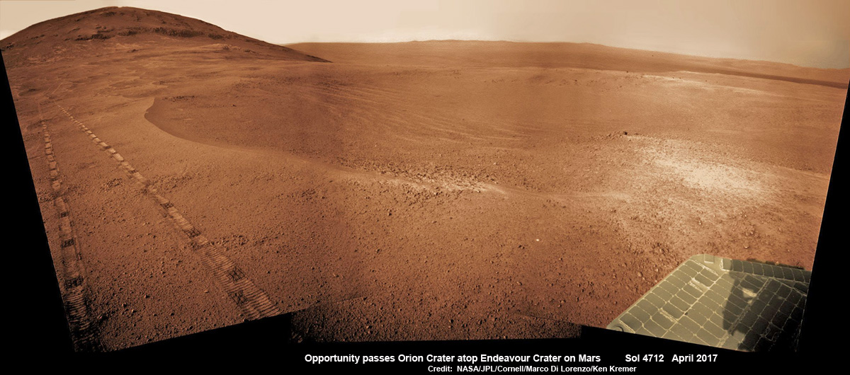
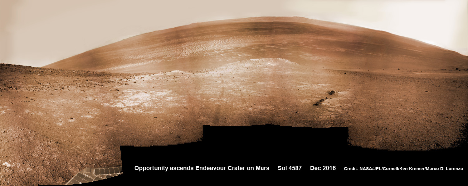
Having just this week notched an astounding 4800 Sols roving the Red Planet, NASA’s resilient Opportunity rover has started driving down from the top of “Perseverance Valley” from the spillway overlooking the upper end of the ancient fluid-carved Martian valley into the unimaginably vast eeriness of alien Endeavour crater.
Water, ice or wind may have flowed over the crater rim and into the crater from the spillway.
“It is a tantalizing scene,” said Opportunity Deputy Principal Investigator Ray Arvidson of Washington University in St. Louis, in a statement. “You can see what appear to be channels lined by boulders, and the putative spillway at the top of Perseverance Valley. We have not ruled out any of the possibilities of water, ice or wind being responsible.”

“With the latest drive on sol 4782, Opportunity began the long drive down the floor of Perseverance Valley here on Endeavour crater, says Larry Crumpler, a rover science team member from the New Mexico Museum of Natural History & Science.
“This is rather historic in that it represents the first time that a rover has driven down an apparent water-cut valley on Mars. Over the next few months Opportunity will explore the floor and sides of the valley for evidence of the scale and timing of the fluvial activity, if that is what is represents.”
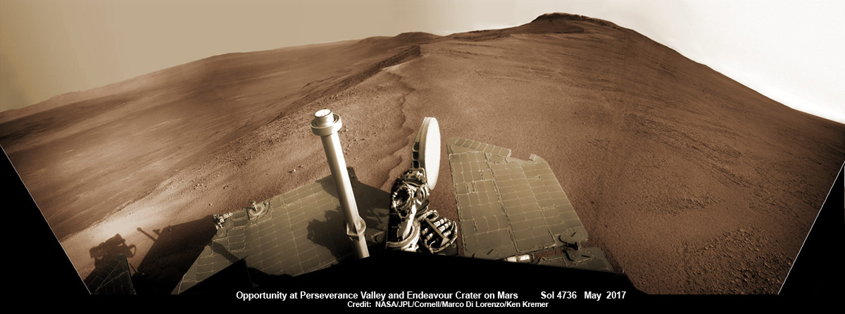
NASA’s unbelievably long lived Martian robot reached a “spillway” at the top of “Perseverance Valley” in May after driving southwards for weeks from the prior science campaign at a crater rim segment called “Cape Tribulation.”
“Investigations in the coming weeks will “endeavor” to determine whether this valley was eroded by water or some other dry process like debris flows,” explains Crumpler.
“It certainly looks like a water cut valley. But looks aren’t good enough. We need additional evidence to test that idea.”
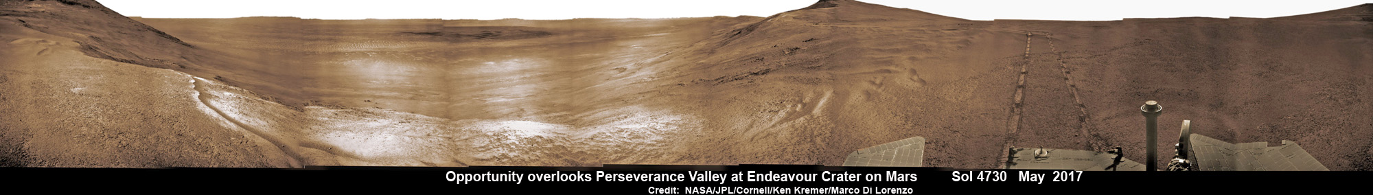
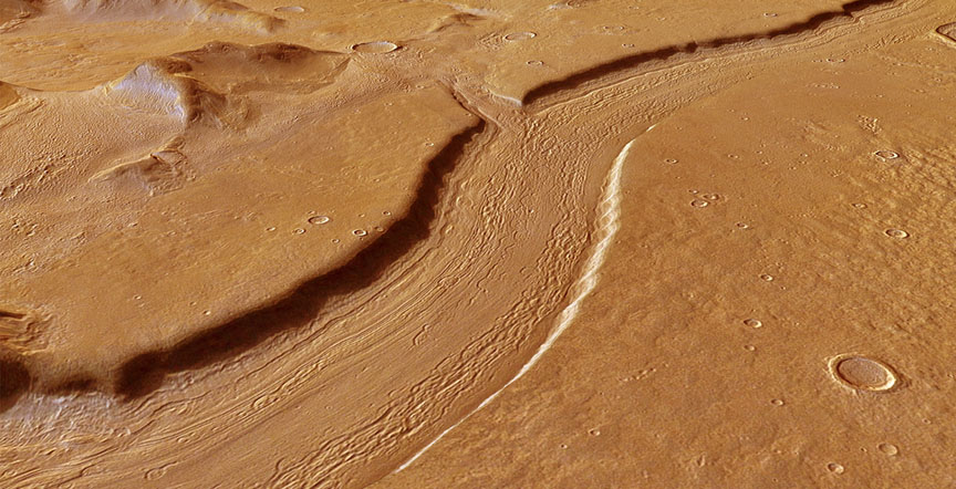
The valley slices downward from the crest line through the rim from west to east at a breathtaking slope of about 15 to 17 degrees – and measures about two football fields in length!
Huge Endeavour crater spans some 22 kilometers (14 miles) in diameter on the Red Planet. Perseverance Valley slices eastwards at approximately the 8 o’clock position of the circular shaped crater. It sits just north of a rim segment called “Cape Byron.”
Why go and explore the gully at Perseverance Valley?
“Opportunity will traverse to the head of the gully system [at Perseverance] and head downhill into one or more of the gullies to characterize the morphology and search for evidence of deposits,” Arvidson elaborated to Universe Today.
“Hopefully test among dry mass movements, debris flow, and fluvial processes for gully formation. The importance is that this will be the first time we will acquire ground truth on a gully system that just might be formed by fluvial processes. Will search for cross bedding, gravel beds, fining or coarsening upward sequences, etc., to test among hypotheses.”
Exploring the ancient valley is the main science destination of the current two-year extended mission (EM #10) for the teenaged robot, that officially began Oct. 1, 2016. It’s just the latest in a series of extensions going back to the end of Opportunity’s prime mission in April 2004.
Before starting the gully descent, Opportunity conducted a walkabout at the top of the Perseverance Valley in the spillway to learn more about the region before driving down.
“The walkabout is designed to look at what’s just above Perseverance Valley,” said Opportunity Deputy Principal Investigator Ray Arvidson of Washington University in St. Louis, in a statwemwent. “We see a pattern of striations running east-west outside the crest of the rim.”
“We want to determine whether these are in-place rocks or transported rocks,” Arvidson said. “One possibility is that this site was the end of a catchment where a lake was perched against the outside of the crater rim. A flood might have brought in the rocks, breached the rim and overflowed into the crater, carving the valley down the inner side of the rim. Another possibility is that the area was fractured by the impact that created Endeavour Crater, then rock dikes filled the fractures, and we’re seeing effects of wind erosion on those filled fractures.”
Having begun the long awaited gully descent, further movements are temporarily on hold since the start of the solar conjunction period which blocks communications between Mars and Earth for about the next two weeks, since Mars is directly behind the sun.
In the meantime, Opportunity will still collect very useful panoramic images and science data while standing still.
The solar conjunction moratorium on commanding extends from July 22 to Aug. 1, 2017.
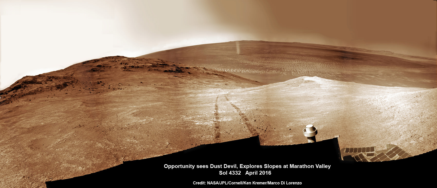
As of today, July 27, 2017, long lived Opportunity has survived over 4800 Sols (or Martian days) roving the harsh environment of the Red Planet.
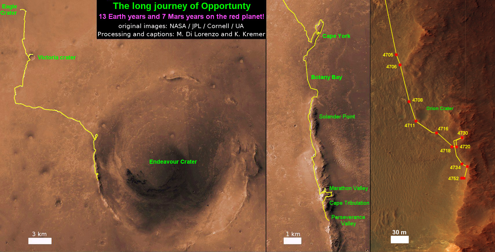
Opportunity has taken over 221,625 images and traversed over 27.95 miles (44.97 kilometers.- more than a marathon.
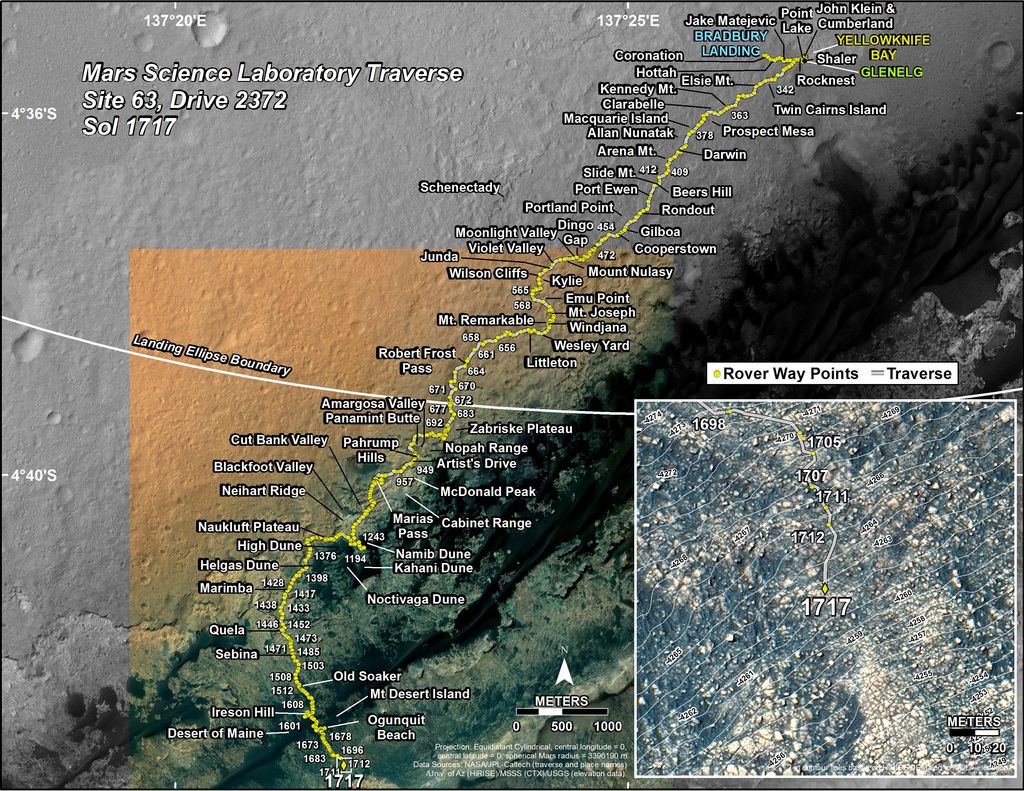
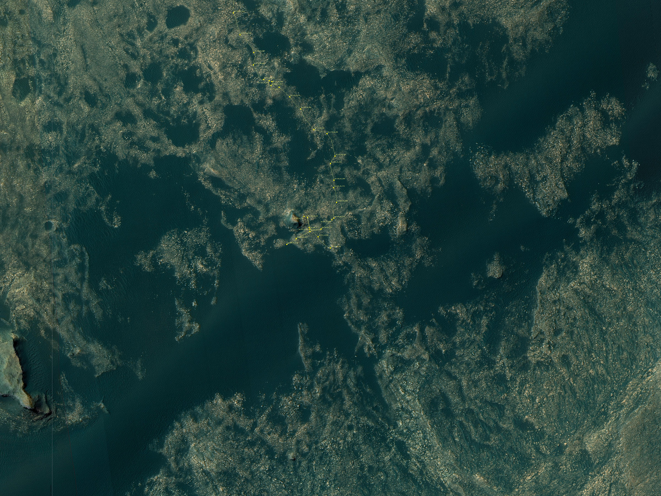
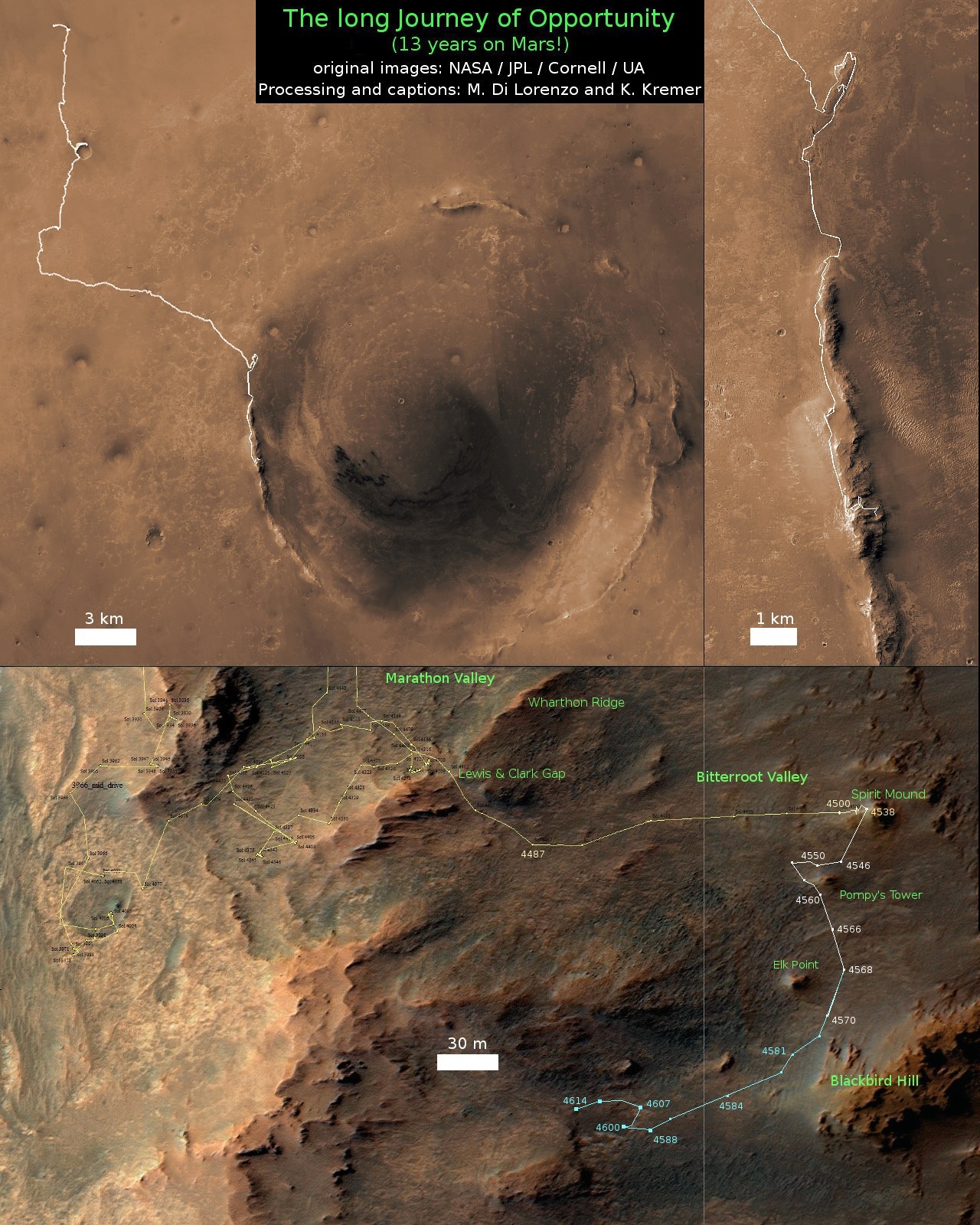
See our updated route map below. It shows the context of the rovers over 13 year long traverse spanning more than the 26 mile distance of a Marathon runners race.
The rover surpassed the 27 mile mark milestone on November 6, 2016 (Sol 4546) and will soon surpass the 28 mile mark.
As of Sol 4793 (July 18, 2017) the power output from solar array energy production is currently 332 watt-hours with an atmospheric opacity (Tau) of 0.774 and a solar array dust factor of 0.534, before heading into another southern hemisphere Martian winter later in 2017. It will count as Opportunity’s 8th winter on Mars.
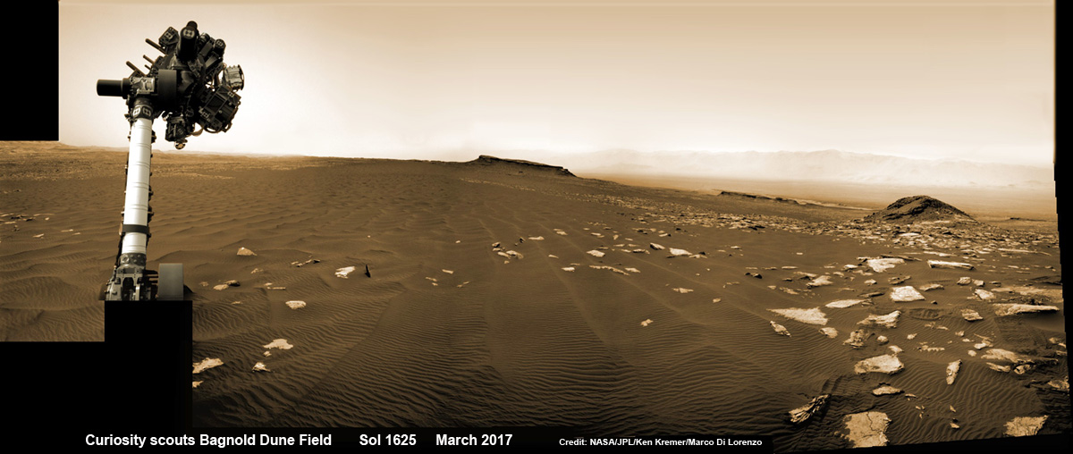
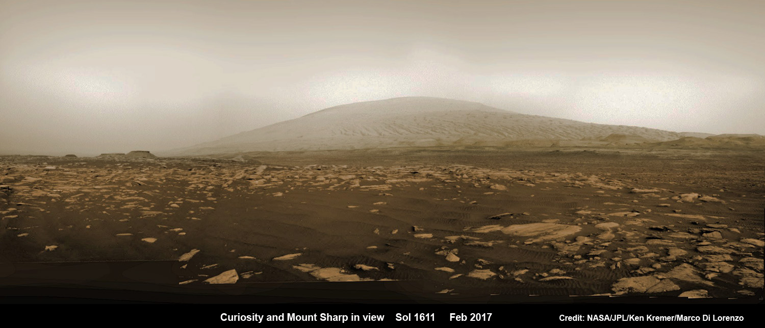
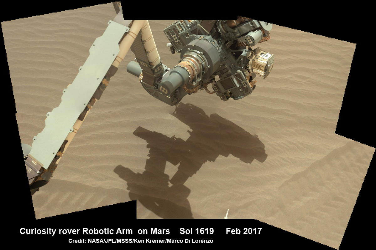
Meanwhile Opportunity’s younger sister rover Curiosity traverses up the lower sedimentary layers at the base of Mount Sharp.
And NASA continues building the next two robotic missions due to touch down in 2018 and 2020.
NASA as well is focusing its human spaceflight efforts on sending humans on a ‘Journey to Mars’ in the 2030s with the Space Launch System (SLS) mega rocket and Orion deep space crew capsule.
Stay tuned here for Ken’s continuing Earth and planetary science and human spaceflight news.


