This Bizarre Image is a 3D Scan of a Cave Network in Spain. This Technology Could be Used to Map Out Lava Tubes on the Moon and Mars

The intricate 3D map of the La Cueva de Los Verdes lava tube system in Lanzarote, Spain. Credit: Vigea – Tommaso Santagata

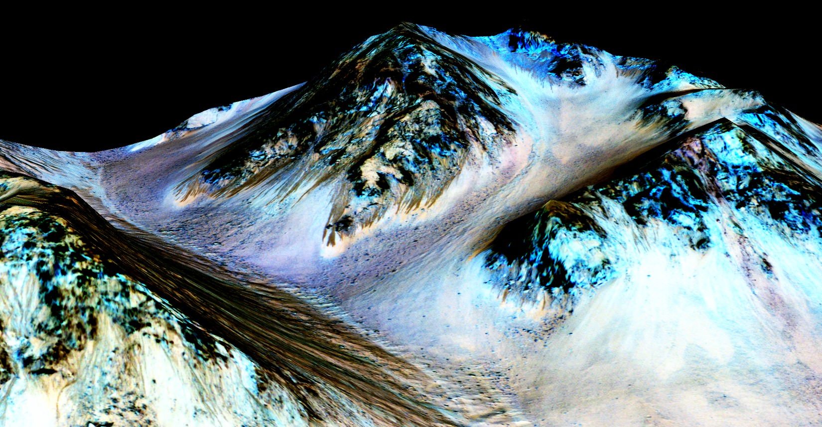
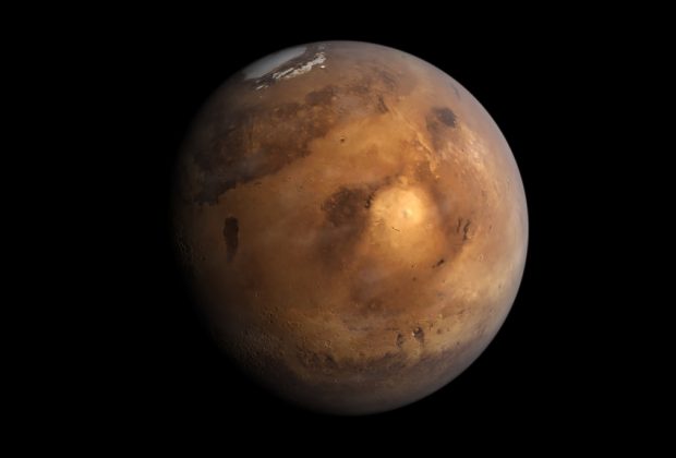
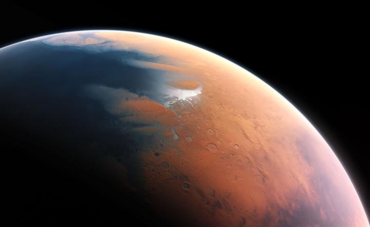
For some time, scientists have known that the Moon and Mars have some fascinating similarities to Earth. In addition to being similar in composition, there is ample evidence that both bodies had active geological pasts. This includes stable lava tubes which are very similar to those that exist here on Earth. And in the future, these tubes could be an ideal location for outposts and colonies.

However, before we can begin choosing where to settle, these locations need to be mapped out to determining which would be suitable for human habitation. Luckily, a team of speleologists (cave specialists), geologists and ESA astronauts recently created the largest 3D image of a lava tube ever created. As part of the ESA’s PANGAEA program, this technology could one day help scientists map out cave systems on the Moon and Mars.

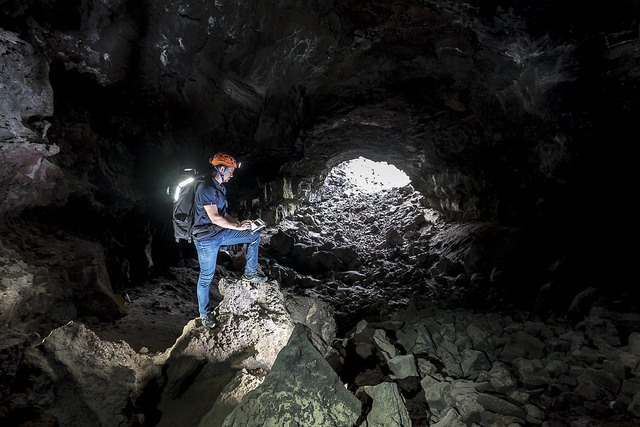
The lava tube in question was the La Cueva de Los Verdes, a famous tourist destination in Lanzarote, Spain. In addition to ESA astronaut Matthias Mauer, the team consisted of Tommaso Santagata (a speleologist from the University of Padova and the co-founder of the Virtual Geographic Agency), Umberto Del Vecchio and Marta Lazzaroni – a geologists and a masters student from the University of Padova, respectively.

Testing out the Leica BLK360 in La Cueva de los Verdes lava tube in Lanzarote, Spain. Credit and Copyright: ESA – Alessio Romeo

Last year, the team mapped the path of this cave system as part of the ESA’s 2017 Pangaea-X campaign. As one of many ESA Spaceflight Analog field campaigns, the purpose of Pangaea-X is to conduct experiments designed to improve the future of the ESA’s Planetary ANalogue Geological and Astrobiological Exercise for Astronauts (PANGAEA) training course.

For five days in November 2017, this campaign mobilized 50 people, four space agencies and 18 organizations in five different locations. The La Cueva de los Verdes lava tube was of particular importance since it is one of the world’s largest volcanic cave complexes, measuring roughly 8 km in length. Some of these caves are even large enough to accommodate residential streets and houses.

During the campaign, Mauer, Santagata, Vecchio and Lazzaroni relied on two instruments to map the lava tube in detail. These included the Pegasus Backpack, a wearable mapping solution that collects geometric data without a satellite ad synchronizes images collected by five cameras and two 3D imaging laser profilers, and the Leica BLK360 – the smallest and lightest imaging scanner on the market.
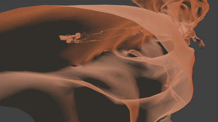
In less than three hours, the team managed to map all the contours of the lava tube. And while the results of the campaign continue to be analyzed, the team chose to use the data they obtained to produce a 3D visual of all the twists and turns of the lava tube. The scan that resulted covers a 1.3 km section of the cave system with an unprecedented resolution of a few centimeters.

Santagata and the Virtual Geography Agency also turned their 3D visual into a lovely video titled “Lave tube fly-through”, which beautifully illustrates the winding and organic nature of the lava tube system.  This video was posted to the ESA’s twitter feed on Tuesday, March 13th (shown above). This video, like the scans that preceded it, represent a breakthrough in geological mapping and astronaut training.

While lava tubes have been mapped since the 1970s, a clear view of this subterranean passage has remained elusive until now. Beyond being the first, the scans the team conducted could also help scientists to study the origins of the cave system, its peculiar formations, and assist local institutions in protecting the subterranean environment. As intended, the scans could also assist future space exploration and colonization efforts.

Pangaea-X arrives at the entrance to La Cueva de los Verdes lava tube. Credit and Copyright: ESA–Robbie Shone

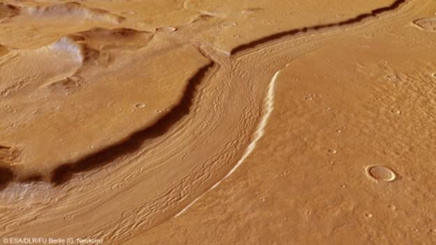
For instance, the 8 km lava tube has both dry and water-filled sections. In the six-kilometer dry section, the lava tube has natural openings (jameos), that are aligned along the top of the cave pathway. These formations are very similar to “skylights” that have been observed on the Moon and Mars, which are holes in the surface that open into stable lava tubes.

Such structures are considered to be a good place for building outposts and colonies since they are naturally shielded from radiation and micrometeorites. Lava tubes also have a constant temperature, therefore offering protection against environmental extremes, and could provide access to underground sources of water ice. Some sections could also be sealed off and pressurized to create a colony.

As such, exploring such environments here on Earth is a good way to train astronauts to explore them on other bodies. As all astronauts know, mapping an environment is the first step in exploration, especially when you are looking for a place to establish a base camp. And in time, this information can be used to establish more permanent settlements, giving rise to eventual colonization.

Further Reading: ESA, Blogs ESA

Opportunity Just Saw its 5,000th Sunrise on Mars

NASA's Mars Exploration Rover Opportunity recorded the dawn of the rover's 4,999th Martian day, or sol, with its Panoramic Camera (Pancam) on Feb. 15, 2018, yielding this processed, approximately true-color scene. Credits: NASA/JPL-Caltech/Cornell/Arizona State Univ./Texas A&M

It’s been a time of milestones for Mars rovers lately! Last month (on January 26th, 2018), NASA announced that the Curiosity rover had spent a total of 2,000 days on Mars, which works out to 5 years, 5 months and 21 days. This was especially impressive considering that the rover was only intended to function on the Martian surface for 687 days (a little under two years).

But when it comes to longevity, nothing has the Opportunity rover beat! Unlike Curiosity, which relied on a Multi-Mission Radioisotope Thermoelectric Generator (MMRTG) for power, the solar-powered Opportunity recently witnessed its five-thousandth sunrise on Mars. This means that the rover has remained in continuous operation for 5000 sols, which works out to 5137.46 Earth days.

This five-thousandth sunrise began on Friday, Feb. 16th, 2018 – roughly 14 Earth years (and 7.48 Martian years) after the rover first landed. From its position on the western rim of the Endeavour Crater, the sunrise appeared over the basin’s eastern rim, about 22 km (14 mi) away. This location, one-third of the way down “Perseverance Valley”, is more than 45 km (28 mi) from Opportunity’s original landing site.

Mosaic view looking down from inside the upper end of “Perseverance Valley” on the inner slope of Endeavour Crater’s western rim. Credit: NASA/JPL/Cornell/Marco Di Lorenzo/Ken Kremer/kenkremer.com

This is especially impressive when you consider that the original science mission was only meant to last 90 sols (92.47 Earth days) and NASA did not expect the rover to survive its first Martian winter. And yet, the rover has not only survived all this time, it continues to send back scientific discoveries from the Red Planet. As John Callas, the Opportunity Project Manager at NASA’s Jet Propulsion Laboratory, explained in a NASA press release:

“Five thousand sols after the start of our 90-sol mission, this amazing rover is still showing us surprises on Mars… We’ve reached lots of milestones, and this is one more, but more important than the numbers are the exploration and the scientific discoveries.”

For instance, the rover has provided us with 225,000 images since its arrival, and revealed that ancient Mars was once home to extensive groundwater and surface water. Beginning in 2008, it began working its way across the  Endeavour Crater in order to get a glimpse deeper into Mars’ past. By 2011, it had reached the crater’s edge and confirmed that mineral-rich water once flowed through the area.

At present, researchers are using Opportunity to investigate the processes that shaped Perseverance Valley, an area that descends down the slope of the western rim of Endeavour Crater. Here too, Opportunity has learned some fascinating things about the Red Planet. For instance, the rover has conducted observations of possible “rock stripes” in the valley, which could be indicative of its valley’s origin.

Textured rows on the ground in this portion of “Perseverance Valley” are under investigation by NASA’s Mars Exploration Rover Opportunity. Credits: NASA/JPL-Caltech

These stripes are of interest to scientists because of the way they resemble rock stripes that appear on mountain slopes here on Earth, which are the result of repeated cycles of freezing and thawing on wet soil. On Mauna Kea, for example, soil freezes every night, but is often dry due to the extreme elevation. This causes soils that have high concentrations of silt, sand and gravel to expand, pushing the larger particles up.

These particles then form stripes as they fall downhill, or are moved by wind or rainwater, and cause the ground to expand less in this space. This process repeats itself over and over, creating a pattern that leads to distinct stripes. As Opportunity observed, there are slopes within the Perseverance Valley where soil and gravel particles appear to have formed into rows that run parallel to the slope, alternating between rows that have more and less gravel.

In the case of the Perseverance Valley’s stripes, scientists are not sure how they formed, but think they could be the result of water, wind, downhill transport, other processes, or a combination thereof. Another theory posits that features like these could be the result of changes in Mars tilt (obliquity) which happen over the course of hundreds of thousands of years.

During these periods, Mars’ axial tilt increases to the point where water frozen at the poles will vaporize and become deposited as snow or frost nearer to the equator. As Ray Arvidson, the Opportunity Deputy Principal Investigator at Washington University, explahttps://www.nasa.gov/feature/jpl/long-lived-mars-rover-opportunity-keeps-finding-surprisesined:

“One possible explanation of these stripes is that they are relics from a time of greater obliquity when snow packs on the rim seasonally melted enough to moisten the soil, and then freeze-thaw cycles organized the small rocks into stripes. Gravitational downhill movement may be diffusing them so they don’t look as crisp as when they were fresh.”

Stone stripes on the side of a volcanic cone on Mauna Kea, Hawaii, which are made of small rock fragments that are aligned downhill. These are formed when freeze-thaw cycles lift them out of the finer-grained regolith and move them to the sides, forming stone stripes. Credits: Washington University in St. Louis/NASA

Having the chance to investigate these features is therefore quite the treat for the Opportunity science team. “Perseverance Valley is a special place, like having a new mission again after all these years.” said Arvidson. “We already knew it was unlike any place any Mars rover has seen before, even if we don’t yet know how it formed, and now we’re seeing surfaces that look like stone stripes. It’s mysterious. It’s exciting. I think the set of observations we’ll get will enable us to understand it.”

Given the state of the Martian surface, it is a safe bet that wind is largely responsible for the rock stripes observed in Perseverance Valley. In this respect, they would be caused by sand blown uphill from the crater floor that sorts larger particles into rows parallel to the slope. As Robert Sullivan, an Opportunity science-team member of Cornell University, explained:

“Debris from relatively fresh impact craters is scattered over the surface of the area, complicating assessment of effects of wind. I don’t know what these stripes are, and I don’t think anyone else knows for sure what they are, so we’re entertaining multiple hypotheses and gathering more data to figure it out.”

Despite being in service for a little over 14 years, and suffering its share of setbacks, Opportunity is once again in a position to reveal things about Mars’ past and how it evolved to become what it is today. Never let it be said that an old rover can’t reveal new secrets! If there’s one thing Opportunity has proven during its long history of service on Mars, it is that the underdog can make some of the greatest contributions.

Further Reading: NASA, NASA (2)

These Streaks on Mars Could be Flowing Sand, not Water

These dark, narrow, 100 meter-long streaks called recurring slope lineae flowing downhill on Mars are inferred to have been formed by contemporary flowing water. However, a new study by planetary scientists indicates that these may actually be the result of dry flows. Credits: NASA/JPL/University of Arizona

When robotic missions first began to land on the surface of Mars in the 1970s, they revealed a harsh, cold and desiccated landscape. This effectively put an end generations of speculation about “Martian canals” and the possibility of life on Mars. But as our efforts to explore the Red Planet have continued, scientists have found ample evidence that the planet once had flowing water on its surface.

In addition, scientists have been encouraged by the appearance of Recurring Slope Lineae (RSL), which were believed to be signs of seasonal water flows. Unfortunately, a new study by researchers from the U.S. Geological Survey indicates that these features may be the result of dry, granular flows. These findings are another indication that the environment could be too dry for microorganisms to survive.

The study, titled “Granular Flows at Recurring Slope Lineae on Mars Indicate a Limited Role for Liquid Water“, recently appeared in the scientific journal Nature Geoscience. Led by Dr. Colin Dundas, of the US Geological Survey’s Astrogeology Science Center, the team also included members from the Lunar and Planetary Laboratory (LPL) at the University of Arizona and Durham University.

This inner slope of a Martian crater has several of the seasonal dark streaks called “recurrent slope lineae,” or RSL, which were caputred by the HiRISE camera on NASA’s Mars Reconnaissance Orbiter. Credits: NASA/JPL-Caltech/UA/USGS

For the sake of their study, the team consulted data from the High Resolution Image Science Experiment (HiRISE) camera aboard the NASA Mars Reconnaissance Orbiter (MRO). This same instrument was responsible for the 2011 discovery of RSL, which were found in the middle latitudes of Mars’ southern hemisphere. These features were also observed to appear on Martian slopes during late spring through summer and then fade away in winter.

The seasonal nature of these flows was seen as a strong indication that they were the result of flowing salt-water, which was indicated by the detection of hydrated salt at the sites. However, after re-examining the HiRISE data, Dundas and his team concluded that RSLs only occur on slopes that are steep enough for dry grains to descend – in much the same way that they would on the faces of active dunes.

As Dundas explained in a recent NASA press release:

“We’ve thought of RSL as possible liquid water flows, but the slopes are more like what we expect for dry sand. This new understanding of RSL supports other evidence that shows that Mars today is very dry.”

Using pairs of images from HiRISE, Dundas and his colleagues constructed a series of 3-D models of slope steepness. These models incorporated 151 RSL features identified by the MRO at 10 different sites. In almost all cases, they found that the RSL were restricted to slopes that were steeper than 27° and each flow ended on a slope that matched the patterns seen in slumping dry sand dunes on Mars and Earth.

Dark, narrow streaks flowing downhill on Mars at sites like the Horowitz Crater are inferred to be due to seasonal flows of water. Credit: NASA/JPL-Caltech/Univ. of Arizona

Basically, sand flows end where a steep angle gives way to a less-steep “angle of repose”, whereas liquid water flows are known to extend along less steep slopes. As Alfred McEwen, HiRISE’s Principal Investigator at the University of Arizona and a co-author of the study, indicated, “The RSL don’t flow onto shallower slopes, and the lengths of these are so closely correlated with the dynamic angle of repose, it can’t be a coincidence.”

These observations is something of a letdown, since the presence of liquid water in Mars’ equatorial region was seen as a possible indication of microbial life. However, compared to seasonal brine flows, the present of granular flows is a far better fit with what is known of Mars’ modern environment. Given that Mars’ atmosphere is very thin and cold, it was difficult to ascertain how liquid water could survive on its surface.

Nevertheless, these latest findings do not resolve all of the mystery surrounding RSLs. For example, there remains the question of how exactly these numerous flows begin and gradually grow, not to mention their seasonal appearance and the way they rapidly fade when inactive. On top of that, there is the matter of hydrated salts, which have been confirmed to contain traces of water.

To this, the authors of the study offer some possible explanations. For example, they indicate that salts can become hydrated by pulling water vapor from the atmosphere, which might explain why patches along the slopes experience changes in color. They also suggest that seasonal changes in hydration might result in some trigger mechanism for RSL grainflows, where water is absorbed and release, causing the slope to collapse.

NASA’s Mars Reconnaissance Orbiter investigating Martian water cycle. Credit: NASA/JPL/Corby Waste

If atmospheric water vapor is a trigger, then it raises another important question – i.e. why do RSLs appear on some slopes and not others? As Alfred McEwen – HiRISE’s Principal Investigator and a co-author on the study – explained, this could indicate that RSLs on Mars and the mechanisms behind their formation may not be entirely similar to what we see here on Earth.

“RSL probably form by some mechanism that is unique to the environment of Mars,” he said, “so they represent an opportunity to learn about how Mars behaves, which is important for future surface exploration.” Rich Zurek, the MRO Project Scientist of NASA’s Jet Propulsion Laboratory, agrees. As he explained,

“Full understanding of RSL is likely to depend upon on-site investigation of these features. While the new report suggests that RSL are not wet enough to favor microbial life, it is likely that on-site investigation of these sites will still require special procedures to guard against introducing microbes from Earth, at least until they are definitively characterized. In particular, a full explanation of how these enigmatic features darken and fade still eludes us. Remote sensing at different times of day could provide important clues.”

In the coming years, NASA plans to carry out the exploration of several sites on the Martian surface using the Mars 2020 rover, which includes a planned sample-return mission. These samples, after being collected and stored by the rover, are expected to be retrieved by a crewed mission mounted sometime in the 2030s, and then returned to Earth for analysis.

The days when we are finally able to study the Mars’ modern environment up close are fast approaching, and is expected to reveal some pretty Earth-shattering things!

Further Reading: NASA

Antarctica has a Huge Mantle Plume Beneath it, Which Might Explain Why its Ice Sheet is so Unstable

Illustration of flowing water under the Antarctic ice sheet. Blue dots indicate lakes, lines show rivers. Marie Byrd Land is part of the bulging "elbow" leading to the Antarctic Peninsula, left center. Credits: NSF/Zina Deretsky

Beneath the Antarctic ice sheet, there lies a continent that is covered by rivers and lakes, the largest of which is the size of Lake Erie. Over the course of a regular year, the ice sheet melts and refreezes, causing the lakes and rivers to periodically fill and drain rapidly from the melt water. This process makes it easier for Antarctica’s frozen surface to slide around, and to rise and fall in some places by as much as 6 meters (20 feet).

According to a new study led by researchers from NASA’s Jet Propulsion Laboratory, there may be a mantle plume beneath the area known as Marie Byrd Land. The presence of this geothermal heat source could explain some of the melting that takes place beneath the sheet and why it is unstable today. It could also help explain how the sheet collapsed rapidly in the past during previous periods of climate change.

The study, titled “Influence of a West Antarctic mantle plume on ice sheet basal conditions“, recently appeared in the Journal of Geophysical Research: Solid Earth. The research team was led by Helene Seroussi of the Jet Propulsion Laboratory, with support from researchers from the Department of Earth and Planetary Sciences at Washington University and the Alfred Wegener Institute, Helmholtz Center for Polar and Marine Research in Germany.

Glaciers seen during NASA’s Operation IceBridge research flight to West Antarctica on Oct. 29, 2014. Credit: NASA/Michael Studinger

The motion of Antarctica’s ice sheet over time has always been a source of interest to Earth scientists. By measuring the rate at which the ice sheet rises and falls, scientists are able to estimate where and how much water is melting at the base. It is because of these measurements that scientists first began to speculate about the presence of heat sources beneath Antarctica’s frozen surface.

The proposal that a mantle plume exists under Marie Byrd Land was first made 30 years ago by Wesley E. LeMasurier, a scientist from the University of Colorado Denver. According to the research he conducted, this constituted a possible explanation for regional volcanic activity and a topographic dome feature. But it was only more recently that seismic imaging surveys offered supporting evidence for this mantle plume.

However, direct measurements of the region beneath Marie Byrd Land is not currently possible. Hence why Seroussi and Erik Ivins of the JPL relied on the Ice Sheet System Model (ISSM) to confirm the existence of the plume. This model is essentially a numerical depiction of the physics of the ice sheet, which was developed by scientists at the JPL and the University of California, Irvine.

To ensure that the model was realistic, Seroussi and her team drew on observations of changes in altitude of the ice sheet made over the course of many years. These were conducted by NASA’s Ice, Clouds, and Land Elevation Satellite (ICESat) and their airborne Operation IceBridge campaign. These missions have been measuring the Antarctic ice sheet for years, which have led tot he creation of very accurate three-dimensional elevation maps.

A view of mountains and glaciers in Antarctica’s Marie Byrd Land seen during the Nov. 2nd, 2014, IceBridge survey flight. Credit: NASA / Michael Studinger

Seroussi also enhanced the ISSM to include natural sources of heating and heat transport that result in freezing, melting, liquid water, friction, and other processes. This combined data placed powerful constrains on the allowable melt rates in Antarctica, and allowed the team to run dozens of simulations and test a wide range of possible locations for the mantle plume.

What they found was that the heat flux caused by the mantle plume would not exceed more than 150 milliwatts per square meter. By comparison, regions where there is no volcanic activity typically experience a feat flux of between 40 and 60 milliwatts, whereas geothermal hotspots – like the one under Yellowstone National Park – experience an average of about 200 milliwatts per square meter.

Where they conducted simulations that exceeded 150 millwatts per square meter, the melt rate was too high compared to the space-based data. Except in one location, which was an area inland of the Ross Sea, which is known to experience intense flows of water. This region required a heat flow of at least 150 to 180 milliwatts per square meter to align with its observed melt rates.

In this region, seismic imaging has also shown that heating might reach the ice sheet through a rift in the Earth’s mantle. This too is consistent with a mantle plume, which are thought to be narrow streams of hot magma rising through the Earth’s mantle and spreading out under the crust. This viscous magma then balloons under the crust and causes it to bulge upward.

Temperature changes in the Antarctic ice sheet over the last 50 years, measured in degrees Celsius. Credit: NASA/GSFC Scientific Visualization Studio

Where ice lies over top of the plume, this process transfers heat into the ice sheet, triggering significant melting and runoff. In the end, Seroussi and her colleagues provide compelling evidence – based on a combination of surface and seismic data – for a surface plume beneath the ice sheet of West Antarctica. They also estimate that this mantle plume formed roughly 50 to 110 million years ago, long before the West Antarctic ice sheet came into existence.

Roughly 11,000 years ago, when the last ice age ended, the ice sheet experienced a period of rapid, sustained ice loss. As global weather patterns and rising sea levels began to change, warm water was pushed closer to the ice sheet. Seroussi and Irvins study suggests that the mantle plume could be facilitating this kind of rapid loss today, much as it did during the last onset of an inter-glacial period.

Understanding the sources of ice sheet loss under West Antarctica is important as far as estimating the rate at which ice may be lost there, which is essentially to predicting the effects of climate change. Given that Earth is once again going through global temperature changes  – this time, due to human activity – it is essential to creating accurate climate models that will let us know how rapidly polar ice will melt and sea levels will rise.

It also informs our understanding of how our planet’s history and climate shifts are linked, and what effect these had on its geological evolution.

Further Reading: NASA, Journal of Geophysical Research

Dinosaur Killing Asteroid hit Earth in Exactly the Wrong Spot

Earth and possibly its Moon were hit by impactors that killed off the dinosaurs
Artistic rendition of the Chicxulub impactor striking ancient Earth, with Pterosaur observing. Could pieces of the same impact swarm have hit the Moon, too? Credit: NASA

Sixty-six million years ago, an asteroid struck Earth in what is now the Yucatan Peninsula in southern Mexico. This event, known as the Chicxulub asteroid impact, measured 9 km in diameter and caused extreme global cooling and drought. This led to a mass extinction, which not only claimed the lives of the dinosaurs, but also wiped out about 75% of all land and sea animals on Earth.

However, had this asteroid impacted somewhere else on the planet, things could have turned out very differently. According to a new study produced by a team of Japanese researchers, the destruction caused by this asteroid was due in large part to where it impacted. Had the Chicxulub asteroid landed somewhere else on the planet, they argue, the fallout would not have been nearly as severe.

The study, which recently appeared in the journal Scientific Reportsis titled “Site of asteroid impact changed the history of life on Earth: the low probability of mass extinctionand was conducted by Kunio Kaiho and Naga Oshima of Tohoku University and the Meteorological Research Institute, respectively. For the sake of their study, the pair considered how geological conditions in the Yucatan region were intrinsic to mass extinction that happened 66 million years ago.

Satellite views of the Chicxulub impact site in the Yucutan Peninsula, southern Mexico. Image credit: NASA/JPL

Dr. Kaiho and Dr. Oshima began by considering recent studies that have shown how the Chicxulub impact heated the hydrocarbon and sulfur content of rocks in the region. This is what led to the formation of stratospheric soot and sulfate aerosols which caused the extreme global cooling and drought that followed. As they state in their study, it was this (not the impact and the detritus it threw up alone) that ensured the mass extinction that followed:

“Blocking of sunlight by dust and sulfate aerosols ejected from the rocks at the site of the impact (impact target rocks) was proposed as a mechanism to explain how the physical processes of the impact drove the extinction; these effects are short-lived and therefore could not have driven the extinction. However, small fractions of stratospheric sulfate (SO4) aerosols were also produced, which may have contributed to the cooling of the Earth’s surface.

Another issue they considered was the source of the soot aerosols, which previous research has indicated were quite prevalent in the stratosphere during the Cretaceous/Paleogene (K–Pg) boundary (ca. 65 million years ago). This soot is believed to coincide with the asteroid impact since microfossil and fossil pollen studies of this period also indicate the presence of iridium, which has been traced to the Chicxulub asteroid. 

Previously, this soot was believed to be the result of wildfires that raged in the Yucatan as a result of the asteroid impact. However, Kaiho and Oshima determined that these fires could not have resulted in stratospheric soot; instead positing that they could only be produced by the burning and ejecting of hyrdocarbon material from rocks in the impact target area.

When an asteroid struck the Yucatan region about 66 million years ago, it wiped out the dinosaurs, and most of life on Earth. If it had hit elsewhere, the dinosaurs might well have survived. Credit: NASA/Don Davis

The presence of these hydrocarbons in the rocks indicate the presence of both oil and coal, but also plenty of carbonate minerals. Here too, the geology of the Yucatan was key, since the larger geological formation known as the Yucatan Platform is known to be composed of carbonate and soluble rocks – particularly limestone, dolomite and evaporites.

To test just how important the local geology was to the mass extinction that followed, Kaiho and Oshima conducted a computer simulation that took into account where the asteroid struck and how much aerosols and soot would be produced by an impact. Ultimately, they found that the resulting ejecta would have been sufficient to trigger global cooling and drought; and hence, an Extinction Level Event (ELE).

This sulfur and carbon-rich geology, however, is not something the Yucatan Peninsula shares with most regions on the planet. As they state in their study:

“Here we show that the probability of significant global cooling, mass extinction, and the subsequent appearance of mammals was quite low after an asteroid impact on the Earth’s surface. This significant event could have occurred if the asteroid hit the hydrocarbon-rich areas occupying approximately 13% of the Earth’s surface. The site of asteroid impact, therefore, changed the history of life on Earth.”

Mass extinction only occurred when the asteroid having 9-km diameter hit the orange areas. Credit: Kunio Kaiho

Basically, Kaiho and Oshima determined that 87% of Earth would not have been able to produce enough sulfate aerosols and soot to trigger a mass extinction. So if the Chicxulub asteroid struck just about anywhere else on the planet, the dinosaurs and most of the world’s animals would have likely survived, and the resulting macroevolution of mammals probably would not have taken place.

In short, modern hominids may very well owe their existence to the fact that the Chicxulub asteroid landed where it did. Granted, the majority of life in the Cretaceous/Paleogene (K–Pg) was wiped out as a result, but ancient mammals and their progeny appear to have lucked out. The study is therefore immensely significant in terms of our understanding of how asteroid impacts affect climatological and biological evolution.

It is also significant when it comes to anticipating future impacts and how they might affect our planet. Whereas a large impact in a sulfur and carbon-rich geological region could lead to another mass extinction, an impact anywhere else could very well be containable. Still, this should not prevent us from developing appropriate countermeasures to ensure that large impacts don’t happen at all!

Further Reading: Science Reports

New Research Says “Levitating” Sands Explain how Mars Got its Landscape

Scientists from the OU have discovered a new phenomenon that could explain the long-debated mystery of how recent land features on Mars are formed in the absence of significant amounts of water. Credit: OUNews

Mars modern landscape is something of a paradox. It’s many surface features are very similar to those on Earth that are caused by water-borne erosion. But for the life of them, scientists cannot imagine how water could have flown on Mars’ cold and desiccated surface for most of Mars’ history. Whereas Mars was once a warmer, wetter place, it has had a very thin atmosphere for billions of years now, which makes water flow and erosion highly unlikely.

In fact, while the surface of Mars periodically becomes warm enough to allow for ice to thaw, liquid water would boil once exposed to the thin atmosphere. However, in a new study led by an international team of researchers from the UK, France and Switzerland, it has been determined that a different kind of transport process involving the sublimation of water ice could have led to the Martian landscape becoming what it is today.

The study, which was led Dr. Jan Raack – a Marie Sklodowska-Curie Research Fellow at The Open University – was recently published in the scientific journal Nature Communications. Titled “Water Induced Sediment Levitation Enhances Downslope Transport on Mars”, this research study consisted of experiments that tested how processes on Mars’ surface could allow water transport without it being in liquid form.

Reull Vallis, the river-like structure captured by the ESA’s Mars Express probe, is believed to have formed when running water flowed in the distant martian past. Credit and copyright: ESA/DLR/FU Berlin (G. Neukum)

To conduct their experiments, the team used the Mars Simulation Chamber, an instrument at The Open University that is capable of simulating the atmospheric conditions on Mars. This involved lowering the atmospheric pressure inside the chamber to what is normal for Mars – about 7 mbar, compared to 1000 mbar (1 bar or 100 kilopascals) here on Earth – while also adjusting temperatures.

On Mars, temperatures range from a low of -143 °C (-255 °F) during winter at the poles to a high of 35 °C (95 °F) at the equator during midday in the summer. Having recreated these conditions, the team found that when water ice exposed to the simulated Martian atmosphere, it would not simply melt. Instead, it would become unstable and begin violently boiling off.

However, the team also found that this process would be capable of moving large amounts of sand and sediment, which would effectively “levitate” on the boiling water. This means that, compared to Earth, relatively small amounts of liquid water are capable of moving sediment across the surface of Mars. These levitating pockets of sand and debris would be capable of forming tje large dunes, gullies, recurring slope lineae, and other features observed on Mars.

In the past, scientists have indicated how these features were the result of sediment transportation down slopes, but were unclear as to the mechanisms behind them. As Dr. Jan Raack explained in a OUNews press release:

“Our research has discovered that this levitation effect caused by boiling water under low pressure enables the rapid transport of sand and sediment across the surface. This is a new geological phenomenon, which doesn’t happen on Earth, and could be vital to understanding similar processes on other planetary surfaces.”

Illustration of the ESA Exomars 2020 Rover, which will explore the Red Planet in search for signs of ancient life. Credit:ESA

Through these experiments, Dr. Raack and his colleagues were able to shed light on how conditions on Mars could allow for features that we tend to associate with flowing water here on Earth. In addition to helping to resolve a somewhat contentious debate concerning Mars’ geological history and evolution, this study is also significant when it comes to future exploration missions.

Dr. Raack acknowledges the need for more research to confirm their study’s conclusions, and indicated that the ESA’s ExoMars 2020 Rover will be well-situated to conduct it once it is deployed :

“This is a controlled laboratory experiment, however, the research shows that the effects of relatively small amounts of water on Mars in forming features on the surface may have been widely underestimated. We need to carry out more research into how water levitates on Mars, and missions such as the ESA ExoMars 2020 Rover will provide vital insight to help us better understand our closest neighbour.”

The study was co-authored by scientists from the STFC Rutherford Appleton Laboratory, the University of Bern, and the University of Nantes. The initial concept was developed by Susan J. Conway of the University of Nantes, and was funded by a grant from the Europlanet 2020 Research Infrastructure, which is part the European Union’s Horizon 2020 Research and Innovation Program.

Be sure to check out this video of Dr. Jan Raack explaining their experiment as well, courtesy of The Open University:

Further Reading: OUNews, Nature

This Meteorite Came From a Volcano on Mars

A sample of nakhlite, a type of volcanic terrain that came to Earth as a Martian meteorite. Credit: University of Glasgow

Today, it is well understood that Mars is a cold, dry, and geologically dead planet. However, billions of years ago when it was still young, the planet boasted a denser atmosphere and had liquid water on its surface. Millions of years ago, it also experienced a significant amount of volcanic activity, which resulted in the formation of it’s massive features – like Olympus Mons, the largest volcano in the Solar System.

Until recently, scientists have understood that Martian volcanic activity has been driven by sources other than tectonic movement, which the planet has been devoid of for billions of years. However, after conducting a study of Martian rock samples, a team of researchers from the UK and United States concluded that eons ago, Mars was more volcanically active than previously thought.

Their study, titled “Taking the Pulse of Mars via Dating of a Plume-fed Volcano“, recently appeared in the scientific journal Nature Communications. Led by Benjamin Cohen, a researcher with the Scottish Universities Environmental Research Center (SUERC) and the School of Geographical and Earth Sciences at the University of Glasgow, the team conducted an analysis of Mars’ volcanic past using samples of Martian meteorites.

Asteroid impacts on Mars have sent samples of Martian rock to Earth in the form of meteorites. Credit: geol.umd.edu

On Earth, the majority of volcanism occurs as a result of plate tectonics, which are driven by convection in the Earth’s mantle. But on Mars, the majority of volcanic activity is the result of mantle plumes, which are highly-localized upwellings of magma that rise from deep within the mantle. This is due to the fact that Mars’ surface has remained static and cool for the past few billion years.

Because of this, Martian volcanoes (though similar in morophology to shield volcanoes on Earth), grow to much larger sizes than those on Earth. Olympus Mons, for example, is not only the largest shield volcano on Mars, but the largest in the Solar System. Whereas the tallest mountain on Earth – Mt. Everest – is 8,848 m (29,029 ft) in height, Olympus Mons stands some 22 km (13.6 mi or 72,000 ft) tall.

For the sake of their study, Dr. Cohen and his colleagues used radioscopic dating techniques, which are commonly used to determine the age and eruption rate of volcanoes on Earth. However, such techniques have not been previously used for shield volcanoes on Mars. As a result, the team’s study of Martian meteorite samples was the first detailed analysis of growth rates in Martian volcanoes.

The six samples they examined are known as nakhlites, a class of Martian meteorite that formed from basaltic magma roughly 1.3 billion years ago. These came to Earth roughly 11 million years ago after being were blasted from the face of Mars by an impact event. By conducting an analysis of Martian meteorites, the team was able to uncover about 90 million years’ worth of new information about Mars’ volcanic past.

Color Mosaic of Olympus Mons on Mars
Color mosaic of Mars’ greatest mountain, Olympus Mons, viewed from orbit. Credit NASA/JPL

As Dr. Cohen explained in a University of Glasgow press release:

“We know from previous studies that the nakhlite meteorites are volcanic rocks, and the development of age-dating techniques in recent years made the nakhlites perfect candidates to help us learn more about volcanoes on Mars.”

The first step was to demonstrate that the rock samples were indeed Martian in origin, which the team confirmed by measuring their exposure to cosmogenic radiation. From this, they determined that the rocks were expelled from the Martian surface 11 million years ago, most likely as a result of an impact event on the Martian surface. They then applied a high-precision radioscopic technique known as 40Ar/39Ar dating.

This consisted of using a noble gas mass spectromomer to measure the amount of argon built up in the samples, which is the result of the natural radioactive decay of potassium. From this, they were able to obtain 90 million years’ worth of new information about the Martian surface. The results of their analysis indicated that there are significant differences in volcanic history between the Earth and Mars. As Dr. Cohen explained:

“We found that the nakhlites formed from at least four eruptions over the course of 90 million years. This is a very long time for a volcano, and much longer than the duration of terrestrial volcanoes, which are typically only active for a few million years. And this is only scratching the surface of the volcano, as only a very small amount of rock would have been ejected by the impact crater – so the volcano must have been active for much longer.”

A triple crater in Elysium Planitia on Mars. Credit: NASA/JPL/University of Arizona

In addition, the team was also able to narrow down which volcanoes their rock samples came from. Previous studies conducted by NASA revealed several candidates for the possible nakhlite source crater. However, only one of the locations matched their results in terms of the age of the volcanic eruptions and the impact that would have ejected the samples into space.

This particular crater (which is currently unnamed) is located in the volcanic plains known as Elysium Planitia, roughly 900 km (560 mi) away from summit of the Elysium Mons volcano  – which stands 12.6 km (7.8 mi) tall. It is also located about 2000 km (1243 mi) north of where the NASA Curiosity rover currently is. As Cohen explained, NASA has some wonderfully detailed satellite images of this particular crater.

“It is 6.5 km wide, and has preserved ejecta rays of debris,” he said. “And we were able to see multiple horizontal bands on the crater walls – which indicating the rocks form layers, with each layer interpreted as a separate lava flow. This study has been able to provide a clearer picture into the history of the nakhlite meteorites, and in turn the largest volcanoes in the solar system.”

In the future, sample return and crewed missions to Mars are sure to clear up this picture even further. Given that Mars, like Earth, is a terrestrial planet, knowing all we can about its geological history will ultimately improve our understanding of how the rocky planets of the Solar System formed. In short, the more we know about Mars’ volcanic history, the most we will be able to learn about the Solar System’s formation and evolution.

Further Reading: University of Glasgow, Nature Communications


Study of Martian Sedimentary Layers Reveals More About the Planet’s Past

An artist’s impression of what Mars might have looked like with water. Credit: ESO/M. Kornmesser

As of 2016, Mars became the permanent residence of no less than eight robotic missions, a combination of orbiters, rovers and landers. Between extensive studies of the Martian atmosphere and surface, scientists have learned a great deal about the planet’s history and evolution. In particular, they have uncovered voluminous amounts of evidence that Mars once had flowing water on its surface.

The most recent evidence to this effect from the University of Texas at Austin, where researchers have produced a study detailing how water deposited sediment in Mars’ Aeolis Dorsa region. According to their research, this area contains extensive sedimentary deposits that act as a historical record of Mars, cataloguing the influence played by water-based erosion over time.

The study, titled “Fluvial Stratigraphy of Valley Fills at Aeolis Dorsa, Mars: Evidence for Base-Level Fluctuations Controlled by a Downstream Water Body“, recently appeared in the scientific journal GeoScienceWorld. Led by Benjamin D. Cardenas – a geologist with the Jackson School of Geosciences at the University of Texas at Austin – the team examined satellite data of the Aeolis Dorsa region to study the structure of sedimentary deposits.

MOLA Topographic Map of Aeolis Quadrangle (MC-23) on the planet Mars. Credit: USGS

For years, Aeolis Dorsa has been of interest to scientists since it contains some of the most densely-packed sedimentary layers on Mars, which were deposited by flowing water (aka. fluvial deposits). These deposits are visible from orbit because of the way they have undergone a process known as “topographic inversion” – which consists of deposits filling low river channels, then being exhumed to create incised valleys.

By definition, incised valleys are topographic lows produced by “riverine” erosion – i.e. relating to a river or riverbank. On Earth, these valleys are commonly created by rising sea levels, and then filled with sediment as a result of falling sea levels. As sea levels rise, the valleys are cut from the landscape as the waters move inland; and as the sea levels drop, retreating waters deposit sediment within them.

According to the study, this process has created an opportunity for geophysicists and planetary scientist to observe Mars’ geological record in three dimensions and across significant distances. As Cardenas told Universe Today via email:

“Sedimentary rocks in general record information about the environments under which they were deposited. Fluvial (river) deposits specifically record information about the way rivers migrated laterally, the way they aggraded vertically, and how these things changed over time.”
The dotted white arrow points to curved strata recording point bar growth and river migration while the black arrow shows topographically inverted river deposits outcropping as ridges (e.g., black arrow). Credit: hou.usra.edu

Here on Earth, the statigraphy (i.e. the order and position of sedimentary layers) of sedimentary rocks has been used by geologists for generations to place constraints on what conditions were like on our planet billions of years ago. It has only been in recent history that the study of sedimentary layers has been used to place constraints on what environmental conditions were like on other planetary bodies (like Mars) billions of years ago.

However, most of these studies have produced data that has been unable to resolve sedimentary packaging at the sub-meter scale. Instead, satellite images have been used to define large-scale stratigraphic relationships, such as deposition patterns along past water channels. In other words, the studies have focused on cataloging the existence of past water flows on Mars more than what has happened since then.

As Cardenas indicated, he and his team took a different approach, one which considered that Mars has experienced changes over the past 3.5 billion years. As he explained:

“In general, there has been the assumption that a lot of the martian surface is not particularly different than it was 3.5 billion years ago. We make an effort to demonstrate that the modern surface at our study area, Aeolis Dorsa, is the result of burial, exhumation, and un-equal erosion, and it can’t be assumed that the modern surface represents the ancient surface at all. We really try to show that what we see today, the features we can measure today, are sedimentary deposits of rivers, and not actual rivers. This is incredibly important to realize when you start making interpretations of your observations, and it is frequently a missed point.”
Perspective view of Reull Vallis based on images taken by the ESA’s Mars Express. Reull Vallis, a river-like structure, is believed to have formed when running water flowed in the distant martian past. Credit and Copyright: ESA/DLR/FU Berlin (G. Neukum)

For the sake of their research, Cardenas and his team used stereo pairs of high-resolution images and topographic data taken by the Context Camera (CTX) and the High Resolution Imaging Science Experiment (HiRISE) aboard the Mars Reconnaissance Orbiter (MRO). This data was then combined with the Integrated Software for Imagers and Spectrometers (ISIS) –  a digital image-processing package used by the U.S. Geological Survey (USGS) – and NASA’s Ames Stereo Pipeline.

These processed the paired images into high-resolution topographic data and digital elevation models (DEMs) which were then compared to data from the Mars Orbiting Laser Altimeter (MOLA) instrument aboard the Mars Global Surveyor (MSG). The final result was a series of DEMs that were orders of magnitude higher in terms of resolution than anything previously produced.

For all of this, Cardenas and his colleagues were able to identify stacking patterns in the fluvial deposits, noted changes in sedimentation styles, and suggested mechanisms for their creation. In addition, the team introduced a brand new method to measure the flow direction of the rivers that left these deposits, which allowed them to see how the landscape has changed over the past few billion years.

“The study shows there was a large body of water on Mars ~3.5 billion years ago, and that this body of water increased and decreased in volume slowly enough that river sedimentation had time to adjust styles,” said Cardenas. “This is more in line with slower climatic changes, and less in line with catastrophic hydrologic events. Aeolis Dorsa is positioned along hypothesized coastlines of an ancient northern ocean on Mars. It’s interesting to find coastal river deposits at Aeolis Dorsa, but it doesn’t help us constrain the size of the water body (lake, ocean, etc.)”

Nanedi Valles, a roughly 800-kilometre valley believed to be caused by ground-water outflow. Copyright ESA/DLR/FU Berlin (G. Neukum)

In essence, Cardenas and his colleagues concluded that – similar to Earth – falling and rising water levels in a large water body forced the formation of the paleo-valleys in their study area. And in a way that is similar to what is happening on Earth today, rivers that formed in coastal regions were strongly influenced by changes in water levels of a large, downstream water body.

For some time, it has been something of a foregone conclusion that the surface of Mars is dead, its features frozen in time. But as this study demonstrated, the landscape has undergone significant changes since it lost its atmosphere and surface water. These findings will no doubt be the subject of interest as we get closer to mounting a crewed mission to the Martian surface.

Further Reading: GSA, GeoScienceWorld

Dinosaur Killing Asteroid Hit in Exactly the Wrong Place

When an asteroid struck the Yucatan region about 66 million years ago, it triggered the extinction of the dinosaurs. ESA's Hera mission is visiting the smallest spacerock ever as part of our effort to not get creamed by an asteroid. Credit: NASA/Don Davis

The asteroid that struck Earth about 66 million years ago and led to the mass extinction of dinosaurs may have hit one of the worst places possible as far as life on Earth was concerned. When it struck, the resulting cataclysm choked the atmosphere with sulphur, which blocked out the Sun. Without the Sun, the food chain collapsed, and it was bye-bye dinosaurs, and bye-bye most of the other life on Earth, too.

But, as it turns out, if it had struck a few moments earlier or later, it would not have hit the Yucatan, and things may have turned out differently. Why? Because of the concentration of the mineral gypsum in that area.

The place where the asteroid hit Earth is called the Chicxulub Crater, and scientists have been studying that area to try to learn more about the impact event that altered the course of life on Earth. An upcoming BBC documentary called “The Day The Dinosaurs Died,” focuses on what happened when the asteroid struck. Drill-core samples from the Yucatan area help explain the events that followed the impact.

The drilling rig off the coast of the Yucatan. The rig was there in the Spring of 2016 obtaining samples from the seafloor. Image: BBC/Barcroft Productions.

The core samples, which are from as deep as 1300 m beneath the Gulf of Mexico, are from a feature called the peak ring.

When the asteroid struck Earth, it excavated a crater 100 km across and 30 km deep. This crater collapsed into a wider but shallower crater 200 km across and a few km deep. Then the center of the crater rebounded, and collapsed again, leaving the peak ring feature. The Chicxulub crater is now partly under water, and that’s where a drilling rig was set up to take samples.

The peak ring is at the center of the crater, offshore of the Yucatan Peninsula. Image: NASA/BBC

The core samples revealed rock that has been heavily fractured and altered by immense pressures. The same impact that altered those rocks would have generated an enormous amount of heat, and that heat created an enormous cloud of sulphur from the vaporized gypsum. That cloud persisted, which led to a global winter. Temperatures dropped, plant growth came to a standstill, and the course of events on Earth were altered forever.

“Had the asteroid struck a few moments earlier or later, rather than hitting shallow coastal waters it might have hit deep ocean,” documentary co-presenter Ben Garrod told the BBC.

“This is where we get to the great irony of the story – because in the end it wasn’t the size of the asteroid, the scale of blast, or even its global reach that made dinosaurs extinct – it was where the impact happened,” said Ben Garrod, who presents “The Day The Dinosaurs Died” with Alice Roberts.

“An impact in the nearby Atlantic or Pacific oceans would have meant much less vaporised rock – including the deadly gypsum. The cloud would have been less dense and sunlight could still have reached the planet’s surface, meaning what happened next might have been avoided,” said Garrod.

In the documentary, host Alice Roberts will also visit a quarry in New Jersey, where fossil evidence shows a massive die-off in a very short period of time. In fact, these creatures could have died on the very day that the asteroid struck.

The core samples from the drilling rig show rocks that were subjected to immense heat and pressure at the time of the impact. Image: Barcroft Productions/BBC

“All these fossils occur in a layer no more than 10cm thick,” palaeontologist Ken Lacovara tells Alice. “They died suddenly and were buried quickly. It tells us this is a moment in geological time. That’s days, weeks, maybe months. But this is not thousands of years; it’s not hundreds of thousands of years. This is essentially an instantaneous event.”

There’s lots of evidence showing that an asteroid struck Earth about 66 million years ago, causing widespread extinction. NASA satellite images clearly show crater features, now obscured by 66 million years of geological activity, but still visible.

There’s also what’s called the K-T Boundary, or Cretaceous-Tertiary Boundary. It’s a geological signature dating to 66 million years ago, which marks the end of the Cretaceous Period. In that boundary is a layer of iridium at very high concentrations, much higher than is normally present in the Earth’s crust. Since iridium is much more abundant in asteroids, the conclusion is that it was probably deposited by an asteroid.

But this is the first evidence that shows how critical the actual location of the event may have been. If it had not struck where it had, dinosaurs may never have gone extinct, you and I would not be here, and things on Earth could look much different.

It might sound like the stuff of science fiction, but who knows? Maybe a race of intelligent lizards might already have mastered interstellar travel.

Early Earth Was Almost Entirely Underwater, With Just A Few Islands

Earth's Hadean Eon is a bit of a mystery to us, because geologic evidence from that time is scarce. Researchers at the Australian National University have used tiny zircon grains to get a better picture of early Earth. Credit: NASA

It might seem unlikely, but tiny grains of minerals can help tell the story of early Earth. And researchers studying those grains say that 4.4 billion years ago, Earth was a barren, mountainless place, and almost everything was under water. Only a handful of islands poked above the surface.

Continue reading “Early Earth Was Almost Entirely Underwater, With Just A Few Islands”