
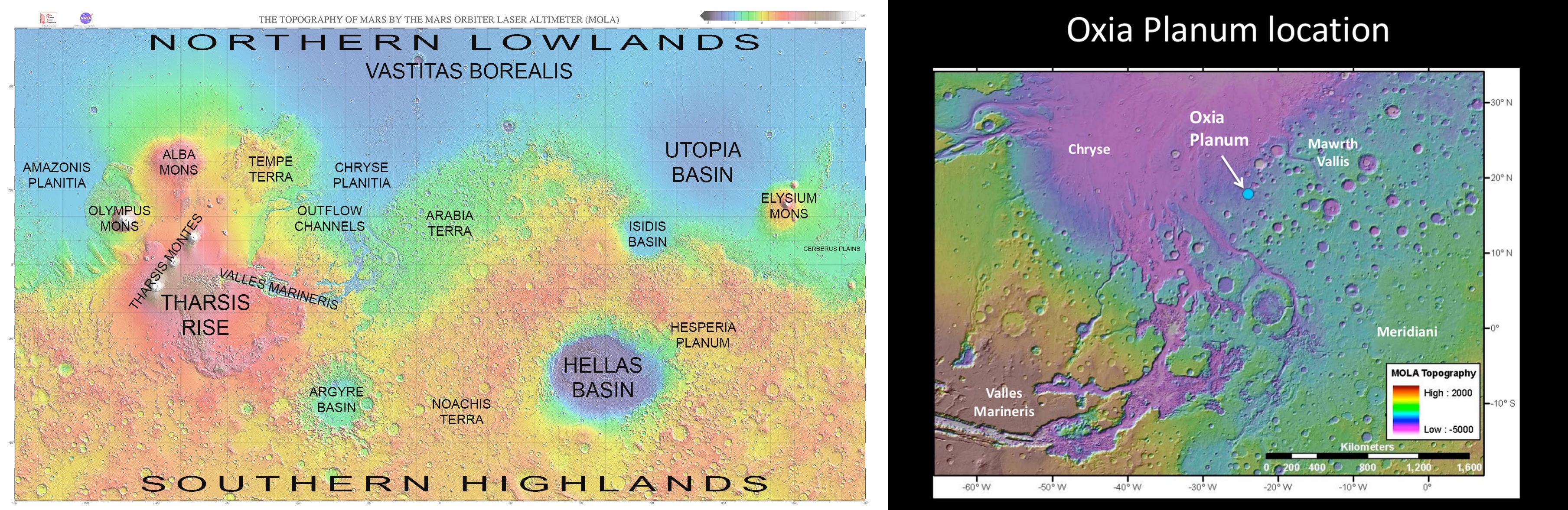
Rosalind Franklin, the ESA's Mars rover, is scheduled to launch no sooner than 2028. Its destination is Oxia Planum, a wide clay-bearing plain to the east of Chryse Planitia. Oxia Planum contains terrains that date back to Mars' Noachian Period, when there may have been abundant surface water, a key factor in the rover's mission.
Rosalind Franklin's primary mission mirrors that of NASA's Perseverance rover: to search for fossil evidence of life. To do that, both rovers are equipped with a suite of powerful instruments. They both have sampling drills, but Franklin's drill wins the tale of the tape. It can penetrate to a depth of two meters, compared to Perseverance's which can only drill a few inches deep.
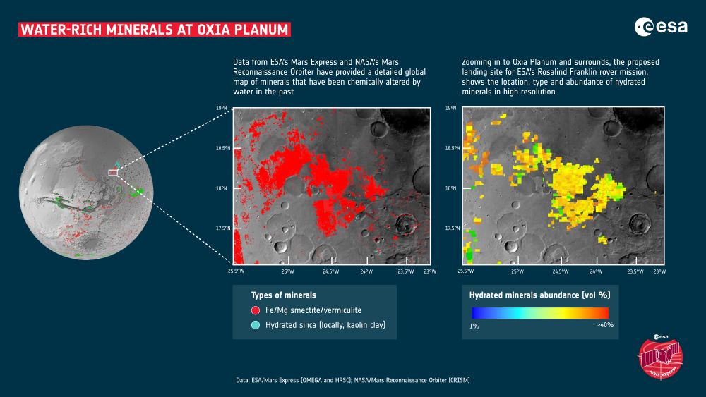
In order for the Franklin to be successful, it needs to land in a place where its drilling capability can be put to good use. That's why the ESA chose Oxia Planum. Not only is it flat, which makes for a safer landing, but it contains hydrated minerals. In fact, it's one of the largest exposed sections of clay-bearing minerals on Mars, and that's where the fossilized evidence of life it seeks may be found.
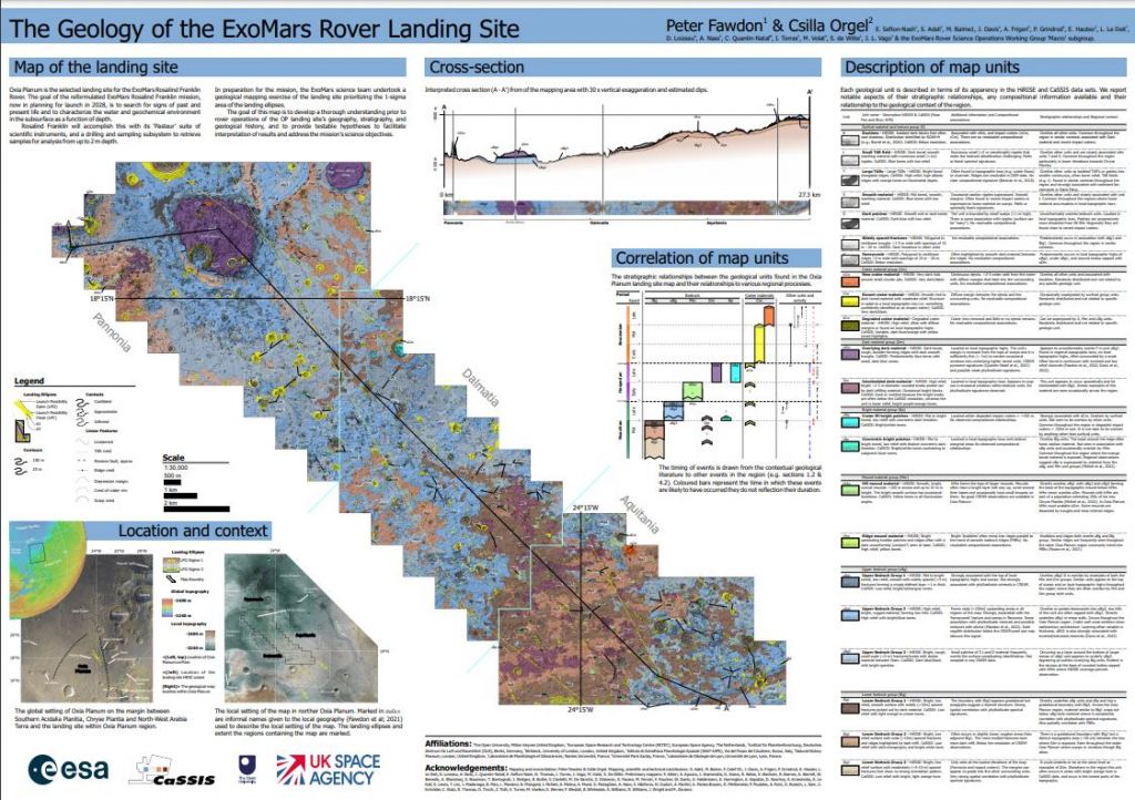
A team of European scientists has created the most detailed geological map of Oxia Planum ever. It took four years to complete and leans heavily on data from orbiters. The detailed map shows 15 units with characteristic geological features that can help decide how the rover explores the area. The map will also help the rover interpret its surroundings and collect evidence of primitive life.
"This map is exciting because it is a guide that shows us where to find the answers."Peter Fawdon, co-lead author, Open University
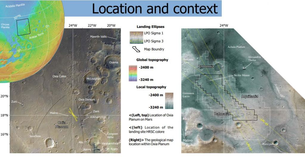
Oxia Planum preserves a record of the forces that shaped the region and that shaped Mars. It's a transitional region between Chryse Planitia, which contains lower elevation plains from the Amazonian/Hesperian, and Arabia Terra, the heavily cratered Noachian-aged region.
The sediments at Oxia Planum are nearly four billion years old. This will be the oldest site ever visited by a rover.
The new map has its roots in the COVID lockdowns. During that time, the Rosalind Franklin science team trained 80 volunteers to help them map Oxia Planum. The ExoMars Trace Gas Orbiter and NASA's Mars Reconnaissance Orbiter supplied the data.
The result is a map that shows Oxia Planum's geology in high detail. It shows types of bedrock and features like ridges and craters. It also shows crater ejecta and windborne dust. The map will not only help the rover navigate through difficult terrain; it'll inform the choices of where to drill for samples.

"The map represents our current understanding of bedrock units and their relationships prior to Rosalind Franklin's exploration of this location," the map creators write in the paper presenting the map.
"The objectives of this map are (i) to identify where the most astrobiologically relevant rocks are likely to be found, (ii) to show where hypotheses about their geological context (within Oxia Planum and in the wider geological history of Mars) can be tested, (iii) to inform both the long-term (hundreds of metres to ~1 km) and the short-term (tens of metres) activity planning for rover exploration, and (iv) to allow the samples analyzed by the rover to be interpreted within their regional geological context," the authors explain.
You can download the map and explore it here.
"The wider region was extensively modified during the late Noachian and Hesperian periods, as shown by evidence of fluvial and paleo-lake activity, possible shoreline formation, volcanism, and aqueous alteration," the authors write. The Hesperian is when Mars lost its water and transitioned from a warm, wet environment to a dry, cold environment. Understanding how that happened is a primary goal in Mars science.
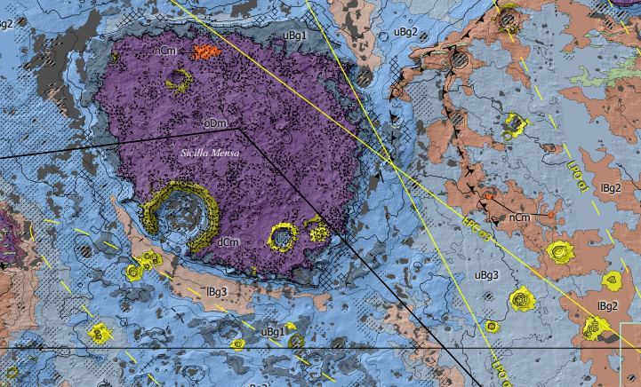
The map shows mound materials, different types of bedrock, features like Mensas and crater materials of different ages.
This is the highest-resolution map of the region ever made. With a scale of 1:25,000, each centimetre on the map equals 250 meters on Mars. Since Rosalind Franklin will travel an average of 25 to 50 meters each day, a day's journey is one or two millimetres on the map.
The making of the map has already provided some benefits to the Rosalind Franklin mission. "The mapping exercise has provided the wider rover team with a sound knowledge of the landing site and has also helped us to develop new geological hypotheses for the region," the authors write.
The map is more than just a driving guide. It's essentially a summary of our hypotheses about Mars. When the rover begins its mission, its initial exploration and drilling will test some of these existing hypotheses for Martian geology and history. Those results will inform the rover team, leading to better decisions about where to drill and explore. That will "... improve the chances of the mission meeting its search for life goals," the authors explain.
"This map is exciting because it is a guide that shows us where to find the answers. It serves as a visual hypothesis of what we currently know about the different rocks in the landing site. The instruments on Rosalind Franklin will allow us to test our knowledge on the spot when the time comes," explained Peter Fawdon, one of the lead authors from the Open University.