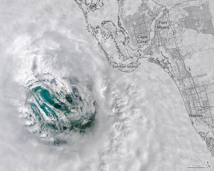
NASA and NOAA satellites -- as well as astronauts on the ISS -- captured some stunning imagery of Hurricane Ian, as seen from orbit. Our lead image shows an eerie view of the hurricane's eye on September 28. The Landsat 8 satellite passed directly over Ian's eye as the storm approached southwest Florida.
The natural-color image above was acquired by the satellite's Operational Land Imager camera at 11:57 a.m. local time (15:57 Universal Time), three hours before the storm made landfall in Caya Costa, Florida. At the time the image was taken, the eye was 42 kilometers (26 miles) in diameter.
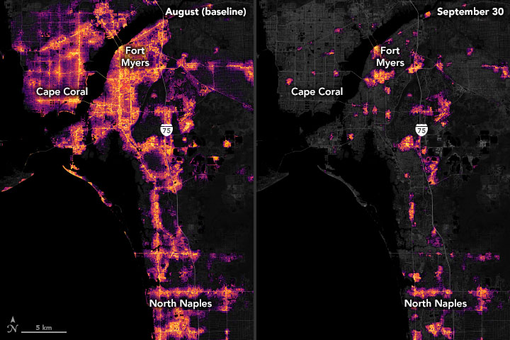
Ian was just shy of a category 5 hurricane when it made landfall, and the intensity of the winds pushed a catastrophic storm surge into coastal communities, including Cape Coral and Fort Myers. Reports from the area show that winds and floods have destroyed or damaged large numbers of homes and knocked out power to millions. Tragically, as CNN reported, as of today (Oct. 3) the number of people killed in Florida by Hurricane Ian rose to at least 100. Rescue crews are still searching for survivors.
NASA says the eye of a hurricane is a circular zone of fair weather at the storm's center. It is surrounded by a towering ring of extremely powerful thunderstorms called an eyewall, the part of the hurricane with the strongest winds. The swirling clouds along the edges of the eyewall are mesovortices—small-scale rotational features found in hurricanes with unusually strong winds.
According to the National Hurricane Center, when Ian's eyewall crashed into Florida, its maximum sustained winds were 240 km/hr (150 mph) hour. Winds at that speed can tear the roofs off homes and snap power lines.
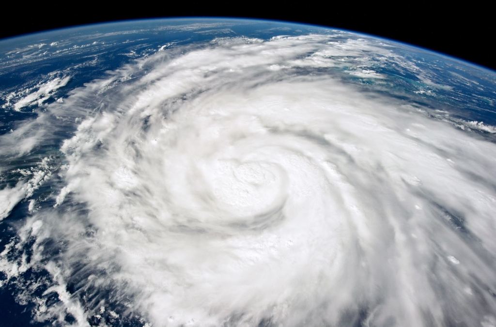
"Those breathtaking low-level cloud swirls in Ian's eye might provide clues into some important processes that affect a hurricane's intensity," said Justin Whitaker, a researcher with NASA's Short-term Prediction Research and Transition Center (SPoRT). The SPoRT team, based at Marshall Space Flight Center, focuses on improving weather forecasts using NASA data. "At SPoRT, we're studying how these inner-core asymmetries can affect a hurricane's structure, its potential to intensify, and whether lightning will occur within the storm's eyewall."
The animation above shows the evolution of Ian’s wind field between September 25–29, 2022. The strongest winds appear bright yellow; more moderate winds are shades of orange and bright purple. Credit: NASA Earth Observatory.
As Ian barreled past Cuba and passed into the Gulf of Mexico on September 27, the hurricane's eye was roughly 20 km (12 miles) wide. As it strengthened over the ocean, the eye expanded to a width of 55 km (34 miles), then reducing in size before landfall in Florida.
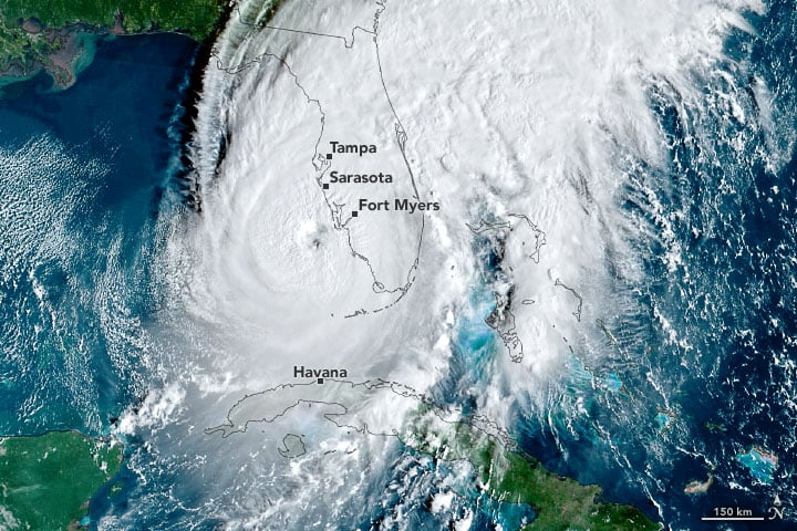
On September 28, 2022, by the Advanced Baseline Imager (ABI) on the Geostationary Operational Environmental Satellite 16 (GOES-16) took this image. At the time this image was taken, the storm had sustained winds of 155 miles (250 kilometers) per hour—making it a major category-4 hurricane and putting it near the threshold of a category-5 storm. Cloud bands already covered much of Florida.
GOES satellites are operated by the National Oceanic and Atmospheric Administration (NOAA); NASA helps develop and launch the GOES series of satellites.
As of today, Ian is considered a post-tropical storm, but it still is making waves along the Atlantic coast. You can see real-time images of the storm at the GOES Image Viewer website.
Loading tweet...
— View on Twitter
Sources: NASA Earth Observatory
