The Raikoke Volcano, dormant for a very long time, has awoken from its slumber. The volcanic island is in the Kuril Island chain, near the Kamchatka Peninsula in Russia. Unlike its more volcanically active neighbours, Raikoke has been dormant since 1924.
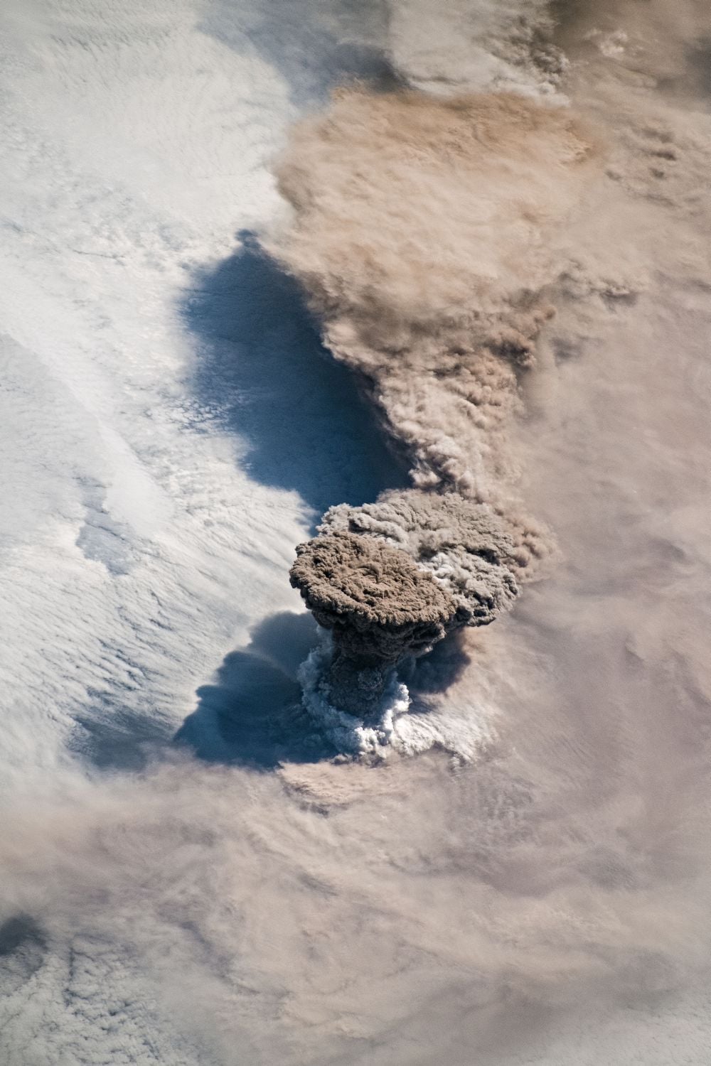
Thanks to astronauts on the International Space Station, we have gorgeous photos of the eruption.
The blessed event took place on June 22nd at about 4:00 am, when the circular 2.5km x 2.0 km (1.6 x 1.2 mile) island spat out a vast plume of volcanic gases and ash between 13 and 17 km (8 to 10 miles) into the sky. The thick plume was carried to the east by a storm in the North Pacific, and astronauts on the ISS, and orbiting satellites, watched it all happen.
The cloud of ash, with its flattened top, resembles an anvil cloud. An anvil cloud is a type of cumulonimbus cloud, responsible for thunder and lightning. The top of the ash cloud is flat because the density of the cloud has equalized to the density of the surrounding atmosphere, and the cloud's stopped rising. The flat top is called the umbrella region.
In a press release, volcanologist Simon Carn from Michigan Tech commented, "What a spectacular image. It reminds me of the classic Sarychev Peak astronaut photograph of an eruption in the Kuriles from about ten years ago. The ring of white puffy clouds at the base of the column might be a sign of ambient air being drawn into the column and the condensation of water vapor. Or it could be a rising plume from interaction between magma and seawater because Raikoke is a small island and flows likely entered the water."
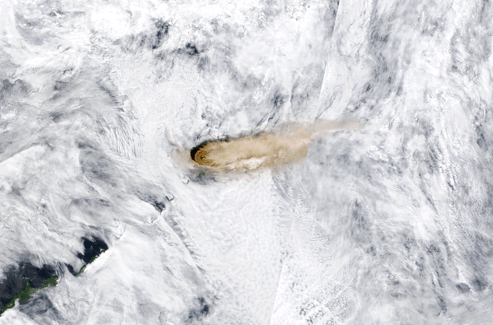
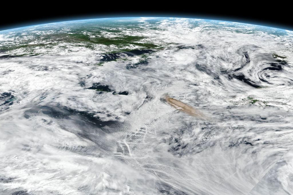
Satellites captured other images of the eruption, from different perspectives and at slightly different times.
The next image was captured with an instrument on NASA's Terra satellite, called MODIS (Moderate Resolution Imaging Spectroradiometer.) Ash was concentrated on the western side of the volcano, and was diffused on the east by the action of the storm north of it.
The third image is from the Suomi NPP (National Polar-orbiting Partnership) satellite. It was captured with the VIIRS (Visible Infrared Imaging Radiometer Suite.) It was taken a few hours after the others and shows how the wind has spread the ash around after volcanic activity had died down.
Japan's Himawari-8 satellite captured a movie of the eruption, and Twitter user Dan Lindsey tweeted the video. It shows Raikoke erupting in a series of pronounced bursts.
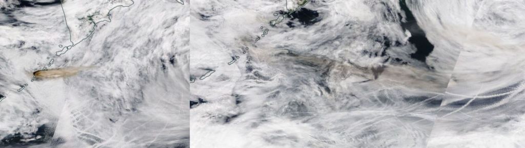
The whole eruption was over pretty quickly. A day after Raikoke erupted, which by the way means "Hellmouth" in the Ainu language, it was all over. All that was left was a brown smear of ash, pulled away and into the storm over the Pacific.
More:
- NASA Press Release: Raikoke Erupts
- NASA Worldview
- Wikipedia: Raikoke
- Japan's Himawari-8 satellite
