

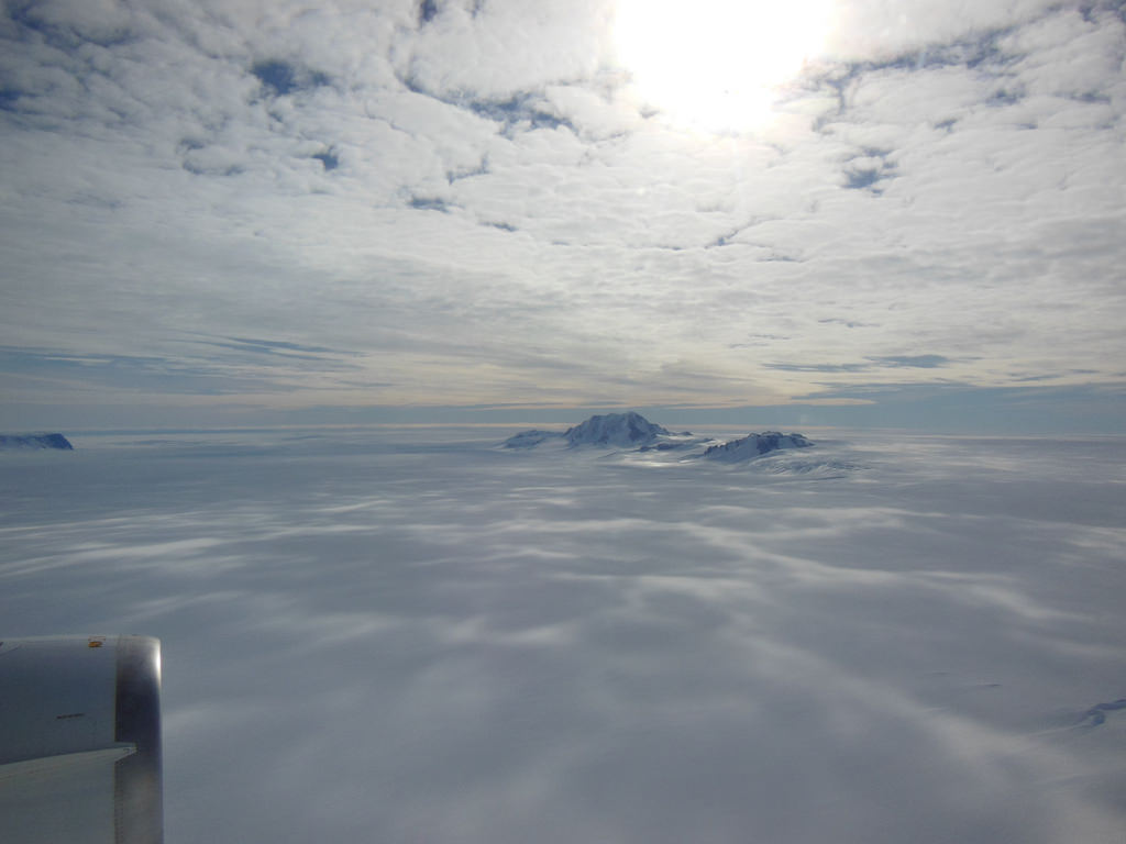
Although it sits isolated at the “bottom of the world” Antarctica is one of the most influential continents on Earth, affecting weather, climate, and ocean current patterns over the entire planet. But Antarctica is also one of the most enigmatic landmasses too, incredibly remote, extremely harsh, and covered by a layer of ice over 2 km thick. And as Earth’s global temperature continues to climb steadily higher, the future of ice in Antarctica — a continent half again as large as the contiguous United States — is a big concern for scientists… but in order to know exactly how its ice will behave to changing conditions, they need to know what’s under it.
This is where the British Antarctic Survey — using data gathered by NASA’s ICESat and Operation IceBridge missions — comes in, giving us a better view of what lies beneath the southern continent’s frozen veil.
A new dataset called Bedmap2 gives a clearer picture of Antarctica from the ice surface down to the bedrock below. Bedmap2 is a significant improvement on the previous collection of Antarctic data — known as Bedmap — that was produced more than 10 years ago. The product was a result of work led by the British Antarctic Survey, where researchers compiled decades worth of geophysical measurements, such as surface elevation measurements from NASA’s Ice, Cloud and Land Elevation Satellite (ICESat) and ice thickness data collected by Operation IceBridge.
Bedmap2, like the original Bedmap, is a collection of three datasets—surface elevation, ice thickness and bedrock topography. Both Bedmap and Bedmap2 are laid out as grids covering the entire continent, but with a tighter grid spacing Bedmap2 includes many surface and sub-ice features too small to be seen in the previous dataset. Additionally, the extensive use of GPS data in more recent surveys improves the precision of the new dataset.
Improvements in resolution, coverage and precision will lead to more accurate calculations of ice volume and potential contribution to sea level rise.
Ice sheet researchers use computer models to simulate how ice sheets will respond to changes in ocean and air temperatures. An advantage of these simulations is that they allow testing of many different climate scenarios, but the models are limited by how accurate the data on ice volume and sub-ice terrain are.
“In order to accurately simulate the dynamic response of ice sheets to changing environmental conditions, such as temperature and snow accumulation, we need to know the shape and structure of the bedrock below the ice sheets in great detail,” said Michael Studinger, IceBridge project scientist at NASA Goddard.
Knowing what the bedrock looks like is important for ice sheet modeling because features in the bed control the ice’s shape and affect how it moves. Ice will flow faster on a downhill slope, while an uphill slope or bumpy terrain can slow an ice sheet down or even hold it in place temporarily. “The shape of the bed is the most important unknown, and affect how ice can flow,” said Nowicki. “You can influence how honey spreads on your plate, by simply varying how you hold your plate.” The vastly improved bedrock data included in Bedmap2 should provide the level of detail needed for models to be realistic.

“It will be an important resource for the next generation of ice sheet modelers, physical oceanographers and structural geologists,” said Peter Fretwell, BAS scientist and lead author.
The BAS’ work was published recently in the journal The Cryosphere. Read more on the original release by George Hale here.
Source: NASA Earth
Sci-Fi short story subject: Satellite data continues to improve. Ice penetrating radar begins to show more and more detail of what lies below the Antarctic ice. Looking at close up images of the topography a researcher notices something that ‘just doesn’t seem right’. She sees and identifies a patchwork of interconnected geometry that looks inexplicably and suspiciously like that of a ruined city with an obvious network of roadways leading outward from the center…..
Done: http://en.wikipedia.org/wiki/The_Ice_People_(Barjavel_novel)
(I imagine it’d be a pretty funny read now, but I quite enjoyed it when I was a teenager.)
Thanks for the link Ted. Very interesting! I’ve never run across that story…. It just goes to show, there isn’t much new under the sun, eh? I’ll keep an eye out for it! I like Sci-Fi… can you tell?
But if all that ice was melted, then sea level would have risen, flooding a large part, right?
Depends. That ice is also pushing down on the surface, so if it melted Antarctica would also rise up a bit.
There was a time when Antarctica was MUCH warmer. They’ve even found dinosaurs there!
http://www.newscientist.com/article/mg21328465.500-antarctic-fossil-shows-sauropod-dinosaurs-were-global.html
New Paper About Hypothesized Wilkes Land impact basin
Existence supported by Bedmap dataset.
von Frese, R. R. B., H. R. Kim, T. E. Leftwich, J. W. Kim and
A. V. Golynsky, 2013, Satellite magnetic anomalies of the
Antarctic Wilkes Land impact basin inferred from regional
gravity and terrain data. Tectonophysics. vol. 585, pp. 185–195.
doi:10.1016/j.tecto.2012.09.009.
http://adsabs.harvard.edu/abs/2013Tectp.585..185V
http://www.sciencedirect.com/science/article/pii/S0040195112005677
Incredible! The continent of Antarctica is truly the ‘real’ land-down-under. I wonder how much gold, silver, platinum and other mineral percentages are under all that frozen H2O. The ice is 1.5 miles think in places. I did not know all that ice is half of earths fresh water.
Coal and oil I only mention because I hope no one goes after and drills for it. Clean energy is the goal now, not coal or oil. PBS has an excellent 1-hour documentary on the progress of China’s relentlessness pursuit of cheaply made and very low cost of solar panels. It showed the USA’s bio-fuel interest and progress. I hope all international countries leaves Antarctica ALONE!
Oil is still almost 100 % of “the goal” in vast areas, such as fuel and plastics, and oil and coal a hefty amount of “the goal” in remaining energy sectors.
FWIW, there is an Antarctica treaty that regulates such stuff that nations have catered to, so far.
Yes thank you, I am aware of the oil industry and the need to make many other products as well. FWIW has more good moments than bad. It is sort of like The United Nations. Treaty’s are broken depending on the “$” and to whom. But for the most part FWIW has been decent on Antartica. Those other countries you speak of, the 100% will be cut down as the years forge on. That is a good thing.
The current conditions there (not the least of which is that very icecap) would likely make it too costly to operate, anyway. Even research bases can’t really be serviced during the winter…
Yes, one of my school mates from 1970’s works for Woods Hole Oceanographic Institute not too far from where I live. He said the same thing. However, .the outskirts of the southern continent was being probed for natural gas, oil by Russia, China etc.. . Besides, the southern circular current down there is quite fierce.
Solar still relies on fossil fuels when there is no sun out. Same with wind when there is no wind. For the foreseeable future, damning supposed “dirty” energy like coal and oil would yield very poor results for the billions who survive and thrive by its use daily — including both you and me.
Yes I agree with some of what you said. We need better way more ‘cleaner’ energy. Oil has seen its better days. We cannot keep up polluting the air. Green house gases must be replaced. Now with saying that, how long is it to replacing coal/oil? 50 years? A 125 years? I believe some where inbetween. The infighting will be with “jobs” and “$”. People scream they want to keep their oil-coal jobs. We do NOT need people whining about their jobs. GET ANOTHER JOB IN ANOTHER FIELD! Lets say, and God forbid, some ones wife dies at an early age. Is he going to cry about wanting the same exact type woman in looks heart, eyes, legs etc..? Hardly! There is only one of ‘her’. But there are many other woman out there that can “love” him like your first wife.
In short.oil/coal is mainly for transportation and electricity. Its getting too old. A retirement center and a museum are needed now. Oil will be used in plastics, commercial toys, and a slew of other commercial and non-commercial products and things. We need to get oil/gas out of our cars, trucks etc.. from burning in our atmosphere. Same with coal fired electric power plants. We need variety of other types of safe, clean alternative energy. Electric cars will start to get accepted more and more. Hydrogen cars also. There’s more to it than I explained. But you get the idea.
So the Antarctic isn’t a continent at all – in fact its an archipelago!
Perhaps there will be a new contender for the worlds largest mountain with all this new data!
Or maybe not, who knows. I’d love to get my hands on the raw data and find out!
Isn’t it amazing? Getting to see something that hasn’t been seen by anyone (Yet, with technology, it has!) for countless years!
Kudos to NASA for this. At least now, when global warming gets the best of us, we’ll have already mapped the newest(Newly available) mountains and their locations for us to hide on!
Interesting. But I found much of what the narrator says difficult to comprehend and I’m British! “Consorshum”??? Britdish Anartic??. It’s becoming truer every year that the British and Americans are separated by a common language.
Thanks for the link Ted. Very
interesting! I’ve never run across that story…. It just goes to show,
there isn’t much new under the sun, eh? I’ll keep an eye out for it! I
like Sci-Fi… can you tell?
Die Abnehm Lösung