The way astronomers study planets in our own solar system is surprisingly similar to the way they study exoplanets, despite the latter being orders of magnitude more distant. The key is spectroscopy – examining the wavelengths of light that reach a telescope from a planet’s atmosphere. Different molecules allow different wavelengths to pass through, creating unique patterns in the spectrum and giving scientists clues about the composition of an atmosphere.
Of course, for planets nearby, we can get more details by visiting them – but this is expensive and difficult – we haven’t visited Uranus since Voyager 2 in 1986, for example, so for all intents and purposes, studying Uranus today is done the same way as studying an exoplanet: with a telescope.
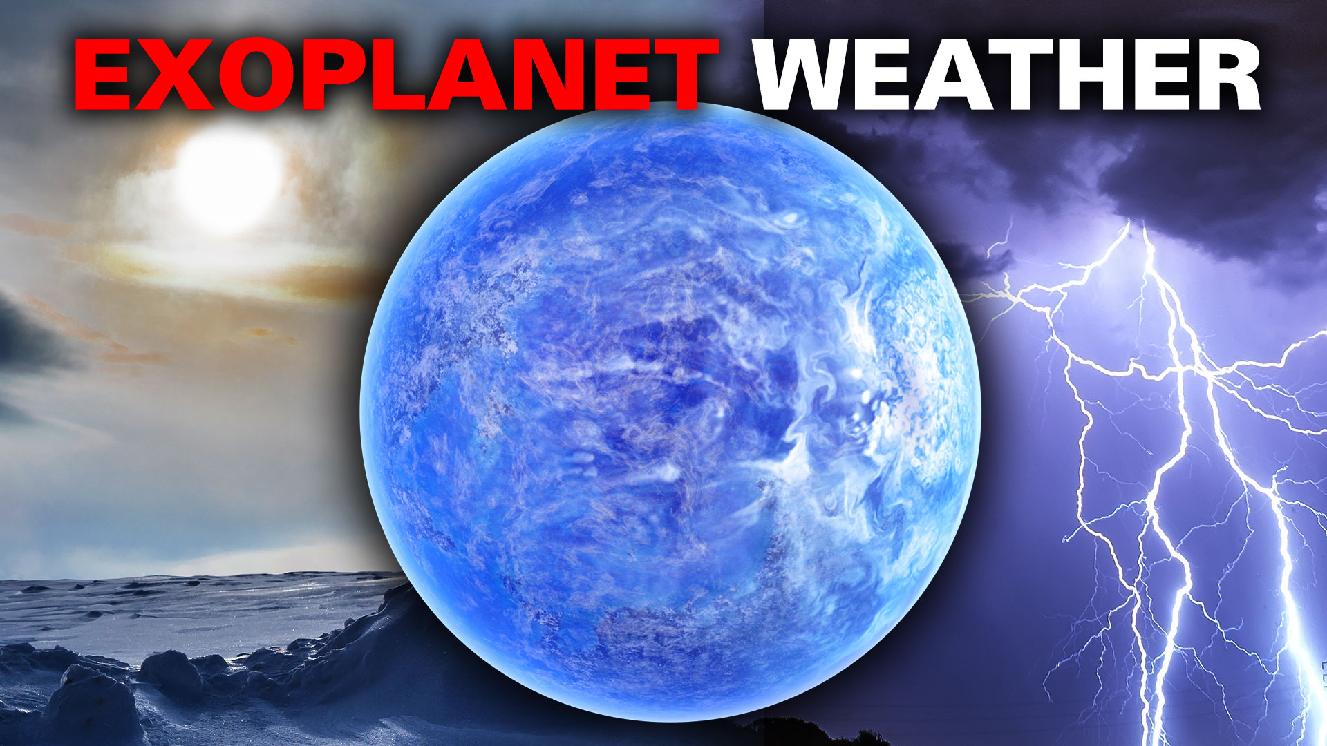
A recent review of planetary atmospheres, in our solar system and elsewhere, reveals the incredible complexity and diversity of weather in our solar system, and what we might expect to find around other stars – but also what we don’t yet understand about our near neighbours: there’s plenty of unknowns.
So let’s take a weather-watcher’s tour of the solar system:
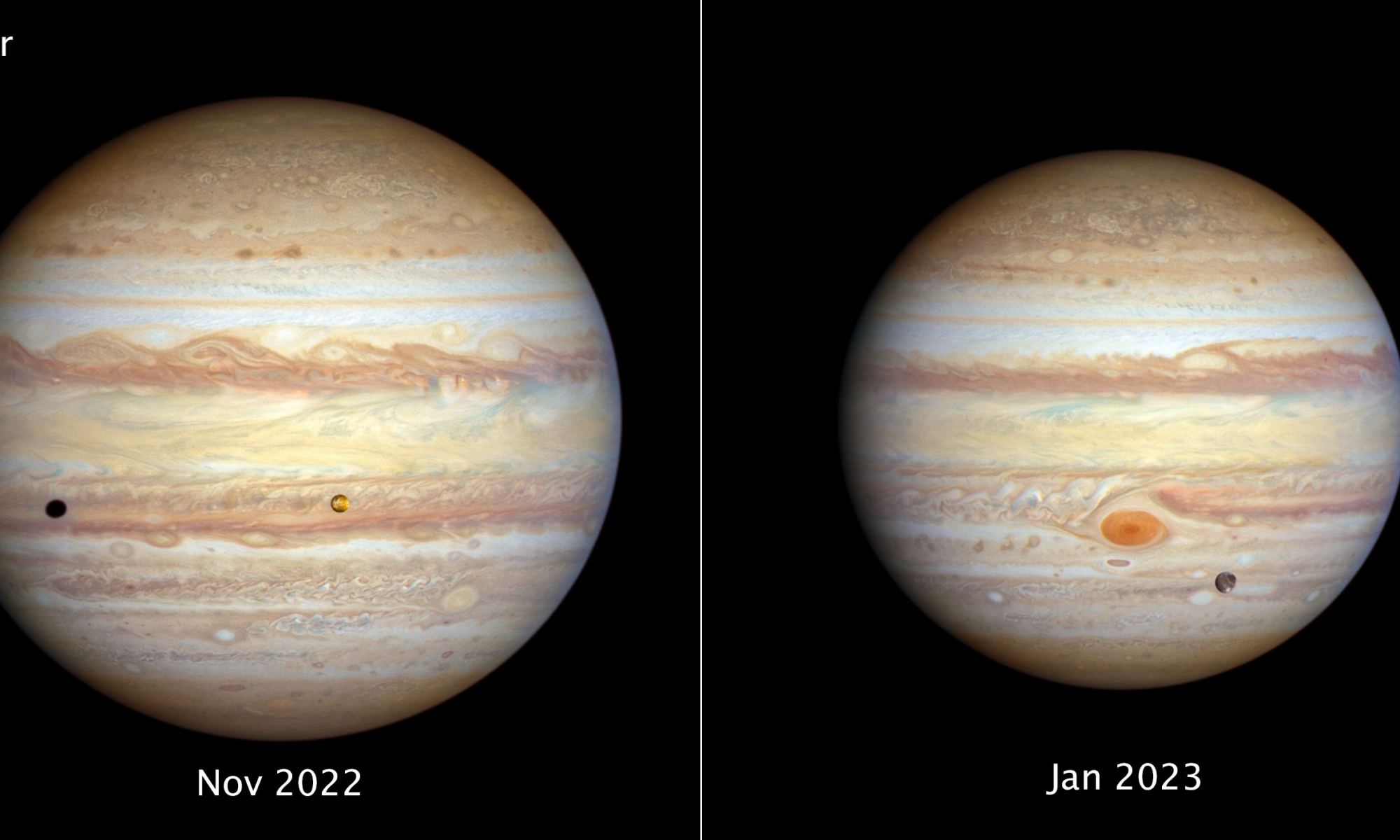
Jupiter, as seen by the Hubble Space Telescope in November 2022 and January 2023. Credits: NASA, ESA, STScI, Amy Simon (NASA-GSFC), and Michael H. Wong (UC Berkeley); Image Processing: Joseph DePasquale (STScI).
A couple times a year, the Hubble Space Telescope turns its powerful gaze on the giant planets in the outer Solar System, studying their cloudtops and weather systems. With the Outer Planet Atmospheres Legacy (OPAL) Program, Hubble provides us with these views and also delivers weather reports on what’s happening. Here’s an updated report and some new images of the stormy surfaces of Jupiter and Uranus.
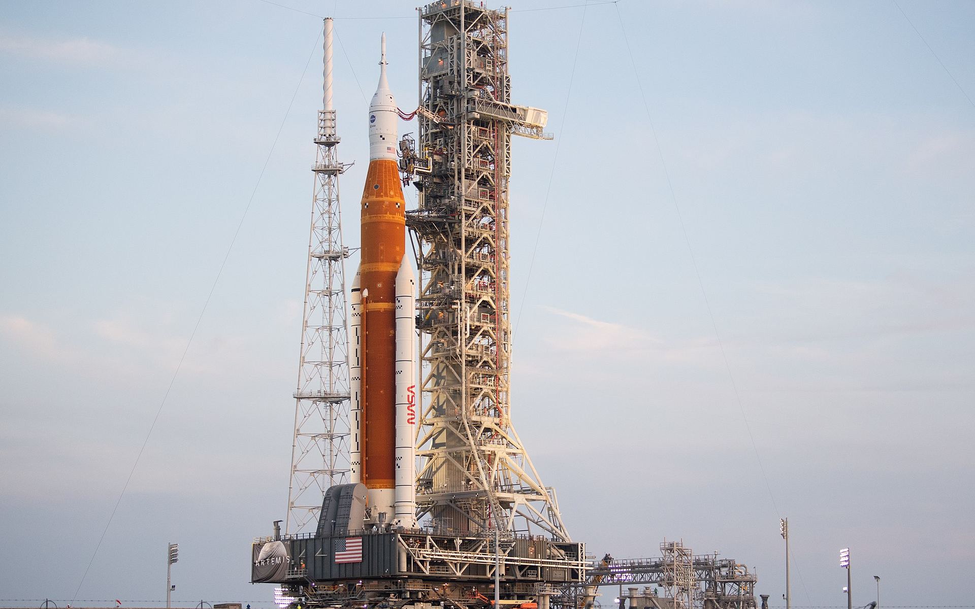
As a result of the latest weather predictions regarding Hurricane Ian, NASA managers met on the morning of September 26 and made the decision to roll Artemis 1 back into the Vehicle Assembly Building to protect the rocket from the impending storm, an operation which commenced at 11 pm EDT that evening.
Illustration by Michael S. Helfenbein; Image courtesy of NASA/JPL-Caltech.
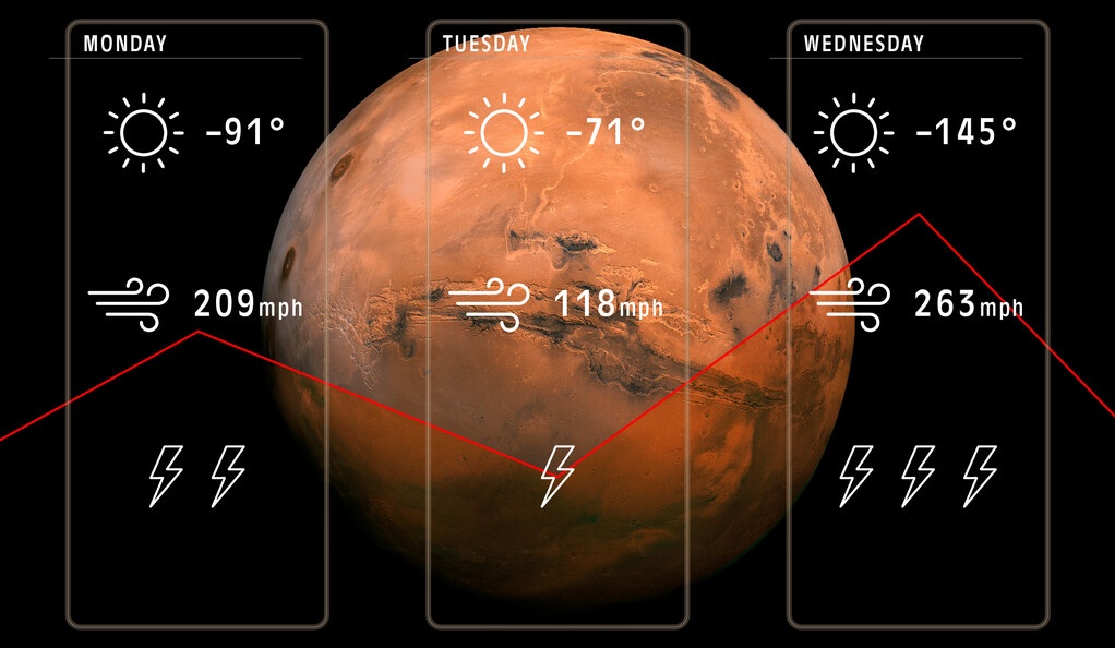
Even meteorologists who forecast the weather on Earth admit that they can’t always accurately predict the weather at a specific location on our planet any given time. And so, attempting to forecast the atmospheric conditions on another world can be downright impossible.
But a new study suggests that an oft-used forecasting technique on Earth can be applied to other worlds as well, such as on Mars or Titan, Saturn’s largest moon.
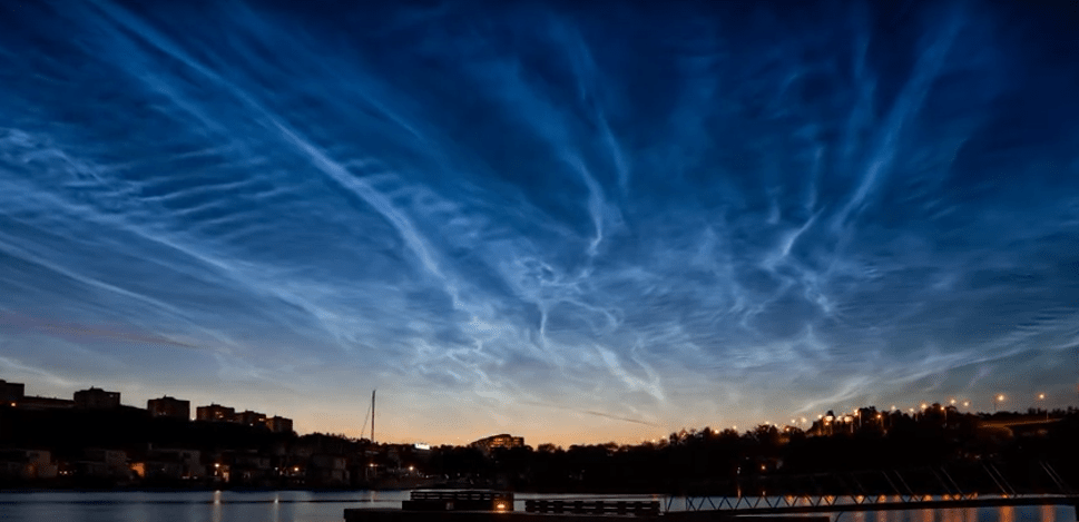
It’s cold right now. Okay, fine, here on Vancouver Island, it’s actually pretty warm. But for the rest of Canada and big parts of the US, it’s terrifyingly cold. Colder than Mars or the North Pole cold. This is all thanks to the break up of the polar vortex. What are polar vertices, how do they form, and where else to we find them in the Solar System?
Noctilucent clouds, or PMC's, form high in the atmosphere above the poles. NASA launched a five-day balloon mission to observe and photograph them. Image: NASA’s Goddard Space Flight Center/Joy Ng
Noctilucent clouds are one of the atmosphere’s most ethereal natural wonders. They form high in the mesosphere, about 80 km (50 mi) above the Earth’s surface, and are rarely seen. In July, 2018, NASA launched a five-day balloon mission, called PMC (Polar Mesospheric Clouds) Turbo, to observe them and photograph them.
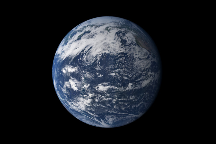
Earth, seen from space, above the Pacific Ocean. Credit: NASA
Many people love to ask, why does it always rain on me? There are those who would like to know why it rains so much when they are sad, when they feel like going out, or only when they decide to jog or take their pet for a walk. There are no easy answers for these arguably subjective questions. However, if one to ask “why does it rain”, the answer would be much simpler.
For starters, rain is liquid precipitation, as opposed to non-liquid kinds (such as snow, hail and sleet). It begins with the vaporization of water near the Earth’s surface, in the form of rivers, lakes, oceans or ground water, provided there are atmospheric temperatures above melting point of water (0°C). This is followed by the condensation of atmospheric water vapor into drops of water that are heavy enough to fall, often making it to the surface.
Precipitation is also a major component of the hydrological cycle – aka. “water cycle“. This is the term used to describe the continuous movement of water on, above, and below the Earth, and is responsible for depositing most of the fresh water on the planet. Rain occurs when two basic processes occur: Saturation and Coalescence.
Diagram of the Water Cycle. Credit: NASA Precipitation Education
Saturation:
This process occurs when “invisible” moisture in the air (water vapor) is forced to condense on microscopic particles (i.e. pollen and dust) to form tiny “visible” droplets. The amount of moisture in air is also commonly reported as relative humidity; which is the percentage of the total water vapor air can hold at a particular air temperature.
How much water vapor a parcel of air can contain before it becomes saturated (100% relative humidity) and forms into a cloud (a group of visible and tiny water and ice particles suspended above the Earth’s surface) depends on its temperature. Warmer air can contain more water vapor than cooler air before becoming saturated.
Coalescence:
Condensation occurs when the air is cooled down to its “dew point” temperature – the point at which it becomes saturated. Coalescence occurs when water droplets fuse to create larger water droplets (or when water droplets freeze onto an ice crystal) which is usually the result of air turbulence which forces collisions to occur.
As these larger water droplets descend, coalescence continues, so that drops become heavy enough to overcome air resistance and fall as rain. Rain is the primary source of freshwater for most areas of the world, providing suitable conditions for diverse ecosystems, as well as water for hydroelectric power plants and crop irrigation.
Image obtained by the Earth Observatory of the sun-glinted ocean and clouds. Credit: NASA
Measurement:
Rainfall is measured through the use of rain gauges. These gauges typically consist of two cylinders, one within the other, that fill with water. The inner cylinder fills first, with overflow entering the outer cylinder. Once the inner cylinder is filled, it is emptied and then filled with the remaining rainfall in the outer cylinder, producing a total estimate in millimeters or inches.
Other types of gauges include the popular wedge gauge, the tipping bucket rain gauge, and the weighing rain gauge. The most inexpensive option is a simple cylinder with a measuring stick, provided the cylinder is straight and the measuring stick is accurate. Any of these gauges can be made at home, with the right kind of knowledge.
Precipitation amounts are also estimated actively by weather radar, and passively by weather satellites. Examples of the latter include the Tropical Rainfall Measuring Mission (TRMM) satellite – a joint mission conducted by NASA and the Japanese Space Agency to monitor precipitation in the tropics – and NASA’s Global Precipitation Measurement (GPM).
Both of these mission employ microwave sensors to create precipitation estimates. Annual precipitation data is collected and monitored by NASA’s Earth Observatory (NEO), which creates detailed maps of global weather patterns (as well as heating and other meteorological factors).
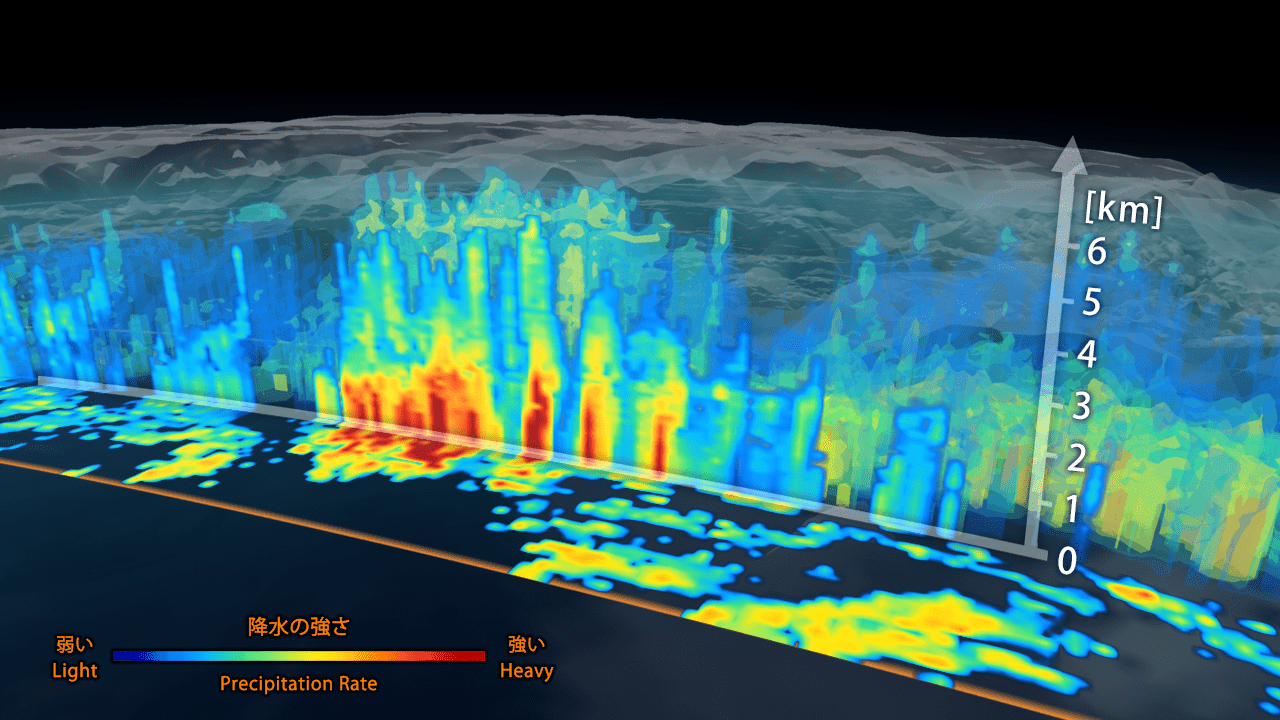
A 3D map of the extra-tropical cyclone observed off the coast of Japan on March 10th, 2014, by GPM’s Dual-frequency Precipitation Radar. The colors indicate intensity of rainfall. Credit: JAXA/NASA
Climate Change:
Anthropocentric Climate Change, which includes Global Warming, is also causing changes in global precipitation patterns. This is due to the fact that increases in carbon dioxide emissions have led to increasing annual temperatures around the globe, leading to more evaporation and precipitation and more extreme weather events.
At latitudes north of 30°, precipitation has increased over the past century, while similarly declining over the tropics since the 1970s. And while there has been no consistent change on a global scale, regional variations have been pronounced. For instance, eastern portions of North and South America, northern Europe, and northern and central Asia have become wetter.
Other regions, such as the Sahel (between the Sahara desert and the Sudanian Savanna), the Mediterranean, southern Africa and parts of southern Asia have become drier. There has also been an increase in both the number of heavy rainstorms and droughts over many areas in the past century. In the tropics and subtropics, there has also been an increase in the prevalence of droughts since the 1970s.
Rain on Other Planets:
Despite what you might think, Earth is not the only planet where rain occurs. On other bodies in the Solar System, liquid precipitation takes place, though it rarely involves water. In fact, on Venus, rain regularly occurs, except that it involves sulfuric acid!
This acid rain is formed high in the atmosphere, where the wind speeds get up to 360 kilometers/hour (224 mph). However, once the droplets reach the lower atmosphere, they evaporate due to the extreme heat – over 460 °C or 860 °F. Hence, the rain never reaches the surface, which is extremely dry and molten.
On Saturn’s moon Titan, rain takes the form of methane. As evidence provided by the Cassini-Huygens mission has indicated, the moon has an active hydrological cycle. Except that Titan’s involves liquid hydrocarbons instead of water. As part of this cycle, liquid methane evaporates on the surface, accumulates in the atmosphere, and then returns to the surface as seasonal rains.
But it gets weirder! For instance, in recent years, scientists have obtained experimental evidence that indicates that Jupiter and Saturn may experience liquid helium rain. Due to the extreme pressure conditions that exist within the gas giants interior, these gases are compressed to the point where they take liquid form.
And then there’s what is known as “diamond rain”, which has been speculated to exist on all the gas giants. Essentially, Jupiter, Saturn, Uranus and Neptune all possess methane in their interiors. Due to the extreme pressure conditions, these hydrocarbons are compressed to the point that actual diamonds are believed to form. As such, diamond rain may actually exist in these gas/ice giants.
Last, but not least, there is the curious case of “Coronal Rain“, which takes place on the Sun. This phenomena occurs during a coronal mass ejection, where plasma cools after being ejected and falls back to the surface. Sometimes, these plasma droplets makes ‘splashes’ where they hit. And instead of falling straight down, the plasma rain appears to follow the path of the Sun’s invisible magnetic field lines.
Here on Earth, rain takes the form of water, and is an intrinsic part of our hydrological cycle. On other worlds, rain can take a different form, but still occupies much the same place in the planet’s cycle. Due to changing temperatures, saturation and coalescence, what goes up (in the form of vapor) must eventually come down.
Countries by average annual precipitation. Credit: Wikipedia Commons/Atila Kagan
Those who live along the “wet coast” – which is what people living in Puget Sound or the lower mainland of British Columbia and Vancouver Island affectionately call their home – might think that they live in the wettest place on Earth. Then again, people living in the Amazon rain forest might think that there lush and beautiful home is the dampest place in the world.
But in truth, all these places come up dry (pun intended!) compared to the one place that has held the title for wettest point on Earth many times in its history. And that place is none other than Mawsynram, India, which experiences an annual average rainfall of 12 meters. And yet, this curious region in northwestern part of the Indian subcontinent is an exercise in extremes, either drowning in rainwater, or starving for it.
Annual Rainfall:
When it comes to describing locations on planet Earth in terms of “wet”, some clarifications are needed. What we are talking about is average annual precipitation – i.e. rainfall, snow, drizzle, fog, etc. – measured in mm (or inches). This is necessary because otherwise, the “wettest” place on Earth would be the Mariana Trench, which has over 10,000 meters (36,000 feet) of water on top of it.
Cherrapunji, one of the wettest places on Earth. Credit: Public Domain
Also, based on rainfall. the wettest place on Earth has been known to change from time to time. In recent years, that title has gone to the town of Mawsynram, a village located in the East Khasi Hills district of northeastern, India. With an average annual rainfall of 11,872 millimetres (467.4 in), it is arguably the wettest place on Earth.
However, it is often in competition with the neighboring town of Cherrapunjee, which is located just 15 km (9.3 mi) to the west of Mawsynram in the East Khasi Hills district in northeastern India. The city’s yearly rainfall average stands at 11,777 millimetres (463.7 in), so it too has held the title.
The reason for these town experiencing so much precipitation has to do with the local climate. Situated within a subtropical highland climate zone, it experiences a lengthy and powerful monsoon season. In once instance, the monsoon season lasted for 2 years straight with no reported break in the rain!
Surprisingly, the high rainfall is a result of the region’s elevation and not the monsoon season alone. Huge amounts of warm air condense and fall as rain when they encounter the Khasi Hills. The topography of the region forces the very moist clouds up and down, forcing them to empty their accumulated water over the region.
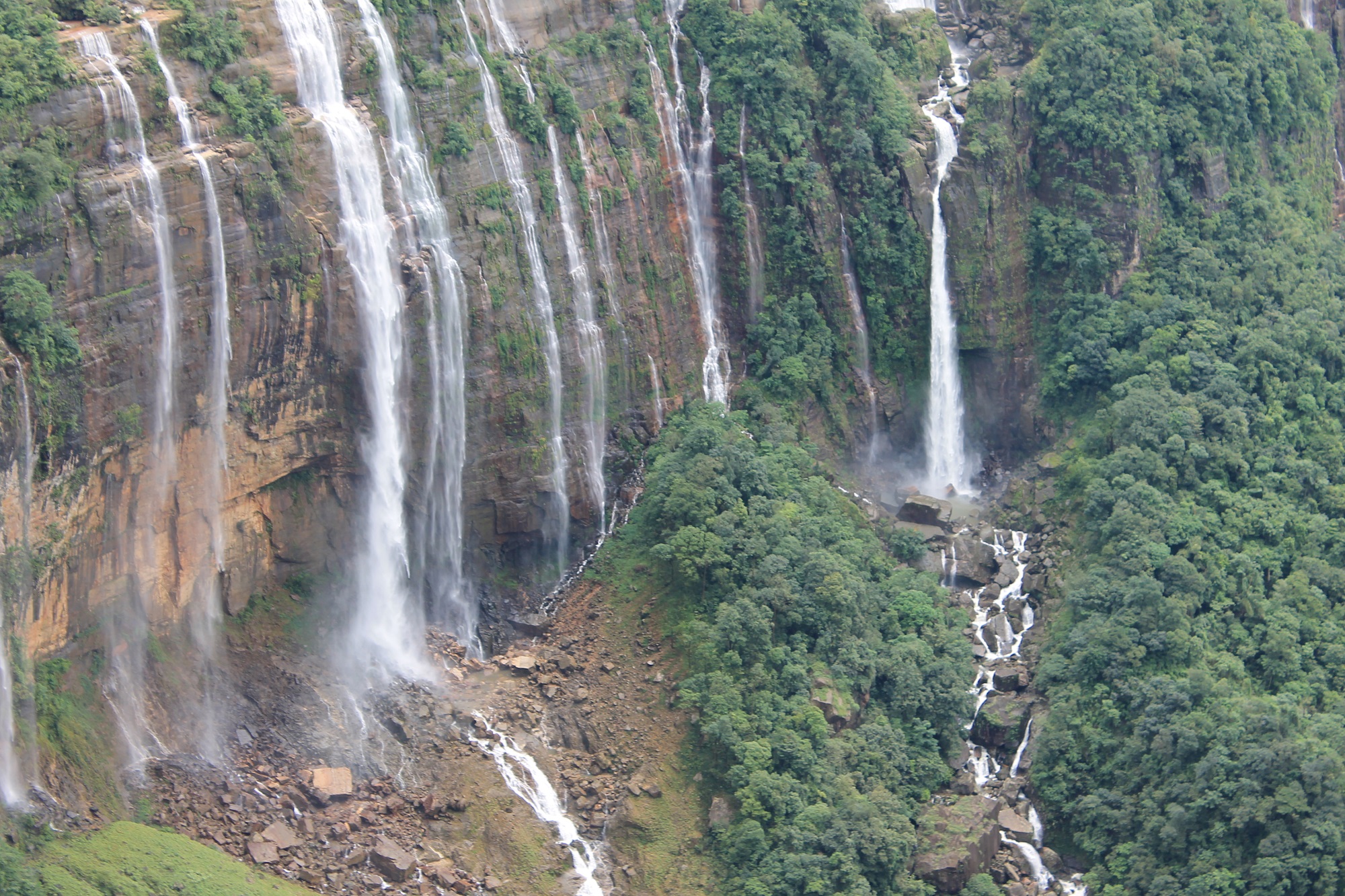
Seven Sisters’ falls, located in the East Khasi Hills district. Credit: Wikipedia Commons/Rishav999
Other Locations:
Beyond northeastern India, there are several other locations on the planet that experience over 10 meters (32.8 feet) of annual precipitation. For instance, the town of Tutunendo, Colombia, experiences an average of 11,770 mm (463.38 in) of annual rainfall. The area actually experiences two rainy seasons a year, so precipitation is pretty much the norm.
Next up, there is Mount Waialeale, a shield volcano located on the island of Kaua’i on the Hawaiian Islands. As the the second highest point on the island, its name literally means “rippling water” (or “overflowing water”), and for good reason! This mountain has had an average of 11,500 mm (452 in) of rainfall since 1912.
However, in 1982, its summit experienced 17,300 mm (683 in), making it the wettest place on Earth in that year. And between 1978-2007, Big Bog – a spot in Haleakala National Park on the island of Maui, Hawaii – experienced an average of 10,300 mm (404 in) of rainfall, putting it in the top ten.
Waialeale (or ‘Rippling Waters’) Lake, located atop Mount Waialeale on the island of Kaua’i, Hawaii. Credit: Wikipedia Commons/Volcantrek8
As already noted, the “wettest place on Earth” changes over time. This should come as no surprise, considering that weather patterns have been known to shift, not only in the course of an average year, but also over the course of centuries and millennia.
Nevertheless, those places that experience over 10 meters of precipitation are generally found within the tropical regions of the world, places known for experiencing intense and prolonged rainy seasons, and where lush tropical rainforests have existed for thousands of years. Here is a recent list of the top 10 locations.
But with anthropogenic climate change becoming a growing factor in planetary weather systems, this too could be subject to change. In the coming decades, and centuries, who’s to say where the most precipitation will fall on planet Earth?
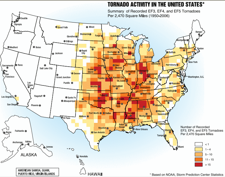
A tornado near Anadarko, Oklahoma. Credit: NSSL/NOAA
Tornadoes are a fascinating force of nature, as awe-inspiring as they are destructive. They form periodically due to the convergence of weather patterns, and often leave plenty of devastation in their wake. And for those who live in the active tornado regions of the world, they are an unfortunate fact of life.
Such is the nature of life for those who live in the infamous “Tornado Alley”, a region that extends from the southern US into parts of Canada. This area is so-named because of the frequency with which tornadoes take place. Compared to other active regions of the world, this area experiences the highest frequency of violent tornadoes.
Origin of the Name:
The term “Tornado Alley” was first used in 1952 as the title of a research project about severe weather in the US. This project was conducted by U.S. Air Force meteorologists Maj. Ernest J. Fawbush and Capt. Robert C. Miller, and covered a region extending from areas of Texas to locations throughout the mid-western US.
Tornado at Union City, Oklahoma. Credit: NOAA Photo Library
The term has since caught on thanks to media sources as well meteorologist and climatologists, though many use the term “Great Plains Tornado Belt” as well.
Geographical Area:
The geographical boundaries of “Tornado Alley” have never been very clearly defined and no official definition has been adopted by the National Weather Service (NWS). As a result, different definitions and boundaries have been adopted based on different sets of criteria. For instance, the National Severe Storms Laboratory (NSSL) states:
“‘Tornado Alley’ is just a nickname made up by the media for an area of relatively high tornado occurrence; it is not a clearly defined area. Is tornado alley the area with the most violent tornadoes, or is it the area with the most tornado-related deaths, or the highest frequency or tornadoes? It depends on what kind of information you want!”
While no region of the US is entirely free of tornadoes, they occur more frequently in the mid-western US – spanning areas of Texas to parts of Oklahoma, Kansas, South Dakota, Iowa, Illinois, Missouri, New Mexico, Colorado, North Dakota, and Minnesota.
Artist’s impression of the geographical region known as “Tornado Alley”. Credit: Dan Craggs/Wikipedia Commons
Texas reports the most tornadoes of any state, whereas Kansas and Oklahoma rank first and second respectively in the number of tornadoes per area. Florida also reports a high number and density of tornado occurrences, though tornadoes there rarely reach the strength of those that sometimes occur in the southern plains.
However, the Canadian prairies, eastern Colorado and western Pennsylvania are often included in the boundaries. And last, several smaller areas have been designated as being their own “Tornado Alley” – which include the Texas/Oklahoma/Kansas core, the Upper Midwest, the lower Ohio Valley, the Tennessee Valley and the lower Mississippi valley.
There is also the term “Dixie Alley”, a name coined by Allen Peasons, a former director of the National Severe Storms Forecasting Center (NSSFC), in 1971. This name refers to the lower Mississippi Valley and upper Tennessee Valley were tornadoes occur frequently.
Nevertheless, most definitions focus on the geographical region known as the Great Plains where no major mountain ranges are located. This is important because mountains act as breaks on weather systems, forcing them to dump the majority of their moisture before crossing over them (the reason why the southwestern US has a more arid climate).
Image from Federal Emergency Management Agency booklet, “Taking Shelter from the Storm: Building a Safe Room Inside your House” (3rd ed.). Credit: FEMA
In the case of the Great Plains, the region’s lack of these natural barriers leaves it open to cold fronts from Canada and warm fronts from Mexico and the Gulf Coast. When cold and warm front collide, they create supercells and thunderstorm systems that lead to tornadoes.
Impact:
Due to the frequency of tornadoes in certain areas of the United States, building codes and warning systems have been implemented. These include the institution of special building codes, construction of storm cellars, sirens, preparedness drills, education programs, and regular weather coverage by local media outlets.
According to the National Climatic Data Center, during the period of 1991 to 2010, those states that have the most experienced an average of 5.7 (Minnesota) to 12.2 (Florida) tornadoes. Using a long-term average (based on data collected between 1950 and 2012), the entire “Alley” experiences about 268 tornadoes per year.
In the southeastern United States, where housing is less robust and many people live in mobile homes, causalities are particularly high. According to the NOAA, almost 3600 tornadoes have occurred in the United States, which resulted in more than 20,000 deaths, between 1680 and 2000.
The track of the tornado that struck Moore, Oklahoma on May 20, 2013 is visible from space in this false color image taken on June 2, 2013 by the Advanced Spaceborne Thermal Emission and Reflection Radiometer (ASTER) on NASA’s Terra satellite.
Meanwhile, data from the Tornado History Project shows there were 5,587 confirmed fatalities blamed on tornadoes across the United States between 1950 and 2012. Of those, 1,110 occurred in Tornado Alley. The injuries caused by tornadoes are much higher, with a reported 64,054 injuries being attributed to tornadoes during the same period – over 15,000 of which occurred in Tornado Alley.
The worst year on record was 2011, when tornado activity spiked leading to 1,704 confirmed tornadoes and 553 confirmed deaths. This includes the 158 deaths that resulted from the tornado that struck Joplin, Missouri, on May 22nd, which was also the deadliest since modern record-keeping began in 1950.
In financial terms, the cost of tornadoes is also quite high. In fact, the Insurance Information Institute reports that between 1993 and 2012, the average insured loss per year was $7.78 billion for severe thunderstorm events, including tornadoes. In 2011, during the spike in storms, an estimated $27 billion was filed for in insurance claims.
No matter how you slice it, living in regions where tornadoes are known to frequent is both a dangerous and expensive prospect. As our understanding of tornadoes grows, we are able to predict where they will form and what paths they will take with greater accuracy. As such, we can reduce the cost in human and monetary terms over time.
Satellite image showing the after-effects of the deadly tornado that ripped through Indiana and Kentucky. Credit: NASA Landsat Project Science Office and USGS EROS
But in the long run, the greatest safeguards against injuries and death are public awareness and education. Tornadoes are also an important aspect of Climate Change, since changes in our environment are likely to effect and exacerbate extreme weather patterns.
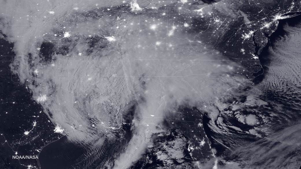
NASA-NOAA's Suomi NPP satellite snapped this image of the approaching blizzard around 2:35 a.m. EST on Jan. 22, 2016 using the Visible Infrared Imaging Radiometer Suite (VIIRS) instrument's Day-Night band. Credit: NOAA/NASA
NASA-NOAA’s Suomi NPP satellite snapped this image of the approaching blizzard around 2:35 a.m. EST on Jan. 22, 2016 using the Visible Infrared Imaging Radiometer Suite (VIIRS) instrument’s Day-Night band. Credit: NOAA/NASA
NEW JERSEY- The monstrous ‘Blizzard of 2016’ predicted by weather forecasters for days has struck a wide swath of the US East Coast from the Gulf coast to the Carolinas to New York and soon into New England, with full fury today, Friday, Jan. 22.
NASA and NOAA satellites are tracking the storm which is already inundating the biggest population centers, affecting some 85 million people in 20 states up and down the Atlantic Coast, as it moves in a northeasterly direction.
This afternoon, NASA and NOAA released a series of eyepopping satellite images showing the massive extent of the storm, which may drop historic amounts of snow on Washington DC and other cities over the next 24 to 48 hours.
The two agencies released a particularly striking image, shown above, showing the storm swarming over virtually the entire eastern half of the continental US as it was barreling towards the East coast cites.
It was taken Friday afternoon by the NASA-NOAA’s Suomi NPP satellite showing the approaching blizzard around 2:35 a.m. EST on Jan. 22, 2016 using the Visible Infrared Imaging Radiometer Suite (VIIRS) instrument’s Day-Night band.
States of Emergency have been declared by Governors of states from the mid-Atlantic to New England, including North Carolina, Virginia, Maryland, New York, Pennsylvania, New Jersey, Kentucky, Georgia, Tennessee, West Virginia, the District of Columbia and the list is growing.
The heaviest snowfall is expected in and around Washington DC with estimates of 24 inches of snow or more. 18 to 24 inches may fall along the metropolitan Northeast corridor on Baltimore, Philadelphia, Trenton and New York City.
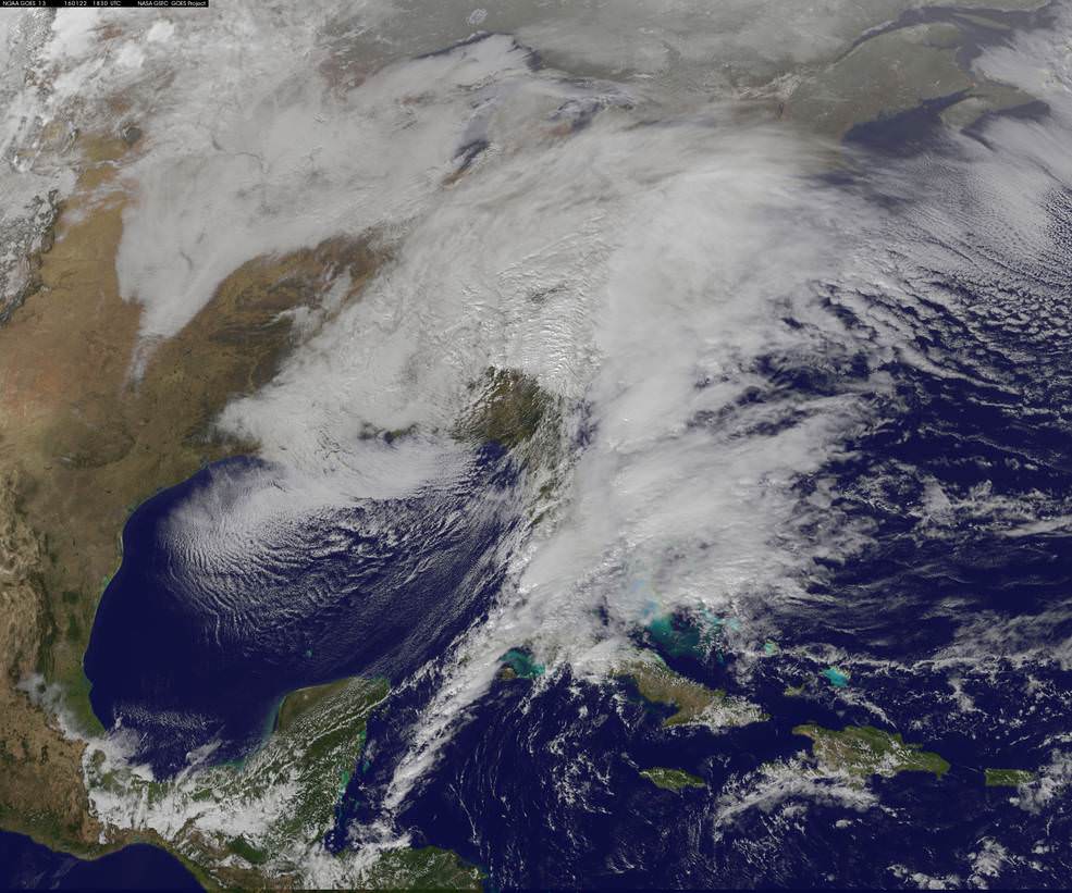
This visible image from NOAA’s GOES-East satellite at 1830 UTC (1:30 p.m. EST) on Jan. 22, 2016 shows the major winter storm now affecting the U.S. East coast. Credits: NASA/NOAA GOES Project
The heavy, blinding snow was already hitting Virginia and Washington by Friday afternoon. Governors, Mayors and Federal officials warned drivers to get off the roads by early Friday afternoon.
Stay off the roadways !!
Widespread treacherous driving with icy roads, sleet, rain, low visibility and whiteout conditions are causing numerous auto accidents as the blizzard bashes the region.
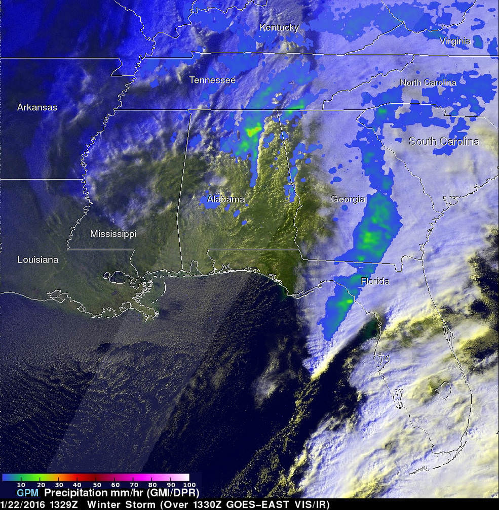
“The winter storm that caused damage during the night along the Gulf Coast has deepened and has started to spread heavy rain, freezing rain, sleet and snow northward into the Mid-Atlantic region. NASA’s GPM and NOAA’s GOES satellites are providing data on rainfall, cloud heights, extent and movement of the storm” wrote NASA’s Rob Gutro in an update on Friday.
On January 22 at 1329 UTC (8:29 a.m. EST) the GPM core satellite saw precipitation falling at a rate of over 64 mm (2.5 inches) per hour in storms over northern Alabama. Credits: SSAI/NASA/JAXA, Hal Pierce
The National Weather Service (NWS) Weather Prediction Center in College Park, Maryland said “An area of low pressure centered over the southeastern U.S. will continue developing into a major winter storm which will impact a large portion of the East Coast from the southern Appalachians through the Mid-Atlantic States from Friday into the weekend. Snowfall totals may exceed 2 feet in portions of these areas, including the Baltimore and Washington D.C. metropolitan areas.”
The monster storm has already caused at least ten deaths. Thousands of motorists are stranded.
High winds up to 55 mph are expected to batter the New Jersey shore, causing significant beach erosion, coastal flooding and property destruction in the same areas devastated by Superstorm Sandy. Thousands of people have been evacuated.
The blizzard has also impacted the US Presidential campaigns and forced New Jersey Governor Chris Christie to temporary cancel campaign appearances in New Hampshire on Friday and Saturday, to deal first hand with the storm back home.
Heavy ice and snow accumulations could cause falling tress resulting in downed power lines and days long power outages during brutally cold temperatures.
Here’s a cool supercomputer animation model:
Video caption: A NASA Center for Climate Simulation supercomputer model that shows the flow of #Blizzard2016 thru Sunday, January 24, 2015. Credit: NASA
Many airports have been closed and some seven thousand flights have also been canceled.
The storm is expected to last into Sunday, Jan. 24
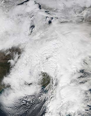
Looking massive from space…. This view of the winter storm over the eastern United States was captured on Friday, January 22, 2016 at 1:55 pm ET via the Visible Infrared Imaging Radiometer Suite (VIIRS) instrument on the Suomi NPP satellite. Credit: NASA/Goddard/Suomi NPP/VIIRS
Stay tuned here for Ken’s continuing Earth and Planetary science and human spaceflight news.