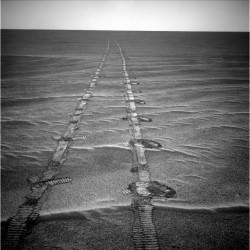
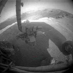
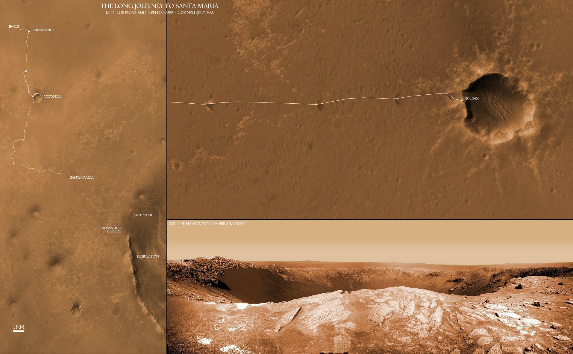
[/caption]
The Opportunity rover is now sending back a plethora of awesome views of Santa Maria Crater since just arriving at the western edge of the crater on Dec. 15 (Sol 2450). This intermediate stop on the rovers 19 km long journey from Victoria Crater to giant Endeavour Crater looks to be well worth the trip and affords another fine feather in the science teams cap.
Santa Maria appears to be “relatively unweathered and fresh”, according to Ray Arvidson, of Washington University in St. Louis. Arvidson is the deputy principal investigator for the Spirit and Opportunity rovers. A bounty of boulders and rocks from the ejecta ring the rim. The crater is roughly 90 meters in diameter with an estimated depth between 9 to 14 meters. It is somewhat oval in shape, not perfectly circular.

After initially driving to a distance of about five meters from the rim on Dec. 16 (Sol 2451), Opportunity has now carefully crawled even nearer to the precipice of the craters steep cliffs. At each spot the rover snaps a series of panoramic images to document the site scientifically and esthetically and plan the next sols drive.
The team back on Earth – and millions of kilometers away – must tread with extreme caution as Opportunity creeps ever closer to the edge lest she fall off a cliff. Whereas the cameras revealed a dramatic gaping hole on Dec. 16, Opportunity is now positioned close enough to point her cameras directly at the steep walled cliffs and towards the sand dunes at the crater floor crater unveiling another stunningly gorgeous Martian vista.
Compare the panoramas from Sols 2451 and 2454 above and below as Opportunity pulled up to the rim in stages and began exploring the crater environment from different vantage points.


The rover handlers are highly adept at precisely maneuvering the 175 kg vehicle back and forth inside the danger zone at crater rims. After all Opportunity has been on a crater tour for her entire 7 year extended mission to the red planet and controllers at NASA’s Jet Propulsion Laboratory (JPL) have honed their driving techniques at countless locales both treacherous and dazzling, especially about the precipitous 50 meter cliff drops at Victoria Crater.
High priority activity on the west side of Santa Maria includes collecting the first pair in a series of long-baseline, high resolution stereo panoramas which will be used to create a digital elevation map in 3 D, according to Guy Webster, the Public Affairs Officer at NASA’s Jet Propulsion Laboratory (JPL) in Pasadena, Calif., which manages the Mars Rover mission for NASA.
The newly assembled crater maps – see the first mosaics herein – will be scrutinized and utilized for planning the best locations to visit during the upcoming multi-week science campaign. .
JPL engineers will move Opportunity in a counterclockwise direction around the rim from the Sol 2450 approach point.
“One last drive before the Christmas break will take us ~ 20m away to a lookout point, to set us up for another drive next week,” tweeted JPL Rover driver Scott Maxwell. “Last weekend’s drive around Santa Maria took us to this gorgeous new outlook. It’s grand here.”
“There are no plans to enter the crater.” Webster confirmed to me. There is no reason to take a risk when Opportunity is so close to those phyllosilicate clays at Endeavour which formed in water and have never before been directly analyzed on the Martian surface.
Opportunity will head to an area on the southeast portion of Santa Maria that shows exposures of water bearing sulfate minerals based on data gathered from Mars orbit by the mineral mapping CRISM spectrometer onboard the Mars Reconnaissance Orbiter (MRO).
“
The current plan calls for Opportunity to stay at Santa Maria through the upcoming Solar conjunction which starts in late January and ends in mid-February,” Webster stated.
The rover will remain stationary during that period and conduct a lengthy focused investigation of a specific spot using the instruments on the robotic arm – which include a rock drill, microscope and spectrometers.
“During conjunction, no commands are uplinked to the rover out of caution that the command transmission could be disrupted. Some downlinks may be received during that period, Webster explained.”
“We will use the ‘no-new-commanding’ time of conjunction for a long-integration assessment of the composition of a selected target,” added Webster.
“The team plans to use Opportunity’s RAT- or Rock Abrasion Tool – on a target at Santa Maria,” says rover project manager John Callas of JPL. The RAT is a high tech device that uses a grinding wheel to cut into martian rocks and has performed far beyond expectation. The diamond embedded abrader teeth still have some life left, and the team wants to save some abrasion capability for the Endeavour rim targets.
Opportunity remains healthy and has abundant solar power for the final leg of the eastward march to Endeavour.


The first image caption is incorrect: “The rovers next destination is Endurance Crater”.
Or so I hope!
fixed. thanks
7 years. Astonishing. I hope the know-how gained from constructing and operating those rovers will find its way into the next generation of probes.
indeed. Spirit and Opportunity are also now serving as pathfinders for MSL – Curiosity, NASA’s next mars lander