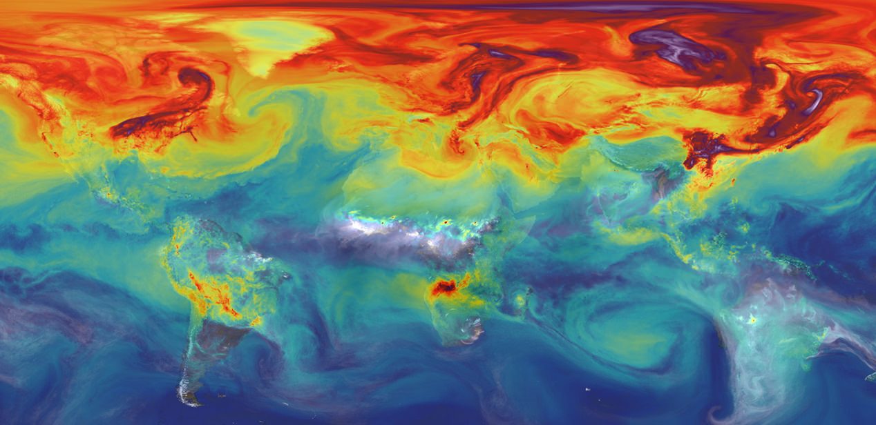
What’s the weather doing? Is it going to rain today? How much? What about temperatures? We depend on modern weather forecasting, thanks, in part to the vast network of weather satellites. What instruments do they have, what orbits do they use.
If you would like to join the Weekly Space Hangout Crew, visit their site here and sign up. They’re a great team who can help you join our online discussions!
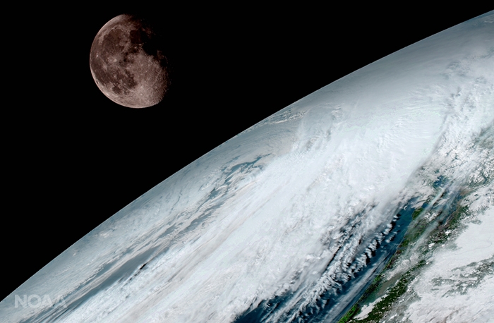
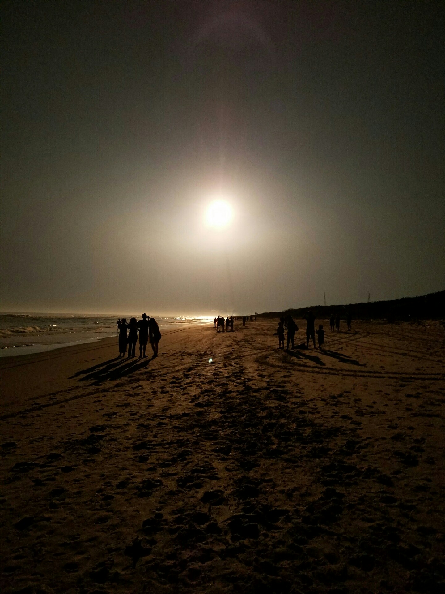
GOES-16 (previously known as GOES-R) captured this view of the moon as it looked across the surface of the Earth on January 15, 2017. Like earlier GOES satellites, GOES-16 will use the moon for calibration. Credit: NOAA/NASA
GOES-16 (previously known as GOES-R) captured this view of the moon as it looked across the surface of the Earth on January 15, 2017. Like earlier GOES satellites, GOES-16 will use the moon for calibration. Credit: NOAA/NASA
KENNEDY SPACE CENTER, FL – A new age has begun in the nations weather forecasting capabilities with the release today (Jan. 23) of the spectacular first images gathered by the recently launched NASA/NOAA GOES-16 observatory.
“It will be like high-definition from the heavens,” says NOAA.
“Today’s release of the first images from #GOES16 signals the start of a new age in satellite weather observation!!!”
Thus the newly obtained and published imagery has been anxiously awaited by scientists, meteorologists and ordinary weather enthusiasts.
“This is such an exciting day for NOAA! One of our GOES-16 scientists compared this to seeing a newborn baby’s first pictures — it’s that exciting for us,” said Stephen Volz Ph.D. director of NOAA’s Satellite and Information Service, in a statement.
“These images come from the most sophisticated technology ever flown in space to predict severe weather on Earth. The fantastically rich images provide us with our first glimpse of the impact GOES-16 will have on developing life-saving forecasts.”
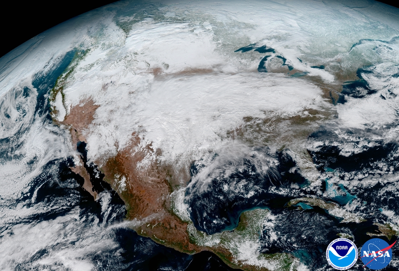
This image clearly shows the significant storm system that crossed North America that caused freezing and ice that resulted in dangerous conditions across the United States on January 15, 2017 resulting in loss of life. Credit: NOAA/NASA
An especially eye-popping image taken by GOES -16 from its equatorial vantage point situated in geostationary orbit 22,300 miles (35,800 kilometers) above Earth and published today, shows both the Earth and the Moon together – as the lead image here.
The Earth/Moon combo shot is not only fantastically pleasing to the eye, but also serves a significant scientific purpose.
“Like earlier GOES satellites, GOES-16 will use the moon for calibration,” say NOAA officials.
“GOES-16 will boost the nation’s weather observation network and NOAA’s prediction capabilities, leading to more accurate and timely forecasts, watches and warnings.”
GOES-16 is the most advanced and powerful weather observatory ever built and will bring about a ‘quantum leap’ in weather forecasting.
“Seeing these first images from GOES-16 is a foundational moment for the team of scientists and engineers who worked to bring the satellite to launch and are now poised to explore new weather forecasting possibilities with this data and imagery,” said Volz.
“The incredibly sharp images are everything we hoped for based on our tests before launch. We look forward to exploiting these new images, along with our partners in the meteorology community, to make the most of this fantastic new satellite.”
It’s dramatic new imagery will show the weather in real time enabling critical life and property forecasting, help pinpoint evacuation zones and also save people’s lives in impacted areas of severe weather including hurricanes and tornadoes.
And the huge satellite can’t come online soon enough, as demonstrated by the severe winter weather and tornadoes that just wreaked havoc and death in various regions of the US.
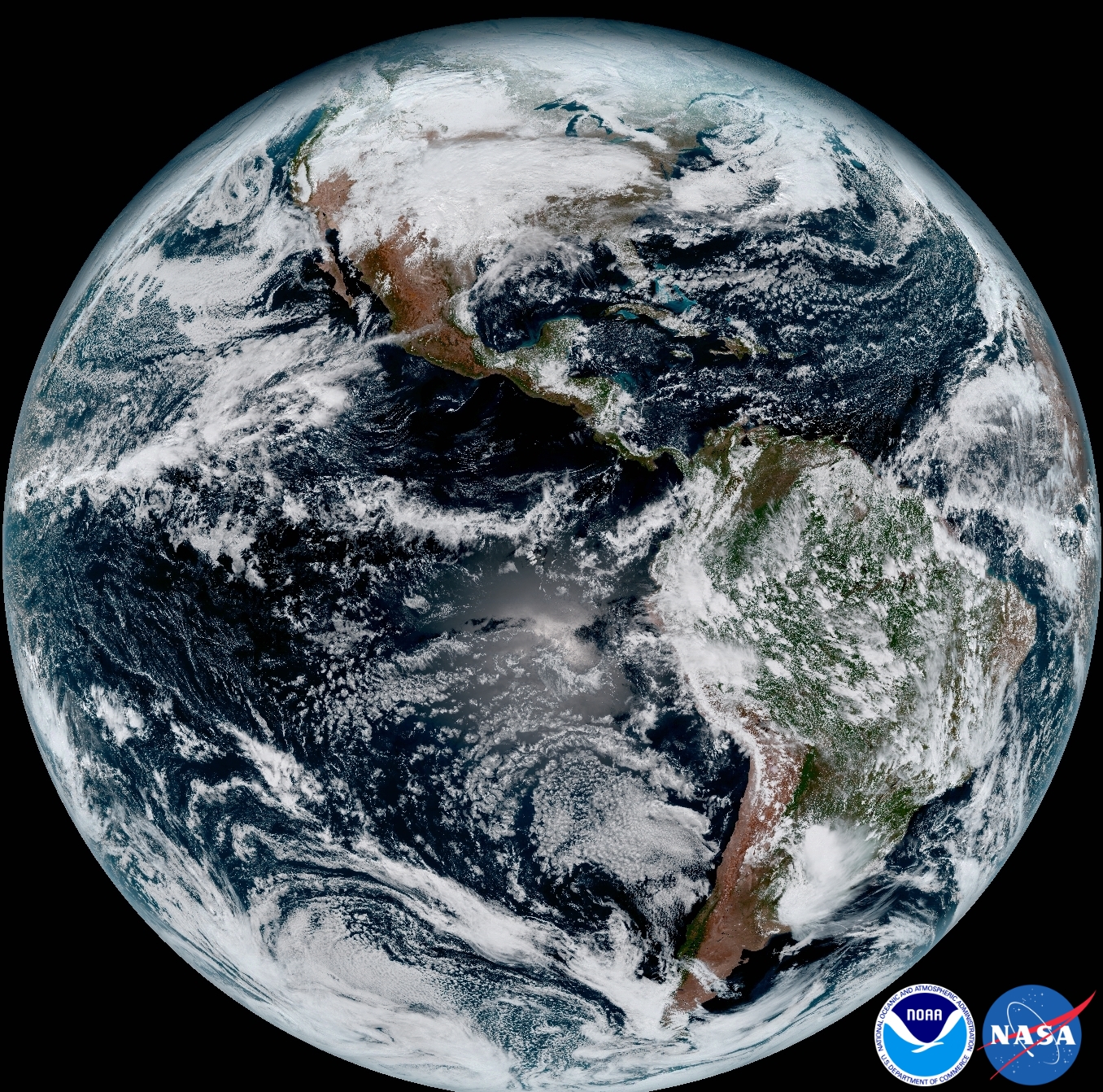
Another breathtaking image product (seen below) produced by the GOES-16 Advanced Baseline Imager (ABI) instrument, built by Harris Corporation, shows a full-disc view of the Western Hemisphere in high detail — at four times the image resolution of existing GOES spacecraft.
This composite color full-disk visible image shows North and South America and was taken on January 15, 2017. It was created using several of the 16 spectral channels available on the GOES-16 Advanced Baseline Imager (ABI) instrument. Credit: NOAA/NASA
The 11,000 pound satellite was built by prime contractor Lockheed Martin and is the first of a quartet of four identical satellites – comprising GOES-R, S, T, and U – at an overall cost of about $11 Billion. This will keep the GOES satellite system operational through 2036.
This next generation of GOES satellites will replace the currently operating GOES East and GOES West satellites.
NOAA will soon decide whether GOES-16 will replace either the East or West satellites. A decision from NOAA is expected in May. GOES-16 will be operational by November 2017 as either the GOES-East or GOES-West satellite. Of course everyone wants it first.
The next satellite is nearing assembly completion and will undergo about a year of rigorous environmental and acoustic testing before launch. It will go to whichever slot was not selected this year.
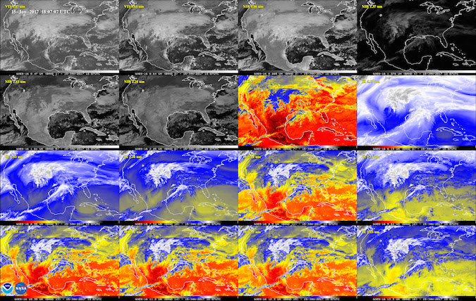
This 16-panel image shows the continental United States in the two visible, four near-infrared and 10 infrared channels on the Advanced Baseline Imager (ABI). These channels help forecasters distinguish between differences in the atmosphere like clouds, water vapor, smoke, ice and volcanic ash. Credit: NOAA/NASA
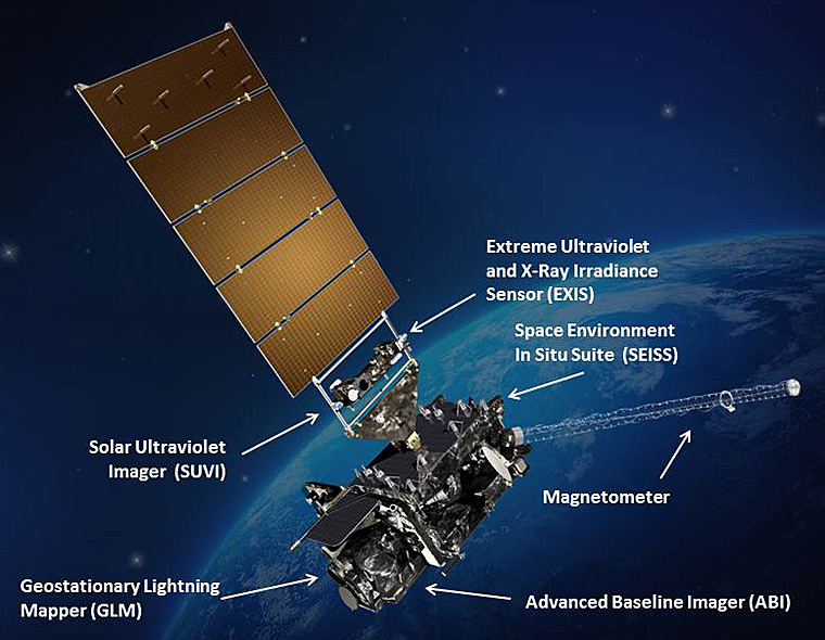
The six instrument science suite includes the Advanced Baseline Imager (ABI) built by Harris Corporation, the Geostationary Lightning Mapper (GLM) built by Lockheed Martin, Solar Ultraviolet Imager (SUVI), Extreme Ultraviolet and X-Ray Irradiance Sensors (EXIS), Space Environment In-Situ Suite (SEISS), and the Magnetometer (MAG).
ABI is the primary instrument and will collect 3 times more spectral data with 4 times greater resolution and scans 5 times faster than ever before – via the primary Advanced Baseline Imager (ABI) instrument – compared to the current GOES satellites.
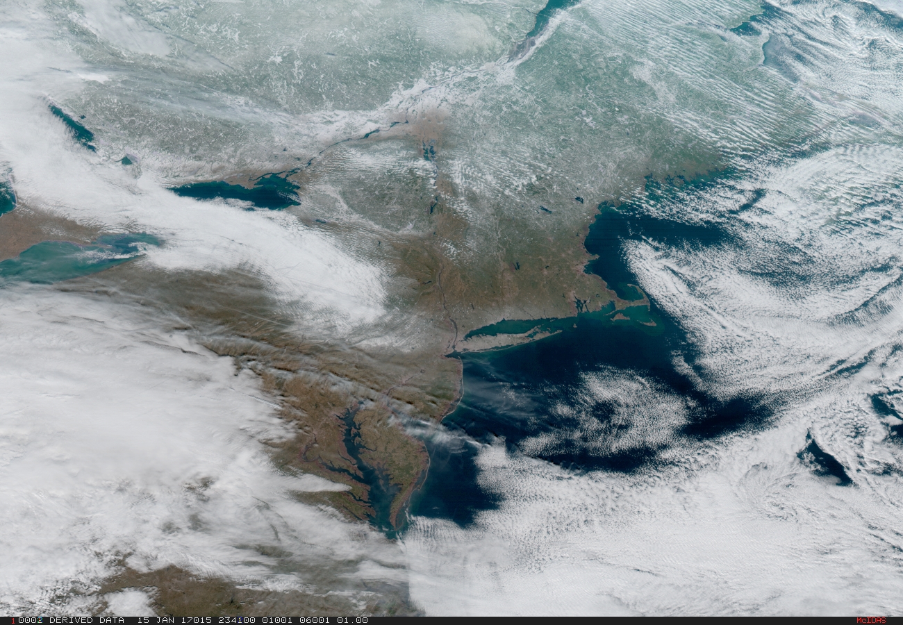
Northeast Coast and New York Metropolitan region. On January 15, 2017 severe weather moved across the central United States before passing through the Northeast on the 16th and 17th where it resulted in wet and wintry weather for travelers across the region. Credit: NOAA/NASA
“The higher resolution will allow forecasters to pinpoint the location of severe weather with greater accuracy. GOES-16 can provide a full image of Earth every 15 minutes and one of the continental U.S. every five minutes, and scans the Earth at five times the speed of NOAA’s current GOES imagers.”
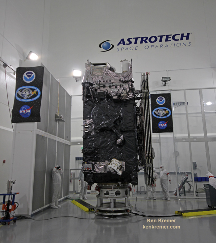
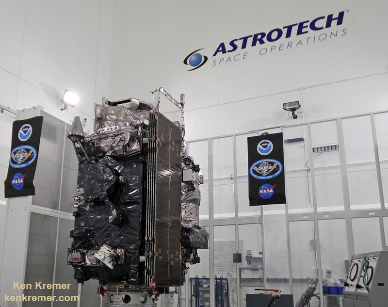
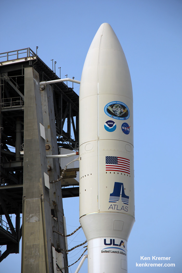
The NASA/NOAA GOES-R (Geostationary Operational Environmental Satellite – R Series) being processed at Astrotech Space Operations, in Titusville, FL, in advance of successful launch on a ULA Atlas V on Nov. 19, 2016. GOES-R/GOES-16 will be America’s most advanced weather satellite. Credit: Ken Kremer/kenkremer.com
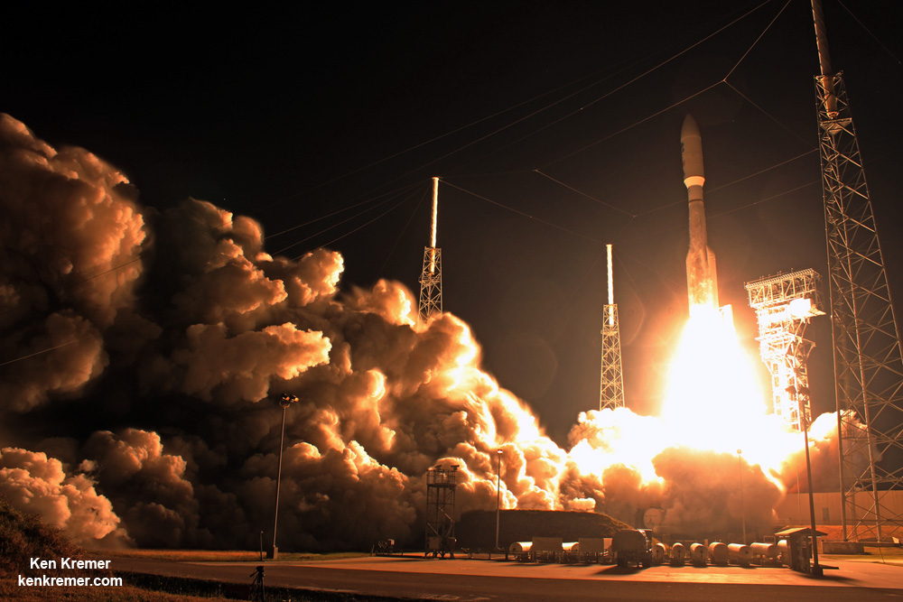
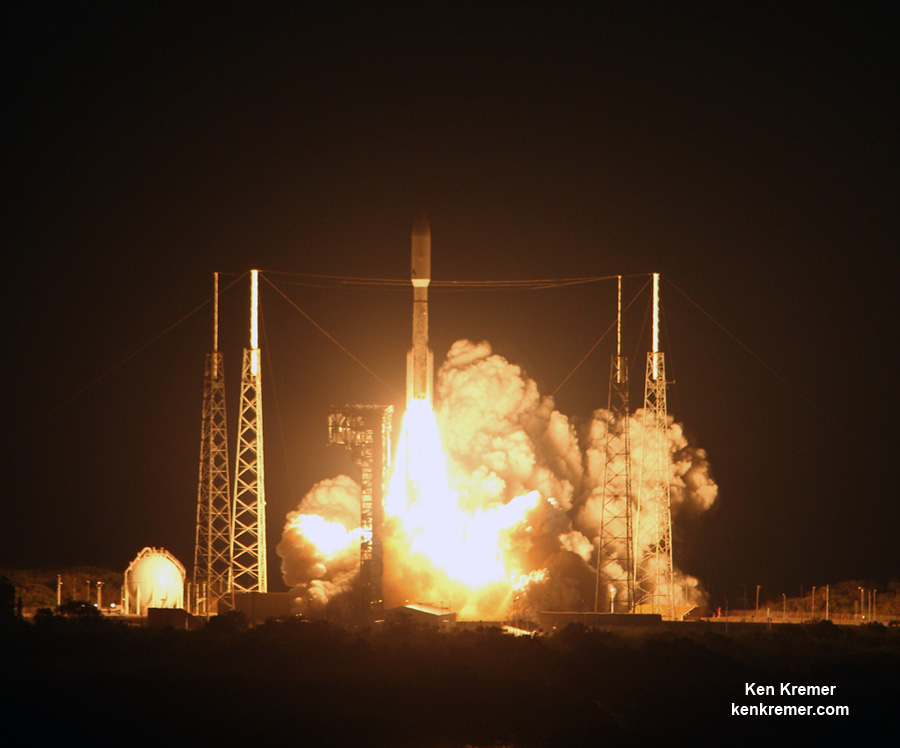
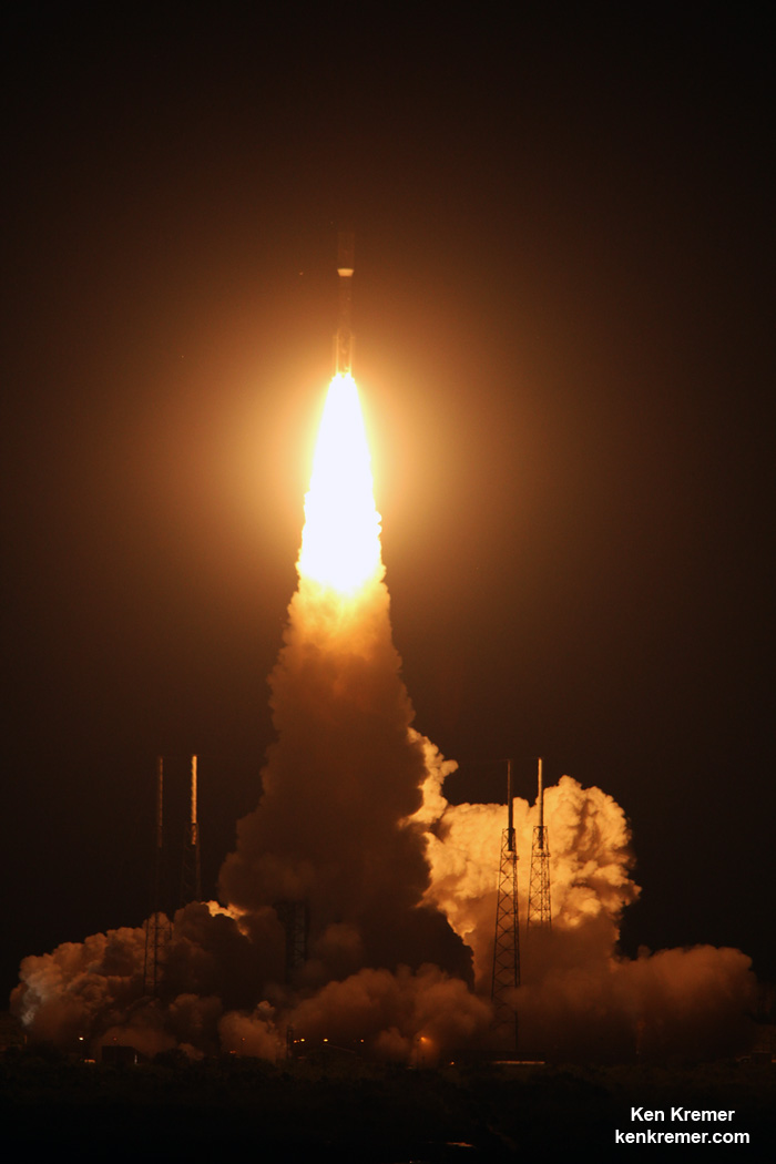
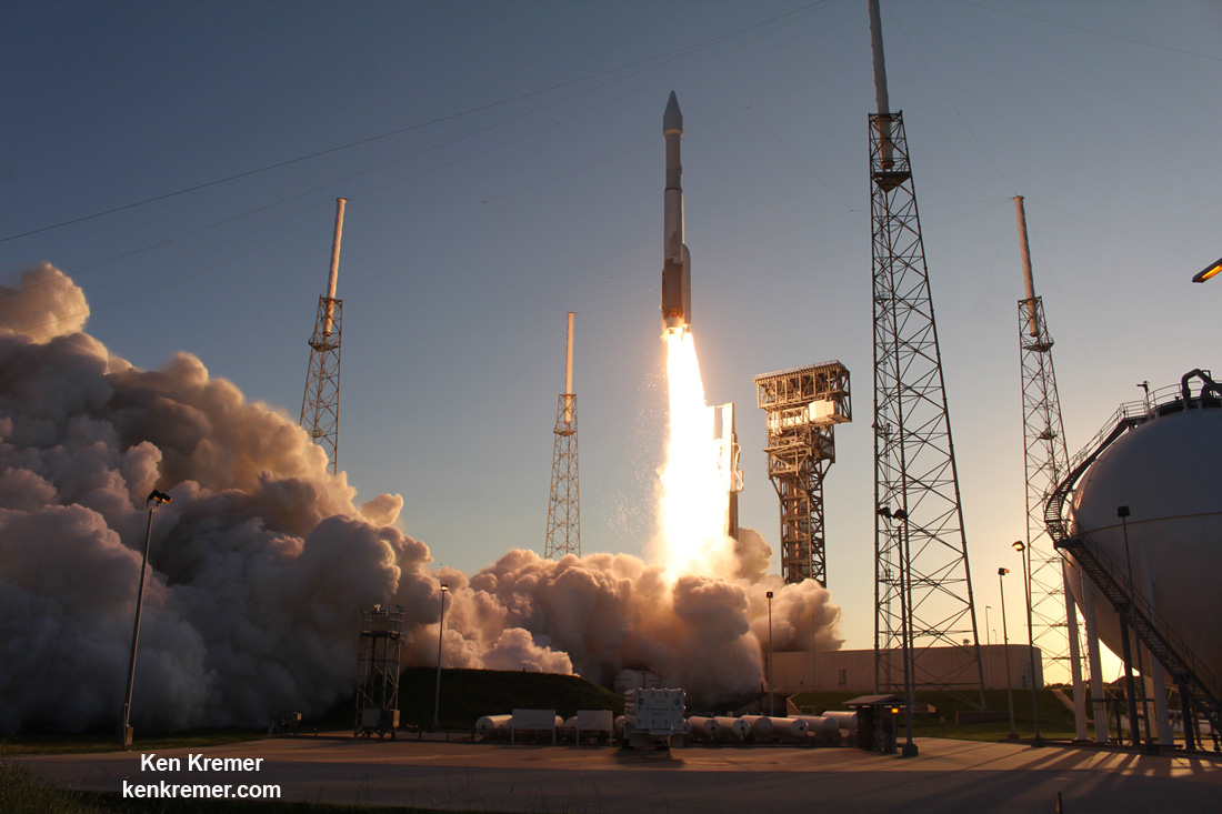
Blastoff of revolutionary NASA/NOAA GOES-R (Geostationary Operational Environmental Satellite – R Series) on ULA Atlas V from Space Launch Complex 41 (SLC-41) on Cape Canaveral Air Force Station, Florida on Nov. 19, 2016. GOES-R will deliver a quantum leap in America’s weather forecasting capabilities. Credit: Ken Kremer/kenkremer.com
Stay tuned here for Ken’s continuing Earth and Planetary science and human spaceflight news.
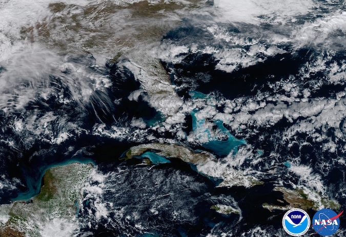
Ken Kremer Florida and The Caribbean. In May 2017, NOAA will announce the planned location for GOES-16. By November 2017, GOES-16 will be operational as either the GOES-East or GOES-West satellite. At its current check out location the satellite captured this image of the Caribbean and Florida. Here the satellite captures the shallows waters of the Caribbean. Credit: NOAA/NASA
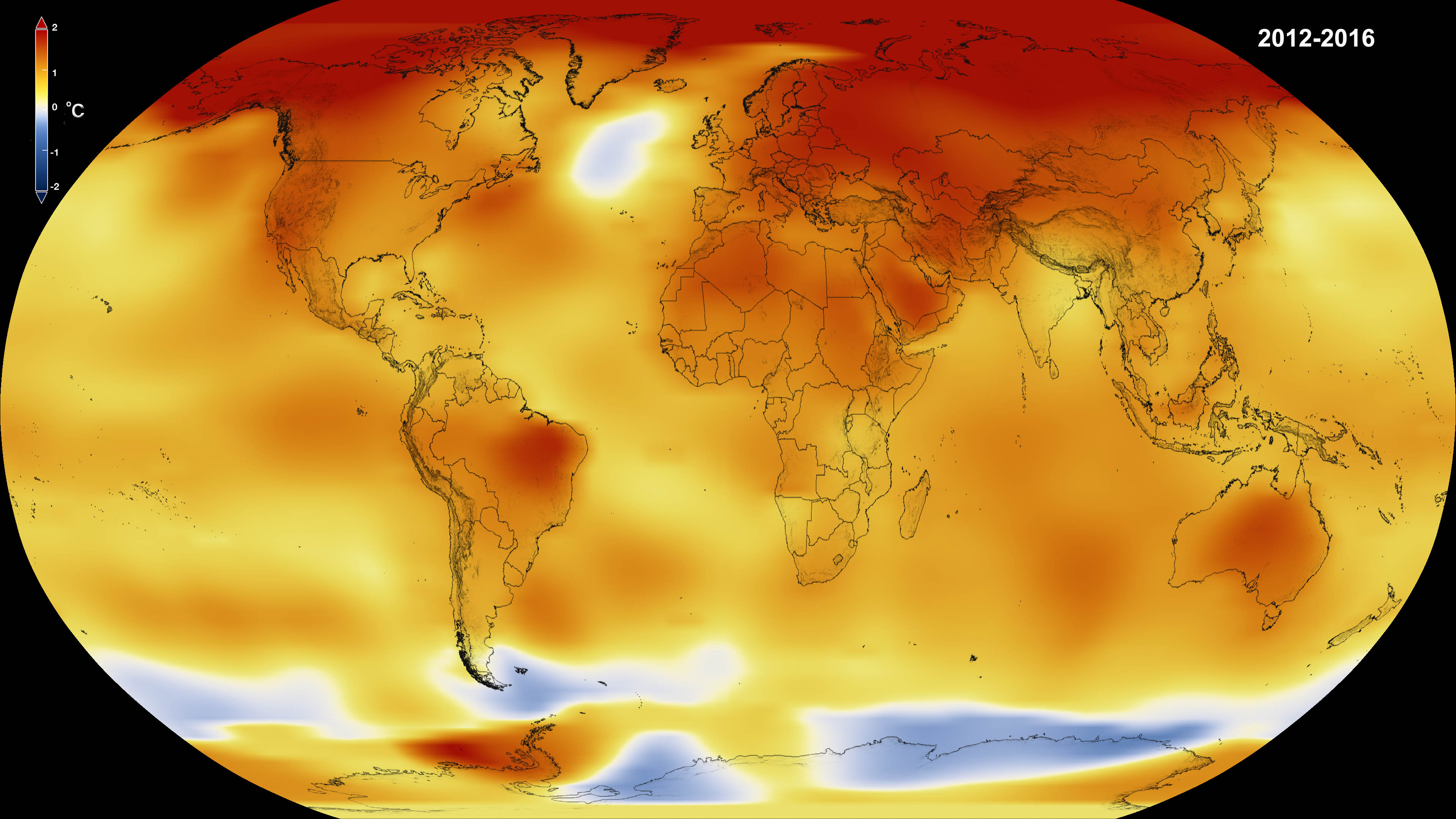
According to data from NASA and the NOAA, 2016 was the hottest year on record yet again. Credit: NASA
The reality of Climate Change has become painfully apparent in recent years, thanks to extended droughts in places like California, diminishing water tables around the world, rising tides, and coastal storms of increasing intensity and frequency. But perhaps the most measurable trend is the way that average global temperatures have kept rising year after year.
And this has certainly been the case for the year of 2016. According to independent analyses provided by NASA’s Goddard Institute for Space Studies (GISS) and the National Oceanic and Atmospheric Agency (NOAA), 2016 was the warmest year since modern record keeping began in 1880. This represents a continuation of a most alarming trend, where 16 of the 17 warmest years on record have occurred since 2001.
Based in New York, GISS conducts space and Earth sciences research, in support of the Goddard Space Flight Center’s (GSFC) Sciences and Exploration Directorate. Since its establishment in 1961, the Institute has conducted valuable research on Earth’s structure and atmosphere, the Earth-Sun relationship, and the structure and atmospheres of other planets in the Solar System.
Monthly temperature anomalies with base 1980-2015, superimposed on a 1980-2015 mean seasonal cycle. Credit: NASA/GISS/Schmidt
Their early studies of Earth and other solar planets using data collected by satellites, space probes, and landers eventually led to GISS becoming a leading authority on atmospheric modeling. Similarly, the NOAA efforts to monitor atmospheric conditions and weather in the US since 1970s has led to them becoming a major scientific authority on Climate Change.
Together, the two organizations looked over global temperature data for the year of 2016 and came to the same conclusion. Based on their assessments, GISS determined that globally-averaged surface temperatures in 2016 were 0.99 °C (1.78 °F) warmer than the mid-20th century mean. As GISS Director Gavin Schmidt put it, these findings should silence any doubts about the ongoing nature of Global Warming:
“2016 is remarkably the third record year in a row in this series. We don’t expect record years every year, but the ongoing long-term warming trend is clear.”
The NOAA’s findings were similar, with an average temperature of 14.83 °C (58.69 °F) being reported for 2016. This surpassed last year’s record by about 0.004 °C (0.07 °F), and represents a change of around 0.94 °C (1.69 F) above the 20th century average. The year began with a boost, thanks to El Nino; and for the eight consecutive months that followed (January to August) the world experienced record temperatures.
This represents a consistent change since 2001, where average global temperatures have increased, leading to of the 16 warmest years on record since 1880 in a row. In addition, on five separate occasions during this period, the annual global temperature was record-breaking – in 2005, 2010, 2014, 2015, and 2016, respectively.
Land and ocean global temperatures in 2013 from both NASA and NOAA. Credit: NASA.
With regards to the long-term trend, average global temperatures have increased by about 1.1° Celsius (2° Fahrenheit) since 1880. This too represents a change, since the rate of increase was placed at 0.8° Celsius (1.4° Fahrenheit) back in 2014. Two-thirds of this warming has occurred since 1975, which coincides with a period of rapid population growth, industrialization, and increased consumption of fossil fuels.
And while there is always a degree of uncertainty when it comes to atmospheric and temperature modelling, owing to the fact that the location of measuring stations and practices change over time, NASA indicated that they were over 95% certain of these results. As such, there is little reason to doubt them, especially since they are consistent with what is at this point a very well-documented trend.
To see an animated graph of average global temperature increases since 1880, click here. To see the full data set and learn about the methods employed by GISS, click here.
And be sure to check out this NASA video that shows these changes on a global map:
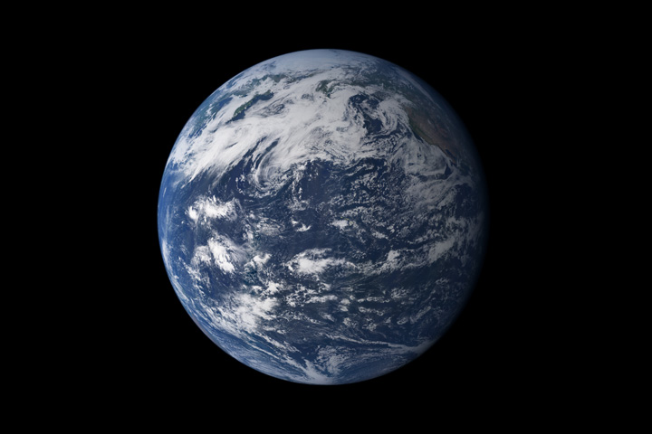
Earth, seen from space, above the Pacific Ocean. Credit: NASA
Since the election of Donald Trump, NASA has had its share of concerns about the future. Given the President-elect’s position and past statements on climate science, there has been speculation that his presidency will curtail funding to some of their research efforts, particularly those that are maintained by the Earth Science Directorate.
Things took another turn on Monday (Dec. 5th) as Trump met with former Vice President and environmental activist Al Gore to discuss his administration’s policy. This meeting was the latest in a series of gestures that suggest that the President-elect might be softening his stances on the environment. However, there is little reason to suspect that this meeting could mean any changes in policy.
The meeting was apparently arranged by the President-elect’s daughter, Ivanka Trump, to coincide with the former VP’s attendance of a conference in New York on Monday. Said conference was the 24 hour live broadcast titled “24 Hours of Reality”, an event being put on by the Climate Reality Project – a non-profit organization founded by Gore to educate the public on climate change and policy.
Much of NASA’s research into Climate Change takes place through the Earth Sciences Directorate. Credit: NASA
The meeting lasted 90 minutes, after which Gore spoke to reporters about the discussion he and the President-elect had. As he was quoted as saying by The Washington Post:
“I had a lengthy and very productive session with the president-elect. It was a sincere search for areas of common ground. I had a meeting beforehand with Ivanka Trump. The bulk of the time was with the president-elect, Donald Trump. I found it an extremely interesting conversation, and to be continued, and I’m just going to leave it at that.”
While this meeting has led to speculation that Trump’s administration might be softening its stance on environmental issues, many are unconvinced. Based on past statements – which include how Climate Change is a “hoax invented by the Chinese” – to his more recent picks for his cabinet, there are those who continue to express concern for the future of NASA programs that are centered on Earth sciences and the environment.
For instance, after weeks of remaining mute on the subject of NASA’s future, the Trump campaign announced that it had appointed Bob Walker – a former Pennsylvania Congressman and the chair of the House Science Committee from 1995 to 1997. A fierce conservative, Walker was recently quoted as saying that NASA should cease its climate research and focus solely on space exploration.
Artist’s impression of the carbon dioxide that will be present in Earth’s atmosphere if half of global-warming emissions are not absorbed. Credit: NASA/JPL/GSFC
“My guess is that it would be difficult to stop all ongoing Nasa programs but future programs should definitely be placed with other agencies,” he said in an interview with the Guardian in late November. “I believe that climate research is necessary but it has been heavily politicized, which has undermined a lot of the work that researchers have been doing. Mr Trump’s decisions will be based upon solid science, not politicized science.”
From statements such as these, plus things said during the campaign that emphasized NASA’s important role in space exploration, the general consensus has been that a Trump administration will likely slash funding to NASA’s Earth Science Directorate while leaving long-term exploration programs unaffected. According to David Titley, who recently wrote an op-ed piece for The Conversation, this would be a terrible mistake.
As he noted in his piece, NASA’s Earth science and Earth observation efforts are vital, and the shared missions they have with organizations like the NOAA have numerous benefits. As he explained:
“There’s a reason why space is called ‘the ultimate high ground’ and our country spends billions of dollars each year on space-based assets to support our national intelligence community. In addition to national security, NASA missions contribute vital information to many other users, including emergency managers and the Federal Emergency Management Agency (FEMA), farmers, fishermen and the aviation industry.”
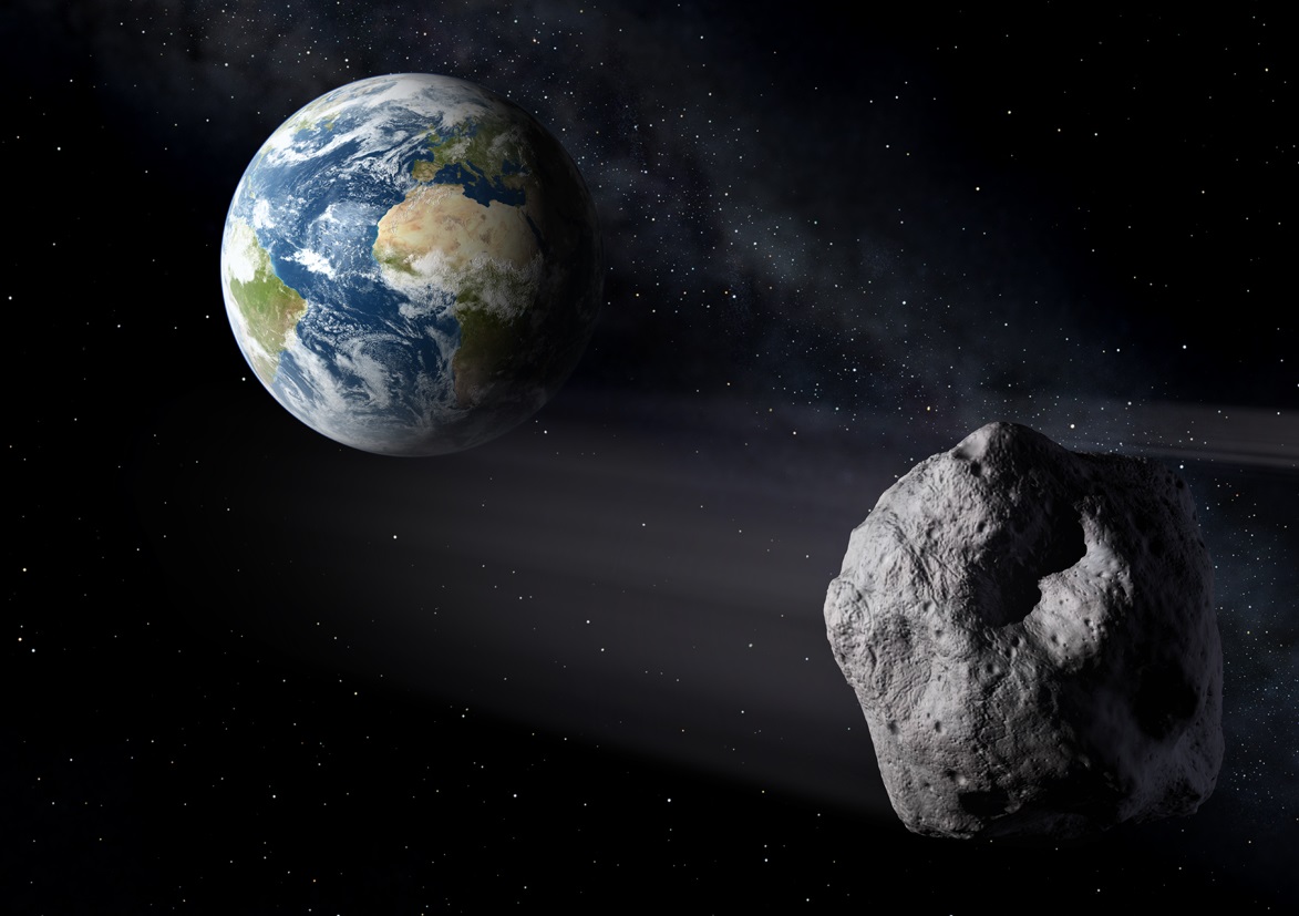
An artist’s conception of an asteroid passing near the Earth. NASA is getting better at spotting them and giving us advance warning of their approach. Image credit: ESA.
In the past, NASA’s Earth Science Directorate has contributed vital information on how rising temperatures could affect water tables and farmlands (such as the ongoing drought in California), and how changes in oceanic systems would affect fisheries. On top of that, FEMA has been working with NASA in recent years in order to develop a disaster-readiness program to address the fallout from a possible asteroid impact.
This has included three tabletop exercises where the two agencies worked through asteroid impact scenarios and simulated how information would be exchanged between NASA scientists an FEMA emergency managers. As Melissa Weihenstroer – a Presidential Management Fellow in FEMA’s Office of External Affairs and who works with NASA’s Planetary Defense Coordination Office – recently wrote about this inter-agency cooperation:
“Since FEMA doesn’t have direct experience with asteroids or their impacts, we’ve turned to some people who do: our partners at the National Aeronautics and Space Administration (NASA). While FEMA will be the agency in charge of the U.S. government efforts in preparing for and responding to any anticipated asteroid-related event here on Earth, NASA is responsible for finding, tracking, and characterizing potentially hazardous asteroids and comets while they are still in space.
Whenever a transition occurs between one presidential administration and the next, there is always some level of concern about the impact it will have on federal organization. However, when an administration is unclear about its policies, and has made statements to the effect that federal agencies should cease conducting certain types of research, NASA can be forgiven for getting a little nervous.
In the coming years, it will be interesting to see how the budget environment changes for Earth science research. One can only hope that a Trump administration will not see fit to make sweeping cuts without first considering the potential consequences.
Blastoff of revolutionary NASA/NOAA GOES-R weather satellite on ULA Atlas V on Nov. 19, 2016 - as seen from remote camera at Space Launch Complex 41 (SLC-41) on Cape Canaveral Air Force Station, Florida. GOES-R will deliver a quantum leap in America’s weather forecasting capabilities. Credit: Ken Kremer/kenkremer.com
Blastoff of revolutionary NASA/NOAA GOES-R weather satellite on ULA Atlas V on Nov. 19, 2016 – as seen from remote camera at Space Launch Complex 41 (SLC-41) on Cape Canaveral Air Force Station, Florida. GOES-R will deliver a quantum leap in America’s weather forecasting capabilities. Credit: Ken Kremer/kenkremer.com
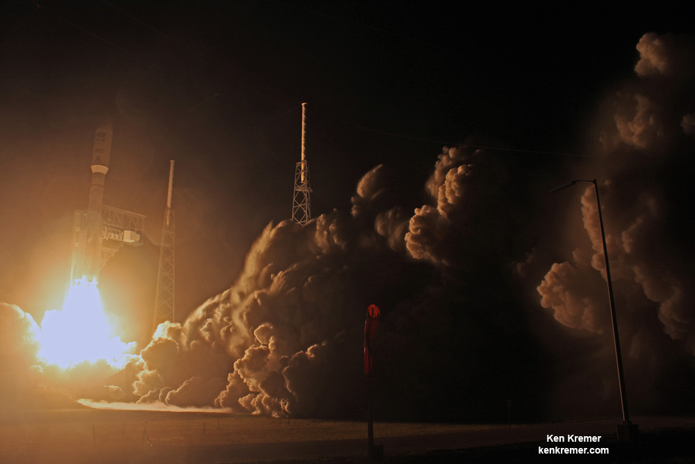
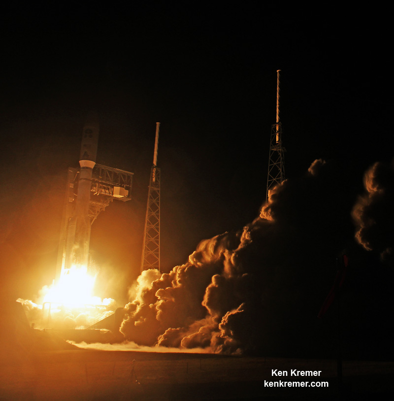
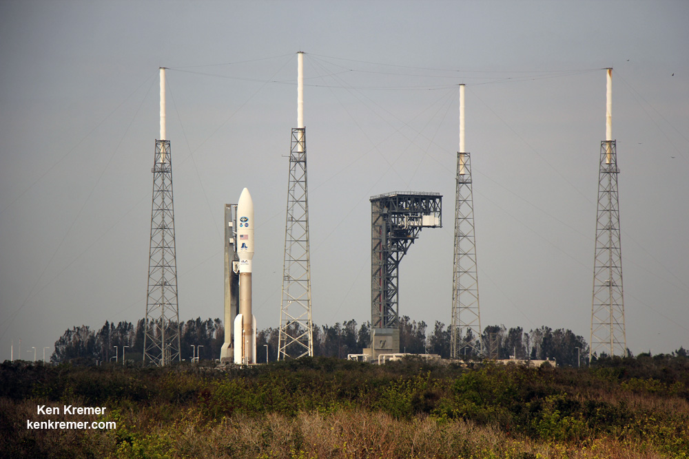
KENNEDY SPACE CENTER, FL – The fire and fury of the mighty ULA Atlas V got the gorgeous NASA/NOAA GOES-R weather observatory to geostationary orbit just days ago – as a ‘Thanksgiving’ present to all the people of Earth through the combined efforts of the government/industry/university science and engineering teams of hard working folks who made it possible.
Check out this dazzling photo and video gallery from myself and several space journalist colleagues showing how GOES got going – from prelaunch to launch atop a United Launch Alliance Atlas V rocket from Space Launch Complex 41 (SLC-41) Cape Canaveral Air Force Station at 6:42 p.m. EST in the evening on Saturday, Nov. 19, 2016.
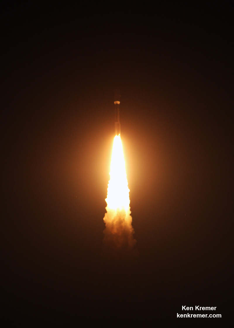
Three and a half hours after liftoff, the bus sized spacecraft successfully separated from the Atlas Centaur upper stage and deployed its life giving solar arrays.
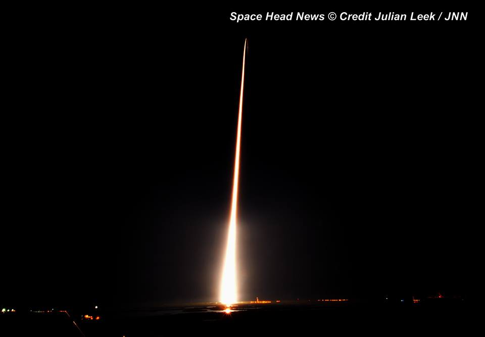
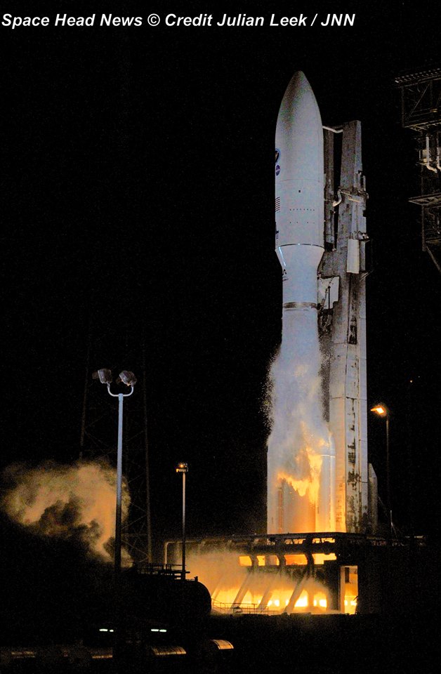
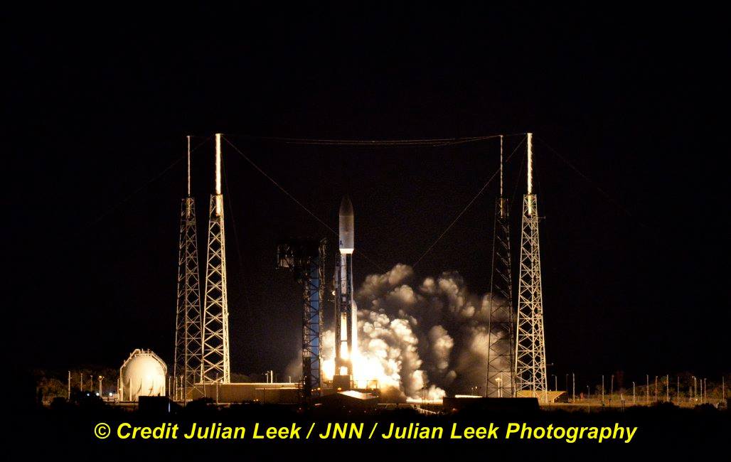
ULA Atlas V rocket and GOES-R weather observatory streak to orbit from launch pad 41 at Cape Canaveral, Florida. Credit: Julian Leek
GOES-R is the most advanced and powerful weather observatory ever built and will bring about a ‘quantum leap’ in weather forecasting.
It’s dramatic new imagery will show the weather in real time enabling critical life and property forecasting, help pinpoint evacuation zones and also save people’s lives in impacted areas of severe weather including hurricanes and tornadoes.
Here’s a pair of beautiful launch videos from space colleague Jeff Seibert and myself:
Video Caption: 5 views from the launch of the NOAA/NASA GOES-R weather satellite on 11/19/2016 from Pad 41 CCAFS on a ULA Atlas. Credit: Jeff Seibert
Video Caption: Launch of the NOAA/NASA GOES-R weather observatory satellite on Nov. 19, 2016 from pad 41 on Cape Canaveral Air Force Station on a ULA Atlas V rocket – as seen in this remote video taken at the pad. Credit: Ken Kremer/kenkremer.com
GOES-R is the first in a new series of revolutionary NASA/NOAA geostationary weather satellites that will soon lead to more accurate and timely forecasts, watches and warnings for the Earth’s Western Hemisphere when it becomes fully operational in about a year.
Ignition of ULA Atlas V rocket and GOES-R weather observatory at launch pad 41 at Cape Canaveral, Florida. Credit: Julian Leek
GOES-R, which stands for Geostationary Operational Environmental Satellite – R Series – is a new and advanced transformational weather satellite that will vastly enhance the quality, speed and accuracy of weather forecasting available to forecasters for Earth’s Western Hemisphere.
The 11,000 pound satellite was built by prime contractor Lockheed Martin and is the first of a quartet of four identical satellites – comprising GOES-R, S, T, and U – at an overall cost of about $11 Billion. This will keep the GOES satellite system operational through 2036.
Blastoff of revolutionary NASA/NOAA GOES-R weather satellite on ULA Atlas V on Nov. 19, 2016 – as seen from remote camera at Space Launch Complex 41 (SLC-41) on Cape Canaveral Air Force Station, Florida. Credit: Ken Kremer/kenkremer.com
The science suite includes the Advanced Baseline Imager (ABI) built by Harris Corporation, the Geostationary Lightning Mapper (GLM) built by Lockheed Martin, Solar Ultraviolet Imager (SUVI), Extreme Ultraviolet and X-Ray Irradiance Sensors (EXIS), Space Environment In-Situ Suite (SEISS), and the Magnetometer (MAG).
ABI is the primary instrument and will collect 3 times more spectral data with 4 times greater resolution and scans 5 times faster than ever before – via the primary Advanced Baseline Imager (ABI) instrument – compared to the current GOES satellites.
Atlas V and GOES-R aloft after Nov. 19, 2016 liftoff of the powerful NASA/NOAA weather observatory on ULA Atlas V from pad 41 on Cape Canaveral Air Force Station, Florida – as seen from the VAB roof. Credit: Ken Kremer/kenkremer.com
GOES-R launched on the massively powerful Atlas V 541 configuration vehicle, augmented by four solid rocket boosters on the first stage.
The payload fairing is 5 meters (16.4 feet) in diameter. The first stage is powered by the Russian built duel nozzle RD AMROSS RD-180 engine. And the Centaur upper stage is powered by a single-engine Aerojet Rocketdyne RL10C engine.
This was only the fourth Atlas V launch employing the 541 configuration.
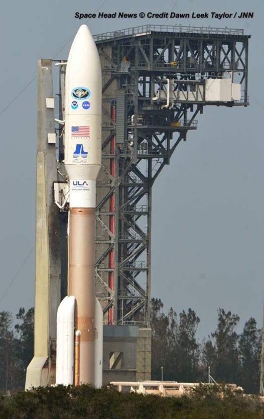
ULA Atlas V rocket and GOES-R weather observatory at launch pad 41 at Cape Canaveral, Florida. Credit: Dawn Leek Taylor
Stay tuned here for Ken’s continuing Earth and Planetary science and human spaceflight news.
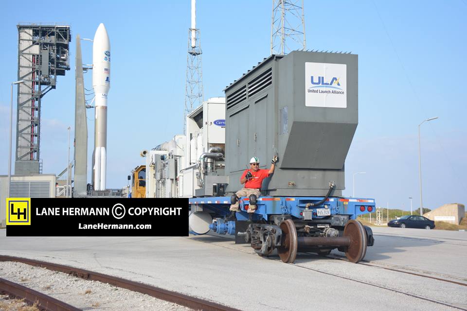
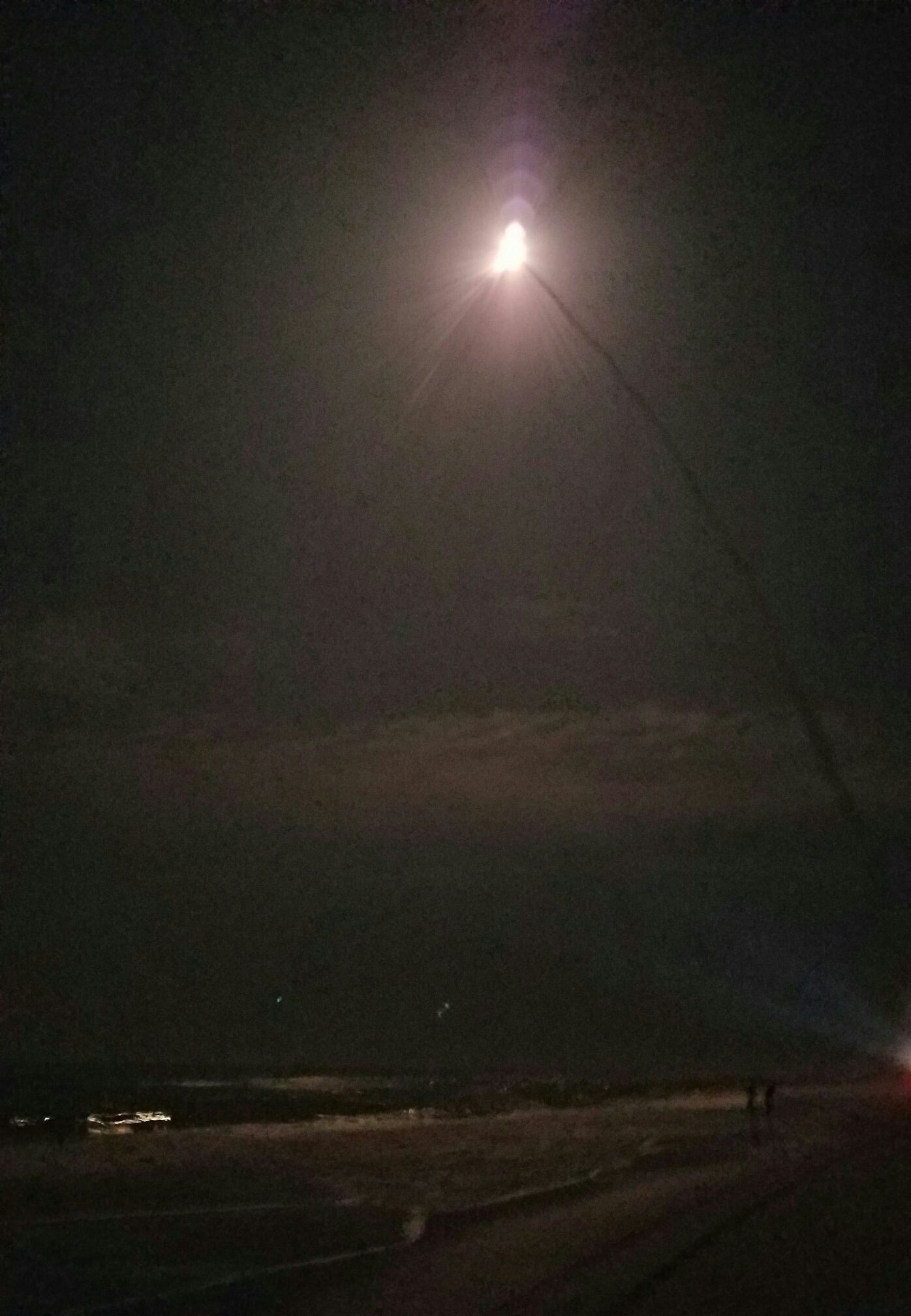
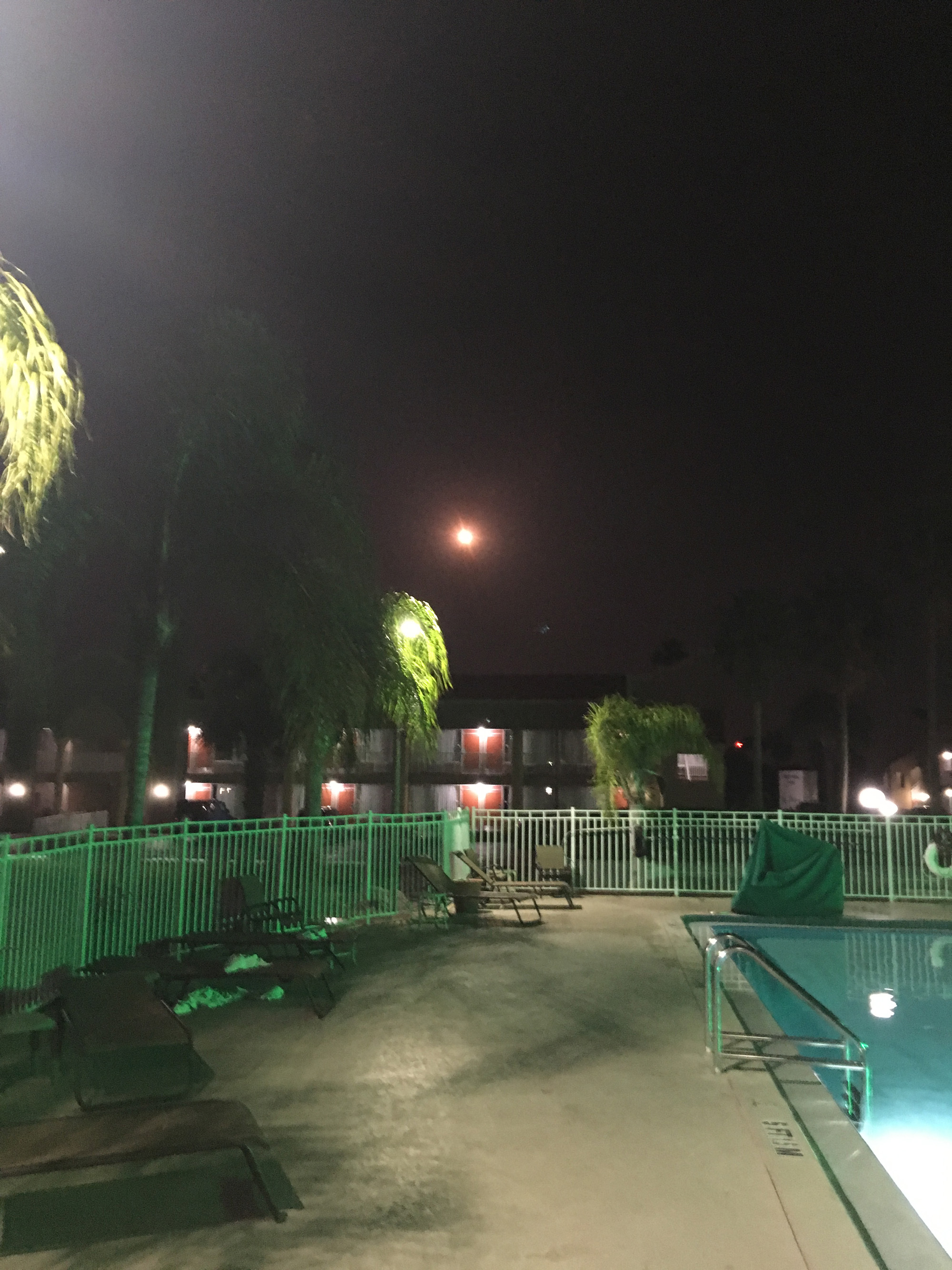
Track mobile used to push ULS Atlas V and NASA/NOAA GOES-R to pad 41 from VIF processing facility. Credit: Lane HermannLaunch of NASA/NOAA GOES-R weather observatory on ULA Atlas V on Nov. 19, 2016 from pad 41 on Cape Canaveral Air Force Station, Florida, as seen from Playalinda beach. Credit: Jillian LaudickAtlas V/GOES-R launch as seen rising over neighbor houses in Titusville, Florida on Nov. 19, 2016. Credit: Melissa BaylesAtlas V rocket and GOES-R nighttime launch soars over the swimming pool at the Quality Inn Kennedy Space Center in Titusville, Florida on Nov. 19, 2016. Credit: Wesley BaskinThe NASA/NOAA GOES-R (Geostationary Operational Environmental Satellite – R Series) being processed at Astrotech Space Operations, in Titusville, FL, in advance of launch on a ULA Atlas V on Nov. 19, 2016. GOES-R will be America’s most advanced weather satellite. Credit: Ken Kremer/kenkremer.com
Blastoff of revolutionary NASA/NOAA GOES-R (Geostationary Operational Environmental Satellite - R Series) on a ULA Atlas V from Space Launch Complex 41 (SLC-41) on Cape Canaveral Air Force Station, Florida on Nov. 19, 2016 - as seen from the VAB roof. GOES-R will soon deliver a quantum leap in America’s weather forecasting capabilities. Credit: Ken Kremer/kenkremer.com
Blastoff of revolutionary NASA/NOAA GOES-R (Geostationary Operational Environmental Satellite – R Series) on a ULA Atlas V from Space Launch Complex 41 (SLC-41) on Cape Canaveral Air Force Station, Florida on Nov. 19, 2016 – as seen from the VAB roof. GOES-R will soon deliver a quantum leap in America’s weather forecasting capabilities. Credit: Ken Kremer/kenkremer.com
Liftoff of the highly advanced Geostationary Operational Environmental Satellite-R (GOES-R) weather observatory bolted atop a ULA Atlas V rocket came at 6:42 p.m. EST on Saturday, Nov. 19, 2016 from Space Launch Complex 41 (SLC-41) on Cape Canaveral Air Force Station, Florida.
The launch was delayed for an hour until the very end of the launch window to deal with unexpected technical and Eastern range issues, that only added more drama and changed the sunset launch into a night launch for the hordes of spectators who gathered here from around the world – appropriate since this probe will touch the lives of humans world wide.
“It’s a dramatic leap in capability – like moving from black and white TV to HDTV,” explained Greg Mandt, the NOAA GOES-R program manager during a prelaunch media briefing in the cleanroom processing facility at Astrotech.
“This is a very exciting time,” explained Greg Mandt, the NOAA GOES-R program manager during the Astrotech cleanroom briefing.
“This is the culmination of about 15 years of intense work for the great team of NOAA and NASA and our contractors Lockheed Martin and Harris.”
“We are bringing the nation a new capability. The GOES program has been around for about 40 years and most every American sees it every night on the weather broadcasts when they see go to the satellite imagery. And what’s really exciting is that for the first time in that 40 years we are really end to end replacing the entire GOES system. The weather community is really excited about what we are bringing.”
GOES-R will bring about a “quantum leap” in weather forecasting capabilities that will soon lead to more accurate and timely forecasts, watches and warnings for the Earth’s Western Hemisphere when it becomes fully operational in about a year.
But the first images are expected within weeks! And both researchers and weather forecasters can’t wait to see, analyze and put to practical use the sophisticated new images and data that will improve forecasts and save lives during extreme weather events that are occurring with increasing frequency.
Blastoff of revolutionary NASA/NOAA GOES-R (Geostationary Operational Environmental Satellite – R Series) on ULA Atlas V from Space Launch Complex 41 (SLC-41) on Cape Canaveral Air Force Station, Florida on Nov. 19, 2016. GOES-R will deliver a quantum leap in America’s weather forecasting capabilities. Credit: Ken Kremer/kenkremer.com
GOES-R will be renamed GOES-16 after it reaches its final orbit 22,000 above Earth about two weeks from now.
Over the next year, teams of engineers and scientists will check out and validate the state of the art suite of six science instruments that also includes the first operational lightning mapper in geostationary orbit – dubbed the Geostationary Lightning Mapper (GLM).
“The launch of GOES-R represents a major step forward in terms of our ability to provide more timely and accurate information that is critical for life-saving weather forecasts and warnings,” said Thomas Zurbuchen, associate administrator for NASA’s Science Mission Directorate in Washington.
“It also continues a decades-long partnership between NASA and NOAA to successfully build and launch geostationary environmental satellites.”
GOES-R, which stands for Geostationary Operational Environmental Satellite – R Series – is a new and advanced transformational weather satellite that will vastly enhance the quality, speed and accuracy of weather forecasting available to forecasters for Earth’s Western Hemisphere.
The science suite includes the Advanced Baseline Imager (ABI), Geostationary Lightning Mapper (GLM), Solar Ultraviolet Imager (SUVI), Extreme Ultraviolet and X-Ray Irradiance Sensors (EXIS), Space Environment In-Situ Suite (SEISS), and the Magnetometer (MAG).
ABI is the primary instrument and will collect 3 times more spectral data with 4 times greater resolution and scans 5 times faster than ever before – via the primary Advanced Baseline Imager (ABI) instrument – compared to the current GOES satellites.
So instead of seeing weather as it was, viewers will see weather as it is.
Whereas the current GOES-NOP imagers scan the full hemispheric disk in 26 minutes, the new GOES-ABI can simultaneously scan the Western Hemisphere every 15 minutes, the Continental U.S. every 5 minutes and areas of severe weather every 30-60 seconds.
Launch of NASA/NOAA GOES-R weather observatory on ULA Atlas V on Nov. 19, 2016 from pad 41 on Cape Canaveral Air Force Station, Florida. Credit: Julian Leek
“The next generation of weather satellites is finally here,” said NOAA Administrator Kathryn Sullivan.
“GOES-R will strengthen NOAA’s ability to issue life-saving forecasts and warnings and make the United States an even stronger, more resilient weather-ready nation.”
Blastoff of revolutionary NASA/NOAA GOES-R (Geostationary Operational Environmental Satellite – R Series) on a ULA Atlas V from Space Launch Complex 41 (SLC-41) on Cape Canaveral Air Force Station, Florida on Nov. 19, 2016 – as seen from the VAB roof. GOES-R will soon deliver a quantum leap in America’s weather forecasting capabilities. Credit: Ken Kremer/kenkremer.com
It is designed to last for a 15 year orbital lifetime.
The 11,000 pound satellite was built by prime contractor Lockheed Martin and is the first of a quartet of four identical satellites – comprising GOES-R, S, T, and U – at an overall cost of about $11 Billion. This will keep the GOES satellite system operational through 2036.
Today’s launch was the 10th of the year for ULA and the 113th straight successful launch since the company was formed in December 2006.
GOES-R launched on the Atlas V 541 configuration vehicle, augmented by four solid rocket boosters on the first stage. The payload fairing is 5 meters (16.4 feet) in diameter. The first stage is powered by the RD AMROSS RD-180 engine. And the Centaur upper stage is powered by a single-engine Aerojet Rocketdyne RL10C engine.
This was only the fourth Atlas V launch employing the 541 configuration.
Stay tuned here for Ken’s continuing Earth and Planetary science and human spaceflight news.
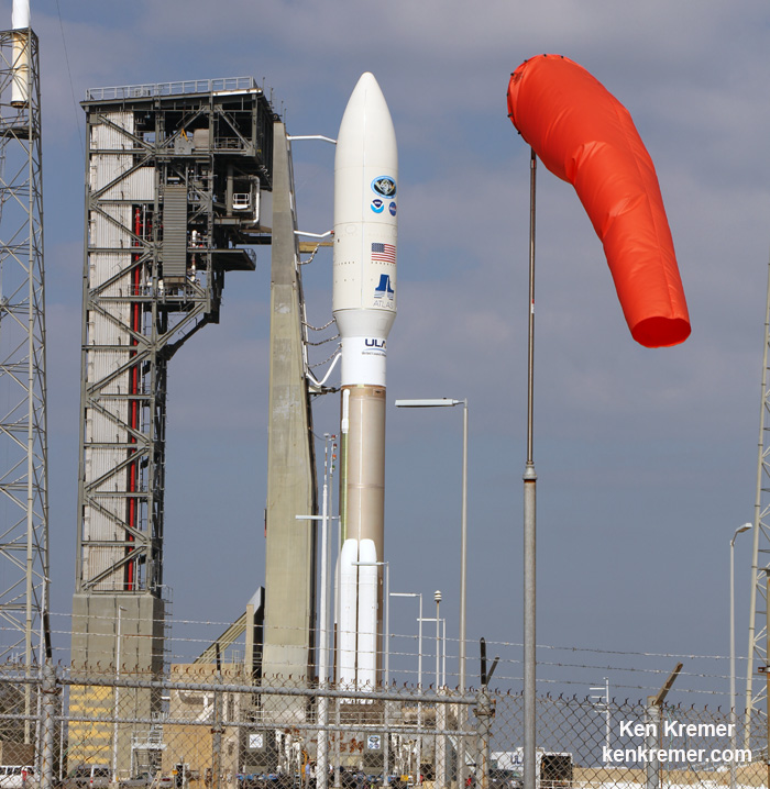
The NASA/NOAA GOES-R (Geostationary Operational Environmental Satellite – R Series) is poised for launch on a ULA Atlas V from Cape Canaveral, Florida on Nov. 19, 2016. GOES-R will be America’s most advanced weather satellite. Credit: Ken Kremer/kenkremer.comLaunch of NASA/NOAA GOES-R weather observatory on ULA Atlas V on Nov. 19, 2016 from pad 41 on Cape Canaveral Air Force Station, Florida, as seen from Playalinda beach. Credit: Jillian Laudick
………….
Learn more about GOES-R weather satellite, Heroes and Legends at KSCVC, OSIRIS-REx, InSight Mars lander, ULA, SpaceX and Orbital ATK missions, Juno at Jupiter, SpaceX AMOS-6 & CRS-9 rocket launch, ISS, ULA Atlas and Delta rockets, Orbital ATK Cygnus, Boeing, Space Taxis, Mars rovers, Orion, SLS, Antares, NASA missions and more at Ken’s upcoming outreach events:
Nov 19-20: “GOES-R weather satellite launch, OSIRIS-Rex, SpaceX and Orbital ATK missions to the ISS, Juno at Jupiter, ULA Delta 4 Heavy spy satellite, SLS, Orion, Commercial crew, Curiosity explores Mars, Pluto and more,” Kennedy Space Center Quality Inn, Titusville, FL, evenings
The NASA/NOAA GOES-R (Geostationary Operational Environmental Satellite - R Series) is poised for launch on a ULA Atlas V from Cape Canaveral, Florida on Nov. 19, 2016. GOES-R will be America’s most advanced weather satellite. Credit: Ken Kremer/kenkremer.com
The NASA/NOAA GOES-R (Geostationary Operational Environmental Satellite – R Series) is poised for launch on a ULA Atlas V from Cape Canaveral, Florida on Nov. 19, 2016. GOES-R will be America’s most advanced weather satellite. Credit: Ken Kremer/kenkremer.com
KENNEDY SPACE CENTER, FL – From both the technical and weather standpoint, the outlook is outstanding for Saturdays sunset blastoff of the NASA/NOAA GOES-R geostationary weather observation satellite that’s set to deliver a ‘quantum leap’ in weather forecasting on Nov. 19.
Everything is progressing as planned toward liftoff of the school bus sized GOES-R weather satellite atop a United Launch Alliance (ULA) Atlas V rocket on Saturday, Nov. 19 at 5:42 p.m. from Space Launch Complex 41 (SLC-41) on Cape Canaveral Air Force Station, just about 17 minutes after sunset.
“GOES-R offers a quantum leap above prior weather satellites, the greatest in 40 years,” said Steve Volz, assistant administrator, NOAA’s Satellite and Information Service, at the prelaunch news briefing at NASA’s Kennedy Space Center.
“GOES-R will be revolutionary with faster, more accurate forecasts and more lives saved.”
“It will take our capability for life saving forecasts to a new level and it will be a game changer.”
GOES-R, which stands for Geostationary Operational Environmental Satellite – R Series – is a new and advanced transformational weather satellite that will vastly enhance the quality, speed and accuracy of weather forecasting available to forecasters for Earth’s Western Hemisphere.
It will collect 3 times more spectral data with 4 times greater resolution and scans 5 times faster than ever before – via the primary Advanced Baseline Imager (ABI) instrument instrument – compared to the current GOES satellites.
So instead of seeing weather as it was, viewers will see weather as it is.
Whereas the current GOES-NOP imagers scan the full hemispheric disk in 26 minutes, the new GOES-ABI can simultaneously scan the Western Hemisphere every 15 minutes, the Continental U.S. every 5 minutes and areas of severe weather every 30-60 seconds.
The soar to space should be spectacular for locals and tourists gathering from around the world to view the launch now slated for less than 24 hours from now.
The launch window opens at 5:42 p.m.
The launch window extends for an hour from 5:42-6:42 p.m. EST.
Following a short delay, the Atlas V with GOES bolted on top was rolled out to pad 41 this morning, Friday, November. 18.
GOES-R is GO for launch.
NASA’s GOES-R launch coverage will be broadcast on NASA TV beginning at 4:45 p.m. EDT Nov. 19.
Coverage will conclude after spacecraft separation from the Centaur and the GOES-R solar arrays are deployed, which occurs approximately 3 ½ hours after launch. At that time the spacecraft initial state of health can be determined and will be confirmed on the air. There is no planned post-launch news conference.
The NASA/NOAA GOES-R (Geostationary Operational Environmental Satellite – R Series) is encapsulated in the nose cone of a ULA Atlas V and rolls out for launch from Space Launch Complex-41 on Cape Canaveral Air Force Station, Florida on Nov. 19, 2016. GOES-R will be America’s most advanced weather satellite. Credit: Ken Kremer/kenkremer.com
The weather forecast shows a 90 percent chance of favorable weather conditions for Saturday’s sunset blastoff. The primary concern is for cumulous clouds.
In the event of a 24 hour delay, the weather forecast shows an 80 percent chance of favorable weather conditions on Sunday, Nov. 20.
The NASA/NOAA GOES-R (Geostationary Operational Environmental Satellite – R Series) is encapsulated in the nose cone of a ULA Atlas V set for launch from Space Launch Complex-41 on Cape Canaveral Air Force Station, Florida on Nov. 19, 2016. GOES-R will be America’s most advanced weather satellite. Credit: Ken Kremer/kenkremer.com
GOES-R is the first in a new series of American’s most powerful and most advanced next generation weather observation satellites. It is designed to last for a 15 year orbital lifetime.
The 11,000 pound satellite was built by prime contractor Lockheed Martin and is the first of a quartet of four identical satellites – comprising GOES-R, S, T, and U – at an overall cost of about $11 Billion. This will keep the GOES satellite system operational through 2036.
GOES-R will blastoff on a ULA Atlas V in the very powerful 541 configuration, augmented by four solid rocket boosters on the first stage. The payload fairing is 5 meters (16.4 feet) in diameter and the upper stage is powered by a single-engine Centaur.
It will be launched to a Geostationary orbit some 22,300 miles above Earth.
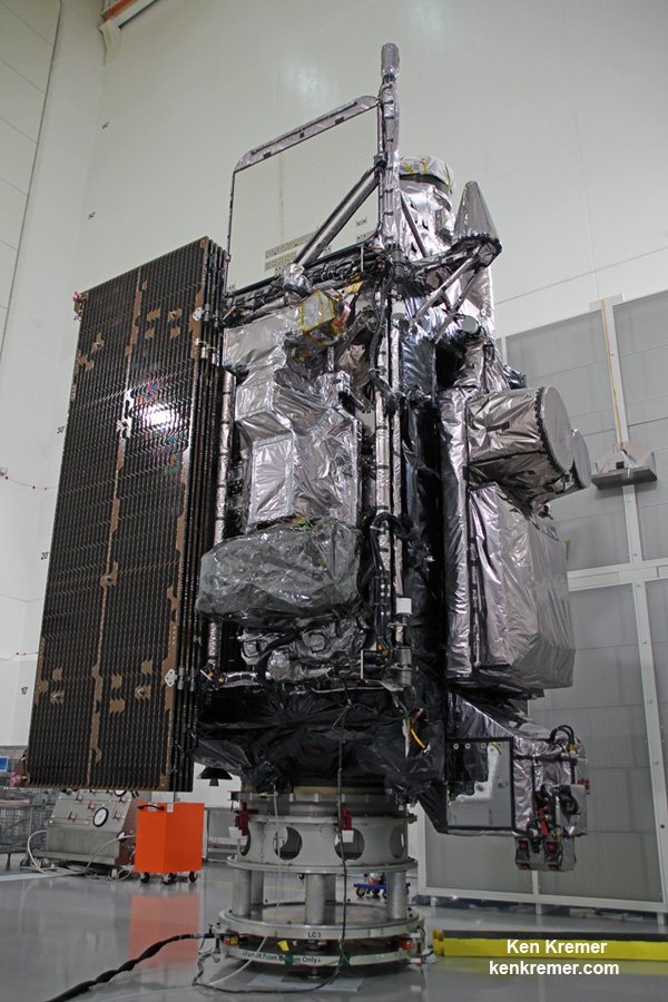
Side view of NASA/NOAA GOES-R next gen weather observation satellite showing solar panels and instruments inside Astrotech Space Operations cleanroom, in Titusville, FL. Launch is set for Nov. 19, 2016. Credit: Ken Kremer/kenkremer.com
The gigantic school bus sized satellite is equipped with a suite of six instruments or sensors that are the most advanced of their kind. They will be used for three types of observations: Earth sensing, solar imaging, and space environment measuring. They will point to the Earth, the Sun and the in-situ environment of the spacecraft.
The suite includes the Advanced Baseline Imager (ABI), Geostationary Lightning Mapper (GLM), Solar Ultraviolet Imager (SUVI), Extreme Ultraviolet and X-Ray Irradiance Sensors (EXIS), Space Environment In-Situ Suite (SEISS), and the Magnetometer (MAG).
Stay tuned here for Ken’s continuing Earth and Planetary science and human spaceflight news.
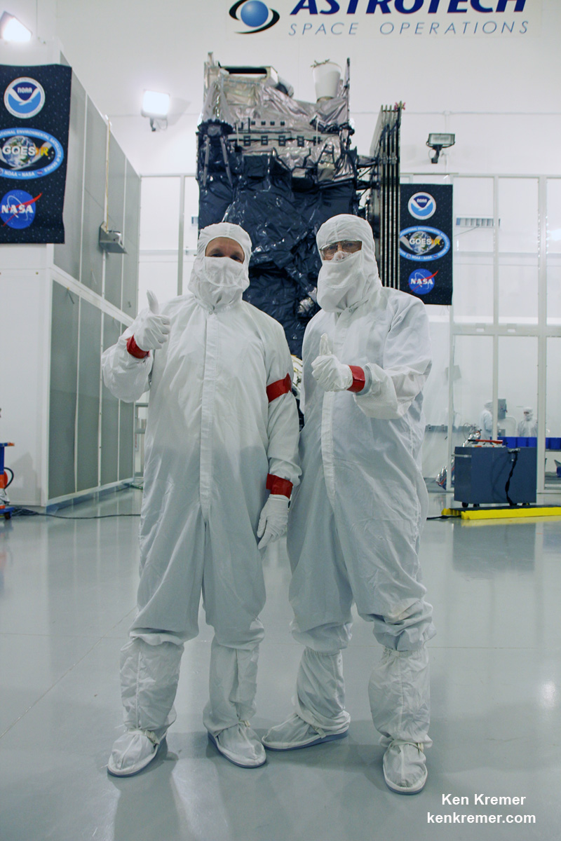
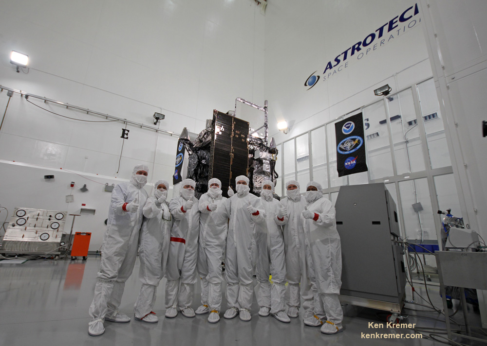
GOES-R weather observation satellite instrument suite. Credit: NASA/NOAATim Gasparinni, GOES-R program manager for Lockheed Martin, and Ken Kremer/University Today pose with GOES-R revolutionary weather satellite inside Astrotech Space Operations cleanroom, in Titusville, FL, and built by NASA/NOAA/Lockheed Martin/Harris. Credit: Ken Kremer/kenkremer.com
The NASA/NOAA GOES-R (Geostationary Operational Environmental Satellite - R Series) being processed at Astrotech Space Operations, in Titusville, FL, in advance of launch on a ULA Atlas V on Nov. 19, 2016. GOES-R will be America’s most advanced weather satellite. Credit: Ken Kremer/kenkremer.com
The NASA/NOAA GOES-R (Geostationary Operational Environmental Satellite – R Series) being processed at Astrotech Space Operations, in Titusville, FL, in advance of planned launch on a ULA Atlas V slated for Nov. 19, 2016. GOES-R will be America’s most advanced weather satellite. Credit: Ken Kremer/kenkremer.com
KENNEDY SPACE CENTER, FL – After an ironic detour due to Hurricane Matthew, liftoff of the game changing NASA/NOAA next generation GOES-R geostationary weather observation satellite offering a “dramatic leap in capability” is finally on track for this weekend on Nov. 19 from the Florida Space Coast.
And Universe Today recently got an up close look and briefing about the massive probe inside the cleanroom processing facility at Astrotech Space Operations in Titusville, Fl.
“We are bringing the nation a new capability .. that’s a dramatic leap .. to scan the entire hemisphere in about 5 minutes,” said Greg Mandt, NOAA GOES-R program manager during a briefing in the Astrotech cleanroom.
“GOES-R has both weather and space weather detection capabilities!” Tim Gasparrini, GOES-R program manager for Lockheed Martin, told Universe Today during a cleanroom interview.
Astrotech is located just a few miles down the road from NASA’s Kennedy Space Center and the KSC Visitor Complex housing the finest exhibits of numerous spaceships, hardware items and space artifacts.
The NASA/NOAA GOES-R (Geostationary Operational Environmental Satellite – R Series) being processed at Astrotech Space Operations, in Titusville, FL, in advance of planned launch on a ULA Atlas V slated for Nov. 19, 2016. GOES-R will be America’s most advanced weather satellite. Credit: Ken Kremer/kenkremer.com
GOES-R, which stands for Geostationary Operational Environmental Satellite – R Series – is a new and advanced transformational weather satellite that will vastly enhance the quality, speed and accuracy of weather forecasting available to forecasters for Earth’s Western Hemisphere.
Liftoff of the NASA/NOAA GOES-R weather satellite atop a United Launch Alliance (ULA) Atlas V rocket is now scheduled for Saturday, Nov. 19 at 5:42 p.m. from Space Launch Complex 41 (SLC-41) on Cape Canaveral Air Force Station, shortly after sunset.
The launch window extends for an hour from 5:42-6:42 p.m. EST.
GOES-R is the first in a new series of American’s most powerful and most advanced next generation weather observation satellites. It is designed to last for a 15 year orbital lifetime.
Once in orbit it will be known as GOES-16. TV viewers are presently accustomed to seeing daily streams of imagery from the GOES-East and GOES-West weather observation satellites currently in orbit.
What’s the big deal about GOES-R?
Audiences will notice big changes from GOES-R once it becomes operational because it will provide images of weather patterns and severe storms as regularly as every five minutes or as frequently as every 30 seconds.
“These images can be used to aid in weather forecasts, severe weather outlooks, watches and warnings, lightning conditions, maritime forecasts and aviation forecasts.
“It also will assist in longer term forecasting, such as in seasonal predictions and drought outlooks. In addition, space weather conditions will be monitored constantly, including the effects of solar flares to provide advance notice of potential communication and navigation disruptions. It also will assist researchers in understanding the interactions between land, oceans, the atmosphere and climate.”
GOES-R was built by prime contractor Lockheed Martin and is the first of a four satellite series – comprising GOES-R, S, T, and U that will be keep the GOES satellite system operational through 2036.
All four of the revolutionary 11,000 pound satellites are identical. The overall cost is about $11 Billion.
“This is a very exciting time,” explained Greg Mandt, the NOAA GOES-R program manager during the Astrotech cleanroom briefing.
“This is the culmination of about 15 years of intense work for the great team of NOAA and NASA and our contractors Lockheed Martin and Harris.”
“We are bringing the nation a new capability. The GOES program has been around for about 40 years and most every American sees it every night on the weather broadcasts when they see go to the satellite imagery. And what’s really exciting is that for the first time in that 40 years we are really end to end replacing the entire GOES system. The weather community is really excited about what we are bringing.”
“It’s a dramatic leap in capability – like moving from black and white TV to HDTV.”
“We will be able to scan the entire hemisphere in about 5 minutes and do things so much faster with double the resolution.”
The NASA/NOAA/Lockheed Martin/Harris GOES-R team gives a big thumbs up for the dramatic leap in capability this next gen weather observation satellite will provide – during media briefing at Astrotech Space Operations, in Titusville, FL. Launch is set for Nov. 19, 2016. Credit: Ken Kremer/kenkremer.com
It was built in facilities in Bucks County, Pennsylvania and Denver, Colorado. It arrived at Astrotech in August for final processing and checkouts of the spacecraft and instruments.
The gigantic school bus sized satellite is equipped with a suite of six instruments or sensors that are the most advanced of their kind. They will be used for three types of observations: Earth sensing, solar imaging, and space environment measuring. They will point to the Earth, the Sun and the in-situ environment of the spacecraft.
The suite includes the Advanced Baseline Imager (ABI), Geostationary Lightning Mapper (GLM), Solar Ultraviolet Imager (SUVI), Extreme Ultraviolet and X-Ray Irradiance Sensors (EXIS), Space Environment In-Situ Suite (SEISS), and the Magnetometer (MAG).
The two Earth-pointing instruments are on the top of the spacecraft – namely ABI and GLM.
“ABI is the premier instrument on the spacecraft. When you turn on the news and see a severe storm picture, that’s the one it comes from. It takes pictures in the visible as well as the infrared (IR), near infrared (IR),” Tim Gasparrini, GOES-R program manager for Lockheed Martin, told Universe Today during a cleanroom interview.
“It is looking for things like moisture, vegetation, aerosols and fire. So it looks across a broad spectrum to determine the environmental conditions on Earth.”
ABI offers 3 times more spectral channels with 4 times greater resolution and scans 5 times faster than ever before, compared to the current GOES satellites.
The GOES-R ABI will view the Earth with 16 different spectral bands (compared to five on current GOES), including two visible channels, four near-infrared channels, and ten infrared channels, according to the mission fact sheet.
It will also carry the first operational lightning mapper ever flown in space – GLM – built by Lockheed Martin. It has a single-channel, near-infrared optical transient detector.
“This is the first lightning mapper in space and at geostationary orbit.”
“GLM takes a picture of a scene on the Earth 500 times per second. And it compares those images for a change in the scene that can detect lightning, using an algorithm,” Gasparrini told me.
“The importance of that is lightning is a precursor to severe weather. So they are hoping that GLM will up to double the tornado warning time. So instead of 10 minutes warning you get 20 minutes warning, for example.”
GLM will measure total lightning (in-cloud, cloud-to-cloud and cloud-to-ground) activity continuously over the Americas and adjacent ocean regions with near-uniform spatial resolution of approximately 10 km.
Side view of NASA/NOAA GOES-R next gen weather observation satellite showing solar panels and instruments inside Astrotech Space Operations cleanroom, in Titusville, FL. Launch is set for Nov. 19, 2016. Credit: Ken Kremer/kenkremer.com
“The two solar pointing instruments are located on a platform that constantly points them at the sun – SUVI (built by Lockheed Martin and EXIS. SUVI looks at the sun in the ultraviolet and EXIS looks at the x-ray wavelengths.”
The instruments work in concert.
“SUVI detects a solar flare on he sun and EXIS measures the intensity of the flare. As it comes towards the Earth, NOAA then uses the DSCOVR satellite [launched last year] as sort of a warning buoy about 30 minutes before the Earth. This gives a warning that a geomagnetic storm is heading toward the Earth.”
“When the storm reaches the Earth, the magnetometer instrument (MAG) on GOES-R then measures the influence of the magnetic storm on the magnetic field of the Earth.”
“Then the SEISS instrument, a charged particle detector, measures the charged particle effect of the storm on the Earth at geostationary orbit.”
“So GOES-R has both weather and space weather detection capabilities!” Gasparini elaborated.
The huge bus sized satellite measures 6.1 m x 5.6 m x 3.9 m (20.0 ft x 18.4 ft x 12.8 ft) with a three-axis stabilized spacecraft bus.
It has a dry mass of 2,857 kg (6,299 lbs) and a fueled mass of 5,192 kg (11,446 lbs) at launch.
The instruments are very sensitive to contamination and the team is taking great care to limit particulate and molecular contaminants in the cleanroom. Some of the instruments have contamination budget limits of less than 10 angstroms – smaller than the diameter of a typical molecule. So there can’t even be a single layer of molecules on the instruments surface after 15 years on orbit.
GOES-R can also multitask according to a NASA/NOAA factsheet.
“It can scan the Western Hemisphere every 15 minutes, the Continental U.S. every 5 minutes and areas of severe weather every 30-60 seconds. All at the same time!”
GOES-R will blastoff on a ULA Atlas V in the very powerful 541 configuration, augmented by four solid rocket boosters on the first stage. The payload fairing is 5 meters (16.4 feet) in diameter and the upper stage is powered by a single-engine Centaur.
It will be launched to a Geostationary orbit some 22,300 miles above Earth.
The Atlas V booster has been assembled inside the Vertical Integration Facility (VIF) at SLC-41 and will be rolled out to the launch pad Friday morning, Nov. 18 with the GOES-R weather satellite encapsulated inside the nose cone.
The weather forecast shows a 80 percent chance of favorable weather conditions for Saturday’s sunset blastoff.
GOES-R logo. Credit: NASA/NOAA
Stay tuned here for Ken’s continuing Earth and Planetary science and human spaceflight news.
Learn more about GOES-R weather satellite, Heroes and Legends at KSCVC, OSIRIS-REx, InSight Mars lander, ULA, SpaceX and Orbital ATK missions, Juno at Jupiter, SpaceX AMOS-6 & CRS-9 rocket launch, ISS, ULA Atlas and Delta rockets, Orbital ATK Cygnus, Boeing, Space Taxis, Mars rovers, Orion, SLS, Antares, NASA missions and more at Ken’s upcoming outreach events:
Nov 17-20: “GOES-R weather satellite launch, OSIRIS-Rex, SpaceX and Orbital ATK missions to the ISS, Juno at Jupiter, ULA Delta 4 Heavy spy satellite, SLS, Orion, Commercial crew, Curiosity explores Mars, Pluto and more,” Kennedy Space Center Quality Inn, Titusville, FL, evenings
GOES-R infographicTim Gasparinni, GOES-R program manager for Lockheed Martin, and Ken Kremer/University Today pose with GOES-R revolutionary weather satellite inside Astrotech Space Operations cleanroom, in Titusville, FL, and built by NASA/NOAA/Lockheed Martin/Harris. Credit: Ken Kremer/kenkremer.com
The NASA/NOAA GOES-R (Geostationary Operational Environmental Satellite - R Series) being processed at Astrotech Space Operations, in Titusville, FL, in advance of launch on a ULA Atlas V on Nov. 19, 2016. GOES-R will be America’s most advanced weather satellite. Credit: Ken Kremer/kenkremer.com
The NASA/NOAA GOES-R (Geostationary Operational Environmental Satellite – R Series) being processed at Astrotech Space Operations, in Titusville, FL, in advance of the planned launch on a ULA Atlas V likely delayed from Nov 4, 2016 by Hurricane Matthew. GOES-R will be America’s most advanced weather satellite. Credit: Ken Kremer/kenkremer.com
Next month’s launch of GOES-R – a new and advanced transformational weather satellite that will vastly enhance the quality, speed and accuracy of weather forecasting – will likely be delayed a few days due to lingering storm related effects of deadly Hurricane Matthew on launch preparations at Cape Canaveral Air Force Station and the Kennedy Space Center (KSC), Universe Today confirmed with launch provider United Launch Alliance (ULA).
Liftoff of the NASA/NOAA GOES-R (Geostationary Operational Environmental Satellite – R Series) weather satellite atop a United Launch Alliance (ULA) Atlas V rocket had been scheduled for Nov. 4 at 5:40 p.m. from Space Launch Complex 41 (SLC-41) on Cape Canaveral Air Force Station.
GOES-R is the first in a new series of American’s most powerful and most advanced next generation weather observation satellites.
It’s ironic that awful weather is impacting the launch of this critical weather satellite.
It’s not known how long any postponement would be – perhaps only a few days since preliminary indications are that the base suffered only minor damage and there are no reports of major damage.
“Our teams are still doing a damage assessment. So we don’t have a status about all of our infrastructure yet,” Chassagne told me.
“A preliminary assessment shows that we have some minor damage to a few of our facilities. We had no rockets on the pads. So there is no damage to hardware.”
Damage assessment teams are evaluating the launch pad and launch facilities in detail right now.
“Since we still have emergency response teams in assessing, we don’t know how long the delay will be until we get those assessments.”
The NASA/NOAA GOES-R (Geostationary Operational Environmental Satellite – R Series) being processed at Astrotech Space Operations, in Titusville, FL, in advance of the planned launch on a ULA Atlas V likely delayed from Nov 4, 2016 by Hurricane Matthew. GOES-R will be America’s most advanced weather satellite. Credit: Ken Kremer/kenkremer.com
The looming threat of a direct hit on Cape Canaveral and KSC from the Category 4 storm Hurricane Matthew on Friday, Oct. 7, forced the closure of both facilities before the storm hit. They remained closed this weekend except to emergency personal.
“Got in today to assess. Light to moderate damage to our facilities. No damage to any flight assets,” tweeted ULA CEO Tory Bruno.
The base closures therefore also forced a halt to launch preparations at the Cape and pad 41.
The storm grazed by the Kennedy Space Center (KSC), Cape Canaveral Air Force Station (CCAFS) and the major population centers along the Florida Space Coast with wind gusts up to 107 mph – rather than making a direct impact as feared.
“Hurricane Matthew passed Cape Canaveral and Kennedy Space Center …. with sustained winds of 90 mph with gusts to 107 mph,” on Friday, NASA officials reported.
The storm passed “the space center about 26 miles off the tip of Cape Canaveral.”
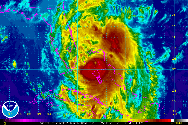
Cat 4 Hurricane Matthew track during the late evening of 6 Oct 2016. Credit: NASA/NOAA
The launch ULA facilities are now being thoroughly inspected before any launch preparation can proceed.
The satellite is in the final stages of preparation at the Astrotech Space Operations Facility in Titusville, FL as I recently observed during an up close visit in the High Bay cleanroom.
Check out this amazing rooftop video showing the high winds pummeling Titusville during Hurricane Matthew just a few miles away from Astrotech and the GOES-R satellite – from my space colleague Jeff Seibert.
Video caption: Before we bailed out on Thursday afternoon, I clamped one of my launch pad remote cameras to the power service post on our roof. Wind is blocked a lot by trees but none fell on the house. The highest recorded wind speed was 51mph at 7:30AM on Oct. 7, 2016. The minimum barometric pressure was 28.79″ from 8:20 – 9 AM. We got 5.9″ of rain. The ridge line faces due east. We never lost power. Credit: Jeff Seibert
Lockheed Martin is the prime contractor for GOES-R.
United Launch Alliance Atlas V rocket lifts off from Space Launch Complex 41 at Cape Canaveral Air Force Station carrying NASA’s Origins, Spectral Interpretation, Resource Identification, Security-Regolith Explorer, or OSIRIS-REx spacecraft on the first U.S. mission to sample an asteroid on September 8, 2016. GOES-R launch on an Atlas V planned for Nov. 4 is likely delayed due to Hurricane Matthew. Credit: Ken Kremer/kenkremer.com
Whenever it does launch, GOES-R will blast off on a ULA Atlas V in the very powerful 541 configuration, augmented by four solid rocket booster on the first stage.
It will be launched to a Geostationary orbit some 22,300 miles above Earth.
But ULA has not yet begun assembling the Atlas V booster inside the Vertical Integration Facility (VIF) at SLC-41 due to the storm.
Because of Hurricane Matthew, the first stage arrival had to be postponed. The second stage is already in port at the Delta operations center and being integrated.
“The first stage booster is not yet at the Cape,” Chassagne confirmed.
However, conditions at the Cape have improved sufficiently for the US Air Force to clear its shipment into port, as of this evening.
“We just cleared CCAFS to be able to accept a booster for the GOES-R launch–how appropriate that GOES is a weather satellite!” wrote Brig. Gen. Wayne Monteith, commander of the Air Force’s 45th Space Wing at Patrick Air Force Base, in a Facebook update late today, Oct. 9.
“We are returning to full mission capability and our status as the World’s Premier Gateway to Space.”
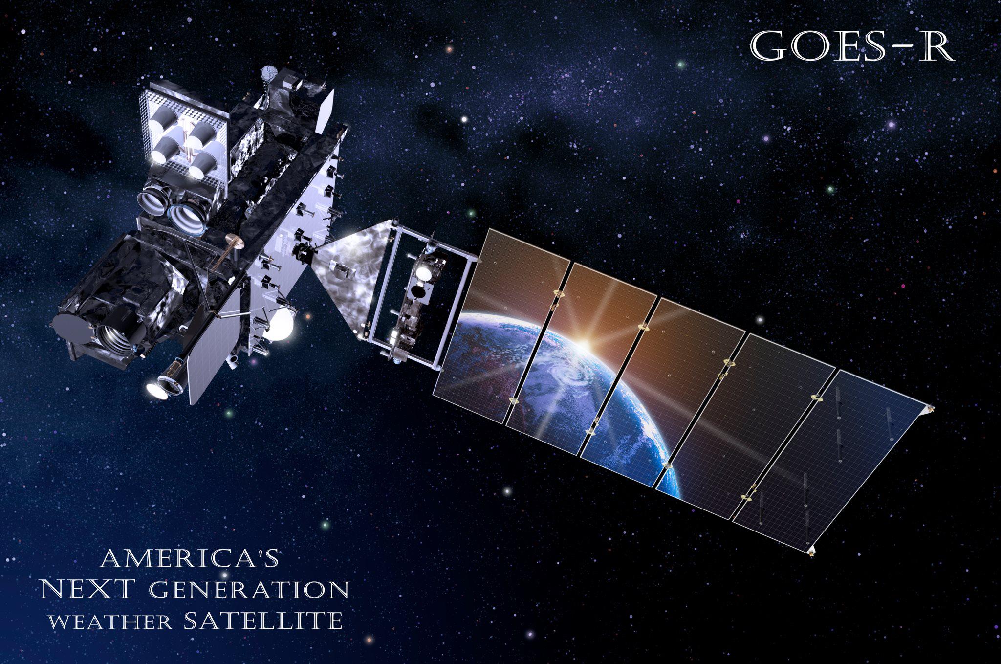
Artists concept for NASA/NOAA GOES-R (Geostationary Operational Environmental Satellite – R Series) advanced weather satellite in Earth orbit. Credit: NASA/NOAA
Stay tuned here for Ken’s continuing Earth and Planetary science and human spaceflight news.
Cat 4 Hurricane Matthew track during the late evening of 6 Oct 2016. Credit: NASA/NOAA
Cat 4 Hurricane Matthew track during the late evening of 6 Oct 2016. Credit: NASA/NOAA
The imminent impact of the already deadly Category 4 Hurricane Matthew along the Florida Space Coast tonight, Thursday, October 6, has forced the closure of NASA’s Kennedy Space Center (KSC) and mass evacuations along the US East coast from Florida, to Georgia to the Carolinas.
“Hurricane Matthew, currently an extremely dangerous Category 4 storm on the Saffir-Simpson Hurricane Wind Scale, continues to bear down on the southeastern United States,” says NASA in an update today.
NASA has closed KSC for today and tomorrow, at a minimum and the center has entered HurrCon 1 status.
“Under the current storm track, peak winds are forecast to be 125 mph sustained with gusts to 150 mph, however a shift in the track even slightly could improve the wind forecast somewhat,” wrote NASA’s Brian Dunbar.
“The Kennedy Space Center is closed today, Oct. 6, and Friday for Hurricane Matthew. Kennedy Space Center is now in HurrCon 1 status, meaning a hurricane is imminent.”
The Kennedy Space Center on Florida’s Space Coast is home to the iconic Vehicle Assembly Building (VAB) – the most well known building at NASA – as well as Launch Complex’s 39 A and B which launched American astronauts to Moon and thereafter Space Shuttles for three decades.
The launch pads sit precariously close to the Atlantic Ocean shoreline – just a few hundred yards (meters) away!
View of the VAB and Mobile Launcher from the KSC Launch Complex 39 Press Site. NASA is upgrading the VAB with new platforms to assemble and launch NASA’s Space Launch System rocket at the Kennedy Space Center in Florida. Credit: Ken Kremer/kenkremer.com
“Across the spaceport, essential personnel are preparing facilities for the storm’s arrival,” according to George Diller, NASA Kennedy Space Center Public Affairs Officer.
“Hurricane Matthew is expected to make its closest approach to the Cape Canaveral/Kennedy area overnight Thursday and into Friday morning, bringing with it the potential for heavy rain, storm surge and hurricane-force winds.”
The last time a major Hurricane impacted near KSC and the Space Coast was in 2004. The VAB suffered some outside damage.
Hurricane Matthew is bearing down on the US East Coast right now at Florida’s Peninsula and is tracking north.
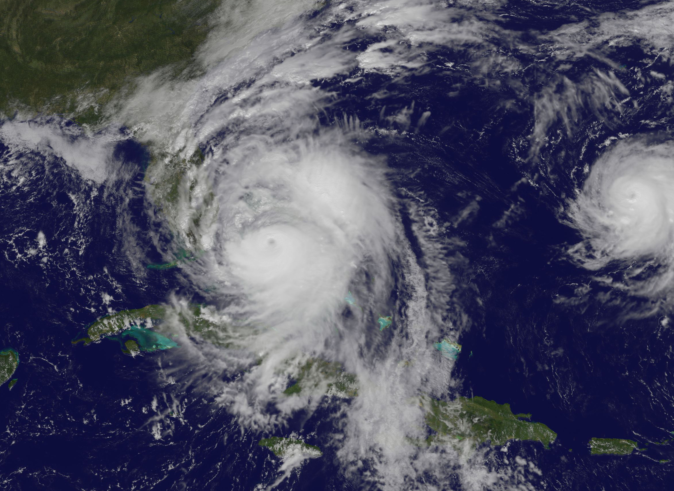
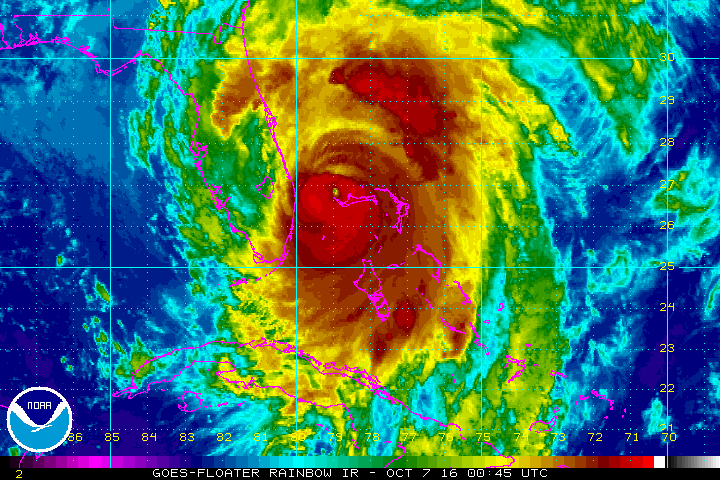
This visible image on Oct. 6 at 1:00 p.m. EDT from NOAA’s GOES-East satellite shows Hurricane Matthew as it regained Category 4 Hurricane Status. Credits: NASA/NOAA GOES Project
Herein is the latest satellite imagery from NASA and NOAA of this evening.
Mass evacuations have been ordered and States of Emergencies declared by the Governors of Florida, Georgia and North and South Carolina.
The high winds, storm surge of potentially 5 to 11 feet, drenching rains and extensive flooding is expected to cause massive damage and devastation to homes, businesses and infrastructure.
Cat 4 Hurricane Matthew track during the late evening of 6 Oct 2016. Credit: NASA/NOAA
Hundreds of thousands of folks have left their home over the past 2 days. Many gas stations are dry and grocery store shelves emptied.
Matthew will cause a wide swath of destruction and potentially deaths along hundreds of miles of US shoreline and inland areas as the massive storm hugs the coast like none before in recorded history.
Furthermore, hundreds of thousands of folks are expected to lose power as well, for days and perhaps weeks.
Hundreds of deaths and massive destruction in Haiti, Cuba and elsewhere in the Caribbean can already be blamed on Hurricane Matthew – a storm like none other and by far the worst since Superstorm Sandy and Hurricane Katrina.
After the storm passes KSC will evaluate all its facilities.
“Once the storm has passed, center facilities and infrastructure will be assessed and employees will be cleared to return when it is safe to do so,” Diller.
Indeed NASA was preparing to launch America’s newest and most advanced weather satellite on Nov 4. It’s named GOES-R and was slated for blastoff from Cape Canaveral Air Force Station atop a ULA Atlas V on Nov. 4.
The launch facilities will have to be thoroughly inspected before the launch can proceed.
The satellite is in the final stages of preparation at the Astrotech Space Operations Facility in Titusville, FL as I recently observed during an up close visit in the High Bay cleanroom.
Titusville and Astrotech could suffer a direct hit from Matthew. But the satellite has been secured.
The NASA/NOAA GOES-R (Geostationary Operational Environmental Satellite – R Series) being processed at Astrotech Space Operations, in Titusville, FL, in advance of the planned launch on a ULS Atlas V on Nov 4, 2016. GOES-R will be America’s most advanced weather satellite. Credit: Ken Kremer/kenkremer.com
Here is the latest Advisory from the National Hurricane Center (NHC) as of 8 PM EDT Oct 6.
At 800 PM EDT (0000 UTC), the eye of Hurricane Matthew was located over the western end of Grand Bahama Island near latitude 26.6 North, longitude 78.9 West. The hurricane is moving toward the northwest near 13 mph (20 km/h), and this general motion is expected to continue tonight with a turn toward the north-northwest early Friday. On the forecast track, the eye of Matthew should move away from Grand Bahama Island during the next few hours, and move close to or over the east coast of the Florida peninsula through Friday night.
Reports from a NOAA Hurricane Hunter aircraft indicate that maximum sustained winds are now near 130 mph (210 km/h) with higher gusts. Matthew is a category 4 hurricane on the Saffir-Simpson Hurricane Wind Scale. Some fluctuations in intensity are likely while the hurricane moves toward the coast of Florida.
Hurricane-force winds extend outward up to 60 miles (95 km) from the center and tropical-storm-force winds extend outward up to 185 miles (295 km). Settlement Point in the Bahamas recently reported a sustained wind of 79 mph (128 km/h) with a gust of 105 mph (169 km/hr). The Lake Worth Pier near Palm Beach, Florida, recently reported a sustained wind of 46 mph (74 km/h) and a wind gust of 60 mph (96 km/h).
The minimum central pressure estimated from NOAA Hurricane Hunter data is 939 mb (27.73 inches).
…….
The latest weather briefing indicates that “tropical storm force winds beginning at Cape Canaveral tonight at midnight with hurricane force winds starting at about 6 a.m.
A hurricane ride-out crew of 116 has arrived at KSC this evening to prepare for Matthew.
“All facilities at Kennedy Space Center and Cape Canaveral Air Force Station have been secured.”
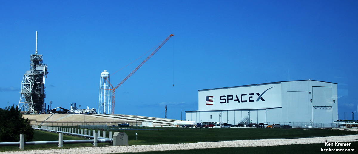
SpaceX is currently renovating and refurbishing pad 39A to launch their commercial Falcon 9 and Falcon Heavy rockets as well the Crew Dragon with astronauts on mission to the ISS.
The eye of the storm is barreling towards KSC at this moment. Stay tuned for the outcome.
SpaceX is renovating Launch Complex 39A at the Kennedy Space Center for launches of the Falcon Heavy and human rated Falcon 9. Credit: Ken Kremer/kenkremer.com
Stay tuned here for Ken’s continuing Earth and Planetary science and human spaceflight news.


