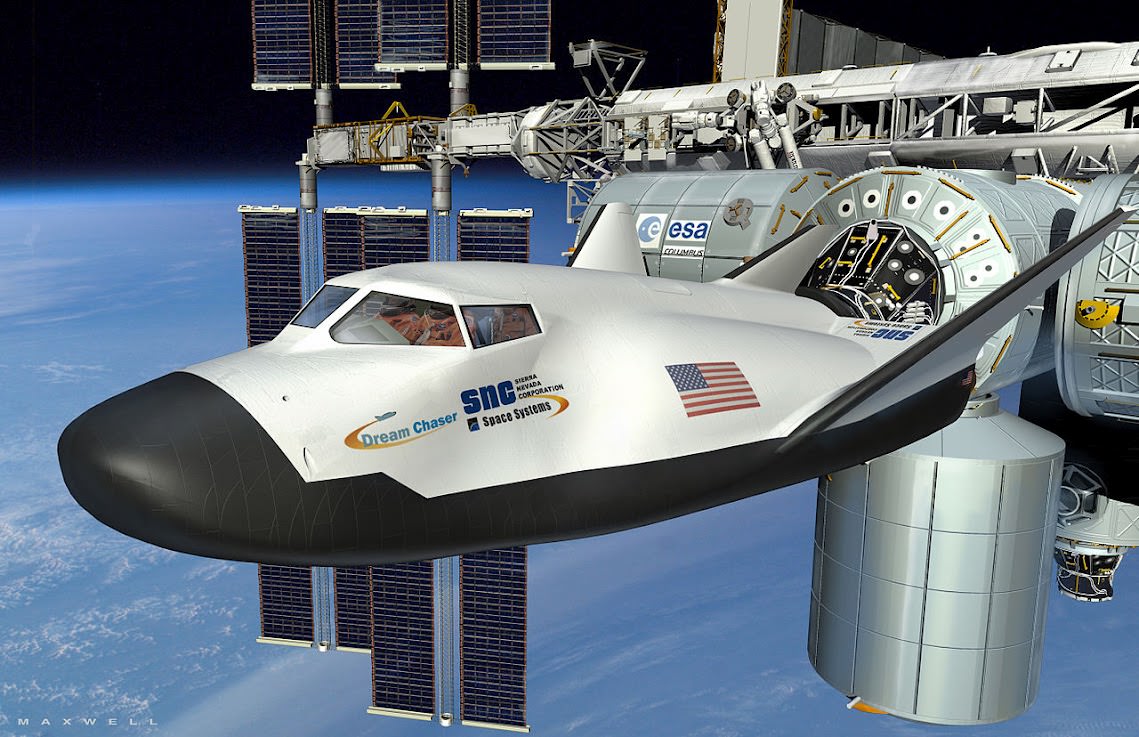
NASA’s Lunar Orbiter Gets an Art Lesson with Lasers

In the ultimate example of science imitating art, engineers working with NASA’s Lunar Reconnaissance Orbiter recently beamed an image of the Mona Lisa to the LRO and back via laser beam in order to measure the rate of transmission between the spacecraft and Earth. This allowed them to then calibrate their software to correct for any discrepancies between the image sent and the one received, resulting in a picture-perfect result.

Leonardo would definitely have approved.

From NASA’s Goddard Space Flight Center:

As part of the first demonstration of laser communication with a satellite at the moon, scientists with NASA’s Lunar Reconnaissance Orbiter (LRO) beamed an image of the Mona Lisa to the spacecraft from Earth.

The iconic image traveled nearly 240,000 miles in digital form from the Next Generation Satellite Laser Ranging (NGSLR) Station at NASA’s Goddard Space Flight Center in Greenbelt, MD, to the Lunar Orbiter Laser Altimeter (LOLA) instrument on the spacecraft. By transmitting the image piggyback on laser pulses that are routinely sent to track LOLA’s position, the team achieved simultaneous laser communication and tracking.

“This test, and the data obtained from it, sets the stage for future high data-rate laser communications demonstrations that will be an essential feature of NASA’s next Moon mission: the Lunar Atmosphere and Dust Environment Explorer.

Video: NASA/GSFC

Region in LMC Ablaze with Light and Color

Nearly 200 000 light-years from Earth, the Large Magellanic Cloud, a satellite galaxy of the Milky Way, floats in space, in a long and slow dance around our galaxy. As the Milky Way’s gravity gently tugs on its neighbour’s gas clouds, they collapse to form new stars. In turn, these light up the gas clouds in a kaleidoscope of colours, visible in this image from the NASA/ESA Hubble Space Telescope.

Hubble view of star formation region N11 from the NASA/ESA Hubble Space Telescope. Image credit: NASA/ESA Hubble. Zoom by John Williams/TerraZoom using Zoomify.

New computer wallpaper alert. Light from the Large Magellanic Cloud takes nearly 200,000 years to travel to Earth. And it’s worth the wait.

Behold LHA 120-N 11, or just simply N11, in this image from the NASA/ESA Hubble Space Telescope.

Continue reading “Region in LMC Ablaze with Light and Color”

New Look and New Animation for Orion’s 2017 Flight to the Moon and Back

The Orion spacecraft has gotten a new look for its first launch atop the inaugural flight of NASA’s Space Launch System (SLS) booster on the Exploration Mission-1 flight around the Moon in 2017 as seen in this new animation.

The vehicles service module will be built by the European Space Agency (ESA), as a result of a new bilateral agreement between NASA and ESA. Orion is designed to carry humans back to the Moon and to deep space destinations like Asteroids and Mars.

The service module will fuel and propel the capsule on its uncrewed journey to the Moon and back on EM-1 in 2017.

Read my follow-up report for details about the new NASA/ESA agreement. See my earlier story here, about preparations for the first Orion launch in September 2014 on the upcoming Exploration Flight Test-1 in 2014 atop a Delta IV Heavy. An unmanned Orion will fly on a two orbit test flight to an altitude of 3,600 miles above Earth’s surface, farther than a human spacecraft has gone in 40 years, and then plunge back to Earth to test the spacecrafts systems and heat shield.

NASA is also simultaneously fostering the development of commercial ‘space taxis’ to fly astronauts to the International Space Station (ISS) as part of a dual track approach to restore America’s human space launch capability. The 1st commercial crew vehicle might fly as early as 2015 – details here.

Ken Kremer

Image caption: Orion EFT-1 crew cabin construction ongoing at the Kennedy Space Center which is due to blastoff in September 2014 atop a Delta 4 Heavy rocket. Credit: Ken Kremer

A Hi-Res Mosaic of Mercury’s Crescent

A view of Mercury from MESSENGER’s October 2008 flyby (NASA / JHUAPL / Gordan Ugarkovic)

Every now and then a new gem of a color-composite appears in the Flickr photostream of Gordan Ugarkovic, and this one is the latest to materialize.

This is a view of Mercury as seen by NASA’s MESSENGER spacecraft during a flyby in October 2008. The image is a composite of twenty separate frames acquired with MESSENGER’s narrow-angle camera from distances ranging from 18,900 to 17,700 kilometers and colorized with color data from the spacecraft’s wide-angle camera. (North is to the right.)

Click the image for a closer look, and for an even bigger planet-sized version click here. Beautiful!

The images that made up this mosaic were taken two and a half years before MESSENGER entered orbit around Mercury on March 19, 2011 UT, becoming the first spacecraft ever to do so and making Mercury the final “classical” planet to be orbited by a manmade spacecraft.

Since that time MESSENGER has completed well over 1,000 orbits and taken more than 100,000 images of the first planet in the Solar System, which filled in most of our gaps in Mercury’s map and showed us many never-before-seen features of the planet’s Sun-scoured surface. And just this past year MESSENGER’s extended mission helped confirm what could be called its most important discovery of all: water ice on Mercury’s north pole.

2012_Year_Highlights-1This was even selected by Scientific American as one of the Top 5 Space Stories of 2012.

With all that’s been achieved by MESSENGER in 2011 and 2012, 2013 is looking to be an interesting year!

“We learned a great deal about Mercury over the past year,” said MESSENGER Principal Investigator Sean Solomon of Columbia University’s Lamont-Doherty Earth Observatory. “The team published three dozen scientific and technical papers and delivered more than 150 presentations at national and international meetings. New measurements continue to stream back from our spacecraft, and we can look forward with excitement to many additional discoveries in 2013.”

Follow the MESSENGER mission news here and see more of Gordan’s space images here.

Inset image: 12 Mercurial discoveries by MESSENGER in 2012. Click to review.

Rover Team Chooses 1st Rock Drilling Target for Curiosity

Image caption: Time lapse mosaic shows Curiosity rover’s arm movement from raised position to surface deployment on Sol 149 (Jan. 5) for contact science near the lower point of the slithery chain of narrow protruding rocks known as ‘Snake River’ – located inside the basin called “Yellowknife Bay’. The rover team will soon conduct historic first rock drilling in these surroindings. Curiosity has now driven to the larger, broken rock just above, right of the sinuous ‘Snake River’ rock formation. Photomosaic was stitched from Navcam raw images and is colorized with patches of sky added to fill in image gaps. Credit: NASA/JPL-Caltech/Ken Kremer/Marco Di Lorenzo

A team of Mars scientists and engineers have chosen the 1st rock drilling target for NASA’s Curiosity rover after carefully considering a range of options over the past several weeks at the robots current location inside a shallow depression known as ‘Yellowknife Bay’, which is replete with light toned rocks.

An official NASA announcement with further information is forthcoming on Tuesday this week, according to a source for this report.

Curiosity is now conducting a detailed science evaluation of the vicinity around a slithery chain of rocks called ‘Snake River’, jutting up from the sandy, rock strewn Martian floor – see our illustrative photo mosaics above & below and earlier story here.

Drilling goes to the heart of the mission and will mark a historic feat in planetary exploration – as the first time that an indigenous sample has been cored from the interior of a rock on another planet and subsequently analyzed by chemical spectrometers to determine its elemental composition and determine if organic molecules are present.

The first report of the drill target selection came just a day ago from Craig Covault at NASA Watch/Spaceref in an article, here – featuring our ‘Snake River’ time lapse mosaic (by Ken Kremer and Marco Di Lorenzo). The mosaic shows the arm in action deploying its science instruments and rotating to capture pictures with the MAHLI microscopic imager and contact science with the APXS mineral spectrometer.

The exact drilling spot has not been divulged but is likely near ‘Snake River’ and visible in our mosaics from Sol 149 and earlier Sols inside the ‘Yellowknife Bay’ basin – which exhibits cross bedding and is reminiscent of a dried up shoreline. Curiosity has now driven to the larger, broken rock just above, right of the sinuous ‘Snake River’ rock formation for up-close contact science investigations.

Curiosity 1st brushoff sol 150_1a_Ken Kremer

Image Caption: Before and after comparison of images of 1st ever rock brush off by Curiosity’s Dust Removal Tool (DRT) on Sol 150 (Jan 6, 2013), nearby to Snake River. Images taken by the high resolution Mastcam 100 camera, contrast enhanced. The brushed patch of rock target called “Ekwir_1” ‘is about 1.85 inches by 2.44 inches (47 millimeters by 62 millimeters). Credit: NASA/JPL-Caltech/MSSS/Ken Kremer

The Mars Science Lab (MSL) team is coordinating with top JPL & NASA management to get approval for the drilling location chosen or select another rock.

The high powered hammering drill is located on the tool turret at the end of the car-sized robots 7 foot (2.1 meter) long mechanical arm.

The percussive drill is the last component of Curiosity’s ten state-of-the-art science instruments that remains to be checked out and put into action.

Rock samples collected from the first test bore holes will be pulverized and the powdery mix will initially be used to rinse the interior chambers of the drill mechanisms and cleanse out residual earthly contaminants – and then dumped. The same procedure was carried out at the windblown ‘Rocknest’ ripple with the initial scoops of soil to cleanse the CHIMRA sample processing systems.

So it’s likely to take several weeks and possible a month or more until sieved samples are finally delivered to the CheMin and SAM analytical chemistry labs on the rover deck for analysis of their inorganic and organic chemical composition.

Curiosity touches Yellowknife Bay Sol 132_4c_Ken Kremer

Image caption: Photo mosaic shows NASA’s Curiosity Mars rover reaching out to investigate rocks at a spot inside Yellowknife Bay on Sol 132, Dec 19, 2012. In search of first drilling target the rover drove to a spot at the right edge of this mosaic called Snake River rock. Curiosity’s navigation camera captured the scene surrounding the rover with the arm deployed and the APXS and MAHLI science instruments on tool turret collecting imaging and X-ray spectroscopic data. Base of Mount Sharp visible at right. The mosaic is colorized with patches of sky added to fill in gaps. Click to enlarge. Credit: NASA/JPL-Caltech/Ken Kremer/Marco Di Lorenzo

As a prelude on Sol 150 (Jan 6.), the rover successfully brushed off one of the flat rocks around Snake River for the first time by using the motorized, wire-bristle brush on the Dust Removal Tool (DRT), built by Honeybee Robotics of NYC.

The brushing was completed on a rock target called ‘Ekwir_1’ – see our mosaic showing a before and after comparison of rock surface images snapped by the Mastcam-100 high resolution color camera.

Brushing is a key step prior to rock drilling and allows the team to much more easily gain insight into the rocks composition with the science instruments compared to the obscured view of a dust blanketed rock. Spirit & Opportunity also have Honeybee Robotics built brushes that have still endured throughout their years’ long miraculous lifetimes.

The team then commanded the rover to bump a bit closer to “slightly younger rocks in front of the rover,” says MSL team member Ken Herkenhoff.

“The contact science activities in the current location went well, including the first brushing of the surface. In order to characterize the geology and chemistry of the rocks at the edge of Yellowknife Bay, we intend to repeat the set of brushing, APXS, MAHLI, ChemCam and Mastcam activities at the new location starting on Sol 152.”

“We are studying chemical and textural differences in the rocks near Snake River,” says Herkenhoff.

On Sol 152 (Jan. 8), Curiosity drove 2.5 meters closer to the area surrounding ‘Snake River’ and began snapping high resolution color imagery.

“It’s one piece of the puzzle,” says John Grotzinger, the mission’s chief scientist of the California Institute of Technology. “It has a crosscutting relationship to the surrounding rock and appears to have formed after the deposition of the layer that it transects.”

Grotzinger and the team are excited because Curiosity is a sort of time machine providing a glimpse into the Red Planets ancient history when the environment was warmer and wetter billions of years ago and much more conducive to the origin of life.

Ken Kremer

PIA16145

Image caption: Diagram shows all instruments on Tool turret on robotic arm. Credit: NASA

Private Test Pilots to Fly 1st Commercial Crewed Space Flights for NASA

Dream Chaser from Sierra Nevada docks at ISS

[/caption]

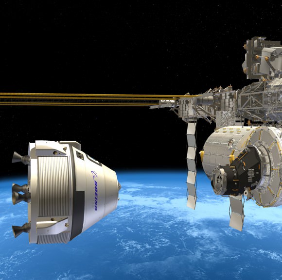
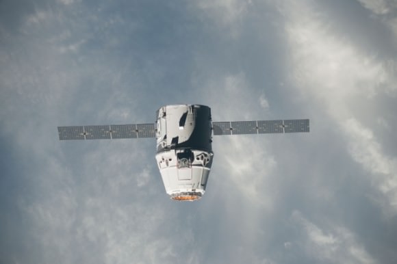
Image Caption: Dream Chaser commercial crew vehicle built by Sierra Nevada Corp docks at ISS

Commercial test pilots, not NASA astronauts, will fly the first crewed missions that NASA hopes will at last restore America’s capability to blast humans to Earth orbit from American soil – perhaps as early as 2015 – which was totally lost following the forced shuttle shutdown.

At a news briefing this week, NASA managers at the Kennedy Space Center (KSC) said the agency is implementing a new way of doing business in human spaceflight and purposely wants private companies to assume the flight risk first with their crews before exposing NASA crews as a revolutionary new flight requirement. Both NASA and the companies strongly emphasized that there will be no shortcuts to flying safe.

A trio of American aerospace firms – Boeing, SpaceX and Sierra Nevada Corp – are leading the charge to develop and launch the new commercially built human-rated spacecraft that will launch Americans to LEO atop American rockets from American bases.

The goal is to ensure the nation has safe, reliable and affordable crew transportation systems for low-Earth orbit (LEO) and International Space Station (ISS) missions around the middle of this decade.

The test launch schedule hinges completely on scarce Federal dollars from NASA for which there is no guarantee in the current tough fiscal environment.

The three companies are working with NASA in a public-private partnership using a combination of NASA seed money and company funds. Each company was awarded contracts under NASA’s Commercial Crew Integrated Capability Initiative, or CCiCap, program, the third in a series of contracts aimed at kick starting the development of the so-called private sector ‘space taxis’ to fly astronauts to and from the ISS.

MTF10-0014-01

Caption: Boeing CST-100 crew vehicle docks at the ISS

The combined value of NASA’s Phase 1 CCiCap contracts is about $1.1 Billion and runs through March 2014 said Ed Mango, NASA’s Commercial Crew Program manager. Phase 2 contract awards will follow and eventually lead to the actual flight units after a down selection to one or more of the companies, depending on NASA’s approved budget.

Since the premature retirement of NASA’s shuttle fleet in 2011, US astronauts have been 100% reliant on the Russians to hitch a ride to the ISS – at a price tag of over $60 Million per seat. This is taking place while American aerospace workers sit on the unemployment line and American expertise and billions of dollars of hi-tech space hardware rots away or sits idly by with each passing day.

Boeing, SpaceX and Sierra Nevada Corp seek to go where no private company has gone before – to low Earth orbit with their private sector manned spacecraft. And representatives from all three told reporters they are all eager to move forward.

All three commercial vehicles – the Boeing CST-100; SpaceX Dragon and Sierra Nevada Dream Chaser – are designed to carry a crew of up to 7 astronauts and remain docked at the ISS for more than 6 months.

“For well over a year now, since Atlantis [flew the last space shuttle mission], the United States of America no longer has the capability to launch people into space. And that’s something that we are not happy about,” said Garrett Reisman, a former space shuttle astronaut who is now the SpaceX Commercial Crew project manager leading their development effort. “We’re very proud to be part of the group that’s going to do something about that and get Americans back into space.”

IMG_3754a_SpaceX launch May 22 2012_Ken Kremer

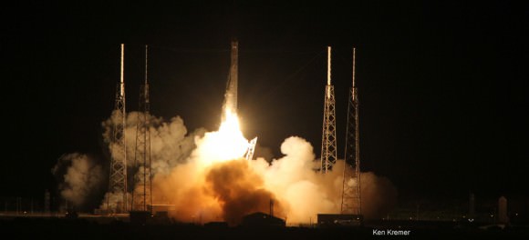
Caption: Blastoff of SpaceX Cargo Dragon atop Falcon 9 from Cape Canaveral, Florida on May, 22, 2012, bound for the ISS. Credit: Ken Kremer

“We are the emotional successors to the shuttle,” said Mark Sirangelo, Sierra Nevada Corp. vice president and SNC Space Systems chairman. “Our target was to repatriate that industry back to the United States, and that’s what we’re doing.”

Sierra Nevada is developing the winged Dream Chaser, a mini-shuttle that launches atop an Atlas V rocket and lands on a runway like the shuttle. Boeing and SpaceX are building capsules that will launch atop Atlas V and Falcon 9 rockets, respectively, and then land by parachute like the Russian Soyuz capsule.

SpaceX appears to be leading the pack using a man-rated version of their Dragon capsule which has already docked twice to the ISS on critical cargo delivery missions during 2012. From the start, the SpaceX Dragon was built to meet the specification ratings requirements for a human crew.

DragonApproachesStation_640

Caption: Dragon spacecraft approaches the International Space Station on May 25, 2012 for grapple and berthing . Photo: NASA

Reisman said the first manned Dragon test flight with SpaceX test pilots could be launched in mid 2015. A flight to the ISS could take place by late 2015. Leading up to that in April 2014, SpaceX is planning to carry out an unmanned in-flight abort test to simulate and test a worst case scenario “at the worst possible moment.”

Boeing is aiming for an initial three day orbital test flight of their CST-100 capsule during 2016, said John Mulholland, the Boeing Commercial Programs Space Exploration vice president and program manager. Mulholland added that Chris Ferguson, the commander of the final shuttle flight by Atlantis, is leading the flight test effort.

Boeing has leased one of NASA’s Orbiter Processing Facility hangers (OPF-3) at KSC. Mulholland told me that Boeing will ‘cut metal’ soon. “Our first piece of flight design hardware will be delivered to KSC and OPF-3 within 5 months.”

IMG_9198a_Boeing CST_Ken Kremer

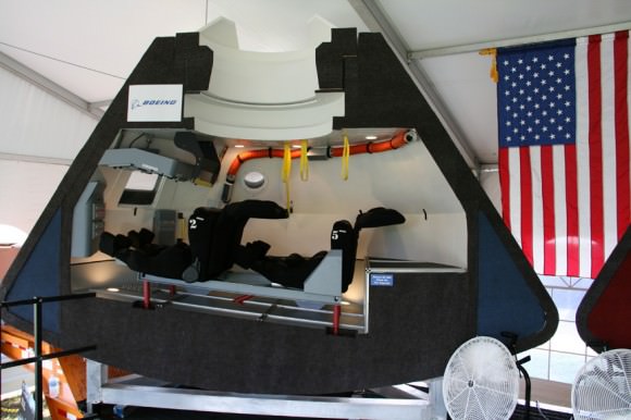
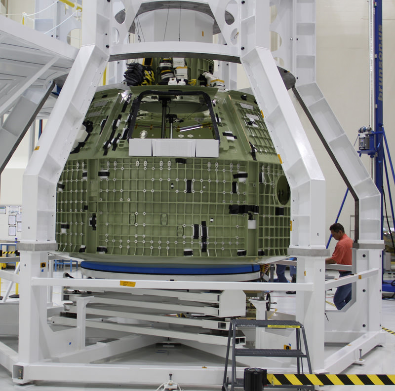
Caption: Boeing CST-100 capsule mock-up, interior view. Credit: Ken Kremer

Sierra Nevada plans to start atmospheric drop tests of an engineering test article of the Dream Chaser from a carrier aircraft in the next few months in an autonomous mode. The test article is a full sized vehicle.

“It’s not outfitted for orbital flight; it is outfitted for atmospheric flight tests,” Sirangelo told me. “The best analogy is it’s very similar to what NASA did in the shuttle program with the Enterprise, creating a vehicle that would allow it to do significant flights whose design then would filter into the final vehicle for orbital flight.”

Now to the issue of using commercial space test pilots in place of NASA astronauts on the initial test flights.

At the briefing, Reisman stated, “We were told that because this would be part of the development and prior to final certification that we were not allowed, legally, to use NASA astronauts to be part of that test pilot crew.”

So I asked NASA’s Ed Mango, “Why are NASA astronauts not allowed on the initial commercial test flights?”

Mango replied that NASA wants to implement the model adopted by the military wherein the commercial company assumes the initial risk before handing the airplanes to the government.

“We would like them to get to a point where they’re ready to put their crew on their vehicle at their risk,” said Mango. “And so it changes the dynamic a little bit. Normally under a contract, the contractor comes forward and says he’s ready to go fly but it’s a NASA individual that’s going to sit on the rocket, so it becomes a NASA risk.

“What we did is we flipped it around under iCAP. It’s not what we’re going to do long term under phase two, but we flipped it around under iCAP and said we want to know when you’re ready to fly your crew and put your people at risk. And that then becomes something that we’re able to evaluate.”

“In the end all our partners want to fly safe. They’re not going to take any shortcuts on flying safe,” he elaborated. “All of us have the same initiative and it doesn’t matter who’s sitting on top of the vehicle. It’s a person, and that person needs to fly safely and get back home to their families. That’s the mission of all our folks and our partners – to go back home and see their family.”

Given the nations fiscal difficulties and lack of bipartisan cooperation there is no guarantee that NASA will receive the budget it needs to keep the commercial crew program on track.

Indeed, the Obama Administrations budget request for commercial crew has been repeatedly slashed by the US Congress to only half the request in the past two years. These huge funding cuts have already forced a multi-year delay in the inaugural test flights and increased the time span that the US has no choice but to pay Russia to launch US astronauts to the ISS.

“The budget is going to be an extremely challenging topic, not only for this program but for all NASA programs,” said Phil McAlister, NASA Commercial Spaceflight Development director.

NASA is pursuing a dual track approach in reviving NASA’s human spaceflight program. The much larger Orion crew capsule is simultaneously being developed to launch atop the new SLS super rocket and carry astronauts back to the Moon by 2021 and then farther into deep space to Asteroids and one day hopefully Mars.

Ken Kremer

Dream_Chaser_Atlas_V_Integrated_Launch_Configuration[1]

Caption: Dream Chaser awaits launch atop Atlas V rocket

Kepler Finds Hundreds of New Exoplanet Candidates

Artist’s depiction of the Kepler 10 system, which contains planets 2.2 and 1.4 times the size of Earth. (NASA/Ames/JPL-Caltech)

Kepler mission scientists announced today the discovery of literally hundreds of new exoplanet candidates — 461, to be exact — orbiting distant stars within a relatively small cross-section of our galaxy, bringing the total number of potential planets awaiting confirmation to 2,740. What’s more, at least 4 of these new candidates appear to be fairly Earth-sized worlds located within their stars’ habitable zone, the orbital “sweet spot” where surface water could exist as a liquid.

Impressive results, considering that NASA’s planet-hunting spacecraft was launched a little under 4 years ago (and watching 150,000 stars to spot the shadows of planets is no easy task!)

“… the ways by which men arrive at knowledge of the celestial things are hardly less wonderful than the nature of these things themselves.”

— Johannes Kepler

Since the last official announcement of Kepler candidates in Feb. 2012 the number of smaller Earth- and super-Earth-sized worlds observed has risen considerably, as well as the identification of multi-planet systems that are organized more-or-less along a flat plane… just like ours.

“There is no better way to kickoff the start of the Kepler extended mission,” said Kepler scientist Christopher Burke, “than to discover more possible outposts on the frontier of potentially life bearing worlds.”

Read more: First Earth-Sized Exoplanets Found by Kepler

From the NASA press release:

Since the last Kepler catalog was released in February 2012, the number of candidates discovered in the Kepler data has increased by 20 percent and now totals 2,740 potential planets orbiting 2,036 stars. The most dramatic increases are seen in the number of Earth-size and super Earth-size candidates discovered, which grew by 43 and 21 percent respectively.

The new data increases the number of stars discovered to have more than one planet candidate from 365 to 467. Today, 43 percent of Kepler’s planet candidates are observed to have neighbor planets.

717592main_NewCandidatesbySize-07Jan13_673

The most dramatic increases are seen in the number of Earth-size and super Earth-size candidates discovered, which grew by 43 and 21 percent respectively. (NASA)

Although some of the new candidates announced today are large Neptune-sized planets, more than half are Earth- to super-Earth sized worlds less than twice the radius of our own planet.

KeplerfieldofviewwithMilkyWayIn order for Kepler candidates to be “officially” called exoplanets, they must be observed 3 times on a regular orbit — that is, their signature dimming of the light from their home star must occur as predicted once their presence and then orbital period is calculated. Only then is an exoplanet confirmed.

To date Kepler has confirmed 105 exoplanets.

The longer the mission continues, the better the chance that Kepler will be able to confirm smaller Earth-sized worlds in longer-period orbits.

Read more: Kepler Mission Extended to 2016

“The analysis of increasingly longer time periods of Kepler data uncovers smaller planets in longer period orbits — orbital periods similar to Earth’s,” said Steve Howell, Kepler mission scientist. “It is no longer a question of will we find a true Earth analogue, but a question of when.”

Scientists analyzed more than 13,000 transit-like signals called ‘threshold crossing events’ to eliminate known spacecraft instrumentation and astrophysical false positives, phenomena that masquerade as planetary candidates, to identify the potential new planets. Watch the video below to see how Kepler observes the light-curve of transit events.

Read more on the NASA press release, and learn more about the Kepler mission here.

Curiosity Touches Mars at Yellowknife Bay and Drives to Snake River for Drilling

Image Caption: Photo mosaic shows NASA’s Curiosity Mars rover in action reaching out to investigate rocks at a location called Yellowknife Bay on Sol 132, Dec 19, 2012 in search of first drilling target. The view is reminiscent of a dried up shoreline. Curiosity’s navigation camera captured the scene surrounding the rover with the arm deployed and the APXS and MAHLI science instruments on tool turret collecting microscopic imaging and X-ray spectroscopic data. The mosaic is colorized. See the full 360 degree panoramic and black & white versions below. Credit: NASA/JPL-Caltech/Ken Kremer/Marco Di Lorenzo

Following the Christmas season break for panoramic imaging of her surroundings, NASA’s Curiosity robot has resumed roving around the shallow depression she reached before the holidays called ‘Yellowknife Bay’ and just arrived at a slithery rock called ‘Snake River’.

The top priority is to locate a target rock to drill into – and that momentous event could at last take place in the next week or so. The drill is the last of Curiosity’s suite of ten science instruments to be fully checked out and commissioned for use.

The drilling scene will look a lot like our photo mosaics, above and below, showing the robotic arm deployed for action. The drill is located on the tool turret at the end of the 7 foot (2.1 meter) long mechanical marvel.

The Curiosity research team is using the newly collected cache of high resolution color images to scan her surroundings in search of scientifically interesting rocks for the historic inaugural use of the high powered hammering drill.

Curiosity touches Yellowknife Bay Sol 132_4c_Ken Kremer

Image Caption: Photo mosaic shows NASA’s Curiosity Mars rover in action reaching out to investigate rocks at a location called Yellowknife Bay on Sol 132, Dec 19, 2012. In search of first drilling target the rover drove to a spot at the right edge of this mosaic called Snake River rock. Curiosity’s navigation camera captured the scene surrounding the rover with the arm deployed and the APXS and MAHLI science instruments on tool turret collecting imaging and X-ray spectroscopic data. Base of Mount Sharp visible at right.The mosaic is colorized with patches of sky added to fill in gaps. Click to enlarge. Credit: NASA/JPL-Caltech/Ken Kremer/Marco Di Lorenzo

The percussive drill will collect the first ever powdered samples from the interior of Martian rocks for analysis by a pair of state-of-the-art analytical chemistry instruments located inside the rover named SAM and CheMin.

“We are firing on all cylinders now and our last thing to do is drilling, and we really hope to start on that process beginning next week,” said John Grotzinger, the mission’s chief scientist of the California Institute of Technology, in an interview with Jonathan Amos of the BBC.

The rover is also using the APXS X-ray mineral spectrometer, ChemCam rock blasting laser and MAHLI hand lens imager to gather science characterization data helpful in choosing the drill target.

Today (Jan. 5) marks exactly 5 months since Curiosity’s hair-raisingly successfully touchdown on Aug. 5, 2012 on the gravelly plains of Gale Crater beside the towering foothills of Mount Sharp, a 3 mi (5 km) high layered mountain holding deposits of hydrated minerals. Mount Sharp is the main destination of Curiosity’s mission.

On Jan. 3 (Sol 147), Curiosity drove another 10 feet (3 meters) northwestward and pulled up to a sinuous rock feature called “Snake River” as part of a campaign to survey a variety of rocks from which to select the drilling site.

“It’s one piece of the puzzle,” says John Grotzinger. “It has a crosscutting relationship to the surrounding rock and appears to have formed after the deposition of the layer that it transects.”

717343main_pia16564-43_946-710

‘Snake River’ sinuous Rock Feature Viewed by Curiosity Mars Rover on Sol 133. On Sol 147 (Jan 3. 2013), the rover drove to within arm’s reach of Snake river for up close examination as possible drill target. Credit: NASA/JPL-Caltech

Snake River is a thin curving line of darker rock cutting through flatter rocks and jutting above sand, says NASA. It’s located at the right side edge of our Sol 132 photo mosaic stitched together from raw images by the image processing team of Ken Kremer & Marco Di Lorenzo to provide a context view of the scenery – and were also featured at NBC News by Alan Boyle, BBC News, NASA Watch and the NY Daily News.

So far the robot has driven a total of 2,303 feet (702 meters) and snapped nearly 36,000 pictures.

Yellowknife Bay is a basin inside an area dubbed ‘Glenelg’ that features a flatter and lighter-toned type of terrain from what the mission crossed during its first four months inside Gale Crater. The rover descended about 2 feet (0.5 m) down a slight incline to reach the inside of the depression in December 2012.

“We’re down at the very lowest layer – what would be the oldest layer that we would see in this succession that might be five to eight meters thick, and that is very likely where we are going to choose our first drilling target, because suddenly we’ve come into an area that represents a very high diversity of things we haven’t seen before,” said Grotzinger to the BBC.

“The place where Curiosity is right now is a small stack of layers – very impressive – and they could be 3-3.5 billion years old, and so we’re very excited about this because unlike the soil which we were analyzing before the holiday season – a loose, windswept patch of dirt on the surface of Mars – we’re now going to start digging down into the very ancient bedrock which we really built the rover to look at,” explained Grotzinger.

Curiosity & Yellowknife Bay Sol 125_2c_Ken Kremer

Image caption: Curiosity peaks around Yellowknife Bay on Sol 125, Dec 12, 2012. The rover has continued driving inside the basin in search of 1st rock drill target in Jan 2013. Credit: NASA/JPL-Caltech/Ken Kremer/Marco Di Lorenzo

The mission goal is to search for habitats and determine if Mars ever could have supported microbial life in the past or present during the 2 year primary mission phase.

“We use these layers as a sort of recording device of past events and conditions, and the rover has the same kind of analytical capability that we would use here on Earth to tell us about the early environmental conditions; and, if life had ever evolved, [whether it would] be the kind of environment that would have been conducive towards sustaining that life,” Grotzinger elaborated to the BBC.

Stay tuned.

Ken Kremer

Curiosity touches Yellowknife Bay Sol 132_3c_Ken Kremer

Image Caption: Photo mosaic shows NASA’s Curiosity Mars rover in action reaching out to investigate rocks at a location called Yellowknife Bay on Sol 132, Dec 19, 2012. Credit: NASA/JPL-Caltech/Ken Kremer/Marco Di Lorenzo

Ancient Impacts Stained Vesta with Carbon-Rich Material

Composite-color 3D image of Cornelia crater on Vesta (NASA/JPL-Caltech/UCLA/MPS/DLR/IDA)

Ever since arriving at Vesta in July 2011, NASA’s Dawn spacecraft has been capturing high-resolution images of the protoplanet’s surface, revealing a surprisingly varied and complex terrain covered in ridges, hills, grooves and, of course, craters of many different sizes and ages. Many of Vesta’s largest craters exhibit strange dark stains and splotches within and around them, some literally darker than coal. These stains were a puzzle to scientists when they were first seen, but the latest research now confirms that they may actually be the remains of the ancient impacts that caused them: dark deposits left by the myriad of carbon-rich objects that struck Vesta over the past four-and-a-half billion years.

Even though Vesta had a completely molten surface 4.5 billion years ago it’s believed that its crust likely solidified within a few million years, making the 530-km (329-mile) -wide world a literal time capsule for events taking place in the inner Solar System since then… one reason why Vesta was chosen as a target for the Dawn mission.

714973main_pia16632-43_946-710Using data acquired by Dawn during its year in orbit around Vesta, a team led by researchers from Germany’s Max Planck Institute for Solar System Research and the University of North Dakota investigated the dark material seen lining the edges of large impact basins located on the protoplanet’s southern hemisphere. What they determined was that much of the material was delivered during an initial large, low-velocity impact event 2–3 billion years ago that created the largest basin — Veneneia — and was then partially covered by a later impact that created the smaller basin that’s nearly centered on Vesta’s southern pole — Rheasilva.

“The evidence suggests that the dark material on Vesta is rich in carbonaceous material and was brought there by collisions with smaller asteroids.”

– Vishnu Reddy, lead author, Max Planck Institute for Solar System Research and the University of North Dakota

714963main_pia16630-43_946-710

Dawn framing camera images of dark material on Vesta. (NASA/JPL-Caltech/UCLA/MPS/DLR/IDA)

Subsequent smaller asteroid impacts over the millennia likely brought more carbonaceous material to Vesta’s surface, both delivering it as well as revealing any that may have existed beneath brighter surfaces.

Read more: Asteroid’s Unusual Light and Dark Crater


The dark, carbon-rich material observed on Vesta by Dawn also seems to match up with similarly dark clasts found in meteorites that have landed on Earth which are thought to have originated from Vesta.

“Our analysis of the dark material on Vesta and comparisons with laboratory studies of HED meteorites for the first time proves directly that these meteorites are fragments from Vesta,” said Lucille Le Corre from the Max Planck Institute for Solar System Research, another lead author of the study.

If evidence of such collisions between worlds can be found on Vesta, it’s likely that similar events were occurring all across the inner solar system during its early days, providing a clue as to how carbon-rich organic material was delivered to Earth — and possibly Mars as well. Such material — the dark stains we see today lining Vesta’s craters — would have helped form the very building blocks of life on our planet.

The team’s findings were published in the November/December issue of the journal Icarus.

Read more on the Max Planck Institute’s news page here, and on the NASA release here. Learn more about the Dawn mission in the video below, narrated by Leonard Nimoy.

The South Rim of Aristarchus

LROC view looking obliquely of the south rim of Aristarchus from the west (NASA/GSFC/Arizona State University)

Flying over at an altitude of 135 km, NASA’s Lunar Reconnaissance Orbiter captured this lovely oblique view of the crater Aristarchus, looking down at the 40-km (25-mile) -wide crater’s southern rim from the west.

The broad flank of Aristarchus’ 300-meter (980-foot) central peak and surrounding hills can be seen at left, casting lengthening shadows in the setting sun.

Named after the Greek astronomer who first proposed a controversial heliocentric model for the Solar System in the 3rd century BCE, Aristarchus is a prominent crater located near the Moon’s northwestern limb within the geologically-diverse Oceanus Procellarum — the “Ocean of Storms.” Surrounded by rays of bright ejecta that extend down its stepped rim, the floor of Aristarchus drops 3.7 km (2.3 miles) below the surrounding lunar landscape.

Read more: LRO Lets You Stand on the Rim of Aristarchus Crater

The bright material seen in the ejecta streaks seems to echo the patterns of light and dark material lining the slopes of Aristarchus’ central peak, suggesting that they may be the made of similar material.

arist_cpeak_halfres

Detail of the 4.5-km-long central peak of Aristarchus (NASA/GSFC/Arizona State University)

The impact that created Aristarchus an estimated 450 million years ago excavated subsurface material, melting and spraying it tens of kilometers over the surrounding plateau. It’s thought that the central peak is likely composed of the same stuff, dredged up by the impact and frozen in place.

Future lunar explorers, should they ever visit this region, would be able to collect samples from the base of the central peak and compare them to samples from the bright rays to see if they match up, allowing researchers to learn about the composition of the material underlying the plateau from rocks scattered conveniently around the surface… this is the beauty of such (relatively) recent craters! The digging’s already been done for us.

Read more about this on Arizona State University’s LROC site and explore a zoomable version of the original NAC frame here.