The Moon as You’ve Never Seen It Before

Lunar Reconnaissance Orbiter Wide Angle Camera color shaded relief of the lunar farside (NASA/GSFC/DLR/Arizona State University).

[/caption]

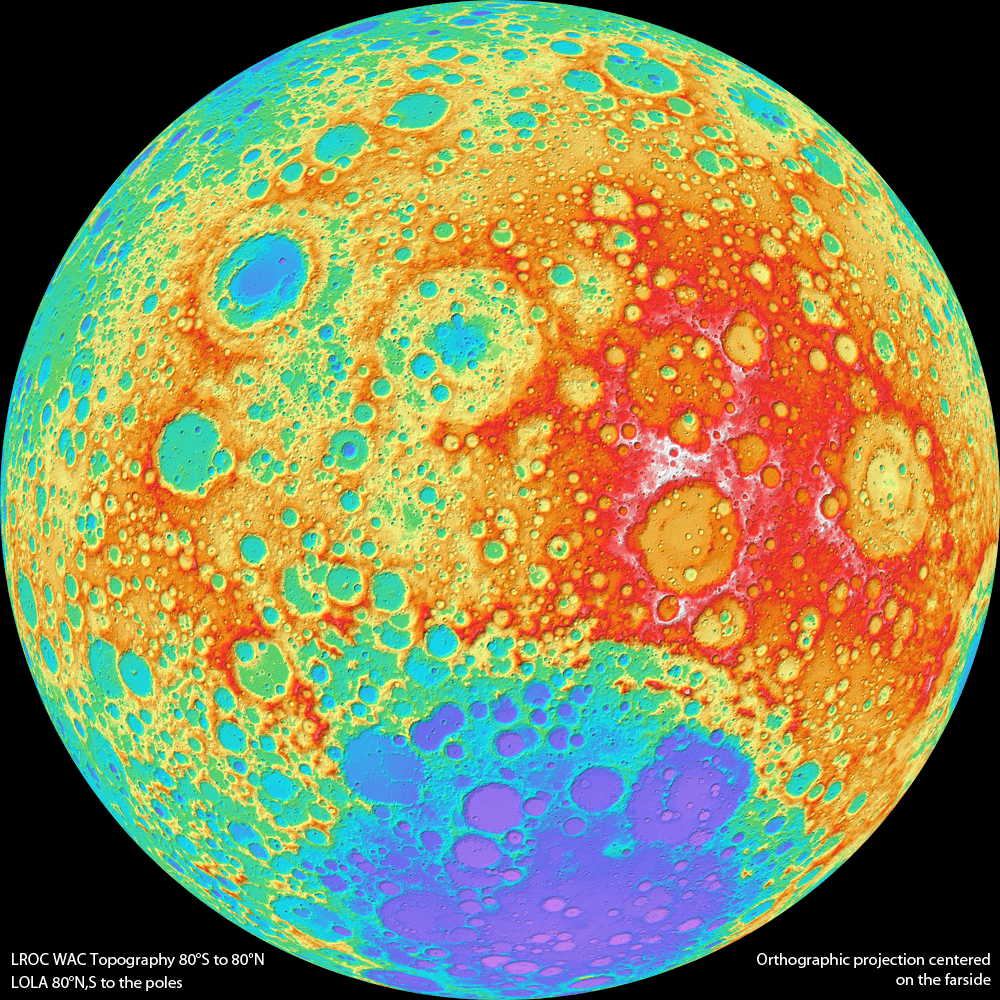
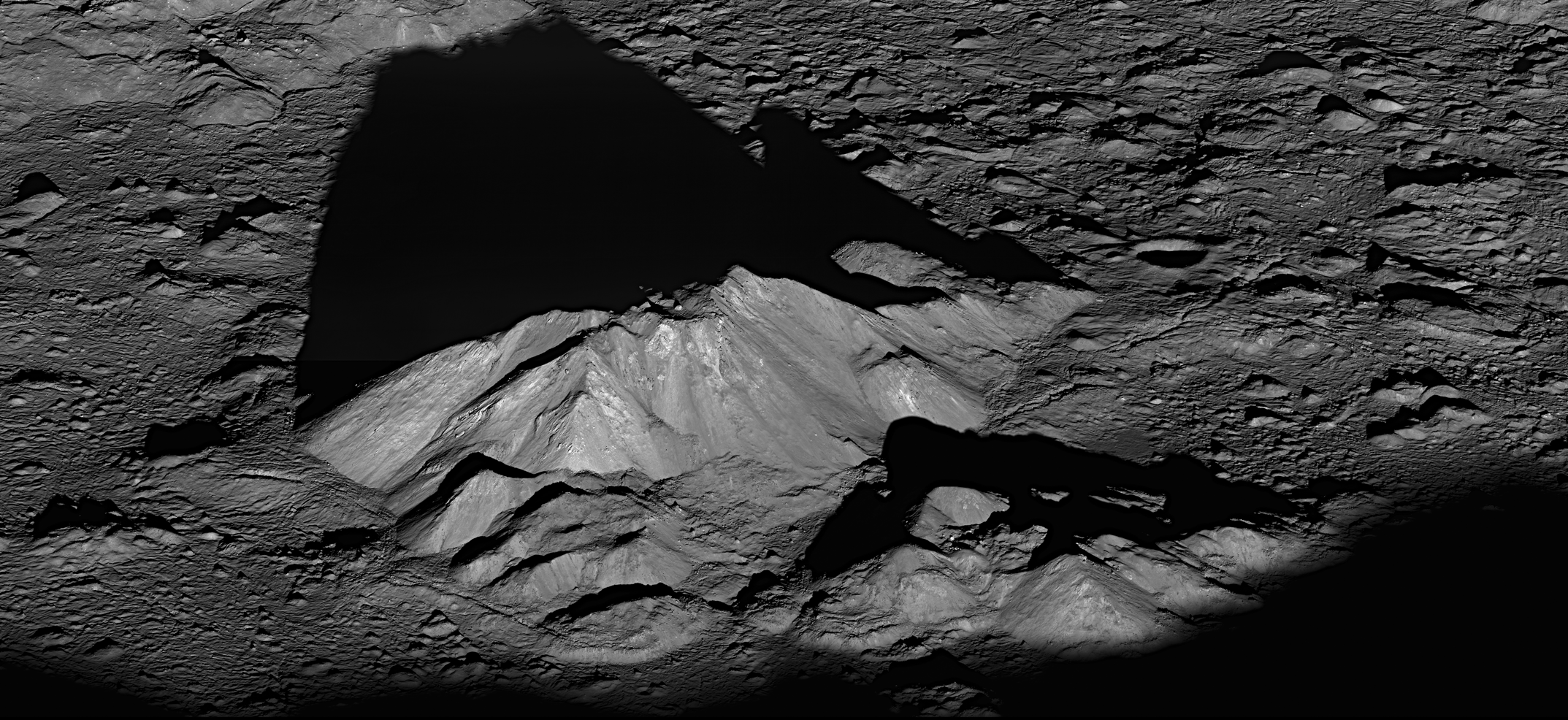
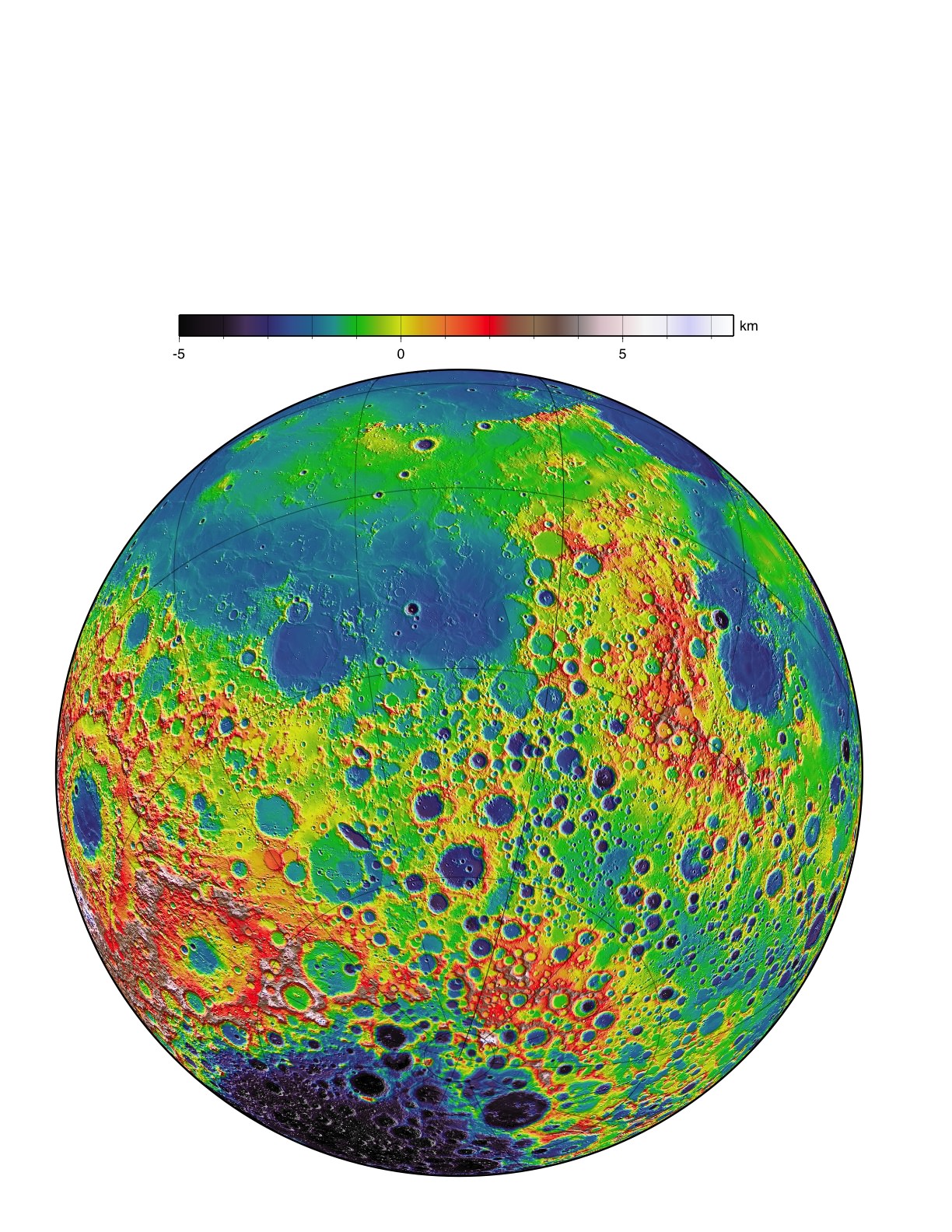
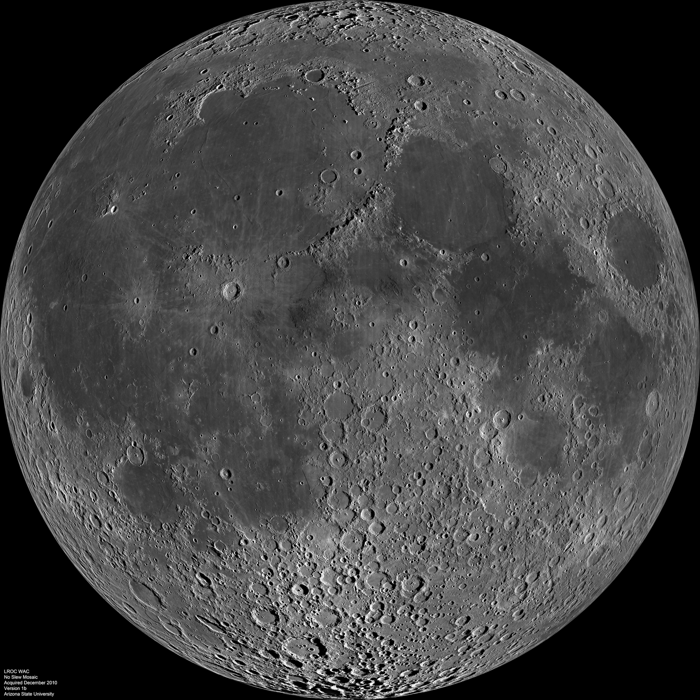
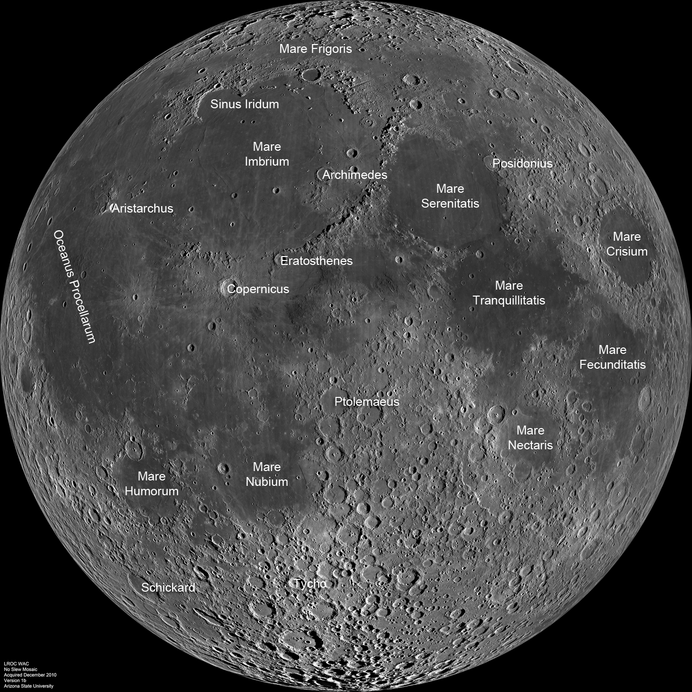
You’re looking at a brand new view of the lunar farside, as never seen before. The team from the Lunar Reconnaissance Orbiter has released the first version of a topographic map of nearly the entire Moon, from data from the Wide Angle Camera (WAC) on the spacecraft.

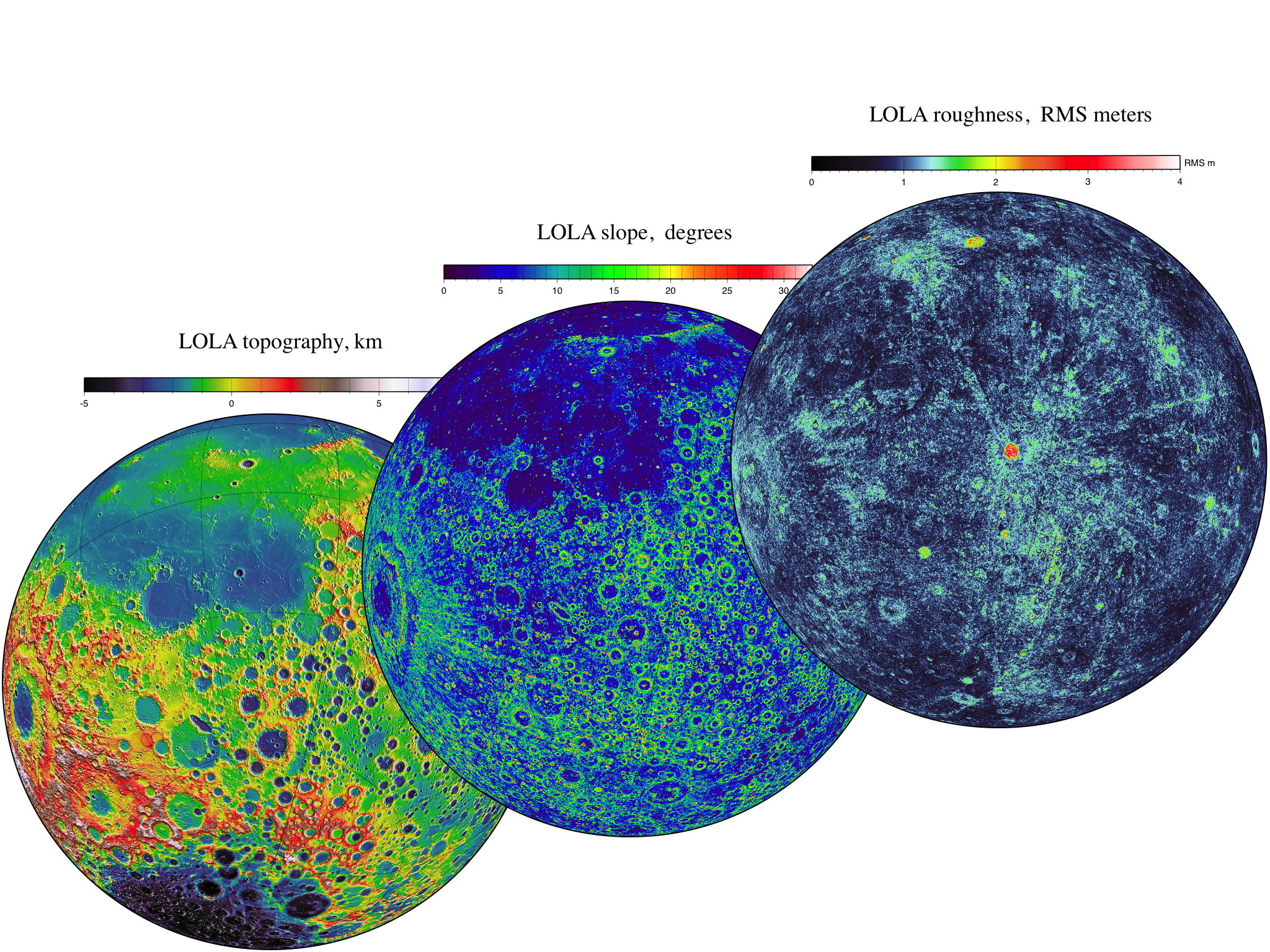
“This amazing map shows you the ups and downs over nearly the entire Moon, at a scale of 100 meters across the surface, and 20 meters or better vertically,” said principal investigator Mark Robinson, writing on the LROC website. “Despite the diminutive size of the WAC (it fits in the palm of one’s hand), it images nearly the entire Moon every month.”

Every month? So why is this a “new” map since LRO has been in lunar orbit since mid-2009?

Robinson said that each month the Moon’s lighting changes, so the WAC methodically builds up a record of how different rocks reflect light under different conditions, and adds to the LROC library of stereo observations.

“The WAC really is the little camera that could!” Robinson said.

Left: LROC Wide Angle Camera attached to a test setup shortly before mounting on the spacecraft. Right: WAC being handed up to engineers for integration with LRO. Photos courtesy Mark Robinson, via the LROC website.

It is very similar to the MARCI camera (Mars Color Imager) on the Mars Reconnaissance Orbiter, another wide-angle, low-resolution camera specially built for orbital observations; both cameras were built by Malin Space Science Systems.

Topographic maps provide a detailed and accurate graphic representation of natural features on the ground, and Robinson this new map of the Moon will help both lunar scientists and future explorers on the Moon.

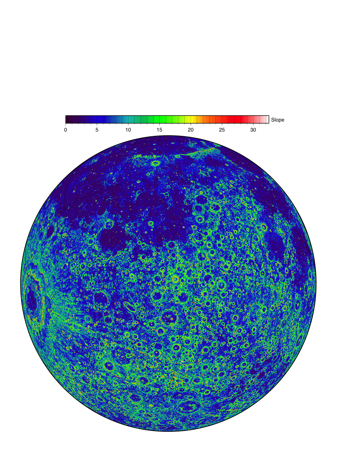
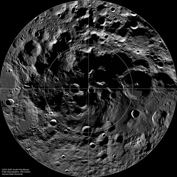
Combing data from the WAC along with the LRO Lunar Orbiter Laser Altimeter (LOLA), the scientists are able to provide a topographic map of nearly the entire Moon. Due to persistent shadows near the poles it is not possible to create a complete WAC stereo map at the very highest latitudes, but LOLA provides a very high resolution topographic model of the poles.

How is a digital topographic map created from stereo images? The WAC stereo images were compared one against another by pattern-matching a moving box of pixels until the best fit was found between two images with different viewing angles. The new topographic model was constructed from 69,000 WAC stereo models.

Robinson and his team are already looking towards improvements they can make with subsequent versions of their topographic maps.

“The current model incorporates the first year of stereo imaging, and there is another year of data that can be added to the solution,” he said. “These additional stereo images will not only improve the sharpness (resolution) of the model but also fill in very small gaps that exist in the current map. The LROC team has made small improvements to the camera distortion model, and the LOLA team has improved our knowledge of the spacecraft position over time. These next generation steps will further improve the accuracy of Version 2 of the LROC GLD100 topographic model of the Moon.”

You can see the “zoomable” full resolution versions of the new map for both the far and near side at this link.

Source: LROC website

LROC “Treasure Map” Reveals Titanium Deposits

LROC WAC mosaic showing boundary between Mare Serenitatis and Mare Tranquillitatis. The relative blue colour of the Tranquillitatis mare is due to higher abundances of the titanium bearing mineral ilmenite. Image Credit: NASA/GSFC/Arizona State University

[/caption]
At a joint meeting of the European Planetary Science Congress and the American Astronomical Society’s Division for Planetary Sciences, Mark Robinson and Brett Denevi have unveiled a map of the Moon combining observations in visible and ultraviolet wavelengths showing areas rich in Titanium ores. This discovery not only provides a potential source of a valuable metal, but also provides valuable information which will help scientists better understand lunar formation and composition of the Moon’s interior.

How did Robinson and Denevi create this map, and what can other scientists learn from this new data?

“Looking up at the Moon, its surface appears painted with shades of grey – at least to the human eye. But with the right instruments, the Moon can appear colourful,” said Robinson, (Arizona State University). “The maria appear reddish in some places and blue in others. Although subtle, these colour variations tell us important things about the chemistry and evolution of the lunar surface. They indicate the titanium and iron abundance, as well as the maturity of a lunar soil.”

Robinson and the LROC team previously used similar methods with Hubble Space Telescope images to map titanium abundances near the Apollo 17 landing site, which had varying titanium levels. When Robinson compared the Apollo data with the HST images, it was revealed that titanium levels corresponded to the ratio of ultraviolet to visible light reflected by the lunar surface.

“Our challenge was to find out whether the technique would work across broad areas, or whether there was something special about the Apollo 17 area,” said Robinson. Using nearly 4000 images from the LRO Wide-Area Camera (WAC), Robinson’s team created a mosaic image, which was then studied using the techniques developed with the Hubble imagery. The research used the same ultraviolet to visible light ratio to deduce titanium abundance, which was verified by surface samples gathered by Apollo and Luna missions.

“We still don’t really understand why we find much higher abundances of titanium on the Moon compared to similar types of rocks on Earth. What the lunar titanium-richness does tell us is that the interior of the Moon had less oxygen when it was formed, knowledge that geochemists value for understanding the evolution of the Moon,” added Robinson.

On our Moon, titanium is found in a mineral known as ilmenite, which contains iron, titanium and oxygen. In theory, Lunar miners could process ilmenite to separate the iron, titanium and oxygen. Aside from the elements present in ilmenite, Apollo data shows that minerals containing titanium can retaining particles from the solar wind, such as helium and hydrogen. Future inhabitants of the Moon would find helium and hydrogen, along with oxygen and iron to be vital resources.

“The new map is a valuable tool for lunar exploration planning. Astronauts will want to visit places with both high scientific value and a high potential for resources that can be used to support exploration activities. Areas with high titanium provide both – a pathway to understanding the interior of the Moon and potential mining resources,” said Denevi (John Hopkins University).

The new maps also provide insight into how lunar surface materials are altered by the impact of charged particles from the solar wind and high-velocity micrometeorite impacts. Over time, lunar rock is pulverized into a fine powder by micrometeorite impacts, and charged particles alter the chemical composition and color of the surface.Recently exposed materials, such as ejecta from impacts appear bluer and have higher reflectivity than older Lunar regolith (soil). Younger material is estimated to take about half a billion years to fully “weather” to the point where it would blend in with older material.

“One of the exciting discoveries we’ve made is that the effects of weathering show up much more quickly in ultraviolet than in visible or infrared wavelengths. In the LROC ultraviolet mosaics, even craters that we thought were very young appear relatively mature. Only small, very recently formed craters show up as fresh regolith exposed on the surface,” said Robinson.

So it seems there’s always something new to be learned from our Moon. Coincidentally, tomorrow (October 8th) is International Observe the Moon Night, so make sure you grab your binoculars or telescope tomorrow night and do some lunar observations! Be sure to check out our previous coverage of International Observe the Moon Night by our Senior Editor, Nancy Atkinson at: http://www.universetoday.com/89522/need-an-excuse-to-gaze-at-the-moon-international-observe-the-moon-night-is-coming/

If you’d like to learn more about the Lunar Reconnaissance Orbiter Camera, visit: http://lroc.sese.asu.edu/

Source: Europlanet Research Infrastructure / Division for Planetary Sciences of the American Astronomical Society Joint Press Release

NASA Releases Closer Looks at Apollo Landing Sites from the Lunar Reconnaissance Orbiter

Low periapsis Narrow Angle Camera image of the Apollo 17 Landing Site. Image is 150 meters wide, Credit: NASA/GSFC/Arizona State University.

[/caption]

New images of the Apollo 12, 14 and 17 landing sites are the highest resolution pictures ever of human forays onto another world, as seen from a bird’s eye view — or in this case, a satellite’s eye view. The Lunar Reconnaissance Orbiter dipped to a lower altitude, just 21 kilometers (13 miles) over the lunar surface.

“We like to look at the Apollo landing site images because it’s fun,” said LRO principal investigator Mark Robinson at a media briefing today. “But LROC (Lunar Reconnaissance Orbiter Camera) is looking at the whole Moon, and we have now taken 1,500 of these very high resolution images from all around the Moon which will help scientists and engineers to plan where we want to go in the future.”

Apollo 17 landing site taken by LRO in its lower orbit, with 25 cm per pixel. Credit: NASA/Goddard/ASU

Apollo 17 landing site from the regular 50 km altitude and about 50 cm per pixel. Credit: NASA/ Goddard/ ASU

Compare in the images above the Apollo 17 landing site with 25 cm per pixel (top) and 50 cm per pixel (bottom).

Most notable are the tracks where the astronauts walked show up better, and details of the landers/descent stages can be resolved better.

Robinson said he was looking at the new images of the Apollo 17 landing site in Taurus Littrow Valley with Apollo 17 astronaut Jack Schmitt and Schmitt said “You need to image the whole valley at this resolution!”

This is the third resolution of Apollo sites that the LRO team has released — the first came from LRO’s commissioning phase where the altitude was about 100 km and the resolution was about 1 meter per pixel; next came the release of images from an altitude of about 50 km, with a resolution of about 50 cm per pixel; and now from about 21-22 km altitude with a resolution of 25 cm per pixel.

“These are the sharpest images of Apollo landing sites we’ll probably ever get with LRO,” said Rich Vondrak, LRO project scientist, “as we’ll never go as low in altitude as we were in the past month.”

LRO has now returned to its circular orbit of 50 km above the surface. This altitude requires monthly reboosts and since keeping LRO in that orbit would quickly exhaust the remaining fuel, in mid-December, LRO will move to an elliptical orbit, (30 km over south pole and 200 km over north pole). LRO will be able to stay in this orbit for several more years.

“This has been a highly productive mission, releasing a total of 245 terabytes of data — which would be a stack of 52,000 DVDs,” Vondrak said. Next week the science team will put out their 7th public release of data to the Planetary Data System, making all that data available to the public.

The paths left by astronauts Alan Shepard and Edgar Mitchell on both Apollo 14 moon walks are visible in this image. (At the end of the second moon walk, Shepard famously hit two golf balls.) 
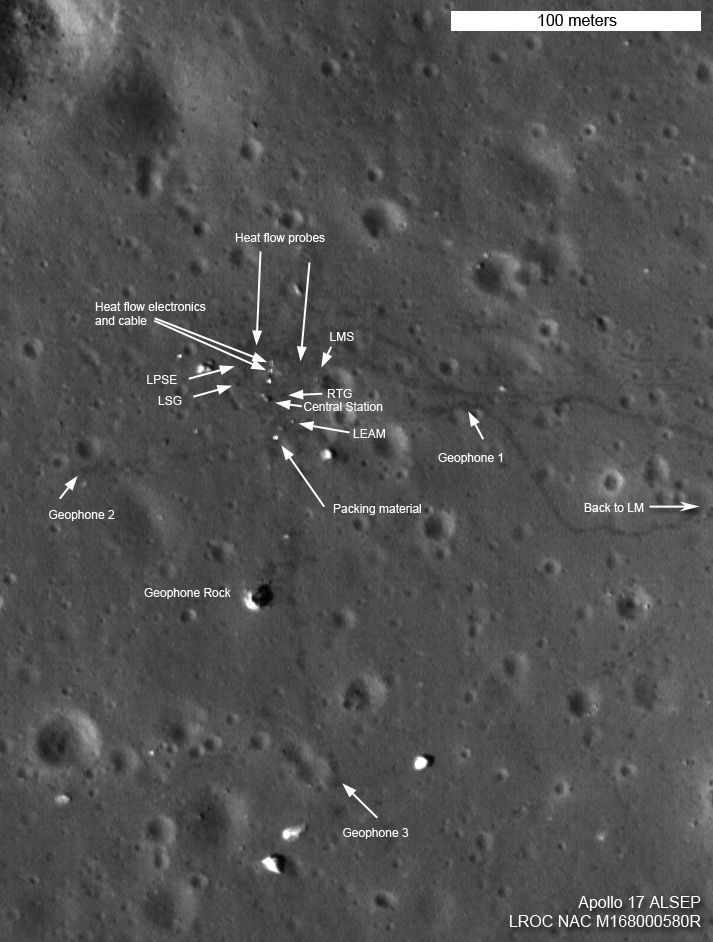
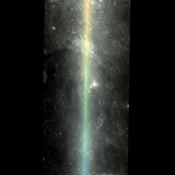
The descent stage of the lunar module Antares is also visible. Credit: NASA's Goddard Space Flight Center/ASU

Robinson noted that the details of what pieces of equipment are in each location are verified by images taken from the surface by the astronauts. He was asked about the flags and if they are still standing: “All we can really see is the spots where the flag was planted because the astronauts tramped down the regolith. I’m not sure if the flags still exist, given the extreme heat and cold cycle and the harsh UV environment. The flags were made of nylon, and personally I would be surprised if anything was left of them since it has been over 40 years since they were left on the Moon and the flags we have here on Earth fade after they are left outside for one summer. If the flags are still there they are probably in pretty rough shape.”

The tracks made in 1969 by astronauts Pete Conrad and Alan Bean, the third and fourth humans to walk on the moon, can be seen in this LRO image of the Apollo 12 site. The location of the descent stage for Apollo 12's lunar module, Intrepid, also can be seen. Credit: NASA/Goddard/ASU

Since we can still see the tracks and equipment looking unchanged (at least from this vantage point) one reporter asked if these items will be on the Moon forever. “Forever is a long time, so no, they won’t be there forever,” Robinson replied. “The Moon is constantly bombarded by micrometeorites, and slowly over time the tracks will disappear, then the smaller pieces of equipment will disappear, and eventually the decent stages will probably get blasted by an a larger asteroid. The estimate is that rocks erode 1 mm per million years. In human terms it may seems like forever, but geologic terms, there will be no traces of Apollo exploration in 10 to 100 million years.”

This video shows more info and a “zoom in” of the sites:

Sources: Media briefing, NASA, LROC

LRO to Move in For Closer Look at the Apollo Landing Sites

Artist concept of LRO in lunar orbit. Credit: NASA

[/caption]

NASA’s Lunar Reconnaissance Orbiter (LRO) is changing our view of the Moon by literally bringing it into sharper focus with its three high resolution cameras. But now, things are about to get even sharper. Today, LRO fired its thrusters to begin dipping down from its usual orbit about 50 km above the surface and moving to an orbit that will allow the spacecraft’s cameras me to image the Apollo sites from about 20 km away.

“This will allow me to obtain images of the Apollo sites that are about 4 times sharper than my current best images,” said the LRO spacecraft on Twitter.


This is just a temporary orbit and the spacecraft will take images of and around the Apollo sites between August 14 and 19, 2011. After that, the spacecraft will return to the 50-km-orbit until December.

LRO has two narrow angle cameras (NACs) and one wide angle camera (WAC).

According to Mark Robinson, LROC Principal Investigator, who spoke at the Lunar Forum at Ames Research Center last month, as of the end of July, 2011 the amount of data returned by LRO has been about 400 gigabits of data every day, which includes 371,027 high resolution images. The WAC has taken about 160,000 images, with about 90,000 in color. In total, the spacecraft has imaged the entire Moon about 20 times with the WAC, and has imaged 20 per cent of the moon with NACs, which provides a narrower but higher resolution view.

“We want to map the whole moon at 50 cm/pixel to 200 cm/pixel, and that would be LROC’s legacy for the next 100 years of lunar exploration and science,” Robinson said.

He noted that all three cameras are performing way better than he had hoped.

“We are very excited about the quality of the data,” Robinson said.

So get ready for a little more quality views of the Apollo landing sites!

Update: as commenter MoonOrBust noted, the LRO Twitter feed had an addendum later in the day, adding that there are several technical challenges associated with getting improved resolution images at the lower altitude orbit. For example, the spacecraft will not slow from its orbital speed of about 1.6 km/s (about 3,500 mph) when it gets closer to the Moon’s surface, which might cause some image blurring, particularly for the LROC Narrow Angle Camera images. “However, it will certainly be fun to compare the images from the different orbits!” the spacecraft Tweeted.

Spectacular View from LRO of Tycho Crater’s Central Uplifts

Oblique view of Tycho crater. Credit: NASA/GSFC/Arizona State University.

[/caption]

Here’s the Moon like you’ve never seen it before: a dramatic sunrise view of Tycho Crater on the Moon, highlighting the peaks and crags of the crater’s central uplifts. On June 10,2011 the Lunar Reconnaissance Orbiter slewed 65° to the west, allowing the Narrow Angle Camera to capture a “sideways” look at Tycho crater, resulting in a spectacular image. The central peak complex is about 15 km wide southeast to northwest (left to right in this view). Below are more images and a video which spans and zooms in to the entire image.


Tycho Crater is a very popular target with amateur astronomers since it is easily seen from Earth. The crater measures about 82 km (51 miles) in diameter, and the summit of the central peak is 2 km (6562 ft) above the crater floor, and the crater floor is about 4700 m (15,420 ft) below the rim.

Central uplifts form in larger impact craters in response to the impact event.

LROC principal investigator Mark Robinson wrote on the LRO website, “Tycho’s features are so steep and sharp because the crater is young by lunar standards, only about 110 million years old….Were these distinctive outcrops formed as a result of crushing and deformation of the target rock as the peak grew? Or do they represent preexisting rock layers that were brought intact to the surface? Imagine future geologists carefully making their way across these steep slopes, sampling a diversity of rocks brought up from depth.”

Here’s a close-up of the summit. The boulder in the background is 120 meters wide, and the image is about 1200 meters wide.

Oblique view of summit area of Tycho crater central peak. Credit: NASA/GSFC/Arizona State University

And here’s the entire crater:

LROC WAC mosaic of Tycho crater with lighting similar to that when the NAC oblique image was taken. Mosaic is 130 km wide, north is up. Credit: NASA/GSFC/Arizona State University.

Click on the images for larger versions on the LROC website, or see this link for more information on these images.

Source: LROC

Sideways Looks at the Moon Like You’ve Never Seen it Before

An oblique look at the Moon from the Lunar Reconnaissance Orbiter. Credit: Moon Zoo, NASA/GSFC/Arizona State University

[/caption]

The Zooites working at the Moon Zoo citizen science project have uncovered some very unique oblique views of the Moon taken by the Lunar Reconnaissance Orbiter. Occasionally, LRO takes “sideways glances” at the Moon instead of looking straight down like the spacecraft normally does. The Moon doesn’t really look like this close up, because these images aren’t scaled correctly (the width and height pixel scales are different by five times, the Zooites say in the Moon Zoo Forum), but they provide a distinctive look at the lunar surface, and things like craters on the side of a hill, — or perhaps an entrance to a cave — show up better than in normal images. Have fun looking at some more of these images below, or on the Moon Zoo Forum.

And don’t forget, if you aren’t working on at least one of the Zooniverse citizen science projects, you are missing out on mountains of fun!

Another oblique look at the Moon from the Lunar Reconnaissance Orbiter. Credit: Moon Zoo, NASA/GSFC/Arizona State University
LRO image M144564740RC. Credit: Moon Zoo, NASA/GSFC/Arizona State University.
LRO image M144653115RC. Credit: Moon Zoo, NASA/GSFC/Arizona State University.

NASA Lunar Reconnaissance Orbiter Delivers Treasure Trove of Data

LOLA data give us three complementary views of the near side of the moon: the topography (left) along with new maps of the surface slope values (middle) and the roughness of the topography (right). All three views are centered on the relatively young impact crater Tycho, with the Orientale basin on the left side. The slope magnitude indicates the steepness of terrain, while roughness indicates the presence of large blocks, both of which are important for surface operations. Lunar topography is the primary measurement being provided, while ancillary datasets are steadily being filled in at the kilometer scale. Credit: NASA/LRO/LOLA Science Team

[/caption]

NASA’s Lunar Reconnaissance Orbiter (LRO) has completed its initial phase of operations during the exploration phase which lasted one year from Sept. 15, 2009 through Sept. 15, 2010 and has now transitioned to the science phase which will last for several more years depending on the funding available from NASA, fuel reserves and spacecraft health. The exploration phase was in support of NASA’s now cancelled Project Constellation

To mark this occasion NASA released a new data set that includes an overlap of the last data from the exploration phase and the initial measurements from the follow on science mapping and observational phase.

This is the fifth dataset released so far. All the data is accessible at the Planetary Data System (PDS) and the LROC website and includes both the raw data and high level processed information including mosaic maps and images.

LRO was launched on June 18, 2009 atop an Atlas V/Centaur rocket as part of a science satellite duo with NASA’s Lunar Reconnaissance Orbiter & Lunar Crater Observation and Sensing Satellite (LCROSS) from Launch Complex 41 at Cape Canaveral Air Force Station in Florida.

After achieving elliptical orbit, LRO underwent a commissioning phase and the orbit was lowered with thruster firings to an approximately circular mapping orbit at about 50 km altitude.

LRO spacecraft (top) protected by gray colored blankets is equipped with 7 science instruments located at upper right side of spacecraft. Payload fairing in background protects the spacecraft during launch and ascent. Credit: Ken Kremer
LRO was equipped with 7 science instruments that delivered more than 192 terabytes of data and with an unprecedented level of detail. Over 41,000 DVDs would be required to hold the new LRO data set.

“The release of such a comprehensive and rich collection of data, maps and images reinforces the tremendous success we have had with LRO in the Exploration Systems Mission Directorate and with lunar science,” said Michael Wargo, chief lunar scientist of the Exploration Systems Mission Directorate at NASA Headquarters in Washington according to a NASA statement.

The new data set includes a global map produced by the onboard Lunar Reconnaissance Orbiter Camera (LROC) that has a resolution of 100 meters. Working as an armchair astronaut, anyone can zoom in to full resolution with any of the mosaics and go an exploration mission in incredible detail because the mosaics are humongous at 34,748 pixels by 34,748 pixels, or approximately 1.1 gigabytes.

Browse the Lunar Reconnaissance Orbiter Camera (LROC) Image Gallery here:

The amount of data received so far from LRO equals the combined total of all other NASA’s planetary missions. This is because the moon is nearby and LRO has a dedicated ground station.

Topographic map from LRO data. Credit: NASA

Data from the other LRO instruments is included in the release including visual and infrared brightness, temperatures maps from Diviner; locations of water-ice deposits from the Lyman-Alpha Mapping Project (LAMP) especially in the permanently shadowed areas and new maps of slope, roughness and illumination conditions from the Lunar Orbiter Laser Altimeter team.

Additional new maps were generated from data compilations from the Lunar Exploration Neutron Detector (LEND), the Cosmic Ray Telescope for the Effects of Radiation and the Miniature Radio Frequency (mini RF) instruments

The combined result of all this LRO data is to give scientists the best ever scientific view of the moon.

“All these global maps and other data are available at a very high resolution — that’s what makes this release exciting,” said Goddard’s John Keller, the LRO deputy project scientist. “With this valuable collection, researchers worldwide are getting the best view of the moon they have ever had.”

Slope image. Credit: NASA
The Atlas V/Centaur carrying NASA's Lunar Reconnaissance Orbiter & Lunar Crater Observation and Sensing Satellite hurtles off Launch Complex 41 at Cape Canaveral Air Force Station in Florida on June18, 2009. Credit: NASA/Tom Farrar, Kevin O'Connell

Source: NASA Press Release

The Moon Just Got Bigger

Lunar Reconnaissance Orbiter Wide Angle Camera mosaic of the lunar nearside. Credit: NASA/GSFC/Arizona State University.

[/caption]

Take a gander at this brand new image of the Moon from the Lunar Reconnaissance Orbiter, which is one of the largest and highest resolution images ever compiled of the near-side of the Moon. For two weeks in mid-December 2010, LRO’s orbit allowed the spacecraft to remain looking straight down. Gathering over 1,300 images during this time, LRO’s imaging run allowed the team to compile a monstrous 24,000 x 24,000 pixel mosaic from the Wide Angle Camera (WAC), with a resolution of approximately 145 meters per pixel. The detail is nothing short of spectacular.

You can go the LROC website and see a 1400 X 1400 version, another 1400 X 1400 version with labels, and the full version that you can “Zoomify” and see incredible detail like never before.

Source: LROC website.

A Rainbow Across the Moon

A 'rainbow' appears on this image from the Lunar Reconnaissance Oribiter

[/caption]

Even though it is not the mind-blowing experience of a double rainbow all the way across the sky, seeing a rainbow on the Moon is pretty unusual. This curious image from the Lunar Reconnaissance Orbiter shows a rainbow effect across 120 km of the lunar surface. And although water has recently been found on the Moon, water droplets have nothing to do with this rainbow. It comes from illumination conditions and viewing angles with having the Sun directly overhead of the LRO and the Moon.

“This image was acquired as the Sun was exactly overhead, allowing us to observe the ‘opposition surge,’said Brent Denevi, writing on the LRO Camera website. “This is a surge in brightness that occurs when the Sun is directly behind the observer because of two effects. First, there are no shadows seen on the surface, because each boulder and grain of soil’s shadow is hidden directly beneath it. Second, as the light reflects back to the observer it constructively interferes with itself.”

It is a very cool effect, giving the Moon a look having some unexpected color. Denevi said images that contain this type of effect are not just pretty, but useful, too. “They provide a huge new dataset for studying how light interacts with a particulate surface at different wavelengths,” he said. “Perhaps an esoteric-sounding field of study, but this data can help us understand the reflectance images and spectra we have of the Moon and other bodies throughout the Solar System.”

Read more on the LROC website.

The Moon’s South Pole as You’ve Never Seen it Before

LROC Wide Angle Camera (WAC) mosaic of the lunar South Pole region, width ~600 km. Credit: NASA/GSFC/Arizona State University.

[/caption]

The lunar South Pole – a land of craters, shadows, intrigue and science! This wide-angle mosaic of the South Pole is one of the latest stunning images from the Lunar Reconnaissance Oribiter. The South Pole is the home of Cabeus Crater, where LCROSS impacted in 2009, as well as the Aitken Basin, which contains impact melt that will allow scientists to unambiguously determine the basin’s age, plus Shackleton crater, the region touted as the perfect place for future outposts and huge telescopes. The permanently shadowed regions in this crater wonderland could harbor reservoirs of ice and other volatiles contain a “priceless record of water composition dating back to the beginning of our Solar System, an incomparable dataset for astrobiology investigations,” said Mark Robinson, principal investigator for the Lunar Reconnaissance Orbiter Camera. “Additionally, these volatile deposits could serve as a tremendously valuable resource for future explorers.”

This is one of LROC’s first mosaics of the lunar South Pole, showing the region in all its glory. These mosaics are composed of several individual images taken by the wide-angle camera (WAC) on LRO that are stitched together. These big, beautiful images allow investigators to explore the geophysical and compositional properties of the lunar surface on a global or regional scale.

WAC South Pole mosaic showing locations of major craters. The impact site of the LCROSS spacecraft is marked with an 'X'. Credit: NASA/GSFC/Arizona State University.

All the mosaics from the WAC and the two Narrow Angle Cameras (NAC) and WAC mosaics are produced using a specialized image-processing package called ISIS, the Integrated System for Imagers and Spectrometers. ISIS has the unique capability for processing data from several NASA spacecraft missions and when it applies, scientists can put everything together to get the big picture.

As LRO passes over the pole every two hours, the LROC WAC snaps an image, and over a month, images covering the entire polar region are captured. This mosaic contains 288 images taken in one month; if you look closely, you can see where the month began and ended at about 90°E longitude and note how the lighting changed. This makes the rim of Shackleton crater appear to be slightly disjointed. This is caused by how the Sun came from opposite sides for portions of the mosaic, resulting in opposite sides of the crater’s wall being illuminated in some images. As the mission progresses, the WAC will capture the pole across the full range of seasons and we’ll see even more spectacular views of this region, as well as the entire Moon.

Stay tuned!

Source: LROC website