NASA has been keeping an eye on tropical storm Ida off the Gulf Coast, which was downgraded from a hurricane earlier today. Its satellites have been helping meteorologists to measure the rainfall and windspeeds of the storm. Ida is predicted by the National Hurricane Center in Miami, Florida to make landfall near Pensacola, Florida on Tuesday morning (Nov. 10th), after which it is expected to drop in intensity and head East.
NASA has been using three different satellites to monitor the tropical storm. The Tropical Rainfall Measuring Mission (TRMM) satellite flew over the storm earlier today, just before it was downgraded from hurricane status. At that time, the data from TRMM showed scattered convective thunderstorms producing moderate to heavy rainfall of about 50mm (2 inches) per hour. The windspeeds were measured at 70 knots (80.5 mph), but have since dropped.
The Quick Scatterometer satellite (QuikScat) used microwaves to observe Ida’s winds. The satellite data showed the speed of the rotating winds in the storm near the ocean surface to be 50-55 knots (57-63 mph) at 7a.m. Eastern Time. The tropical force winds extend out up to 200 miles from the center of Ida.
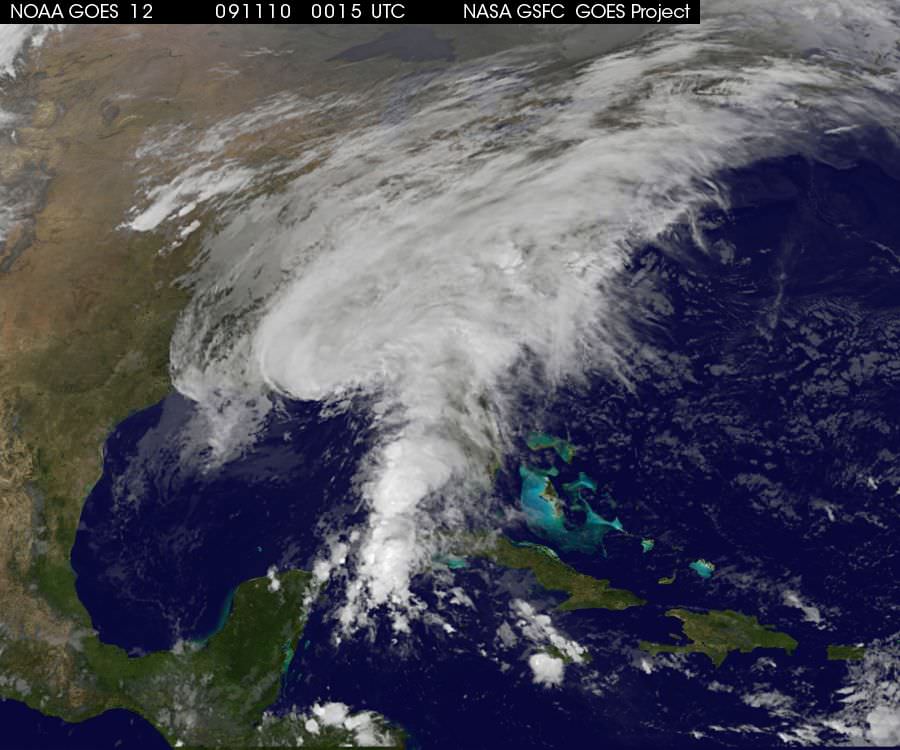
The third satellite NASA is using is the Geostationary Operational Environmental Satellite, GOES-12. From the imaging taken with GOES-12, the GOES Project at NASA’s Goddard Space Flight Center in Greenbelt, Md. was able to make a movie of the storm’s movement from November 7th-9th. The movie and many other images of the storm, updated hourly, are available on the GOES Project Science website.
Though Ida is not a hurricane, it still poses a significant threat to those living in the region where it will make landfall. The National Hurricane Center noted that “Large and destructive waves will accompany a storm surge of 3 to 5 feet near the point of landfall.” Local advisories are in effect on the ground for residents of the Gulf coast from the Florida panhandle to New Orleans and Baton Rouge, Louisiana. These areas and more northern areas into eastern Tennessee Valley and southern Appalachians can expect 3 to 5 inches of rainfall, with isolated totals of 8 inches.
If you live in these areas, please take care to follow any official advisories on the storm, available on the National Hurricane Center website.
Source: Eurekalert