Perseverance Finally Spots its Own Parachute on the Surface of Mars

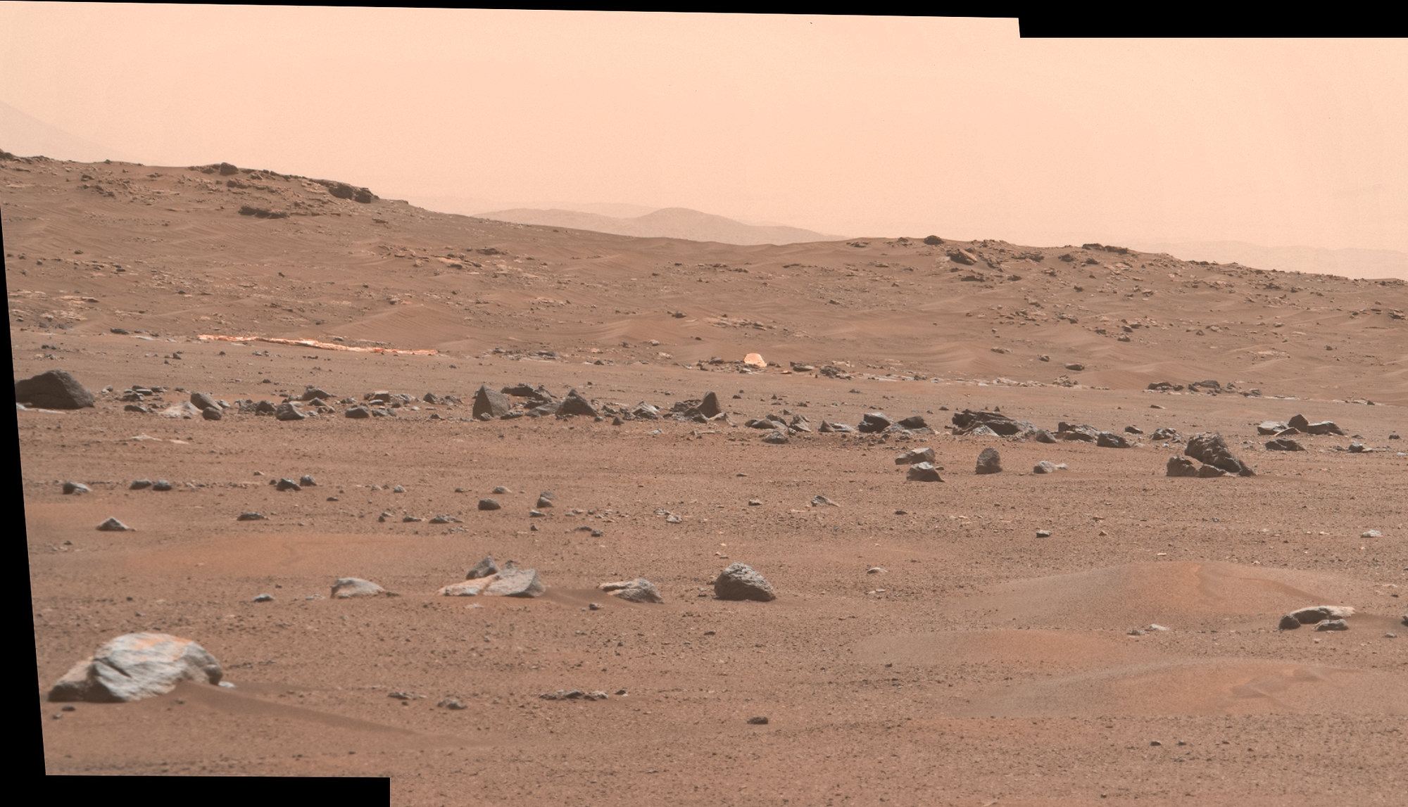
The parachute of the Perseverance rover lies on the Martian regolith in the distance. Sol 404 - MastCam-Z image. Credit: NASA/JPL-Caltech/ASU/Kevin M. Gilk

More than 13 months after the Perseverance rover landed on Mars (on February 18, 2021), the rover’s cameras have finally spotted some of the parts of the Mars 2020 landing system that got the rover safely to the ground.  The parachute and backshell were imaged by Perseverance’s MastCam-Z, seen off in the distance, just south of the rover’s current location. The image was taken on Sol 404, or April 6, 2022 on Earth.

Continue reading “Perseverance Finally Spots its Own Parachute on the Surface of Mars”

What a Feat! Ingenuity Photographed From Space

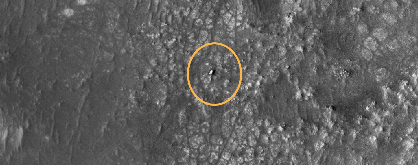
It seems like only months ago that the Perseverance Rover landed in Jezero Crater on Mars. But in fact, it’s been there longer than a year. Perseverance has had company during this time; its sidekick, the Ingenuity helicopter, completed 23 flights in Mars’ thin atmosphere so far.

The HiRISE camera on the MRO has captured an image of the rover and the tiny helicopter on Mars as it rests on the surface.

Continue reading “What a Feat! Ingenuity Photographed From Space”

Strange Intersecting Sand Dunes on Mars

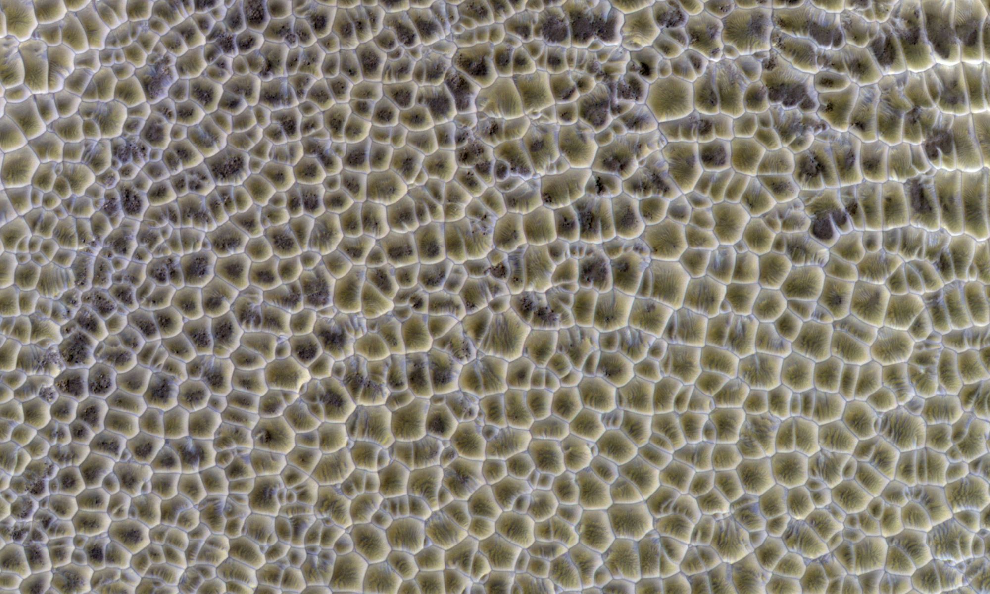
Polygonal dunes on Mars, as seen by the HiRISE camera on the Mars Reconnaissance Orbiter. Credit: NASA/JPL/UArizona

In our exploration of Mars, we’ve seen some strange but naturally occurring shapes. Polygons – a shape with at least three straight sides and angles, typically with five or more – have been seen in several different Martian landscapes, and scientists say these shapes are of great interest because they often indicate the presence of shallow ice, or that water formerly was present in these areas.

Continue reading “Strange Intersecting Sand Dunes on Mars”

Bright Ejecta Reveals a Fresh Crater on Mars

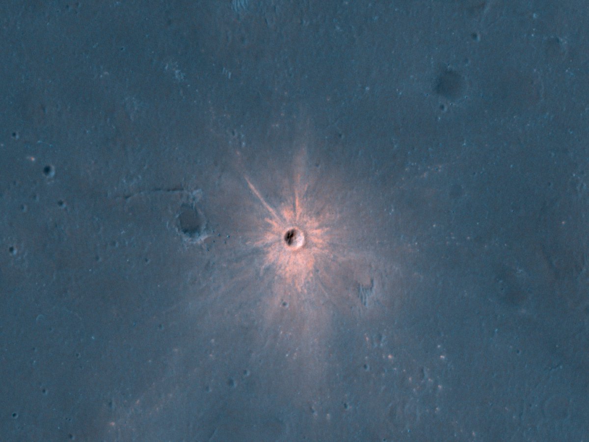
Meteors hit much harder on Mars than they do on the Earth.  Lack of atmosphere obviously contributes to that, but its proximity to the asteroid belt also makes the red planet a more likely target for some gravitationally disturbed rock to run into.  Now that we have a satellite infrastructure consistently monitoring Mars, we are able to capture the aftermath of what happens when it is pummeled by space debris, and the results can be dramatic.

Continue reading “Bright Ejecta Reveals a Fresh Crater on Mars”

Mars has Been Through Many Ice Ages in the Last Billion Years

Deuteronilus Mensae (DM)has many rough surface features. The Mars Reconnaissance Orbiter has shown that many areas in DM are sub-surface glaciers covered by a thin layer of debris. Image: NASA/JPL/University of Arizona

Like Earth, Mars has experienced periods of extreme glaciation or ice sheet coverage, which are known as ice ages. As these ice ages come and go, glaciers expand and contract along the planet’s surface, grinding huge boulders down to smaller rocks. By examining the size of boulders and rocks at specific locations on Mars, we should be able to understand the history of the Martian ice ages.

A new study did just that.

Continue reading “Mars has Been Through Many Ice Ages in the Last Billion Years”

This Martian Lava Tube Skylight is 50 Meters Across. The Biggest Lava Tube on Earth is Only 15 Meters Across

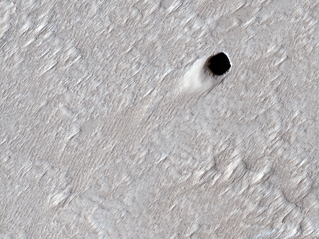
This is the collapsed ceiling of a Martian lava tube. It measures 50 meters (150 ft) across, much larger than any Earth lava tubes. Image Credit: NASA/JPL/University of Arizona

NASA’s Mariner 9 was the first spacecraft to orbit another planet when it reached Mars in late 1971. It got there only a few weeks before the Soviet Union’s Mars 2 and Mars 3 spacecraft, despite being launched 11 days later than those missions. Unfortunately, there was a major dust storm when Mariner 9 arrived, and NASA had to wait until January before the spacecraft could get good images.

When it did get those images, they revealed a surprise: volcanoes and lava flows cover large portions of the Martian surface.

Continue reading “This Martian Lava Tube Skylight is 50 Meters Across. The Biggest Lava Tube on Earth is Only 15 Meters Across”

Sediments on Mars, Created By Blowing Wind or Flowing Water

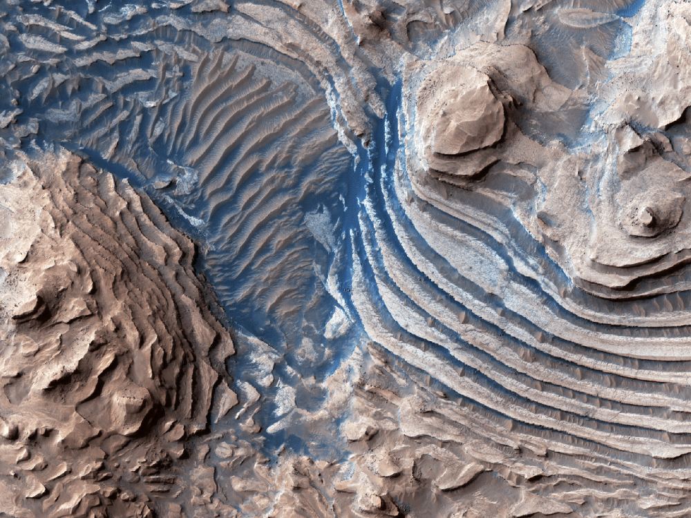
The HiRISE Picture of the Day from May 9th 2020. Sedimentary rocks in and impact crater on Mars. Image Credit: NASA/JPL/UArizona

The HiRISE (High-Resolution Imaging Science Experiment) instrument on NASA’s Mars Reconnaissance Orbiter (MRO) has given us a steady stream of images of the Martian surface. It’s been in orbit around Mars since March 2006, and has greatly outlived its intended mission length.

One of the latest Hi-PODs, or HiRISE Pictures of the Day, is this one, of sedimentary rock on Mars being eroded away.

Continue reading “Sediments on Mars, Created By Blowing Wind or Flowing Water”

Another Incredible Picture of Mars, This Time From a Region Just Outside Valles Marineris

HiRISE image showing the terrain in Juventae Chasma. Credit: NASA/JPL/UArizona

The Mars Reconnaissance Orbiter (MRO) delivers once again! Using its advanced imaging instrument, the High Resolution Imaging Experiment (HiRISE) camera, the orbiter captured a breathtaking image (shown below) of the plains north of Juventae Chasma. This region constitutes the southwestern part of Valles Marineris, the gigantic canyon system that runs along the Martian equator.

Continue reading “Another Incredible Picture of Mars, This Time From a Region Just Outside Valles Marineris”

This is the Spot Where ESA’s Schiaparelli Crashed Into Mars

Credit: HiRISE/LPL/University of Arizona

On October 19th, 2016, the NASA/ESA ExoMars mission arrived at the Red Planet to begin its study of the surface and atmosphere. While the Trace Gas Orbiter (TGO) successfully established orbit around Mars, the Schiaparelli Lander crashed on its way to the surface. At the time, the Mars Reconnaissance Orbiter (MRO) acquired images of the crash site using its High Resolution Imaging Science Experiment (HiRISE) camera.

In March and December of 2019, the HiRISE camera captured images of this region once again to see what the crash site looked like roughly three years later. The two images show the impact crater that resulted from the crash, which was partially-obscured by dust clouds created by the recent planet-wide dust storm. This storm lasted throughout the summer of 2019 and coincided with Spring in Mars’ northern hemisphere.

Continue reading “This is the Spot Where ESA’s Schiaparelli Crashed Into Mars”