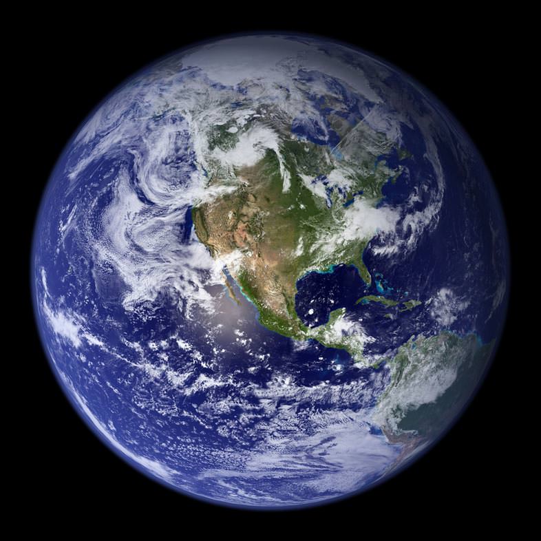
The Goddard Space Flight Center has a Flickr account showcasing a series of images of our own home planet. Called “Blue Marble,” these spectacular images are the most detailed true-color image of the entire Earth to date. Using a collection of satellite-based observations, scientists and visualizers stitched together months of observations in 2001 of the land surface, oceans, sea ice, and clouds into a seamless, true-color mosaic of every square kilometer (.386 square mile) of our planet. Your tax dollars at work, these images are freely available to educators, scientists, museums, and the public. This record includes preview images and links to full resolution versions up to 21,600 pixels across.
Our blue marble. Credit: NASA
Compare these new images to the original “Blue Marble” photograph, below, taken by the Apollo 17 crew in 1968. The original Blue Marble by Apollo 17.
This view of Earth comes from NASA's Moderate Resolution Imaging Spectroradiometer aboard the Terra satellite.
[/caption]
Yikes! Just how big was the magnitude 8.8 earth quake in Chile? One scientist says the shaking may have affected the entire planet by shifting Earth on its axis. This possibly may have shortened the length of a day on Earth by about 1.26 microseconds. Using a complex model JPL research scientist Richard Gross computed how Earth’s rotation should have changed as a result of the Feb. 27, 2010 quake. If his figures are correct, the quake should have moved Earth’s figure axis (the axis about which Earth’s mass is balanced) by 2.7 milliarcseconds (about 8 centimeters, or 3 inches).
Earth’s figure axis is not the same as its north-south axis; they are offset by about 10 meters (about 33 feet). By comparison, Gross said the same model estimated the 2004 magnitude 9.1 Sumatran earthquake should have shortened the length of day by 6.8 microseconds and shifted Earth’s axis by 2.32 milliarcseconds (about 7 centimeters, or 2.76 inches).
Gross said that even though the Chilean earthquake is much smaller than the Sumatran quake, it is predicted to have changed the position of the figure axis by a bit more for two reasons. First, unlike the 2004 Sumatran earthquake, which was located near the equator, the 2010 Chilean earthquake was located in Earth’s mid-latitudes, which makes it more effective in shifting Earth’s figure axis.
Second, the fault responsible for the 2010 Chiliean earthquake dips into Earth at a slightly steeper angle than does the fault responsible for the 2004 Sumatran earthquake. This makes the Chile fault more effective in moving Earth’s mass vertically and hence more effective in shifting Earth’s figure axis.
Gross said the Chile predictions will likely change as data on the quake are further refined.
One of the oldest questions for mankind is how the Earth was formed. However, no one has an exact answer. First by the best estimates it occurred over 4 billion years ago before any life appeared. So there are no eyewitness accounts and other pieces of evidence. The best we can do is look at the geologic record and the stars to get our answers. While we may not have the entire picture we have a good idea and it all starts with how stars are born.
Just like the formation of the Earth and other planets stars take a long time to be be born. Stars are essentially formed from clouds of gas in space. We know these as nebulas. You can basically consider them to be star forges. Over time gravity causes the atoms of gases and space dust to start coming together and gathering. Over time this gather of gases gains more mass and with it stronger gravity. This is a process that can take millions of years. In time the gravity causes the gases, mainly hydrogen to fuse in a nuclear reaction and a star is formed.
The formation of the Earth occurred after this intial phase happened for our Sun. After the Sun was formed we know from observations and other indirect evidence that there were left over gases and heavier elements. The gravity of the Sun helped to flatten these left overs into a disk and start to fuse them together. This created the planetesimals and planetoids which would later make up the planets. Over time these planetesimals would collide creating even bigger masses. It was in this method that the Earth was eventually formed.
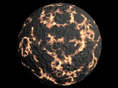
Now we need to know that fusion eventually creates heavier elements such as carbon and iron. These elements were to compose a significant part of young Earth. The pressure and heat from radioactive decay of elements and the aftershocks of massive collisions caused the Earth to be molten. Over time the surface of the Earth cooled and became the Crust. However the molten layers that remained became our mantle and the core. The currents of this massive underground ocean of magma cause volcanic activity that released gases. These would lead to the creation of the atmosphere and the oceans starting the water cycle.
The formation of the Earth was only the beginning and we still see the Earth changing year by years through erosion and plate tectonics. However in learning more about the formation of the Earth we are able to better understand what makes life possible on our planet.
If you enjoyed this article there are several others on Universe Today that you will enjoy. There is a great article on plate boundaries and an interesting piece on early Earth.
You can also find some great resources online. There is a great web page on the University of Oregon web site that goes into detail about the formation of the Earth. You can also look at the Hadean page on the Smithsonian website. It talks about the Hadean period the period of geologic time when the Earth was formed.
You can also listen to Astronomy Cast. Episode 108 is about the life of the Sun.
The "pale blue dot" of Earth captured by Voyager 1 in Feb. 1990 (NASA/JPL)
NASA’s Voyager spacecraft pushed further out into space than any other mission before them. Voyager 1 and 2 visited Jupiter and Saturn, and Voyager 2 went on to travel to Uranus and Neptune. In 1990, after Voyager 2 completed its mission of visiting the outer planets, Carl Sagan encouraged NASA to have the Voyager 1 spacecraft to take a final picture of Earth, from a distance of more than 6 billion kilometers from Earth. The resulting image showed Earth as nothing more than a tiny spec, a “pale blue dot“. That was the name given to it by Carl Sagan, and it stuck.
Voyager 1 took this photograph in 1990, when it was approximately 40.5 astronomical units from Earth (6 billion km, or 3.8 billion miles). It was taken at a height of 32° above the plane of the ecliptic, using red, green and blue filters. Earth is the little dot circled in the image. The beams you see in the image are a glare from the Sun seen by Voyager 1’s camera.
Sagan wrote a book with the title “Pale Blue Dot”, and he gave a commencement address in 1996 reflecting on the image:
“Look again at that dot. That’s here, that’s home, that’s us. On it everyone you love, everyone you know, everyone you ever heard of, every human being who ever was, lived out their lives. The aggregate of our joy and suffering, thousands of confident religions, ideologies, and economic doctrines, every hunter and forager, every hero and coward, every creator and destroyer of civilization, every king and peasant, every young couple in love, every mother and father, hopeful child, inventor and explorer, every teacher of morals, every corrupt politician, every “superstar,” every “supreme leader,” every saint and sinner in the history of our species lived there – on a mote of dust suspended in a sunbeam.”
[/caption]
The average distance to the centre of the Earth is 6,371 km or 3,959 miles. In other words, if you could dig a hole 6,371 km, you’d reach the center of the Earth. At this point you’d be in the Earth’s liquid metal core.
I said that this number is an average. That’s because the Earth isn’t a perfect sphere, it’s actually an oblate spheroid – a squished ball. The Earth is rotating on its axis, turning around once a day. Points on the equator are moving in a circle more than 1,600 km/hour. This creates a centrifugal force that pulls regions of the equator outward and flattens the poles.
The distance to the center of the Earth from the equator is 6,378 km or 3,963 miles. And the distance to the center of the Earth from the poles is only 6,356 km or 3,949 miles. That’s a difference of 22 km. In other words, if you’re standing on the equator, you’re 22 km further away from the center of the Earth than someone standing on the North Pole.
So if you did want to dig that hole into the Earth, the shortest distance would be from the North or South Pole. Good luck!
[/caption]
The average Earth surface temperature is 14° C. That’s 287 kelvin, or 57.2° F.
As you probably realize, that number is just an average. The Earth’s temperature can be much higher or lower than this temperature. In the hottest places of the planet, in the deserts near the equator, the temperature on Earth can get as high as 57.7° C. And then in the coldest place, at the south pole in Antarctica, the temperature can dip down to -89° C.
The reason the average temperature on Earth is so high is because of the atmosphere. This acts like a blanket, trapping infrared radiation close to the planet and warming it up. Without the atmosphere, the temperature on Earth would be more like the Moon, which rises to 116° C in the day, and then dips down to -173° C at night.
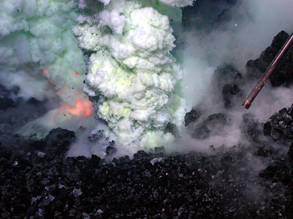
The orange glow of magma is visible on the left of the sulfur-laden plume. The area shown in this image is approximately six feet across in an eruptive area approximately the length of a football field that runs along the summit. (Image courtesy of NSF, NOAA, and WHOI Advanced Imaging and Visualization Lab)
Ever seen fire and smoke under water before? Oceanographers using a remotely operated underwater vehicle discovered and recorded the first video and still images of the deepest underwater volcano actively erupting molten lava on the seafloor. The ROV Jason vehicle captured the powerful event nearly 1.2 km (4,000 feet) below the surface of the Pacific Ocean, in the “Ring of Fire” region, near Fiji, Tonga and Samoa. “It was very exciting. We’ve never seen anything like that on the ocean floor,” said Bob Embley, a marine geologist with NOAA, who described the event an underwater Fourth of July. “When we started to see red flashes of light, everyone was extremely excited. Then we had to get down to the work of actually understanding of what we were seeing.”
The scientists presented their findings, along with HD video at the American Geophysical Union’s fall meetings in San Fransciso. The video was taken in May of 2009, and the science team said the undersea volcano is likely to still be erupting, and may have started activity in late 2008.
[/caption]
Embly said the eruption couldn’t be seen above the water, but there were “water column anomlies which indicated an eruption going on. We knew within a few hundred feet where the eruption was taking place.”
There were actually two erupting regions, but the video shows the most dramatic one. Visible in the video is magma – sometimes fiery, red hot at 1,371 C (2,500 degrees F) – bursting up through the seawater, with fragments of rock being propelled and magma flowing down the slope of the volcano. Hot sulfer “smoke” plumes can also be seen.
The volcano is spewing a type of lava known as Boninite, which until now had only been seen in extinct volcanoes more than a million years old.
A underwater “hydrophone” recorded the sound, and it was synched with the video.
Samples collected near the volcano showed the seawater to be highly acidic, similar to battery or stomach acid, the researchers said. Despite the harsh conditions, scientists found and photographed a species of shrimp apparently thriving near the volcanic vents.
“Nobody would have predicted that things would have survived long enough in water that acidic. It seems like it’s too harsh a condition,” said University of Washington chemical oceanographer Joseph Resing.
They hope to go back in a few months and see all the other creatures that have taken up residence there.
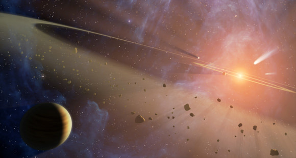
A new study from the University of Heidelberg suggests that flash-heating and carbon depletion could have been intrinsic to the emergence and evolution of life on Earth. Credit: NASA
[/caption]
A new study finds the gases which formed the Earth’s atmosphere – as well as its oceans – did not come from inside the Earth but from comets and meteorites hitting Earth during the Late Heavy Bombardment period. A research team tested volcanic gases to uncover the new evidence. “We found a clear meteorite signature in volcanic gases,” said Dr. Greg Holland the project’s lead scientist. “From that we now know that the volcanic gases could not have contributed in any significant way to the Earth’s atmosphere. Therefore the atmosphere and oceans must have come from somewhere else, possibly from a late bombardment of gas and water rich materials similar to comets.”
Holland said textbook images of ancient Earth with huge volcanoes spewing gas into the atmosphere will have to be rethought.
According to the theory of the Late Heavy Bombardment, the inner solar system was pounded by a sudden rain of solar system debris only 700 million years after it formed, which likely had monumental effects on the nascent Earth. So far, the evidence for this event comes primarily from the dating of lunar samples, which indicates that most impact melt rocks formed in this very narrow interval of time. But this new research on the origin of Earth’s atmosphere may lend credence to this theory as well.
The researchers analyzed the krypton and xenon found in upper-mantle gases leaking from the Bravo Dome gas field in New Mexico. They found that the two noble gases have isotopic signatures characteristic of early Solar System material similar to me teorites instead of the modern atmosphere and oceans. It therefore appears that noble gases trapped within the young Earth did not contribute to Earth’s later atmosphere.
The study is also the first to establish the precise composition of the Krypton present in the Earth’s mantle.
“Until now, no one has had instruments capable of looking for these subtle signatures in samples from inside the Earth – but now we can do exactly that,” said Holland.
The team’s research, “Meteorite Kr in Earth’s Mantle Suggests a Late Accretionary Source for the Atmosphere” was published in the journal Science.
[/caption]
The Earth’s mass is 5.9736 x 1024 kg. That’s a big number, so let’s write it out in full: 5,973,600,000,000,000,000,000,000 kg. You could also say the Earth’s mass is 5.9 sextillion tonnes. Phew, that’s a lot of mass.
That sounds like a lot, and it is, but the Earth has a fraction of the mass of some other objects in the Solar System. The Sun has 333,000 times more mass than the Earth. And Jupiter has 318 times more mass. But then there are some less massive objects too. Mars has only 11% the mass of the Earth.
Because of its high mass for its size, Earth actually has the highest density of all the planets in the Solar System. The density of Earth is 5.52 grams per cubic centimeter. The high density comes from the Earth’s metallic core, which is surrounded by the rocky mantle. Less dense planets, like Jupiter, are just made up of gases like hydrogen.
We’ve written several articles about the mass of planets in the Solar System. Here’s an article about the mass of Mercury, and here’s an article about the mass of the Sun.
There are many tall mountains around the world as well as on other worlds. Mount Everest is the highest mountain in the world at 8,848 meters. Mauna Kea is the tallest mountain in the world. The tallest mountain is measured from base to top while the highest mountain is measured from sea level to the top. Everest is located in the Himalayan mountain range in Nepal and near Tibet. Mauna Kea is located in Hawaii and is 10,200 meters from base to tip. From sea level though, it is only about 4,205 meters tall. Mauna Kea is an extinct shield volcano.
These are not the only tall mountains though. K2 is in the Karakoram mountain range on the border of Pakistan and China. It is 8,612 meters tall and is generally considered the second tallest mountain in the world. The Himalayans are home to many tall mountains besides Mount Everest. This includes Mount Kangchenjunga at 8,586 meters and Mount Lhotse I at 8,501 meters.
Most of the world’s tallest mountains are located in Asia; however, there are a number of tall mountains that are located on other continents. The seven tallest mountains in different continents are known as the Seven Summits. Climbing all seven mountains is a mountaineering challenge that was started in the 1980’s.The first of these is Mount Everest. Another summit is Aconcagua, which is a mountain in Argentina in South America. At approximately 6,962 meters, it is the tallest mountain in the Americas. North America’s tallest mountain is Mount McKinley at 6,194 meters. Mount Kilimanjaro can be found in Tanzania in the continent of Africa and is 5,895 meters tall. The large summit of Mount Kilimanjaro is covered with an ice cap that is receding and according to scientists will eventually be gone. Mount Elbrus, the tallest mountain in Europe at 5,642 meters, can be found in Russia. Vinson Massif is Antarctica’s tallest mountain at 4,897 meters. It is also very large being 21 kilometers long and 13 kilometers wide. Australia-Oceania’s largest mountain can be found in Indonesia. At 4,884 meters, it is Puncak Jaya, which is also known as the Carstensz Pyramid.
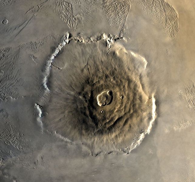
The tallest mountain that we know of is not even on Earth. It is located on Mars and is known as Olympus Mon. A shield volcano, Olympus Mon is 27,000 meters tall. Mars is not the only other planet with tall mountains though. Venus’ Maxwell Montes is 11,000 meters tall. Satellites also have tall mountains including our Moon, which has Mons Huygens at 4,700 meters tall. The moon Io has a mountain, Boösaule Montes, which is approximately 17,000 meters tall.