Why are Earth’s Hemispheres the Same Brightness? New Research Solves a 50-year-old Mystery.

The Blue Marble from Apollo 17
The Blue Marble image of Earth from Apollo 17. Credit: NASA

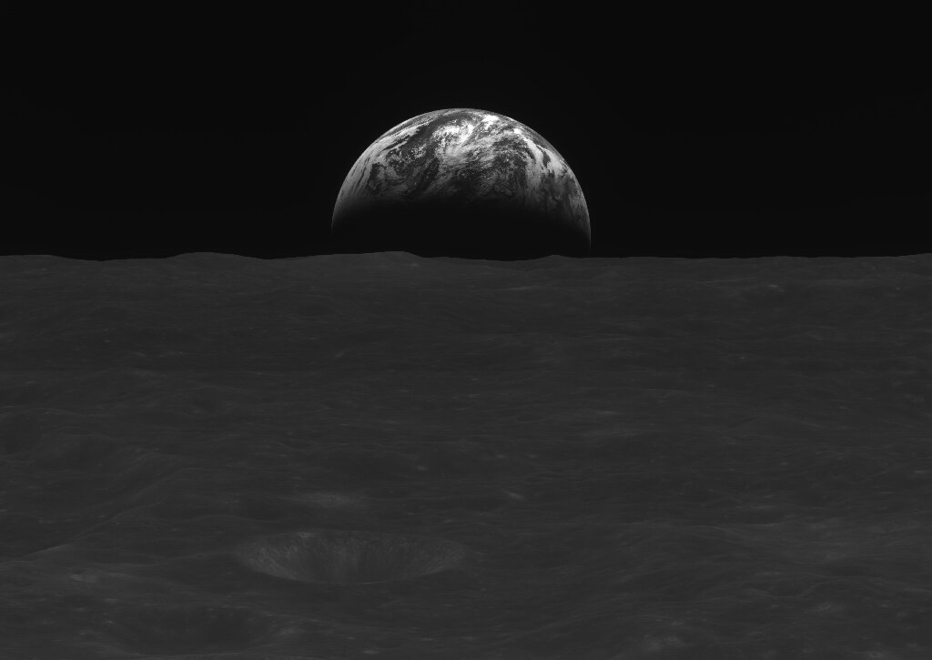
NASA’s Apollo program most notably explored the Moon. But it also helped us study the Earth as well, as it provided some of the first high-resolution images of our whole planet, like the famous “Blue Marble” photo taken by the Apollo 17 astronauts.

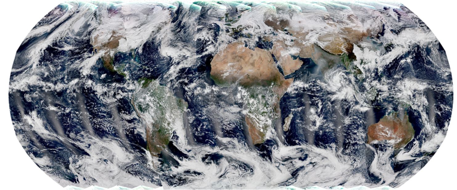
However, these full-Earth photos revealed a mystery.  Scientists expected that Earth’s two hemispheres, the north and south, would have different albedos, a difference in the amount of light they reflect. This is because Earth’s northern and southern hemispheres of Earth are quite different from each other. The southern hemisphere is mostly covered with dark oceans, while the northern hemisphere contains vast land areas that are much brighter than the oceans

Yet, when observing Earth from space, the two hemispheres appear equally bright.

This symmetry in brightness has been a puzzle for over 50 years. But now, a new study shows that the albedos are roughly the same because of the increased clouds and storms in the southern hemisphere.

Continue reading “Why are Earth’s Hemispheres the Same Brightness? New Research Solves a 50-year-old Mystery.”

How Can We Know if We’re Looking at Habitable exo-Earths or Hellish exo-Venuses?

How can astronomers tell exo-Earths and exo-Venuses apart? Polarimetry might be the key. Image Credits: NASA

The differences between Earth and Venus are obvious to us. One is radiant with life and adorned with glittering seas, and the other is a scorching, glowering hellhole, its volcanic surface shrouded by thick clouds and visible only with radar. But the difference wasn’t always clear. In fact, we used to call Venus Earth’s sister planet.

Can astronomers tell exo-Earths and exo-Venuses apart from a great distance?

Continue reading “How Can We Know if We’re Looking at Habitable exo-Earths or Hellish exo-Venuses?”

South Korea’s Danuri Mission Sends Home Pictures of the Earth and Moon

Credit: Korea Aerospace Research Institute (KARI)

The Korea Aerospace Research Institute (KARI) both ended 2022 and started 2023 on a very high note as its first-ever lunar orbiter, Danuri, sent back black-and-white images of the Earth with the Moon’s surface in the foreground that were photographed between December 24 and January 1, KARI announced in a January 3rd statement. Both the images and videos were taken less than 120 kilometers (75 miles) above the Moon’s surface, and will be “used to select potential sites for a Moon landing in 2032,” KARI added in the statement.

Continue reading “South Korea’s Danuri Mission Sends Home Pictures of the Earth and Moon”

The Outer Solar System Supplied a Surprising Amount of Earth’s Water

Currently exploring the Kuiper Belt, New Horizons is just one of five spacecraft to reach beyond 50 astronomical units, on its way out of the solar system and, eventually, into interstellar space. (Credit: NASA/Johns Hopkins APL/Southwest Research Institute)

In a recent study published in Science, a team of researchers at Imperial College London examined 18 meteorites containing the volatile element zinc to help determine their origin, as it has been long hypothesized that Earth’s volatiles materials, including water, were derived from asteroids closer to our home planet. However, their results potentially indicate a much different origin story.

Continue reading “The Outer Solar System Supplied a Surprising Amount of Earth’s Water”

NOAA’s New Weather Satellite is Operational, and its Pictures of Earth are Gorgeous

Polar-orbiting satellites capture swaths of data throughout the globe, and observe the entire planet twice each day. The global mosaic, captured by the VIIRS instrument on the recently launched NOAA-21 satellite, is a composite image created from these swaths. Image Credit: NOAA STAR VIIRS Imagery Team.

You’d have to be in some kind of sense-of-wonder-repressed coma not to appreciate satellite images of Earth. If you are, then images from the NOAA’s newest satellite might pull you out of it.

And they’re only a taste of the fascinating images that it will provide.

Continue reading “NOAA’s New Weather Satellite is Operational, and its Pictures of Earth are Gorgeous”

Earth’s Water is 4.5 Billion Years Old

A protosolar disk is the disk of material around a young stellar object that isn't yet a star. It's called a protoplanetary disk once the star has formed and begun fusion. Planetesimals are the building blocks of planets and are present in both stages of a disk's evolution. Image Credit: NASA/JPL

The origin of Earth’s water has been an enduring mystery. There are different hypotheses and theories explaining how the water got here, and lots of evidence supporting them.

But water is ubiquitous in protoplanetary disks, and water’s origin may not be so mysterious after all.

Continue reading “Earth’s Water is 4.5 Billion Years Old”

Asteroids Didn’t Create the Moon’s Largest Craters. Left-Over Planetesimals Did

The largest impact basin on the Moon is the South-Pole Aitken basin. It, and other impact basins, were created by planetesimals according to a new study. Image Credit: Moriarty et al., 2021.

The Moon’s pock-marked surface tells the story of its history. It’s marked by over 9,000 impact craters, according to the International Astronomical Union (IAU.) The largest ones are called impact basins, not craters. According to a new study, asteroids didn’t create the basins; leftover planetesimals did.

Continue reading “Asteroids Didn’t Create the Moon’s Largest Craters. Left-Over Planetesimals Did”

OK, Artemis. Now You’re Just Showing Off. A Stunning View of the Moon Eclipsing Earth From the Orion Spacecraft

Screenshot of the Moon eclipsing Earth, via NASA's livestream from Orion.

Have you ever seen a lunar eclipse of the Earth from the far side of the Moon? Now we have.

On Monday (November 28, 2022) NASA’s Orion spacecraft streamed back live video showing the Earth and Moon right next to each other, followed by a stunning view of the Moon eclipsing the Earth.

What a time to be alive! Image editor Kevin Gill might have said it best:

Continue reading “OK, Artemis. Now You’re Just Showing Off. A Stunning View of the Moon Eclipsing Earth From the Orion Spacecraft”

Mars Once had Enough Water for a Planet-Wide Ocean 300 Meters Deep

This artist’s impression shows how Mars may have looked about four billion years ago. The young planet Mars would have had enough water to cover its entire surface in a liquid layer about 140 metres deep, but it is more likely that the liquid would have pooled to form an ocean occupying almost half of Mars’s northern hemisphere, and in some regions reaching depths greater than 1.6 kilometres. Credit: ESO/M. Kornmesser

Today, Mars is colloquially known as the “Red Planet” on a count of how its dry, dusty landscape is rich in iron oxide (aka. “rust”). In addition, the atmosphere is extremely thin and cold, and no water can exist on the surface in any form other than ice. But as the Martian landscape and other lines of evidence attest, Mars was once a very different place, with a warmer, denser atmosphere and flowing water on its surface. For years, scientists have attempted to determine how long natural bodies existed on Mars and whether or not they were intermittent or persistent.

Another important question is how much water Mars once had and whether or not this was enough to support life. According to a new study by an international team of planetary scientists, Mars may have had enough water 4.5 billion years ago to cover it in a global ocean up to 300 meters (almost 1,000 feet) deep. Along with organic molecules and other elements distributed throughout the Solar System by asteroids and comets at this time, they argue, these conditions indicate that Mars may have been the first planet in the Solar System to support life.

Continue reading “Mars Once had Enough Water for a Planet-Wide Ocean 300 Meters Deep”

What’s the Best Mix of Oceans to Land for a Habitable Planet?

A new study asks what ratio of land to ocean is best for habitability? Image Credit: Reto Stöckli, Render by Robert Simmon. Based on data from the MODIS Science Team

Earth is about 29% land and 71% oceans. How significant is that mix for habitability? What does it tell us about exoplanet habitability?

Continue reading “What’s the Best Mix of Oceans to Land for a Habitable Planet?”