50 Amazing Facts About Earth By Jason Major - April 22, 2013 02:15 PM UTC | Planetary Science Continue reading
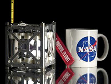
Antares Rocket Launches Successfully By Nancy Atkinson - April 21, 2013 10:57 PM UTC | Missions Continue reading
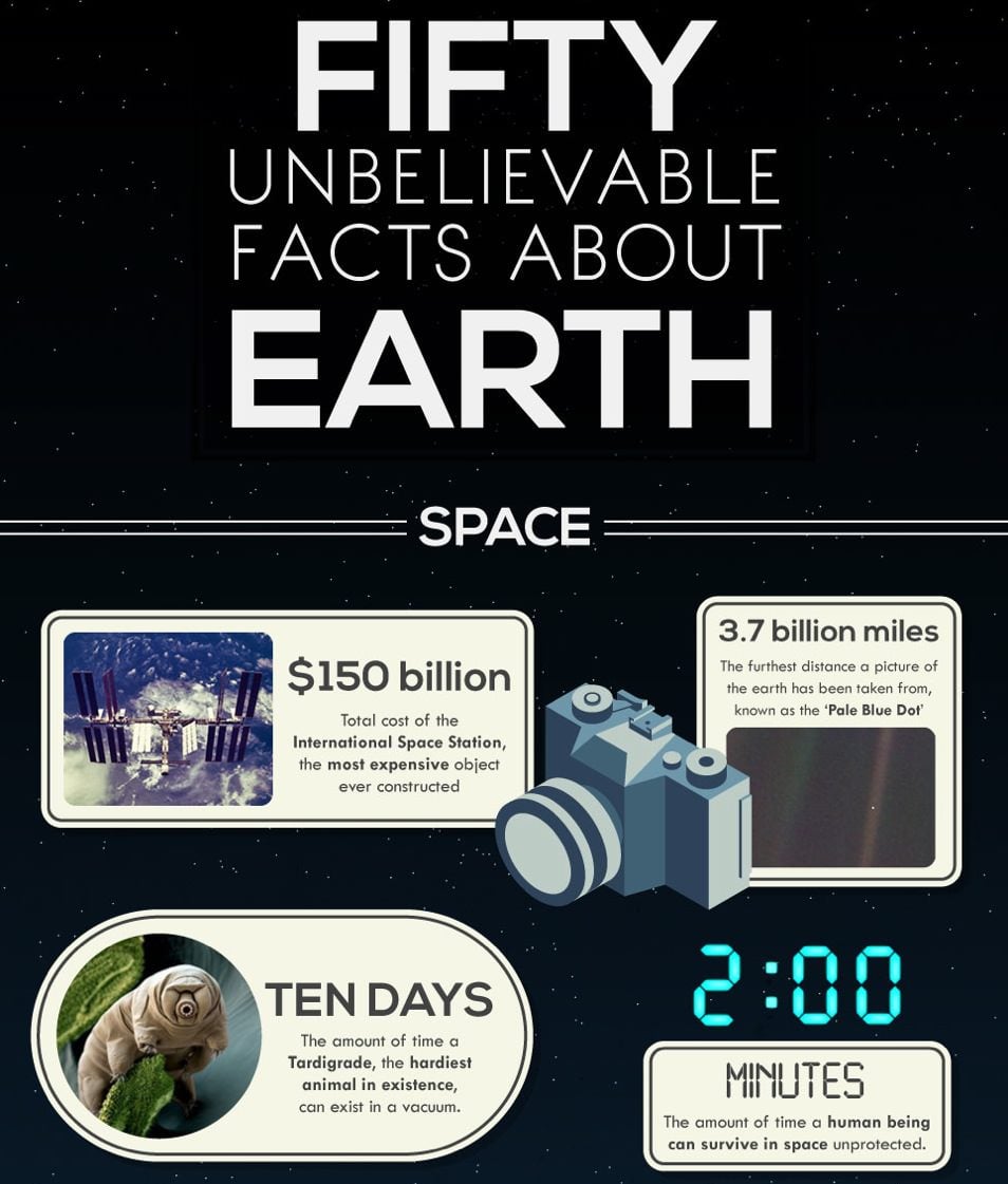
Zoom into the Moon with this Insanely High-Resolution Mosaic By Nancy Atkinson - April 19, 2013 10:17 PM UTC | Planetary Science Continue reading
Book Review: The Life and Death of Stars By Evan Gough - April 19, 2013 08:36 PM UTC | Stars Continue reading
This Week's Best Space Photos - April 19, 2013 By john-williams - April 19, 2013 07:35 PM UTC | Site News Continue reading
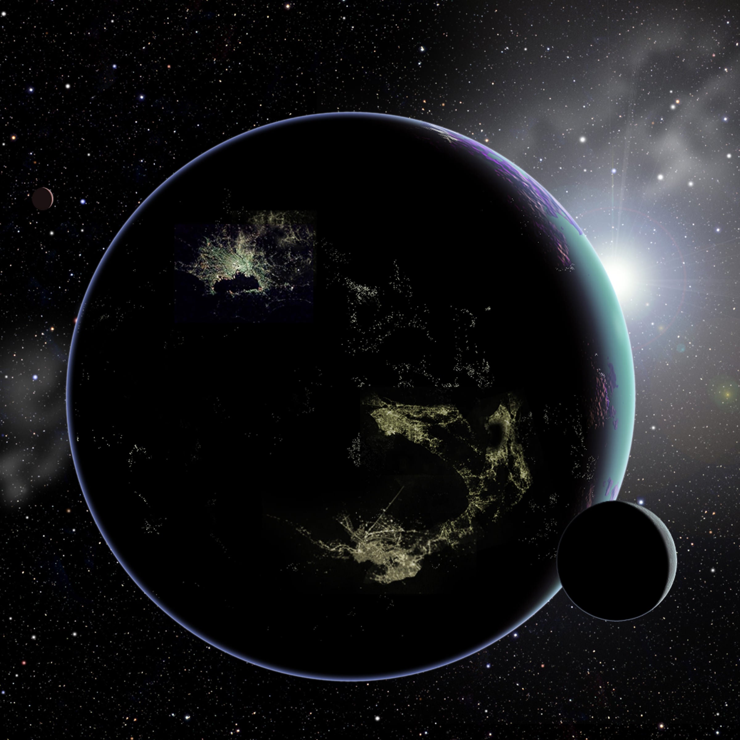
Earth is the Most Exotic Place In The Universe By bob-king - April 19, 2013 07:13 PM UTC | Astrobiology Continue reading
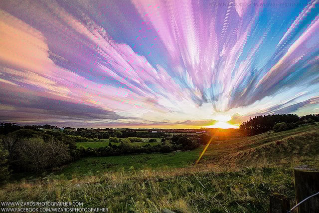
Astrophoto: Paint the Sky with Clouds By Nancy Atkinson - April 19, 2013 04:18 PM UTC | Observing Continue reading
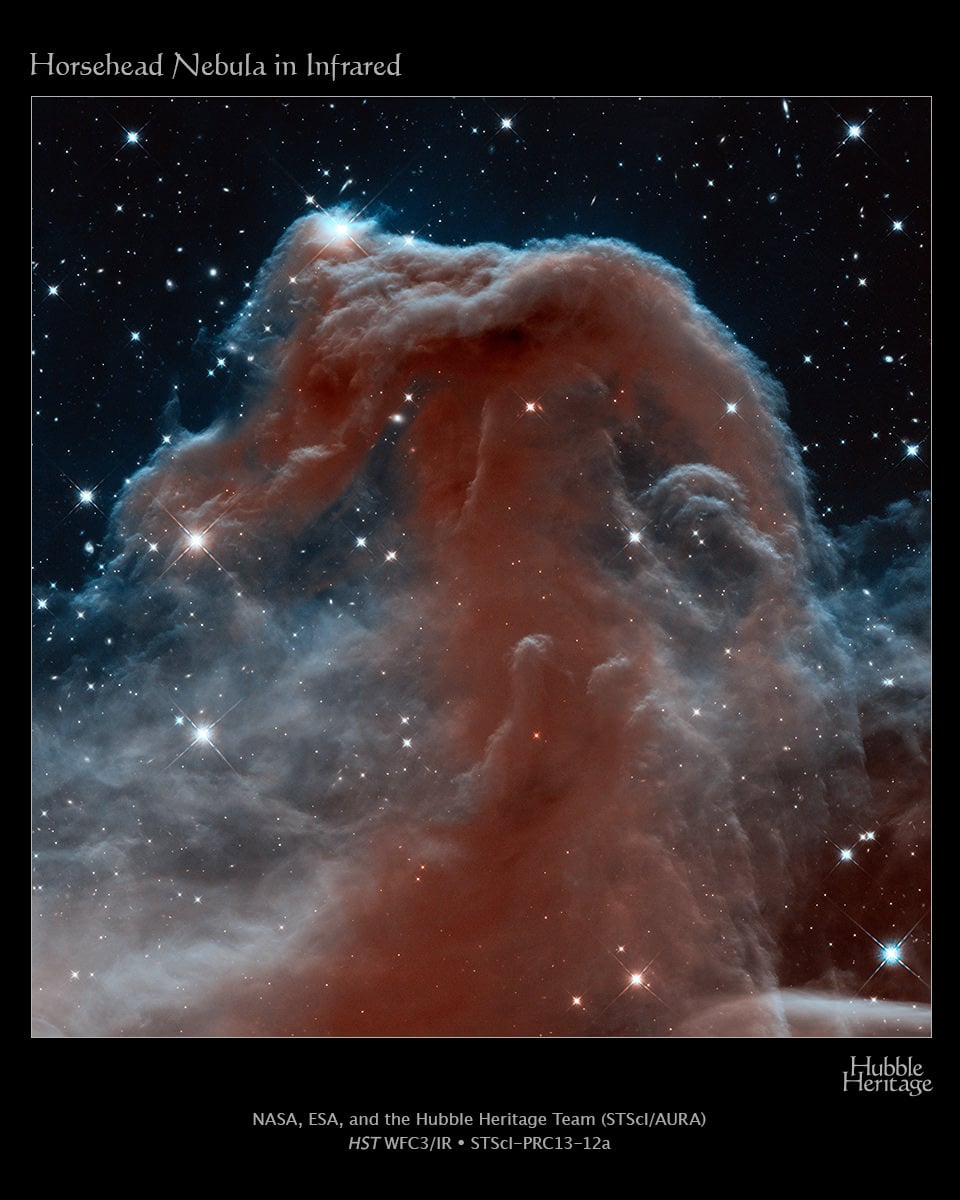
A New Look at the Horsehead Nebula for Hubble's 23rd Anniversary By Nancy Atkinson - April 19, 2013 02:45 PM UTC | Extragalactic Continue reading
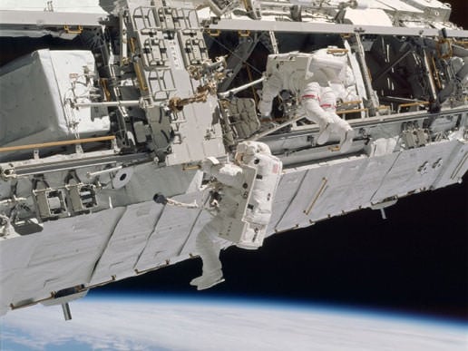
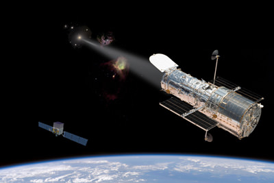
How Micrometeoroid Impacts Pose a Danger for Today's Spacewalk By David Dickinson - April 19, 2013 01:43 PM UTC | Space Exploration Continue reading
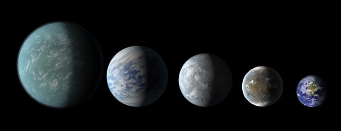
Habitable Worlds? New Kepler Planetary Systems in Images By Nancy Atkinson - April 18, 2013 08:45 PM UTC | Exoplanets Continue reading
Bright Blazar's Emission Defies Explanations By tammy-plotner - April 18, 2013 08:26 PM UTC | Extragalactic Continue reading
Kepler Team Finds System with Two Potentially Habitable Planets By Nancy Atkinson - April 18, 2013 06:03 PM UTC | Exoplanets Continue reading
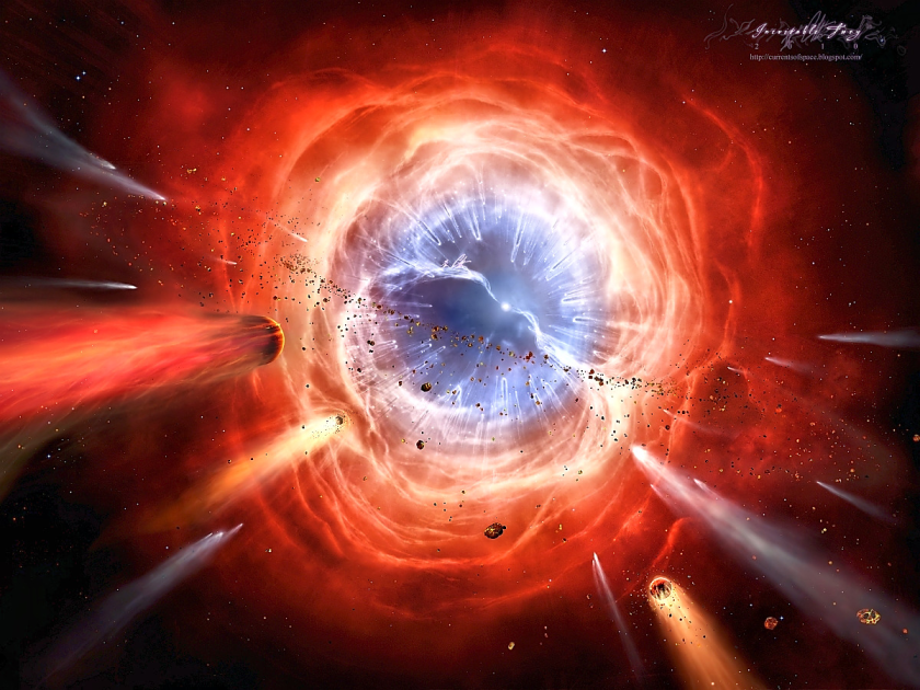
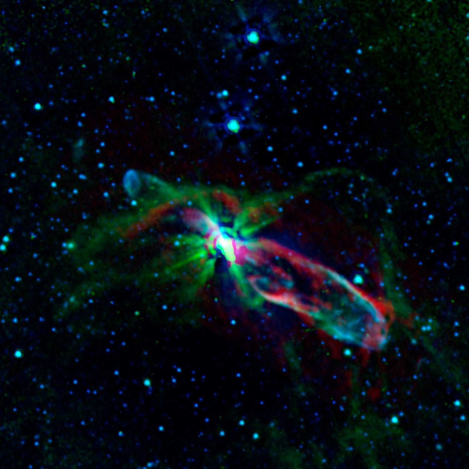
Astronomers Hint that our Sun won't Terminate as the Typical Planetary Nebula By daniel-majaess - April 18, 2013 05:43 PM UTC | Stars Continue reading
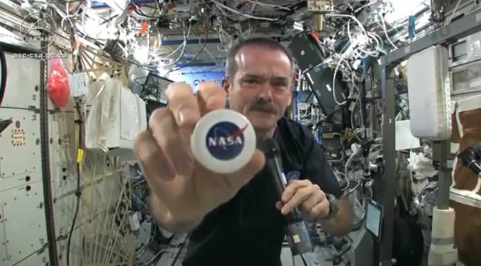
Incredible Demonstration of Fluid Dynamics in Zero-G By Nancy Atkinson - April 18, 2013 04:49 PM UTC | Physics Continue reading
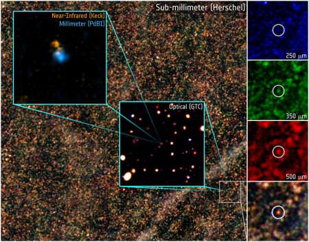
Fast Working ALMA Resolves Star-Forming Galaxies By tammy-plotner - April 18, 2013 12:14 AM UTC | Extragalactic Continue reading
Ancient Galaxy 'Bursting' with Stars By Nancy Atkinson - April 17, 2013 09:35 PM UTC | Extragalactic Continue reading
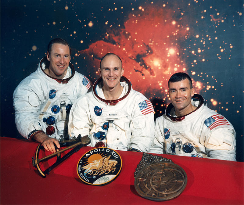
Ken Mattingly Explains How the Apollo 13 Movie Differed From Real Life By Elizabeth Howell - April 17, 2013 04:24 PM UTC | Space Exploration Continue reading
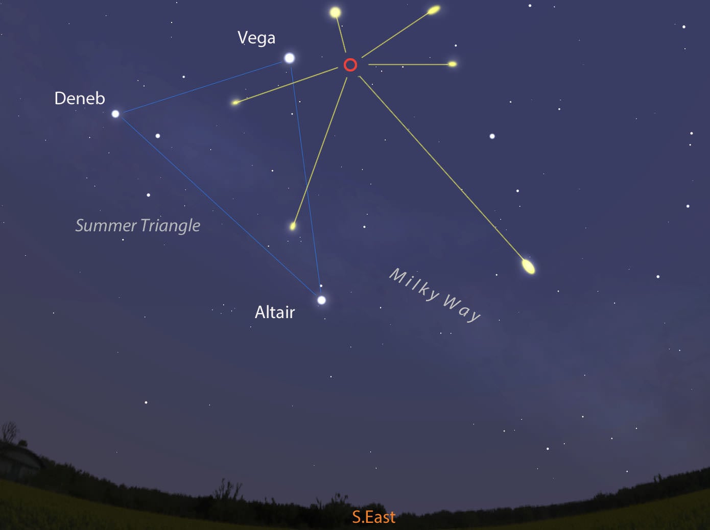
This Weekend's Lyrid Meteor Shower: How to See It By bob-king - April 17, 2013 03:40 PM UTC | Observing Continue reading
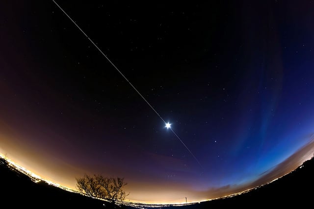
Astrophoto: Space Station Flies Through the Moon! By Nancy Atkinson - April 17, 2013 02:53 PM UTC | Observing Continue reading