
The aerospace industry is typically filled with engineers, scientists and pilots. Hardly the segment of the population that is subject to expounding on the virtues of their trade in prose or through some other format. That said, every once and a while, a campaign, image or video comes along that simply nails what the men and women of the industry have been trying to say. Continue reading “Coalition for Space Exploration Tasks us to “Think Outside the Circle””
NASA Researchers Find Brand New Mineral in Old Meteorite
[/caption]
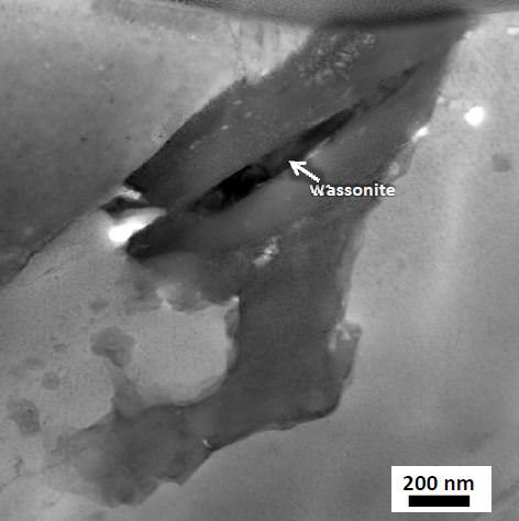
It’s a brand new mineral, and it’s from space. Researchers taking a new look at an old meteorite with a high-tech electron microscope have found a new mineral, now called Wassonite, in a space rock found in Anarctica back in 1969, the Yamato 691 enstatite chondrite. The meteorite likely originated from the Asteroid Belt between Mars and Jupiter and is about 4.5 billion years old.
“Wassonite is a mineral formed from only two elements, sulfur and titanium, yet it possesses a unique crystal structure that has not been previously observed in nature,” said Keiko Nakamura-Messenger, a NASA scientist who headed the research team.
Wassonite now joins the list of 4,500 official minerals, approved by the International Mineralogical Association. It was named after meteorite researcher John T. Wasson, from the University of California, Los Angeles (UCLA).
But there could be more unknown minerals inside the meteorite. The researchers found Wassonite surrounded by additional minerals that have not been seen before, and the team is continuing their investigations.
The amount of Wassonite in the rock is less than one-hundredth the width of a human hair or 50×450 nanometers wide. Without NASA’s transmission electron microscope, which is capable of isolating the Wassonite grains and determining their chemical composition and atomic structure, the mineral would have been impossible to see.
In 1969, members of the Japanese Antarctic Research Expedition discovered nine meteorites on the blue ice field of the Yamato Mountains in Antarctica. This was the first significant recovery of Antarctic meteorites and represented samples of several different types. As a result, the United States and Japan conducted systematic follow-up searches for meteorites in Antarctica that recovered more than 40,000 specimens, including extremely rare Martian and lunar meteorites.
“More secrets of the universe can be revealed from these specimens using 21st century nano-technology,” said Nakamura-Messenger.
“Meteorites, and the minerals within them, are windows to the formation of our solar system,” said Lindsay Keller, space scientist at NASA’s Johnson Space Center in Houston, who was the principal investigator of the microscope used to analyze the Wassonite crystals. “Through these kinds of studies we can learn about the conditions that existed and the processes that were occurring then.”
For more information see this NASA pdf. which provides more images and details about the Wassonite detection.
Revolutionary Dawn Closing in on Asteroid Vesta with Opened Eyes
[/caption]
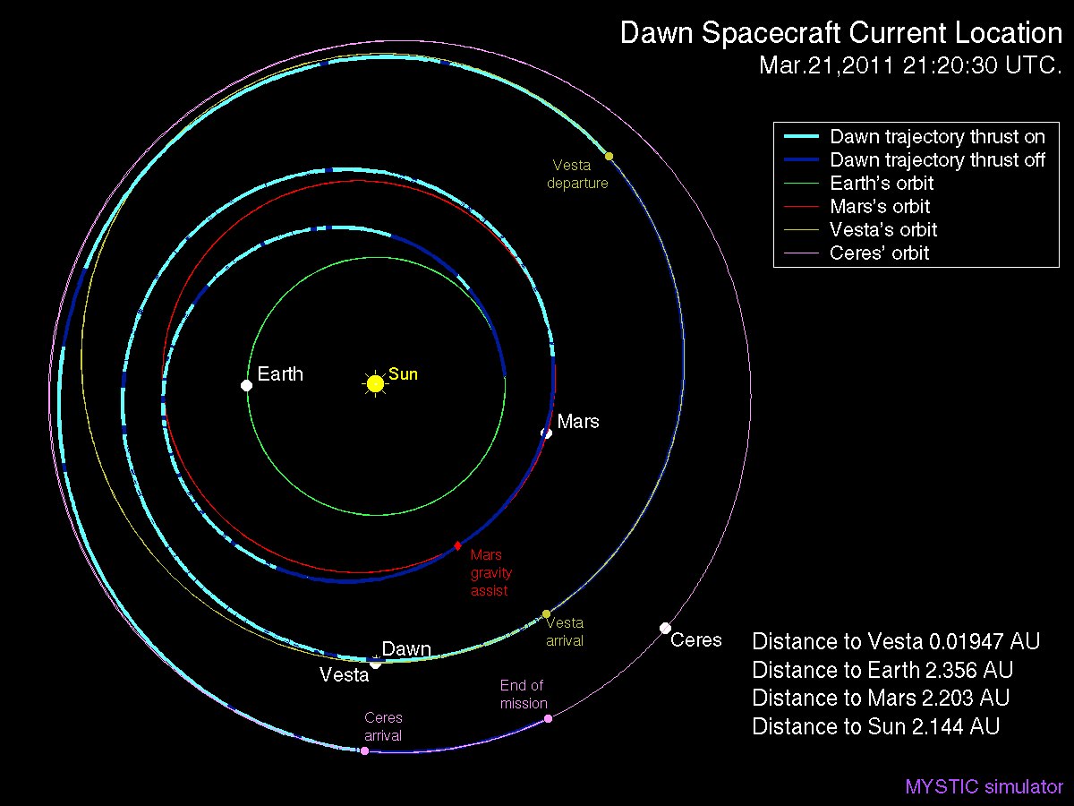
The excitement is building as NASA’s innovative Dawn spacecraft closes in on its first protoplanetary target, the giant asteroid Vesta, with its camera eyes now wide open. The probe is on target to become the first spacecraft from Earth to orbit a body in the main asteroid belt and is set to arrive about four months from now in late July 2011.
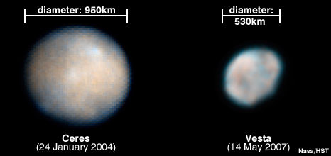
Vesta is the second most massive object in the Asteroid Belt between Mars and Jupiter (map below). Since it is also one of the oldest bodies in our Solar System, scientists are eager to study it and search for clues about the formation and early history of the solar system. Dawn will spend about a year orbiting Vesta. Then it will fire its revolutionay ion thrusters and depart for Ceres, the largest asteroid in our solar system.
Dawn is equipped with three science instruments to photograph and investigate the surface mineralogy and elemental composition of the asteroid. The instruments were provided by the US, Germany and Italy. The spacecraft has just awoken from a six month hibernation phase. All three science instruments have been powered up and reactivated.
 Dawn will image about 80 percent of Vesta’s surface at muliple angles with the onboard framing cameras to generate topographical maps. During the year in orbit, the probe will adjust its orbit and map the protoplanet at three different and decreasing altitudes between 650 and 200 kilometers, and thus increasing resolution. The cameras were provided and funded by Germany.
To prepare for the imaging campaign, mission planners from the US and Germany conducted a practice exercise to simulate the mission as though they were mapping Vesta. The effort was coordinated among the science and engineering teams at NASA’s Jet Propulsion Laboratory, the Institute of Planetary Research of the German Aerospace Center (DLR) in Berlin and the Planetary Science Institute in Tuscon, Ariz.
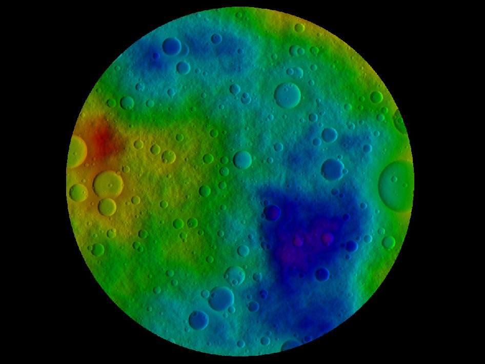
This image shows the scientists' best guess to date of what the surface of the protoplanet Vesta might look like from the south pole, as projected onto a sphere 250 kilometers (160 miles) in radius. It was created as part of an exercise for NASA's Dawn mission involving mission planners at NASA's Jet Propulsion Laboratory and science team members at the Planetary Science Institute in Tuscon, Ariz. Credit: NASA/JPL-Caltech/UCLA/PSI
“We won’t know what Vesta really looks like until Dawn gets there,” said Carol Raymond in a NASA statement. Raymond is Dawn’s deputy principal investigator, based at JPL, who helped orchestrate the activity. “But we needed a way to make sure our imaging plans would give us the best results possible. The products have proven that Dawn’s mapping techniques will reveal a detailed view of this world that we’ve never seen up close before.”
Two teams worked independently and used different techniques to derive the topographical maps from the available data sets. The final results showed only minor differences in spatial resolution and height accuracy.
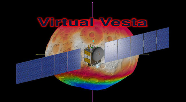
Using the best available observations from the Hubble Space Telescope and ground based telescopes and computer modeling techniques, they created maps of still images and a rotating animation (below) showing their best guess as to what Vesta’s surface actually looks like. The maps include dimples, bulges and craters based on the accumulated data to simulate topography and thus give a sense of Virtual Vesta in three dimensions (3 D).
“Working through this exercise, the mission planners and the scientists learned that we could improve the overall accuracy of the topographic reconstruction, using a somewhat different observation geometry,” said Nick Mastrodemo, Dawn’s optical navigation lead at JPL. “Since then, Dawn science planners have worked to tweak the plans to implement the lessons of the exercise.”

The framing camera system consists of two identical cameras developed and built by the Max Planck Institute for Solar System Research, Katlenburg-Lindau, Germany and the German Aerospace Center (DLR) in Berlin.
“The camera system is working flawlessly. The dry run was a complete success,” said Andreas Nathues, lead investigator for the framing camera at the Max Planck Institute in Katlenburg-Lindau, Germany.
Since the probe came out of hibernation, the mechanical and electrical components were checked out in mid March and found to be in excellent health and the software was updated.
Dawn is a mission of many firsts.
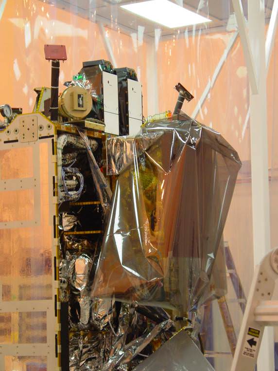
Picture shows close up view of two science instruments;
The twin Framing Cameras at top (white rectangles) and VIR Spectrometer at right. Credit: Ken Kremer
The revolutionary Dawn mission is powered by exotic ion propulsion which is vastly more efficient than chemical propulsion thrusters. Indeed the ability to orbit two bodies in one mission is only enabled via the use of the ion engines fueled by xenon gas.
Vesta and Ceres are very different worlds that orbit between Mars and Jupiter. Vesta is rocky and may have undergone volcanism whereas Ceres is icy and may even harbor a subsurface ocean conducive to life.
Dawn will be able to comparatively investigate both celestial bodies with the same set of science instruments and try to unlock the mysteries of the beginnings of our solar system and why they are so different.
Dawn is part of NASA’s Discovery program and was launched in September 2007 by a Delta II rocket from Cape Canaveral Air Force Station, Florida.
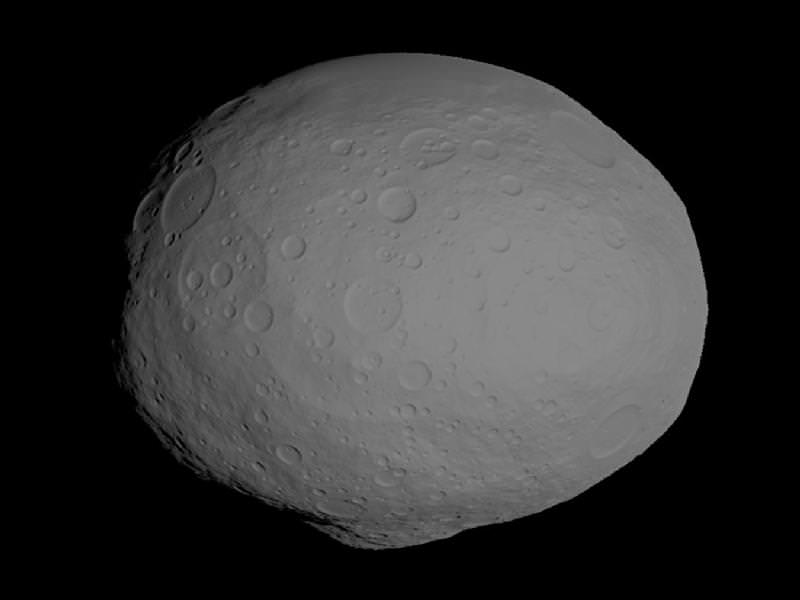
This image shows a model of the protoplanet Vesta, using scientists' best guess to date of what the surface of the protoplanet might look like. The images incorporate the best data on dimples and bulges of Vesta from ground-based telescopes and NASA's Hubble Space Telescope. The cratering and small-scale surface variations are computer-generated, based on the patterns seen on the Earth's moon, an inner solar system object with a surface appearance that may be similar to Vesta. Credit: NASA/JPL-Caltech/UCLA/PSI
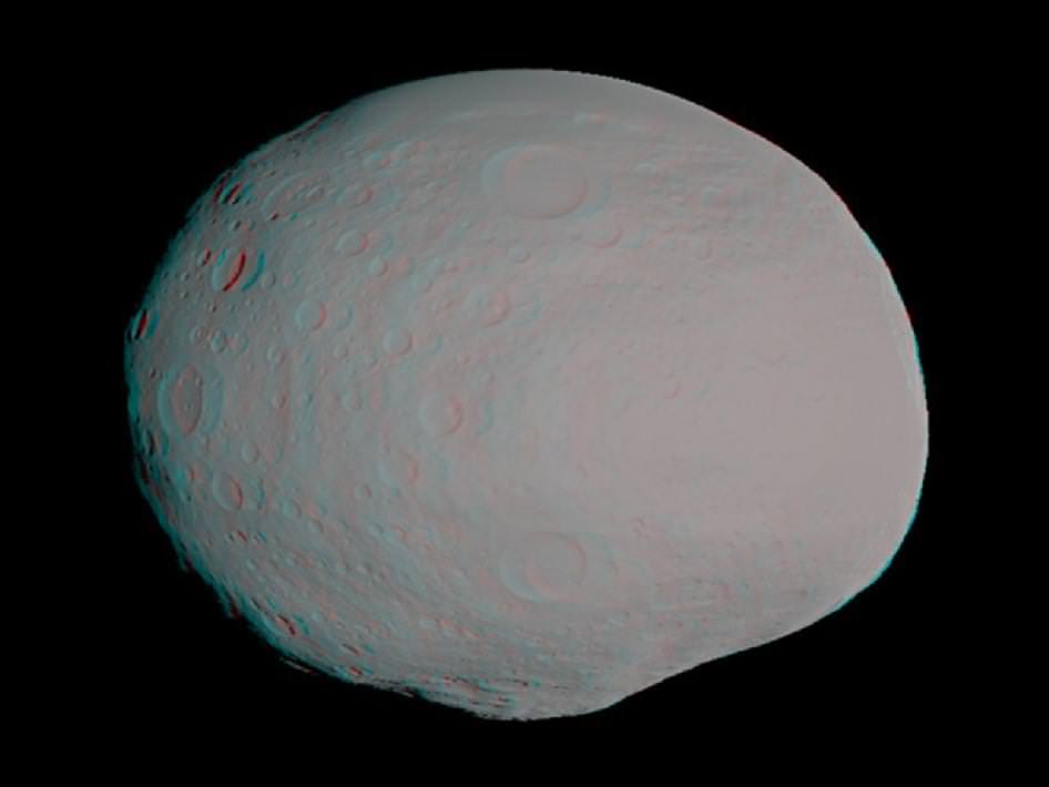
This anaglyph -- best viewed through red-blue glasses -- shows a 3-D model of the protoplanet Vesta, using scientists' best guess to date of what the surface of the protoplanet might look like. Image credit: NASA/JPL-Caltech/UCLA/PSI
Probing the Moho Boundary – Earth’s Own Unexplored Frontier
[/caption]
The boundary where Earth’s crust gives way to the unexplored mantle was first detected in 1909, because of a change in the travel of seismic waves. Named the Moho boundary for Andrija Mohorovicic, who listened to those seismic waves, the crust-mantle boundary is a frontier that remains elusive and compelling — harboring tantalizing clues as to the story of Earth’s formation — even as our technologies push into the outer reaches of the solar system and beyond.
The first serious attempts to probe the Moho boundary ran aground in the late 1950s. Now, technology already in use on a Japanese ship, combined with a United States digging program already under way, could finally yield success. Damon Teagle and Benoît Ildefonse have written about the ongoing efforts for an article in the journal Nature, released today.
Teagle is at the University of Southampton’s National Oceanography Centre in the UK, and Ildefonse is at Université Montpellier in France. They are co-chief scientists on an expedition called the IODP Expedition 335, “to obtain for the first time a section of the lower oceanic crust — the material lying just above the mantle,” they write.
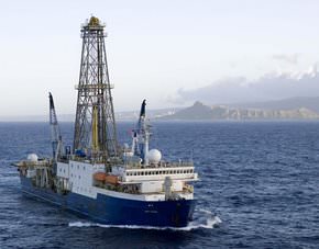
The IODP is using the U.S. ship JOIDES Resolution, pictured above, which will drill from April to June this year off the coast of Costa Rica.
“This site is in ocean crust that formed superfast — at more than 20 centimetres a year, much faster than any present day crust formation,” the co-authors write. “That makes the upper crust there much thinner than elsewhere, so it is possible to reach the lower portions without having to drill very deep. Three previous expeditions to Hole 1256D have drilled down to more than 1.5 kilometres below the sea floor, into the transition zone between dikes and gabbros.”
This spring they hope to push it another 400 meters, and recover gabbros from the lower crust, “which will be the deepest types of rock ever extracted from beneath the sea floor,” even though the deepest hole reached 2,111 meters under the eastern Pacific off of Colombia, they write.

Teagle and Ildefonse note that some pieces of the mantle have been thrust up to Earth’s surface during tectonic mountain building, and ejected from volcanoes and sea floor dikes. Those samples have provided clues to the mantle’s composition, but they don’t reveal the variability of the mantle — and all of the samples have been altered by the processes that revealed them.
They say the IODP mission should help to settle many debates, including how crust is formed at mid-ocean ridges, how magma from the mantle is intruded into the lower crust, the geometry and vigor of how sea water can pull heat from the lower oceanic crust and the contribution of the lower crust to marine magnetic anomalies. The project will also provide “further impetus for, and confidence in, deep ocean crust drilling,” write Teagle and Ildefonse — but it will reach a depth far less than what will be needed to actually get at the Moho boundary. It occurs at least 30 kilometers (18 miles) under the continents but just 6 kilometers (3.7 miles) under the seas.
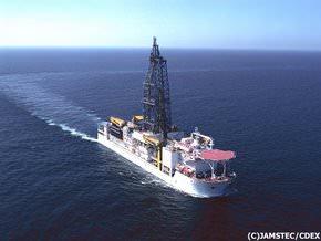
That’s where Chikyu comes in. Launched in 2002, “Chikyu is a giant ship, capable of carrying 10 kilometres of drilling pipes, and is equipped for riser drilling in 2.5 kilometres of water,” the authors write. Although Chikyu wouldn’t yet be able to go the full distance, its design is advanced enough to be the launching pad for such efforts:
“The vessel has a riser system: an outer pipe surrounds the drill string — the steel pipe through which cores are recovered,” the co-authors write. “The drilling mud and cuttings are returned up to the vessel in the space between the two pipes. This helps to recycle the drilling mud, control its physical properties and the pressure within the drill hole and helps to stabilize the borehole walls.”
Teagle and Ildefonse say the ideal drilling program to reach the mantle boundary will happen in one of three places — off the coasts of Hawaii, Baja California and Costa Rica — where the water is the most shallow, over the coldest possible crust. Wherever and however it happens, they write, it will be worth doing:
“Drilling to the mantle is the most challenging endeavour in the history of Earth science. It will provide a legacy of fundamental scientific knowledge, and inspiration and training for the next generation of geoscientists, engineers and technologists.”
Source: Nature. See also the websites for Chikyu and JOIDES.
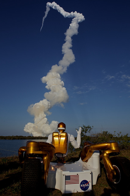
Robo Trek Debuts … Robonaut 2 Unleashed and joins First Human-Robot Space Crew
Star Trek’s Data must be smiling.
One of his kind has finally made it to the High Frontier. The voyages of Robo Trek have begun !
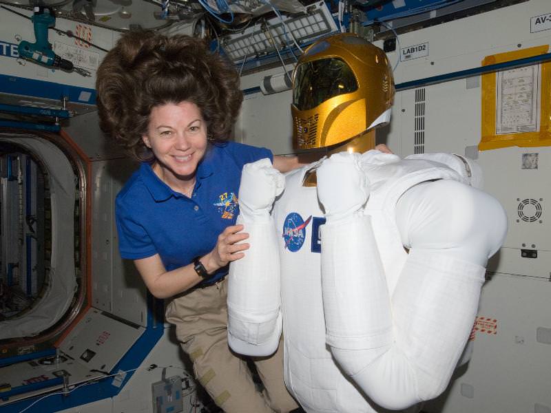
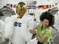
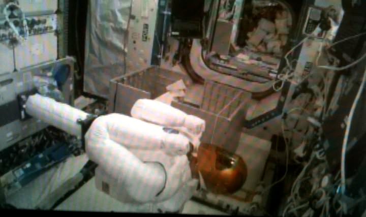
Robonaut 2, or R2, was finally unleashed from his foam lined packing crate by ISS crewmembers Cady Coleman and Paolo Nespoli on March 15 and attached to a pedestal located inside its new home in the Destiny research module. R2 joins the crew of six human residents as an official member of the ISS crew. See the video above and photos below.
[/caption]
The fancy shipping crate goes by the acronym SLEEPR, which stands for Structural Launch Enclosure to Effectively Protect Robonaut. R2 had been packed inside since last summer.
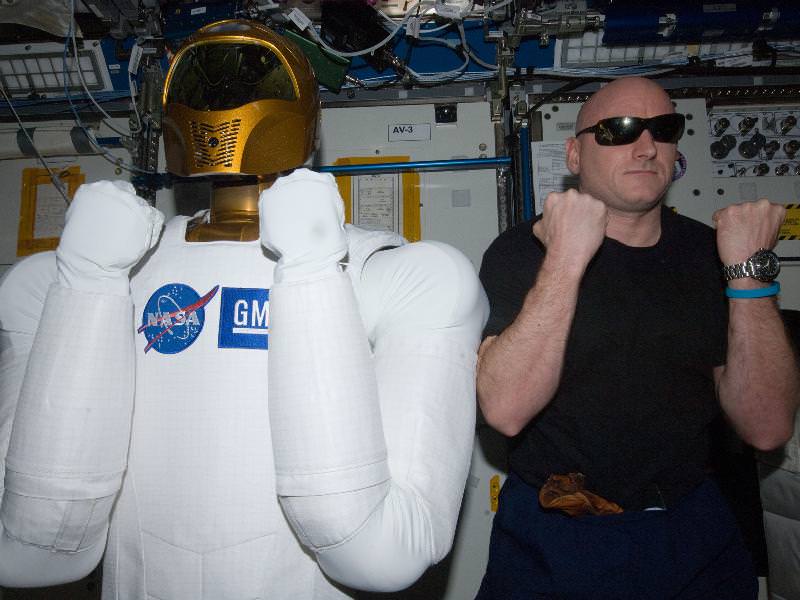
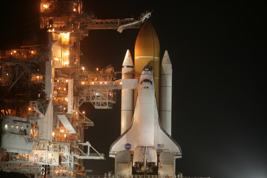
Robonaut 2 is the first dexterous humanoid robot in space and was delivered to the International Space Station by Space Shuttle Discovery on STS-133.
”Robonaut is now onboard as the newest member of our crew. We are happy to have him onboard. It’s a real good opportunity to help understand the interface of humans and robotics here in space.” said Coleman. “We want to see what Robonaut can do. Congratulations to the team of engineers [at NASA Johnson Space center] who got him ready to fly.”
Discovery blasted off for her historic final mission on Feb. 24 and made history to the end by carrying the first joint Human-Robot crew to space.
 The all veteran human crew of Discovery was led by Shuttle Commander Steve Lindsey. R2 and SLEEPR were loaded aboard the “Leonardo” storage and logistics module tucked inside the cargo bay of Discovery. Leonardo was berthed at the ISS on March 1 as a new and permanent addition to the pressurized habitable volume of the massive orbiting outpost.
“It feels great to be out of my SLEEPR, even if I can’t stretch out just yet. I can’t wait until I get to start doing some work!” tweeted R2.
The 300-pound R2 was jointly developed in a partnership between NASA and GM at a cost of about $2.5 million. It consists of a head and a torso with two arms and two hands. It was designed with exceptionally dexterous hands and can use the same tools as humans.

R2 will function as an astronaut’s assistant that can work shoulder to shoulder alongside humans and conduct real work, ranging from science experiments to maintenance chores. After further upgrades to accomplish tasks of growing complexity, R2 may one day venture outside the ISS to help spacewalking astronauts.
“It’s a dream come true to fly the robot to the ISS,” said Ron Diftler in an interview at the Kennedy Space Center. Diftler is the R2 project manager at NASA’s Johnson Space Center.
President Obama called the joint Discovery-ISS crew during the STS-133 mission and said he was eager to see R2 inside the ISS and urged the crew to unpack R2 as soon as possible.
“I understand you guys have a new crew member, this R2 robot,” Obama said. “I don’t know whether you guys are putting R2 to work, but he’s getting a lot of attention. That helps inspire some young people when it comes to science and technology.”
Commander Lindsey replied that R2 was still packed in the shipping crate – SLEEPR – and then joked that, “every once in a while we hear some scratching sounds from inside, maybe, you know, ‘let me out, let me out,’ we’re not sure.”
Robonaut 2 is free at last to meet his destiny in space and Voyage to the Stars.
“I don’t have a window in front of me, but maybe the crew will let me look out of the Cupola sometime,” R2 tweeted from the ISS.
Read my earlier Robonaut/STS-133 stories here, here, here and here.
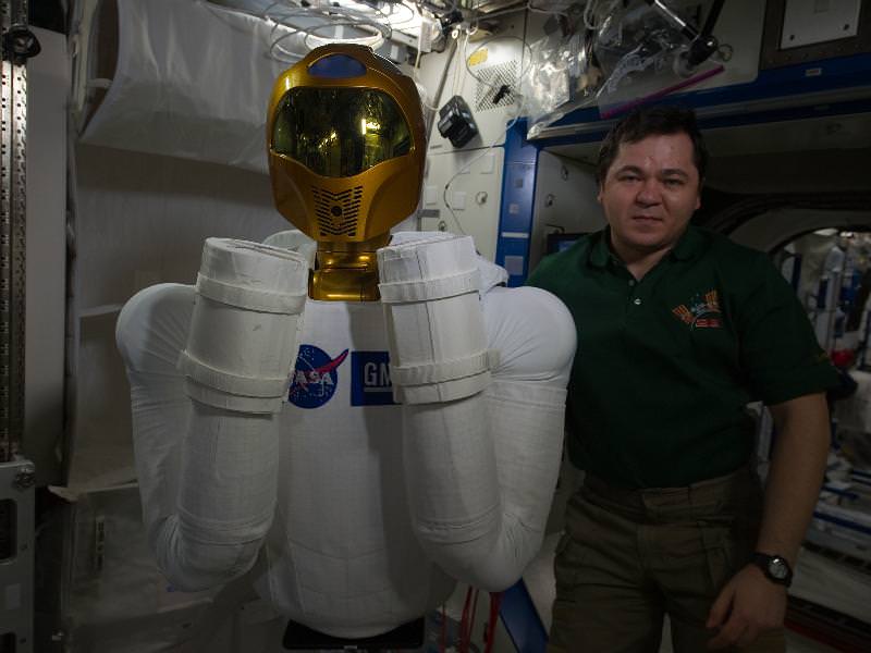
I’m in space, says Robonaut 2 from inside the Destiny module at the ISS. Credit: NASA

Robonaut 2, the dexterous humanoid astronaut helper, is pictured in the Destiny laboratory of the International Space Station.
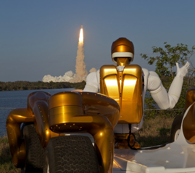
Robonaut R2A waving goodbye as Robonaut R2B launches into space aboard STS-133 from the Kernnedy Space Center. R2 is the first humanoid robot in space. Credit: Joe Bibby
First joint Human – Robot crew. Credit: Ken Kremer

Robonaut 2 and the NASA/GM team of scientists and engineers watched the launch of Space Shuttle Discovery and the first joint Human-Robot crew on the STS-133 mission on Feb. 24, 2011 from the Kennedy Space Center. Credit: Ken Kremer
Titan’s Spring Showers Bring Torrents of Methane, Maintain ‘Dry’ Gullies
[/caption]
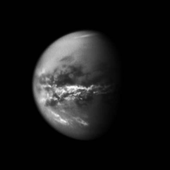
Titan’s skies dump methane rain on the bizarre moon a quarter of the year, which collects in northern methane lakes and maintains gullies and washes once presumed to have been sculpted in a wetter age.
Elizabeth Turtle from the Johns Hopkins University Applied Physics Laboratory (APL) is lead author on the new Science paper reporting that Cassini seems to have caught a storm in action last year: “We report the detection by Cassini’s Imaging Science Subsystem of a large low-latitude cloud system early in Titan’s northern spring and extensive surface changes,” write Turtle and her co-authors in the new paper, which appears today. “The changes are most consistent with widespread methane rainfall reaching the surface, which suggests that the dry channels observed at Titan’s low latitudes are carved by seasonal precipitation.”
While Saturn’s largest moon has methane lakes at high latitudes, its equatorial regions are mostly arid, with vast expanses of dunes. Researchers first observed dry, riverbed-like channels in these regions in Huygens probe images, but generally believed them to be remnants of a past wetter climate.
Turtle and her colleagues observed sudden decreases in the brightness of the surface near Titan’s equator after a cloud outburst. The authors consider several possible explanations for these changes, including wind storms and volcanism, but they conclude that rainfall from a large methane storm over the region is most likely responsible for the darkening they observed. The surface changes they noted after the storm spanned more than 500,000 square kilometers, about the size of California.
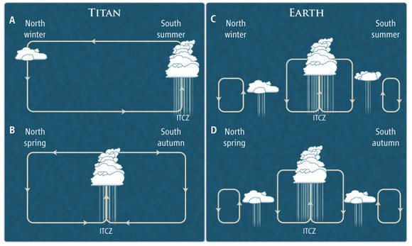
In a related Perspectives piece, Tetsuya Tokan from the Universität zu Köln in Köln, Germany wrote that Titan’s precipitation climatology “is clearly different from that of Earth, and exotic climate zones unknown in Köppen’s classification may exist.” He was referring to a widely-used climate classification system coined by Wladimir Köppen in 1884.
Tokan writes that while Earth’s global circulation patterns concentrate precipitation in rainy belts along the equatorial regions, Titan’s “convergence zone” appears migrate north and south over time, distributing precipitation more equitably across the moon.
Source: “Rapid and Extensive Surface Changes Near Titan’s Equator: Evidence of April Showers,” by Elizabeth Turtle et al. and the related Perspectives piece, “Precipitation Climatology on Titan,” by Tetsuya Tokan. Both articles appear today in the journal Science.
Google Lunar X-Prize’s ‘college team’ gaining steam, attention and support
[/caption]
ORLANDO – The Google Lunar X-PRIZE (GLXP) recently announced the 29 official teams that will be vying for the $30 million grand prize. One group in particular stands out amongst the list however – Omega Envoy. This team is comprised primarily by college students from the University of Central Florida, working on engineering and other degrees. However, while they may be relatively young, they have drawn the attention of the media, numerous sponsors, NASA and the space industry.
NASA has inked a deal with the tiny band of potential explorers to purchase data from their spacecraft. The space agency awarded the Innovative Lunar Demonstration Data contract to Omega Envoy. This contract is worth up to $10 million. However, while this contract and the growing list of sponsors is impressive, the feat that the team is trying to accomplish is daunting. What they are attempting to do, only nations have done before.
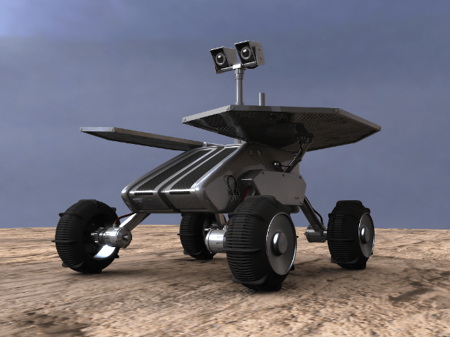
The GLXP requires that to win, the team must safely land a robot on the lunar surface, have it travel 1,500 feet and send back both images and data to Earth. Given the fact that, to date, only the U.S. and Russia have accomplished this before – this is no small task.

The Google Lunar X-PRIZE is another effort by the X-PRIZE Foundation. The impetus behind this organization is to accelerate space exploration efforts much in the same way that the Orteig Prize accelerated air travel in the 20th Century. That prize was a paltry (by today’s standards) $25,000 for the first person to fly non-stop from New York to Paris (or vice-versa). Its winner, Charles Lindbergh, would go down in history as one of the most famous aviators of all time. It is with this premise in mind that the X-PRIZE Foundation works to inspire today’s explorers and innovators.

For the original Ansari X-PRIZE it took an established (if somewhat outside of the mainstream) aerospace company with years of experience to finally accomplish the objectives laid out. Scaled Composites, renowned for their kit aircraft; successfully sent a manned spacecraft into sub-orbital space, returned safely and then sent the same spacecraft, SpaceShipOne; back into space within the required two weeks.
The non-profit organization that oversees all aspects of Omega Envoy, Earthrise Space Inc. (ESI), works to provide services to private companies, government agencies, as well as educational institutions that currently have the resources to explore space and are looking for low cost products that will accomplish their requirements. They feel that this will enhance the accessibility of technology and increase educational interest amongst the workforce that drives the space.
“Aside from the GLXP, ESI intends to continuously schedule lunar deliveries for scientific payloads and robotics,” said Earthrise Space Institute’s Project Director Ruben Nunez. “Other mission objectives for Omega Envoy entail the visual feedback of a scientific payload that will analyze the lunar terrain.”

Through the Google Lunar X-PRIZE and government contracts such as the contract with NASA, it is hoped that this initiative will enable the creation of a new economic system to support lunar exploration as well as Technology Readiness Level (TRL) advancement of innovative, commercial space systems.
“I am fortunate in that I had the opportunity to witness what Omega Envoy is capable of producing when I field tested their prototype rover during the 2009 FMARS (Flashline Mars Arctic Research Station) Expedition,” said Joseph Palaia 4Frontiers’ Vice President. “There is little doubt in my mind that this team is fully capable of accomplishing the objectives laid out in the GLXP.”

Japan Quake May Have Shortened Earth Days, Moved Axis

[/caption]
The terribly destructive magnitude 9.0 earthquake which struck Japan on March 11, may have had another effect – Shortening the length of each Earth day and shifting its axis. Did you notice any change ?
Well according to NASA, the changes are so small that you won’t notice the difference.
Based on initial calculations conducted by Richard Gross, a research scientist at NASA’s Jet Propulsion Laboratory, the earthquake should have caused Earth to rotate just slightly faster, shortening the length of the day by about 1.8 microseconds (a microsecond is one millionth of a second), according to a statement released by NASA.
A reader posted this link to before and after photos
Gross used complex modeling and estimates of fault slippage to perform a preliminary theoretical calculation of how the earth’s rotation may have been affected.
Calculations by Gross also indicate that the position of Earth’s figure axis could have shifted by about 17 centimeters (6.5 inches), towards 133 degrees east longitude. The figure axis is the axis about which Earth’s mass is balanced.
Earth’s figure axis is therefore different and offset from the north-south axis by about 10 meters.
“This shift in Earth’s figure axis will cause Earth to wobble a bit differently as it rotates, but it will not cause a shift of Earth’s axis in space-only external forces such as the gravitational attraction of the sun, moon and planets can do that,” according to the NASA statement.
The estimates for both the shortening in the Earth’s rotation and shift in the figure axis are preliminary and will very likely change as more data is collected and the calculations are refined.
The March 11 earthquake was the fifth largest since 1900. So far, over 4000 people are confirmed dead and the overall death total may exceed 10,000.
Several heavily damaged nuclear reactors at the Fukushima plant are in danger of meltdown as hero workers inside put their lives on the line to avoid a catastrophic failure and try to prevent the spread of lethal radiation.

Previously, Gross had calculated the affects of the magnitude 8.8 Chilean quake in 2010 and found them to be slightly smaller compared to the Japanese quake. He calculated a shortening in the length of day of about 1.26 microseconds and shifting of Earth’s figure axis of about 8 centimeters (3 inches). These affects are dependent on the magnitude of the quake, exactly where it is located as well as how the particulars of how the fault slips.
In fact, Earth’s rotation is changing all the time as a result of continual changes in atmospheric winds and oceanic currents and these effects are about 550 times larger than the Japanese earthquake.
“Over the course of a year, the length of the day increases and decreases by about a millisecond,” says Gross. Indeed, the effects of earthquakes on changing rotation are so tiny that they are smaller than the margin of error in the measurements themselves.
By comparison, measurements of the figure axis are much more reliable and meaningful. Changes to the figure axis can be accurately measured to within about 5 centimeters. This means that the estimated 17 centimeter shift from the Japanese quake may be real after accounting for the effects of the atmospheric winds and ocean currents. Further research is needed as more data are collected and analyzed.
“These changes in Earth’s rotation are perfectly natural and happen all the time. People shouldn’t worry about them,” said Gross.
Source: NASA Press Release:
Aged Voyager 1 Does In-flight Gymnastics for Science
[/caption]
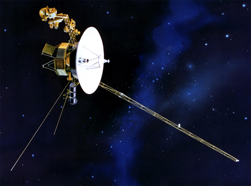
She might be old, but she’s still got it where it counts. The 33-year old Voyager 1 probe, flying out near the edge of the solar system conducted a roll program, spinning 70 degrees counterclockwise, and held the position by spinning gyroscopes for two hours, 33 minutes. Voyager performed its in-flight gymnastics on March 7, 2011 and scientists hope the maneuver will help answer the question of which direction is the sun’s stream of charged particles turns when it nears the edge of the solar system.
“Even though Voyager 1 has been traveling through the solar system for 33 years, it is still a limber enough gymnast to do acrobatics we haven’t asked it to do in 21 years,” said Suzanne Dodd, Voyager project manager, based at NASA’s Jet Propulsion Laboratory. “It executed the maneuver without a hitch, and we look forward to doing it a few more times to allow the scientists to gather the data they need.”
Voyager needed to get in the right orientation to enable its Low Energy Charged Particle instrument to gather data.
The last time either of the two Voyager spacecraft rolled and stopped in a gyro-controlled orientation was Feb. 14, 1990, when Voyager 1 snapped a family portrait of the planets. See the image here.
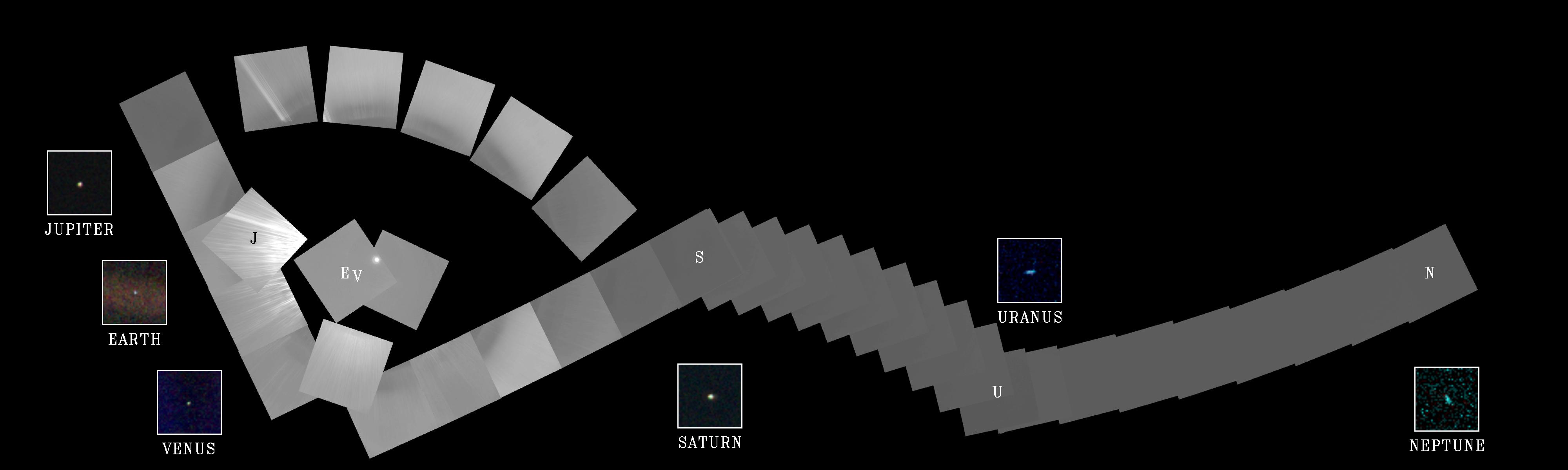
The two Voyager spacecraft are traveling through a turbulent area known as the heliosheath,the outer shell of a bubble around our solar system created by the solar wind. The solar wind is traveling outward from the sun at a million miles per hour. Scientists think the wind must turn as it approaches the heliosheath where it makes contact with the interstellar wind — , which originates in the region between stars.
In June 2010, when Voyager 1 was about 17 billion kilometers (about 11 billion miles) away from the sun, data from the Low Energy Charged Particle instrument began to show that the net outward flow of the solar wind was zero. That zero reading has continued since. The Voyager science team doesn’t think the wind has disappeared in that area, but perhaps has just turned a corner. But where does it go from there: up, down or to the side?
“Because the direction of the solar wind has changed and its radial speed has dropped to zero, we have to change the orientation of Voyager 1 so the Low Energy Charged Particle instrument can act like a kind of weather vane to see which way the wind is now blowing,” said Edward Stone, Voyager project manager. “Knowing the strength and direction of the wind is critical to understanding the shape of our solar bubble and estimating how much farther it is to the edge of interstellar space.”
Voyager engineers performed a test roll and hold back on Feb. 2, just to make sure the spacecraft was still capable. No problems for the old girl, and spacecraft had no problem in reorienting itself and locking back onto its guide star, Alpha Centauri.

There will be five more of these maneuvers over the next seven days, with the longest hold lasting three hours 50 minutes. The Voyager team plans to execute a series of weekly rolls for this purpose every three months.
Over the next few months, scientists will analyze the data.
“We do whatever we can to make sure the scientists get exactly the kinds of data they need, because only the Voyager spacecraft are still active in this exotic region of space,” said Jefferson Hall, Voyager mission operations manager at JPL. “We were delighted to see Voyager still has the capability to acquire unique science data in an area that won’t likely be traveled by other spacecraft for decades to come.”
Voyager 2 was launched on Aug. 20, 1977. Voyager 1 was launched on Sept. 5, 1977. On March 7, Voyager 1 was 17.4 billion kilometers (10.8 billion miles) away from the sun. Voyager 2 was 14.2 billion kilometers (8.8 billion miles) away from the sun, on a different trajectory.
The solar wind’s outward flow has not yet diminished to zero where Voyager 2 is exploring, but that may happen as the spacecraft approaches the edge of the bubble in the years ahead.
Voyager is just another good old girl.
Source: JPL
PAMELA Uncovers Cosmic Ray Surprise
[/caption]
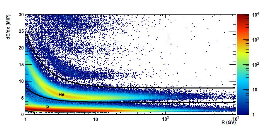
High energy particles called cosmic rays are constantly bombarding Earth from all directions, and have been thought to come from the blast waves of supernova remnants. But new observations from the PAMELA cosmic ray detector show an unexpected difference in the speeds of protons and helium nuclei, the most abundant components of cosmic rays. The difference is extremely small, but if they were accelerated from the same event, the speeds should be the same.

PAMELA, the Payload for Anti-Matter Exploration and light-Nuclei Astrophysics, is on board the Earth-orbiting Russian Resurs-DK1 satellite. It uses a permanent magnet spectrometer along with a variety of specialized detectors to measure the abundance and energy spectra of cosmic rays electrons, positrons, antiprotons and light nuclei over a very large range of energy from 50 MeV to hundreds of GeV.
Just as astronomers use light to view the Universe, scientists use galactic cosmic rays to learn more about the composition and structure of our galaxy, as well as to find out how things like how nuclei can accelerate to nearly the speed of light.
Oscar Adriani and his colleagues using the PAMELA instrument say their new findings are a challenge to our current understanding of how cosmic rays are accelerated and propagated. “We find that the spectral shapes of these two species are different and cannot be well described by a single power law,” the team writes in their paper. “These data challenge the current paradigm of cosmic-ray acceleration in supernova remnants followed by diffusive propagation in the Galaxy.”
Instead, the team concludes, the acceleration and propagation of cosmic rays may be controlled by now unknown and more complex processes.
Supernova remnants are expanding clouds of gas and magnetic fields and can last for thousands of years. Within this cloud, particles are accelerated by bouncing back and forth in the magnetic field of the remnant, and some of the particles gain energy, and eventually they build up enough speed that the remnant can no longer contain them, and they escape into the Galaxy as cosmic rays.
One key question that scientists hope to answer with PAMELA data is whether the cosmic rays are continuously accelerated over their entire lifetime, whether the acceleration occurs just once, or if there is any deceleration.
Scientists say that determining the fluxes in the proton and helium nuclei will give information about the early Universe as well as the origin and evolution of material in our galaxy.
Adriani and his team hope to uncover more information with PAMELA to help better understand the origins of cosmic rays. They say possible contributions could be from additional galactic sources, such as pulsars or dark matter.
Abstract: PAMELA Measurements of Cosmic-Ray Proton and Helium Spectra
Source: Science