Mars is Still an Active World. Here’s a Landslide in Nili Fossae

Credit: UofA/LPL

Since the 1960s and 70s, scientists have come to view Mars as something of a “dead planet.” As the first close-up images from orbit and the surface came in, previous speculation about canals, water, and a Martian civilization were dispelled. Subsequent studies also revealed that the geological activity that created features like the Tharsis Mons region (especially Olympus Mons) and Valles Marineris had ceased long ago.

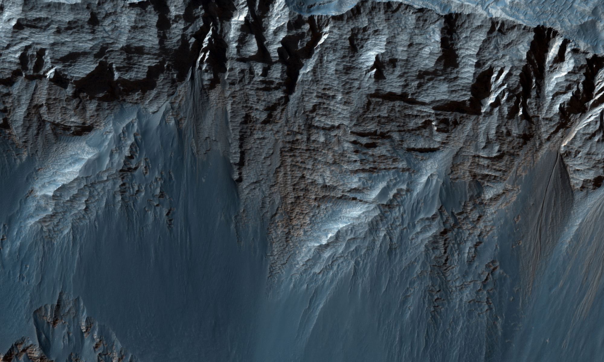
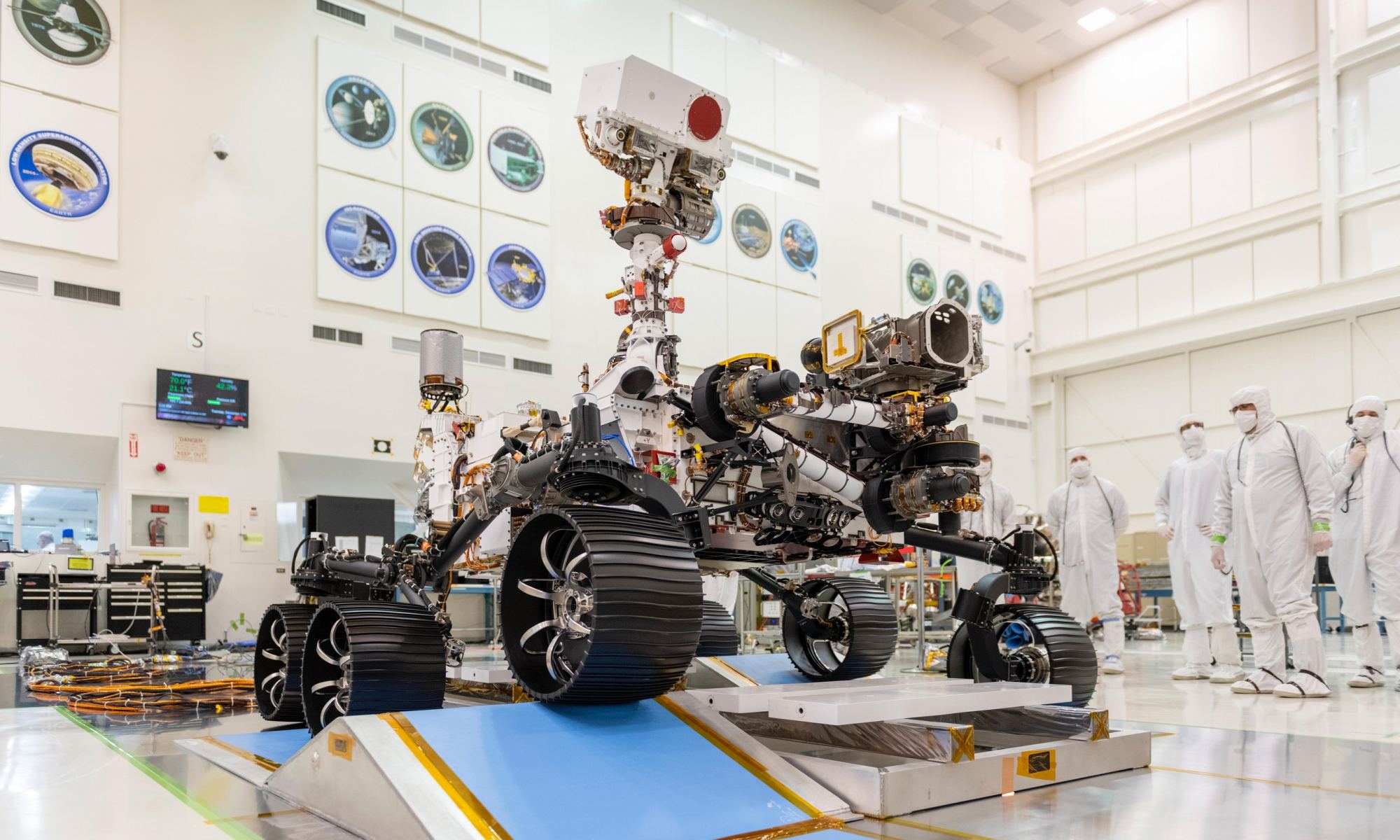
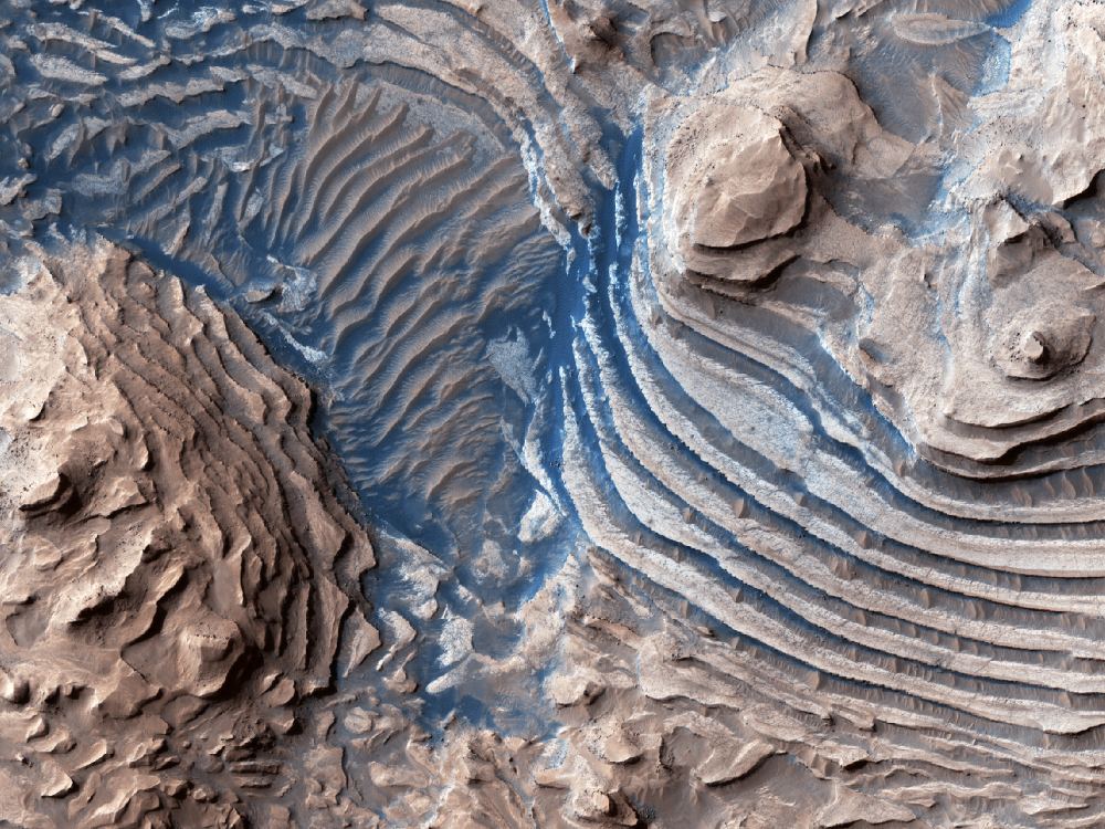
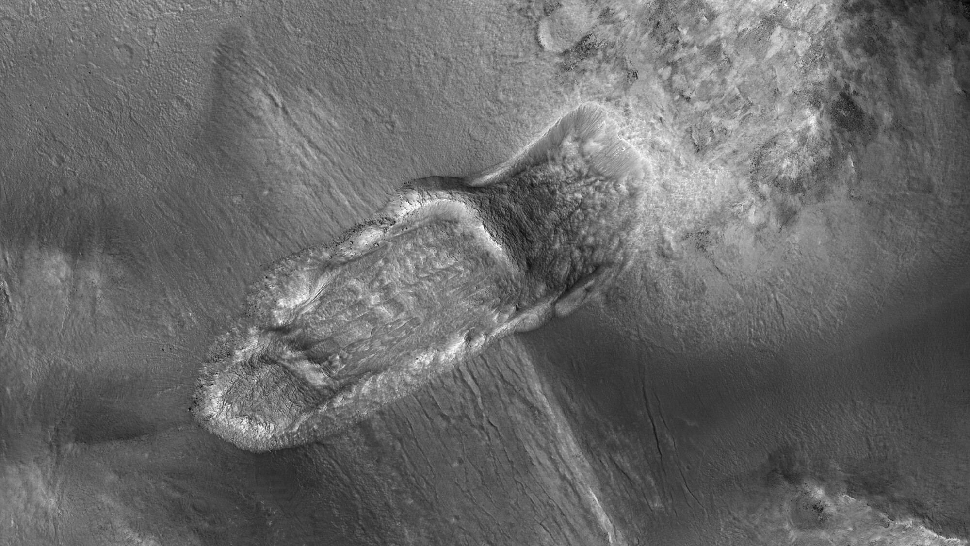
However, in the past few decades, robotic missions have found ample evidence that Mars is still an active place. A recent indication was an image taken by the Mars Reconnaissance Orbiter (MRO), which showed relatively fresh landslides in a crater near Nili Fossae. This area is part of the Syrtis Major region and is located just north of the Jezero Crater (where the Perseverance rover will be landing in six weeks!)

Continue reading “Mars is Still an Active World. Here’s a Landslide in Nili Fossae”

Layers Upon Layers of Rock in Candor Chasma on Mars

In many ways, Mars is the planet that is most similar to the Earth. The red world has polar ice caps, a nearly 24-hour rotation period (about 24 hours and 37 minutes), mountains, plains, dust storms, volcanoes, a population of robots, many of which are old and no longer work, and even a Grand Canyon of sorts. The ‘Grand Canyon’ on Mars is actually far grander than any Arizonan gorge. Valles Marineris dwarfs the Grand Canyon of the southwestern US, spanning 4,000 km in length (the distance between LA and New York City), and dives 7 kilometers into the Martian crust (compared to a measly 2km of depth seen in the Grand Canyon). Newly released photos from the High-Resolution Imaging Science Experiment (HiRISE) aboard the Mars Reconnaissance Orbiter (MRO) reveal a stunning look at eroding cliff faces in Candor Chasma, a gigantic canyon that comprises a portion of the Valles Marineris system.

Continue reading “Layers Upon Layers of Rock in Candor Chasma on Mars”

This Martian Lava Tube Skylight is 50 Meters Across. The Biggest Lava Tube on Earth is Only 15 Meters Across

This is the collapsed ceiling of a Martian lava tube. It measures 50 meters (150 ft) across, much larger than any Earth lava tubes. Image Credit: NASA/JPL/University of Arizona

NASA’s Mariner 9 was the first spacecraft to orbit another planet when it reached Mars in late 1971. It got there only a few weeks before the Soviet Union’s Mars 2 and Mars 3 spacecraft, despite being launched 11 days later than those missions. Unfortunately, there was a major dust storm when Mariner 9 arrived, and NASA had to wait until January before the spacecraft could get good images.

When it did get those images, they revealed a surprise: volcanoes and lava flows cover large portions of the Martian surface.

Continue reading “This Martian Lava Tube Skylight is 50 Meters Across. The Biggest Lava Tube on Earth is Only 15 Meters Across”

The Colorful Walls of an Exposed Impact Crater on Mars

A view of the interior of an impact crater on Mars shows prominent bright layer of bedrock. Credit: NASA/JPL/UArizona

Impact craters have been called the “poor geologists’ drill,” since they allow scientists to look beneath to the subsurface of a planet without actually digging down. It’s estimated that Mars has over 600,000 craters, so there’s plenty of opportunity to peer into the Red Planet’s strata – especially with the incredible HiRISE (High Resolution Imaging Science Experiment) camera on board the Mars Reconnaissance Orbiter which has been orbiting and studying Mars from above since 2006.

Continue reading “The Colorful Walls of an Exposed Impact Crater on Mars”

Perseverance and the Quest to Find Life on Mars

Perseverance Rover before being sent to Mars

I remember the Summer of 1997 when a shoebox-sized Mars rover literally broke the Internet.

Sojourner – the first rover we sent to another planet – had just landed on Mars in a giant space airbag bouncing along the surface to a safe stop. The Internet was new. And I was a young space enthusiast with a dial-up modem. For the first time, images from a space exploration mission were beamed to an audience that was connected online. Now we use the term “broke the Internet” as a hyperbolic phrase for various Internet phenomena, but interest in the Mars mission in 97 drove so many hits to NASA mirror servers around the world that global web traffic was disrupted. Patiently I watched as, line by line, orange sky to red stone, the first image posted by NASA loaded on my screen…it took about an hour. Each line resolved was like my own exploration of the planet. And finally, the landing site, in “real time”, was revealed to me and the entire world all at once. What would we discover together?

One of the first images of Sojourner from the 97 Mars Pathfinder Landing – NASA/JPL
Continue reading “Perseverance and the Quest to Find Life on Mars”

Sediments on Mars, Created By Blowing Wind or Flowing Water

The HiRISE Picture of the Day from May 9th 2020. Sedimentary rocks in and impact crater on Mars. Image Credit: NASA/JPL/UArizona

The HiRISE (High-Resolution Imaging Science Experiment) instrument on NASA’s Mars Reconnaissance Orbiter (MRO) has given us a steady stream of images of the Martian surface. It’s been in orbit around Mars since March 2006, and has greatly outlived its intended mission length.

One of the latest Hi-PODs, or HiRISE Pictures of the Day, is this one, of sedimentary rock on Mars being eroded away.

Continue reading “Sediments on Mars, Created By Blowing Wind or Flowing Water”