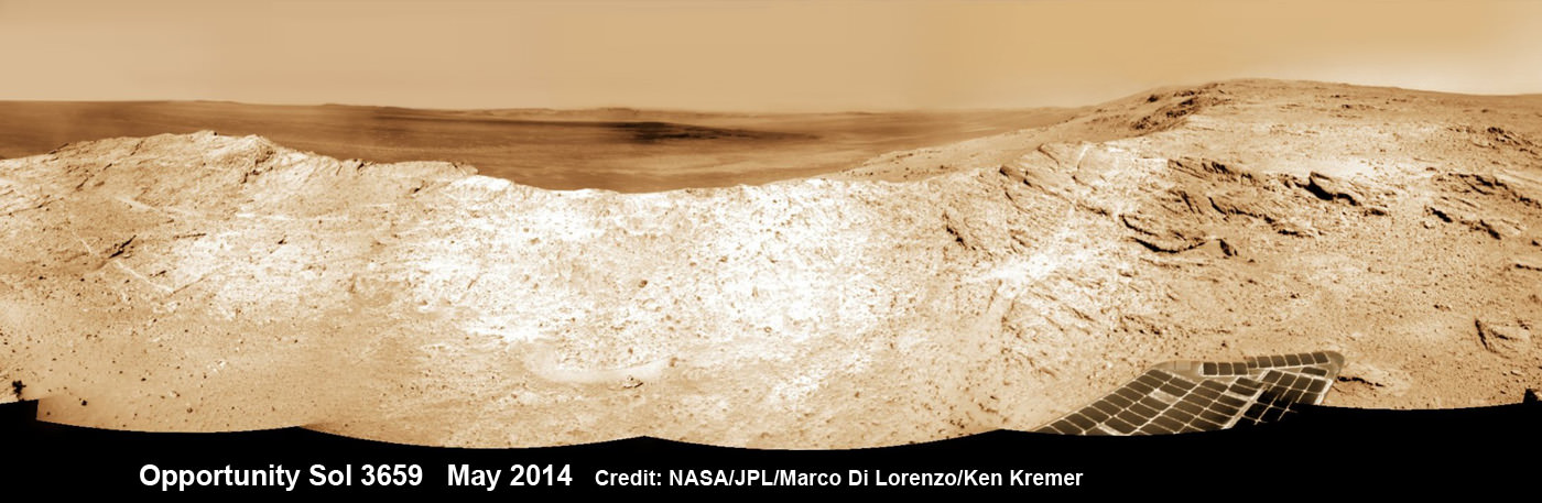
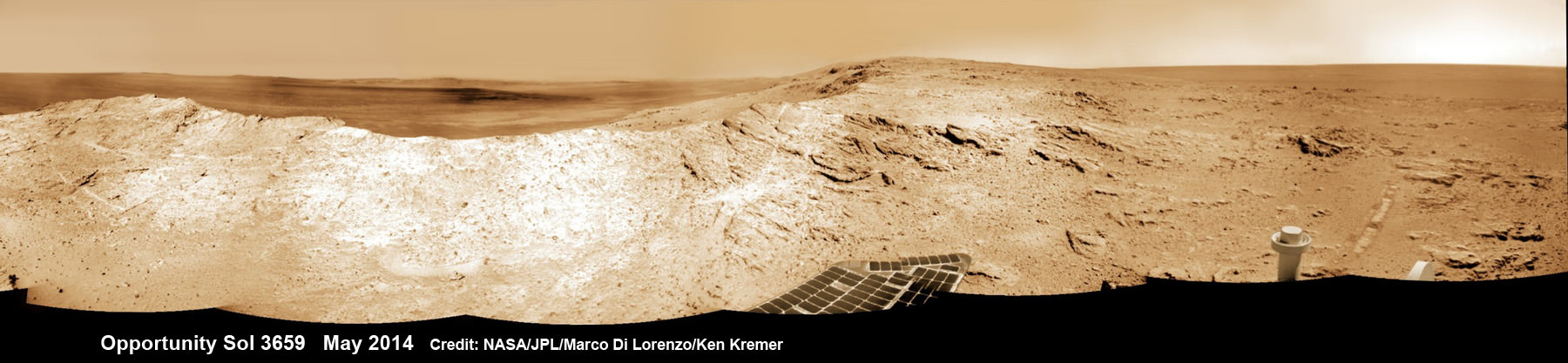
NASA’s Opportunity Mars rover captures sweeping panoramic vista near the ridgeline of 22 km (14 mi) wide Endeavour Crater’s western rim. The center is southeastward and also clearly shows the distant rim. See the complete panorama below. This navcam panorama was stitched from images taken on May 10, 2014 (Sol 3659) and colorized. Credit: NASA/JPL/Cornell/Marco Di Lorenzo/Ken Kremer-kenkremer.com
More mosaics and 10 year route map below[/caption]
NASA’s incredibly long lived Opportunity rover has driven to the ridgeline of a Martian mountain and captured spectacular panoramic vistas peering down into the vast expanse of huge Endeavour crater and out along the jagged rim segments leading to her next target – which scientists believe holds minerals indicative of a habitable zone. See mosaic views above and below.
Since departing the world famous ‘Jelly Doughnut’ rock by the summit of ‘Solander Point’ in February, Opportunity has spent the past several months driving south and exploring intriguing rock outcrops on ‘Murray Ridge’ located along the eroded western rim of Endeavour Crater.
The renowned robot is now exploring a region of outcrops atop the rims ridge that’s a possible site harboring deposits of hydrated clay minerals, formed in the ancient past when Mars was warmer and wetter.
The ten year old Red Planet rover first reached the rim of Endeavour Crater in August 2011. She has captured numerous sweeping gorgeous vistas during her first of its kind expedition on the surface of another planet by an alien probe from Earth.
Read my earlier story detailing the top 10 discoveries from twin sisters Spirit and Opportunity according to Deputy Principal Investigator Prof. Ray Arvidson – here.
The gigantic crater spans 14 miles (22 kilometers) in diameter.
So there is endless enthralling terrain to investigate – for at least another 10 years!
The floor of Endeavour crater is filled with dark sand, brighter dust, and, in the distance, dusty haze, says NASA.
Opportunity’s goal all the while has been to doggedly trek southwards towards exposures of aluminum-rich clays detected from orbit by NASA’s powerful Martian ‘Spysat’ – the Mars Reconnaissance Orbiter (MRO) – while gathering context data at rock outcrops at Murray Ridge along the winding way.
These aluminum-rich clay minerals, or phyllosilicates, likely formed billions of years ago in flowing liquid neutral water which is more conducive to life, compared to more acidic environments explored earlier in the mission, and is therefore potentially indicative of a Martian habitable zone and a scientific goldmine.
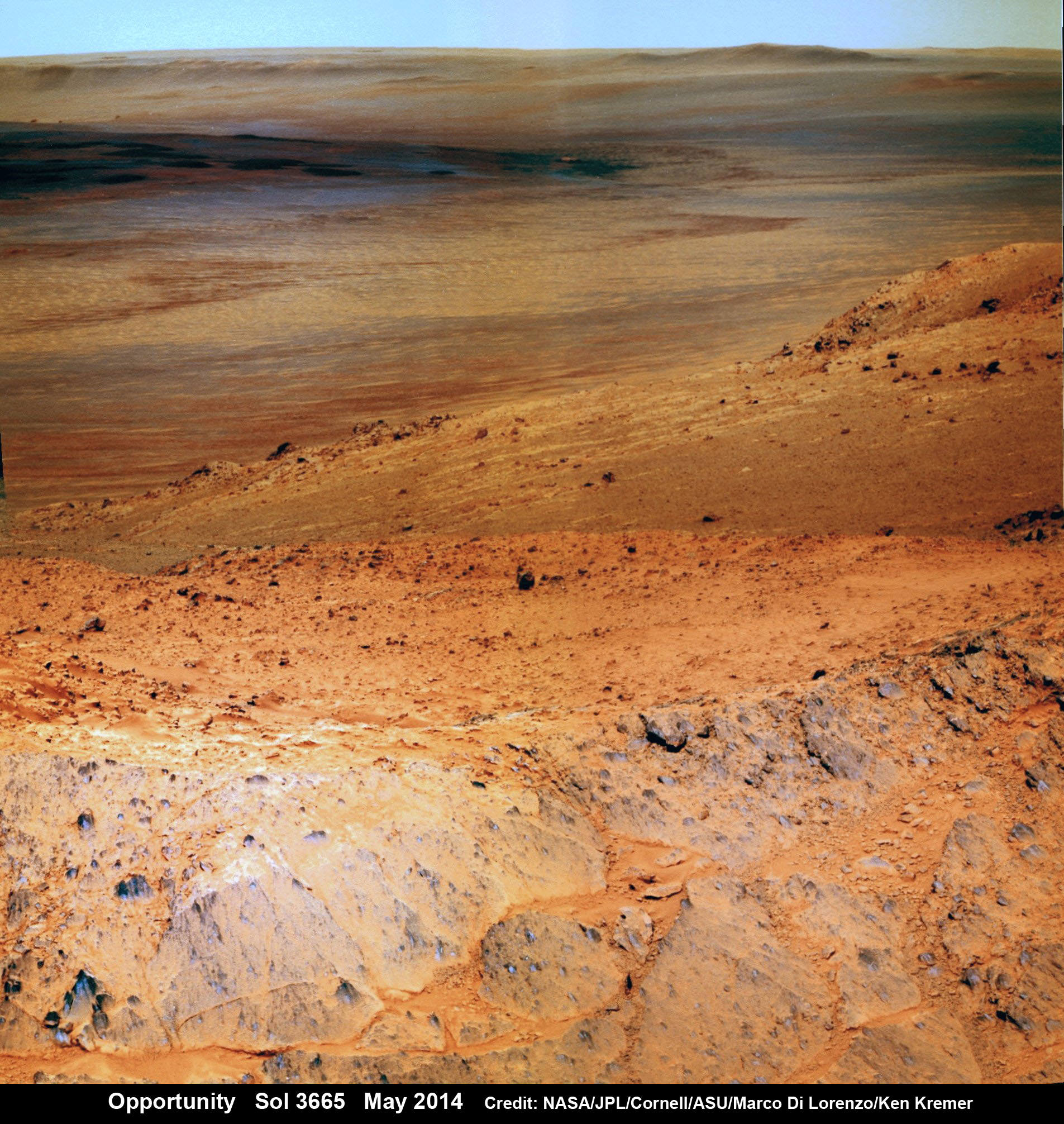
The science and engineering team has used the high resolution MRO spectral and imaging data to more efficiently direct Opportunity southwards along the Endeavour crater rim and towards the biggest caches of the clay minerals – which were detected at a mountainous rim segment called ‘Cape Tribulation’ and which is seen in the panoramic vistas.
Although Cape Tribulation still lies some 1.2 miles (2 kilometers) further south, the rover has just arrived at a region which the team believes shows the first signatures of the clay minerals.
“The rover is exploring the region of aluminum-hydroxyl clay minerals seen from orbit,” said NASA in a mission update.
The six wheeled robot will utilize her mast mounted cameras and arm mounted microscopic imager (MI) and APXS spectrometer to gather images and measurements to unlock the mysteries of Mars ability to support life – past or present.
“The more we explore Mars, the more interesting it becomes. These latest findings present yet another kind of gift that just happens to coincide with Opportunity’s 10th anniversary on Mars,” said Michael Meyer, lead scientist for NASA’s Mars Exploration Program.
“We’re finding more places where Mars reveals a warmer and wetter planet in its history. This gives us greater incentive to continue seeking evidence of past life on Mars.”
And Opportunity is now power-rich following a series of fortuitous wind cleaning events that substantially cleared the dust off the power generating solar wing arrays.
The solar array energy production has reached 761 watt-hours compared to about 900 watt-hours at landing in 2004 and only about 270 watt-hours just before Christmastime in December 2013.
“Solar panels [are] cleanest since about sol 1600 [September 2008],” says mission science team member Larry Crumpler.
More power means more work time and more bonus science studies and data return.
So the robot survived magnificently through her 6th harsh Martian winter with plenty of science rich targets planned ahead during the southern hemisphere Martian spring and summer.

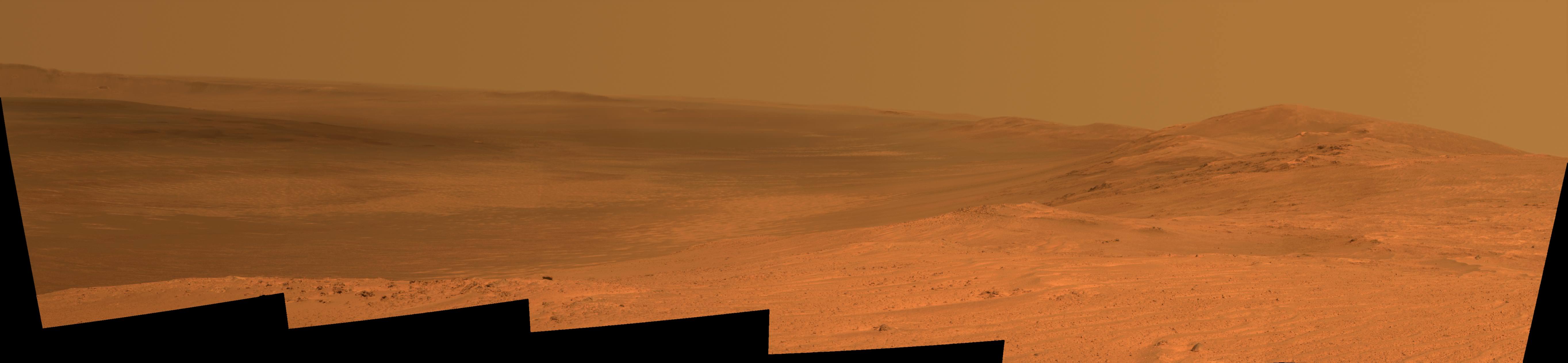
NASA’s Opportunity rover captured this panoramic mosaic on Dec. 10, 2013 (Sol 3512) near the summit of “Solander Point” on the western rim of Endeavour Crater where she starts Decade 2 on the Red Planet. She is currently investigating outcrops of potential clay minerals formed in liquid water on her 1st mountain climbing adventure. Assembled from Sol 3512 navcam raw images. Credit: NASA/JPL/Cornell/Marco Di Lorenzo/Ken Kremer-kenkremer.com
Today, May 24, marks Opportunity’s 3673nd Sol or Martian Day roving Mars – compared to a warranty of just 90 Sols.
So far she has snapped over 192,600 amazing images on the first overland expedition across the Red Planet.
Her total odometry stands at over 24.49 miles (39.41 kilometers) since touchdown on Jan. 24, 2004 at Meridiani Planum.
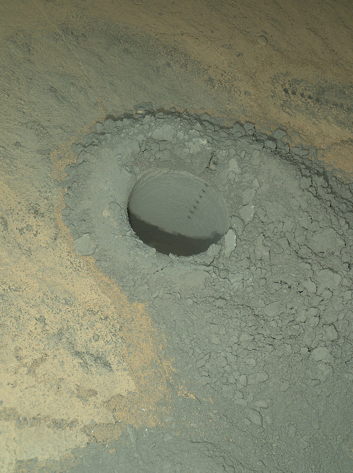
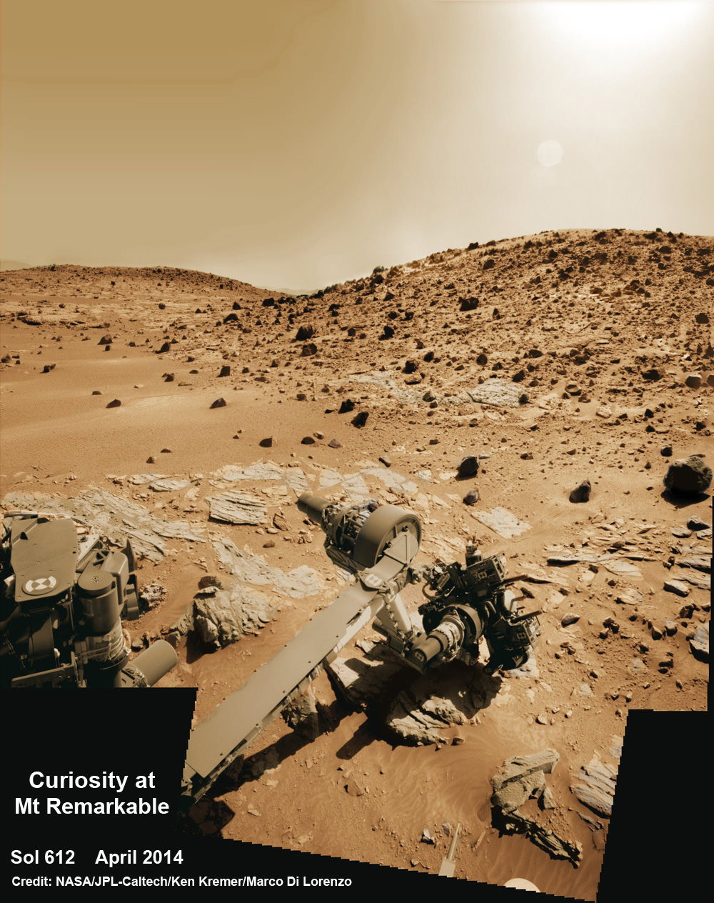
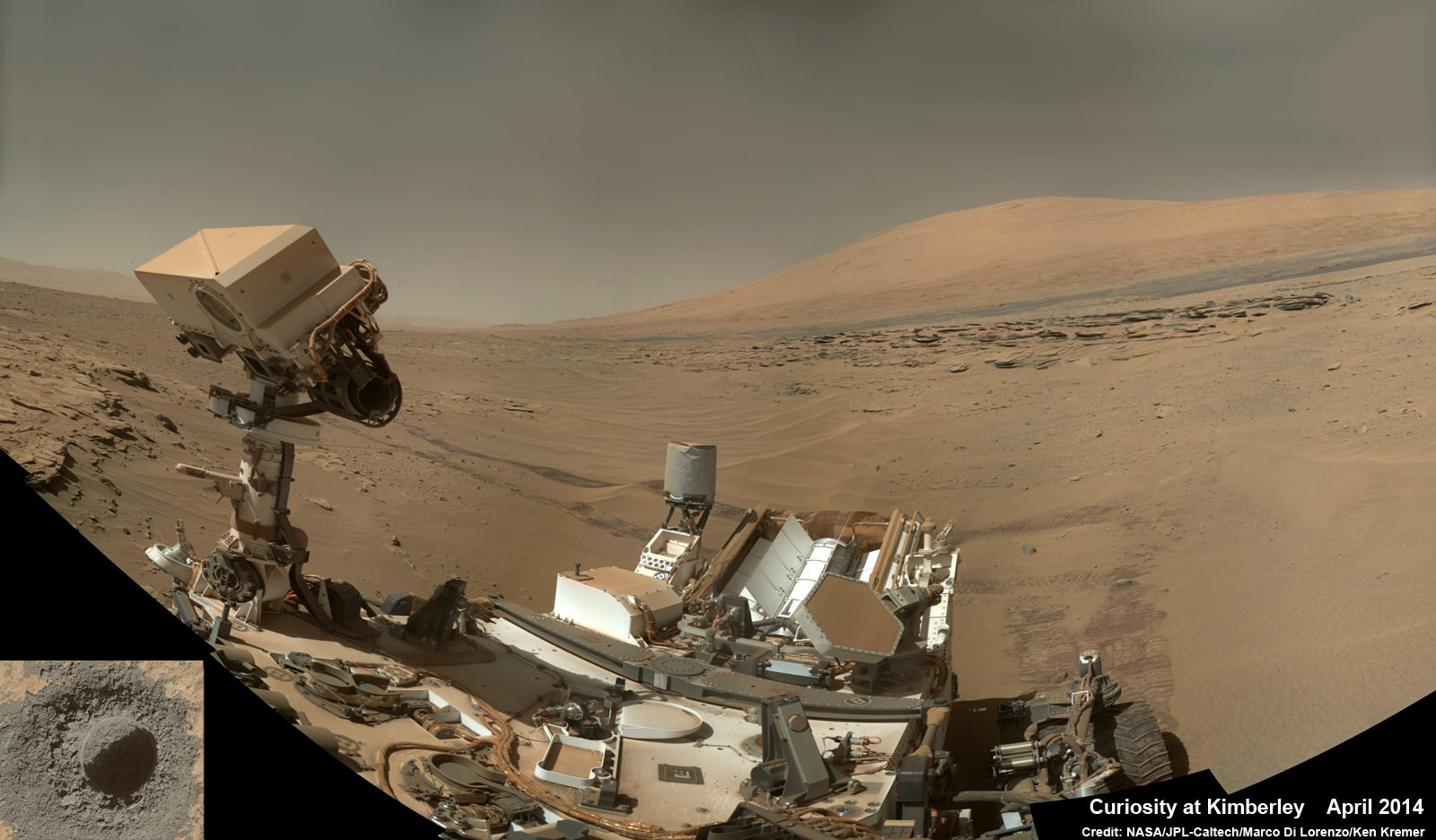
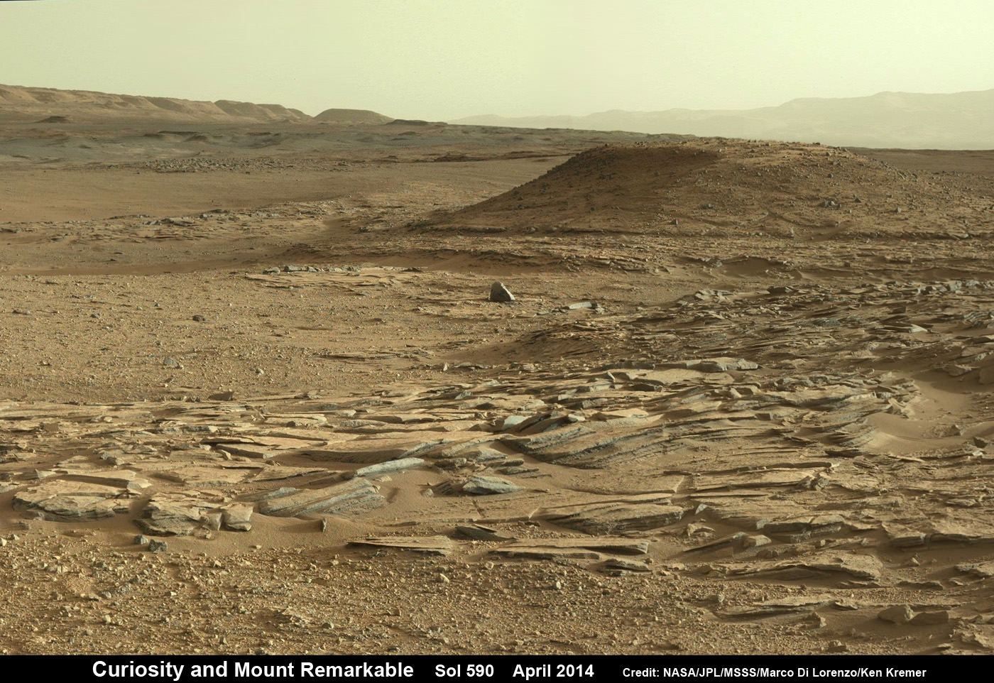
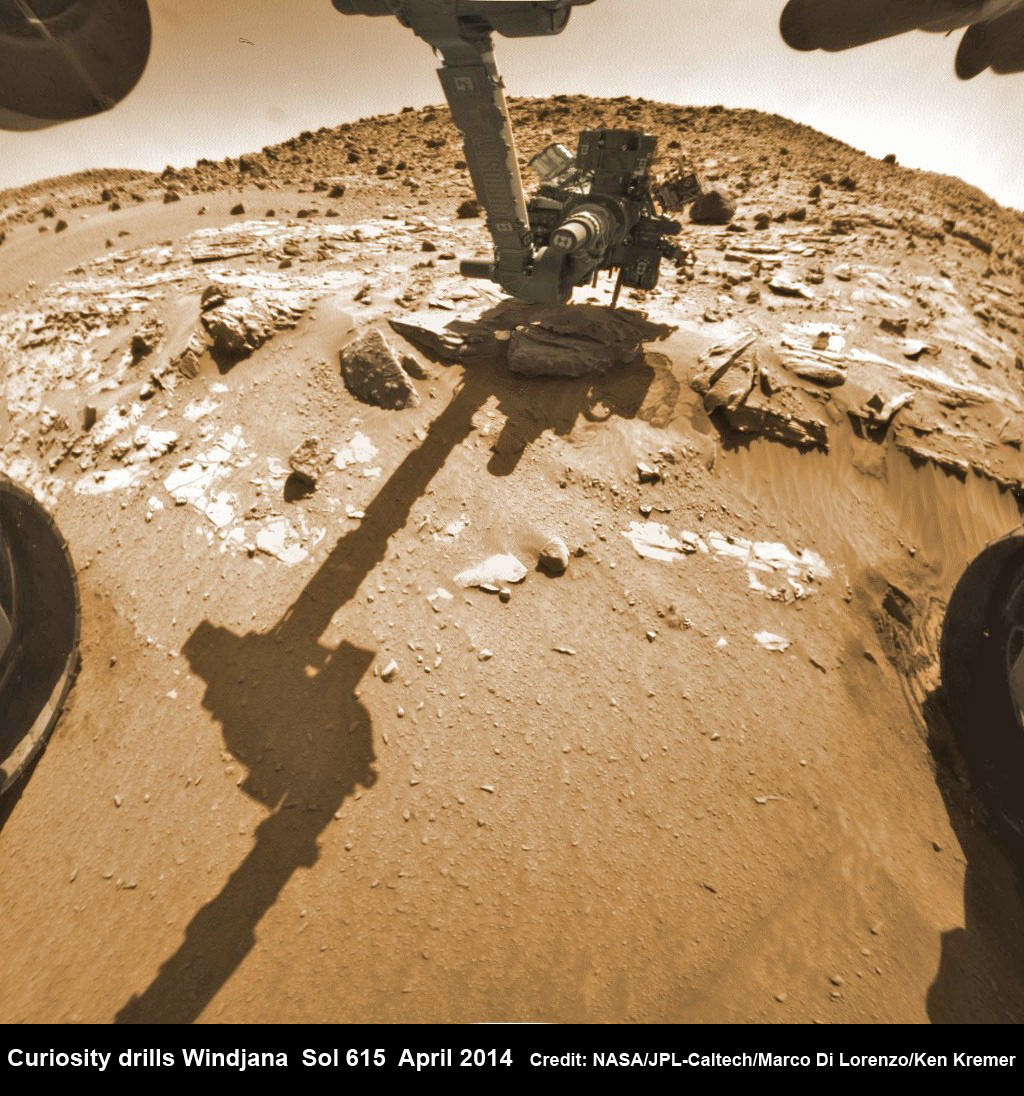
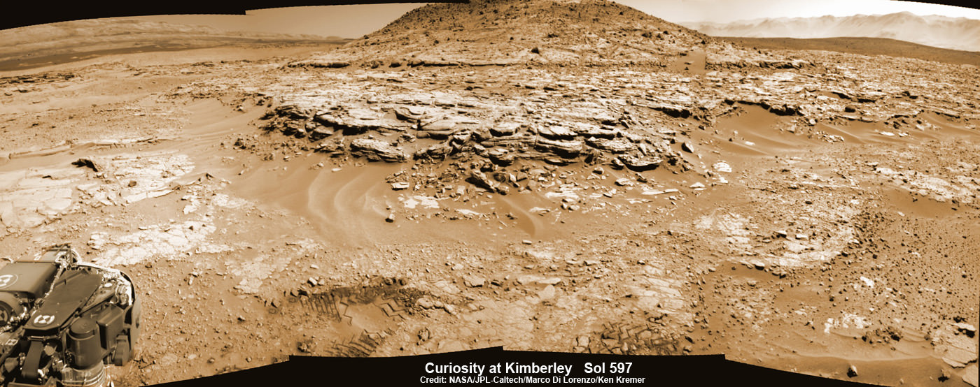
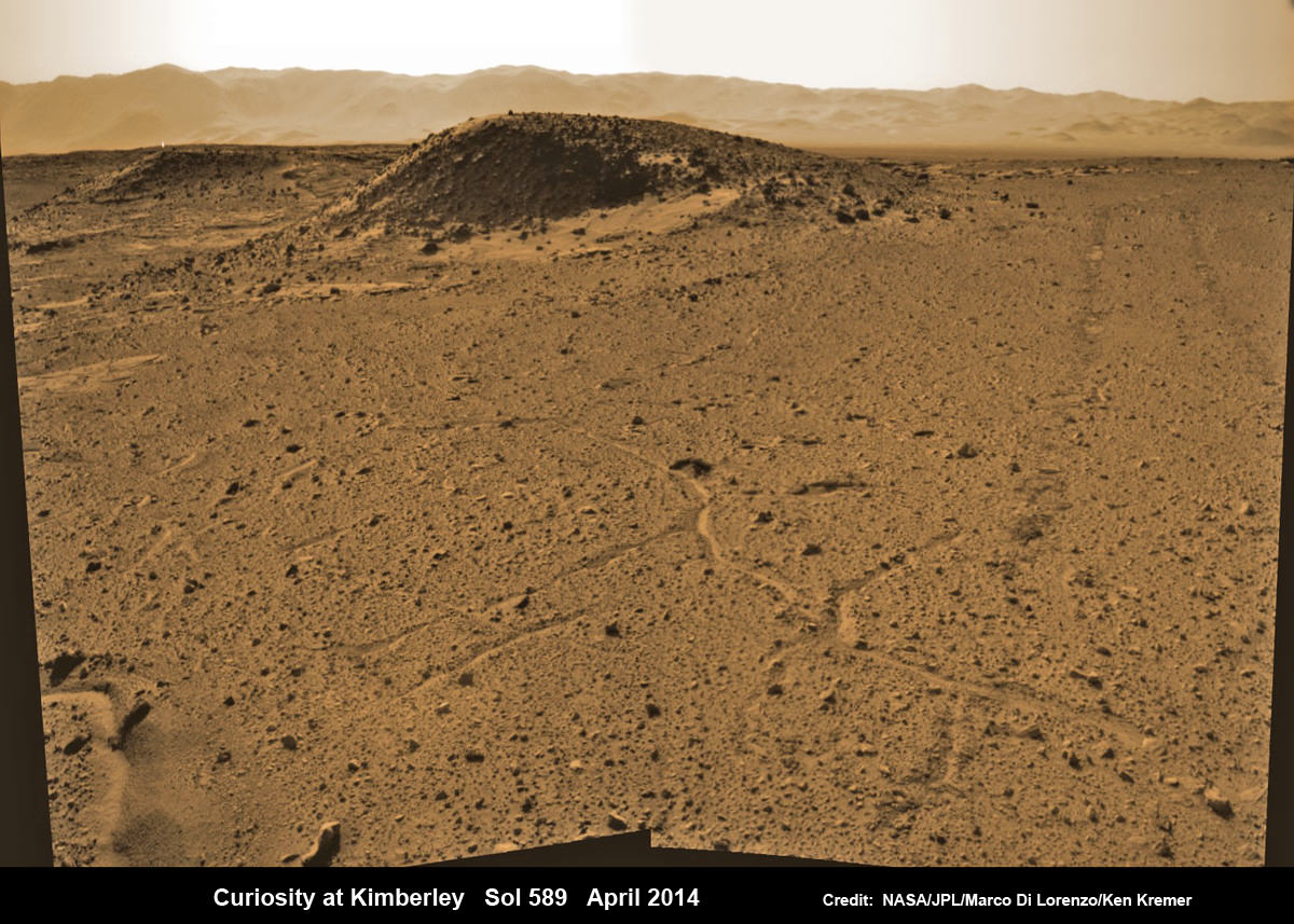
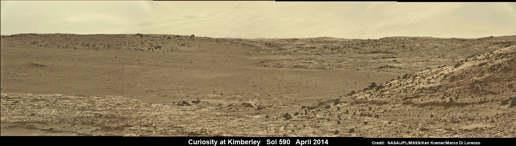
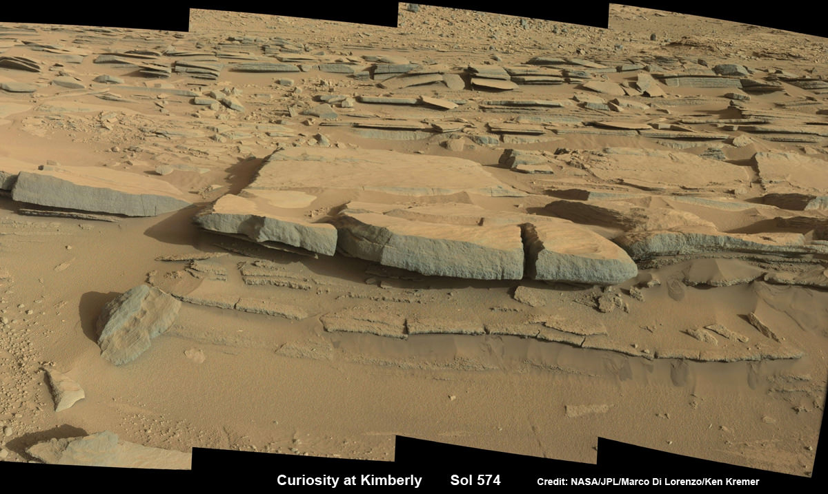
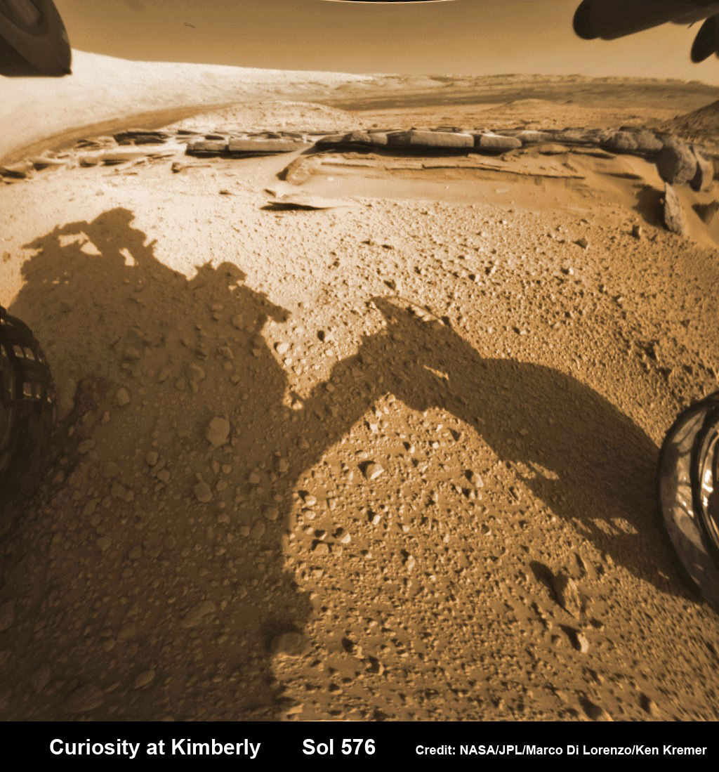
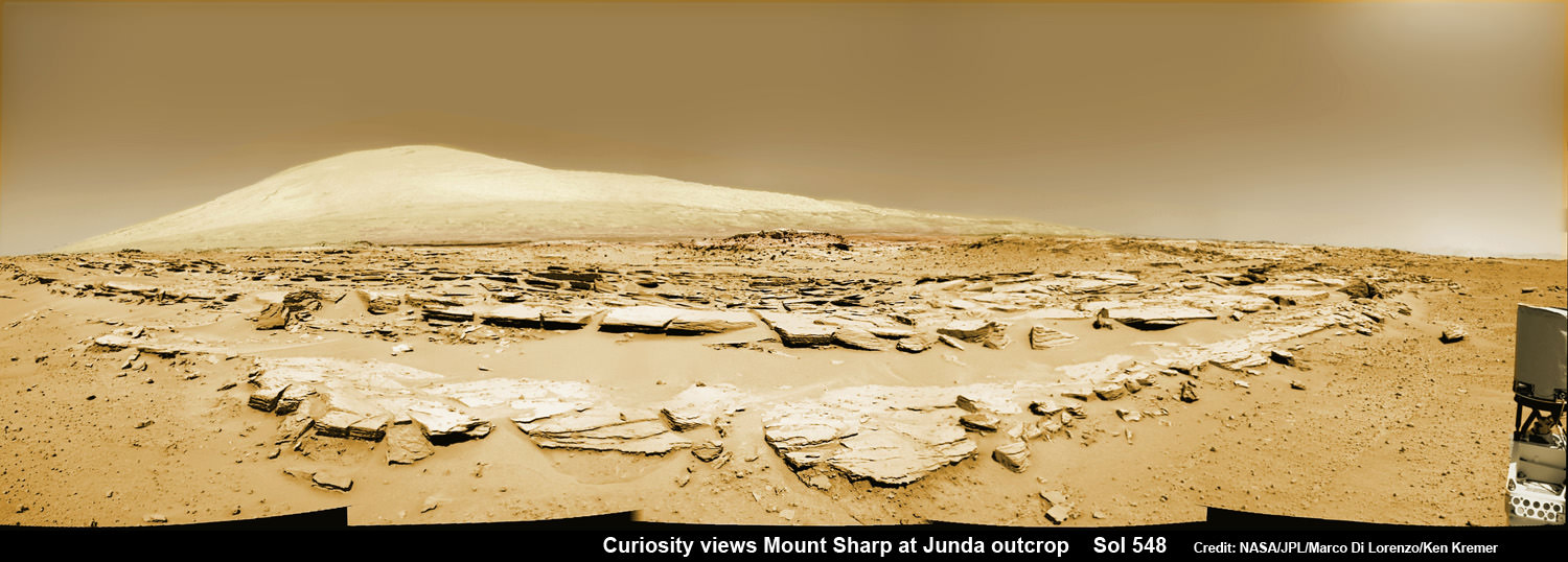
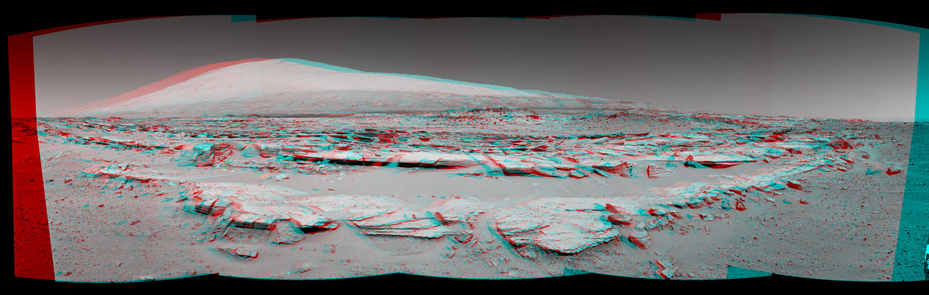
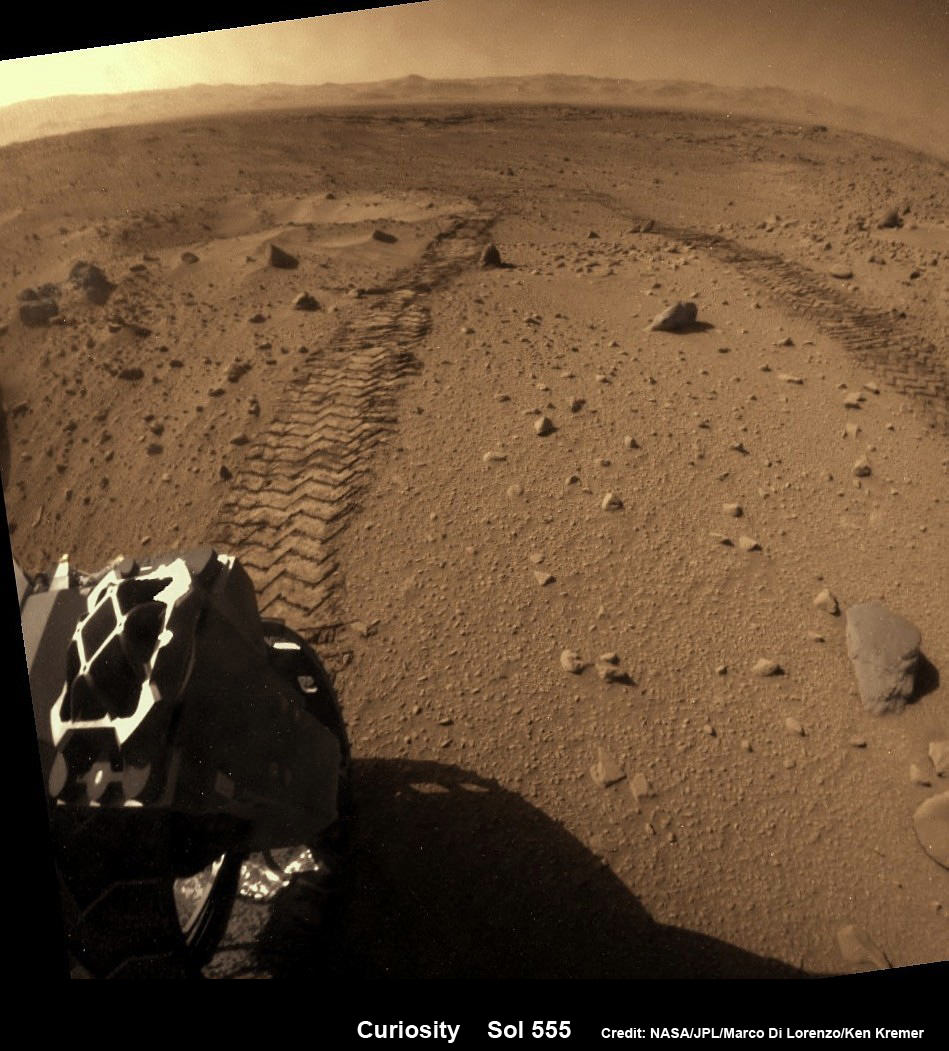
Meanwhile on the opposite side of Mars, Opportunity’s younger sister rover Curiosity is trekking towards gigantic Mount Sharp and just drilled into her 3rd Red Planet rock at Kimberley.
Stay tuned here for Ken’s continuing Curiosity, Opportunity, Orion, SpaceX, Boeing, Orbital Sciences, MAVEN, MOM, Mars and more planetary and human spaceflight news.
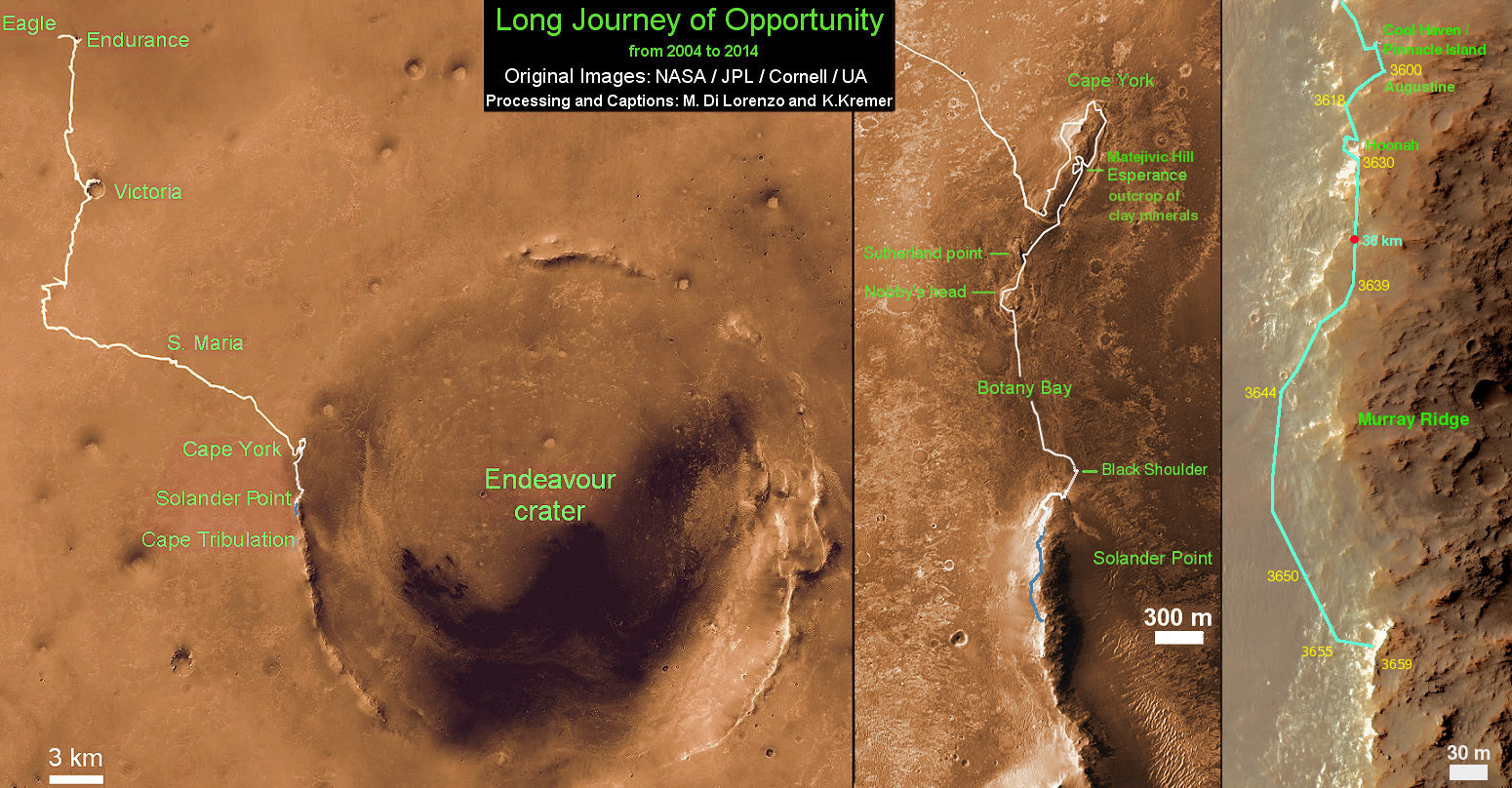
This map shows the entire path the rover has driven during a decade on Mars and over 3660 Sols, or Martian days, since landing inside Eagle Crater on Jan 24, 2004 to current location along Murray Ridge south of Solander Point summit at the western rim of Endeavour Crater and heading to clay minerals at Cape Tribulation. Opportunity discovered clay minerals at Esperance – indicative of a habitable zone. Credit: NASA/JPL/Cornell/ASU/Marco Di Lorenzo/Ken Kremer