Curiosity has zapped hundreds of Red Planet rocks with her powerful laser blaster during her lifetime and has now caught the sparks flying for the first time as they happened – as seen in new photos and video above and below released this week by NASA.
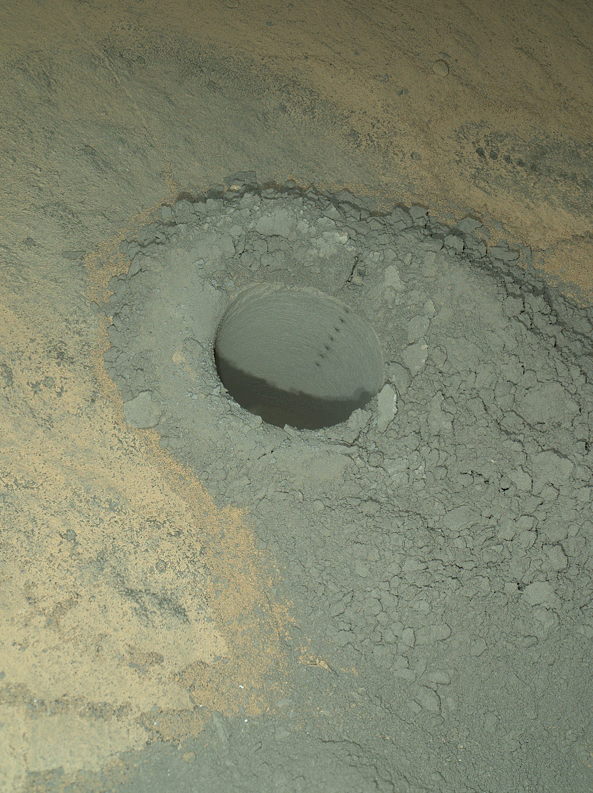
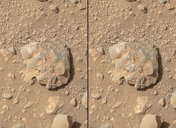
As the NASA rover’s million watt Chemistry and Camera (ChemCam) instrument fired multiple laser shots at a rock fortuitously named “Nova” the team commanded her arm-mounted Mars Hand Lens Imager (MAHLI) high resolution imaging camera to try and capture the action as it occurred, for the first time. And they succeeded.
Curiosity blasted the baseball sized “Nova” rock target over 100 times on July 12, 2014, or Sol 687.
Since the nail biting touchdown nearly two years ago on Aug. 5, 2012 inside Gale Crater, ChemCam has aimed the laser instrument at more than 600 rock or soil targets and fired more than 150,000 laser shots.
Here’s a NASA/JPL video showing the laser flash:
Video Caption: The sparks that appear on the baseball-sized rock (starting at :17) result from the laser of the ChemCam instrument on NASA’s Curiosity Mars rover hitting the rock. Credit: NASA/JPL-Caltech/MSSS
ChemCam is used to determine the composition of Martian rocks and soils at a distance of up to 25 feet (8 meters) yielding preliminary data for the scientists and engineers to decide if a target warrants up close investigation and in rare cases sampling and drilling activities.
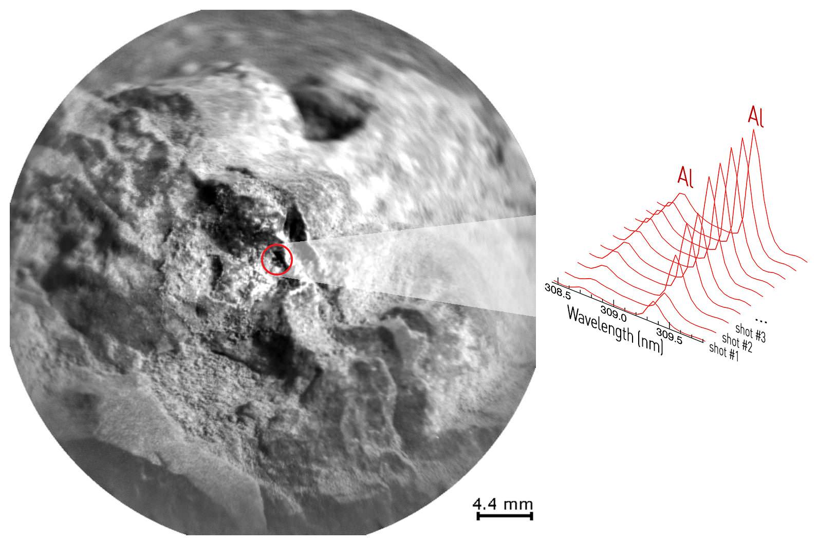
ChemCam works through a process called laser-induced breakdown spectroscopy. The laser hits a target with pulses to generate sparks, whose spectra provide information about which chemical elements are in the target.
Successive laser shots are fired in sequence to gradually blast away thin layers of material. Each shot exposes a slightly deeper layer for examination by the ChemCam spectrometer.
As Curiosity fired deeper into “Nova” it showed an increasing concentration of aluminum as the sequential laser blasts penetrated through the uninteresting dust on the rock’s surface. Silicon and sodium were also detected.
“This is so exciting! The ChemCam laser has fired more than 150,000 times on Mars, but this is the first time we see the plasma plume that is created,” said ChemCam Deputy Principal Investigator Sylvestre Maurice, at the Research Institute in Astrophysics and Planetology, of France’s National Center for Scientific Research and the University of Toulouse, France, in a statement.
“Each time the laser hits a target, the plasma light is caught and analyzed by ChemCam’s spectrometers. What the new images add is confirmation that the size and shape of the spark are what we anticipated under Martian conditions.”
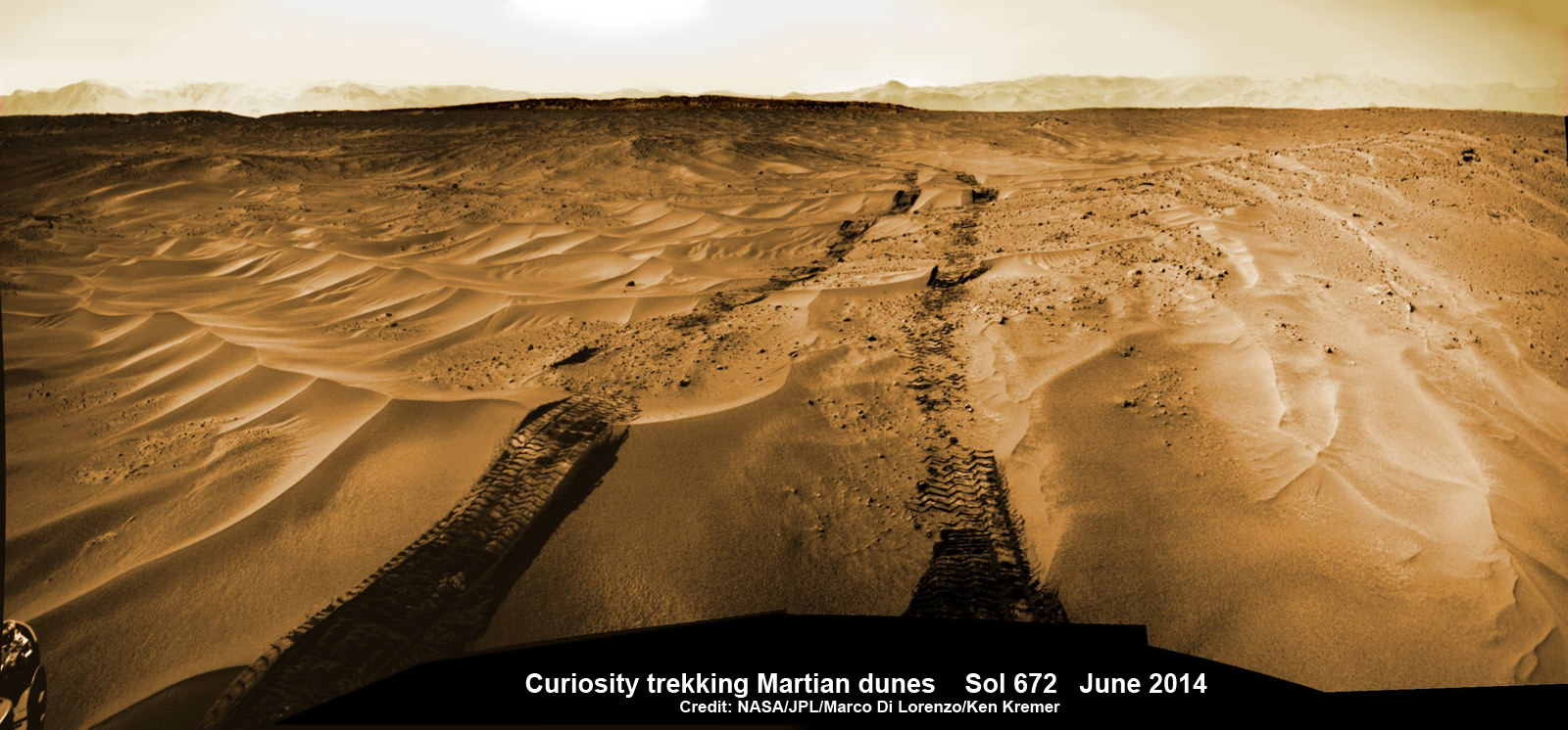
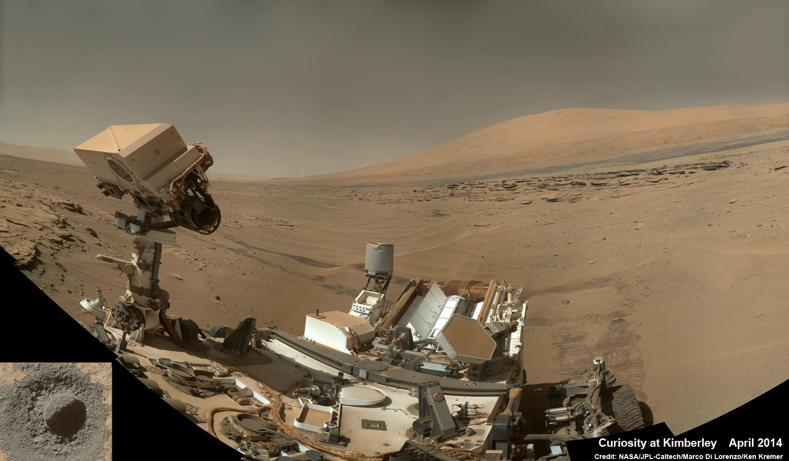
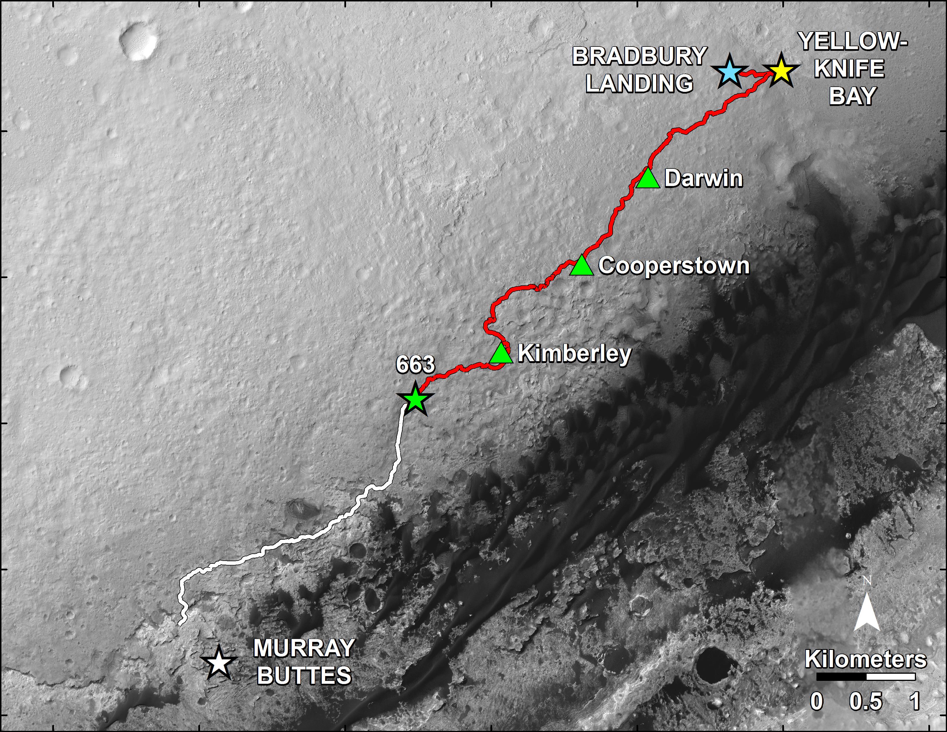
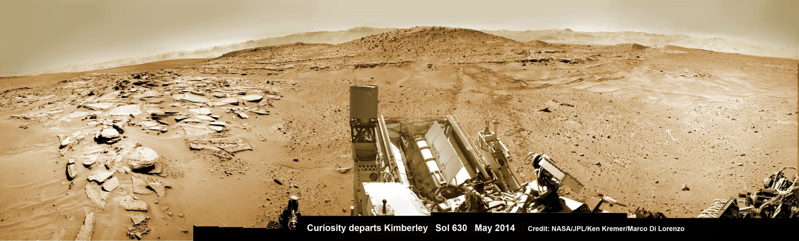
The SUZ sized rover is driving as swiftly as possible to the base of Mount Sharp which dominates the center of Gale Crater and reaches 3.4 miles (5.5 km) into the Martian sky – taller than Mount Rainier.
During Year 1 on Mars, Earth’s emissary has already accomplished her primary objective of discovering a habitable zone on the Red Planet that contains the minerals necessary to support microbial life in the ancient past when Mars was far wetter and warmer billions of years ago.
To date, Curiosity’s odometer totals over 5.1 miles (8.4 kilometers) since landing inside Gale Crater on Mars in August 2012. She has taken over 166,000 images.
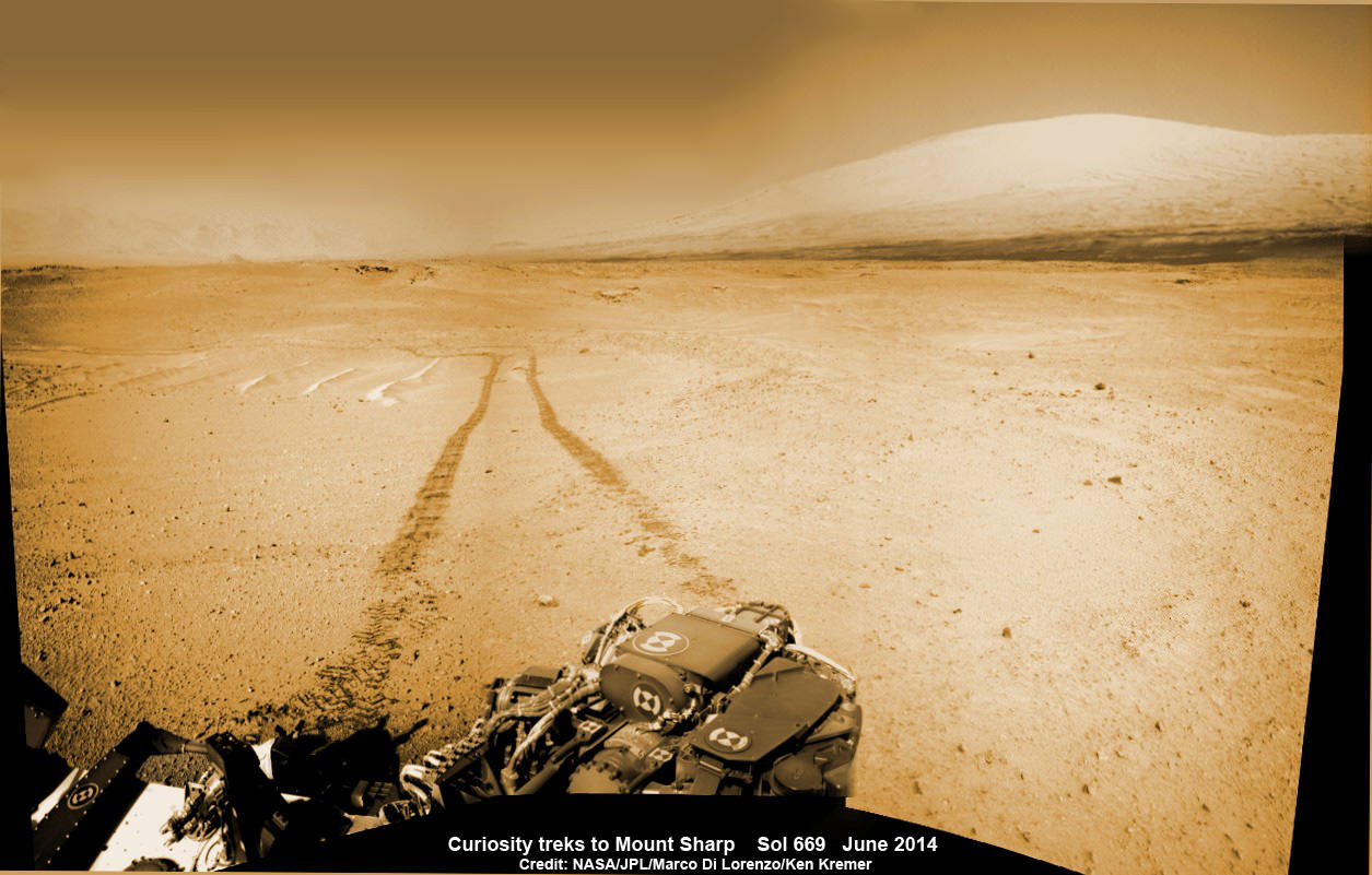
Curiosity still has about another 2.4 miles (3.9 kilometers) to go to reach the entry way at a gap in the treacherous sand dunes at the foothills of Mount Sharp sometime later this year.
Stay tuned here for Ken’s continuing Curiosity, Opportunity, Orion, SpaceX, Boeing, Orbital Sciences, commercial space, MAVEN, MOM, Mars and more planetary and human spaceflight news.