Mars Orbiter Captures Images of China’s Rover From Space

The Chinese Zhurong rover landed on Mars in May 2021.This HiRISE image, acquired on 11 March 2022, shows the rover's new location. Credit: NASA/JPL/UofA

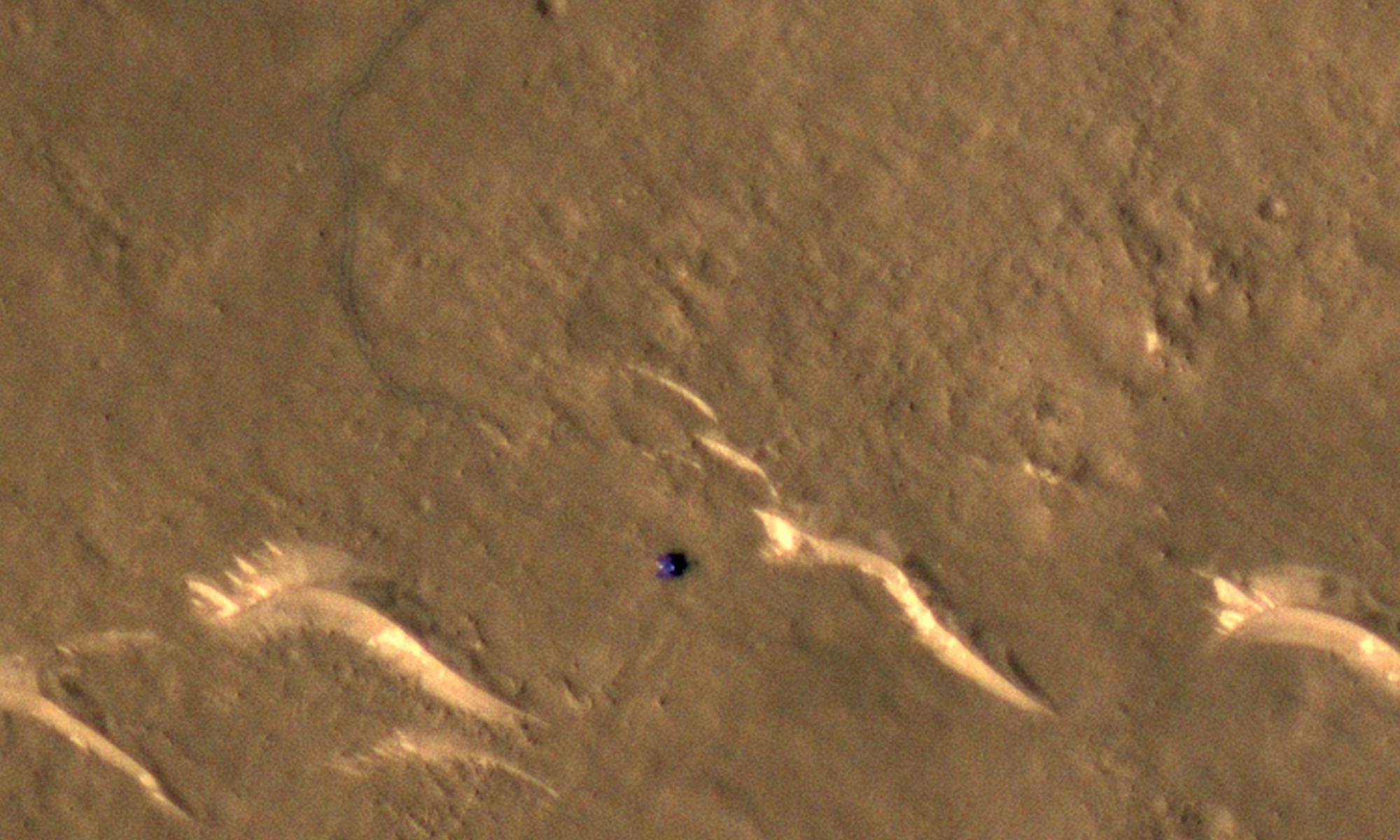
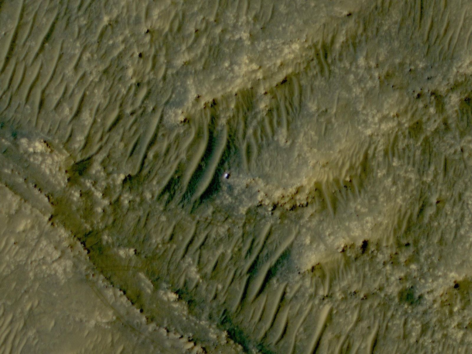
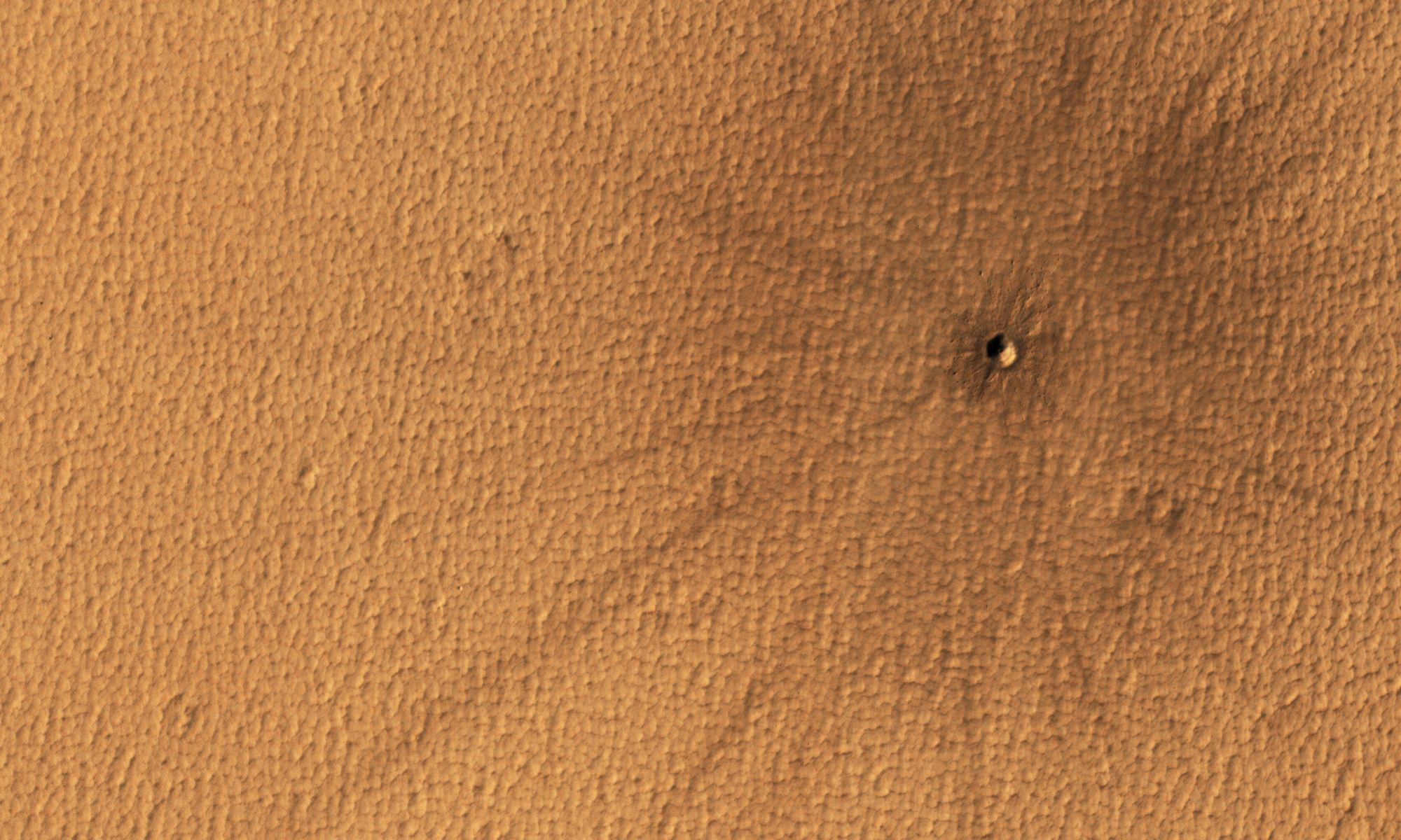
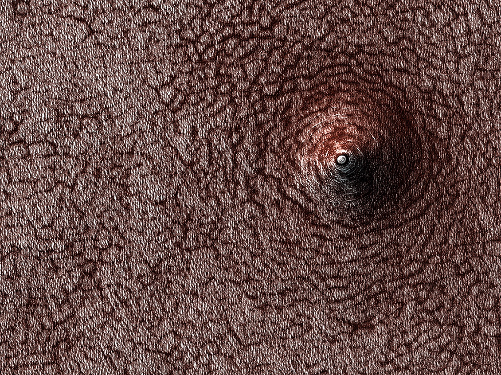
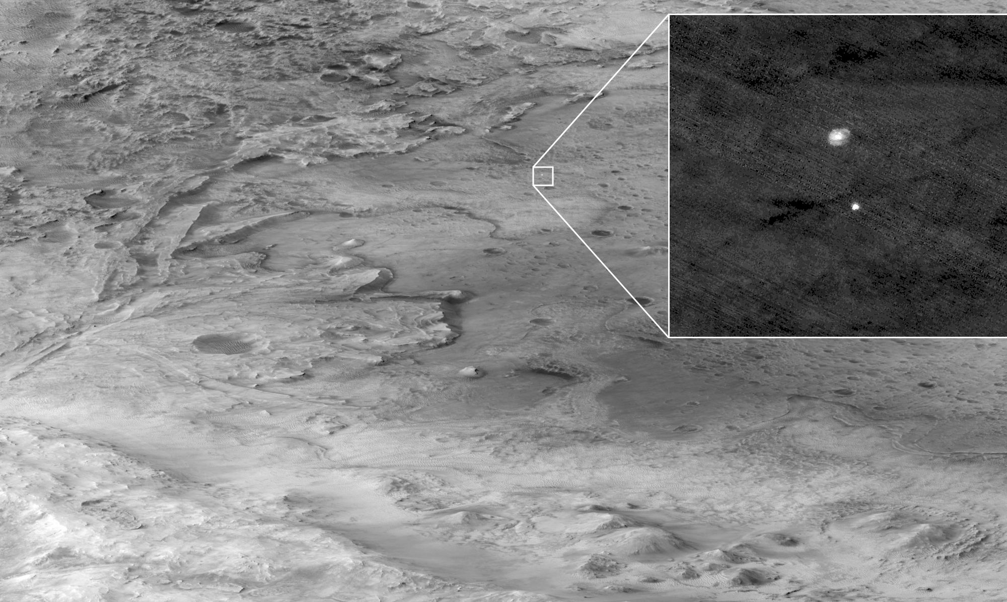
China’s Tianwen-1 lander and Zhurong rover touched down on the Martian plain Utopia Planitia on May 14, 2021 after spending about three months orbiting the Red Planet. While the Chinese Space Agency has shared images of the rover and lander (including a cute family portrait taken by a wireless remote camera), NASA’s Mars Reconnaissance Orbiter has been following the rover’s travels from above.

Continue reading “Mars Orbiter Captures Images of China’s Rover From Space”

Strange Terraces on Mars are a Clear Signal of Sedimentary Rock

Sedimentary rock in Danielson Crater on Mars. Credit: NASA/JPL/UArizona

If we’ve learned anything about Mars the past 2-3 decades from the various rovers, landers and orbiters we’ve sent to the Red Planet, it’s that the planet’s geologic history is much more complicated and diverse than what we thought.

This picture from the HiRISE (High Resolution Imaging Science Experiment) camera on the Mars Reconnaissance Orbiter shows fractured sedimentary rock inside a crater called Danielson. Sedimentary rock is a sure sign that this planet was active in the past. The fracturing, layering and terrace-like structures suggests a long-term watery history in this region.

Continue reading “Strange Terraces on Mars are a Clear Signal of Sedimentary Rock”

‘Glowing’ Sand Dune Erosion on the Side of a Martian Crater

Erosion in Kaiser Crater on Mars, as seen by the HiRISE camera on the Mars Reconnaissance Orbiter. Credit: NASA/JPL/UArizona.

While Mars is known as the Red Planet, a variety of colors can be found on the planet’s surface. Just like on Earth, the array of colors we can see in images from Mars comes from the diverse minerals on or just under the surface.

In the case of this picture, subsurface minerals show up in gullies that have eroded down the side of a a giant sand dune.   

Continue reading “‘Glowing’ Sand Dune Erosion on the Side of a Martian Crater”

Here’s Perseverance, Seen From Space

The white speck in the middle of this image is the Perseverance rover, as seen by the HiRISE camera on the Mars Reconnaissance Orbiter. Credit: NASA/JPL-Caltech/University of Arizona

The Mars Perseverance rover is on the move! The HiRISE camera on the Mars Reconnaissance Orbiter spotted the rover from above, the first view since shortly after the rover landed in February 2021. Perseverance appears as the white speck in the center of the image above, in the the “South Séítah” area of Mars’ Jezero Crater.

The HiRISE team said the rover is about 700 meters (2,300 feet) from its original landing site.

Continue reading “Here’s Perseverance, Seen From Space”

Strange Intersecting Sand Dunes on Mars

Polygonal dunes on Mars, as seen by the HiRISE camera on the Mars Reconnaissance Orbiter. Credit: NASA/JPL/UArizona

In our exploration of Mars, we’ve seen some strange but naturally occurring shapes. Polygons – a shape with at least three straight sides and angles, typically with five or more – have been seen in several different Martian landscapes, and scientists say these shapes are of great interest because they often indicate the presence of shallow ice, or that water formerly was present in these areas.

Continue reading “Strange Intersecting Sand Dunes on Mars”

This is why Martian Colonists are Going to Wish They had an Atmosphere Above Them

A small impact crater on Mars that was created within the past 5 years, seen by the HiRISE camera on the Mars Reconnaissance Orbiter. Credit: NASA/JPL/UArizona.

There will be all sorts of risks for any future colonists on Mars, such as extreme weather and temperatures, radiation, and the human physiological problems associated with living in with decreased gravity. But another issue means colonists on Mars will have to be on a constant lookout above their heads.

Continue reading “This is why Martian Colonists are Going to Wish They had an Atmosphere Above Them”

This Is a Collapsed Pit on Mars, Not a Pimple

A HiRISE image of the southern polar region of Mars shows a sunken pit on the layered surface. Credit: NASA/JPL/University of Arizona

Mars has been in the news a lot lately, and for good reason. With the historic landing of the Perseverance Rover earlier in the year, and the successful flight of Ingenuity, the first-ever aircraft to fly in another atmosphere, earlier this morning (April 19, 2021), there’s no shortage of exciting stories of technical brilliance from the human-built wonders exploring the red planet. High above the plucky helicopter, the Mars Reconnaissance Orbiter (MRO) surveys the Martian landscape on a grand scale. A brain-bending image released by High Resolution Imaging Science Experiment (HiRISE), a powerful camera aboard MRO, shows a sunken pit in the planet’s polar region. From the high-altitude perspective of the orbiter, it’s easy for the mind to warp the concave depression into a convex, acne-esque Martian polar zit!

Continue reading “This Is a Collapsed Pit on Mars, Not a Pimple”

Perseverance’s Landing … Seen From Orbit!

The Mars 2020 descent stage holding NASA’s Perseverance rover can be seen falling through the Martian atmosphere, its parachute trailing behind, in this image taken on February 18, 2021 by the HiRISE camera on the Mars Reconnaissance Orbiter. Credit: NASA/JPL/UArizona

The HiRISE camera on the Mars Reconnaissance Orbiter has done it again.

The imaging team was able to capture the Perseverance rover as it descended through the Martian atmosphere, hanging under its parachute.

Stunning.

Continue reading “Perseverance’s Landing … Seen From Orbit!”

How Old is the Ice at Mars’ North Pole?

Ice at the north pole of Mars is seen from orbit in this image captured by Mars Express in May 2014. Credit: ESA/DLR/FU Berlin/J. Cowart

On Earth, the study of ice core samples is one of many methods scientists use to reconstruct the history of our past climate change. The same is true of Mars’ northern polar ice cap, which is made up of many layers of frozen water that have accumulated over eons. The study of these layers could provide scientists with a better understanding of how the Martian climate changed over time.

This remains a challenge since the only way we are able to study the Martian polar ice caps right now is from orbit. Luckily, a team of researchers from UC Boulder was able to use data obtained by the High-Resolution Imaging Science Experiment (HiRISE) aboard the Mars Reconnaissance Orbiter (MRO) to chart how the northern polar ice caps’ evolved over the past few million years.

Continue reading “How Old is the Ice at Mars’ North Pole?”