Wow, Mars Sure Can Be Pretty

This colorful image of Martian bedrock, punctuated in the center by dunes, is courtesy of the HiRise camera aboard NASA's Mars Reconnaissance Orbiter. Image: NASA/JPL/University of Arizona

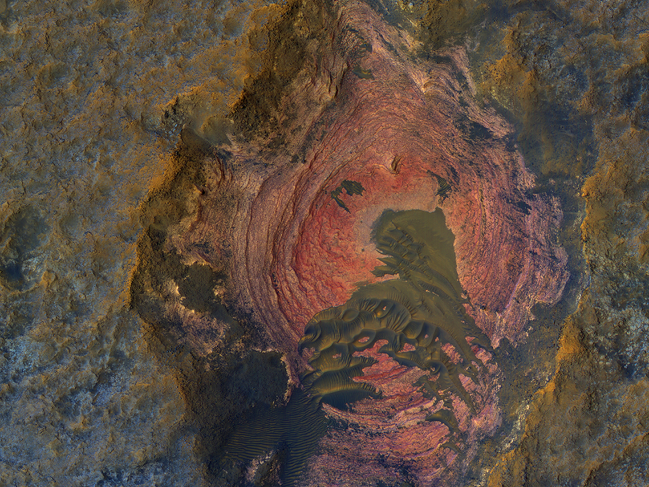
For a supposedly dead world, Mars sure provides a lot of eye candy. The High Resolution Imaging Science Experiment (HiRise) aboard NASA’s Mars Reconnaissance Orbiter (MRO) is our candy store for stunning images of Mars. Recently, HiRise gave us this stunning image (above) of colorful, layered bedrock on the surface of Mars. Notice the dunes in the center. The colors are enhanced, which makes the images more useful scientifically, but it’s still amazing.

HiRise has done it before, of course. It’s keen vision has fed us a steady stream of downright jaw-dropping images of Elon Musk’s favorite planet. Check out this image of Gale Crater taken by HiRise to celebrate its 10 year anniversary orbiting Mars. This image was captured in March 2016.

HiRise captured this image of unusual textures on the floor of the Gale Crater, the same crater where the Curiosity rover is working. Image: NASA/JPL-Caltech/Univ. of Arizona

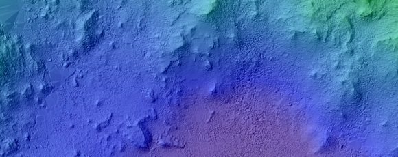
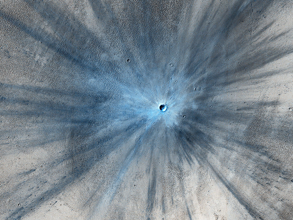
The MRO is approaching its 11 year anniversary around Mars. It has completed over 45,000 orbits and has taken over 216,000 images. The next image is of a fresh impact crater on the Martian surface that struck the planet sometime between July 2010 and May 2012. The impact was in a dusty area, and in this color-enhanced image the fresh crater looks blue because the impact removed the red dust.

This color-enhanced image of a fresh Martian crater was captured by the HiRise camera. Image: NASA/JPL-Caltech/Univ. of Arizona

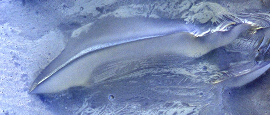
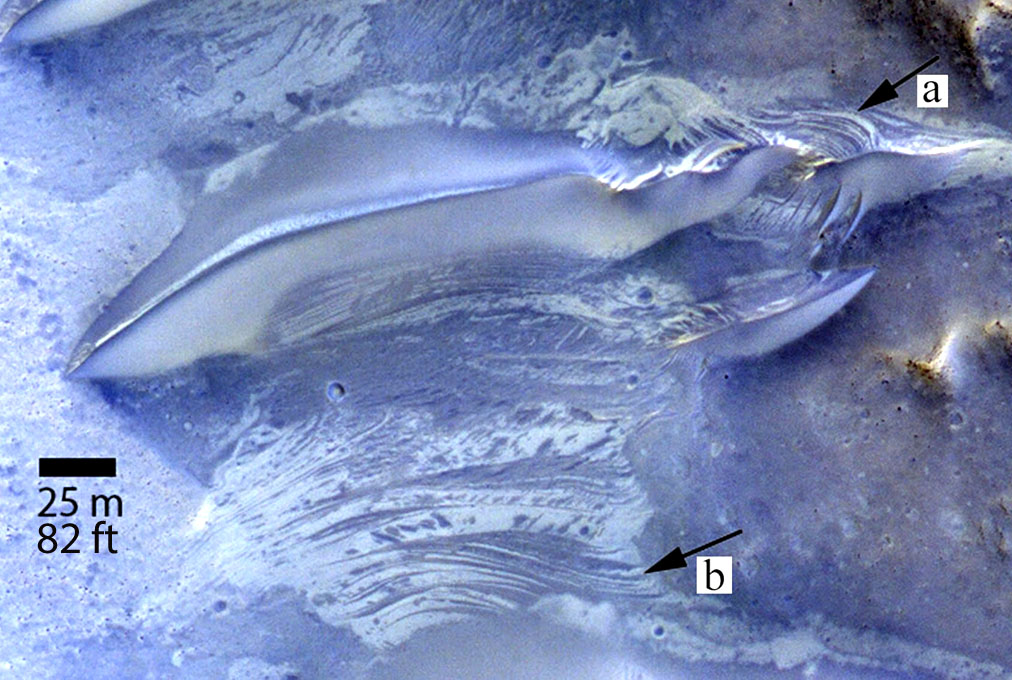
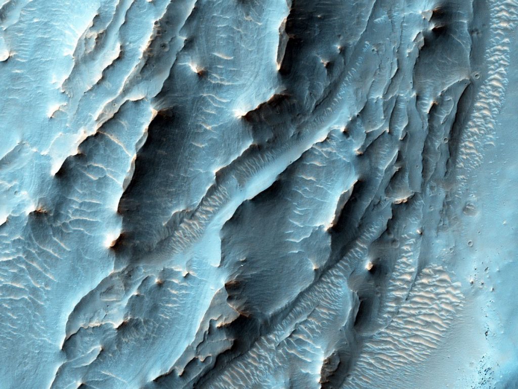
These landforms on the surface of Mars are still a bit of a mystery. It’s possible that they formed in the presence of an ancient Martian ocean, or perhaps glaciers. Whatever the case, they are mesmerizing to look at.

These odd ridges are still a mystery. Were they formed by glaciers? Oceans? Image: NASA/JPL-Caltech/Univ. of Arizona

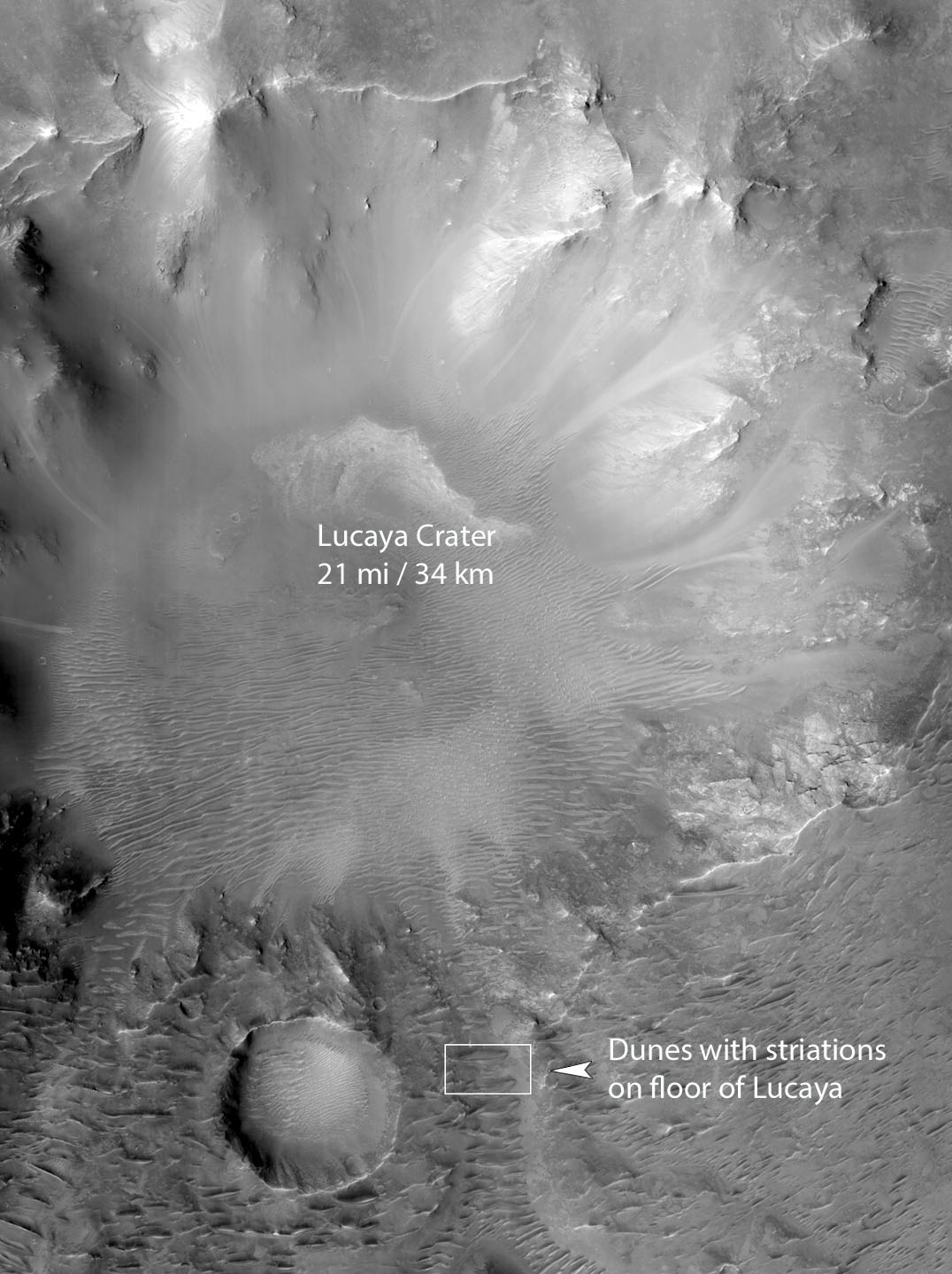
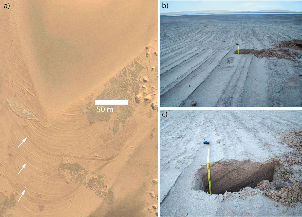
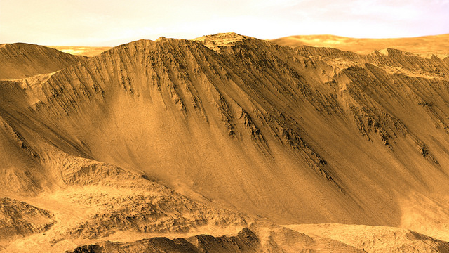
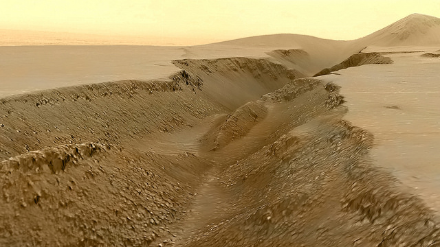
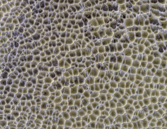
Many images of the Martian surface have confounded scientists, and some of them still do. But some, though they look puzzling and difficult to explain, have more prosaic explanations. The image below is a large area of intersecting sand dunes.

What is this? A vast area of Martian rice paddies? Lizard skin? Nope, just an area of intersecting sand dunes. Image: NASA/JPL-Caltech/Univ. of Arizona

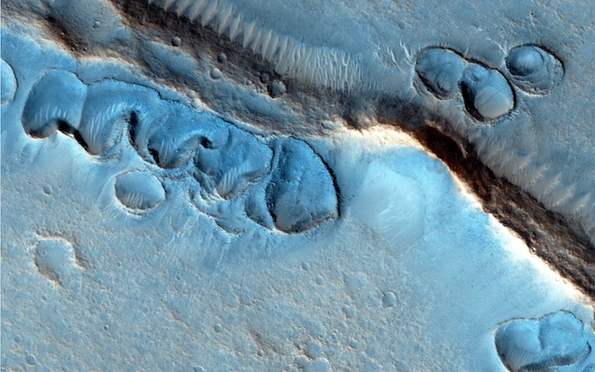
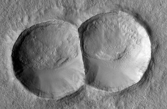
The surface of Mars is peppered with craters, and HiRise has imaged many of them. This double crater was caused by a meteorite that split in two before hitting the surface.

This double impact crater was caused by a meteorite that split into two before hitting Mars. Notice how the eroding force of the wind has shaped each crater the same, smoothing one edge and creating dunes in the same place. Image: NASA/JPL-Caltech/Univ. of Arizona

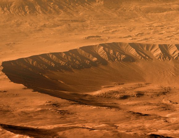
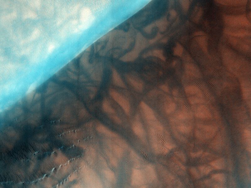
The image below shows gullies and dunes at the Russell Crater. In this image, the field of dunes is about 30 km long. This image was taken during the southern winter, when the carbon dioxide is frozen. You can see the frozen CO2 as white on the shaded side of the ridges. Scientists think that the gullies are formed when the CO2 melts in the summer.

These gullies are on the dunes of Russell Crater on Mars. This image was taken during winter, and the frozen carbon dioxide on the shaded slopes. Credit: NASA/JPL/University of Arizona

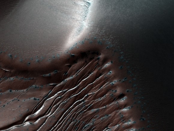
The next image is also the Russell Crater. It’s an area of study for the HiRise team, which means more Russell eye candy for us. This images shows the dunes, CO2 frost, and dust devil tracks that punctuate the area.

This image of the Russell Crater, an area of study for HiRise, shows the area covered in dunes, with some frost visible in the lower left. The larger, darker markings are dust devil tracks. Image: By NASA/JPL/University of Arizona – HiRISE, Public Domain, https://commons.wikimedia.org/w/index.php?curid=12015650

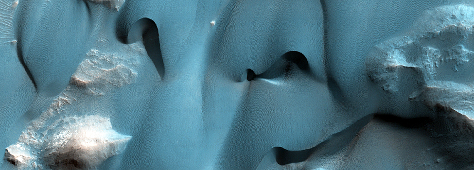
One of the main geological features on Mars is the Valles Marineris, the massive canyon system that dwarfs the Grand Canyon here on Earth. HiRise captured this image of delicate dune features inside Valles Marineris.

These delicate dune features formed inside the Valles Mariners, the massive canyon system on Mars. Image: NASA/JPL/University of Arizona

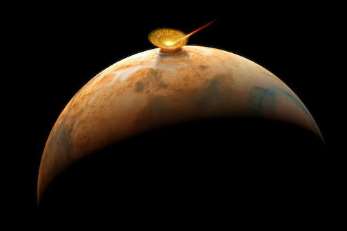
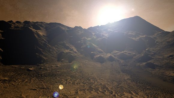
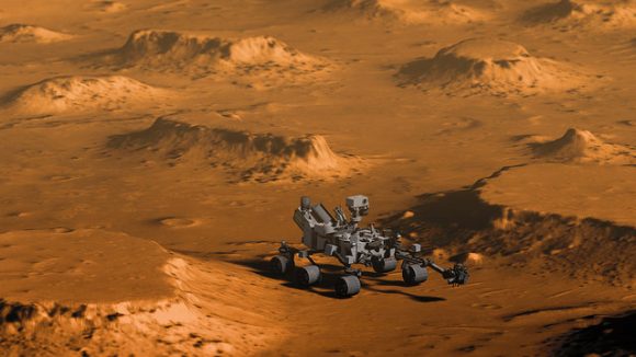
The Mars Reconnaissance Orbiter is still going strong. In fact, it continues to act as a communications relay for surface rovers. The HiRise camera is along for the ride, and if the past is any indication, it will continue to provide astounding images of Mars.

And we can’t seem to get enough of them.

A Region On Mars With Recent Water Is About To Get Major Attention

Credit: NASA/ JPL-Caltech
Striations exposed on the surface between Martian sand dunes (one pictured at top) in Lucaya Crater indicate fluctuating levels of salty groundwater. At “a” we see possible cross beds which are tilted layers of sand within larger layers deposited by wind or water. At b, dark and light strata are similar to that exposed in the dune at top and resemble the striations seen in the Namib Desert on Earth. The photo was taken by NASA’s Mars Reconnaissance Orbiter in infrared, red and blue light. Credit: NASA/JPL-Caltech

Researcher Dr. Mary Bourke from Trinity College Dublin have discovered a patch of land in an ancient valley in Mars’ Lucaya Crater that appears to have held water in the not-too-distant past, making it a prime target to search for past life forms on the Red Planet. Signs of water past and present pop up everywhere on Mars from now-dry, wriggly riverbeds snaking across arid plains to water ice exposed at the poles during the Martian summer.

A valley lined with sand dunes crosses the southern floor of the 21-mile-wide Lucaya Crater, located at latitude 11° south and longitude 52° east on Mars. Striations found between the dunes may have been created by recent water flows. The box shows the area pictured in the close up above. The 3.7-mile-long valley measures between 2,000 and 2,600 feet wide. Credit: NASA/JPL-Caltech with additions by the author

On Earth, Bourke had done previous studies of dunes in the Namib Desert near Walvis Bay, Namibia and noted “arctuate striations” — crusty arcs of sand cemented by water and minerals — on the surfaces of migrating sand dunes using photos taken by satellite. She subsequently assembled a team to check them out on the ground and discovered that the striations resulted when dune materials had been chemically cemented by salts left behind by evaporating groundwater.

“On Earth, desert dune fields are periodically flooded by water in areas of fluctuating groundwater, and where lakes, rivers and coasts are found in proximity,” said Bourke. These periodic floods leave tell-tale patterns behind them.” Once the material had been cemented, it hardens and remains behind as the dunes continue to migrate downwind.

Compare these cemented arctuate striations between dunes near Walvis Bay, Namibia with those in Lucaya Crater’s valley in the earlier image. White arrows highlight particularly prominent examples. Photos in (b) and (c) were taken from the ground. The excavated pit in (c) shows that the dipping sediment layers below the surface match the protruding layers on the surface. Alternating light and dark layers have different salt composition and grain size. Credit: Google Earth (left) and Dr Mary Bourke, Trinity College Dublin

Next, Bourke and colleague Prof. Heather Viles, from the University of Oxford, examined close up images of Mars taken with the Mars Reconnaissance Orbiter (MRO) and experienced a flash of insight: “You can imagine our excitement when we scanned satellite images of an area on Mars and saw this same patterned calling card, suggesting that water had been present in the relatively recent past.”

Bourke examined similar arcuate striations exposed on the surface between dunes, indications of fluctuating levels of salty groundwater during a time when dunes were actively migrating down the valley.

A possible scenario: an asteroid impacts Mars, forming Lucaya Crater and unleashing water flows that created the crater valley and striations.

So where did the water come from to create the striations in the crater valley? Bourke and Viles propose that water may have been released by the impact that formed Lucaya Crater especially if the target area was rich in ice.

Extreme temperatures during the impact would have vaporized water but also possibly melted other ice to flow for a time as liquid water. Alternatively, the impact may have jump-started hydrothermal activity as hot springs-style underground flows.

Flowing water would have created the valley and saturated the soils there with salty water. In dry periods, erosion from the wind would have picked away the water-eroded sands to create the striking pattern of repeating dunes we see to this day.

Water, water everywhere … once upon a time. Nanedi Valles, a roughly 500-mile-long (800 km) valley extending southwest-northeast and photographed by Mars Express. In this view, Nanedi Valles ranges from approximately 0.5 – 3 miles (0.8- to 5.0 km) wide and extends to a maximum of about 1,640 feet (500 meters) below the surrounding plains. The valley’s origins remain unclear, with scientists debating whether erosion caused by ground-water outflow, flow of liquid beneath an ice cover or collapse of the surface in association with liquid flow is responsible. In all cases, it’s clear that water was involved. Copyright ESA/DLR/FU Berlin (G. Neukum)

Carbonate rocks, which require liquid water to form are dissolved by the same, have been detected in the valley using spectroscopy and could have served as the cement to solidify sands between the moving dunes. That in concert with alternating dry and wet periods would create the striations seen in the MRO photos.

“These findings are hugely significant,” said Bourke. “Firstly, the Martian sand dunes show evidence that water may have been active near Mars’ equator — potentially in the not-too-distant past. And secondly, this location is now a potential geological target for detecting past life forms on the Red Planet, which is important to those involved in selecting sites for future missions.”

Get Away From It All with these Amazing DTM Views of Mars

The rim of Tooting Crater on Mars, rendered from HiRISE data using Autodesk Maya and Adobe Photoshop. Credit: NASA/JPL/University of Arizona/USGS/image editing by Kevin Gill.

By day, Kevin Gill is a software engineer at the Jet Propulsion Laboratory. But on nights and weekends he takes data from spacecraft and turns them into scenes that can transport you directly to the surface of Mars.

Gill is one of many so-called “amateur” image editing enthusiasts that take real, high-resolution data from spacecraft and create views that can make you feel like you are standing on the surface of Mars, or out flying around the Solar System.

Gasa Crater on Mars. Rendered using Autodesk Maya and Adobe Photoshop. HiRISE data processed using HiView and gdal. Credit: NASA/JPL/University of Arizona/USGS/image editing by Kevin Gill.

Some of the best data around for these purposes come from the HiRISE camera on board the Mars Reconnaissance Orbiter. Data known as Digital Terrain Model (DTM) files, the HiRISE DTMs are made from two or more images of the same area of a region on Mars, taken from different angles. This data isn’t just for making stunning images or amazing movies. For scientists, DTMs are very powerful research tools, used to take measurements such a elevation information and model geological processes.

So, just how do you go from this DTM image from HiRISE:

DTM image of the Central Peak of Elorza Crater on Mars. Credit: NASA/JPL/University of Arizona/USGS

To this amazing image?

Martian sunrise over the Central Peak of Elorza Crater. Rendered using Autodesk Maya and Adobe Photoshop. HiRISE data processed using HiView and gdal. Credit: NASA/JPL/University of Arizona/USGS/image editing by Kevin Gill

I’m going to let Kevin explain it:

To prep the data, I use Photoshop (to convert the JP2 file to a TIFF), and then standard GIS tools like gdal (Geospatial Data Abstraction Library) to create textures for 3D modeling. Using Autodesk Maya, I input those into a material as a color texture (orthoimagery) or displacement map (the DTM data).

I connect that material to a NURBS plane (sort of like a polygon mesh) that is scaled similarly to the physical properties of the data. I set up a camera at a nice angle (it takes a number of low-resolution test renders to get an angle I like) and let it render.

Then I just pull that render into Photoshop where I have a series of monochromatic color tints which gives the image it’s Martian feel. For the sky, I use either a sky from a MSL MastCam image or one that I took outside with my cell phone. If I’m using a sky I took with my cell phone, I’ll adjust the colors to make it look more like it would on Mars. If the colors in the image are still boring at this point, I may run a HDR adjustment on it in Photoshop.

Fissure in the Cerberus region. This false color view of a volcanic fissure in the Cerberus region of Mars was created using a digital terrain model (DTM) from the High Resolution Imaging Science Experiment (HiRISE) camera aboard NASA’s Mars Reconnaissance Orbiter. The horizon was taken from Curiosity Mastcam imagery. Credit: NASA/JPL-Caltech/University of Arizona/ image editing by Kevin Gill.

What all this means is that you can create all these amazing view, plus incredible flyover videos, like this one Kevin put together of Endeavour Crater:

Or you can have some fun and visualize where the Curiosity rover is sitting:

Doin’ Science with Curiosity. Created using HiRIST DTM and Ortho data and NASA model of Curiosity. Rendered using Autodesk Maya and Adobe Photoshop. Curiosity Model: Brian Kumanchik, NASA/JPL-Caltech. Image editing by Kevin Gill.

We’ve written about this type of image editing previously, with the work of the people at UnmannedSpaceflight.com and others. Of course, the image editing software keeps improving, along with all the techniques.

Kevin also wanted to point out the work of other image editing enthusiast, Sean Doran.

“Sean’s work is resulting in views similar to mine,” Kevin said via email. “I know he’s using a process very different from mine, but we are thinking along the same lines in what we want out of the end product. His are quite impressive.”

For example, here is a flyover video of the Opportunity rover sitting along the rim of Endeavour Crater:

You can see more of Sean’s work on his Flickr page

And you can see all of Kevin’s Mars DTM images at his Flick page here. Kevin also recently wrote up a great explanation of his image editing for The Planetary Society, which you can read here.

Thanks to Kevin Gill for sharing his images and expertise!