Just Like Earth, Titan Has a “Sea Level” for its Lakes and Seas

Ligeia Mare, shown in here in data obtained by NASA's Cassini spacecraft, is the second largest known body of liquid on Saturn's moon Titan. It is filled with liquid hydrocarbons, such as ethane and methane, and is one of the many seas and lakes that bejewel Titan's north polar region. Credit: NASA/JPL-Caltech/ASI/Cornell

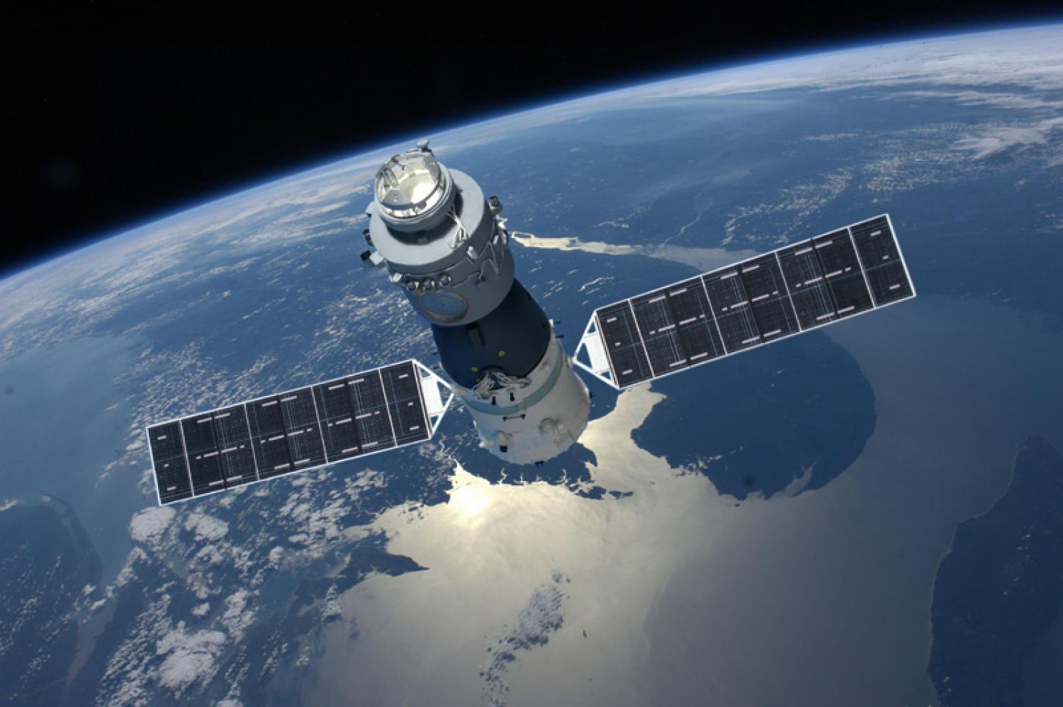
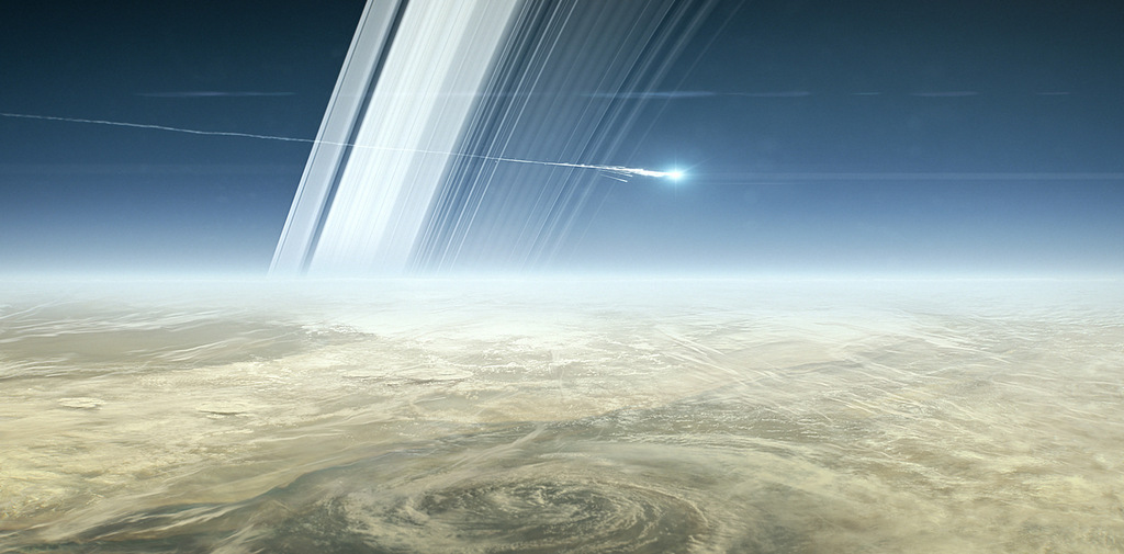
Thanks to the Cassini mission, we have learned some truly amazing things about Saturn and its largest moon, Titan. This includes information on its dense atmosphere, its geological features, its methane lakes, methane cycle, and organic chemistry. And even though Cassini recently ended its mission by crashing into Saturn’s atmosphere, scientists are still pouring over all of the data it obtained during its 13 years in the Saturn system.

And now, using Cassini data, two teams led by researchers from Cornell University have released two new studies that reveal even more interesting things about Titan. In one, the team created a complete topographic map of Titan using Cassini’s entire data set. In the second, the team revealed that Titan’s seas have a common elevation, much like how we have a “sea level” here on Earth.

The two studies recently appeared in the Geophysical Research Letters, titled “Titan’s Topography and Shape at the End of the Cassini Mission” and “Topographic Constraints on the Evolution and Connectivity of Titan’s Lacustrine Basins“. The studies were led by Professor Paul Corlies and Assistant Professor Alex Hayes of Cornell University, respectively, and included members from The Johns Hopkins University Applied Physics Laboratory, NASA’s Jet Propulsion Laboratory, the US Geological Survey (USGS), Stanford University, and the Sapienza Universita di Roma.

This true-color image of Titan, taken by the Cassini spacecraft, shows the moon's thick, hazy atmosphere. Image: By NASA - http://photojournal.jpl.nasa.gov/catalog/PIA14602, Public Domain, https://commons.wikimedia.org/w/index.php?curid=44822294
This true-color image of Titan, taken by the Cassini spacecraft, shows the moon’s thick, hazy atmosphere. Credit: NASA

In the first paper, the authors described how topographic data from multiple sources was combined to create a global map of Titan. Since only about 9% of Titan was observed with high-resolution topography (and 25-30% in lower resolution) the remainder of the moon was mapped with an interpolation algorithm. Combined with a global minimization process, this reduced errors that would arise from such things as spacecraft location.

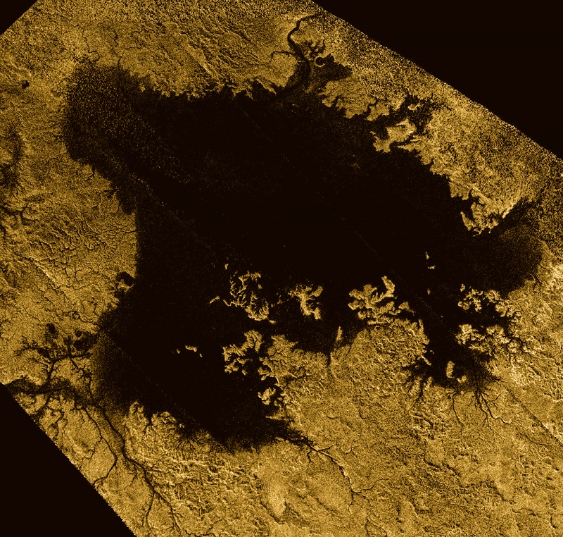
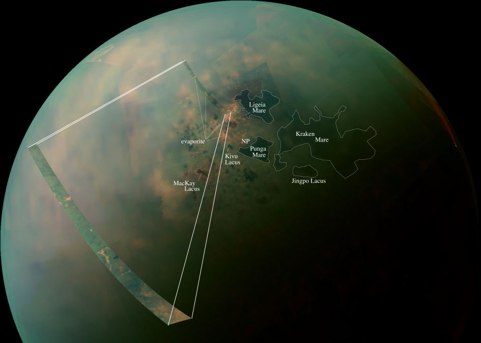
The map revealed new features on Titan, as well as a global view of the highs and lows of the moon’s topography. For instance, the maps showed several new mountains which reach a maximum elevation of 700 meters (about 3000 ft). Using the map, scientists were also able to confirm that two locations in the equatorial regions are depressions that could be the result of ancient seas that have since dried up or cryovolcanic flows.

The map also suggests that Titan may be more oblate than previously thought, which could mean that the crust varies in thickness. The data set is available online, and the map which the team created from it is already proving its worth to the scientific community. As Professor Corlies explained in a Cornell press release:

“The main point of the work was to create a map for use by the scientific community… We’re measuring the elevation of a liquid surface on another body 10 astronomical units away from the sun to an accuracy of roughly 40 centimeters. Because we have such amazing accuracy we were able to see that between these two seas the elevation varied smoothly about 11 meters, relative to the center of mass of Titan, consistent with the expected change in the gravitational potential. We are measuring Titan’s geoid. This is the shape that the surface would take under the influence of gravity and rotation alone, which is the same shape that dominates Earth’s oceans.”

False-color mosaic of Titan’s northern lakes, made from infrared data collected by NASA’s Cassini spacecraft. Credit: NASA

Looking ahead, this map will play an important role when it comes tr scientists seeking to model Titan’s climate, study its shape and gravity, and its surface morphology. In addition, it will be especially helpful for those looking to test interior models of Titan, which is fundamental to determining if the moon could harbor life. Much like Europa and Enceladus, it is believed that Titan has a liquid water ocean and hydrothermal vents at its core-mantle boundary.

The second study, which also employed the new topographical map, was based on Cassini radar data that was obtained up to just a few months before the spacecraft burned up in Saturn’s atmosphere. Using this data, Assistant Professor Hayes and his team determined that Titan’s seas follow a constant elevation relative to Titan’s gravitational pull. Basically, they found that Titan has a sea level, much like Earth. As Hayes explained:

“We’re measuring the elevation of a liquid surface on another body 10 astronomical units away from the sun to an accuracy of roughly 40 centimeters. Because we have such amazing accuracy we were able to see that between these two seas the elevation varied smoothly about 11 meters, relative to the center of mass of Titan, consistent with the expected change in the gravitational potential. We are measuring Titan’s geoid. This is the shape that the surface would take under the influence of gravity and rotation alone, which is the same shape that dominates Earth’s oceans.”

This common elevation is important because liquid bodies on Titan appear to be connected by something resembling an aquifer system. Much like how water flows underground through porous rock and gravel on Earth, hydrocarbons do the same thing under Titan’s icy surface. This ensures that there is transference between large bodies of water, and that they share a common sea level.

Artist concept of Cassini’s last moments at Saturn. Credit: NASA/JPL.

“We don’t see any empty lakes that are below the local filled lakes because, if they did go below that level, they would be filled themselves,”  said Hayes. “This suggests that there’s flow in the subsurface and that they are communicating with each other. It’s also telling us that there is liquid hydrocarbon stored on the subsurface of Titan.”

Meanwhile, smaller lakes on Titan appear at elevations several hundred meters above Titan’s sea level. This is not dissimilar to what happens on Earth, where large lakes are often found at higher elevations. These are known as “Alpine Lakes”, and some well-known examples include Lake Titicaca in the Andes, Lakes Geneva in the Alps, and Paradise Lake in the Rockies.

Last, but not least, the study also revealed the vast majority of Titan’s lakes are found within sharp-edged depressions that are surrounded by high ridges, some of which are hundreds of meters high. Here too, there is a resemblance to features on Earth – such as the Florida Everglades – where underlying material dissolves and causes the surface to collapse, forming holes in the ground.

The shape of these lakes indicate that they may be expanding at a constant rate, a process known as uniform scarp retreat. In fact, the largest lake in the south – Ontario Lacus – resembles a series of smaller empty lakes that have coalesced to form a single feature. This process is apparently due to seasonal change, where autumn in the southern hemisphere leads to more evaporation.

While the Cassini mission is no longer exploring the Saturn system, the data it accumulated during its multi-year mission is still bearing fruit. Between these latest studies, and the many more that will follow, scientists are likely to reveal a great deal more about this mysterious moon and the forces that shape it!

Further Reading: NASA, Cornell University, Geophysical Research Letters

Astronomers Set the Limit for Just How Massive Neutron Stars Can Be

Artist's illustration of two merging neutron stars. The narrow beams represent the gamma-ray burst while the rippling spacetime grid indicates the isotropic gravitational waves that characterize the merger. Swirling clouds of material ejected from the merging stars are a possible source of the light that was seen at lower energies. Credit: National Science Foundation/LIGO/Sonoma State University/A. Simonnet

In February of 2016, scientists working at the Laser Interferometer Gravitational-Wave Observatory (LIGO) made history when they announced the first-ever detection of gravitational waves. Since that time, the study of gravitational waves has advanced considerably and opened new possibilities into the study of the Universe and the laws which govern it.

For example, a team from the University of Frankurt am Main recently showed how gravitational waves could be used to determine how massive neutron stars can get before collapsing into black holes. This has remained a mystery since neutron stars were first discovered in the 1960s. And with an upper mass limit now established, scientists will be able to develop a better understanding of how matter behaves under extreme conditions.

The study which describes their findings recently appeared in the scientific journal The Astrophysical Journal Letters under the title “Using Gravitational-wave Observations and Quasi-universal Relations to Constrain the Maximum Mass of Neutron Stars“. The study was led by Luciano Rezzolla, the Chair of Theoretical Astrophysics and the Director of the Institute for Theoretical Physics at the University of Frankfurt, with assistance provided by his students, Elias Most and Lukas Wei.

Collisions of neutron stars produce powerful gamma-ray bursts – and heavy elements like gold. Credit: Dana Berry, SkyWorks Digital, Inc.

For the sake of their study, the team considered recent observations made of the gravitational wave event known as  GW170817. This event, which took place on August 17th, 2017, was the sixth gravitational wave to be discovered by the Laser Interferometer Gravitational-wave Observatory (LIGO) and Virgo Observatory. Unlike previous events, this one was unique in that it appeared to be caused by the collision and explosion of two neutron stars.

And whereas other events occurred at distances of about a billion light years, GW170817 took place only 130 million light years from Earth, which allowed for rapid detection and research. In addition, based on modeling that was conducted months after the event (and using data obtained by the Chandra X-ray Observatory) the collision appeared to have left behind a black hole as a remnant.

The team also adopted a “universal relations” approach for their study, which was developed by researchers at Frankfurt University a few years ago. This approach implies that all neutron stars have similar properties which can be expressed in terms of dimensionless quantities. Combined with the GW data, they concluded that the maximum mass of non-rotating neutron stars cannot exceed 2.16 solar masses.


Artist’s impression of gravitational-wave emissions from a collapsing star. Credit: aktuelles.uni-frankfurt.de

As Professor Rezzolla explained in a University of Frankfurt press release:

“The beauty of theoretical research is that it can make predictions. Theory, however, desperately needs experiments to narrow down some of its uncertainties. It’s therefore quite remarkable that the observation of a single binary neutron star merger that occurred millions of light years away combined with the universal relations discovered through our theoretical work have allowed us to solve a riddle that has seen so much speculation in the past.”

This study is a good example of how theoretical and experimental research can coincide to produce better models ad predictions. A few days after the publication of their study, research groups from the USA and Japan independently confirmed the findings. Just as significantly, these research teams confirmed the studies findings using different approaches and techniques.

In the future, gravitational-wave astronomy is expected to observe many more events. And with improved methods and more accurate models at their disposal, astronomers are likely to learn even more about the most mysterious and powerful forces at work in our Universe.

Further Reading: Goethe University Frankfurt am Main, The Astrophysical Journal Letters

Physicists Have Created an Artificial Gamma Ray Burst in the Lab

Artist's impression of a gamma-ray burst, showing the two intense beams of relativistic matter emitted by the black hole. To be visible from Earth, the beams must be pointing directly towards us. Credit : NASA/Swift/Mary Pat Hrybyk-Keith and John Jones

On July 2nd, 1967, the U.S. Vela 3 and 4 satellites noticed something rather perplexing. Originally designed to monitor for nuclear weapons tests in space by looking for gamma radiation, these satellites picked up a series of gamma-ray bursts (GRBs) coming from deep space. And while decades have passed since the “Vela Incident“, astronomers are still not 100% certain what causes them.

One of the problems has been that until now, scientists have been unable to study gamma ray bursts in any real capacity. But thanks to a new study by an international team of researchers, GRBs have been recreated in a laboratory for the first time. Because of this, scientists will have new opportunities to investigate GRBs and learn more about their properties, which should go a long away towards determining what causes them.

The study, titled “Experimental Observation of a Current-Driven Instability in a Neutral Electron-Positron Beam“, was recently published in the Physical Review Letters. The study was led by Jonathon Warwick from Queen’s University Belfast and included members from the SLAC National Accelerator Laboratory, The John Adams Institute for Accelerator Science, the Rutherford Appleton Laboratory, and multiple universities.

Artist’s impression of a gamma ray burst in space. Credit: ESO/A. Roquette

Until now, the study of GRBs have been complicated by two major issues. On the one hand, GRBs are very short lived, lasting for only seconds at a time. Second, all detected events have occurred in distant galaxies, some of which were billions of light-years away. Nevertheless, there are a few theories as to what could account for them, ranging from the formation of black holes and collisions between neutron stars to extra-terrestrial communications.

For this reason, investigating GRBs is especially appealing to scientists since they could reveal some previously-unknown things about black holes. For the sake of their study, the research team approached the question of GRBs as if they were related to the emissions of jets of particles released by black holes. As Dr. Gianluca Sarri, a lecturer at Queen’s University Belfast, explained in a recent op-ed piece with The Conversation:

“The beams released by the black holes would be mostly composed of electrons and their “antimatter” companions, the positrons… These beams must have strong, self-generated magnetic fields. The rotation of these particles around the fields give off powerful bursts of gamma ray radiation. Or, at least, this is what our theories predict. But we don’t actually know how the fields would be generated.”

With the assistance of their collaborators in the US, France, the UK and Sweden, the team from Queen’s University Belfast relied on the Gemini laser, located at the Rutherford Appleton Laboratory in the UK. With this instrument, which is one of the most powerful lasers in the world, the international collaboration sought to create the first small scale replica of GRBs.

Artist’s impression of a supermassive black hole emitting powerful jets of charged particles. Credit: Robin Dienel/Carnegie Institution for Science

By shooting this laser onto a complex target, the team was able to create miniature versions of these ultra-fast astrophysical jets, which they recorded to see how they behaved. As Dr. Sarri indicated:

“In our experiment, we were able to observe, for the first time, some of the key phenomena that play a major role in the generation of gamma ray bursts, such as the self-generation of magnetic fields that lasted for a long time. These were able to confirm some major theoretical predictions of the strength and distribution of these fields. In short, our experiment independently confirms that the models currently used to understand gamma ray bursts are on the right track.”

This experiment was not only important for the study of GRBs, it could also advance our understanding about how different states of matter behave. Basically, almost all phenomena in nature come down to the dynamics of electrons, as they are much lighter than atomic nuclei and quicker to respond to external stimuli (such as light, magnetic fields, other particles, etc).

“But in an electron-positron beam, both particles have exactly the same mass, meaning that this disparity in reaction times is completely obliterated,” said Dr. Sarri. “This brings to a quantity of fascinating consequences. For example, sound would not exist in an electron-positron world.”

Artist’s illustration of two merging neutron stars. The narrow beams represent the gamma-ray burst while the rippling spacetime grid indicates the isotropic gravitational waves that characterize the merger. Credit: National Science Foundation/LIGO/Sonoma State University/A. Simonnet

In addition, there is the aforementioned argument that GRBs could in fact be evidence of Extra-Terrestrial Intelligence (ETI). In the Search for Extra-Terrestrial Intelligence (SETI), scientists look for electromagnetic signals that do not appear to have natural explanations. By knowing more about different types of electromagnetic bursts, scientists could be better able to isolate those for which there are no known causes. As Dr. Sarri put it:

“Of course, if you put your detector to look for emissions from space, you do get an awful lot of different signals. If you really want to isolate intelligent transmissions, you first need to make sure all the natural emissions are perfectly known so that they can excluded. Our study helps towards understanding black hole and pulsar emissions, so that, whenever we detect anything similar, we know that it is not coming from an alien civilization.”

Much like research into gravitational waves, this study serves as an example of how phenomena that were once beyond our reach is now open to study. And much like gravitational waves, research into GRBs is likely to yield some impressive returns in the coming years!

Further Reading: The Conversation, Physical Review Letters

James Webb Wraps up 3 Months in the Freezer. It’s Ready for Space

The James Webb Space Telescope inside a cleanroom at NASA’s Johnson Space Center in Houston. Credit: NASA/JSC

When the James Webb Space Telescope finally takes to space, it will study some of the most distant objects in the Universe, effectively looking back in time to see the earliest light of the cosmos. It will also study extra-solar planets around nearby stars and even bodies within the Solar System. In this respect, the JWST is the natural successor to Hubble and other pioneering space telescopes.

It is therefore understandable why the world is so eager for the JWST to be launched into space (which is now scheduled to take place in 2019). And recently, the telescope passed another major milestone along the road towards deployment. After spending three months in a chamber designed to simulate the temperatures and vacuum conditions of space, the JWST emerged and was given a clean bill of health.

The tests took place inside Chamber A, a thermal vacuum testing facility located at the Johnson Space Center in Houston, Texas. This chamber was built back in 1965 as part of NASA’s race to the Moon, where it conducted tests to ensure that the Apollo command and service modules were space-worthy. Beginning in mid-July, the telescope was put into the chamber and subjected to temperatures ranging from 20 to 40 K (-253 to -233 °C; 423 to 387 °F).

NASA’s James Webb Space Telescope sits in Chamber A at NASA’s Johnson Space Center in Houston awaiting the colossal door to close in July 2017 for cryogenic testing. Credits: NASA/Chris Gunn

Once the temperature and vacuum conditions were just right, a team of NASA engineers began testing the alignment of the JWST’s 18 primary mirror segments to make sure they would act as a single, 6.5-meter telescope. As Bill Ochs – the James Webb telescope project manager at NASA’s Goddard Space Flight Center – indicated to ArsTechnica, this latest test has shown that the telescope is indeed space-worthy.

“We now have verified that NASA and its partners have an outstanding telescope and set of science instruments,” he said. “We are marching toward launch.”

The team of engineers also tested the JWST’s guidance and optical systems by simulating the light of a distant star. Not only was the telescope able to detect the light, its optical systems were able to process it. The telescope was also able to track the simulated star’s movement, which demonstrated that the JWST will be able to acquire and hold research targets once it is in space.

Many tests are still needed before the JWST can take to space next year. These will be conducted at Northrop Grumman’s company headquarters in Los Angeles, where the telescope will be transported after leaving the Johnson Space Center in late January or early February. Once there, the optical instrument will mated to the spacecraft and sunshield to complete the construction of the telescope.

The sunshield test unit on NASA’s James Webb Space Telescope is unfurled for the first time. Credit: NASA

These tests are necessary since NASA will be hard-pressed to service the telescope once it is in space. This is due to the fact that it will be operating at the Earth-Sun L2 Lagrange Point (which will place farther away from Earth than the Moon) for a minimum of five years. At this distance, any servicing missions will be incredibly difficult, time-consuming and expensive to mount.

However, once the JWST has passed its entire battery of tests and NASA is satisfied it is ready to take to space, it will be shipped off to the Guiana Space Center in Kourou, French Guiana. Once there, it will launch aboard a European Space Agency (ESA) Ariane V booster. Originally, this was scheduled to take place in October of 2017, but is now expected to take place no earlier than Spring of 2018.

When the James Webb Space Telescope is operational, it is expected to reveal some truly amazing things about our Universe. In addition to looking farther into space than any previous telescope (and further back in time), its other research goals include studying nearby exoplanets in unprecedented detail, circumstellar debris disks, supermassive black holes at the centers of galaxies, and even searching for life in the Solar System by examining Jupiter’s moons.

For this reason, NASA can be forgiven for pushing the launch back to make sure everything is in working order. But of course, we can be forgiven for wanting to see it launched as soon as possible! There are mysteries out there that are just waiting to be revealed, and some amazing scientific finds that need to be followed up on.

In the meantime, be sure to check out this video about the JWST, courtesy of NASA:

Further Reading: ArsTechnica, NASA

Asteroid Mining is Getting Closer to Reality. Planetary Resources Arkyd-6 Satellite Just Launched

The launch of the PSLV-C40 rocket from the First Launch Pad at the Satish Dhawan Space Centre. Credit: ISRO

In 2009, Arkyd Aeronautics was formed with the intention of becoming the first commercial deep-space exploration program. In 2012, the company was renamed Planetary Resources, and began exploring the ambitious idea of asteroid prospecting and mining. By harnessing Near-Earth Objects (NEOs) for their water and minerals, the company hopes to substantially reduce the costs of space exploration.

A key step in this vision is the deployment of the Arkyd 6, a CubeSat that will begin testing key technologies that will go into asteroid prospecting. Last week (on Friday, January 12th), the Arkyd-6 was one of 31 satellites that were launched into orbit aboard an Indian-built PSLV rocket. The CubeSat has since been deployed into orbit and is already delivering telemetry data to its team of operators on the ground.

The launch was not only a milestone for the asteroid prospecting company, but for commercial aerospace in general. For the purposes of creating the Arkyd 6, the company modified commercial-available technology to be used in space. This includes the mid-wave infrared (MWIR) sensor the spacecraft will use to detect water on Earth, as well as its avionics, power systems, communications, attitude determination and control systems.

The Arkyd-6 deploying from the PSLV rocket that carried it into orbit. Credit: ISRO

This process is central to the new era of commercial aerospace, where the ability to adapt readily-available technology will allow companies to have control over every stage of the development process, as well as significantly reducing costs. As Chris Lewicki, the President and CEO Planetary Resources, said in a recent company statement:

“The success of the Arykd-6 will validate and inform the design and engineering philosophies we have embraced since the beginning of this innovative project. We will continue to employ these methods through the development of the Arkyd-301 and beyond as we progress toward our Space Resource Exploration Mission.”

The company hopes to mount the Space Resource Exploration Mission by 2020, which will involve multiple spacecraft being deployed as part of a single rocket launch. These will be carried beyond Earth’s orbit and will use low-thrust ion propulsion systems to travel to asteroids that have been prospected by Arkyd-301. Once there, they will collect data and collect samples for analysis.

During the course of the Arkyd-6’s flight, 17 elements will be tested in total, the most important of which is the MWIR imager. This instrument will be the first commercial infrared imager to be used in space and relies on custom optics to collect pixel-level data. With this high-level of precision, the imager will conduct hydration studies of Earth to determine how effective the instrument is at sniffing out sources of water on other bodies.

Planetary Resources onfographic, showing the process of asteroid prospecting. Credit: Planetary Resources

Based on the findings from this initial flight, the company plans to further develop the sensor technology, which will be incorporated into their next mission – the Arkyd-301. This spacecraft will be the first step in Planetary Resources plan to make asteroid mining a reality. Using the same technology as the Arkyd-6 (with some refinements), the spacecraft will be responsible for identifying sources of water on Near-Earth Asteroids.

These asteroids will be the target of future missions, where commercial spacecraft attempt to rendezvous and mine them for water ice. As Chris Voorhees, the Chief Engineer at Planetary Resources, said:

“If all of the experimental systems operate successfully, Planetary Resources intends to use the Arkyd-6 satellite to capture MWIR images of targets on Earth’s surface, including agricultural land, resource exploration regions, and infrastructure for mining and energy. In addition, we will also have the opportunity to perform specific celestial observations from our vantage point in low Earth orbit. Lessons learned from Arkyd-6 will inform the company’s approach as it builds on this technology to enable the scientific and economic evaluation of asteroids during its future Space Resource Exploration Mission.”

All told, there are over 1600 asteroids in Near-Earth space. According to Planetary Resources own estimates, these contain a total of 2 trillion metric tons (2.2 US tons) of water, which can be used for the sake of life support and manufacturing fuel for space missions. By tapping this abundant off-world resource, they estimate that the associated costs of mounting missions to space can be reduced by 95%.

Much like SpaceX’s ongoing development of reusable rockets and attempts to create reusable space planes (such as the Dream Chaser and the Sabre Engine), the goal here is to make space exploration not only affordable, but lucrative. Once that is achieved, the size and shape of space exploration will be limited only by our imaginations.

And be sure to check out this video from Planetary Resources that outlines their Exploration Program:

“The success of the Arykd-6 will validate and inform the design and engineering philosophies we have embraced since the beginning of this innovative project,” said Chris Lewicki, President and CEO, Planetary Resources. “We will continue to employ these methods through the development of the Arkyd-301 and beyond as we progress toward our Space Resource Exploration Mission.”

Further Reading: Planetary Resources

China Has a Plan to Clean Up Space Junk with Lasers

Artist's impression of a laser removing orbital debris, based on NASA pictures. Credit: Fulvio314/NASA/Wikipedia Commons

Orbital debris (aka. space junk) is one of the greatest problems facing space agencies today. After sixty years of sending rockets, boosters and satellites into space, the situation in the Low Earth Orbit (LEO) has become rather crowded. Given how fast debris in orbit can travel, even the tiniest bits of junk can pose a major threat to the International Space Station and threaten still-active satellites.

It’s little wonder then why ever major space agency on the planet is committed to monitoring orbital debris and creating countermeasures for it. So far, proposals have ranged from giant magnets and nets and harpoons to lasers. Given their growing presence in space, China is also considering developing giant space-based lasers as a possible means for combating junk in orbit.

One such proposal was made as part of a study titled “Impacts of orbital elements of space-based laser station on small scale space debris removal“, which recently appeared in the scientific journal Optik. The study was led by Quan Wen, a researcher from the Information and Navigation College at China’s Air Force Engineering University, with the help of the Institute of China Electronic Equipment System Engineering Company.

Graphic showing the cloud of space debris that currently surrounds the Earth. Credit: NASA’s Goddard Space Flight Center/JSC

For the sake of their study, the team conducted numerical simulations to see if an orbital station with a high-powered pulsed laser could make a dent in orbital debris. Based on their assessments of the velocity and trajectories of space junk, they found that an orbiting laser that had the same Right Ascension of Ascending Node (RAAN) as the debris itself would be effective at removing it. As they state in their paper:

“The simulation results show that, debris removal is affected by inclination and RAAN, and laser station with the same inclination and RAAN as debris has the highest removal efficiency. It provides necessary theoretical basis for the deployment of space-based laser station and the further application of space debris removal by using space-based laser.”

This is not the first time that directed-energy has been considered as a possible means of removing space debris. However, the fact that China is investigating directed-energy for the sake of debris removal is an indication of the nation’s growing presence in space. It also seems appropriate since China is considered to be one of the worst offenders when to comes to producing space junk.

Back in 2007, China conducted a anti-satellite missile test that resulted in the creation over 3000 of bits of dangerous debris. This debris cloud was the largest ever tracked, and caused significant damage to a Russian satellite in 2013. Much of this debris will remain in orbit for decades, posing a significant threat to satellites, the ISS and other objects in LEO.

The chip in the ISS’ Cupola window, photographed by astronaut Tim Peake. Credit: ESA/NASA/Tim Peake

Of course, there are those who fear that the deployment of lasers to LEO will mean the militarization of space. In accordance with the 1966 Outer Space Treaty, which was designed to ensure that the space exploration did not become the latest front in the Cold War, all signatories agreed to “not place nuclear weapons or other weapons of mass destruction in orbit or on celestial bodies or station them in outer space in any other manner.”

In the 1980s, China was added to the treaty and is therefore bound to its provisions. But back in March of 2017, US General John Hyten indicated in an interview with CNN that China’s attempts to develop space-based laser arrays constitutes a possible breach of this treaty:

“They’ve been building weapons, testing weapons, building weapons to operate from the Earth in space, jamming weapons, laser weapons, and they have not kept it secret. They’re building those capabilities to challenge the United States of America, to challenge our allies…We cannot allow that to happen.”

Such concerns are quite common, and represent a bit of a stumbling block when it comes to the use of directed-energy platforms in space. While orbital lasers would be immune to atmospheric interference, thus making them much more effective at removing space debris, they would also lead to fears that these lasers could be turned towards enemy satellites or stations in the event of war.

As always, space is subject to the politics of Earth. At the same time, it also presents opportunities for cooperation and mutual assistance. And since space debris represents a common problem and threatens any and all plans for the exploration of space and the colonization of LEO, cooperative efforts to address it are not only desirable but necessary.


Further Reading: Newsweek, Optik

Lava Tube Openings Found Near the Moon’s North Pole

Artist's impression of a lunar base created with 3-d printing techniques. Credits: ESA/Foster + Partners

Between NASA, the Chinese National Space Agency, the European Space Agency and Roscosmos, there’s no shortage of plans for returning to the Moon and creating a permanent base there. Naturally, these plans have given rise to questions of where such bases should be built. So far, the top contenders have been lava tubes that have been spotted in various locations across the surface of the Moon and in the polar regions.

Whereas the polar regions are permanently shaded and appear to have abundant ice water, stable lava tubes would offer protection against the elements and harmful radiation. However, according to a new discovery presented at NASA’s Lunar Science for Landed Missions Workshop, it appears that there is a location on the Moon that ticks off both boxes – a possible lava tube that is located in the norther polar region!

This discovery was detailed in an abstract titled “Philolaus Crater: Exploring Candidate Lava Tubes And Skylights Near The Lunar North Pole“. The author was Pascal Lee, the co-founder and chairman of the Mars Institute, a planetary scientist at the SETI Institute, and the Principal Investigator of the Haughton-Mars Project (HMP) at NASA’s Ames Research Center.

NASA Lunar Reconnaissance Orbiter image showing some of the newly discovered lava tube skylight candidates at Philolaus Crater near the North Pole of the Moon. Credit: NASA/LRO/SETI Institute/Mars Institute/Pascal Lee

These pits were identified based on an analysis of imaging data from NASA’s Lunar Reconnaissance Orbiter (LRO). These images indicated the presence of small pits in the northeastern floor of the Philolaus Crater, a 70 km (43 mi)-diameter impact crater located about 550 km (340 mi) from the Moon’s North Pole. These pits could potentially be “skylights”, holes in the surface that lead to subterranean recesses.

Each pit appears to be a rimless depression measuring roughly 15 to 30 meters (50 to 11 ft) across and have shadowed interiors. Moreover, the pits are located along winding channels known as “sinous rilles” that are present along the floor of the Philolaus Crater. On the moon, these channels are thought to be the result of subterranean lava tubes that have since collapsed, or partially collapsed.

If water ice is present in the region, then these skylights could allow future explorers access to subsurface water ice that is less tainted by regolith. This presents a number of opportunities for research, and future long-term missions to the lunar surface. As Pascal Lee explained:

“The highest resolution images available for Philolaus Crater do not allow the pits to be identified as lava tube skylights with 100 percent certainty, but we are looking at good candidates considering simultaneously their size, shape, lighting conditions and geologic setting.”

In recent years, over 200 pits have been discovered by other researchers on the Moon, many of which were identified as possible skylights leading to underground lava tubes. However, this latest discovery is the first to place a possible skylight and lava tube within the Moon’s polar regions. These regions have become the focal point of research in recent years due to the fact that water ice is known to exist in the polar regions.

Within these permanently-shadowed cratered regions – particularly the South Pole-Aitken Basin – water ice is known to exist within the regolith. As a result, multiple proposals have been made to create lunar bases in the polar regions. However, there remains the challenge of how to get to that water (which would require drilling) and the fact that a permanently-shadowed region would not allow access to solar power.

This new discovery is therefore exciting for three reasons. For one, it would allow for much easier access to lunar polar ice that would be much more pure than anything drilled from the surface. Second, solar power would be available nearby, just outside each skylight. And third, these openings could provide access to a stable lava tube that contains water ice itself, much as lava tubes on Earth do.

Philolaus Crater also offers two additional bonuses when it comes a lunar settlement. Given that the crater formed in the Copernican Era (i.e. the last 1.1 billion years) it is relatively young as lunar craters go. As such, it would offer scientists with plenty of opportunities to study the Moon’s more recent geological history. Also, since the Philolaus Crater is on the near-side on the Moon, it would allow direct communications with Earth.

And as Lee added, a base in this location would also allow for some amazing views:

“We would also have a beautiful view of Earth. The Apollo landing sites were all near the Moon’s equator, such that the Earth was almost directly overhead for the astronauts. But from the Philolaus skylights, Earth would loom just over the crater’s mountainous rim, near the horizon to the southeast.”

Looking ahead, Lee and his colleagues indicate that further exploration is needed to verify whether or not these pits are lava tube skylights and whether or not they contain ice. In the future, astronauts and robots could be sent to the polar regions of the Moon in order to seek out and explore caves that have been identified from orbit. As Lee explained, this will have benefits that go far beyond lunar exploration.

“Exploring lava tubes on the Moon will also prepare us for the exploration of lava tubes on Mars,” he said. “There, we will face the prospect of expanding our search for life into the deeper underground of Mars where we might find environments that are warmer, wetter, and more sheltered than at the surface.”

And as Bill Diamond – president and CEO of the SETI Institute – explained, this discovery highlights the true nature of exploration, which goes well beyond orbiters and robotic explorers:

“This discovery is exciting and timely as we prepare to return to the Moon with humans. It also reminds us that our exploration of planetary worlds is not limited to their surface, and must extend into their mysterious interiors”.

The Lunar Science for Landed Missions Workshop was convened by the Solar System Exploration Research Virtual Institute (SSERVI) at NASA’s Ames Research Center. The purpose of the workshop was to examine the range of scientific investigations that could be conducted on the Moon, including in-situ science, network science and sample return missions.

Further Reading: SETI

Huge Sheets of Ice Found Hidden Just Beneath the Surface of Mars

A cross-section of underground ice is exposed at the steep slope that appears bright blue in this enhanced-color view from the HiRISE camera on NASA's Mars Reconnaissance Orbiter. Credits: NASA/JPL-Caltech/UA/USGS

Its an established fact that Mars was once a warmer and wetter place, with liquid water covering much of its surface. But between 4.2 and 3.7 billion years ago, the planet lost its atmosphere, which caused most of its surface water to disappear. Today, much of that water remains hidden beneath the surface in the form of water ice, which is largely restricted to the polar regions.

In recent years, scientists have also learned of ice deposits that exist in the equatorial regions of Mars, though it was unlcear how deep they ran. But according to a new study led by the U.S. Geological Survey, erosion on the surface of Mars has revealed abundant deposits of water ice. In addition to representing a major research opportunity, these deposits could serve as a source of water for Martian settlements, should they ever be built.

The study, titled “Exposed subsurface ice sheets in the Martian mid-latitudes“, recently appeared in Science. The study was led by Colin M. Dundas, a researcher with the U.S. Geological Survey, and included members from the Lunar and Planetary Laboratory (LPL) at the University of Arizona, Johns Hopkins University, the Georgia Institute of Technology, the Planetary Science Institute, and the Institute for Geophysics at the University of Texas at Austin.

Artists concept of the Mars Reconnaisance Orbiter (MRO). Credit: NASA/JPL

For the sake of their study, the team consulted data obtained by the High Resolution Imaging Science Experiment (HiRISE) aboard the Mars Reconnaissance Orbiter (MRO). This data revealed eight locations in the mid-latitude region of Mars where steep slopes created by erosion exposed substantial quantities of sub-surface ice. These deposits could extend as deep as 100 meters (328 feet) or more.

The fractures and steep angles indicate that the ice is cohesive and strong. As Dundas explained in a recent NASA press statement:

“There is shallow ground ice under roughly a third of the Martian surface, which records the recent history of Mars. What we’ve seen here are cross-sections through the ice that give us a 3-D view with more detail than ever before.”

These ice deposits, which are exposed in cross-section as relatively pure water ice, were likely deposited as snow long ago. They have since become capped by a layer of ice-cemented rock and dust that is between one to two meters (3.28 to 6.56 ft) thick. The eight sites they observed were found in both the northern and southern hemispheres of Mars, at latitudes from about 55° to 58°, which accounts for the majority of the surface.

It would be no exaggeration to say that this is a huge find, and presents major opportunities for scientific research on Mars. In addition to affecting modern geomorphology, this ice is also a preserved record of Mars’ climate history. Much like how the Curiosity rover is currently delving into Mars’ past by examining sedimentary deposits in the Gale Crater, future missions could drill into this ice to obtain other geological records for comparison.

At this pit on Mars, the steep slope at the northern edge (toward the top of the image) exposes a cross-section of a thick sheet of underground water ice. Credits: NASA/JPL-Caltech/UA/USGS

These ice deposits were previously detected by the Mars Odyssey orbiter (using spectrometers) and ground-penetrated radar aboard the MRO and the ESA’s Mars Express orbiter. NASA also sent the Phoenix lander to Mars in 2008 to confirm the findings made by the Mars Odyssey orbiter, which resulted in it finding and analyzing buried water ice located at 68° north latitude.

However, the eight scarps that were detected in the MRO data directly exposed this subsurface ice for the first time. As Shane Byrne, the University of Arizona Lunar and Planetary Laboratory and a co-author on the study, indicated:

“The discovery reported today gives us surprising windows where we can see right into these thick underground sheets of ice. It’s like having one of those ant farms where you can see through the glass on the side to learn about what’s usually hidden beneath the ground.”

These studies would also help resolve a mystery about how Mars’ climate changes over time. Today, Earth and Mars have similarly-tiled axes, with Mars’ axis tilted at 25.19° compared to Earth’s 23.439°. However, this has changed considerably over the course of eons, and scientists have wondered how increases and decreases could result in seasonal changes.

Artist’s impression of glaciers that may have existed on the surface of Mars in the past. Credit: NASA/Caltech/JPL/UTA/UA/MSSS/ESA/DLR Eric M. De Jong, Ali Safaeinili, Jason Craig, Mike Stetson, Koji Kuramura, John W. Holt

Basically, during periods where Mars’ tilt was greater, climate conditions may have favored a buildup of ice in the middle-latitudes. Based on banding and color variations, Dundas and his colleagues have suggested that layers in the eight observed regions were deposited in different proportions and with varying amounts of dust based on varying climate conditions.

As Leslie Tamppari, the MRO Deputy Project Scientist at NASA’s Jet Propulsion Laboratory, said:

“If you had a mission at one of these sites, sampling the layers going down the scarp, you could get a detailed climate history of Mars. It’s part of the whole story of what happens to water on Mars over time: Where does it go? When does ice accumulate? When does it recede?”

The presence of water ice in multiple locations throughout the mid-latitudes on Mars is also tremendous news for those who want to see permanent bases constructed on Mars someday. With abundant water ice just a few meters below the surface, and which is periodically exposed by erosion, it would be easily accessible. It would also mean bases need not be built in polar areas in order to have access to a source of water.

This research was made possible thanks to the coordinated use of multiple instruments on multiple Mars orbiters. It also benefited from the fact that these missions have been studying Mars for extended periods of time. The MRO has been observing Mars for 11 years now, while the Mars Odyssey probe has been doing so for 16. What they have managed to reveal in that time has provided all kinds of opportunities for future missions to the surface.

Further Reading: NASA, Science

Astronomers Figure Out How Black Holes Can Blast Out Relativistic Jets of Material Across Light Years of Space

Artist's impression of the relativistic jet emanating from a black hole. Credit: Northwestern University

Black holes have been an endless source of fascination ever since Einstein’s Theory of General Relativity predicted their existence. In the past 100 years, the study of black holes has advanced considerably, but the awe and mystery of these objects remains. For instance, scientists have noted that in some cases, black holes have massive jets of charged particles emanating from them that extend for millions of light years.

These “relativistic jets” – so-named because they propel charged particles at a fraction of the speed of light – have puzzled astronomers for years. But thanks to a recent study conducted by an international team of researchers, new insight has been gained into these jets. Consistent with General Relativity, the researchers showed that these jets gradually precess (i.e. change direction) as a result of space-time being dragged into the rotation of the black hole.

Their study, titled “Formation of Precessing Jets by Tilted Black Hole Discs in 3D General Relativistic MHD Simulations“, recently appeared in the Monthly Notices of the Royal Astronomical Society. The team consisted of members from the Anton Pannekoek Institute for Astronomy at the University of Amsterdam and a professor from the Center for Interdisciplinary Exploration and Research in Astrophysics (CIERA) at Northwestern University.

For the sake of their study, the team conducted simulations using the Blue Waters supercomputer at the University of Illinois. The simulations they conducted were the first ever to model the behavior of relativistic jets coming from Supermassive Black Holes (SMBHs). With close to a billion computational cells, it was also the highest-resolution simulation of an accreting black hole ever achieved.

As Alexander Tchekhovskoy, an assistant professor of physics and astronomy at Northwestern’s Weinberg College of Arts and Sciences, explained in a recent Northwestern Now press release:

“Understanding how rotating black holes drag the space-time around them and how this process affects what we see through the telescopes remains a crucial, difficult-to-crack puzzle. Fortunately, the breakthroughs in code development and leaps in supercomputer architecture are bringing us ever closer to finding the answers.”

Much like all Supermassive Black Holes, rapidly spinning SMBHs regularly engulf (aka. accrete) matter. However, rapidly spinning black holes are also known for the way they emit energy in the form of relativistic jets. The matter that feeds these black holes forms a rotating disk around them – aka. an accretion disk – which is characterized by hot, energized gas and magnetic field lines.

It is the presence of these field lines that allows black holes to propel energy in the form of these jets. Because these jets are so large, they are easier to study than the black holes themselves. In so doing, astronomers are able to understand how quickly the direction of these jets change, which reveals things about the rotation of the black holes themselves – such as the orientation and size of their rotating disks.

Advanced computer simulations are necessary when it comes to the study of black holes, largely because they are not observable in visible light and are typically very far away. For instance, the closest SMBH to Earth is Sagittarius A*, which is located about 26,000 light-years away at the center of our galaxy. As such, simulations are the only way to determine how a highly complex system like a black hole operates.

In previous simulations, scientists operated under the assumption that black hole disks were aligned. However, most SMBHs have been found to have tilted disks – i.e. the disks rotate around a separate axis than the black hole itself. This study was therefore seminal in that it showed how disks can change direction relative to their black hole, leading to precessing jets that periodically change their direction.

This was previously unknown because of the incredibly amount of computing power that is needed to construct 3-D simulations of the region surrounding a rapidly spinning black hole. With the support of a National Science Foundation (NSF) grant, the team was able to achieve this by using the Blue Waters, one of the largest supercomputers in the world.

Detection of an unusually bright X-Ray flare from Sagittarius A*, a supermassive black hole in the center of the Milky Way galaxy. Credit: NASA/CXC/Stanford/I. Zhuravleva et al.

With this supercomputer at their disposal, the team was able to construct the first black hole simulation code, which they accelerated using graphical processing units (GPUs). Thanks to this combination, the team was able to carry out simulations that had the highest level of resolution ever achieved – i.e. close to a billion computational cells. As Tchekhovskoy explained:

“The high resolution allowed us, for the first time, to ensure that small-scale turbulent disk motions are accurately captured in our models. To our surprise, these motions turned out to be so strong that they caused the disk to fatten up and the disk precession to stop. This suggests that precession can come about in bursts.”

The precession of relativistic jets could explain why light fluctuations have been observed coming from around black holes in the past – which are known as quasi-periodic oscillations (QPOs). These beams, which were first discovered by Michiel van der Klis (one of the co-authors on the study), operate in much the same way as a quasar’s beams, which appear to have a strobing effect.

This study is one of many that is being conducting on rotating black holes around the world, the purpose of which is to gain a better understanding about recent discoveries like gravitational waves, which are caused by the merger of black holes. These studies are also being applied to observations from the Event Horizon Telescope, which captured the first images of Sagittarius A*’s shadow. What they will reveal is sure to excite and amaze, and potentially deepen the mystery of black holes.

In the past century, the study of black holes has advanced considerably – from the purely theoretical, to indirect studies of the effects they have on surrounding matter, to the study of gravitational waves themselves. Perhaps one day, we might actually be able to study them directly or (if it’s not too much to hope for) peer directly inside them!

Further Reading: Northwestern Now, MNRAS

China Says it Still has Control Over Tiangong-1 and Can Decide Where It’ll Crash

An artist's illustration of China's uncrewed Tiangzhou-1 cargo ship in orbit. Credit: China Manned Space Agency

The Tiangong-1 space station has been the subject of a lot of interest lately. Though its mission was meant to end in 2013, the China National Space Agency extended its service until 2016. In September of 2017, after much speculation from the international community, the Agency acknowledged that the station’s orbit was degrading and that it would fall to Earth later in the year.

Based on updates from satellite trackers, it has been indicated that Tianglong-1 will likely reenter our atmosphere in March of 2018, with the possibility of debris making it to the surface. However, according to a statement made by a top engineer at the China Aerospace Science and Technology Corporation (CASTC), reports that the Chinese National Space Agency (CNSA) has lost control of the space station have been wildly exaggerated.

The statement came from Zhu Congpeng, a top engineer at the China Aerospace Science and Technology Corporation (CASTC). As he was quoted as saying to the Science and Technology Daily newspaper – a state-backed Chinese science journal – the CNSA is still in control of the space station, it’s reentry will be controlled, and it will not pose a threat to the environment or any population centers.

Artist’s illustration of China’s 8-ton Tiangong-1 space station, which is expected to fall to Earth in late 2017. Credit: CMSE

Previously, the CNSA claimed that the majority of the station would burn up in orbit, with only small pieces falling to the Earth. But according to Zhu Congpeng’s statement, when the station burns up in the atmosphere, the remaining debris will not jeopardize people, infrastructure or the environment anywhere on the surface. As Zhu Congpeng stated:

“We have been continuously monitoring Tiangong-1 and expect to allow it to fall within the first half of this year. It will burn up on entering the atmosphere and the remaining wreckage will fall into a designated area of the sea, without endangering the surface.”

As with previous missions – like the Mir space station, the Russian Progress spacecraft, and NASA’s Compton Gamma-Ray Observatory – the designated crash site is a deep-sea area in the South Pacific known as the “spacecraft cemetery”. As a further indication that the CNSA is still in control of Tiangong-1, Zhu claimed that the CNSA has been constantly monitoring the space station since the end of its mission.

“The latest bulletin shows that on December 17-24, 2017, Temple One runs on an orbit with an average height of about 286.5 kilometers (height of about 272.6 kilometers near perigee, height of about 300.4 kilometers at apogee and inclination of about 42.85 degrees), attitude stability,” he said. “There is no abnormal morphology.”

The Aerospace Corporations predicted reentry for Tiangong-1. Credit: aerospace.org

He also emphasized that the station’s reentry was delayed until September in order to ensure the the wreckage would fall into the South Pacific. In other words, the position of Tiangong-1 is something the Chinese have been monitoring closely, and they will continue to do so when it reenters the atmosphere this coming March. This latest statement comes on the heels of statements made by both China’s manned space engineering office and the Aerospace Corporation, which appeared to offer a different appraisal.

Back in mid-September, Wu Ping – the deputy director of China’s manned space engineering office – stated at a press conference that there was some chance that debris would land on Earth. While she was insistent that the odds of any debris surviving the passage through Earth’s atmosphere were minimal, it did suggest that the reentry would be uncontrolled.

This echoed the comprehensive report recently issued by the Aerospace Corporation, which stated that the Chinese space agency was unlikely to remain in control of Tiangong-1’s for the entirety of its reentry. Much like Wu, they also emphasized that the majority of the station would burn up on reentry and that it was unlikely that any debris would make it to the surface and cause damage.

As such, its not entirely clear if the reentry will be entirely controlled or not. But even if it should prove to be the latter, there is little reason to worry. As the Aerospace Corporation stated in their report:

“[T]he probability that a specific person (i.e., you) will be struck by Tiangong-1 debris is about one million times smaller than the odds of winning the Powerball jackpot. In the history of spaceflight, no known person has ever been harmed by reentering space debris. Only one person has ever been recorded as being hit by a piece of space debris and, fortunately, she was not injured.”

Banxing-2 snaps Tiangong-2 and Shenzhou-11 using a fisheye camera. Credit: Chinese Academy of Sciences

On top of that, the European Space Agency’s Inter Agency Space Debris Coordination Committee (IADC) will also be monitoring the reentry closely. They’ll also be using the occasion to conduct a test campaign designed to improve the accuracy of reentry predictions. And so far, all their predictions indicate that come March, people on Earth will be safe from falling debris.

So if you happen to live close to the equator, this coming March is sure to be an exciting time for sky-watchers! And if there’s any chance of debris landing where you live, you can sure you’ll hear about it well in advance.


Further Reading: Independent, STDaily