
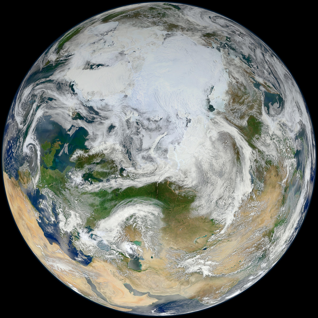
This latest portrait of Earth from NASA’s Suomi NPP satellite puts the icy Arctic in the center, showing the ice and clouds that cover our planet’s northern pole. The image you see here was created from data acquired during fifteen orbits of Earth.
In January of this year Suomi NPP images of Earth were used to create an amazing “Blue Marble” image that spread like wildfire across the internet, becoming one of the latest “definitive” images of our planet. Subsequent images have been released by the team at Goddard Space Flight Center, each revealing a different perspective of Earth.
See a full-sized version of the image above here.
NASA launched the National Polar-orbiting Operational Environmental Satellite System Preparatory Project (or NPP) on October 28, 2011 from Vandenberg Air Force Base. On Jan. 24, NPP was renamed Suomi National Polar-orbiting Partnership, or Suomi NPP, in honor of the late Verner E. Suomi. It’s the first satellite designed to collect data to improve short-term weather forecasts and increase understanding of long-term climate change.
Suomi NPP orbits the Earth about 14 times each day and observes nearly the entire surface of the planet.
Image credit: NASA/GSFC/Suomi NPP
Nice! Not the usual orientation for a Blue Marble picture, but I like it.
I don’t know about others, but I much prefer the photos taken by the astronauts on the Apollo missions. This just feels to computer composited. Looks very unnatural.
Interestingly enough, Suomi can be seen on that picture, pun intended.
my friend’s mother-in-law makes $85 every hour on the computer. She has been out of a job for 6 months but last month her paycheck was $19177 just working on the computer for a few hours. Read more here
?????? (Click On My Name For Link)
7