Blue Marble 2012: The Arctic Edition

This latest portrait of Earth from NASA’s Suomi NPP satellite puts the icy Arctic in the center, showing the ice and clouds that cover our planet’s northern pole. The image you see here was created from data acquired during fifteen orbits of Earth.

In January of this year Suomi NPP images of Earth were used to create an amazing “Blue Marble” image that spread like wildfire across the internet, becoming one of the latest “definitive” images of our planet. Subsequent images have been released by the team at Goddard Space Flight Center, each revealing a different perspective of Earth.

See a full-sized version of the image above here.

NASA launched the National Polar-orbiting Operational Environmental Satellite System Preparatory Project (or NPP) on October 28, 2011 from Vandenberg Air Force Base. On Jan. 24, NPP was renamed Suomi National Polar-orbiting Partnership, or Suomi NPP, in honor of the late Verner E. Suomi. It’s the first satellite designed to collect data to improve short-term weather forecasts and increase understanding of long-term climate change.

Suomi NPP orbits the Earth about 14 times each day and observes nearly the entire surface of the planet.

Image credit: NASA/GSFC/Suomi NPP


A Night Flight Over the Mideast

India-Pakistan Border from ISS
India-Pakistan Border from orbit. Credit: NASA.


The cities of the Middle East and southern Asia shine bright in the night beneath the International Space Station as it passed high overhead on October 21, 2011.

This video, an animation made from dozens of still images taken by the Expedition 29 crew, was assembled by the Image Science and Analysis Laboratory at Johnson Space Center in Houston. It was uploaded to the Gateway to Astronaut Photography of Earth site on October 27.

[/caption]

Some glare from the Moon (off screen to the upper left) can be seen in the Plexiglas of the ISS window. The strobe-like flashes are lightning in clouds. Airglow is also visible as a band of hazy green light surrounding the planet.

Another particularly noticeable feature visible in this video is the bright orange line of the border between India and Pakistan. Erected by the Indian government to prevent smuggling, nearly 1200 miles (1930 km) of floodlights and fences separate the two countries, creating a geopolitical feature easily visible from orbit.

The website’s description states:

The sequence of shots was taken October 21, 2011 from 19:53:26 to 20:25:24 GMT, on a pass beginning over Turkmenistan, east of the Caspian Sea to southeastern China, just northwest of Hong Kong. City lights show at the beginning of the video as the ISS travels southeastward towards the India-Pakistan borderline (click here for the Earth Observatory article to learn more about this area). Pakistan’s second largest city, Lahore, can be easily seen as the brightly lit area left of track. Immediately downtrack of Lahore is New Delhi, India’s capital city, with the Kathiawar Peninsula right of track dimly lit. Smaller cities in southern India can be seen as the pass continues southeastward through southern India, into the Bay of Bengal. Lightning storms are also present, represented by the flashing lights throughout the video. The pass ends over western Indonesia, looking left of track at the island of Sumatra.

I particularly like the way the stars shine so prominently beyond Earth’s limb, and how the moonlight illuminates the clouds… not to mention the bloom of dawn at the end. What an incredible sight this must be for the ISS crew members! I can’t imagine ever getting tired of seeing this outside the Station windows.

Watch more ISS videos here.

Video courtesy of the Image Science & Analysis Laboratory, NASA Johnson Space Center.

What Is The Largest Continent

Asia Image Credit: NASA's Blue Marble project

[/caption]

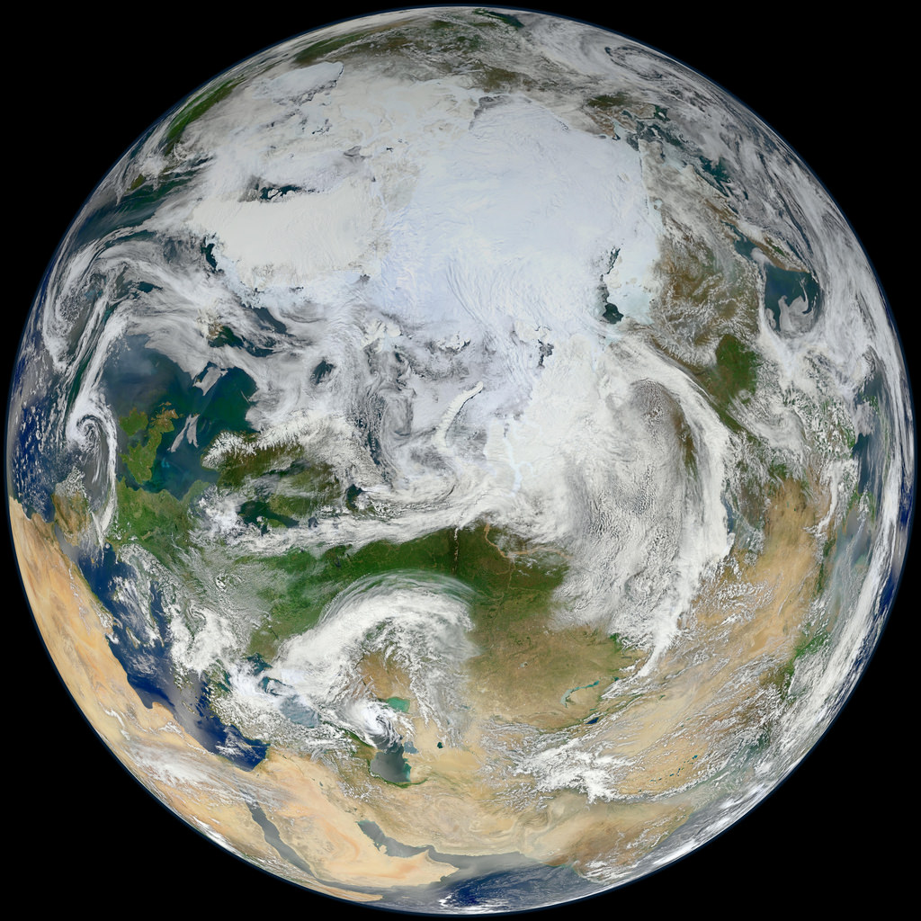
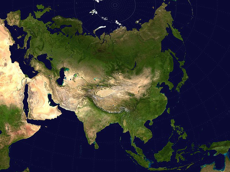
There are a few different ways to answer ‘what is the largest continent’. The first is by area and another is by population. By area, Asia is the largest continent at 44,391,162 square km. It is also the largest by population with more than 4 billion people.

There is quite a bit of debate as to how many continents there are. Some areas of the world combine Asia and Europe into one continent called Eurasia. In that case, the continent of Eurasia would be the biggest continent in both area and population.

The debate as to how many continents there are is based in the basic, yet confusing definition of what a continent is. A continent is understood to be large, continuous, discrete mass of land, ideally separated by an expanse of water. Many of the seven most commonly recognized continents identified by convention are not discrete landmasses separated by water. The criteria of being large is used arbitrarily. Greenland has an area of 2,166,086 square km and is considered an island. Australia has an area of 7,617,930 square km, but it is called a continent. The distinct landmass separated by water criteria is sometimes ignored in the case of Europe and Asia. All of the criteria are a consensus, not a rule, so some countries teach a different number of continents.

Whether you have been taught that there are 6 or 7 continents, you need to know that here have been changing numbers of continents since the formation of the Earth. There have been anywhere from 1 to 7 continents. As the tectonic plates have shifted, the continents have broken apart and collided together again. The Earth’s tectonic plates are still moving, so it is hard to predict how many continents there will be in 500,000 years, 1 million years, and so forth.

The answer to ‘what is the largest continent’ is pretty cut and dry. If you consider that there are seven continents, then Asia is the largest in area and population. If you combine Europe and Asia into the continent of Eurasia, it is still the largest by area and population.

We have written many articles about Continent for Universe Today. Here’s an article about the number of continents in the Earth, and here’s an article about the Continental Drift Theory.

If you’d like more info on continents, check out NASA’s Solar System Exploration Guide on Earth. And here’s a link to NASA’s Earth Observatory.

We’ve also recorded an episode of Astronomy Cast all about planet Earth. Listen here, Episode 51: Earth.

Source:
Wikipedia