
[/caption]
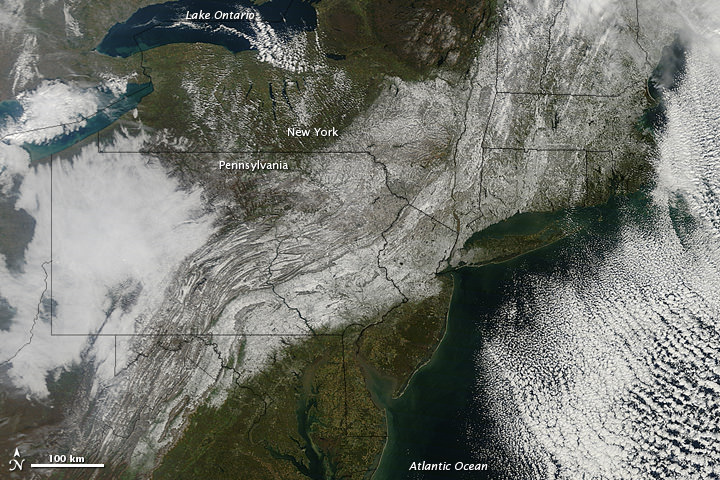
An unusual October storm dumped wet heavy snow across much of the Northeast US over the weekend, as much as 32 inches (81 centimeters) in some areas. Nicknamed “Snowtober,” the storm left as many as 3 million people without power at the snowstorm’s peak, and was blamed for the deaths of at least 10 people. In this images from the Moderate Resolution Imaging Spectroradiometer (MODIS) on NASA’s Terra satellite, a swath of snow sweeps from West Virginia northeastward to Maine, as seen on Oct. 30, 2011. Clouds hover east and west of the snow, blocking the satellite sensor’s view of western Pennsylvania and parts of the Atlantic Ocean.
The storm broke snowfall-total records in many cities, with strong winds and heavy tree damage as the heavy snow easily clung to trees which still had their leaves, snapping branches and power lines.
Source: NASA Earth Obseratory