From the Land of Ice and Snow
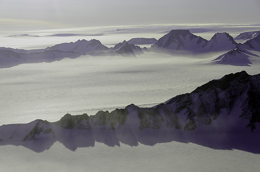
Ice-coated mountaintops of Alexander Island, one of the largest islands off Antarctica. Credit: Michael Studinger/NASA.
[/caption]
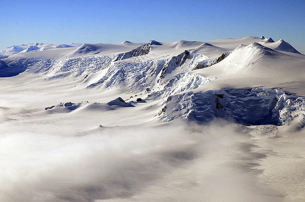
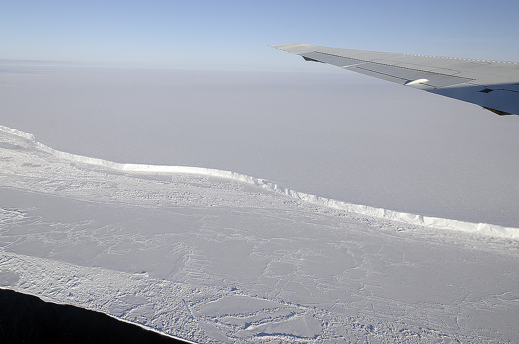
Views from the window of NASA’s DC-8 reveal sweeping expanses of ice and rock as part of the ongoing 2011 Operation IceBridge survey of Antarctica’s ice cover.
Now in its third season, Operation IceBridge is a six-year-long mission to study the dynamics of the Antarctic and Arctic ice sheets. It’s the largest ever aerial survey of the polar ice and will yield valuable data on the state of Earth’s vast reservoirs of frozen water, including the land and sea underneath and how they are being affected by today’s rapidly changing climate.
Researchers – like Michael Studinger, who took the incredible photos seen here – fly over Greenland during the months of March through May and over Antarctica in October and November. NASA’s instrument-laden DC-8 flies over these remote locations at a low altitude of about 1,500 feet, often with little or no advance weather data.
98 percent of Antarctica is covered with ice. Information obtained by Operation IceBridge will be combined with satellite data to create the most accurate models possible of Antarctic ice loss and how it will affect future sea level rise.
This season’s Antarctic IceBridge campaign features NASA’s DC-8, at 157 feet long the largest plane in the agency’s airborne research fleet, and will also feature the debut of the Gulfstream V (G-V) operated by the National Science Foundation and National Center for Atmospheric Research.
While the DC-8 flies at low altitudes, the G-V will fly above 30,000 feet to utilize its Land, Vegetation and Ice Sensor (LVIS), which makes detailed topographic studies of the surface.
“With IceBridge, our aim is to understand what the world’s major ice sheets could contribute to sea-level rise. To understand that you have to record how ice sheets and glaciers are changing over time.”
– Michael Studinger, IceBridge project scientist at NASA’s Goddard Space Flight Center in Greenbelt, Md.
Recent Posts
Vera Rubin’s Primary Mirror Gets its First Reflective Coating
First light for the Vera Rubin Observatory (VRO) is quickly approaching and the telescope is…
Two Stars in a Binary System are Very Different. It's Because There Used to be Three
A beautiful nebula in the southern hemisphere with a binary star at it's center seems…

The Highest Observatory in the World Comes Online
The history of astronomy and observatories is full of stories about astronomers going higher and…
Is the JWST Now an Interplanetary Meteorologist?
The JWST keeps one-upping itself. In the telescope's latest act of outdoing itself, it examined…
Solar Orbiter Takes a Mind-Boggling Video of the Sun
You've seen the Sun, but you've never seen the Sun like this. This single frame…
What Can AI Learn About the Universe?
Artificial intelligence and machine learning have become ubiquitous, with applications ranging from data analysis, cybersecurity,…