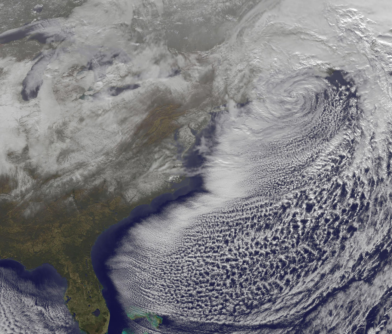
The Christmas Blizzard of 2010 dumped up to 30 inches of snow in the northeast United States, with winds gusts up to 60 mph. An Earth-orbiting satellite, GOES-13 captured a series of visible images of the storm, showing its progression. News reports from New York City say this is the sixth largest snowstorm in the city’s history and it buried the streets in four-foot drifts, bringing transit to a halt with cars and buses stranded in the streets.
Snowfall ranged from 1.5 inches in Atlanta, Georgia to more than two feet in various areas of New Jersey, New York and the New England states.
[/caption]
Some of those snows are visible in the above GOES-13 satellite image. Snowfall on the ground can be seen in the image over South and North Carolina, Virginia, Maryland, Delaware, eastern Pennsylvania, New Jersey, and southeastern New York. The clouds of the low obscure New England in the image.
Photographer Michael Black took an amazing timelapse of the blizzard, with a Canon DLSR on tripod with remote timer taking a photo once every five minutes (approximately 20 hours in 40 seconds.) — and obviously having to go outside and readjust the clock and markers.
December 2010 Blizzard Timelapse from Michael Black on Vimeo.


… now for the rest of us;
30 inches = 0.76 metres = 76cm.
60 mph. = 100 kph. (rounded from 96.6 kph)
1.5 inches = 3.8 centimetres (rounded 4 centimetres)
two feet = 0.6 metres or 60 centimetres
Otherwise, seeing this on the nightly news. Brrrrrrrrrrrrrrr!
Oh… and for the record;
20 hours in 40 seconds = 20 hours in 40 seconds.
Thinking about it. Is this not rather illogical?
“How about 20 hours condensed into a movie lasting 40 seconds.” or
“720 photos taken once every five minutes over about 20 hours?”
I’m curious, where was the ‘720 over 20 in 40’ taken ?
And, is it just me, or is the “Satellite Views of the Christmas Blizzard Video” not working ? All I get is a black screen and nothing more.
Also, the “720 over 20 in 40” is most excellently well done !!!
Bravo !!!
It shows the progression, duration, and accumulation rates in a way that the usual ‘statistics’ never tell !
The snowfall speedup video was impressive, but may not be indicative of the true snowfall accumulation as it appears to be taken right next to the house.
A few weekends ago (not sure when as winter becomes a non-ending blur of snow after a while), we got officially got 10 inches (25 cm) of snow, but one side of the house it was about 5 ft high (1.52 M), Couldn’t open the door on that side and needed to go out another door and shovel a path around.
Regardless of my criticism, the snowfall event on the East coast was remarkable and the video was very effective in showcasing it, Bravo to Mr. Black for creating it
Brrrrrr. you’re making me cold reading just reading this!
Where I live it never snows. Once in New Zealand, I remember being in a few inches (5-10 cm.), went to bed and woke up find I was sealed in as the snow had reached well above the door. We literally had to dig our way out.
The event left me with an strong appreciation of snow storms and what you go through. Keep warm ‘theCAse”, Cheers!