
[/caption]
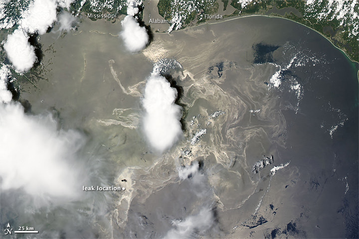
Here’s the latest satellite image of the BP oil leak in the Gulf of Mexico. The oil keeps spreading towards the northeast, and appears as a maze of silvery-gray ribbons in this image from the Moderate Resolution Imaging Spectroradiometer (MODIS) on NASA’s Terra satellite. The MODIS team said that the spot of black just north of the location of the oil well may be smoke; reports from the National Oceanic and Atmospheric Administration say that oil and gas continue to be captured and burned as part of the emergency response efforts.
The MODIS team is putting out about two satellite images of the region a day, which can be seen at this link.
Below is a video from reporter David Hammer from the Times-Picayune newspaper in New Orleans, Louisiana, who is covering the BP oil spill, explaining the latest developments as of June 21,2010. Apologies for the 15 second ad at the beginning, but Hammer provides a good overview of what has been happening.
| Oil spill video: Times-Picayune reporter update |
In case anyone is wondering, click on the image to see the enlarged 5200×6000 pixel version.
Burning the oil.
Why has nobody mentioned the evironmental damage of the greenhouse gasses produced?
BP must pay for that as well !!!