NASA Aids California Wildfire Fight: An Opinion from the Smoke
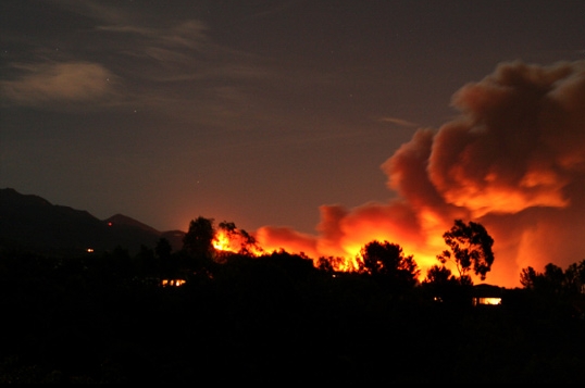
Santa Ana wind-fuelled wildfires on October 13th in the San Fernando valley, north of Los Angeles. NASA's Aqua satellite captured this image (NASA)
[/caption]
This morning at 5:30am, I woke up to the smell of smoke. It’s one of those horrid, gut-wrenching feelings for anyone as your mind jumps from “did I leave the oven on?” to “oh no, it’s our turn.” The latter thought is probably one that everyone living near summer-dried woodland in California thinks on waking to the smell of smoke. And in the San Fernando Valley, we’ve had one or two scares this year.
This time, it wasn’t “our turn” as we live on the south-west side of the valley. But late last night, hundreds of families weren’t so lucky and had to be evacuated from their homes as fires raged along the northern edge of the LA County line up to Santa Barbara…
It was a strange atmosphere in the valley today. A huge smokestack was growing about 12 miles north, and brown smoke filled the air, filtering out much of the sunlight. Walking into the garden with my coffee after the disturbed night sleep, I noticed a thin layer of soot over the patio and table. It was eerily quiet. Add this to the unseasonably warm weather we are having, there was a real sense the raging wildfire was a lot closer than it was.
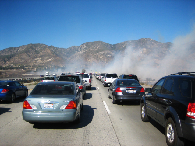
Last month was my last experience of a particularly vicious sequence of fires (again, causing huge problems for people in the north of the valley), and it looks like we have a few more days of trouble ahead of us. Governor Arnold Schwarzenegger has issued an emergency declaration for the Sayre fire in Sylmar and as I write, mandatory evacuations have been placed on some locations north of LA, down to Orange County. There is also the threat of rolling blackouts as the blazes deprive some areas of electricity supplies. The problem is spreading across the region.
Use Google Maps to monitor the areas affected in the region »
This afternoon, although life continued as normally as it could though the unhealthy haze of smoke trapped in the valley basin, I saw two yellow firefighting aircraft landing in Van Nuys airport, before flying north to assist the thousands of brave firefighters on the ground. We can only imagine how extreme it must be over there.
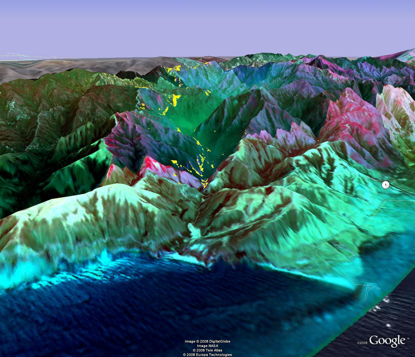
In July, when California was suffering a state-wide wildfire emergency (is it me, or has the wildfire season lasted a lot longer this year?), NASA flew a robotic Ikhana aircraft across much of the state, charting over 300 fires that had broken out. The Ikhana was using an Autonomous Modular Scanner developed at NASA’s Ames Research Center at Moffett Field to precisely measure temperature variations across the landscape from one-half degree to approximately 1,000 °F (537 °C). Areas currently burning and areas already burnt could then be identified. From this information, areas at risk could be quickly focused on, providing the firefighters with advanced warning before a fire takes hold.
“NASA’s emergency imaging gives us immediate information that we can use to manage fires, identify threats and deploy firefighting assets,” Governor Schwarzenegger said in July. “I thank NASA for providing us with this important firefighting tool.”
Whether or not the Ikhana aircraft is in the skies at the moment, it is unknown, but NASA has some other fire monitoring tricks a little higher in the sky.
From the MODIS Rapid Response System:
The Moderate Resolution Imaging Spectroradiometer (MODIS) flies onboard NASA’s Aqua and Terra satellites as part of the NASA-centered international Earth Observing System. Both satellites orbit the Earth from pole to pole, seeing most of the globe every day. Onboard Terra, MODIS sees the Earth during the morning, while Aqua MODIS orbits the Earth in the afternoon.
True-color, photo-like imagery and false-color imagery are available within a few hours of being collected, making the system a valuable resource for organizations like the U.S. Forest Service and the international fire monitoring community, who use the images to track fires; the United States Department of Agriculture Foreign Agricultural Service, who monitors crops and growing conditions; and the United States Environmental Protection Agency and the United States Air Force Weather Agency, who track dust and ash in the atmosphere. The science community also uses the system in projects like the Aerosol Robotic Network (AERONET), which studies particles like smoke, pollution, or dust in the atmosphere.
Here’s to hoping NASA’s resources are being made available as widely as possible as LA County is now in a state of emergency. Our thoughts are with the people who have been injured, displaced and lost their homes, and to the Fire Service who are fighting day and night to bring these blazes under control.
I hope we hear better news in the morning…
Sources: Examiner, CBS2, CNN, NASA Fire and Smoke, BBC
Recent Posts
Astronomers Will Get Gravitational Wave Alerts Within 30 Seconds
Any event in the cosmos generates gravitational waves, the bigger the event, the more disturbance.…
Next Generation Ion Engines Will Be Extremely Powerful
During the Space Race, scientists in both the United States and the Soviet Union investigated…

Neutron Stars Could be Capturing Primordial Black Holes
The Milky Way has a missing pulsar problem in its core. Astronomers have tried to…
Japan’s Lunar Lander Survives its Third Lunar Night
Space travel and exploration was never going to be easy. Failures are sadly all too…
Black Holes Can Halt Star Formation in Massive Galaxies
It’s difficult to actually visualise a universe that is changing. Things tend to happen at…
Mapping the Milky Way’s Magnetic Field in 3D
We are all very familiar with the concept of the Earth’s magnetic field. It turns…