Having eyes in the sky is useful for a variety of activities. Everything from farming to military operations has benefited from the boom in drone usage, as the small aircraft track the progress of crop disease, enemy movements, or how awesome a professor skier looks going down a mountain. Now the benefits of aerial surveillance has spread to other worlds as Perseverance is starting to map out its path with help from Ingenuity.
It has always been difficult to guide rovers over the Martian surface from over 200 million miles away. NASA, and now China, have done surprisingly well so far by not having their rovers being stuck for any significant amount of time during their normal mission operation time. However, campaigns such as " Free Spirit " show the devastating effect terrain can have on a rover. So it is all the more important for rover handlers to know what they are driving over and how it might affect the rover itself.
Normally this is done by very careful pathfinding. There is an entire team at NASA that is dedicated solely to finding the best path forward for Perseverance and Curiosity. In the past, such as with Spirit and Opportunity, rover navigators had to rely on space based images such as those provided by HiRISE and other orbiting satellites. While useful, the resolution was less than desired, as they were only able to capture features measured about a meter. Even smaller obstructions could prove fatal to the rovers, so drivers had to also rely on the cameras on the rovers themselves to ensure they weren't falling into any sand pits or similar hazards.
That resolution problem has now been solved with Ingenuity. After it's successful first few flights, which were focused on proving the idea of a helicopter working on another planet, the miniature aircraft switched roles to try to prove its usefulness as a scout for its larger rover companion.
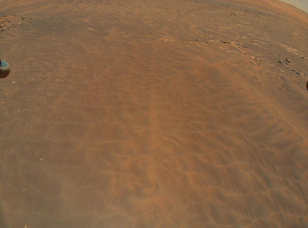
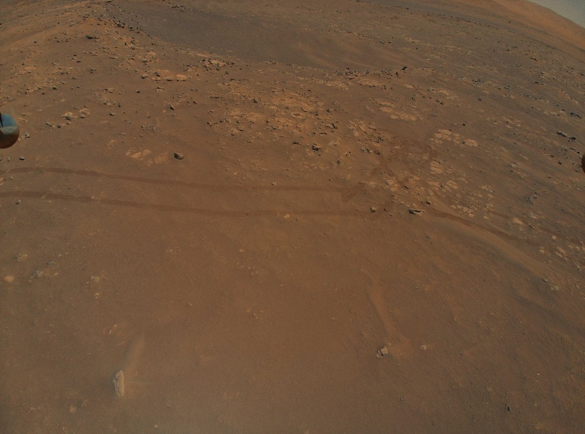
On its ninth flight, Ingenuity successfully transmitted back some images of the tracks Perseverance had already made, as well as some new areas the rover is approaching. Some of those areas will actually be inaccessible to the rover, making Ingenuity likely the only close up viewpoint that we will ever get of them. A dune field, nicknamed Séítah, for example, is too difficult to traverse with the rover, but captured beautifully as Ingenuity flew right over it.
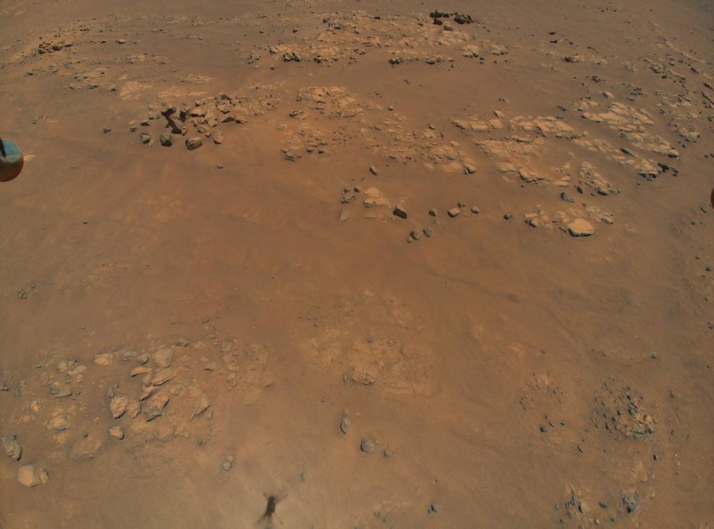
The helicopter also helped to scout some areas of interest in Jezero Crater, including the Raised Ridges, which could have hosted underground water flows in the past. The feature is Perseverance's next stopping point, where the rover will collect samples to be picked up by a later sample return mission.
Ingenuity isn't the only navigation help Perseverance is getting though - it harbors a feature called AutoNav that will allow it to automatically skirt around boulders and rocks rather than having to be directed manually by a controller back on Earth. This allows Perseverance to travel further than would otherwise be possible with only direct control. However, AutoNav isn't so great at picking out sand, making it important for a human operator to still have the ability to point out more subtle hazards.
The combination of new navigation is only one reason why Perseverance is the most capable rover ever landed on Mars. With months more science effort ahead of it, it has only just started collecting data on its environs. Helping to clarify Mars' ancient climate and geology is an important part of the rover's mission. But an arguably even more important search is one of the driving forces behind where the rover wants to go next - the search for life on Mars. Whatever the result of that search, Ingenuity now seems well placed to help get Perseverance to the right places to start looking.
Learn More:
JPL - NASA’s Mars Helicopter Reveals Intriguing Terrain for Rover Team
IEEE - NASA Extends Mars Helicopter Mission, Will Scout for Perseverance Rover
UPI - Mars helicopter begins to scout for Perseverance rover with longest flight
UT - Ingenuity Completes a Huge 50-Meter Flight on Mars
Lead Image:
Image of Perseverance's tracks that were captured in Ingenuity